SlideShare a Scribd company logo
Road Diets: The Seattle Experience


      Pro Walk / Pro Bike: Pro Place
          September 11, 2012
              Brian Dougherty
              Carol McMahan
Where is Seattle?
Complete Streets

• 16% of households do not
  have a car

• Seniors

• Youth

• Safety

• Transit riders

 Ultimately, we all need
 complete streets
Seattle’s Complete Streets Approach
• Vision: Streets that are      • Implementation: Complete
  safe, convenient and            Streets checklist
  accessible for everyone
                                • Outreach: Community
• Plans: Bicycle, Pedestrian,     collaboration
  Transit, Freight
                             • Opportunities: Redesigning
• Funding: Bridging the Gap,   city streets
  state, federal grants
For whom road diets might apply
• ADT < 15,000         OK


• ADT 15,000 - 20,000 Evaluate

• ADT >20,000      Maybe
                            Small Cities   Large Cities
  Towns      Suburbs
Why Road Diets?
Complete Streets Approach
Economic Benefits
Economic Benefits
Why Road Diets? Fewer Collisions

                                                                                                                                                   US Federal Highway Administration Proven Safety
                                                                                                                                                       Measure to reduce all collisions by 29%

The image cannot be display ed. Your computer may not hav e enough memory to open the image, or the image may hav e been corrupted. Restart y our computer, and then open the file again. If the red x still appears, y ou may hav e to delete the image and then insert it again.
Why Road Diets? Pedestrian Safety
A modest decrease in motor vehicle
speed can dramatically increase
survival in pedestrian crashes


                                     Speed
                                     reduction from
                                     40 to 30
                                     increases
                                     survival rate by
                                     5x
Seattle Road Diet History
14

12

10

8
                                                           Miles
6
                                                           Projects
4

2

0
     1972 -   1979 -   1986 -   1993 -   2000 -   2007 -
      1978     1985     1992     1999     2006     2012
Seattle Road Diet History
• 34 road diets have been
  installed in Seattle since
  1972

• 1972 – 2006: 21 Projects
• 2007 – 2012: 13 Projects
How are Corridors Identified?
• Complete Streets for
  capital projects

• Bicycle Master Plan

• Pedestrian Master Plan

• Community requests for
  neighborhood plan
  implementation                 S Columbian Way
What Factors are Considered?
 Tier 1: Traffic Operations


Before                        After   Nickerson St
What Factors are Considered?
 Tier 2: Safety/Collisions


Before                       After   N 130th St (2010)
What Factors are Considered?
 Tier 3: Livability


Before                    After     7th Ave (2010)
Don’t Forget the Design Details

•Freight
   •Lane width
   •Turning movements

•Transit
   •Lane width
   •Turning movements
   •Stop consolidation
   •Trolley lines
Don’t Forget the Design Details

• Parking
  – Peak hour
  – Utilization
Don’t Forget the Design Details
• Pedestrian crossings
  – Refuge islands
  – Marked crosswalks
Don’t Forget the Design Details
• Signals
  – Detection
  – Optimize corridor
Don’t Forget the Design Details
• Pavement Condition


          Spot repair
Out Reach: Common Concerns
• There will be gridlock!
   – Maintain capacity at signalized intersections
   – Gain efficiency by removing left turns from travel lanes

• People will cut though the neighborhood!
   – Monitor pre and post project implementation
   – Implement traffic calming measures if problems occur

• I’ll be trapped in my driveway by all the traffic!
   – Sight distance is improved for left turns
   – Access from side streets and driveways improved by
       crossing only one travel lane to the two-way left turn lane.
Out Reach: Common Concerns
Street         Before     After      Requests to
               Comments   Comments   remove

NE 125th St       394         7           3

Nickerson St      66          8           0
Pitfalls


Carolina Beach, North Carolina
Before & After Studies
Data needs               Before Study   After Study (>1 year)
ADT                                √               √
Bike and Ped Counts                √               √
Crash Data                         √               √
Speed                              √               √
Transit Operations                 √               √
Turning vehicle counts             √               √
Gap Studies                        √               √
Parking use                        √               √
Side street diversion              √               √
Vehicle Classification             √               √
Resident Satisfaction              √               √
Business Satisfaction              √               √
Case Study: Stone Way N
•   1.2 miles
•   ADT – 13,000
•   Burke-Gilman Trail Access
•   Woodland Park Access
•   Within 5 blocks – 8 schools, 2
    libraries and 5 parks
Stone Way N: Marked Crosswalks

• Uncontrolled, marked
  crosswalks at 4
  intersections.
• Crosswalk guidelines
  changed in 2004.
• Marked crosswalks would
  be non-compliant with
  four-lane cross section.
Stone Way N: Bicycle Master Plan


• Adopted in 2007.
• Stone one of the first
  projects completed under
  the plan.
• Recommended climbing
  lane and sharrow.
Stone Way N: 85th Percentile Speed

• Speed limit 30
• 85th percentile was 37
  mph prior to
  rechannelization
• Dropped to 36 mph
  northbound
• Dropped to 34 mph
  soundbound
Stone Way N: Aggressive Speeders
• 3% of vehicles traveled at
  40 mph+ prior to
  rechannelization
• Fewer than 1% traveled
  at 40mph+ after
  rechannelization
• Reducing the number of
  top speeders greatly
  reduces seriousness of
  collisions and injuries.
Stone Way N: Bicycle Volume


• Increased 35%
• Represents almost 15%
  of the peak hour traffic
  volume!
Stone Way N: Motor Vehicle Volume
• ADT Dropped 6%
  (consistent with citywide
  trend between 2006-08)
• Peak Hour volume
  dropped approximately
  5%
• Off-peak volume actually
  increased south of 45th
  Street
Stone Way N: Neighborhood Traffic
• Four non-arterial streets
  commonly mentioned as
  alternatives to Stone
• Volume decreased on all
  four of those streets
• Traffic did not divert after
  rechannelization.
Stone Way N: Collisions
• Total collisions declined
  14%
• Injury collisions declined
  33%
• Angle collisions declined
  56%
• Bicycle collisions no
  change, but rate declined
• Pedestrian collisions
  declined 80%
Stone Way N: Conclusions
• Speed has declined
• Collisions have declined
• Pedestrian crossings are
  safer
• Bicycle volume has
  increased
• Traffic has not diverted to
  neighborhood streets
• Peak hour capacity has
  been maintained
• Strong case for
  implementing road diets
Possible Elements of Future Studies
Study Data:              To Address/Answer:
• Pre and Post survey    • Livability
  of nearby businesses   • Impact to business
  and residents          • Travel time
• Traffic signal LOS     • Diversions to other
• Volume of parallel       arterial streets
  arterials
Follow-up studies and monitoring
• Volume of principal street
  /peak hour capacity

• Speed and collisions

• Traffic signal level of service

• Volume of parallel arterials

• Travel time

• Bicycle volumes
                                    Stone Way
NE 125th St
Factors:
• ADT 16,200
• 4 lanes to 2 lanes
  with TWLTL and bike
  lanes
• Business district
• High bus usage
• High number of
  pedestrian collisions

                               Before
NE 125th Street


Before   After
NE 125th St
Volume


  ADT     AM     PM
  4%      6%     12%
Speed


  85th%   OVER   TOP
   -8%
            30   END
          -12%   -69%
Nickerson St:


Before   After
Nickerson Case Study


Before
Nickerson Case Study


After
Columbian Way Complete Street
• ADT 11,200

• Repave project

• 4 lanes to 2 lanes
  with TWLTL and bike
  lanes

• New sidewalks
Recent Results
Street         ADT      ADT      Collisions   85th % Top end    Travel
               begin    change                       speeders   time

Stone Way      13,000     -6%      - 14%       - 6%    - 80%      N/A

                                                                 + 1.5
NE 125th St    16,200    + 4%       N/A        - 8%    - 69%
                                                                  min

Nickerson St   18,600    - 1%      - 23%       - 21%   - 94%      N/A


Columbian
               11,200    + 20%   No change     - 6%    -50%       N/A
Way
Not the end of the story: Dexter Ave N


Before               After
Not the end of the story: Dexter Ave N

Before                After
Just Completed: S Othello Street

Before                 After
Additional Resources
• Nickerson Street Before and After Study
    –   http://www.seattle.gov/transportation/nickerson.htm


• Stone Way Before and After Study
    – http://www.seattle.gov/transportation/docs/StoneWaybeforeafterFINAL.pdf


• FHWA: Proven Safety Countermeasures
    –   http://safety.fhwa.dot.gov/provencountermeasures/index.htm


• NACTO Guides
    –   http://nacto.org/


• National Complete Streets Coalition
    –   http://www.completestreets.org/


•

More Related Content

What's hot

VDOT: Fairfax County Board of Supervisors Transportation Committee: Dec. 13, ...
VDOT: Fairfax County Board of Supervisors Transportation Committee: Dec. 13, ...VDOT: Fairfax County Board of Supervisors Transportation Committee: Dec. 13, ...
VDOT: Fairfax County Board of Supervisors Transportation Committee: Dec. 13, ...
Fairfax County
 
November 3, 2021 CTAC Virtual Workshop
November 3, 2021 CTAC Virtual WorkshopNovember 3, 2021 CTAC Virtual Workshop
November 3, 2021 CTAC Virtual Workshop
Miami-Dade Transportation Planning Organization
 
Applying the Road Diet for Livable Communities
Applying the Road Diet for Livable CommunitiesApplying the Road Diet for Livable Communities
Applying the Road Diet for Livable Communities
streetsblog
 
Enticer Trail: Road-to-Trail Conversion
Enticer Trail: Road-to-Trail ConversionEnticer Trail: Road-to-Trail Conversion
Enticer Trail: Road-to-Trail Conversion
Andrew Pellkofer
 
Fairbank and Oakwood stations open house
Fairbank and Oakwood stations open house  Fairbank and Oakwood stations open house
Fairbank and Oakwood stations open house
Crosstown TO
 
Steeles Avenue Widening and Morningside Avenue Extension - Display Panels, Ju...
Steeles Avenue Widening and Morningside Avenue Extension - Display Panels, Ju...Steeles Avenue Widening and Morningside Avenue Extension - Display Panels, Ju...
Steeles Avenue Widening and Morningside Avenue Extension - Display Panels, Ju...
Toronto Public Consultation Unit
 
Central-East Open House - Laird Station to West At-Grade (Sunnybrook - O'Conn...
Central-East Open House - Laird Station to West At-Grade (Sunnybrook - O'Conn...Central-East Open House - Laird Station to West At-Grade (Sunnybrook - O'Conn...
Central-East Open House - Laird Station to West At-Grade (Sunnybrook - O'Conn...
Crosstown TO
 
Leaside station open house
Leaside station open house Leaside station open house
Leaside station open house
Crosstown TO
 
King Street Pilot Public Meeting - Feb 13 2017
King Street Pilot Public Meeting - Feb 13 2017King Street Pilot Public Meeting - Feb 13 2017
King Street Pilot Public Meeting - Feb 13 2017
City of Toronto Planning
 
Steeles Bridge EA PIC#2 powerpoint 04_01_2017
Steeles Bridge  EA PIC#2 powerpoint 04_01_2017Steeles Bridge  EA PIC#2 powerpoint 04_01_2017
Steeles Bridge EA PIC#2 powerpoint 04_01_2017
Paul B. Martin
 
Science centre station open house
Science centre station open houseScience centre station open house
Science centre station open house
Crosstown TO
 
Forest Hill station open house
Forest Hill station open houseForest Hill station open house
Forest Hill station open house
Crosstown TO
 
Re imagining yonge street mcea study - pic 2 display panels low res
Re imagining yonge street mcea study - pic 2 display panels low resRe imagining yonge street mcea study - pic 2 display panels low res
Re imagining yonge street mcea study - pic 2 display panels low res
knelischer
 
Inglewood Blvd Traffic Redesign CEE181
Inglewood Blvd Traffic Redesign CEE181Inglewood Blvd Traffic Redesign CEE181
Inglewood Blvd Traffic Redesign CEE181Adam Richardson, EIT
 
Complete Freeways: Evaluation of Florida's Bicycles on Limited Access Facilit...
Complete Freeways: Evaluation of Florida's Bicycles on Limited Access Facilit...Complete Freeways: Evaluation of Florida's Bicycles on Limited Access Facilit...
Complete Freeways: Evaluation of Florida's Bicycles on Limited Access Facilit...
Project for Public Spaces & National Center for Biking and Walking
 
January 12, 2021 BPAC Virtual Workshop
January 12, 2021 BPAC Virtual Workshop January 12, 2021 BPAC Virtual Workshop
January 12, 2021 BPAC Virtual Workshop
Miami-Dade Transportation Planning Organization
 
Ada resurface apwa_2016_presentation
Ada resurface apwa_2016_presentationAda resurface apwa_2016_presentation
Ada resurface apwa_2016_presentation
Florida Public Works Expo - 2016 - Tampa, Florida
 
Erik Updyke & Imelda Diaz: Bonded Wearing Course
Erik Updyke & Imelda Diaz: Bonded Wearing CourseErik Updyke & Imelda Diaz: Bonded Wearing Course
Erik Updyke & Imelda Diaz: Bonded Wearing Course
California Asphalt Pavement Association
 
Ite California Slide Presentation 2006
Ite California Slide Presentation 2006Ite California Slide Presentation 2006
Ite California Slide Presentation 2006
eshimizu
 

What's hot (19)

VDOT: Fairfax County Board of Supervisors Transportation Committee: Dec. 13, ...
VDOT: Fairfax County Board of Supervisors Transportation Committee: Dec. 13, ...VDOT: Fairfax County Board of Supervisors Transportation Committee: Dec. 13, ...
VDOT: Fairfax County Board of Supervisors Transportation Committee: Dec. 13, ...
 
November 3, 2021 CTAC Virtual Workshop
November 3, 2021 CTAC Virtual WorkshopNovember 3, 2021 CTAC Virtual Workshop
November 3, 2021 CTAC Virtual Workshop
 
Applying the Road Diet for Livable Communities
Applying the Road Diet for Livable CommunitiesApplying the Road Diet for Livable Communities
Applying the Road Diet for Livable Communities
 
Enticer Trail: Road-to-Trail Conversion
Enticer Trail: Road-to-Trail ConversionEnticer Trail: Road-to-Trail Conversion
Enticer Trail: Road-to-Trail Conversion
 
Fairbank and Oakwood stations open house
Fairbank and Oakwood stations open house  Fairbank and Oakwood stations open house
Fairbank and Oakwood stations open house
 
Steeles Avenue Widening and Morningside Avenue Extension - Display Panels, Ju...
Steeles Avenue Widening and Morningside Avenue Extension - Display Panels, Ju...Steeles Avenue Widening and Morningside Avenue Extension - Display Panels, Ju...
Steeles Avenue Widening and Morningside Avenue Extension - Display Panels, Ju...
 
Central-East Open House - Laird Station to West At-Grade (Sunnybrook - O'Conn...
Central-East Open House - Laird Station to West At-Grade (Sunnybrook - O'Conn...Central-East Open House - Laird Station to West At-Grade (Sunnybrook - O'Conn...
Central-East Open House - Laird Station to West At-Grade (Sunnybrook - O'Conn...
 
Leaside station open house
Leaside station open house Leaside station open house
Leaside station open house
 
King Street Pilot Public Meeting - Feb 13 2017
King Street Pilot Public Meeting - Feb 13 2017King Street Pilot Public Meeting - Feb 13 2017
King Street Pilot Public Meeting - Feb 13 2017
 
Steeles Bridge EA PIC#2 powerpoint 04_01_2017
Steeles Bridge  EA PIC#2 powerpoint 04_01_2017Steeles Bridge  EA PIC#2 powerpoint 04_01_2017
Steeles Bridge EA PIC#2 powerpoint 04_01_2017
 
Science centre station open house
Science centre station open houseScience centre station open house
Science centre station open house
 
Forest Hill station open house
Forest Hill station open houseForest Hill station open house
Forest Hill station open house
 
Re imagining yonge street mcea study - pic 2 display panels low res
Re imagining yonge street mcea study - pic 2 display panels low resRe imagining yonge street mcea study - pic 2 display panels low res
Re imagining yonge street mcea study - pic 2 display panels low res
 
Inglewood Blvd Traffic Redesign CEE181
Inglewood Blvd Traffic Redesign CEE181Inglewood Blvd Traffic Redesign CEE181
Inglewood Blvd Traffic Redesign CEE181
 
Complete Freeways: Evaluation of Florida's Bicycles on Limited Access Facilit...
Complete Freeways: Evaluation of Florida's Bicycles on Limited Access Facilit...Complete Freeways: Evaluation of Florida's Bicycles on Limited Access Facilit...
Complete Freeways: Evaluation of Florida's Bicycles on Limited Access Facilit...
 
January 12, 2021 BPAC Virtual Workshop
January 12, 2021 BPAC Virtual Workshop January 12, 2021 BPAC Virtual Workshop
January 12, 2021 BPAC Virtual Workshop
 
Ada resurface apwa_2016_presentation
Ada resurface apwa_2016_presentationAda resurface apwa_2016_presentation
Ada resurface apwa_2016_presentation
 
Erik Updyke & Imelda Diaz: Bonded Wearing Course
Erik Updyke & Imelda Diaz: Bonded Wearing CourseErik Updyke & Imelda Diaz: Bonded Wearing Course
Erik Updyke & Imelda Diaz: Bonded Wearing Course
 
Ite California Slide Presentation 2006
Ite California Slide Presentation 2006Ite California Slide Presentation 2006
Ite California Slide Presentation 2006
 

Viewers also liked

Bringing Bike Share to Small/Medium Sized Cities
Bringing Bike Share to Small/Medium Sized CitiesBringing Bike Share to Small/Medium Sized Cities
Bringing Bike Share to Small/Medium Sized Cities
Project for Public Spaces & National Center for Biking and Walking
 
Level of Service F for Grade A Streets
Level of Service F for Grade A StreetsLevel of Service F for Grade A Streets
Building Better Bike Share: Advancing Social Equity in Bike Share
Building Better Bike Share: Advancing Social Equity in Bike ShareBuilding Better Bike Share: Advancing Social Equity in Bike Share
Building Better Bike Share: Advancing Social Equity in Bike Share
Project for Public Spaces & National Center for Biking and Walking
 
Approaching Equity Outreach: A Chicago Case Study
Approaching Equity Outreach: A Chicago Case StudyApproaching Equity Outreach: A Chicago Case Study
Approaching Equity Outreach: A Chicago Case Study
Project for Public Spaces & National Center for Biking and Walking
 
Not Your Grandfather's DOT: The FDOT District 5 and PennDOT Experiences--Bria...
Not Your Grandfather's DOT: The FDOT District 5 and PennDOT Experiences--Bria...Not Your Grandfather's DOT: The FDOT District 5 and PennDOT Experiences--Bria...
Not Your Grandfather's DOT: The FDOT District 5 and PennDOT Experiences--Bria...
Project for Public Spaces & National Center for Biking and Walking
 
Community Engagement Approaches for Active Transportation and Equity
Community Engagement Approaches for Active Transportation and EquityCommunity Engagement Approaches for Active Transportation and Equity
Community Engagement Approaches for Active Transportation and Equity
Project for Public Spaces & National Center for Biking and Walking
 
'Selling' Rural Communities on Cycling-Lessons from the Historic Columbia Riv...
'Selling' Rural Communities on Cycling-Lessons from the Historic Columbia Riv...'Selling' Rural Communities on Cycling-Lessons from the Historic Columbia Riv...
'Selling' Rural Communities on Cycling-Lessons from the Historic Columbia Riv...
Project for Public Spaces & National Center for Biking and Walking
 
'Selling' Rural Communities on Cycling-The River Town Program
'Selling' Rural Communities on Cycling-The River Town Program'Selling' Rural Communities on Cycling-The River Town Program
'Selling' Rural Communities on Cycling-The River Town Program
Project for Public Spaces & National Center for Biking and Walking
 
Why Walking and Walkability? The Latest Info to Make the Case--Making Walkabi...
Why Walking and Walkability? The Latest Info to Make the Case--Making Walkabi...Why Walking and Walkability? The Latest Info to Make the Case--Making Walkabi...
Why Walking and Walkability? The Latest Info to Make the Case--Making Walkabi...
Project for Public Spaces & National Center for Biking and Walking
 
Policies for Pupils: Working with School Boards on Walking and Bicycling Poli...
Policies for Pupils: Working with School Boards on Walking and Bicycling Poli...Policies for Pupils: Working with School Boards on Walking and Bicycling Poli...
Policies for Pupils: Working with School Boards on Walking and Bicycling Poli...
Project for Public Spaces & National Center for Biking and Walking
 

Viewers also liked (18)

Bringing Bike Share to Small/Medium Sized Cities
Bringing Bike Share to Small/Medium Sized CitiesBringing Bike Share to Small/Medium Sized Cities
Bringing Bike Share to Small/Medium Sized Cities
 
#18 Making Tough Choices Easier: A Prioritization Process for Pedestrian Infr...
#18 Making Tough Choices Easier: A Prioritization Process for Pedestrian Infr...#18 Making Tough Choices Easier: A Prioritization Process for Pedestrian Infr...
#18 Making Tough Choices Easier: A Prioritization Process for Pedestrian Infr...
 
#14 Part 2: Presenting the Model Design Manual for Living Streets (Implementa...
#14 Part 2: Presenting the Model Design Manual for Living Streets (Implementa...#14 Part 2: Presenting the Model Design Manual for Living Streets (Implementa...
#14 Part 2: Presenting the Model Design Manual for Living Streets (Implementa...
 
Level of Service F for Grade A Streets
Level of Service F for Grade A StreetsLevel of Service F for Grade A Streets
Level of Service F for Grade A Streets
 
Building Better Bike Share: Advancing Social Equity in Bike Share
Building Better Bike Share: Advancing Social Equity in Bike ShareBuilding Better Bike Share: Advancing Social Equity in Bike Share
Building Better Bike Share: Advancing Social Equity in Bike Share
 
#35 Bridging Sectors: Fostering Collaboration between Health and Transportati...
#35 Bridging Sectors: Fostering Collaboration between Health and Transportati...#35 Bridging Sectors: Fostering Collaboration between Health and Transportati...
#35 Bridging Sectors: Fostering Collaboration between Health and Transportati...
 
#40 Safe Routes Networks: Building Livable Communities for Kids and Everyone ...
#40 Safe Routes Networks: Building Livable Communities for Kids and Everyone ...#40 Safe Routes Networks: Building Livable Communities for Kids and Everyone ...
#40 Safe Routes Networks: Building Livable Communities for Kids and Everyone ...
 
Approaching Equity Outreach: A Chicago Case Study
Approaching Equity Outreach: A Chicago Case StudyApproaching Equity Outreach: A Chicago Case Study
Approaching Equity Outreach: A Chicago Case Study
 
Not Your Grandfather's DOT: The FDOT District 5 and PennDOT Experiences--Bria...
Not Your Grandfather's DOT: The FDOT District 5 and PennDOT Experiences--Bria...Not Your Grandfather's DOT: The FDOT District 5 and PennDOT Experiences--Bria...
Not Your Grandfather's DOT: The FDOT District 5 and PennDOT Experiences--Bria...
 
#3 / #50 Navigating MAP-21
#3 / #50 Navigating MAP-21#3 / #50 Navigating MAP-21
#3 / #50 Navigating MAP-21
 
Community Engagement Approaches for Active Transportation and Equity
Community Engagement Approaches for Active Transportation and EquityCommunity Engagement Approaches for Active Transportation and Equity
Community Engagement Approaches for Active Transportation and Equity
 
#35 Bridging Sectors: Fostering Collaboration between Health and Transportati...
#35 Bridging Sectors: Fostering Collaboration between Health and Transportati...#35 Bridging Sectors: Fostering Collaboration between Health and Transportati...
#35 Bridging Sectors: Fostering Collaboration between Health and Transportati...
 
'Selling' Rural Communities on Cycling-Lessons from the Historic Columbia Riv...
'Selling' Rural Communities on Cycling-Lessons from the Historic Columbia Riv...'Selling' Rural Communities on Cycling-Lessons from the Historic Columbia Riv...
'Selling' Rural Communities on Cycling-Lessons from the Historic Columbia Riv...
 
'Selling' Rural Communities on Cycling-The River Town Program
'Selling' Rural Communities on Cycling-The River Town Program'Selling' Rural Communities on Cycling-The River Town Program
'Selling' Rural Communities on Cycling-The River Town Program
 
Why Walking and Walkability? The Latest Info to Make the Case--Making Walkabi...
Why Walking and Walkability? The Latest Info to Make the Case--Making Walkabi...Why Walking and Walkability? The Latest Info to Make the Case--Making Walkabi...
Why Walking and Walkability? The Latest Info to Make the Case--Making Walkabi...
 
#47 Getting the Bike Fix on Route 66 - Sullivan
#47 Getting the Bike Fix on Route 66 - Sullivan#47 Getting the Bike Fix on Route 66 - Sullivan
#47 Getting the Bike Fix on Route 66 - Sullivan
 
#9 New Research on Pedestrian and Bicycle Behavior: Perceptions, Attitudes, a...
#9 New Research on Pedestrian and Bicycle Behavior: Perceptions, Attitudes, a...#9 New Research on Pedestrian and Bicycle Behavior: Perceptions, Attitudes, a...
#9 New Research on Pedestrian and Bicycle Behavior: Perceptions, Attitudes, a...
 
Policies for Pupils: Working with School Boards on Walking and Bicycling Poli...
Policies for Pupils: Working with School Boards on Walking and Bicycling Poli...Policies for Pupils: Working with School Boards on Walking and Bicycling Poli...
Policies for Pupils: Working with School Boards on Walking and Bicycling Poli...
 

Similar to #27 Road Diets – Improving Safety for Everyone - Dougherty

Revolutionise roundabout design
Revolutionise roundabout designRevolutionise roundabout design
Revolutionise roundabout design
JumpingJaq
 
2017 VDOT Repaving and Restriping Reston: Bicycle, Pedestrian and Traffic Saf...
2017 VDOT Repaving and Restriping Reston: Bicycle, Pedestrian and Traffic Saf...2017 VDOT Repaving and Restriping Reston: Bicycle, Pedestrian and Traffic Saf...
2017 VDOT Repaving and Restriping Reston: Bicycle, Pedestrian and Traffic Saf...
Fairfax County
 
Session 61 Robert Thomson
Session 61 Robert ThomsonSession 61 Robert Thomson
Session 61 Robert ThomsonRWThomson
 
Final power point pedestrian safety presentation se rl
Final power point pedestrian safety presentation se rlFinal power point pedestrian safety presentation se rl
Final power point pedestrian safety presentation se rl
cityofevanston
 
July 13, 2021 BPAC Virtual Workshop
July 13, 2021 BPAC Virtual WorkshopJuly 13, 2021 BPAC Virtual Workshop
July 13, 2021 BPAC Virtual Workshop
Miami-Dade Transportation Planning Organization
 
Beal Parkway Public Meeting (Oct. 14, 2014)
Beal Parkway Public Meeting (Oct. 14, 2014)Beal Parkway Public Meeting (Oct. 14, 2014)
Beal Parkway Public Meeting (Oct. 14, 2014)
City of Midland
 
Rethinking How We Get Around Sunnyvale
Rethinking How We Get Around SunnyvaleRethinking How We Get Around Sunnyvale
Rethinking How We Get Around Sunnyvale
TransFormCA
 
Proposed Bicycle Facilities: VDOT Summer 2015 Repaving-Franconia Road
Proposed Bicycle Facilities: VDOT Summer 2015 Repaving-Franconia RoadProposed Bicycle Facilities: VDOT Summer 2015 Repaving-Franconia Road
Proposed Bicycle Facilities: VDOT Summer 2015 Repaving-Franconia Road
Fairfax County
 
I-75 / University Drive: An Interchange Under Pressure Becomes a Diamond
I-75 / University Drive: An Interchange Under Pressure Becomes a DiamondI-75 / University Drive: An Interchange Under Pressure Becomes a Diamond
I-75 / University Drive: An Interchange Under Pressure Becomes a Diamond
OHM Advisors
 
sr 90 sw 8th street at sw 87 avenue pd&e study
sr 90 sw 8th street at sw 87 avenue pd&e studysr 90 sw 8th street at sw 87 avenue pd&e study
sr 90 sw 8th street at sw 87 avenue pd&e study
Miami-Dade Transportation Planning Organization
 
Traffic Control Center Award
Traffic Control Center AwardTraffic Control Center Award
Traffic Control Center Award
City of College Station
 
Gardiner short briefing package
Gardiner   short briefing packageGardiner   short briefing package
Gardiner short briefing package
WaterfrontTO
 
Data Driven Design - Matthew Roe, New York City DOT
Data Driven Design - Matthew Roe, New York City DOTData Driven Design - Matthew Roe, New York City DOT
Data Driven Design - Matthew Roe, New York City DOT
WRI Ross Center for Sustainable Cities
 
2016 master slides
2016 master slides2016 master slides
2016 master slides
melissanatech
 
Neighborhood Greenways
Neighborhood GreenwaysNeighborhood Greenways
Neighborhood GreenwaysTrailnet
 
Great streets brownbag
Great streets brownbagGreat streets brownbag
Great streets brownbagtfooq
 

Similar to #27 Road Diets – Improving Safety for Everyone - Dougherty (20)

Revolutionise roundabout design
Revolutionise roundabout designRevolutionise roundabout design
Revolutionise roundabout design
 
Livable Streets Carlsbad
Livable Streets Carlsbad Livable Streets Carlsbad
Livable Streets Carlsbad
 
2017 VDOT Repaving and Restriping Reston: Bicycle, Pedestrian and Traffic Saf...
2017 VDOT Repaving and Restriping Reston: Bicycle, Pedestrian and Traffic Saf...2017 VDOT Repaving and Restriping Reston: Bicycle, Pedestrian and Traffic Saf...
2017 VDOT Repaving and Restriping Reston: Bicycle, Pedestrian and Traffic Saf...
 
Session 61 Robert Thomson
Session 61 Robert ThomsonSession 61 Robert Thomson
Session 61 Robert Thomson
 
Final power point pedestrian safety presentation se rl
Final power point pedestrian safety presentation se rlFinal power point pedestrian safety presentation se rl
Final power point pedestrian safety presentation se rl
 
July 13, 2021 BPAC Virtual Workshop
July 13, 2021 BPAC Virtual WorkshopJuly 13, 2021 BPAC Virtual Workshop
July 13, 2021 BPAC Virtual Workshop
 
Beal Parkway Public Meeting (Oct. 14, 2014)
Beal Parkway Public Meeting (Oct. 14, 2014)Beal Parkway Public Meeting (Oct. 14, 2014)
Beal Parkway Public Meeting (Oct. 14, 2014)
 
Rethinking How We Get Around Sunnyvale
Rethinking How We Get Around SunnyvaleRethinking How We Get Around Sunnyvale
Rethinking How We Get Around Sunnyvale
 
Proposed Bicycle Facilities: VDOT Summer 2015 Repaving-Franconia Road
Proposed Bicycle Facilities: VDOT Summer 2015 Repaving-Franconia RoadProposed Bicycle Facilities: VDOT Summer 2015 Repaving-Franconia Road
Proposed Bicycle Facilities: VDOT Summer 2015 Repaving-Franconia Road
 
I-75 / University Drive: An Interchange Under Pressure Becomes a Diamond
I-75 / University Drive: An Interchange Under Pressure Becomes a DiamondI-75 / University Drive: An Interchange Under Pressure Becomes a Diamond
I-75 / University Drive: An Interchange Under Pressure Becomes a Diamond
 
sr 90 sw 8th street at sw 87 avenue pd&e study
sr 90 sw 8th street at sw 87 avenue pd&e studysr 90 sw 8th street at sw 87 avenue pd&e study
sr 90 sw 8th street at sw 87 avenue pd&e study
 
Traffic Control Center Award
Traffic Control Center AwardTraffic Control Center Award
Traffic Control Center Award
 
Gardiner short briefing package
Gardiner   short briefing packageGardiner   short briefing package
Gardiner short briefing package
 
Complete Streets: Designing Healthy Places in Rhode Island
Complete Streets: Designing Healthy Places in Rhode Island Complete Streets: Designing Healthy Places in Rhode Island
Complete Streets: Designing Healthy Places in Rhode Island
 
Son march18 full version
Son march18 full versionSon march18 full version
Son march18 full version
 
Data Driven Design - Matthew Roe, New York City DOT
Data Driven Design - Matthew Roe, New York City DOTData Driven Design - Matthew Roe, New York City DOT
Data Driven Design - Matthew Roe, New York City DOT
 
2016 master slides
2016 master slides2016 master slides
2016 master slides
 
NZC - Bracke
NZC - BrackeNZC - Bracke
NZC - Bracke
 
Neighborhood Greenways
Neighborhood GreenwaysNeighborhood Greenways
Neighborhood Greenways
 
Great streets brownbag
Great streets brownbagGreat streets brownbag
Great streets brownbag
 

More from Project for Public Spaces & National Center for Biking and Walking

Level of Service F for Grade A Streets--Cesar Chavez Street
Level of Service F for Grade A Streets--Cesar Chavez Street  Level of Service F for Grade A Streets--Cesar Chavez Street
Level of Service F for Grade A Streets--Cesar Chavez Street
Project for Public Spaces & National Center for Biking and Walking
 
A Systematic Approach to Bicycle Parking Planning for Cities
A Systematic Approach to Bicycle Parking Planning for CitiesA Systematic Approach to Bicycle Parking Planning for Cities
A Systematic Approach to Bicycle Parking Planning for Cities
Project for Public Spaces & National Center for Biking and Walking
 
Policies for Pupils: Working with School Boards on Walking and Bicycling Poli...
Policies for Pupils: Working with School Boards on Walking and Bicycling Poli...Policies for Pupils: Working with School Boards on Walking and Bicycling Poli...
Policies for Pupils: Working with School Boards on Walking and Bicycling Poli...
Project for Public Spaces & National Center for Biking and Walking
 
Federal Funding for Active Transportation and Recreation-Wesley Blount
Federal Funding for Active Transportation and Recreation-Wesley BlountFederal Funding for Active Transportation and Recreation-Wesley Blount
Federal Funding for Active Transportation and Recreation-Wesley Blount
Project for Public Spaces & National Center for Biking and Walking
 
A Systematic Approach to Bicycle Parking Planning for Cities--Bike Parking Ap...
A Systematic Approach to Bicycle Parking Planning for Cities--Bike Parking Ap...A Systematic Approach to Bicycle Parking Planning for Cities--Bike Parking Ap...
A Systematic Approach to Bicycle Parking Planning for Cities--Bike Parking Ap...
Project for Public Spaces & National Center for Biking and Walking
 
Selling' Rural Communities on Cycling--ODOT Pedestrian and Bicycle Program
Selling' Rural Communities on Cycling--ODOT Pedestrian and Bicycle ProgramSelling' Rural Communities on Cycling--ODOT Pedestrian and Bicycle Program
Selling' Rural Communities on Cycling--ODOT Pedestrian and Bicycle Program
Project for Public Spaces & National Center for Biking and Walking
 
A Systematic Approach to Bicycle Parking Planning for Cities-Level of Service...
A Systematic Approach to Bicycle Parking Planning for Cities-Level of Service...A Systematic Approach to Bicycle Parking Planning for Cities-Level of Service...
A Systematic Approach to Bicycle Parking Planning for Cities-Level of Service...
Project for Public Spaces & National Center for Biking and Walking
 
Taking Pedestrian and Bicycle Counting Programs to the Next Level
Taking Pedestrian and Bicycle Counting Programs to the Next Level Taking Pedestrian and Bicycle Counting Programs to the Next Level
Taking Pedestrian and Bicycle Counting Programs to the Next Level
Project for Public Spaces & National Center for Biking and Walking
 
Federal Funding for Active Transportation and Recreation
Federal Funding for Active Transportation and RecreationFederal Funding for Active Transportation and Recreation
Federal Funding for Active Transportation and Recreation
Project for Public Spaces & National Center for Biking and Walking
 
Not Your Grandfather's DOT: The FDOT District 5 and PennDOT Experiences--Bold...
Not Your Grandfather's DOT: The FDOT District 5 and PennDOT Experiences--Bold...Not Your Grandfather's DOT: The FDOT District 5 and PennDOT Experiences--Bold...
Not Your Grandfather's DOT: The FDOT District 5 and PennDOT Experiences--Bold...
Project for Public Spaces & National Center for Biking and Walking
 
Transportation Studies in the 21st Century: Incorporating all Modes-SFMTA Urb...
Transportation Studies in the 21st Century: Incorporating all Modes-SFMTA Urb...Transportation Studies in the 21st Century: Incorporating all Modes-SFMTA Urb...
Transportation Studies in the 21st Century: Incorporating all Modes-SFMTA Urb...
Project for Public Spaces & National Center for Biking and Walking
 
Transportation Studies in the 21st Century: Incorporating all Modes
Transportation Studies in the 21st Century: Incorporating all ModesTransportation Studies in the 21st Century: Incorporating all Modes
Transportation Studies in the 21st Century: Incorporating all Modes
Project for Public Spaces & National Center for Biking and Walking
 
Integrating a Health Impact Assessment into District-Wide School Travel Plan...
	Integrating a Health Impact Assessment into District-Wide School Travel Plan...	Integrating a Health Impact Assessment into District-Wide School Travel Plan...
Integrating a Health Impact Assessment into District-Wide School Travel Plan...
Project for Public Spaces & National Center for Biking and Walking
 
Safer People, Safer Streets, and Safer Policies at USDOT--Dan Goodman
Safer People, Safer Streets, and Safer Policies at USDOT--Dan GoodmanSafer People, Safer Streets, and Safer Policies at USDOT--Dan Goodman
Safer People, Safer Streets, and Safer Policies at USDOT--Dan Goodman
Project for Public Spaces & National Center for Biking and Walking
 
Transportation Studies in the 21st Century: Incorporating all Modes
Transportation Studies in the 21st Century: Incorporating all ModesTransportation Studies in the 21st Century: Incorporating all Modes
Transportation Studies in the 21st Century: Incorporating all Modes
Project for Public Spaces & National Center for Biking and Walking
 
What Do The Kids Say? Giving a Voice to Youth Perspectives on Biking and Walk...
What Do The Kids Say? Giving a Voice to Youth Perspectives on Biking and Walk...What Do The Kids Say? Giving a Voice to Youth Perspectives on Biking and Walk...
What Do The Kids Say? Giving a Voice to Youth Perspectives on Biking and Walk...
Project for Public Spaces & National Center for Biking and Walking
 
Safer People, Safer Streets, and Safer Policies at USDOT
Safer People, Safer Streets, and Safer Policies at USDOTSafer People, Safer Streets, and Safer Policies at USDOT
Safer People, Safer Streets, and Safer Policies at USDOT
Project for Public Spaces & National Center for Biking and Walking
 
Maximizing Biking and Walking Access to Transit
Maximizing Biking and Walking Access to TransitMaximizing Biking and Walking Access to Transit
Maximizing Biking and Walking Access to Transit
Project for Public Spaces & National Center for Biking and Walking
 

More from Project for Public Spaces & National Center for Biking and Walking (20)

Level of Service F for Grade A Streets--Cesar Chavez Street
Level of Service F for Grade A Streets--Cesar Chavez Street  Level of Service F for Grade A Streets--Cesar Chavez Street
Level of Service F for Grade A Streets--Cesar Chavez Street
 
A Systematic Approach to Bicycle Parking Planning for Cities
A Systematic Approach to Bicycle Parking Planning for CitiesA Systematic Approach to Bicycle Parking Planning for Cities
A Systematic Approach to Bicycle Parking Planning for Cities
 
Policies for Pupils: Working with School Boards on Walking and Bicycling Poli...
Policies for Pupils: Working with School Boards on Walking and Bicycling Poli...Policies for Pupils: Working with School Boards on Walking and Bicycling Poli...
Policies for Pupils: Working with School Boards on Walking and Bicycling Poli...
 
Policies for Pupils: Working with School Boards on Walking and Bicycling Poli...
Policies for Pupils: Working with School Boards on Walking and Bicycling Poli...Policies for Pupils: Working with School Boards on Walking and Bicycling Poli...
Policies for Pupils: Working with School Boards on Walking and Bicycling Poli...
 
Federal Funding for Active Transportation and Recreation-Wesley Blount
Federal Funding for Active Transportation and Recreation-Wesley BlountFederal Funding for Active Transportation and Recreation-Wesley Blount
Federal Funding for Active Transportation and Recreation-Wesley Blount
 
A Systematic Approach to Bicycle Parking Planning for Cities--Bike Parking Ap...
A Systematic Approach to Bicycle Parking Planning for Cities--Bike Parking Ap...A Systematic Approach to Bicycle Parking Planning for Cities--Bike Parking Ap...
A Systematic Approach to Bicycle Parking Planning for Cities--Bike Parking Ap...
 
Selling' Rural Communities on Cycling--ODOT Pedestrian and Bicycle Program
Selling' Rural Communities on Cycling--ODOT Pedestrian and Bicycle ProgramSelling' Rural Communities on Cycling--ODOT Pedestrian and Bicycle Program
Selling' Rural Communities on Cycling--ODOT Pedestrian and Bicycle Program
 
A Systematic Approach to Bicycle Parking Planning for Cities-Level of Service...
A Systematic Approach to Bicycle Parking Planning for Cities-Level of Service...A Systematic Approach to Bicycle Parking Planning for Cities-Level of Service...
A Systematic Approach to Bicycle Parking Planning for Cities-Level of Service...
 
Taking Pedestrian and Bicycle Counting Programs to the Next Level
Taking Pedestrian and Bicycle Counting Programs to the Next Level Taking Pedestrian and Bicycle Counting Programs to the Next Level
Taking Pedestrian and Bicycle Counting Programs to the Next Level
 
Federal Funding for Active Transportation and Recreation
Federal Funding for Active Transportation and RecreationFederal Funding for Active Transportation and Recreation
Federal Funding for Active Transportation and Recreation
 
Not Your Grandfather's DOT: The FDOT District 5 and PennDOT Experiences--Bold...
Not Your Grandfather's DOT: The FDOT District 5 and PennDOT Experiences--Bold...Not Your Grandfather's DOT: The FDOT District 5 and PennDOT Experiences--Bold...
Not Your Grandfather's DOT: The FDOT District 5 and PennDOT Experiences--Bold...
 
Transportation Studies in the 21st Century: Incorporating all Modes-SFMTA Urb...
Transportation Studies in the 21st Century: Incorporating all Modes-SFMTA Urb...Transportation Studies in the 21st Century: Incorporating all Modes-SFMTA Urb...
Transportation Studies in the 21st Century: Incorporating all Modes-SFMTA Urb...
 
Transportation Studies in the 21st Century: Incorporating all Modes
Transportation Studies in the 21st Century: Incorporating all ModesTransportation Studies in the 21st Century: Incorporating all Modes
Transportation Studies in the 21st Century: Incorporating all Modes
 
Integrating a Health Impact Assessment into District-Wide School Travel Plan...
	Integrating a Health Impact Assessment into District-Wide School Travel Plan...	Integrating a Health Impact Assessment into District-Wide School Travel Plan...
Integrating a Health Impact Assessment into District-Wide School Travel Plan...
 
Safer People, Safer Streets, and Safer Policies at USDOT--Dan Goodman
Safer People, Safer Streets, and Safer Policies at USDOT--Dan GoodmanSafer People, Safer Streets, and Safer Policies at USDOT--Dan Goodman
Safer People, Safer Streets, and Safer Policies at USDOT--Dan Goodman
 
Transportation Studies in the 21st Century: Incorporating all Modes
Transportation Studies in the 21st Century: Incorporating all ModesTransportation Studies in the 21st Century: Incorporating all Modes
Transportation Studies in the 21st Century: Incorporating all Modes
 
What Do The Kids Say? Giving a Voice to Youth Perspectives on Biking and Walk...
What Do The Kids Say? Giving a Voice to Youth Perspectives on Biking and Walk...What Do The Kids Say? Giving a Voice to Youth Perspectives on Biking and Walk...
What Do The Kids Say? Giving a Voice to Youth Perspectives on Biking and Walk...
 
Safer People, Safer Streets, and Safer Policies at USDOT
Safer People, Safer Streets, and Safer Policies at USDOTSafer People, Safer Streets, and Safer Policies at USDOT
Safer People, Safer Streets, and Safer Policies at USDOT
 
Maximizing Biking and Walking Access to Transit
Maximizing Biking and Walking Access to TransitMaximizing Biking and Walking Access to Transit
Maximizing Biking and Walking Access to Transit
 

#27 Road Diets – Improving Safety for Everyone - Dougherty

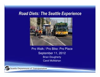
  • 1. Road Diets: The Seattle Experience Pro Walk / Pro Bike: Pro Place September 11, 2012 Brian Dougherty Carol McMahan
  • 3. Complete Streets • 16% of households do not have a car • Seniors • Youth • Safety • Transit riders Ultimately, we all need complete streets
  • 4. Seattle’s Complete Streets Approach • Vision: Streets that are • Implementation: Complete safe, convenient and Streets checklist accessible for everyone • Outreach: Community • Plans: Bicycle, Pedestrian, collaboration Transit, Freight • Opportunities: Redesigning • Funding: Bridging the Gap, city streets state, federal grants
  • 5. For whom road diets might apply • ADT < 15,000 OK • ADT 15,000 - 20,000 Evaluate • ADT >20,000 Maybe Small Cities Large Cities Towns Suburbs
  • 7.
  • 8.
  • 9.
  • 13. Why Road Diets? Fewer Collisions US Federal Highway Administration Proven Safety Measure to reduce all collisions by 29% The image cannot be display ed. Your computer may not hav e enough memory to open the image, or the image may hav e been corrupted. Restart y our computer, and then open the file again. If the red x still appears, y ou may hav e to delete the image and then insert it again.
  • 14. Why Road Diets? Pedestrian Safety A modest decrease in motor vehicle speed can dramatically increase survival in pedestrian crashes Speed reduction from 40 to 30 increases survival rate by 5x
  • 15. Seattle Road Diet History 14 12 10 8 Miles 6 Projects 4 2 0 1972 - 1979 - 1986 - 1993 - 2000 - 2007 - 1978 1985 1992 1999 2006 2012
  • 16. Seattle Road Diet History • 34 road diets have been installed in Seattle since 1972 • 1972 – 2006: 21 Projects • 2007 – 2012: 13 Projects
  • 17. How are Corridors Identified? • Complete Streets for capital projects • Bicycle Master Plan • Pedestrian Master Plan • Community requests for neighborhood plan implementation S Columbian Way
  • 18. What Factors are Considered? Tier 1: Traffic Operations Before After Nickerson St
  • 19. What Factors are Considered? Tier 2: Safety/Collisions Before After N 130th St (2010)
  • 20. What Factors are Considered? Tier 3: Livability Before After 7th Ave (2010)
  • 21. Don’t Forget the Design Details •Freight •Lane width •Turning movements •Transit •Lane width •Turning movements •Stop consolidation •Trolley lines
  • 22. Don’t Forget the Design Details • Parking – Peak hour – Utilization
  • 23. Don’t Forget the Design Details • Pedestrian crossings – Refuge islands – Marked crosswalks
  • 24. Don’t Forget the Design Details • Signals – Detection – Optimize corridor
  • 25. Don’t Forget the Design Details • Pavement Condition Spot repair
  • 26. Out Reach: Common Concerns • There will be gridlock! – Maintain capacity at signalized intersections – Gain efficiency by removing left turns from travel lanes • People will cut though the neighborhood! – Monitor pre and post project implementation – Implement traffic calming measures if problems occur • I’ll be trapped in my driveway by all the traffic! – Sight distance is improved for left turns – Access from side streets and driveways improved by crossing only one travel lane to the two-way left turn lane.
  • 27. Out Reach: Common Concerns Street Before After Requests to Comments Comments remove NE 125th St 394 7 3 Nickerson St 66 8 0
  • 29. Before & After Studies Data needs Before Study After Study (>1 year) ADT √ √ Bike and Ped Counts √ √ Crash Data √ √ Speed √ √ Transit Operations √ √ Turning vehicle counts √ √ Gap Studies √ √ Parking use √ √ Side street diversion √ √ Vehicle Classification √ √ Resident Satisfaction √ √ Business Satisfaction √ √
  • 30. Case Study: Stone Way N • 1.2 miles • ADT – 13,000 • Burke-Gilman Trail Access • Woodland Park Access • Within 5 blocks – 8 schools, 2 libraries and 5 parks
  • 31. Stone Way N: Marked Crosswalks • Uncontrolled, marked crosswalks at 4 intersections. • Crosswalk guidelines changed in 2004. • Marked crosswalks would be non-compliant with four-lane cross section.
  • 32. Stone Way N: Bicycle Master Plan • Adopted in 2007. • Stone one of the first projects completed under the plan. • Recommended climbing lane and sharrow.
  • 33. Stone Way N: 85th Percentile Speed • Speed limit 30 • 85th percentile was 37 mph prior to rechannelization • Dropped to 36 mph northbound • Dropped to 34 mph soundbound
  • 34. Stone Way N: Aggressive Speeders • 3% of vehicles traveled at 40 mph+ prior to rechannelization • Fewer than 1% traveled at 40mph+ after rechannelization • Reducing the number of top speeders greatly reduces seriousness of collisions and injuries.
  • 35. Stone Way N: Bicycle Volume • Increased 35% • Represents almost 15% of the peak hour traffic volume!
  • 36. Stone Way N: Motor Vehicle Volume • ADT Dropped 6% (consistent with citywide trend between 2006-08) • Peak Hour volume dropped approximately 5% • Off-peak volume actually increased south of 45th Street
  • 37. Stone Way N: Neighborhood Traffic • Four non-arterial streets commonly mentioned as alternatives to Stone • Volume decreased on all four of those streets • Traffic did not divert after rechannelization.
  • 38. Stone Way N: Collisions • Total collisions declined 14% • Injury collisions declined 33% • Angle collisions declined 56% • Bicycle collisions no change, but rate declined • Pedestrian collisions declined 80%
  • 39. Stone Way N: Conclusions • Speed has declined • Collisions have declined • Pedestrian crossings are safer • Bicycle volume has increased • Traffic has not diverted to neighborhood streets • Peak hour capacity has been maintained • Strong case for implementing road diets
  • 40. Possible Elements of Future Studies Study Data: To Address/Answer: • Pre and Post survey • Livability of nearby businesses • Impact to business and residents • Travel time • Traffic signal LOS • Diversions to other • Volume of parallel arterial streets arterials
  • 41. Follow-up studies and monitoring • Volume of principal street /peak hour capacity • Speed and collisions • Traffic signal level of service • Volume of parallel arterials • Travel time • Bicycle volumes Stone Way
  • 42. NE 125th St Factors: • ADT 16,200 • 4 lanes to 2 lanes with TWLTL and bike lanes • Business district • High bus usage • High number of pedestrian collisions Before
  • 44. NE 125th St Volume ADT AM PM 4% 6% 12% Speed 85th% OVER TOP -8% 30 END -12% -69%
  • 48. Columbian Way Complete Street • ADT 11,200 • Repave project • 4 lanes to 2 lanes with TWLTL and bike lanes • New sidewalks
  • 49. Recent Results Street ADT ADT Collisions 85th % Top end Travel begin change speeders time Stone Way 13,000 -6% - 14% - 6% - 80% N/A + 1.5 NE 125th St 16,200 + 4% N/A - 8% - 69% min Nickerson St 18,600 - 1% - 23% - 21% - 94% N/A Columbian 11,200 + 20% No change - 6% -50% N/A Way
  • 50. Not the end of the story: Dexter Ave N Before After
  • 51. Not the end of the story: Dexter Ave N Before After
  • 52. Just Completed: S Othello Street Before After
  • 53. Additional Resources • Nickerson Street Before and After Study – http://www.seattle.gov/transportation/nickerson.htm • Stone Way Before and After Study – http://www.seattle.gov/transportation/docs/StoneWaybeforeafterFINAL.pdf • FHWA: Proven Safety Countermeasures – http://safety.fhwa.dot.gov/provencountermeasures/index.htm • NACTO Guides – http://nacto.org/ • National Complete Streets Coalition – http://www.completestreets.org/ •