Download to read offline


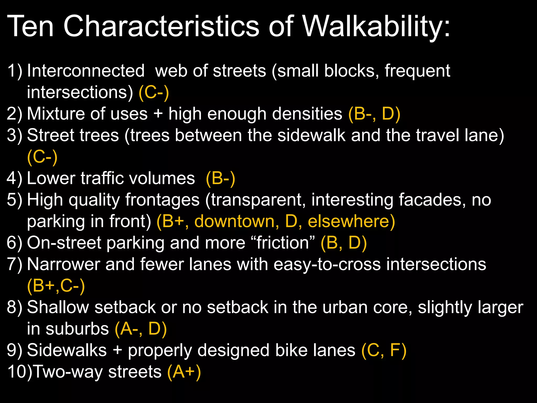
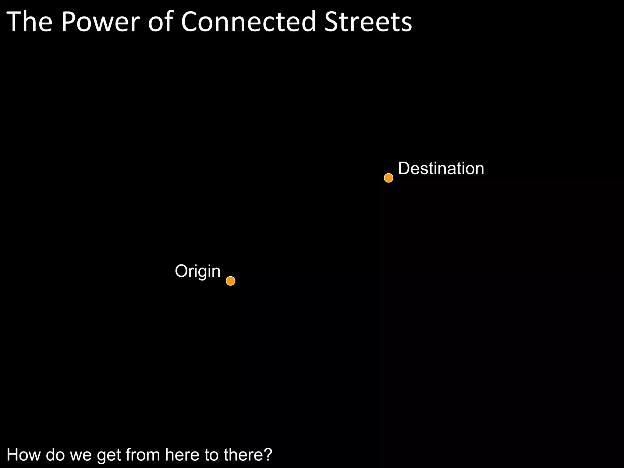
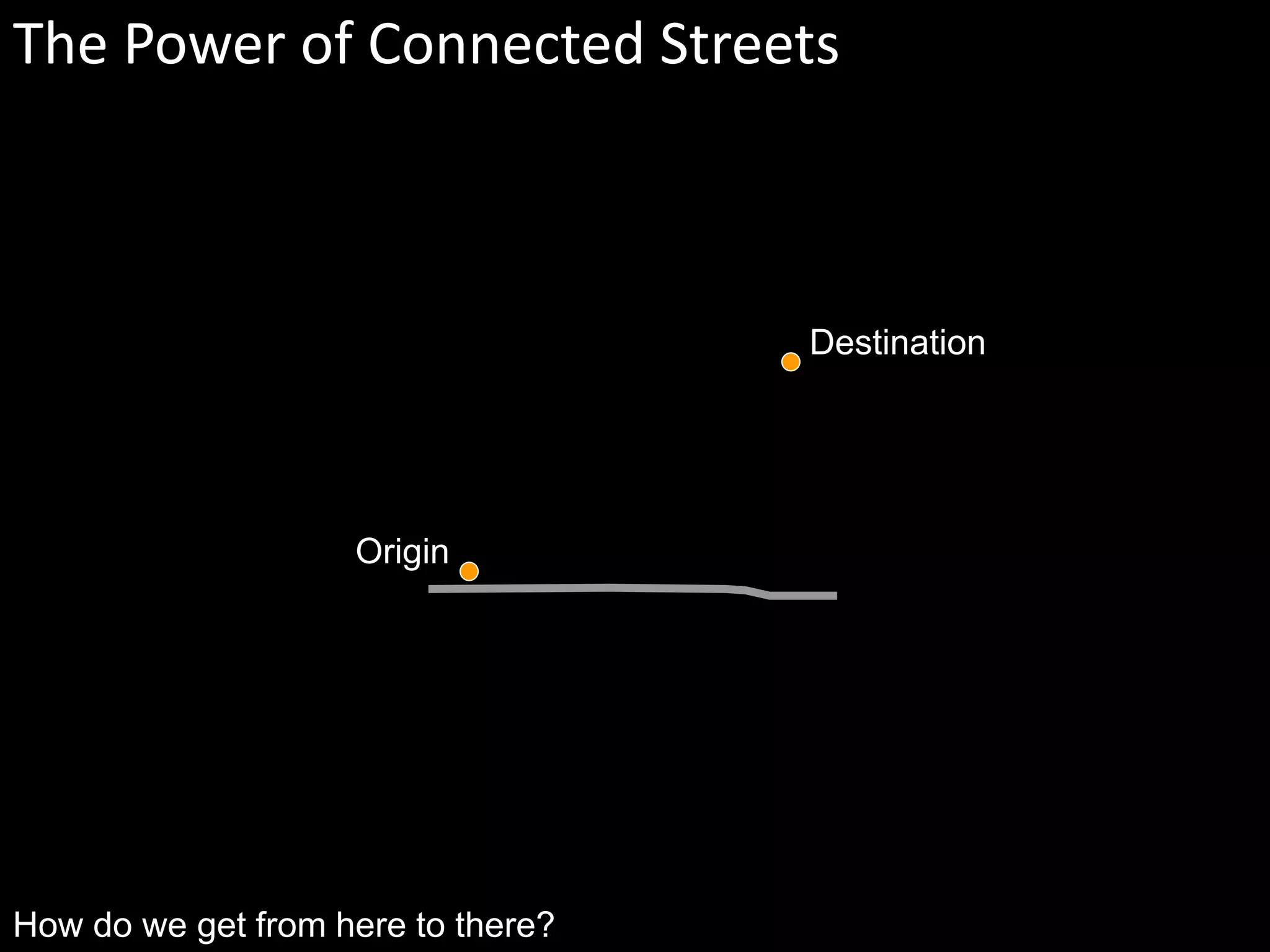
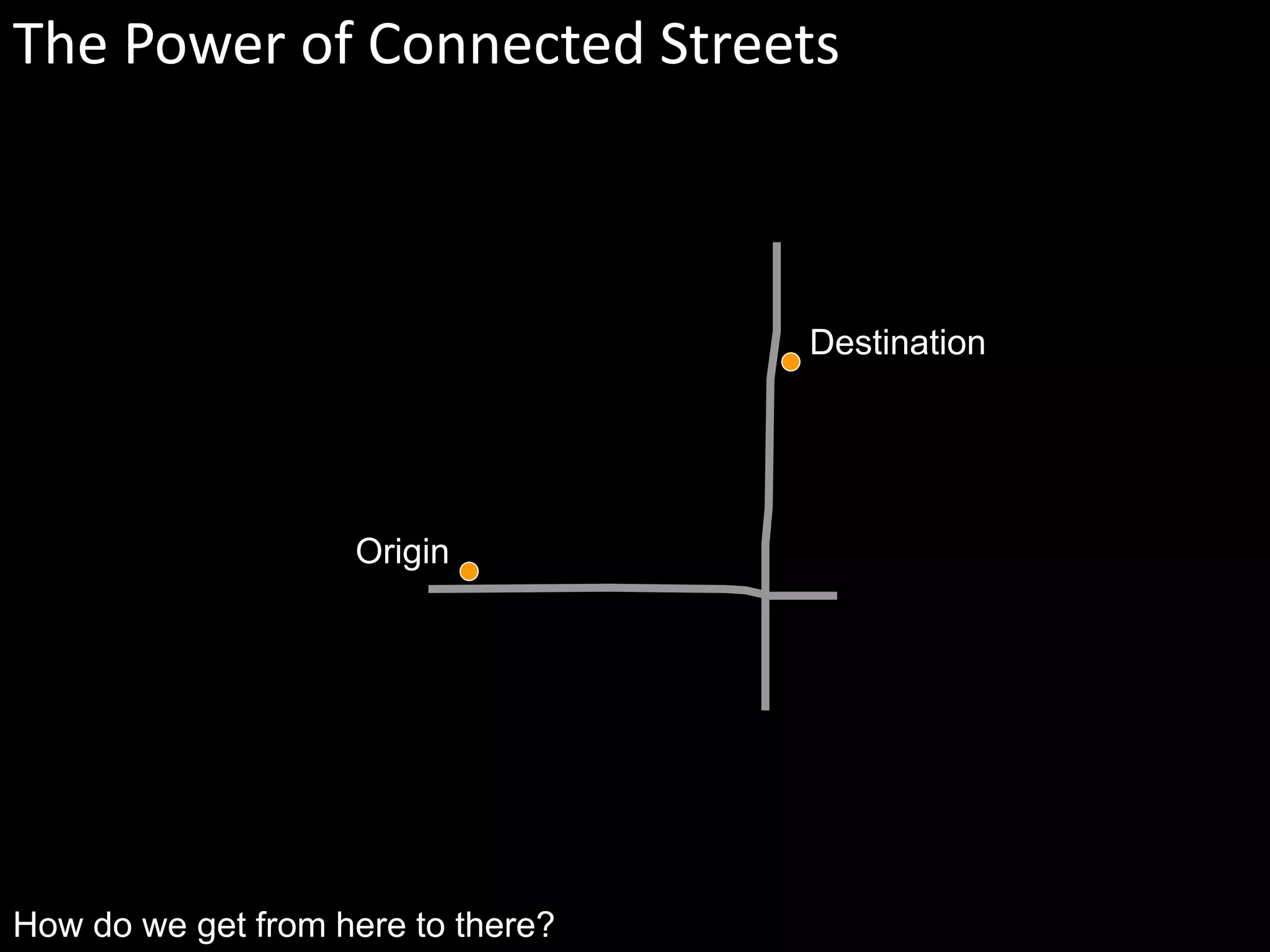
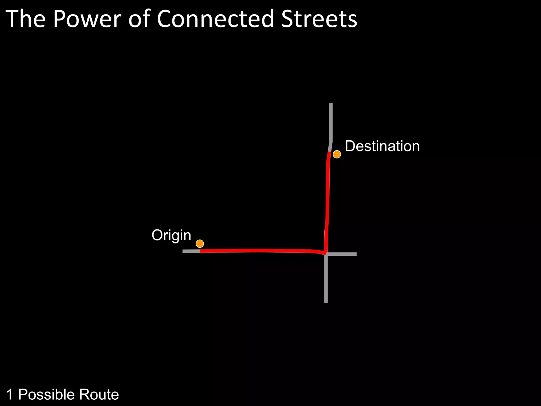
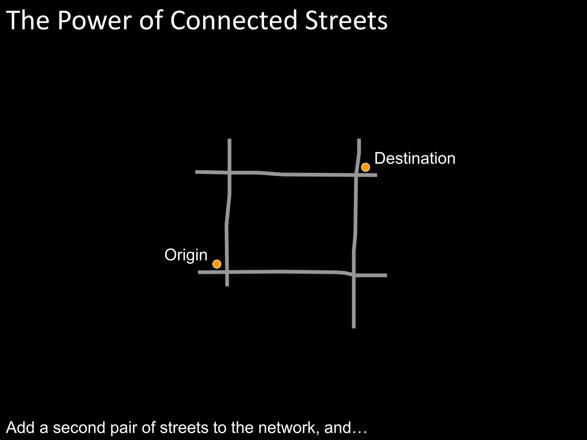
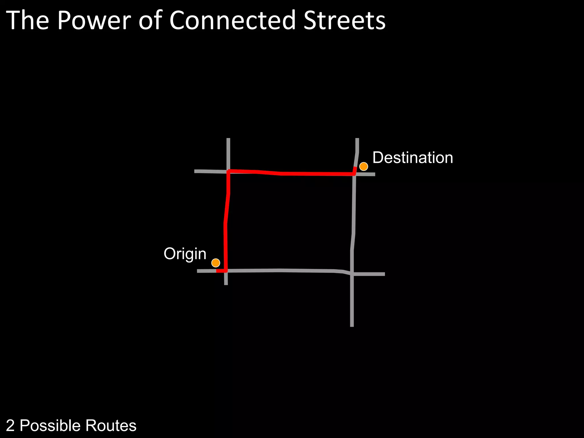
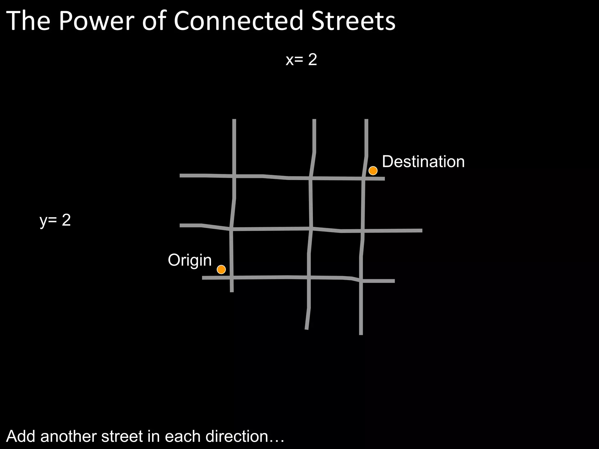
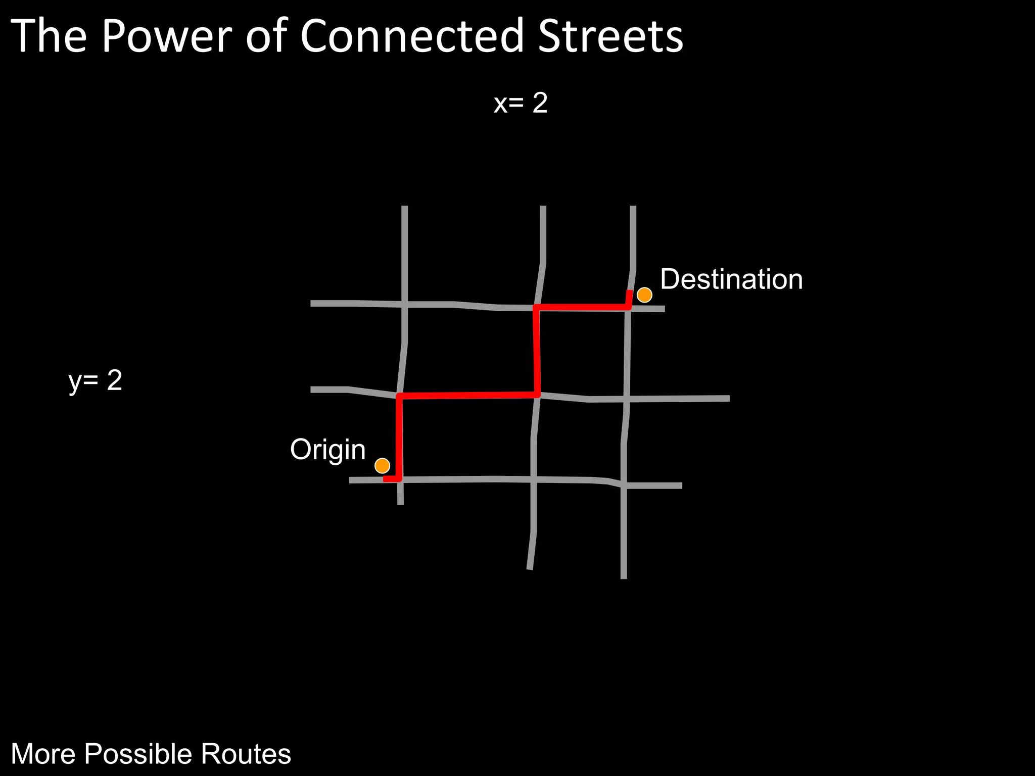
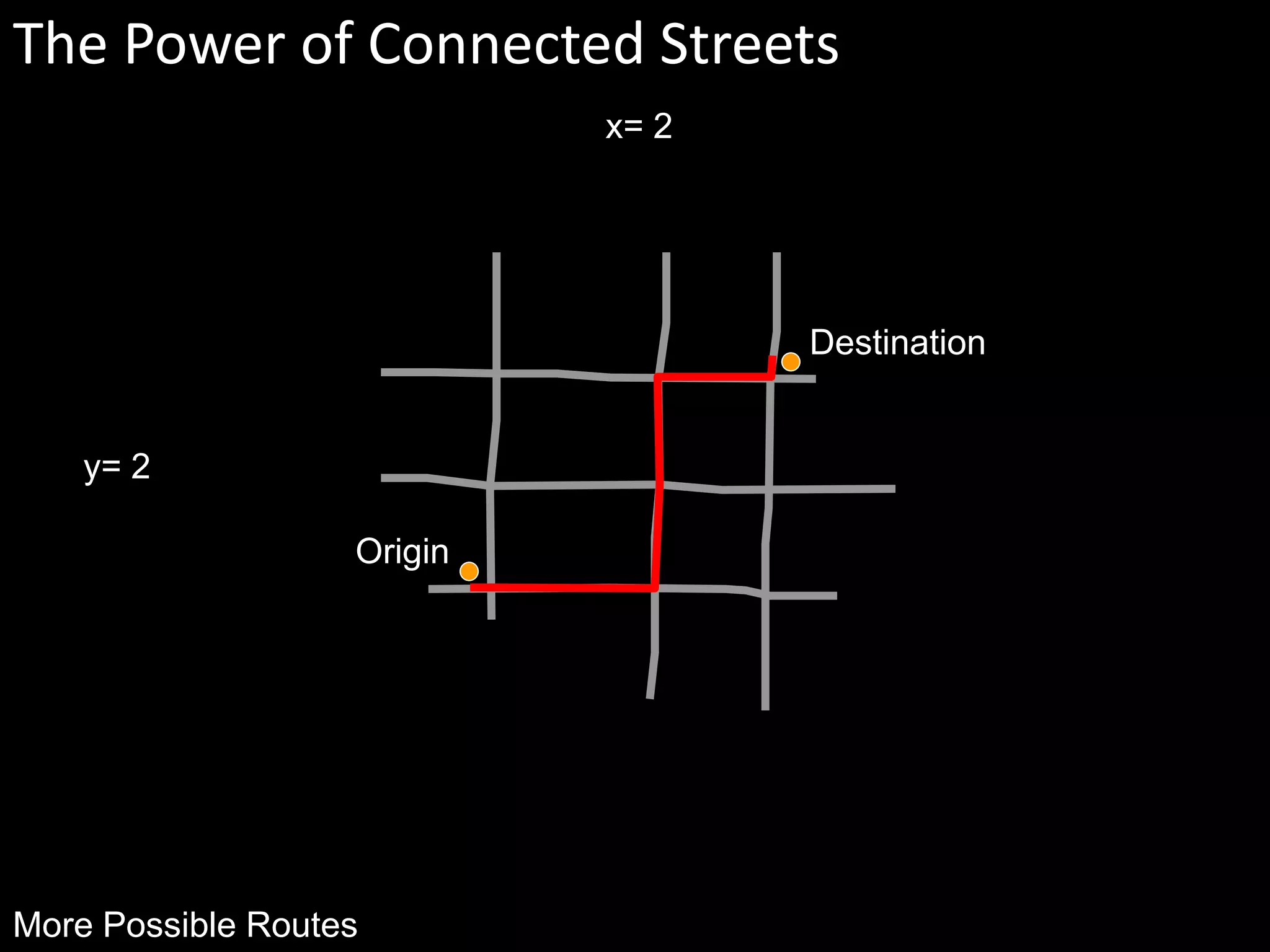
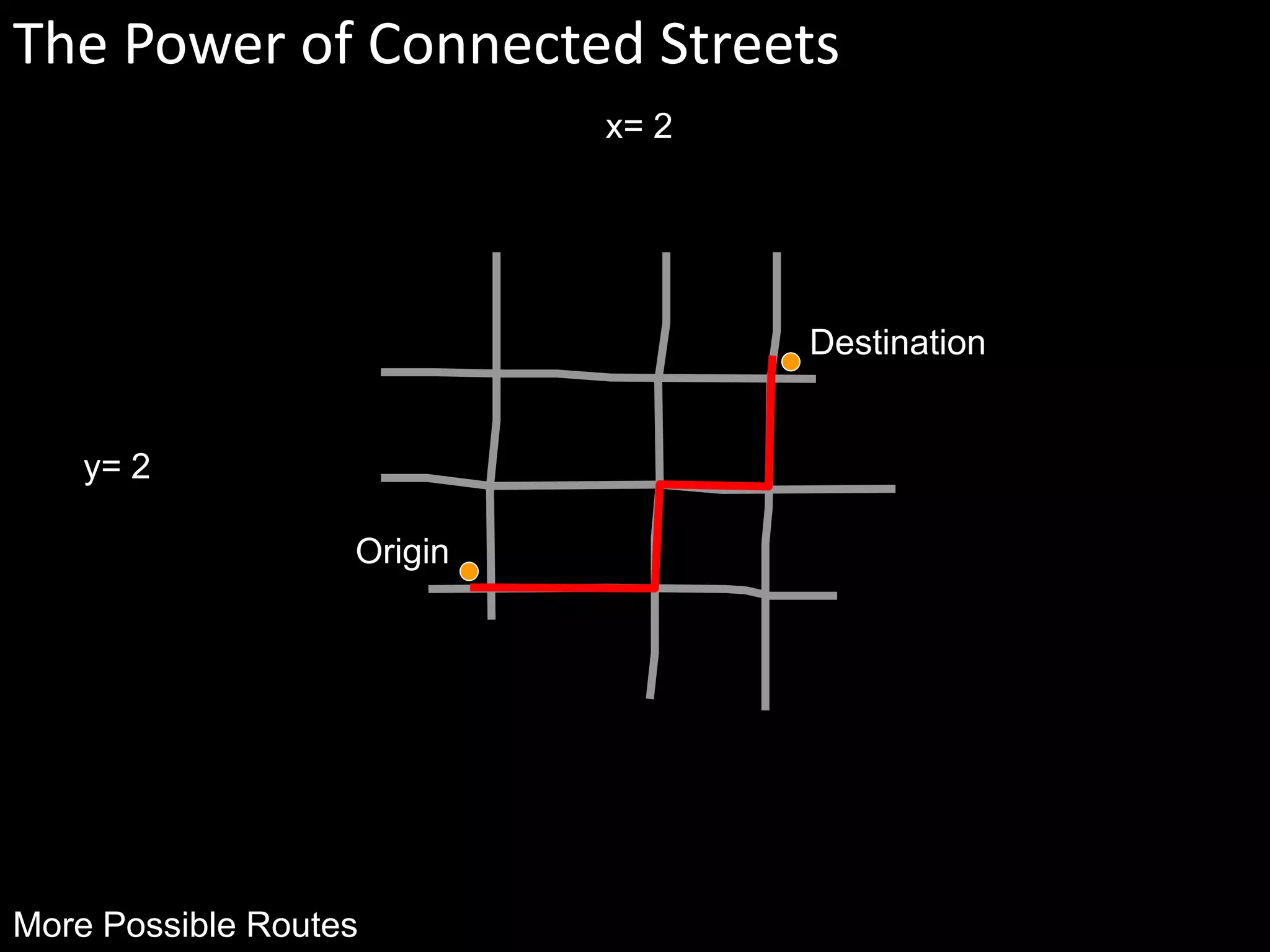
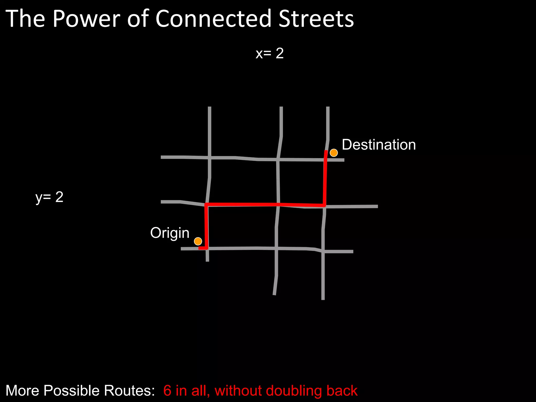
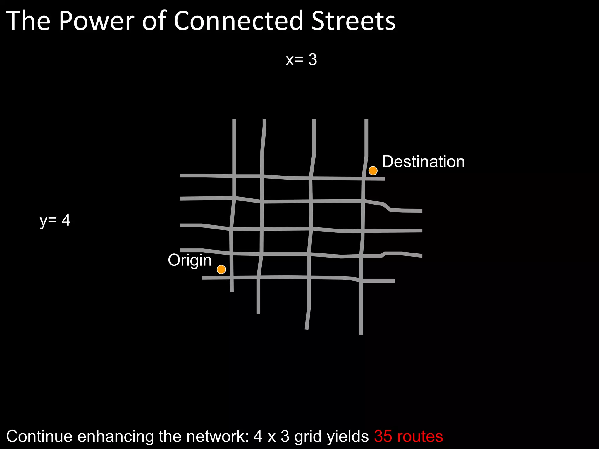
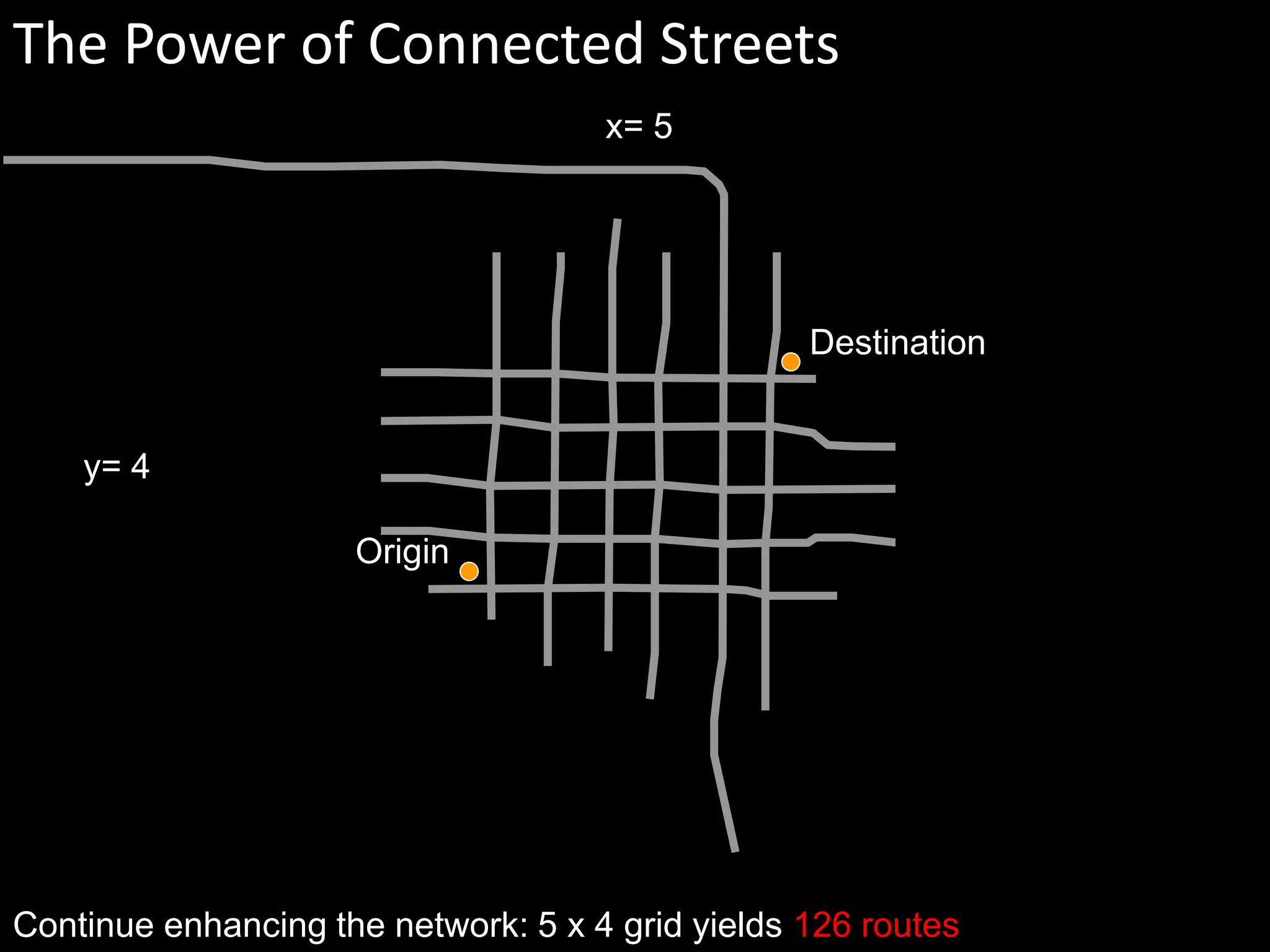
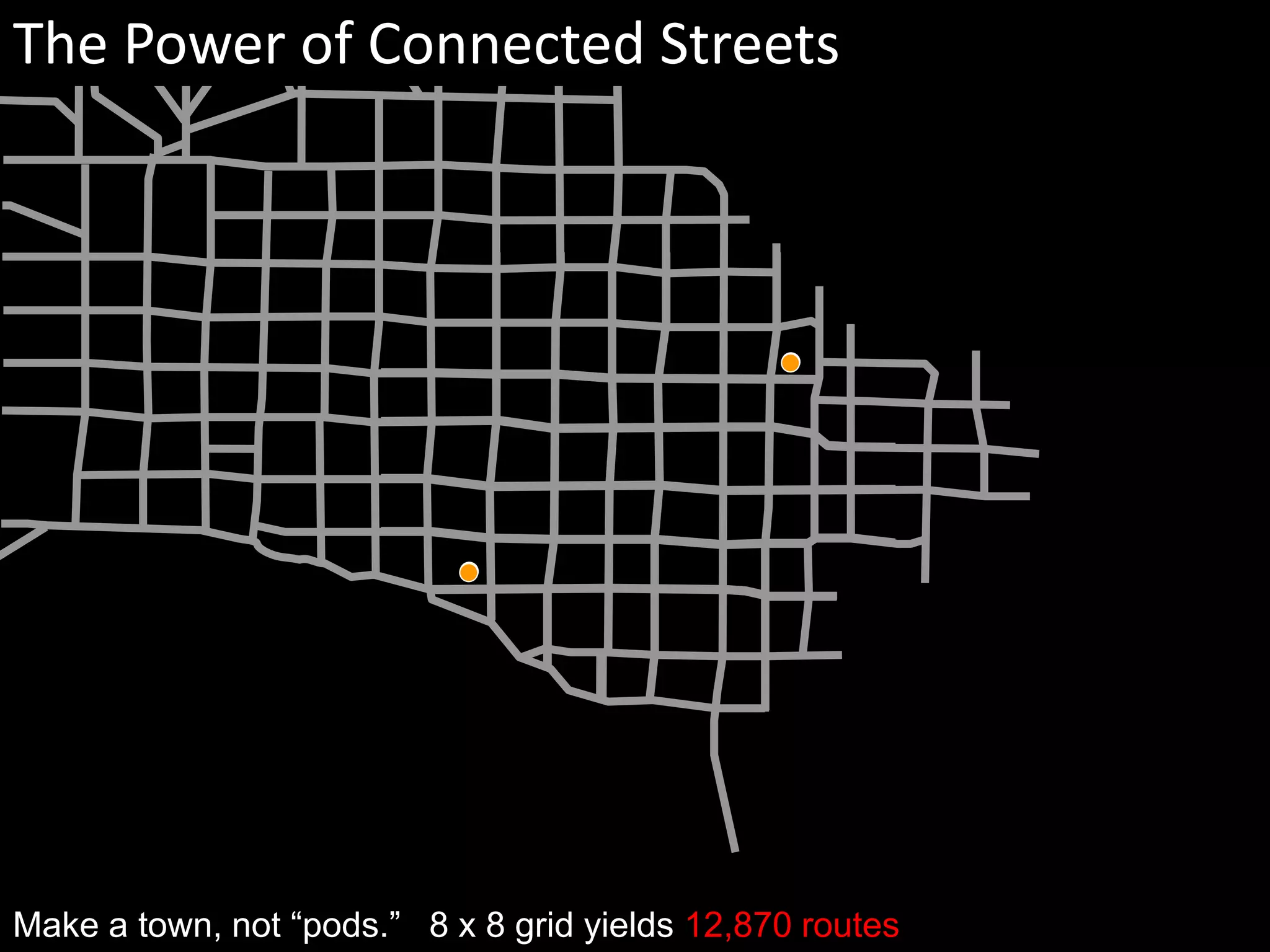
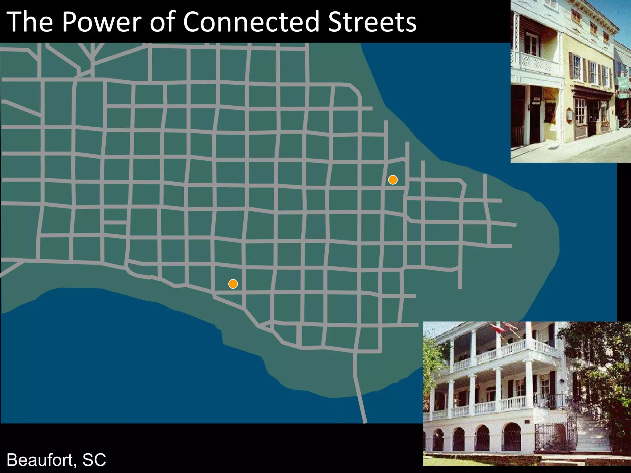


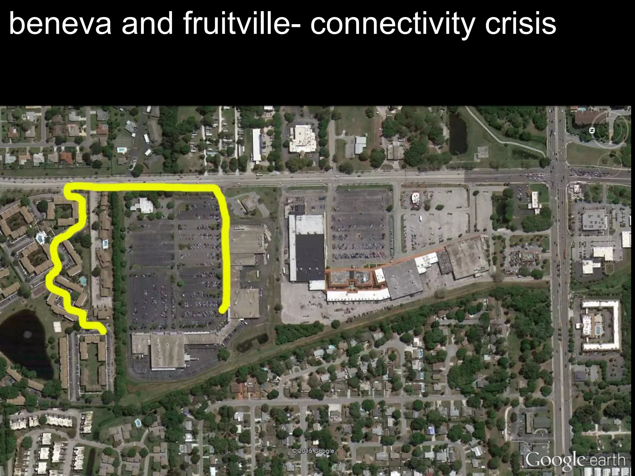
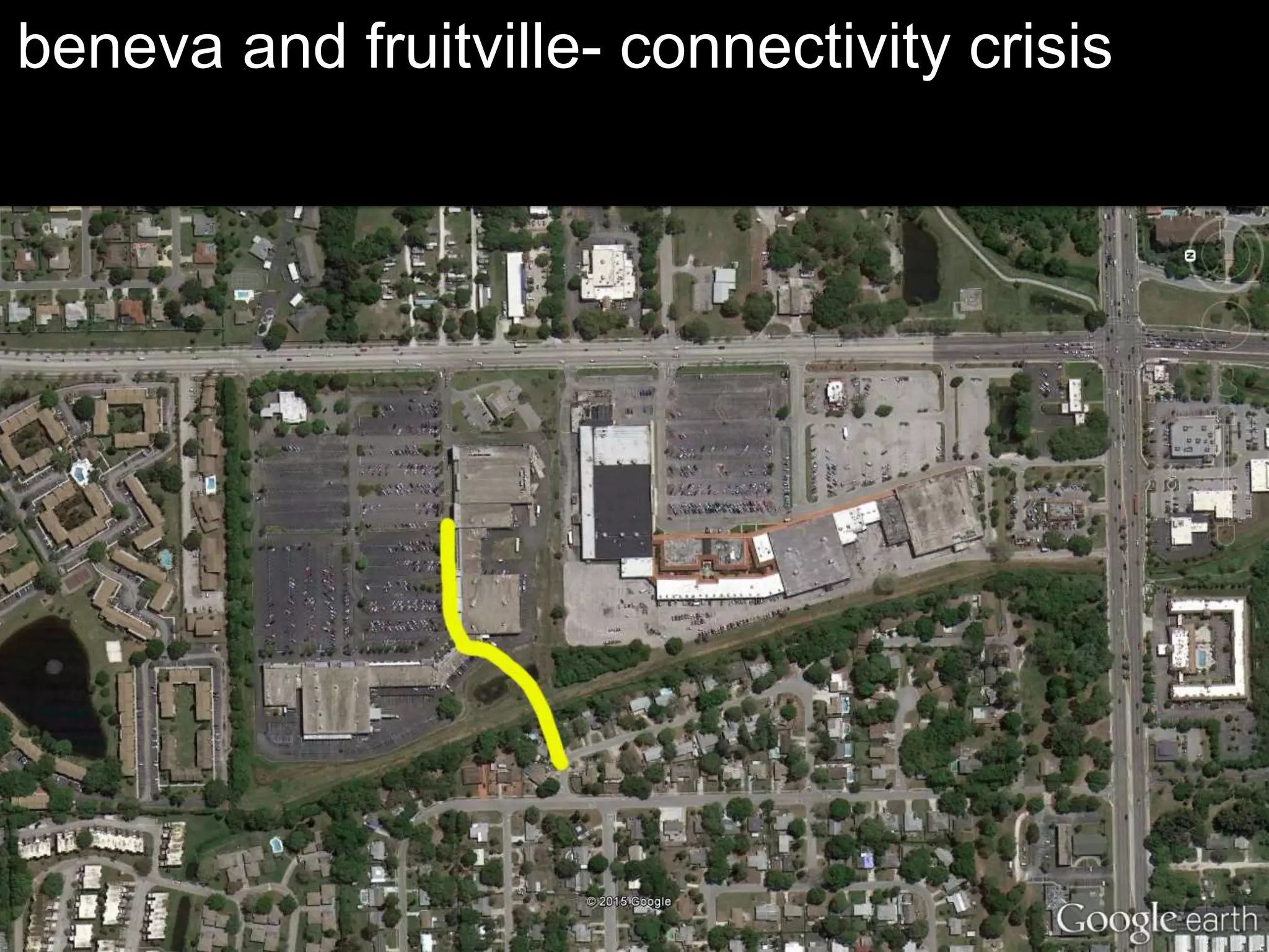
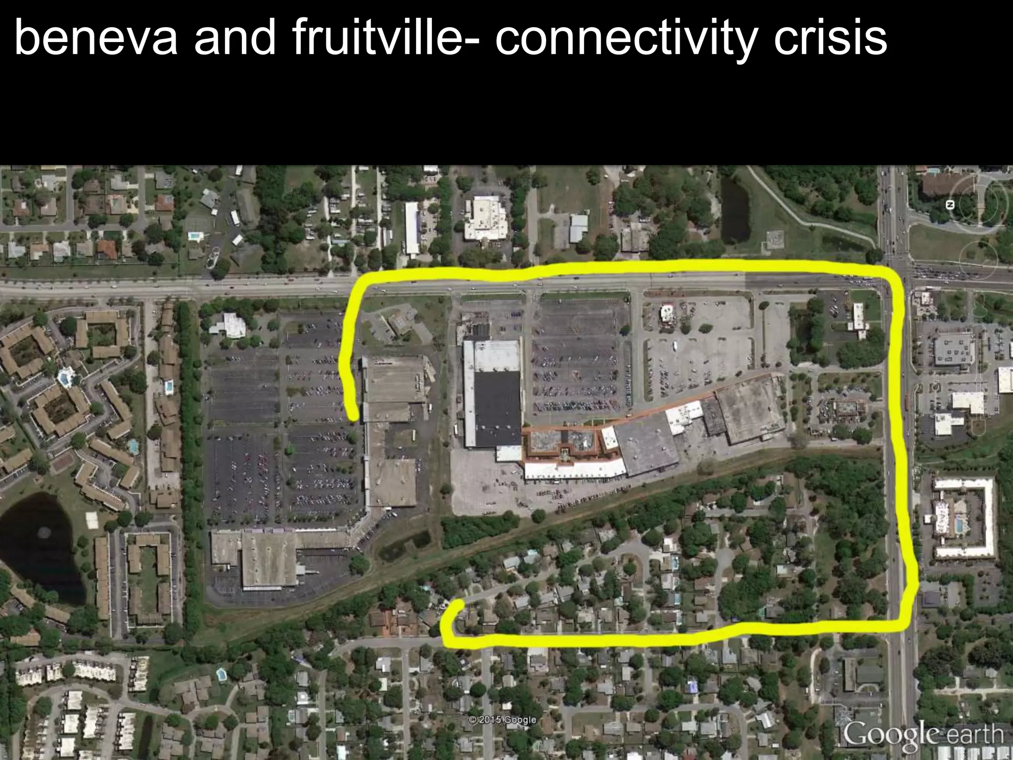
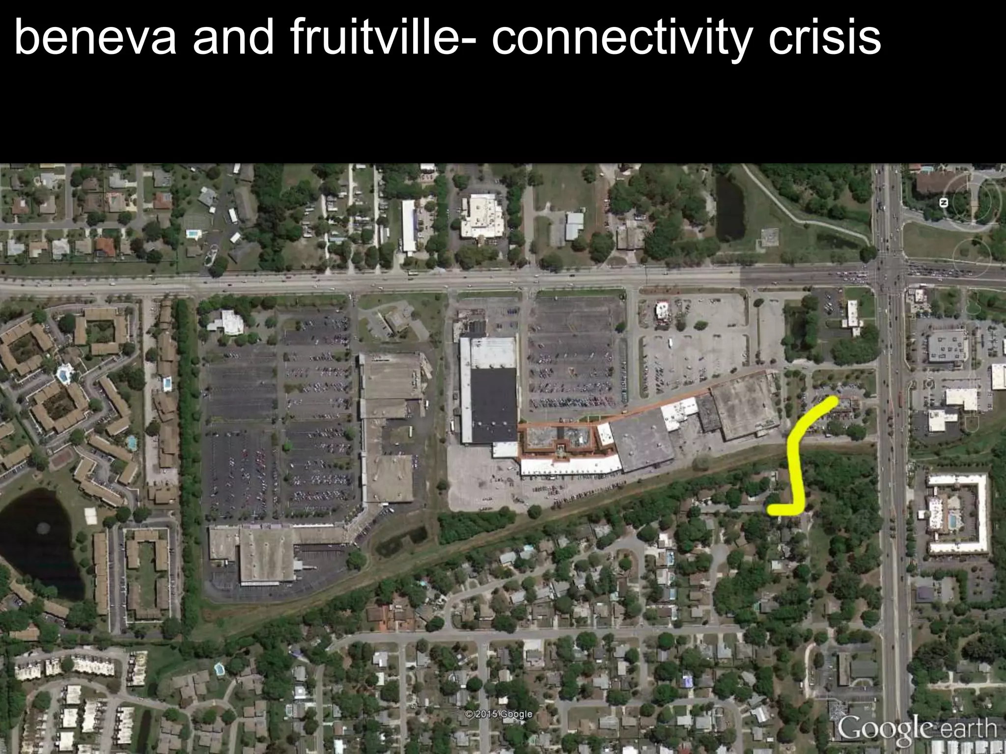
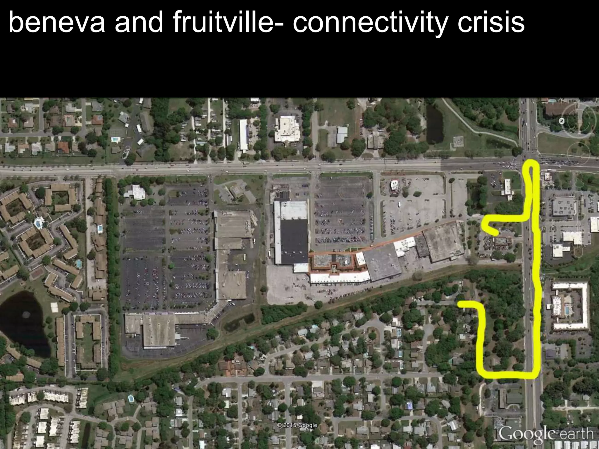
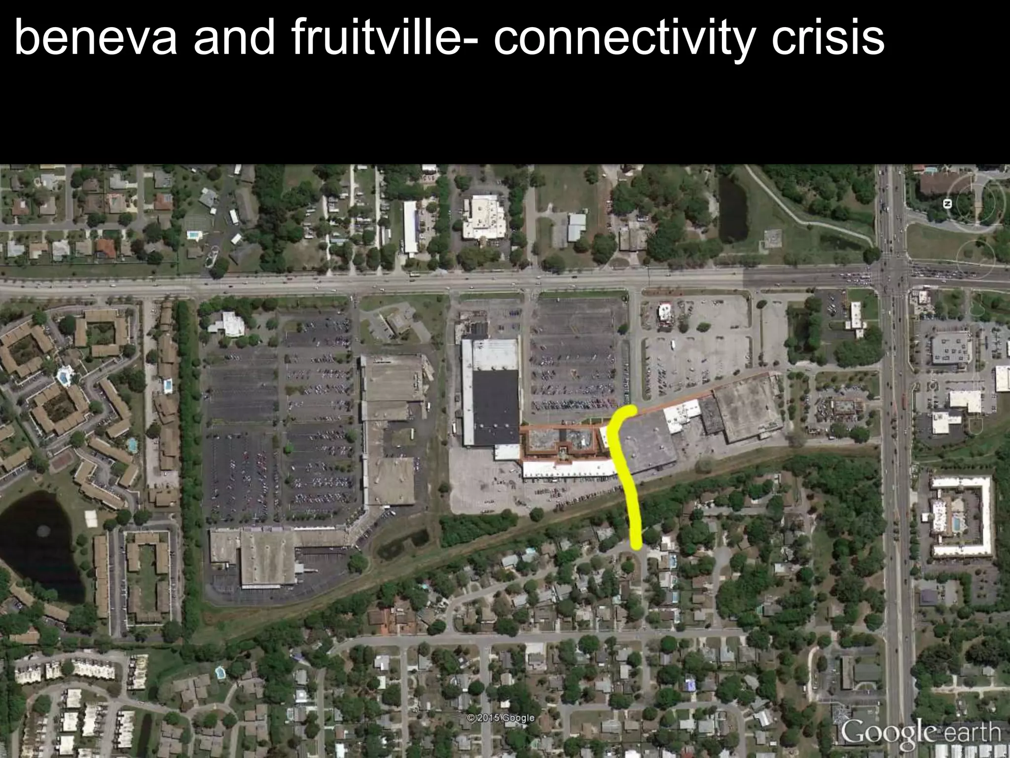
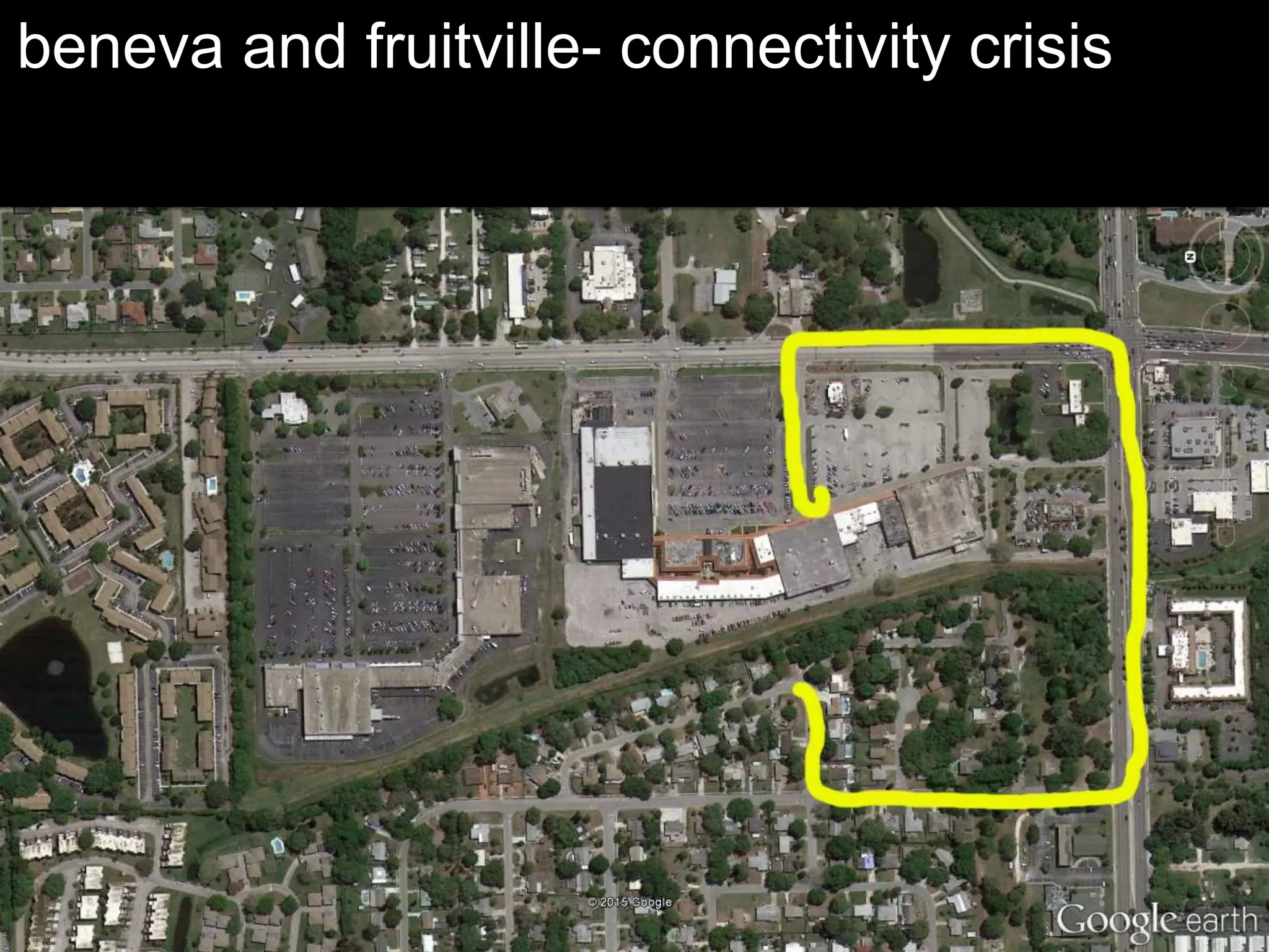
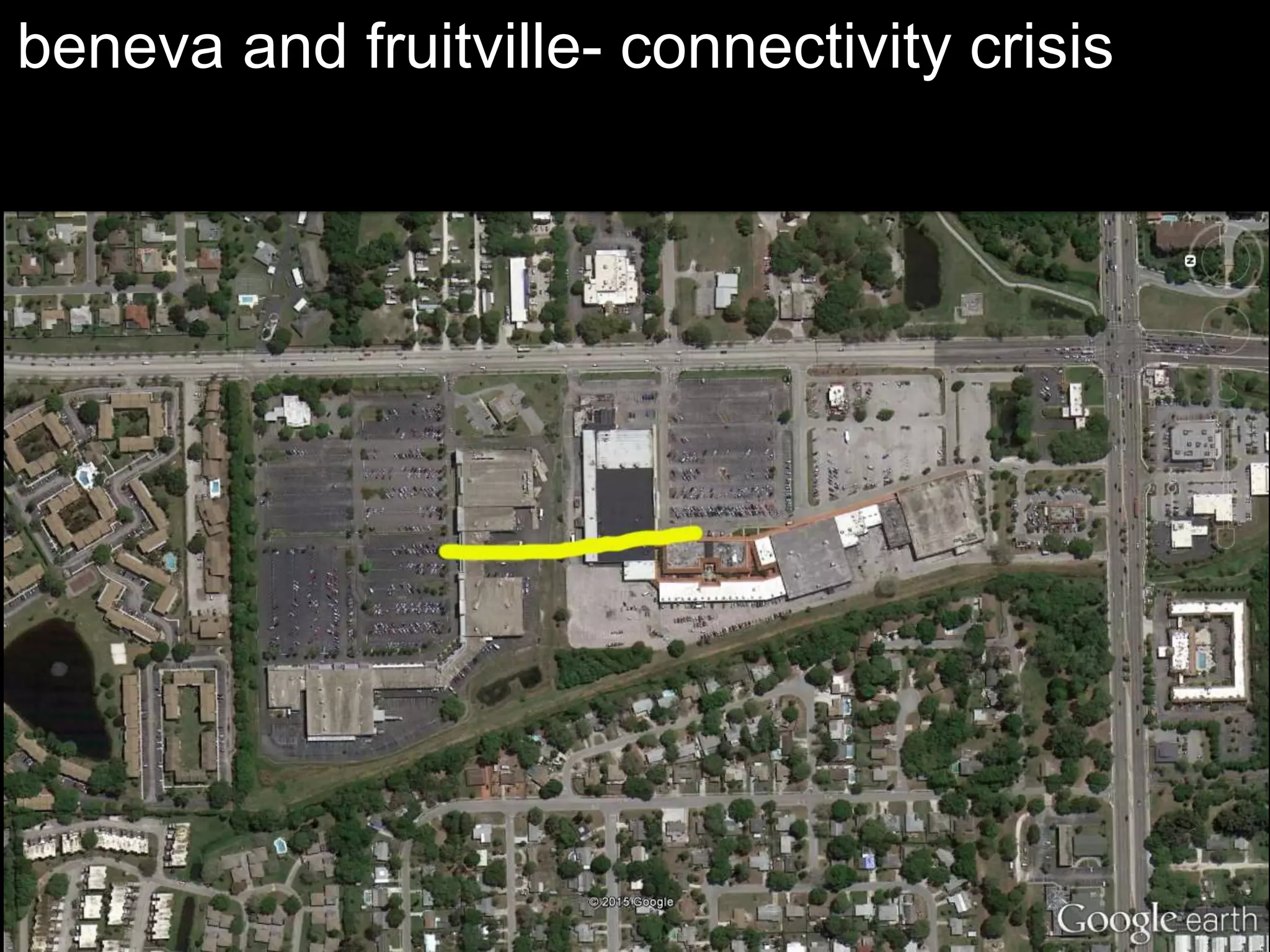
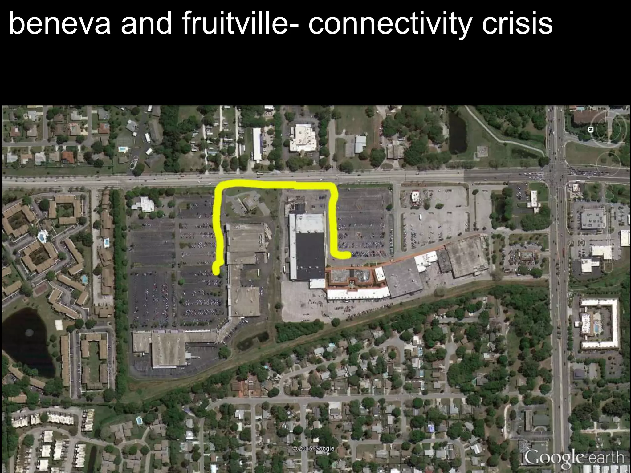
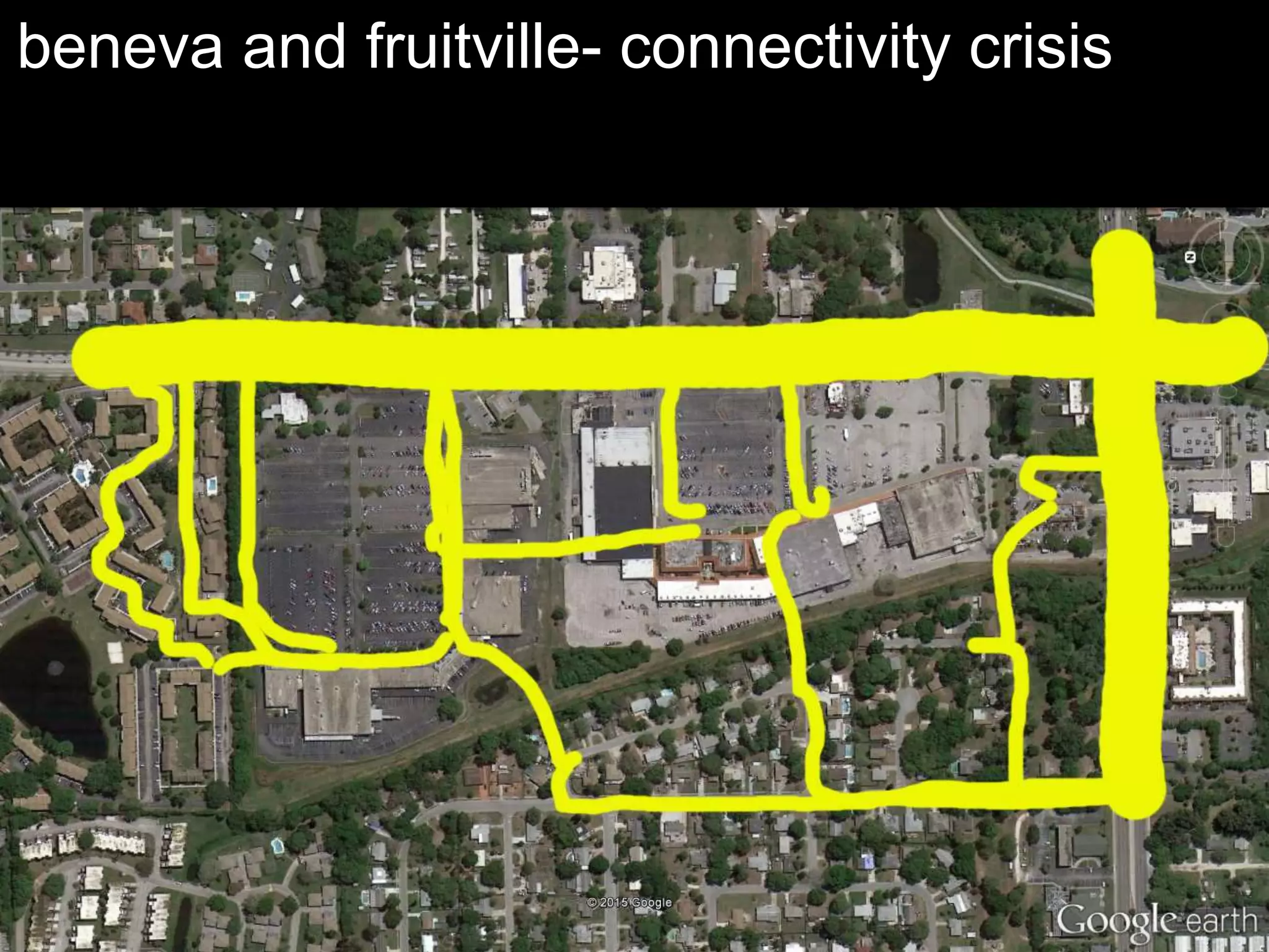
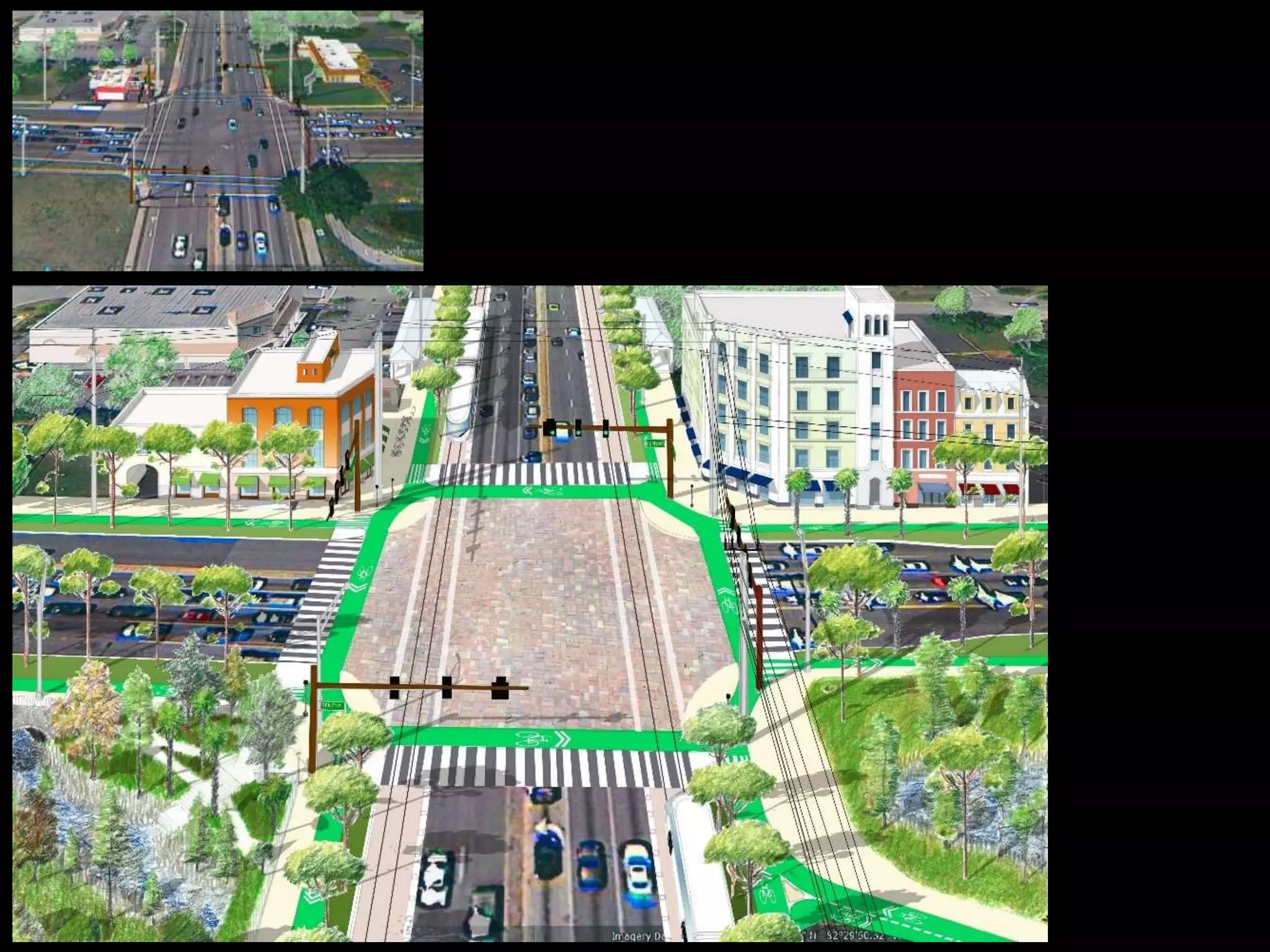
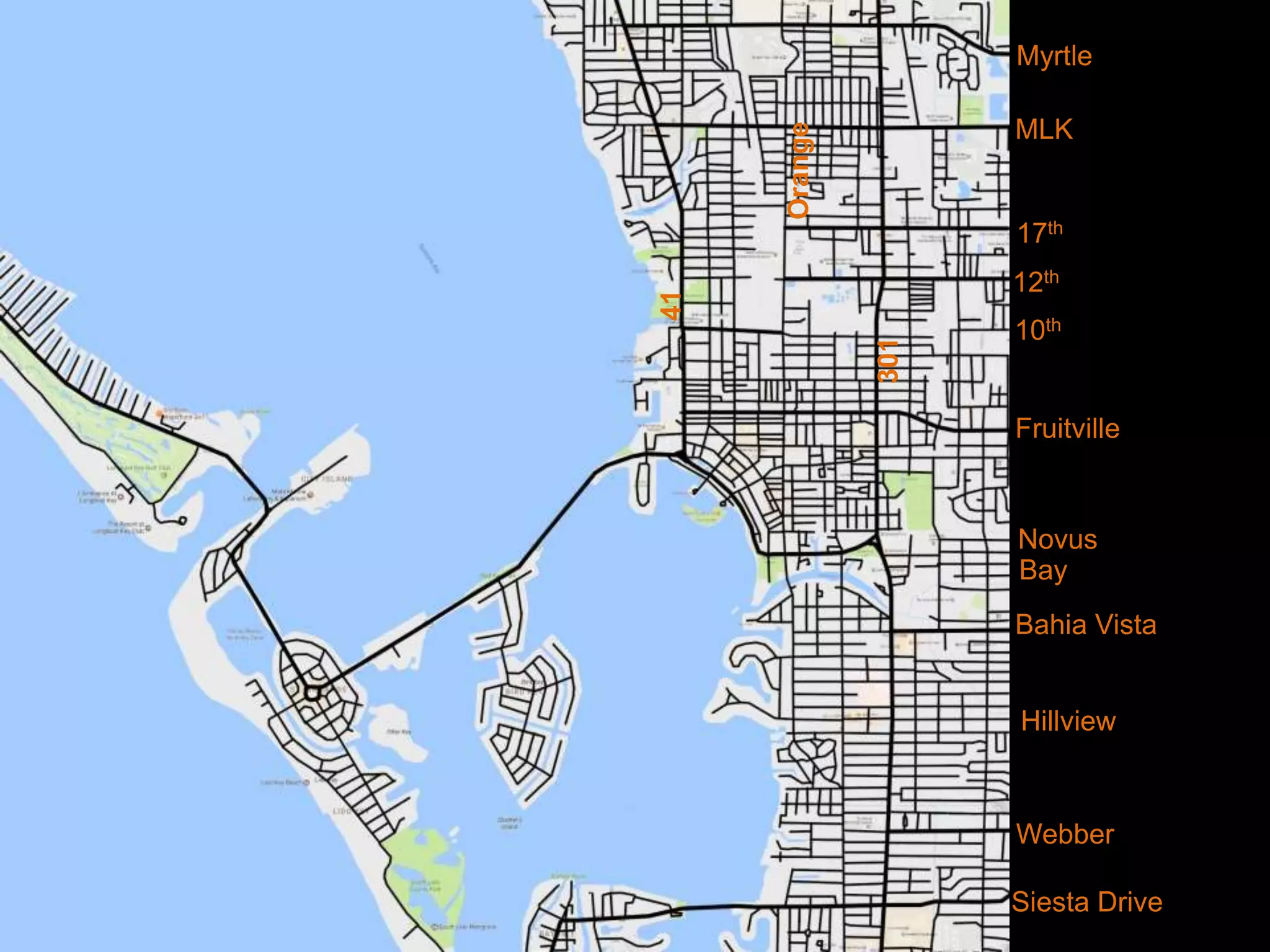
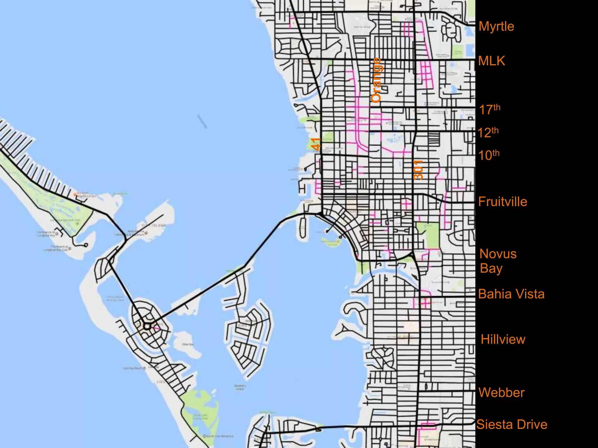
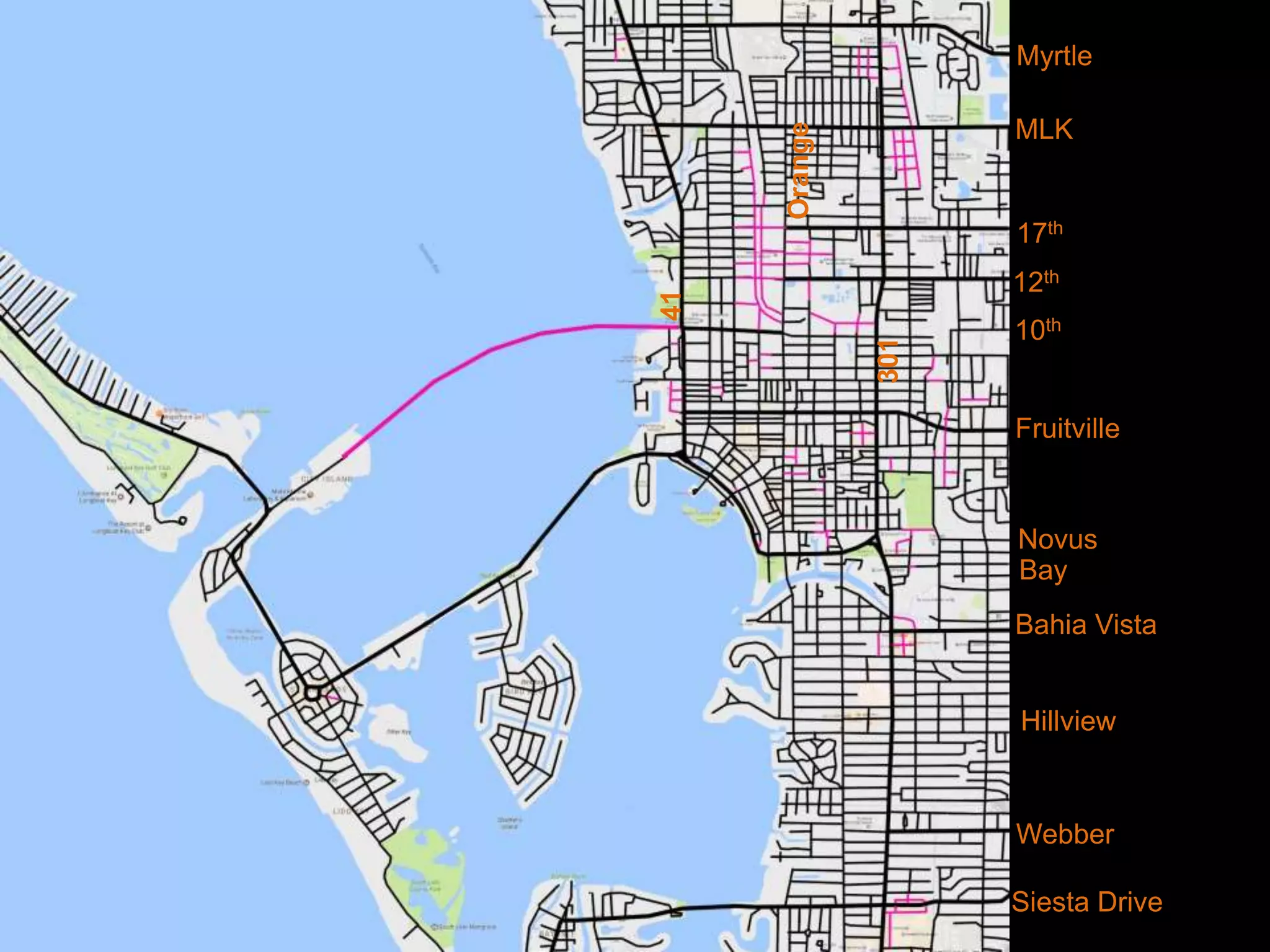
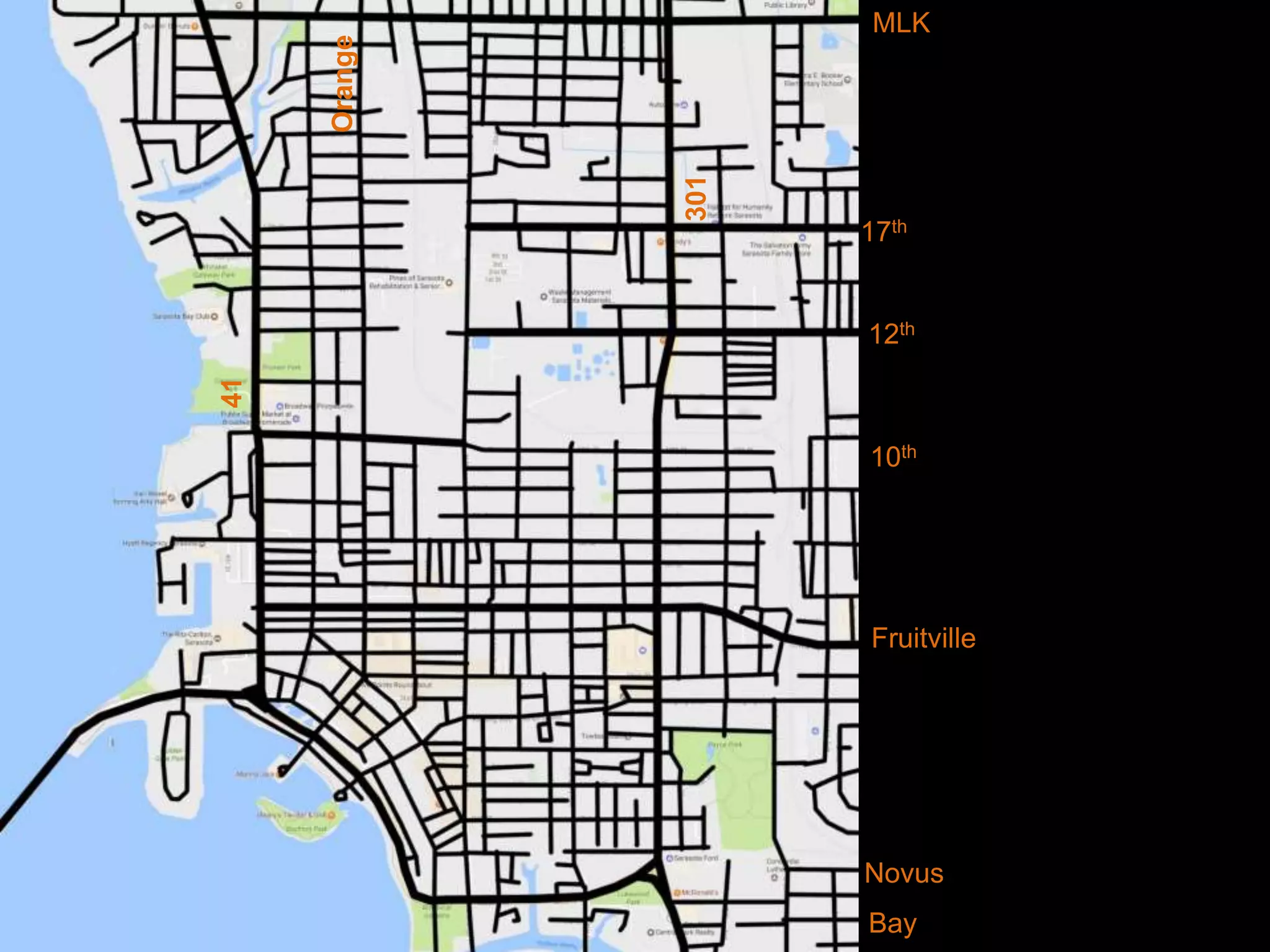
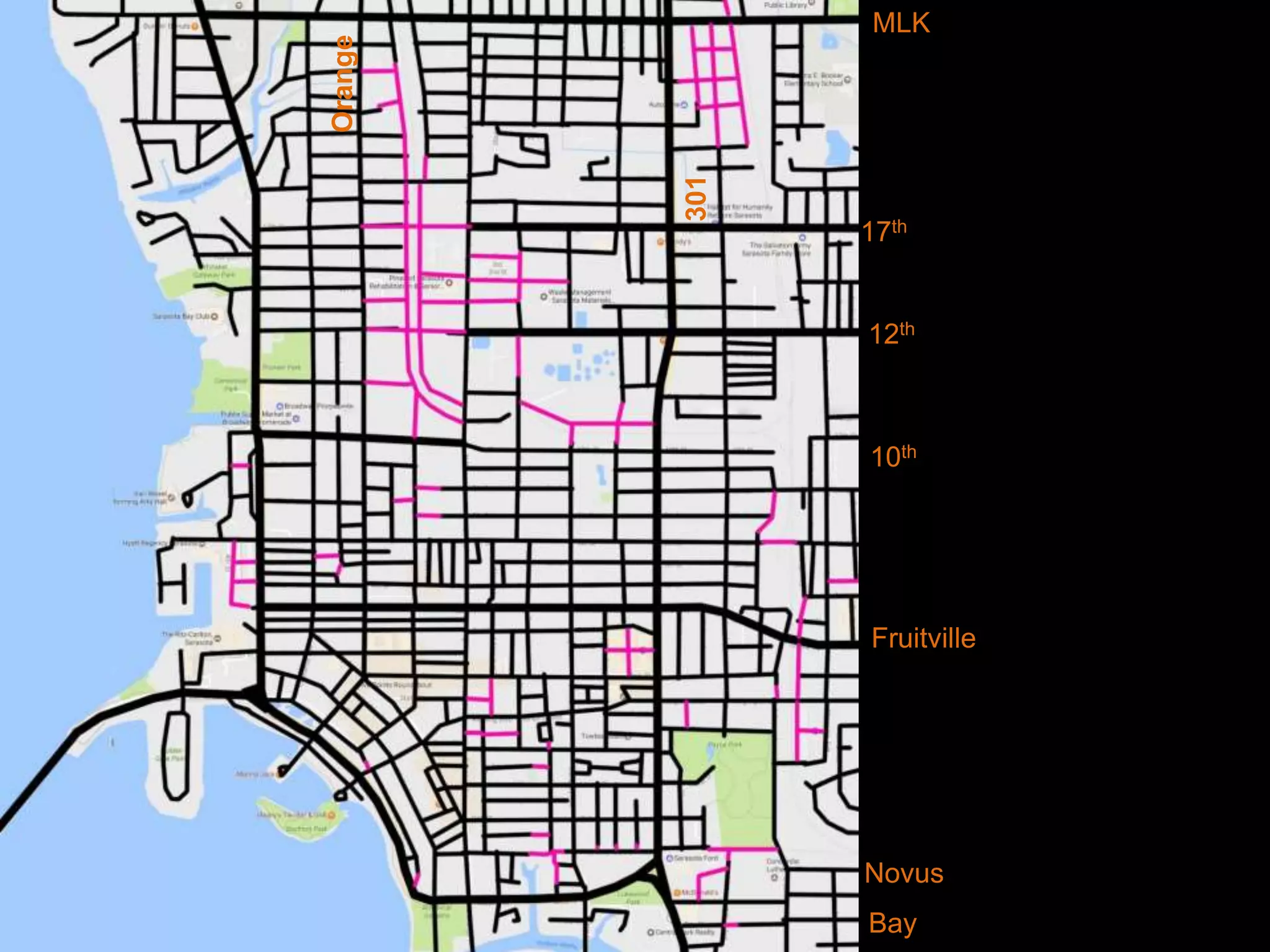
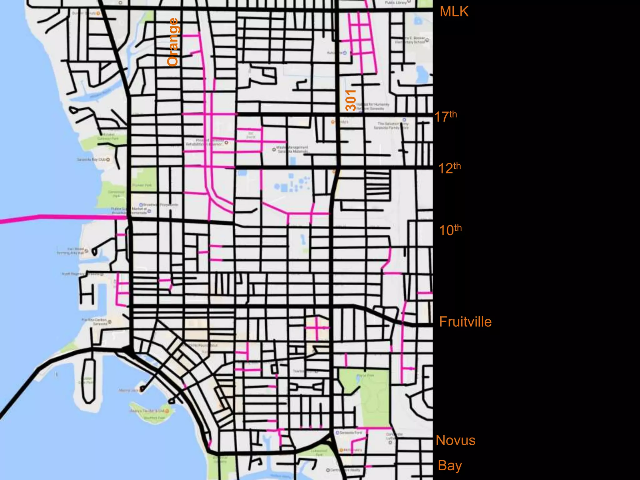


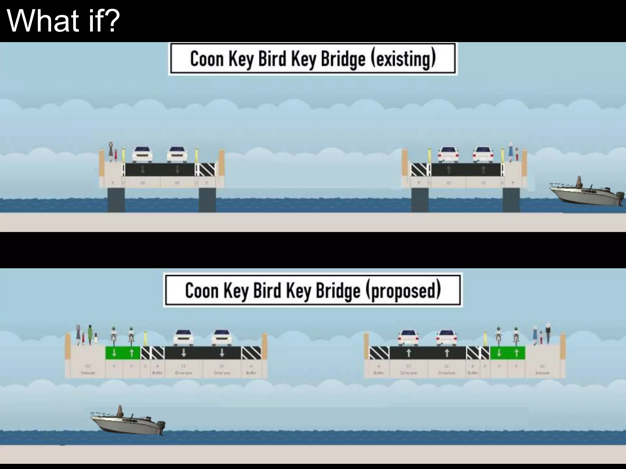


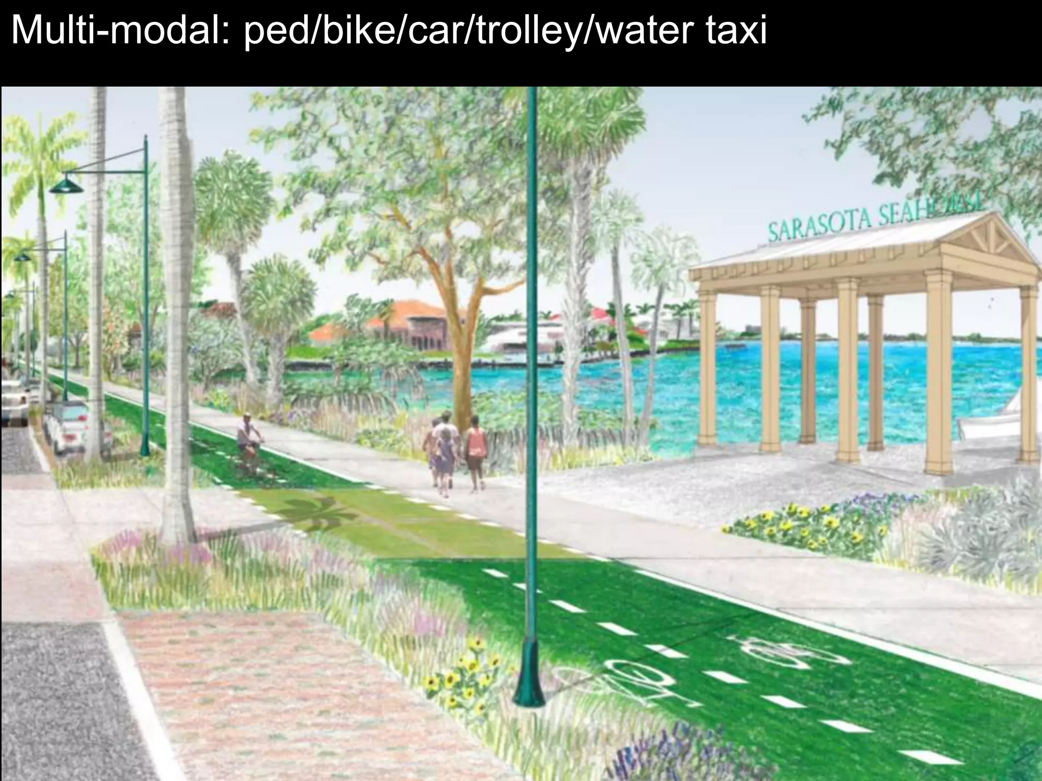


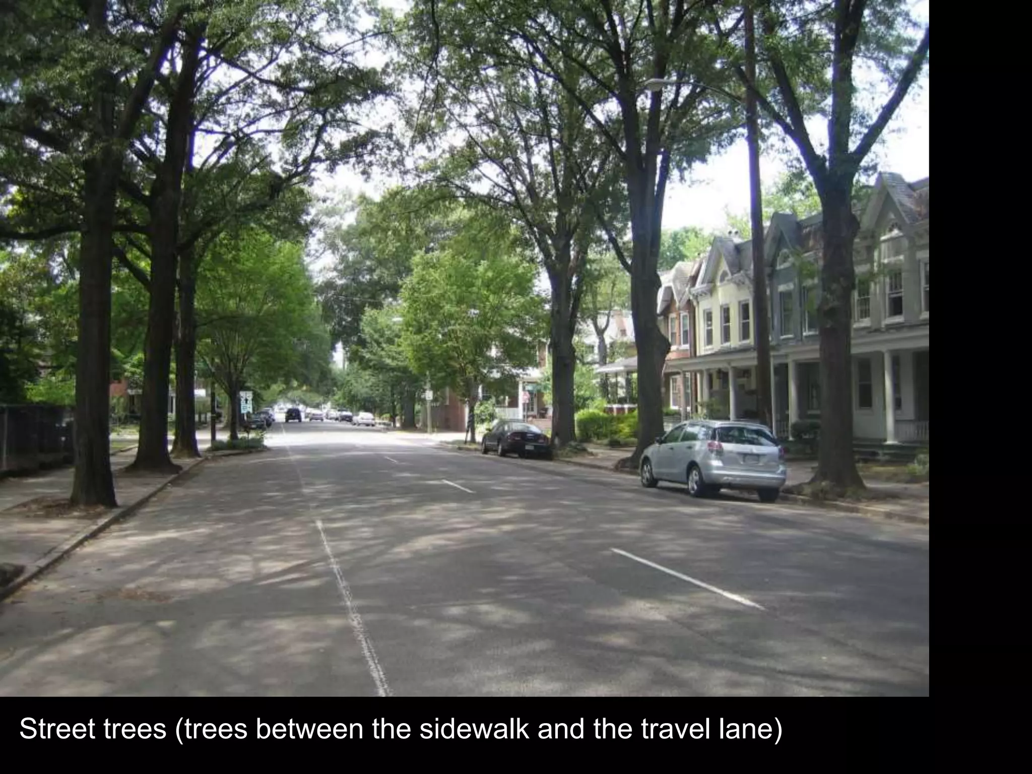
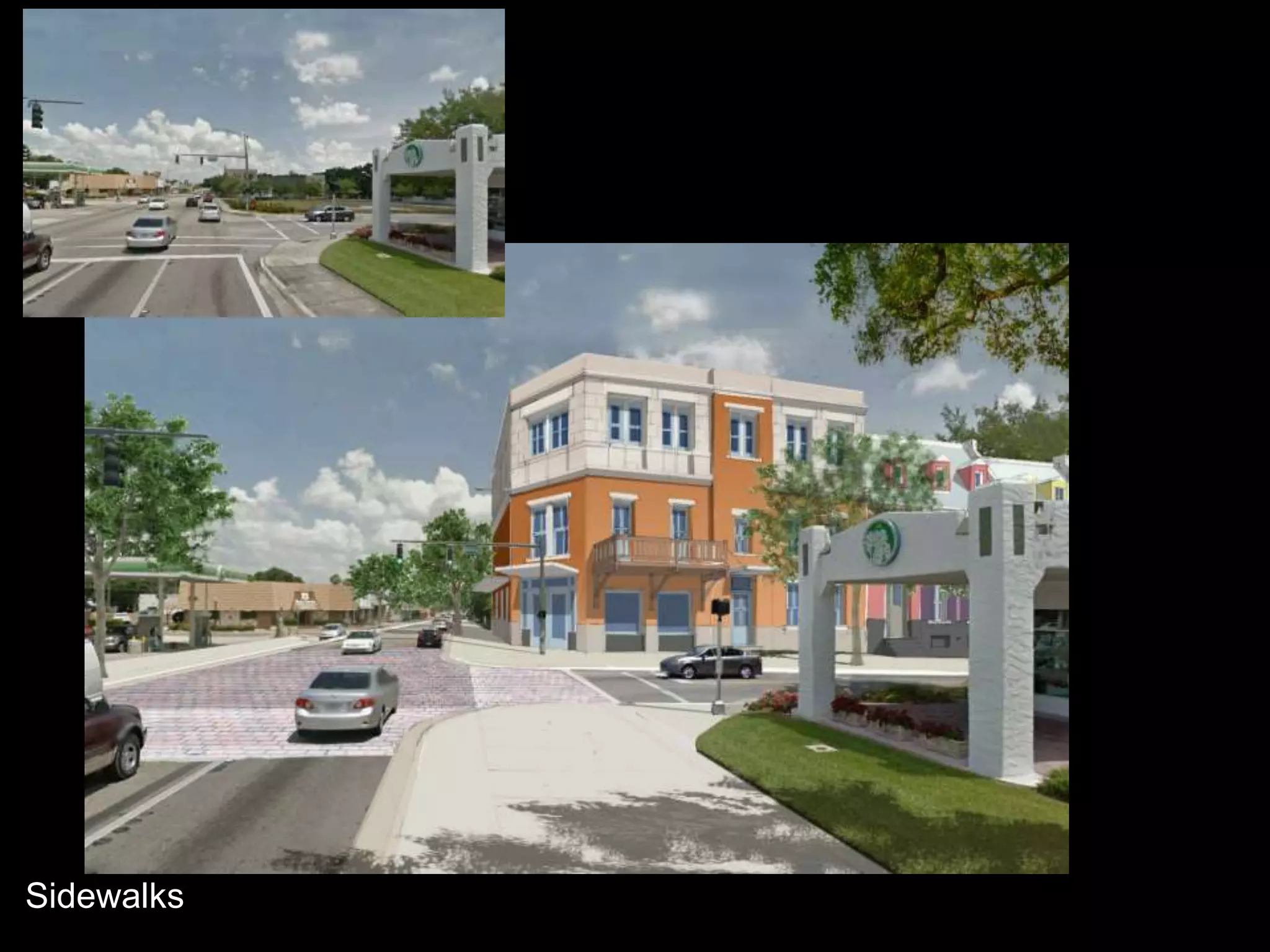
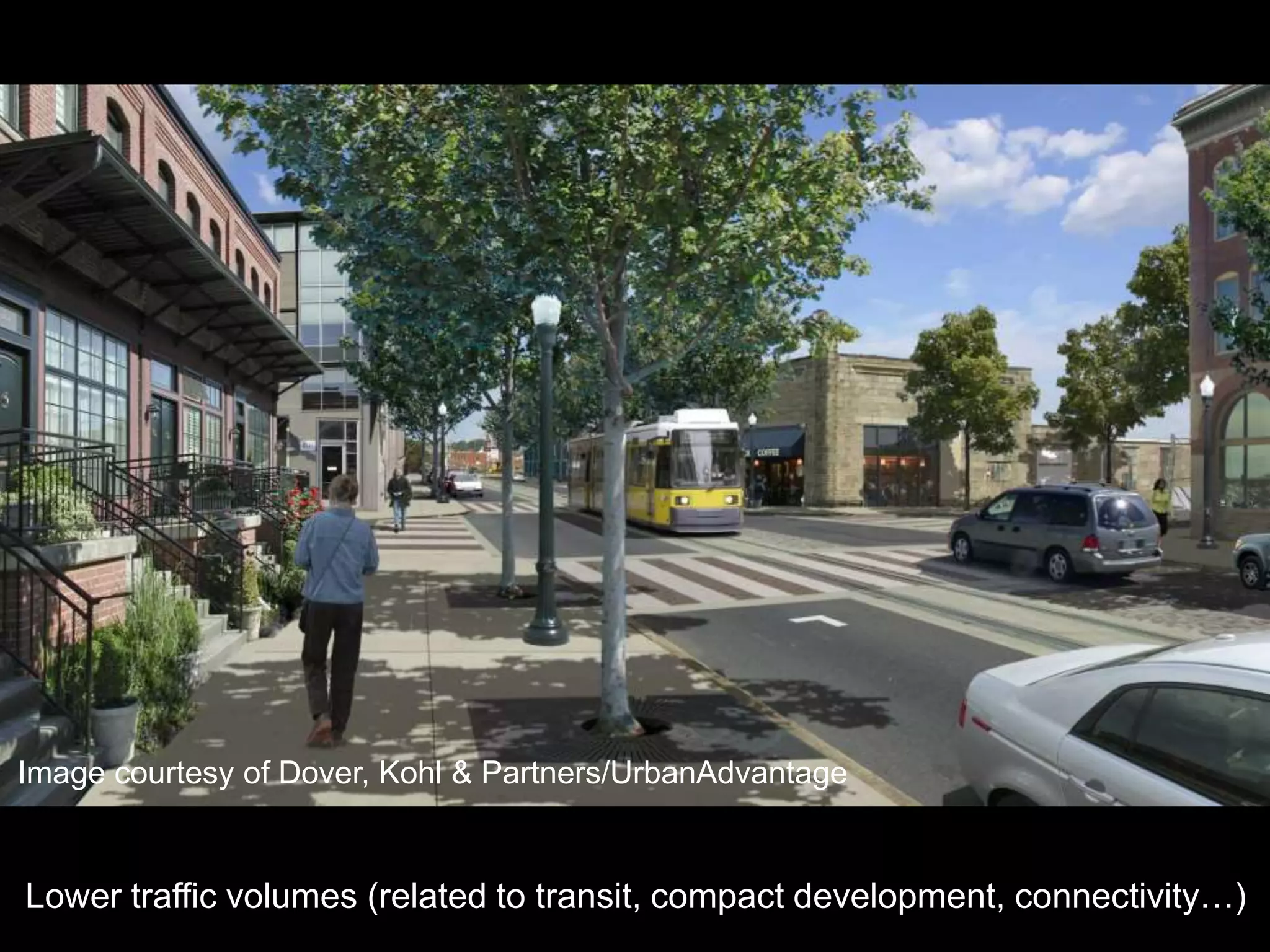
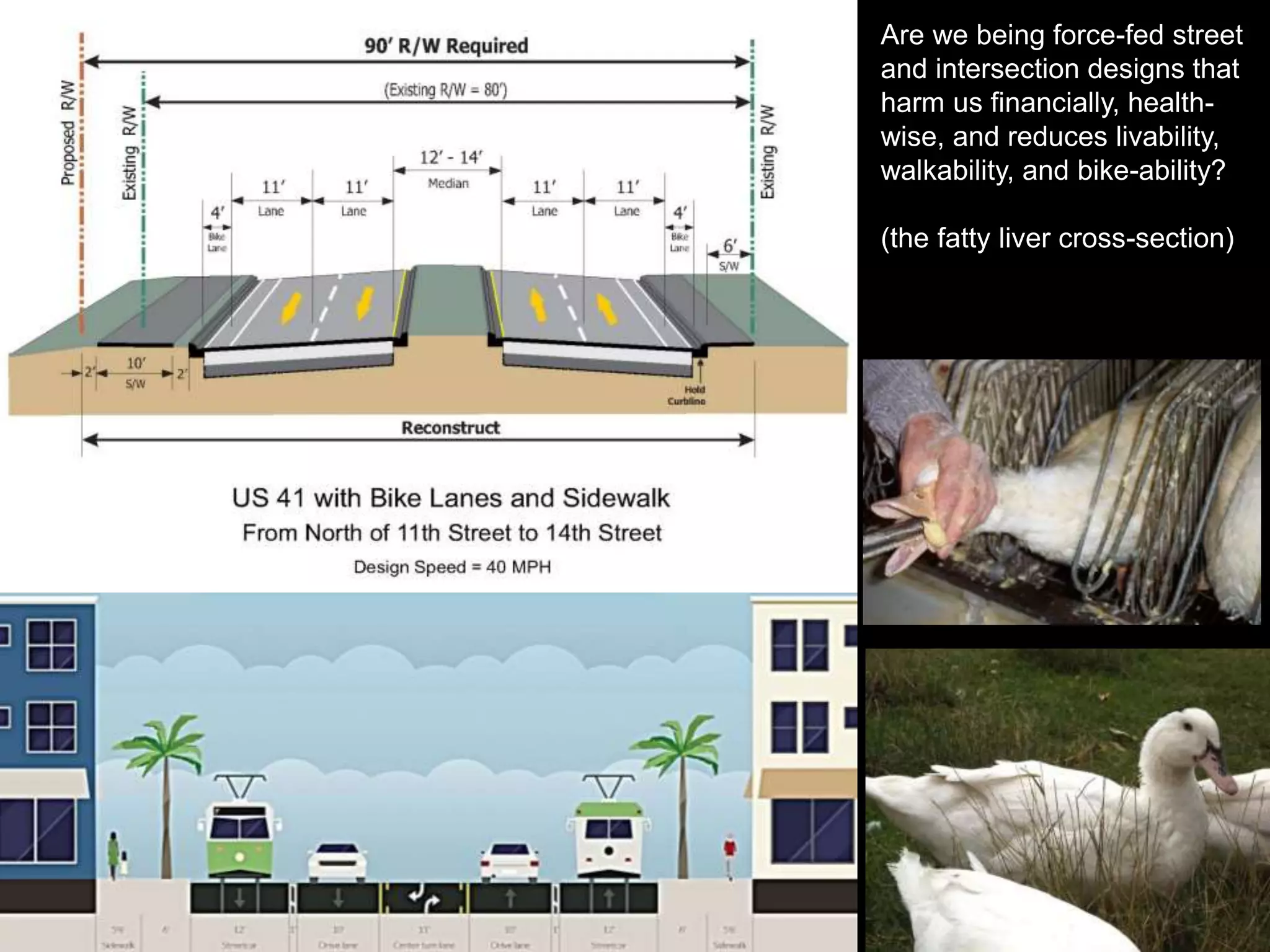
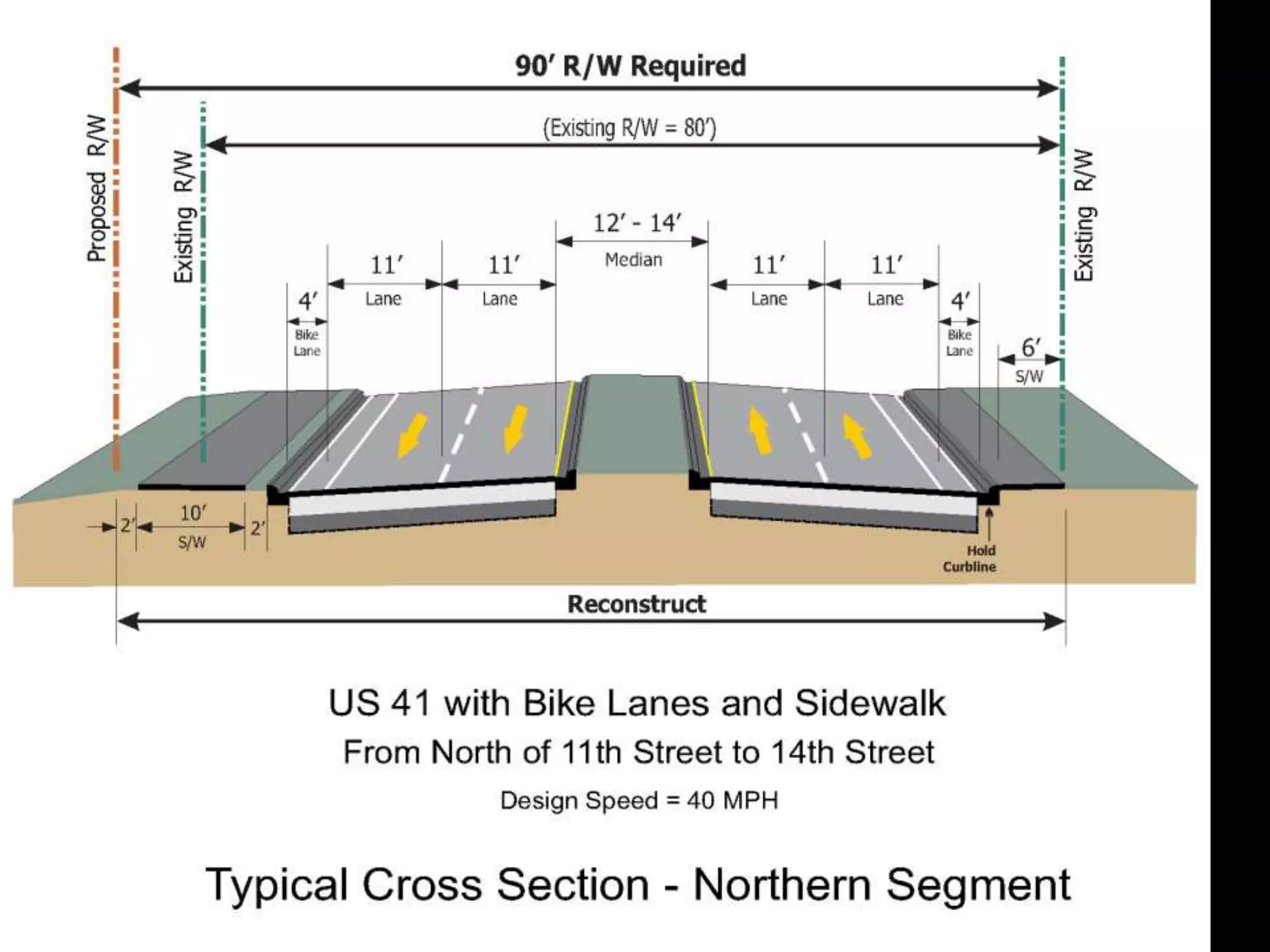
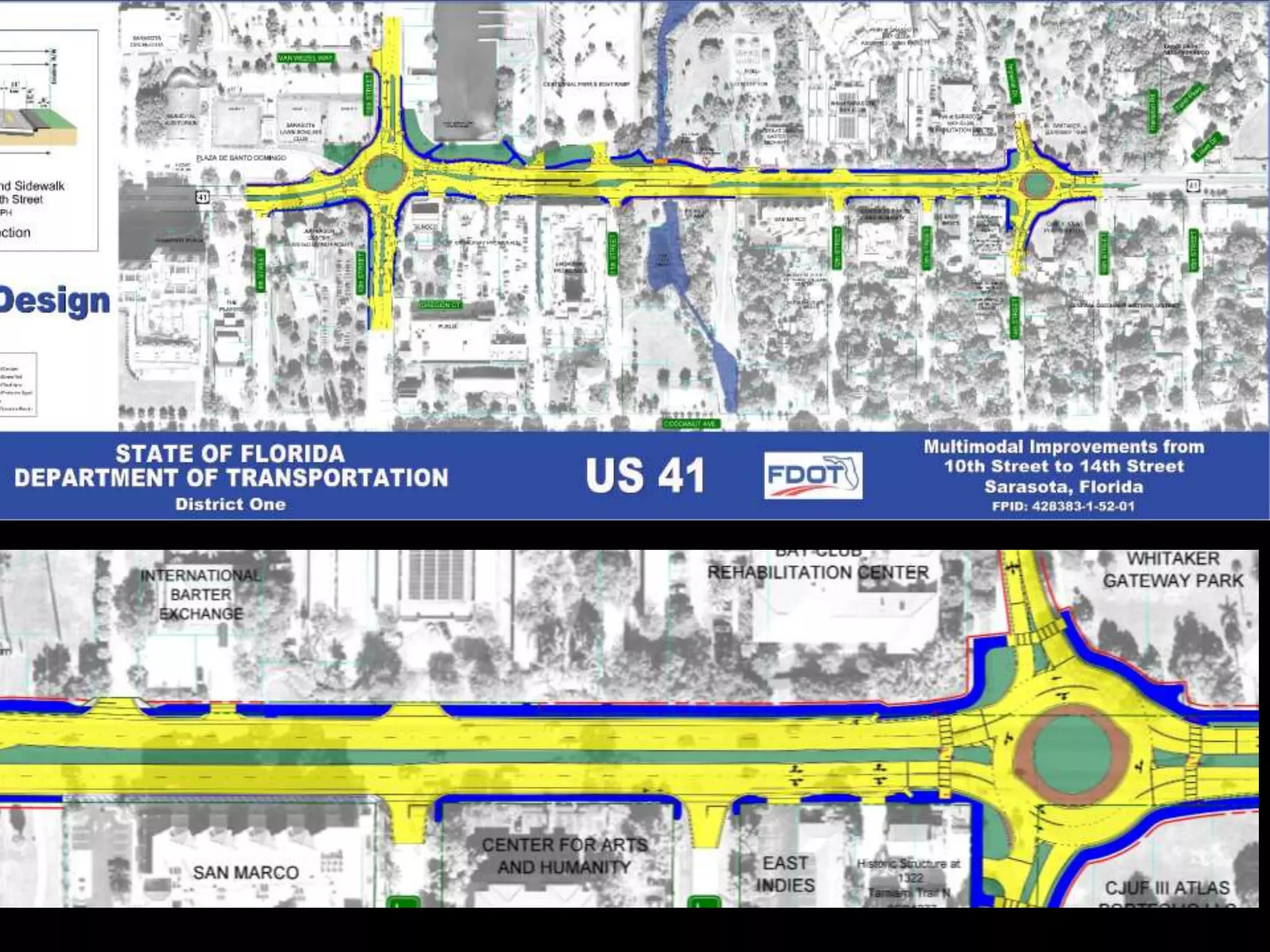
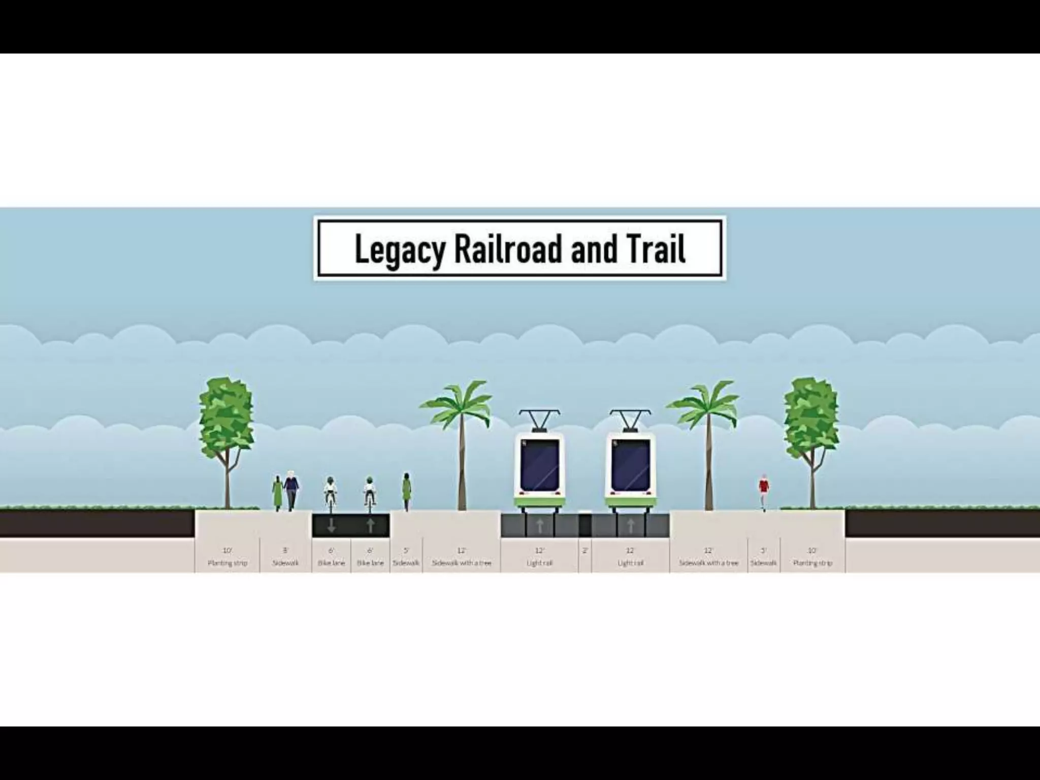
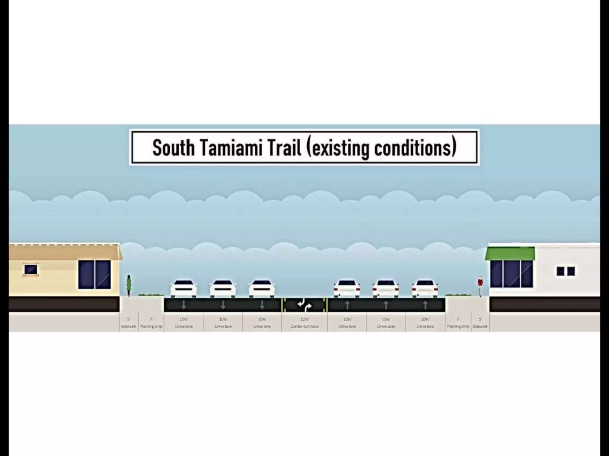
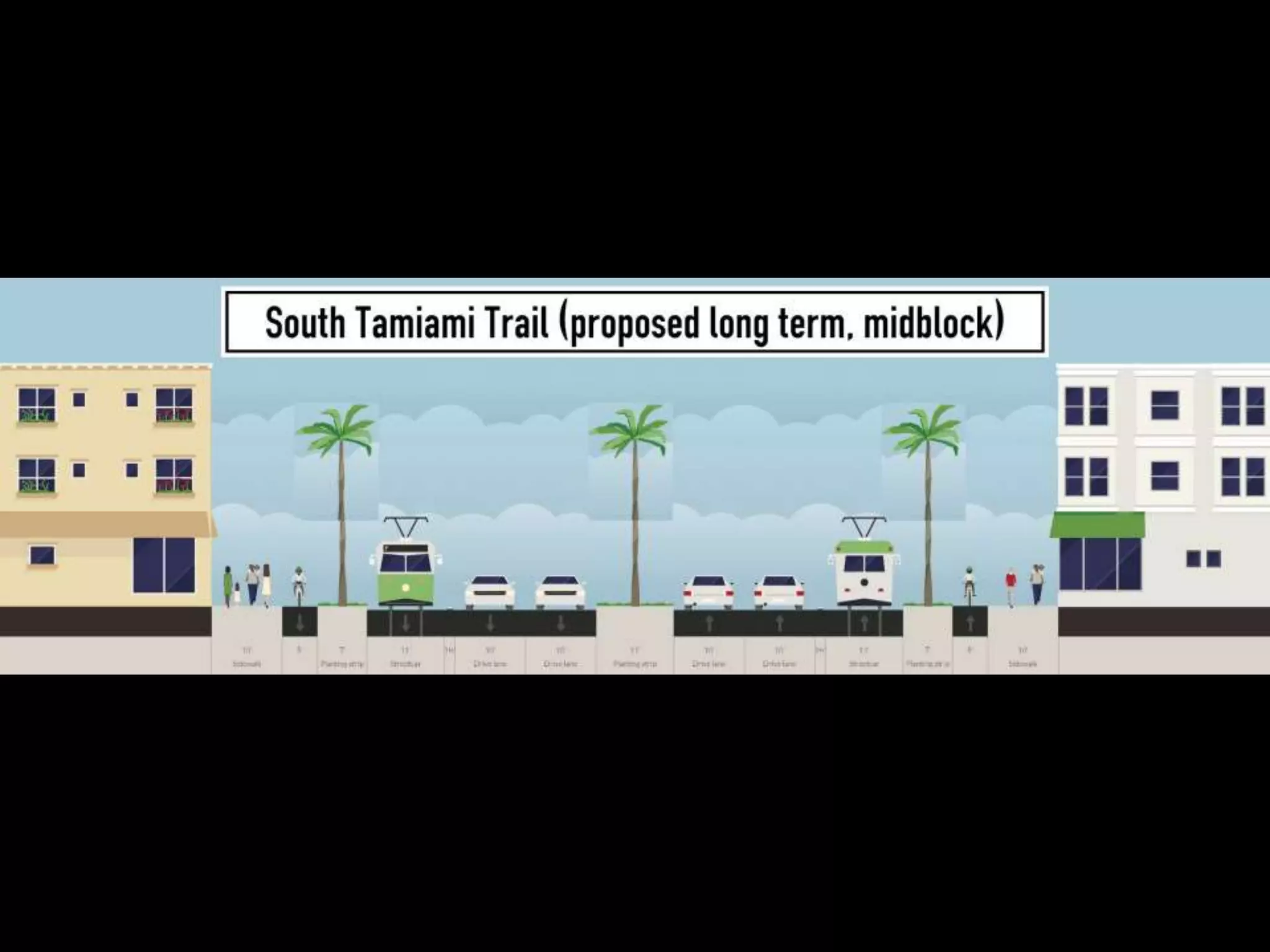
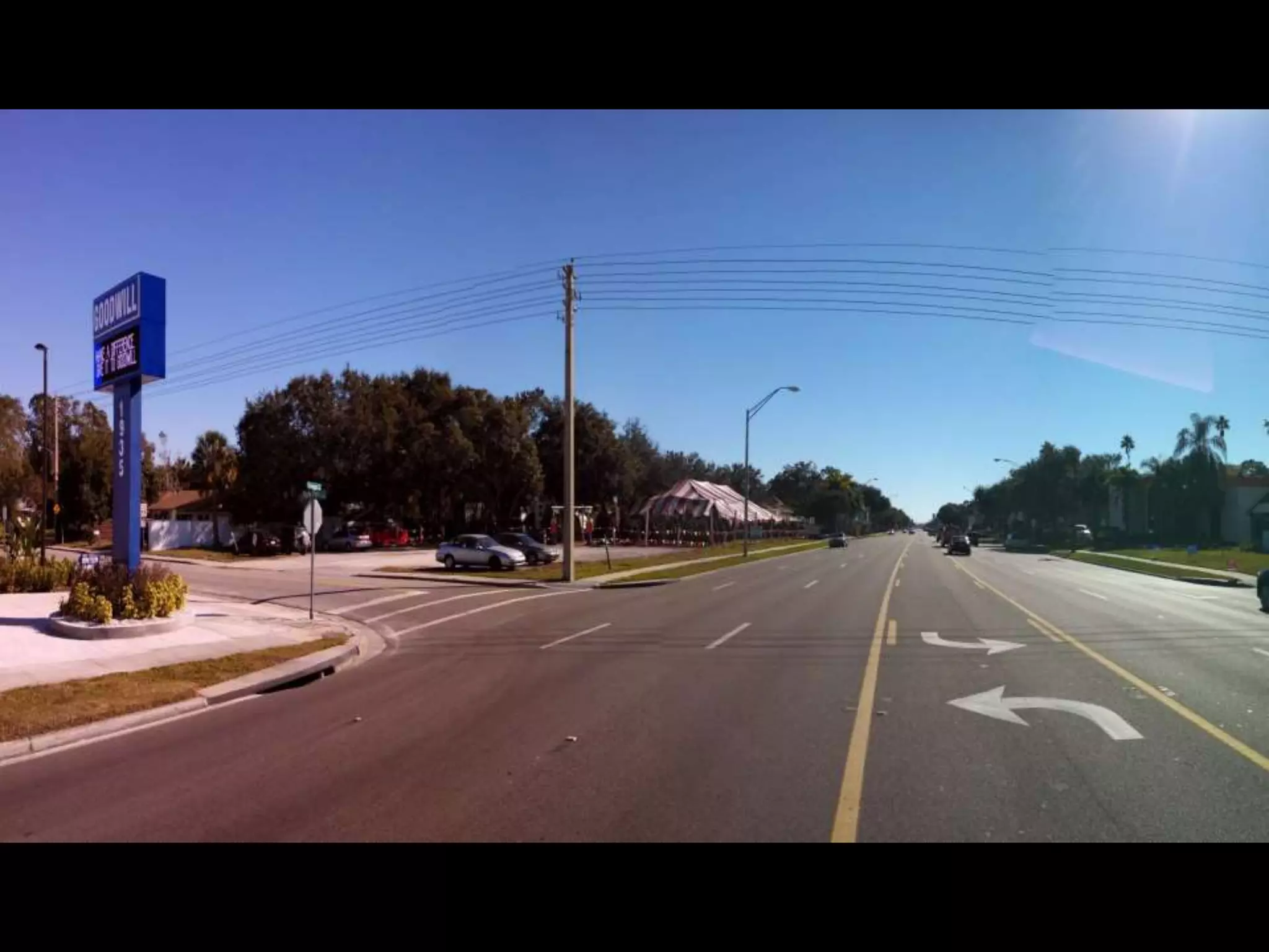
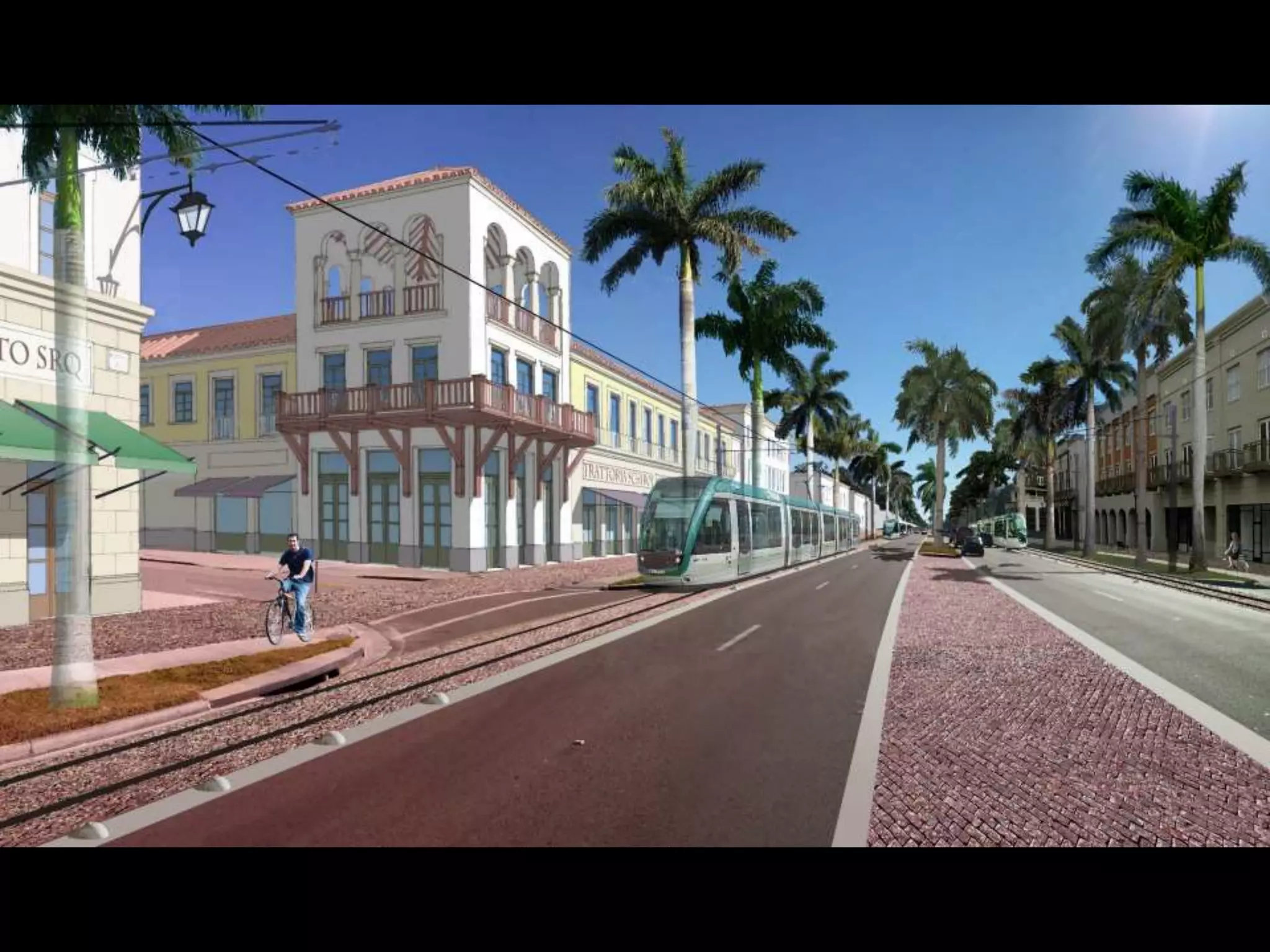
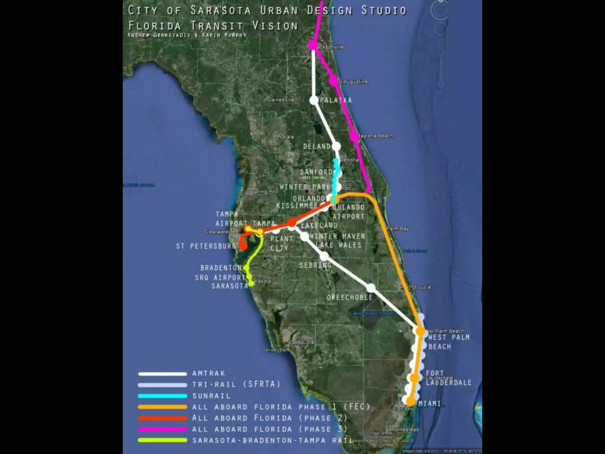


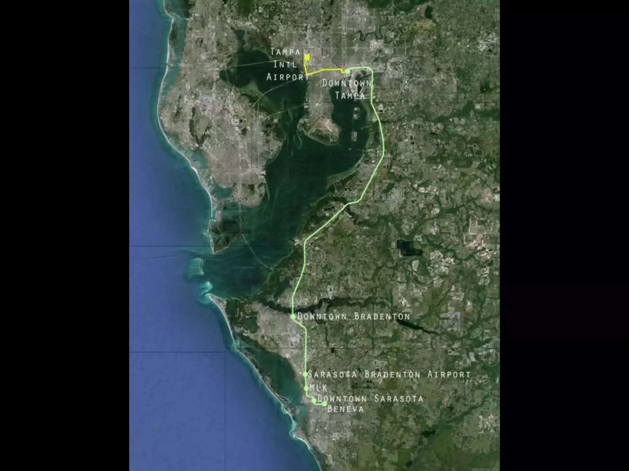
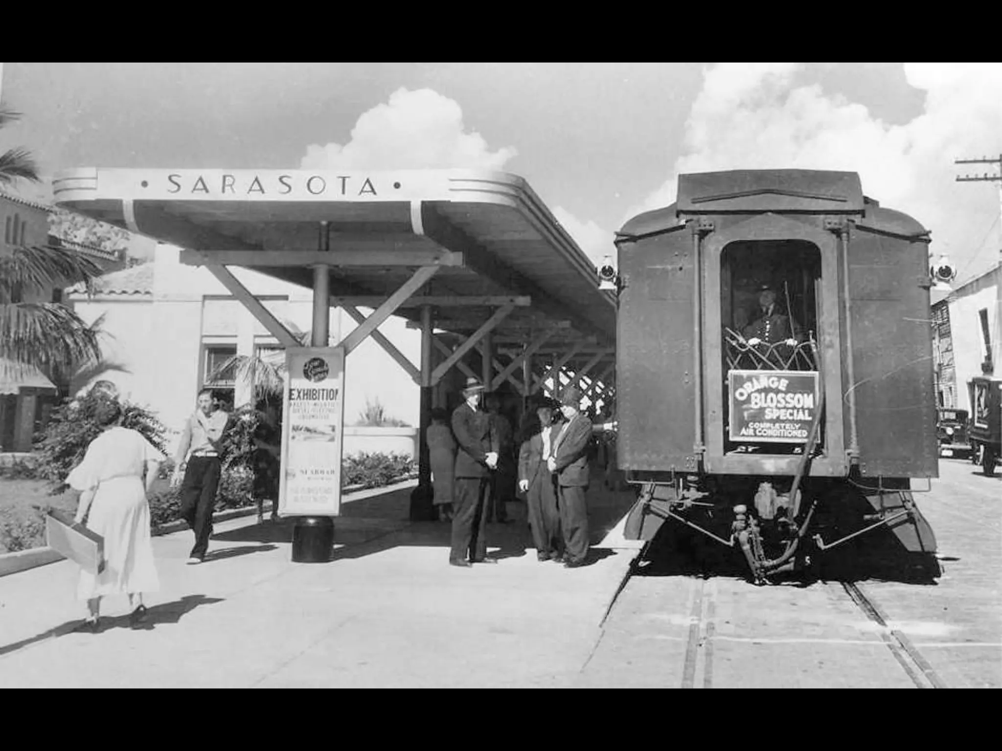
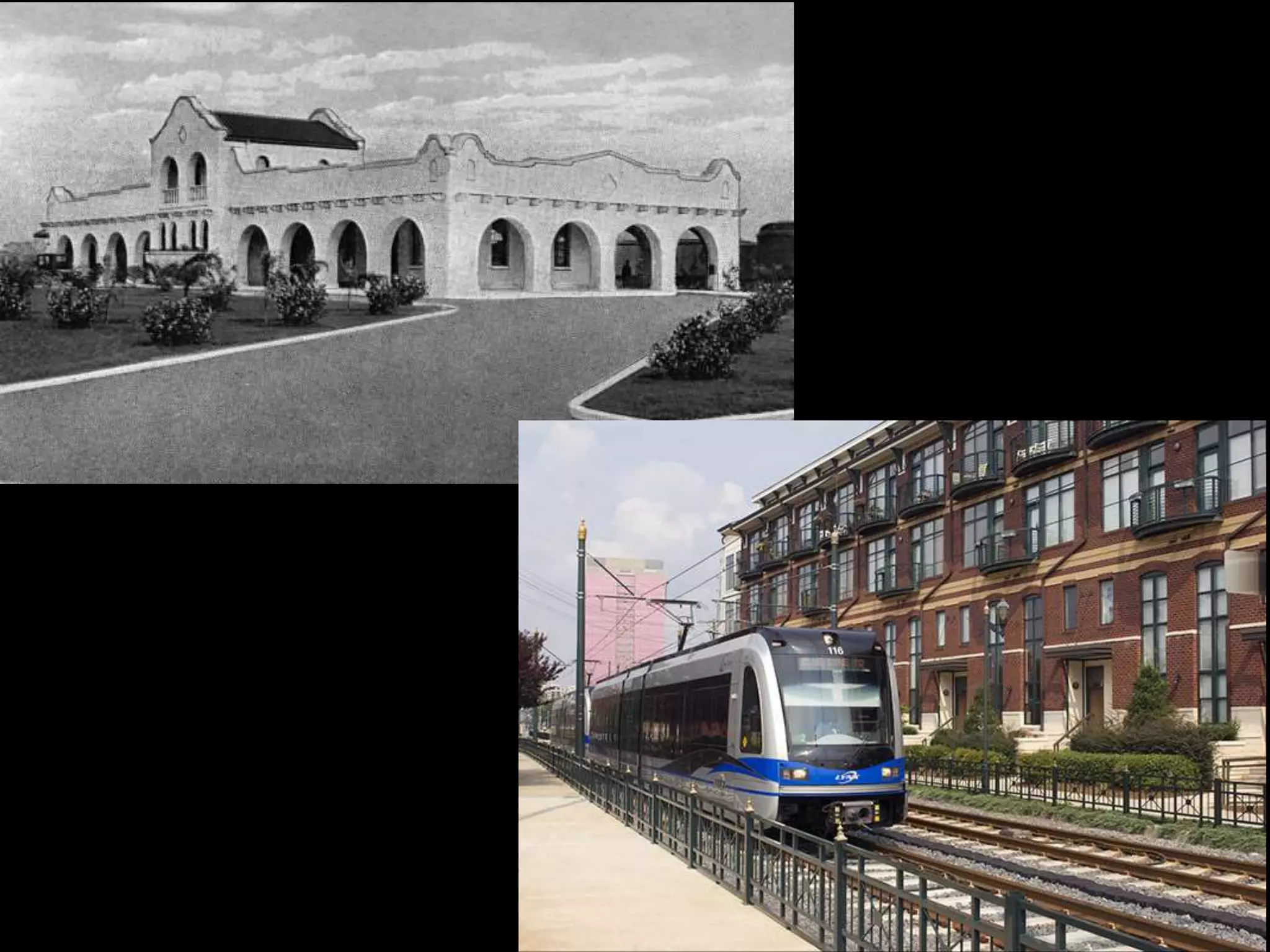
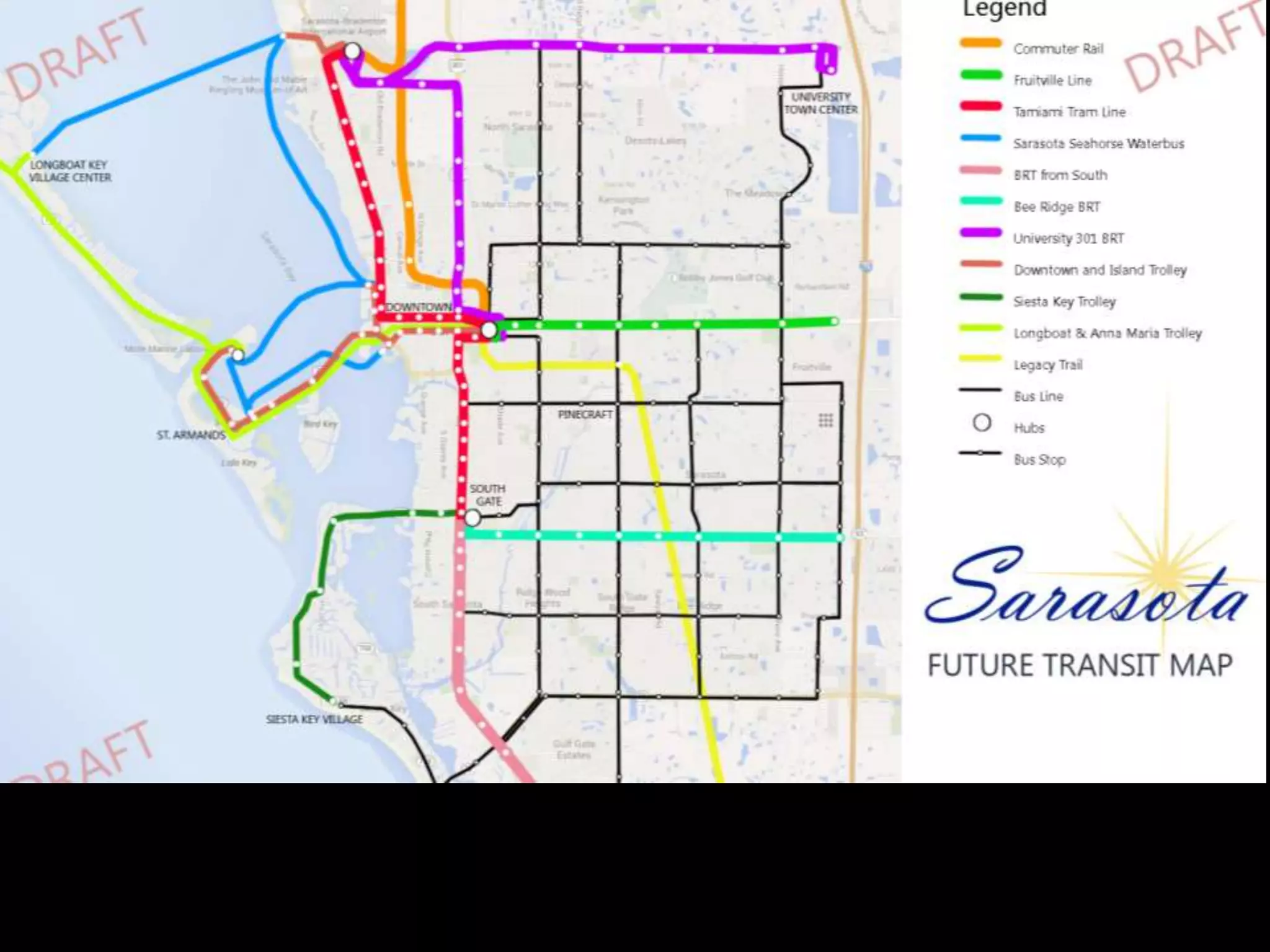

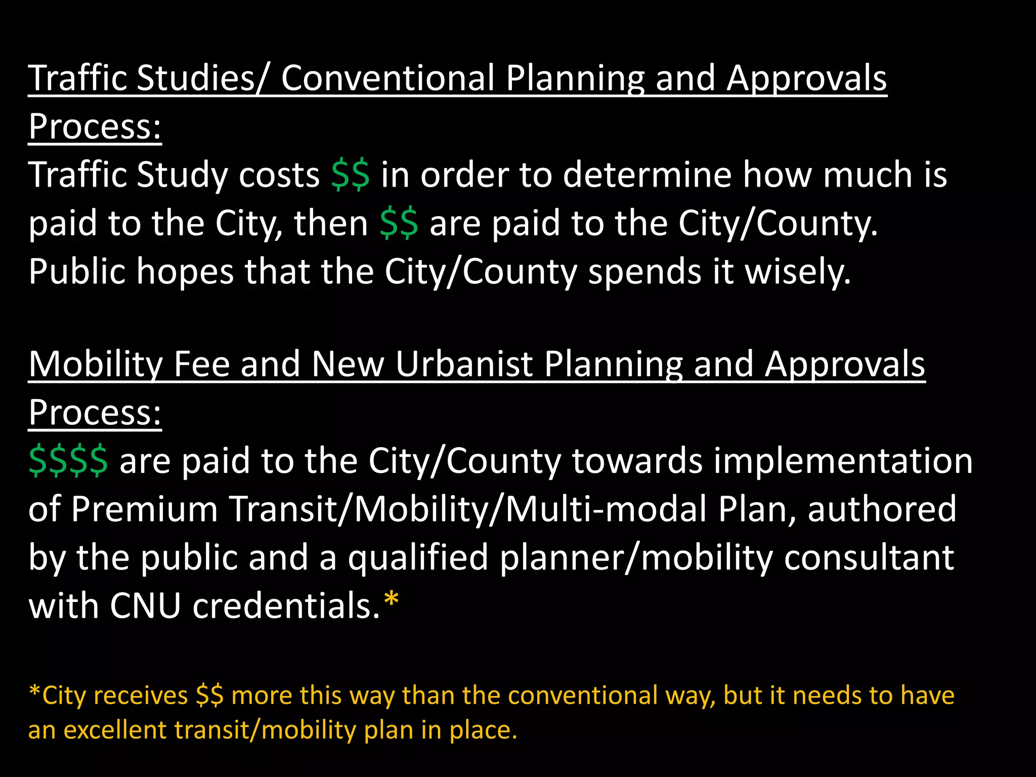
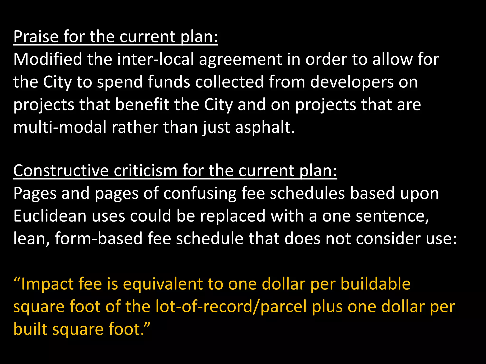
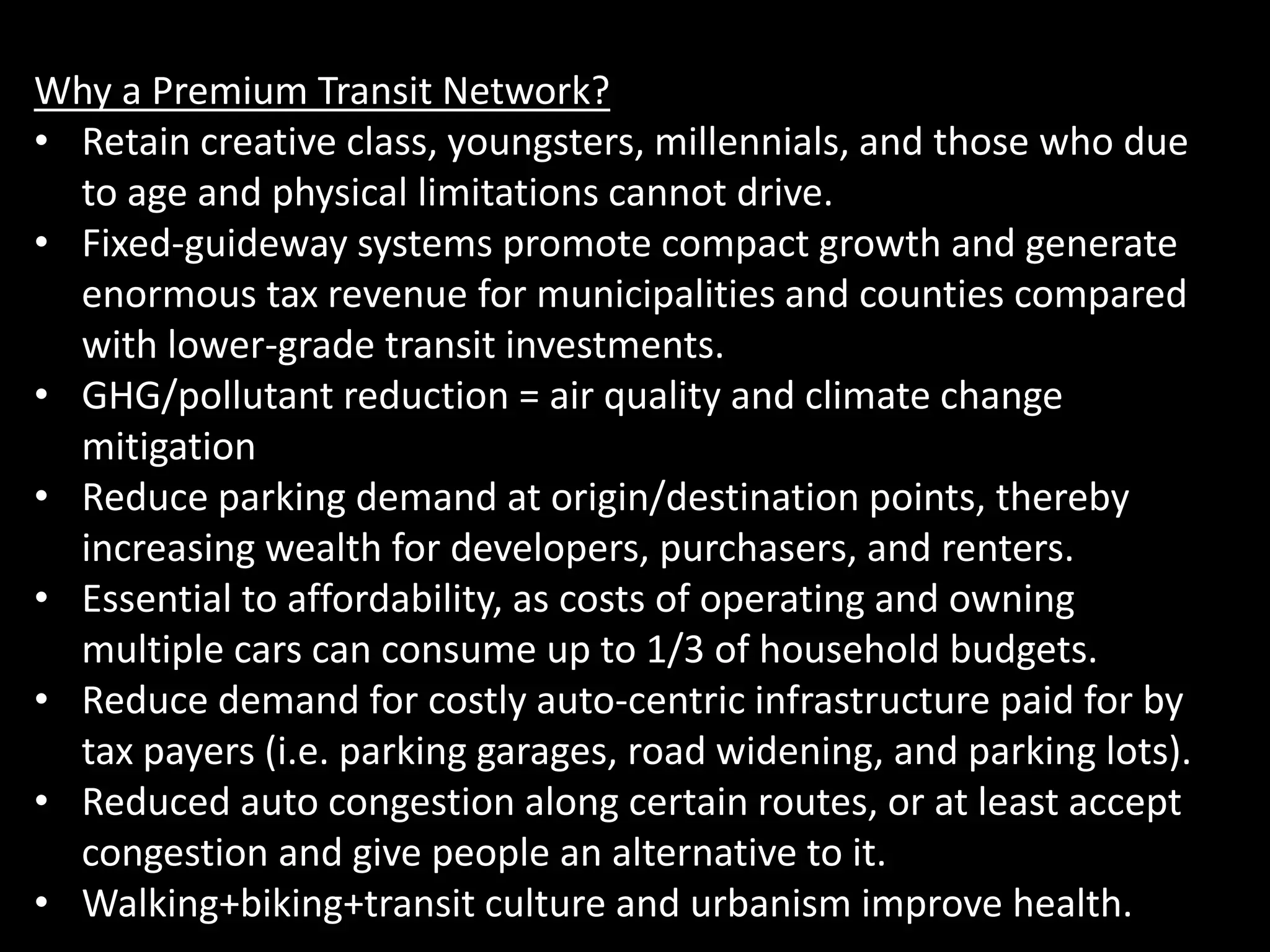
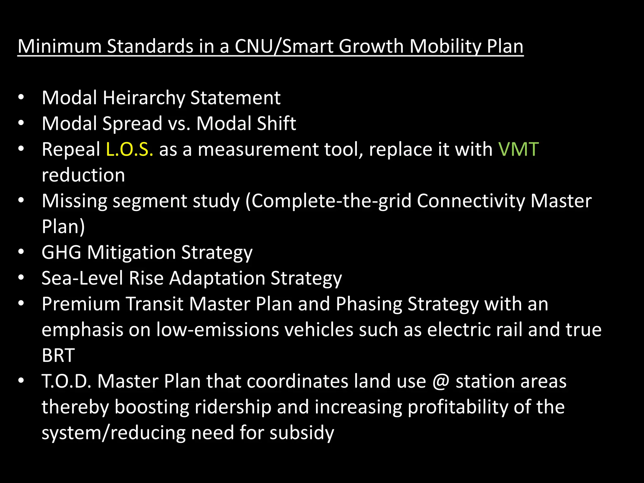

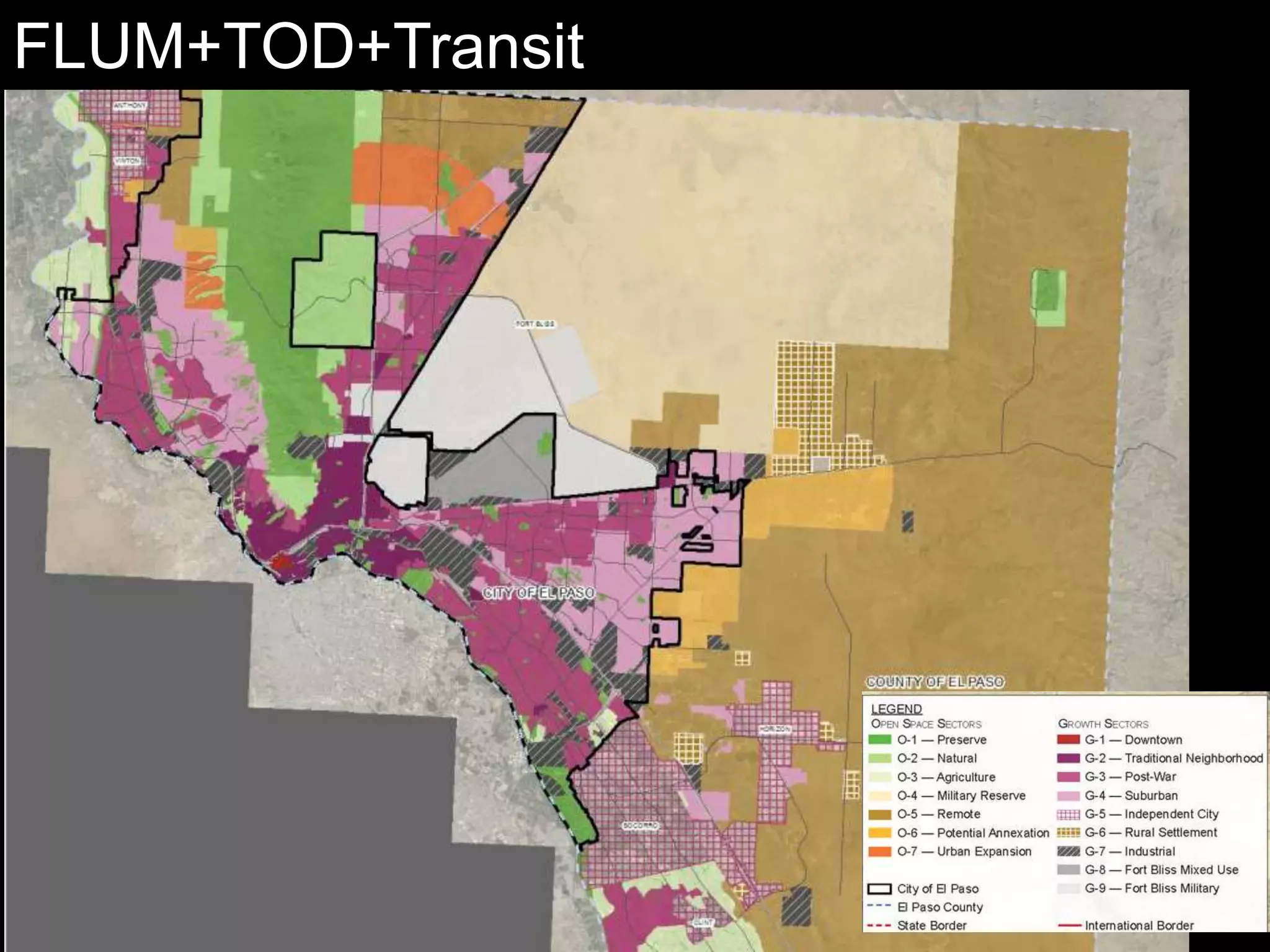
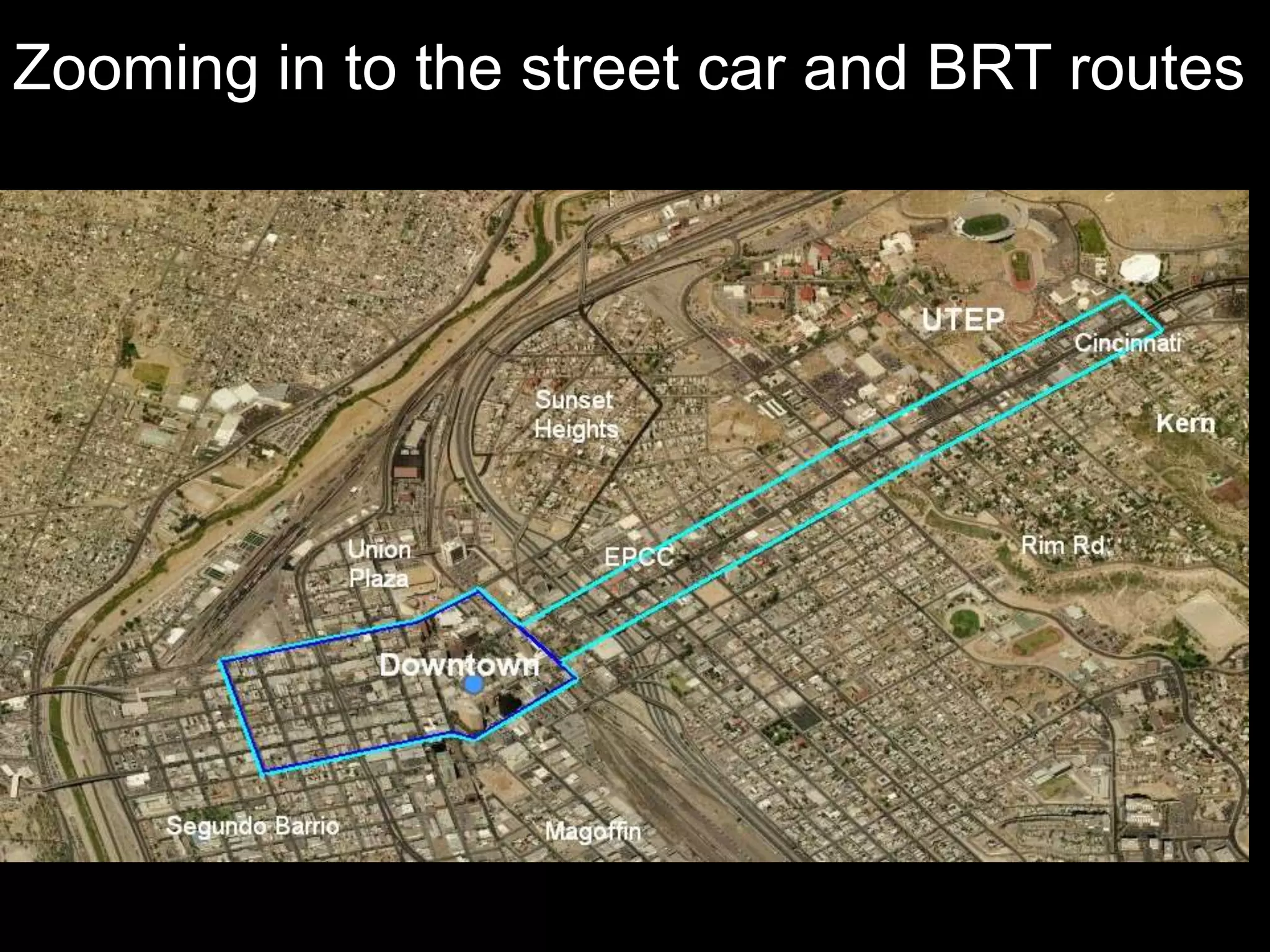

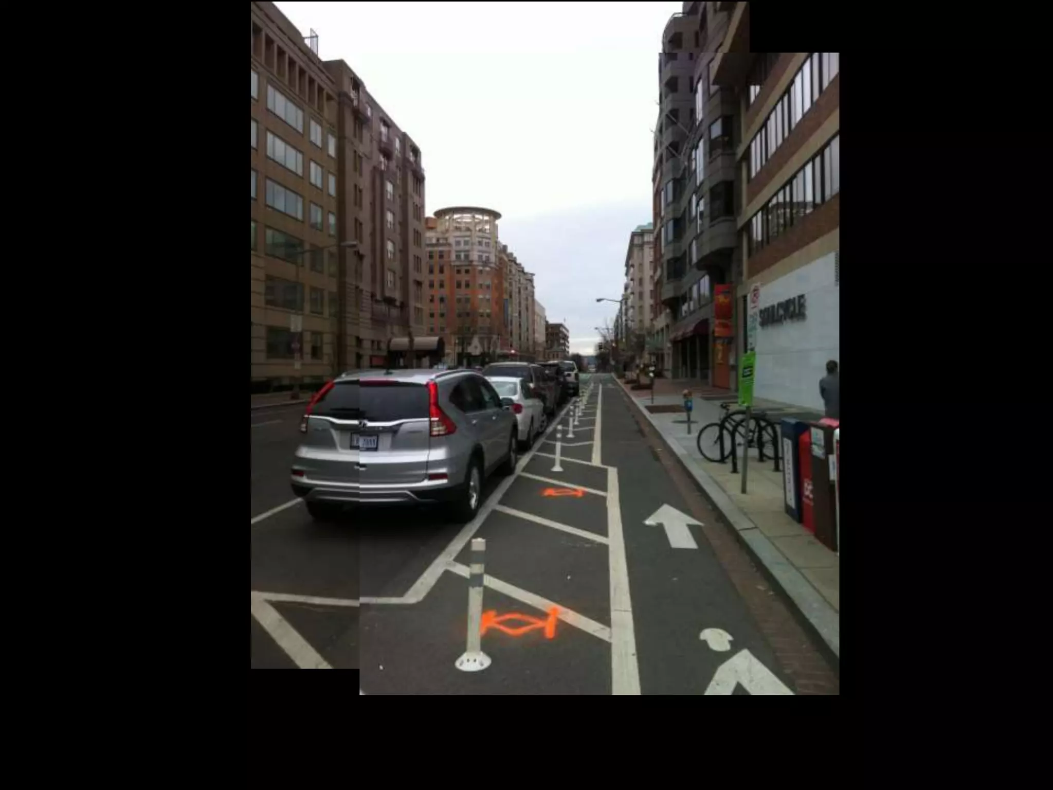
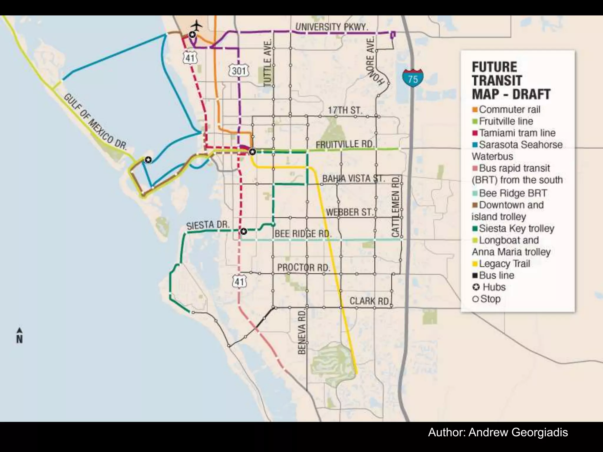


The document outlines ten characteristics of walkability and emphasizes the importance of a connected street network to enhance urban mobility, highlighting various routes and grid configurations. It advocates for a comprehensive mobility plan that includes multi-modal transportation strategies and critiques current conventional planning processes. Additionally, it discusses the need for premium transit systems to support economic growth, environmental sustainability, and improved quality of life in Sarasota.