Roswell - 2nd Public Meeting
•Download as PPT, PDF•
0 likes•201 views
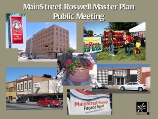
We presented this Tuesday evening in Roswell to get feedback on some of the ideas we will be presenting in the Master Plan
Report
Share
Report
Share

Recommended
Grandview District steering committee presentation Nov. 3, 2011
The document summarizes a steering committee meeting for the Grandview District in Edina, Minnesota. It discusses exploring underground infrastructure like stormwater management and geothermal energy. It also mentions pursuing public-private partnerships for demonstration projects. Key goals discussed include enhancing bike and pedestrian access, seeking additional parks and open space, defining a community commons space, promoting the arts, revealing the district's history, and partnering with Metro Transit on a park and ride. Concept plans and illustrations show potential build-outs and improvements to streets, public spaces, and connections within the district.
Nj future redevelopment forum 2014 plenary baudouin
This document summarizes the transformation of downtown Providence, Rhode Island over the past 20 years through six major redevelopment projects: rail relocation, river relocation, downtown revitalization, the Providence Downtown Improvement District, downtown parks, and I-195 relocation. It notes that these projects have led to over $2 billion in private investment, 1,400 new housing units, and 38,980 jobs in downtown Providence. Key factors in its success have included developing a bold long-term vision, gaining consensus among stakeholders, strong leadership, cooperation across different levels of government and the private sector, and celebrating incremental successes.
Harbor Ring Campaign
The document discusses lessons learned from advocating for a pathway on the Verrazano Narrows Bridge. It summarizes the timeline of advocacy efforts from 2012-2017, which included rallies, press coverage, and meetings with transportation agencies. It also examines differences in pathway design standards and costs for various bridges. A key lesson is that cost estimates can vary greatly depending on an agency's risk tolerance and interpretation of design guidelines, rather than actual construction needs. Advocates need to push for more transparency and public input in the planning process to avoid overly costly designs.
Stop demo 4 parking
This document summarizes concerns about the demolition of historic buildings in San Diego to make way for parking lots. It notes that the historic review board decision was reversed, community advisory committees were not consulted, proper notice was not given, and community plans calling for adaptive reuse and fine-grained development were ignored. Destroying buildings eliminates opportunities and creates parking lots that disrupt the urban fabric for years. It asks people to sign a petition to deliver to the mayor calling for an emergency ordinance or directive to staff to prevent further demolitions.
Chichester Lane Sidewalk Improvements
Chichester Lane Walkway: Day Lily Court Trail to Cherry Drive improvement included approximately 270 linear feet of a five-foot wide concrete sidewalk, curb, gutter, stormwater infrastructure and restoration.
Urban Design and Street Typology: Do They Matter?
Despite a growing body of work defining the benefits and methods to encourage multi-modal travel, only a small body of research has worked to fuse urban design and complete street philosophies. Based on work recently published in the Journal of Planning Education and Research on street design and two-way street conversions, Dr. William Riggs will discuss how street typologies and complete streets dialogues are linked, and how urban design policies might be advanced to facilitate safer and more livable streets.
Dolley Madison Sidewalk - Chain Bridge Road to Kurtz Road
The Dolley Madison sidewalk project included 345 linear feet of concrete sidewalk, pedestrian ramps, curb and gutter, modification of existing median, pavement marking and signage, pavement mill and overlay and other associated work.
Simran deo- architectural conservation- neighbourhood design and planning
1. Judkins Park in Seattle is working to improve its neighborhood through park upgrades, expanded community gardens, and improved transit access. Plans include expanding picnic areas and greenways in Judkins Park, improving the community garden, and establishing a new RapidRide bus line and neighborhood greenway that will enhance connectivity. The goal is to prepare for future growth through better parks, open spaces, and transportation options.
Streetcar Recommendation for City Council Transportation Cmte
The First Hill Streetcar Project Update provides an overview of the recommended route for a streetcar line connecting the First Hill neighborhood in Seattle to the light rail system. Key points include:
- The recommended route is 1.25 miles long with 10 stops and would connect First Hill to the International District station in 12 minutes and Capitol Hill station in 4 minutes.
- It has the potential for high ridership and connects major activity centers like hospitals and universities. It also provides opportunities for urban design and bike integration.
- Alternatives like routes along Boren Avenue and Broadway were considered but not recommended due to higher costs, traffic and operational issues.
- Next steps include environmental review, siting a maintenance facility
Greening govt center symposium program
This document summarizes a symposium to conceptualize a new vision for Boston City Hall, the Plaza, and Government Center. The goals are to identify sustainability best practices and innovative ideas to green the area and catalyze greening throughout Government Center. Experts will provide feasible and cutting-edge solutions for buildings, City Hall, and the Plaza, setting sustainability criteria. Multiple comprehensive visions will be crafted to revitalize the Plaza's spaces and accommodate public uses. Key issues and goals will be identified for a subsequent design charrette.
Portland 3
This document summarizes Portland, Oregon's transition to more sustainable transportation and land use policies over recent decades. It discusses Portland's downtown grid network, investments in light rail and streetcar systems, efforts to revitalize formerly industrial urban areas through dense mixed-use transit-oriented development, and initiatives to promote biking through extensive bike infrastructure and bike-friendly policies. While Portland still faces challenges around traffic congestion and funding, it is widely seen as a national leader in sustainable transportation planning and an example of how a relatively small city can significantly influence urban policy nationwide.
Mayor Stakeholders 3172010
The SDOT recommended a streetcar route from the International District to First Hill that would:
- Cost $125 million and have 10 stops
- Take 12 minutes from the Link light rail station in the International District and 4 minutes from Capitol Hill
- Provide good opportunities for urban design/bike integration and excellent ridership potential by connecting to key destinations
- Minimally impact traffic, existing transit routes, and utilities
Congress Parkway Construction Overview, January 2010
Congress Parkway improvement project
Michigan Avenue to Wells Street.
Includes history, background, project goals & scope, as well as schedule and public outreach tactics
West Side Master Plan Report
The document summarizes a master plan for the Dania Beach Westside area. It identifies opportunities such as the waterfront, businesses, and transportation infrastructure. Constraints include airport operations, heights limits, and inconsistent land patterns. The plan aims to provide a variety of housing, improve sustainability, create distinctive places, encourage mixed uses and transit, and strengthen existing communities. Goals include improving east-west transit, beautifying corridors, promoting quality development, enhancing neighborhoods and recreation, and supporting sustainable and economic development. Recommendations address issues along Griffin Road and include acquiring dilapidated structures, traffic calming, identity creation, and facilitating redevelopment.
Active Living Redwood
This document discusses tools and strategies for promoting active living through community planning and design. It outlines how land use, transportation, parks and recreation can encourage walking, biking and physical activity. Specific policies and projects are mentioned, including complete streets, traffic calming, safe routes to school and compact development. Resources for additional information on active living and community design are provided.
C1 Planning with Kids
This document summarizes planning projects done by high school students in Simsbury, Connecticut and Boston, Massachusetts.
In Simsbury, AP Economics students were tasked with reimagining redevelopment plans for a vacant site. They proposed a variety of uses including parks, retail, offices, housing, and more. In Boston, students helped plan improvements to Mt. Vernon Street by advocating for safer pedestrian and bicycle infrastructure. They shared perspectives as users and helped educate the public. The resulting plan included protected bike lanes, landscaping, and improved crosswalks to create a more livable street for all. Engaging students provided valuable insights and helped advance successful community-oriented projects.
Вэйвэнь Хуан "Многоуровневые городские изыскания: какие системы управления и ...
Weiwen Huang "Multi-Ground City exploration: What governance and city planning systems are needed to build and operate 21st century infrastructure"
Вэйвэнь Хуан "Многоуровневые городские изыскания: какие системы управления и городского планирования необходимы для строительства и эксплуатации инфраструктуры XXI века"
Park East Freeway Rightsizing
The Park East Freeway in Milwaukee, Wisconsin was only 0.8 miles long and underutilized, depreciating nearby property values. Local government boards and councils supported tearing it down to free up 26 acres for development. The area has since attracted $175 million in investment like a new mixed-use building, while a form-based code ensures compatible infill development and restoration of the urban fabric. Temporary art installations demonstrated the cultural potential without the freeway, and traffic now runs smoothly on the surface road that replaced it.
Project 2 north central expy-high 5 interchange 092210
Case Study #2 for UTCM Report #08-14-03 "Making Mobility Improvements a Community Asset: Transportation Improvements Using Context-Sensitive Solutions"
Center Road sidewalk
The Center Road Sidewalk project in Fairfax County, VA was substantially completed in November 2019. The project connected sections of sidewalk along Center Road between Rolling Spring Court and Reza Court through the installation of concrete sidewalk, curb ramps, a retaining wall, storm drains, relocation of a water main, and road widening/repaving. The annual contractor Finley Asphalt and Sealing, Inc. completed the work with oversight from Fairfax County transportation and construction management staff.
Removing Toronto's Expressway One Piece at a Time
The document summarizes the dismantling of a 1.4 km section of the elevated F.G. Gardiner Expressway in Toronto. The expressway was replaced with a 4-lane arterial road, pedestrian/cycle path, and landscaped areas. This created opportunities for redevelopment, encouraged alternative transportation, and improved the urban environment. The project was completed on time and on budget through careful planning, community consultation, and innovative construction techniques.
Community Growth & Land Use Planning in Athens-Clarke County
Community Growth & Land Use Planning in Athens-Clarke CountyThe Chamber For a Greater Chapel Hill-Carrboro
The document discusses land use goals, community design practices, and planning department activities in Athens-Clarke County, Georgia. The comprehensive plan aims to protect the environment, encourage growth, maximize infrastructure use, and implement practices like reducing development impact, increasing green spaces, and promoting alternative transportation. The planning department oversees land use boards and reviews development applications, totaling over $295 million in projects in 2012-2013, including expansions of the Classic Center, hospitals, and industrial/commercial facilities.Northstar Business Park 5.7.11
The document summarizes Elk River's plans to develop its first publicly-owned business park. It discusses the city's need for more industrial sites due to growth. The city acquired 90 acres and will invest $1.27 million in infrastructure to plat the land into lots for sale. Three companies have already agreed to purchase lots totaling 70,000 square feet and bringing over 130 jobs to the area. The development is expected to leverage over $1.7 million in tax abatements and grants.
Six Points Reconfiguration - Community Update June, 2014
Do not include any personal information as all posted material on this site is considered to be part of a public record as defined by section 27 of the Municipal Freedom of Information and Protection of Privacy Act.
We reserve the right to remove inappropriate comments. Please see Terms of Use for City of Toronto Social Media Sites at http://www.toronto.ca/e-updates/termsofuse.htm.
MAPD 2010 - I-cubed dif-other financing
This document summarizes infrastructure financing mechanisms in Massachusetts, including recent policies that enable public-private partnerships. It discusses examples from Somerville, Marshfield, and Westford that showcase different approaches, such as an infrastructure development assistance agreement and district improvement financing. The Marshfield case highlights lessons learned about needing a committed development partner to absorb risk. Local bylaws can also help coordinate infrastructure mitigation through methods like betterments or business improvement districts.
Metro Louisville Urban Development: SoBro
Guest lecturer, Brent Collins, delivers a presentation to the University of Louisville eMBA students regarding Urban Development in Louisville's SoBro District. Luckett & Farley, the city's oldest architecture and engineering firm, calls SoBro home. It has played a role in the original urban development of Louisville beginning in 1853, with some of the firm's historical structure still present in the neighborhood. While many studies have been conducted in recent past, the "no man's land" of downtown is searching for an identity and beginning to organize its stakeholders to play a critical role in helping Louisville realize a strong Fourth Street Corridor from Main Street to Churchill Downs.
2.3 layout of housing & road network
Growth pattern of towns Natural and Planned,
Types of zoning and importance,
various road networks(Grid iron pattern, shoe string development,
Surveys for data collection, physical survey, social survey, economic survey, civic survey,
Town aesthetics, landscape architecture,
Rehabilitation of slum and urban renewal,
Unit 6 ch 14 s2 urban land use
Urban areas that grow quickly can experience an urban crisis where infrastructure cannot keep up with population growth, leading to issues like traffic jams and overcrowded schools. In contrast, urban areas that grow slowly plan infrastructure in advance to support new residents. Open spaces within cities provide environmental benefits like reducing flooding and moderating temperatures by absorbing rainfall and reducing the urban heat island effect. Land use planning aims to determine how land will be used to address issues of urban growth, and tools like geographic information systems allow planners to analyze layers of geographic data to make informed decisions about future development.
Cle Neighborhood2012
Presentation on the role of neighborhood associations at the recent land use law CLE conference in Albuquerque
Western Planner 2012
The document summarizes a sector plan update for a downtown neighborhood area. It describes the context and issues in 1976, including poor housing conditions, lack of investment, and office uses creeping into the neighborhood. The 1976 plan rezoned areas but did not achieve redevelopment. The new plan process included public involvement like walking tours. The plan aims to preserve historic character, encourage walkability, and allow appropriate infill. It makes zoning designations and provides policies and strategies to implement the plan over time.
More Related Content
What's hot
Streetcar Recommendation for City Council Transportation Cmte
The First Hill Streetcar Project Update provides an overview of the recommended route for a streetcar line connecting the First Hill neighborhood in Seattle to the light rail system. Key points include:
- The recommended route is 1.25 miles long with 10 stops and would connect First Hill to the International District station in 12 minutes and Capitol Hill station in 4 minutes.
- It has the potential for high ridership and connects major activity centers like hospitals and universities. It also provides opportunities for urban design and bike integration.
- Alternatives like routes along Boren Avenue and Broadway were considered but not recommended due to higher costs, traffic and operational issues.
- Next steps include environmental review, siting a maintenance facility
Greening govt center symposium program
This document summarizes a symposium to conceptualize a new vision for Boston City Hall, the Plaza, and Government Center. The goals are to identify sustainability best practices and innovative ideas to green the area and catalyze greening throughout Government Center. Experts will provide feasible and cutting-edge solutions for buildings, City Hall, and the Plaza, setting sustainability criteria. Multiple comprehensive visions will be crafted to revitalize the Plaza's spaces and accommodate public uses. Key issues and goals will be identified for a subsequent design charrette.
Portland 3
This document summarizes Portland, Oregon's transition to more sustainable transportation and land use policies over recent decades. It discusses Portland's downtown grid network, investments in light rail and streetcar systems, efforts to revitalize formerly industrial urban areas through dense mixed-use transit-oriented development, and initiatives to promote biking through extensive bike infrastructure and bike-friendly policies. While Portland still faces challenges around traffic congestion and funding, it is widely seen as a national leader in sustainable transportation planning and an example of how a relatively small city can significantly influence urban policy nationwide.
Mayor Stakeholders 3172010
The SDOT recommended a streetcar route from the International District to First Hill that would:
- Cost $125 million and have 10 stops
- Take 12 minutes from the Link light rail station in the International District and 4 minutes from Capitol Hill
- Provide good opportunities for urban design/bike integration and excellent ridership potential by connecting to key destinations
- Minimally impact traffic, existing transit routes, and utilities
Congress Parkway Construction Overview, January 2010
Congress Parkway improvement project
Michigan Avenue to Wells Street.
Includes history, background, project goals & scope, as well as schedule and public outreach tactics
West Side Master Plan Report
The document summarizes a master plan for the Dania Beach Westside area. It identifies opportunities such as the waterfront, businesses, and transportation infrastructure. Constraints include airport operations, heights limits, and inconsistent land patterns. The plan aims to provide a variety of housing, improve sustainability, create distinctive places, encourage mixed uses and transit, and strengthen existing communities. Goals include improving east-west transit, beautifying corridors, promoting quality development, enhancing neighborhoods and recreation, and supporting sustainable and economic development. Recommendations address issues along Griffin Road and include acquiring dilapidated structures, traffic calming, identity creation, and facilitating redevelopment.
Active Living Redwood
This document discusses tools and strategies for promoting active living through community planning and design. It outlines how land use, transportation, parks and recreation can encourage walking, biking and physical activity. Specific policies and projects are mentioned, including complete streets, traffic calming, safe routes to school and compact development. Resources for additional information on active living and community design are provided.
C1 Planning with Kids
This document summarizes planning projects done by high school students in Simsbury, Connecticut and Boston, Massachusetts.
In Simsbury, AP Economics students were tasked with reimagining redevelopment plans for a vacant site. They proposed a variety of uses including parks, retail, offices, housing, and more. In Boston, students helped plan improvements to Mt. Vernon Street by advocating for safer pedestrian and bicycle infrastructure. They shared perspectives as users and helped educate the public. The resulting plan included protected bike lanes, landscaping, and improved crosswalks to create a more livable street for all. Engaging students provided valuable insights and helped advance successful community-oriented projects.
Вэйвэнь Хуан "Многоуровневые городские изыскания: какие системы управления и ...
Weiwen Huang "Multi-Ground City exploration: What governance and city planning systems are needed to build and operate 21st century infrastructure"
Вэйвэнь Хуан "Многоуровневые городские изыскания: какие системы управления и городского планирования необходимы для строительства и эксплуатации инфраструктуры XXI века"
Park East Freeway Rightsizing
The Park East Freeway in Milwaukee, Wisconsin was only 0.8 miles long and underutilized, depreciating nearby property values. Local government boards and councils supported tearing it down to free up 26 acres for development. The area has since attracted $175 million in investment like a new mixed-use building, while a form-based code ensures compatible infill development and restoration of the urban fabric. Temporary art installations demonstrated the cultural potential without the freeway, and traffic now runs smoothly on the surface road that replaced it.
Project 2 north central expy-high 5 interchange 092210
Case Study #2 for UTCM Report #08-14-03 "Making Mobility Improvements a Community Asset: Transportation Improvements Using Context-Sensitive Solutions"
Center Road sidewalk
The Center Road Sidewalk project in Fairfax County, VA was substantially completed in November 2019. The project connected sections of sidewalk along Center Road between Rolling Spring Court and Reza Court through the installation of concrete sidewalk, curb ramps, a retaining wall, storm drains, relocation of a water main, and road widening/repaving. The annual contractor Finley Asphalt and Sealing, Inc. completed the work with oversight from Fairfax County transportation and construction management staff.
Removing Toronto's Expressway One Piece at a Time
The document summarizes the dismantling of a 1.4 km section of the elevated F.G. Gardiner Expressway in Toronto. The expressway was replaced with a 4-lane arterial road, pedestrian/cycle path, and landscaped areas. This created opportunities for redevelopment, encouraged alternative transportation, and improved the urban environment. The project was completed on time and on budget through careful planning, community consultation, and innovative construction techniques.
Community Growth & Land Use Planning in Athens-Clarke County
Community Growth & Land Use Planning in Athens-Clarke CountyThe Chamber For a Greater Chapel Hill-Carrboro
The document discusses land use goals, community design practices, and planning department activities in Athens-Clarke County, Georgia. The comprehensive plan aims to protect the environment, encourage growth, maximize infrastructure use, and implement practices like reducing development impact, increasing green spaces, and promoting alternative transportation. The planning department oversees land use boards and reviews development applications, totaling over $295 million in projects in 2012-2013, including expansions of the Classic Center, hospitals, and industrial/commercial facilities.Northstar Business Park 5.7.11
The document summarizes Elk River's plans to develop its first publicly-owned business park. It discusses the city's need for more industrial sites due to growth. The city acquired 90 acres and will invest $1.27 million in infrastructure to plat the land into lots for sale. Three companies have already agreed to purchase lots totaling 70,000 square feet and bringing over 130 jobs to the area. The development is expected to leverage over $1.7 million in tax abatements and grants.
Six Points Reconfiguration - Community Update June, 2014
Do not include any personal information as all posted material on this site is considered to be part of a public record as defined by section 27 of the Municipal Freedom of Information and Protection of Privacy Act.
We reserve the right to remove inappropriate comments. Please see Terms of Use for City of Toronto Social Media Sites at http://www.toronto.ca/e-updates/termsofuse.htm.
MAPD 2010 - I-cubed dif-other financing
This document summarizes infrastructure financing mechanisms in Massachusetts, including recent policies that enable public-private partnerships. It discusses examples from Somerville, Marshfield, and Westford that showcase different approaches, such as an infrastructure development assistance agreement and district improvement financing. The Marshfield case highlights lessons learned about needing a committed development partner to absorb risk. Local bylaws can also help coordinate infrastructure mitigation through methods like betterments or business improvement districts.
Metro Louisville Urban Development: SoBro
Guest lecturer, Brent Collins, delivers a presentation to the University of Louisville eMBA students regarding Urban Development in Louisville's SoBro District. Luckett & Farley, the city's oldest architecture and engineering firm, calls SoBro home. It has played a role in the original urban development of Louisville beginning in 1853, with some of the firm's historical structure still present in the neighborhood. While many studies have been conducted in recent past, the "no man's land" of downtown is searching for an identity and beginning to organize its stakeholders to play a critical role in helping Louisville realize a strong Fourth Street Corridor from Main Street to Churchill Downs.
2.3 layout of housing & road network
Growth pattern of towns Natural and Planned,
Types of zoning and importance,
various road networks(Grid iron pattern, shoe string development,
Surveys for data collection, physical survey, social survey, economic survey, civic survey,
Town aesthetics, landscape architecture,
Rehabilitation of slum and urban renewal,
Unit 6 ch 14 s2 urban land use
Urban areas that grow quickly can experience an urban crisis where infrastructure cannot keep up with population growth, leading to issues like traffic jams and overcrowded schools. In contrast, urban areas that grow slowly plan infrastructure in advance to support new residents. Open spaces within cities provide environmental benefits like reducing flooding and moderating temperatures by absorbing rainfall and reducing the urban heat island effect. Land use planning aims to determine how land will be used to address issues of urban growth, and tools like geographic information systems allow planners to analyze layers of geographic data to make informed decisions about future development.
What's hot (20)
Streetcar Recommendation for City Council Transportation Cmte
Streetcar Recommendation for City Council Transportation Cmte
Congress Parkway Construction Overview, January 2010
Congress Parkway Construction Overview, January 2010
Вэйвэнь Хуан "Многоуровневые городские изыскания: какие системы управления и ...
Вэйвэнь Хуан "Многоуровневые городские изыскания: какие системы управления и ...
Project 2 north central expy-high 5 interchange 092210
Project 2 north central expy-high 5 interchange 092210
Community Growth & Land Use Planning in Athens-Clarke County
Community Growth & Land Use Planning in Athens-Clarke County
Six Points Reconfiguration - Community Update June, 2014
Six Points Reconfiguration - Community Update June, 2014
Viewers also liked
Cle Neighborhood2012
Presentation on the role of neighborhood associations at the recent land use law CLE conference in Albuquerque
Western Planner 2012
The document summarizes a sector plan update for a downtown neighborhood area. It describes the context and issues in 1976, including poor housing conditions, lack of investment, and office uses creeping into the neighborhood. The 1976 plan rezoned areas but did not achieve redevelopment. The new plan process included public involvement like walking tours. The plan aims to preserve historic character, encourage walkability, and allow appropriate infill. It makes zoning designations and provides policies and strategies to implement the plan over time.
Final Charrette Presentation
The document summarizes discussions from a community planning charrette in Tucumcari, New Mexico about revitalizing the downtown area. Key opportunities discussed include redeveloping the historic train depot into a railroad museum, renovating vacant buildings on Main Street, and improving wayfinding and branding to attract more visitors. Challenges include declining population and needing public-private partnerships to fund catalytic projects that can spur further redevelopment momentum.
Continuity Of Care Records
This document discusses continuity of care records (CCR), which aim to provide a standardized summary of a patient's healthcare information. The document outlines the history, goals, uses, actors involved, technologies used, content included in CCRs, conceptual models, benefits, and potential usage of CCRs. It also includes reference URLs and space for questions or comments.
Continuity of Care
The CCD documents helps the physicians to send the medical information to other providers without loss.
Webinar Transforming Digital Health Technologies for Patient Engagement and R...
The document discusses digital health technologies for patient engagement and clinical trial reporting, including Medelinked's personal health engagement platform. Medelinked allows patients to build and manage health data online and share it with their connected health network. It also discusses how Medelinked integrates with clinical trials to directly import patient data from mobile apps and EHRs into electronic data capture systems in order to streamline clinical trials and reduce manual data entry. This improves data quality and compliance with FDA electronic source data guidance.
The Six Highest Performing B2B Blog Post Formats
If your B2B blogging goals include earning social media shares and backlinks to boost your search rankings, this infographic lists the size best approaches.
The Outcome Economy
1) The document discusses the opportunity for technology to improve organizational efficiency and transition economies into a "smart and clean world."
2) It argues that aggregate efficiency has stalled at around 22% for 30 years due to limitations of the Second Industrial Revolution, but that digitizing transport, energy, and communication through technologies like blockchain can help manage resources and increase efficiency.
3) Technologies like precision agriculture, cloud computing, robotics, and autonomous vehicles may allow for "dematerialization" and do more with fewer physical resources through effects like reduced waste and need for transportation/logistics infrastructure.
Viewers also liked (8)
Webinar Transforming Digital Health Technologies for Patient Engagement and R...
Webinar Transforming Digital Health Technologies for Patient Engagement and R...
Similar to Roswell - 2nd Public Meeting
Balboa Avenue Station Presentation
This document summarizes a presentation for the Pacific Beach Community Planning Group regarding a Specific Plan being developed for the Balboa Avenue Trolley station area. The presentation includes an overview of the Specific Plan process and team, existing conditions analysis of land use, mobility, economic context and the environment. Community input is gathered on defining character, challenges, and priorities. Mobility opportunities and constraints are discussed, including parking, pedestrian, bicycle and vehicle access.
Sectors 2 & 3 Charrette Closing Presentation
This is the final presentation given on October 4, at 5:30pm in the City Council Chambers. Mayor Keyserling gave an introduction, followed by Demetri Baches. Craig Lewis presented the work produced at the charrette, which went from Sept. 27-Oct. 4.
Grandview District analysis + frameworks
The document summarizes a steering committee meeting discussing development plans for the Grandview District in Edina, Minnesota. It outlines 7 guiding principles for the development focused on creating a vibrant, connected, and sustainable neighborhood. It also summarizes working group reports on transportation, community needs, land use, finance, city departments, businesses, and feedback from a public meeting. Concept plans were presented showing potential frameworks and details for the district including intersections, sidewalks, public spaces, and parking structures.
Capitol Hill Light Rail TOD Forum 2/23/10
The summary discusses Sound Transit's community forum about the transit-oriented development around the future Capitol Hill light rail station. It outlines the agenda for the forum, including presentations on past outreach and next steps. It also summarizes feedback received at previous forums about desired community uses, housing, retail, and parking for the development sites. Sound Transit aims to balance community priorities with financial considerations in selecting developers for the sites.
Infrastructure Financing Mechanisms in Massachusetts
Infrastructure Financing Mechanisms in MassachusettsMassachusetts Association of Planning Directors (MAPD)
The document summarizes infrastructure financing mechanisms in Massachusetts, including recent policies that enable public-private partnerships. It provides examples of district improvement financing (DIF) initiatives in the towns of Marshfield and Westford. The Marshfield DIF proposal aimed to catalyze development through road and sewer improvements but was withdrawn due to lack of a committed private partner. Lessons highlighted include the need for a developer willing to assume risk and a specific development plan. The discussion also reviews coordination of development mitigation between the public and private sectors.SNEAPA 2013 Thursday c2 1_45 meeting the growing demand
SNEAPA 2013 Thursday c2 1_45 meeting the growing demandAmerican Planning Association - Massachusetts Chapter
The document summarizes a pilot program to promote mixed-use and upper-story residential development in downtown areas. It discusses challenges like regulatory barriers, lack of financing options, and perceptions that density leads to blight. The program provided development audits, model building analyses, and assistance to property owners in 3 pilot communities - Torrington, Waterbury, and Middletown. Key lessons included that mixed-use is a lost art, projects require public-private partnerships, and communities need education and technical assistance to support redevelopment. The document reviews pilot program outcomes like improved understanding of next steps and appreciation for public-private partnerships needed to achieve reuse of underutilized properties.Monroe Downtown Master Plan Public Meeting 2 Presentation
The document provides information about a public meeting for phase two of the Monroe Downtown Master Plan. It introduces the consultant team and steering committee, then discusses the purpose and agenda for the meeting. It reviews the project history and engagement process to date. Key takeaways from public feedback are presented, along with overall goals and preliminary recommendations regarding public spaces, development, transportation, and more. Concept plans and renderings are shown to test recommendations for different downtown zones.
Broadway 360 Opening Presentation
The document outlines a presentation for a neighborhood plan on Broadway Avenue in Saskatoon, Saskatchewan. It includes an introduction to the study and process, key outcomes from a community summit, observations from experts on the area, and existing conditions. Challenges to address include defining the area's character, appropriate new development forms, enhancing pedestrian experiences, transitions to adjacent neighborhoods, parking issues, and traffic strategies.
St. Elizabeths Presentation: Public Mtg #1
The document summarizes plans for development of the St. Elizabeths East campus, including:
- Creating a master plan to guide sustainable development that celebrates historic resources and improves connectivity;
- Defining the first phase of development and infrastructure needs like roads and utilities;
- Conducting an environmental assessment of the transportation network to support development and connect to surrounding areas.
The process involves community input, historic preservation approvals, and identifying funding to build out the transportation system and other needs to guide controlled growth of the campus over 20 years.
Brownfields Redevelopment Journey: Seth
This presentation was delivered at NADO's 2018 Annual Training Conference, held in Charlotte, NC on October 13-16. For more information, visit: https://www.nado.org/events/2018-annual-training-conference/
Bond Election Presentation
The City of Hutto, Texas is holding a bond election on November 3, 2009 to fund various city improvement projects. The bond committee reviewed long-range plans and survey results to develop four bond propositions totaling $22.5 million for street improvements, parks/recreation facilities, a sports complex, and a joint city/YMCA recreation center. If approved, the bonds would require an estimated $0.19 increase to the interest and sinking tax rate over 5 years for debt repayment.
Rethinking Neighborhood Design
This document evaluates different aspects of neighborhood design in downtown Salt Lake City on a scale of 1 to 10. It summarizes that:
1) Energy use of buildings scored 5/10 due to a lack of alternative energy sources and lack of building heating/cooling to mitigate heat islands.
2) Transportation options scored 8.5/10, praising shade and pedestrian protections but noting better bike lanes are needed.
3) The overall neighborhood design scored 6.8 out of 10 across all categories. Improvements in affordable housing, bike lanes, public spaces, and addressing vacant buildings were recommended.
Clairemont CPG Ad Hoc Subcommittee Meeting
On Tuesday, May 10, 2016, the project team presented on the study area's existing condition to the Clairemont Community Planning Group Ad Hoc Subcommittee.
Beaufort-Sector1-Charrette-FinalPresentation
This is the original version of the final presentation, given March 28, 2011 at City Hall Council Chambers.
20140818 downtown gateway stakeholder workshop
This document discusses plans to improve the Capital Metro Rail system and develop a new multimodal transportation hub in downtown Austin. It outlines challenges like accommodating growth and facilitating transportation between popular areas. Early concepts for the hub considered how to meet operational needs while enhancing user experience, traffic flow, and connections to surrounding neighborhoods. Stakeholder feedback emphasized creating a gateway for downtown that improves pedestrian access and provides public amenities while maintaining existing transit and event functions. Next steps include further developing concepts, obtaining funding, and conducting environmental reviews and public outreach.
April 12 Planning Public Forum
The document summarizes a public forum to gather community feedback on alternatives and sites being considered for a clean water facility in Oak Harbor, Washington. It provides an overview of the project schedule and decision making criteria involving financial, social, environmental, and technical objectives. Three potential sites - Old City Shops, Beachview Farm, and Windjammer Park - are described and conceptual designs shown. Attendees were asked to provide feedback to help evaluate and select the best alternative and site. The next steps outlined collecting public input, further technical analysis, and presenting a site recommendation to city council for decision.
Beaverton civic plan city council 030111 forweb
The document summarizes the results of a telephone survey conducted for the Beaverton Civic Plan. Key findings include:
- 30% of respondents were familiar with the Civic Plan
- 62% supported creating an Urban Renewal District
- Canyon Road improvements and additional streets to relieve congestion were top priorities
- 59% supported public parking lots and 57% supported enhancing the bike lane network
- 60% supported investing in new open spaces
The steering committee's top priority initiatives included Canyon Road improvements, a Broadway Festival Street, adopting an Urban Renewal plan, and investing in creeks, plazas and public art.
Wpc.sw barriers
This document discusses pedestrian challenges and opportunities in SW Portland. It identifies barriers like missing or narrow sidewalks, unsafe street crossings, and speeding traffic. It presents potential solutions such as constructing new sidewalks and paths, improving bus stops, and adding marked crosswalks. The document provides examples of specific problem areas and estimates costs for various projects to create a more walkable and bikeable transportation system in SW neighborhoods.
Portland's Complete Streets Policy - GSMSummit 2014, Bruce Hyman
Why plan for growth and change, when it seems so much easier to simply react?
When there is a distinct and shared vision for your community - when residents, businesses and local government anticipate a sustainable town with cohesive and thriving neighborhoods - you have the power to conserve your beautiful natural spaces, enhance your existing downtown or Main Street, enable rural areas to be productive and prosperous, and save money through efficient use of existing infrastructure.
This is the dollars and sense of smart growth.
Success is clearly visible in Maine, from the creation of a community-built senior housing complex and health center in Fort Fairfield to conservation easements creating Forever Farms to Rockland's revitalized downtown. Communities have options. We have the power to manage our own responses to growth and change.
After all, “Planning is a process of choosing among those many options. If we do not choose to plan, then we choose to have others plan for us.” - Richard I. Winwood
And in the end, this means that our children and their children will choose to make Maine home and our economy will provide the opportunities to do so.
The Summit offers you a wonderful opportunity to be a part of the transformative change in Maine that we’ve seen these gatherings produce. We encourage you to consider the value of being actively involved in growing Maine’s economy and protecting the reasons we choose to live here.
Downtown Improvement Project 1/20/2010
This Downtown Improvement Project update was presented by Weston & Sampson to the Franklin, MA Town Council on Wednesday, Jan 20, 2010.
Similar to Roswell - 2nd Public Meeting (20)
Infrastructure Financing Mechanisms in Massachusetts
Infrastructure Financing Mechanisms in Massachusetts
SNEAPA 2013 Thursday c2 1_45 meeting the growing demand
SNEAPA 2013 Thursday c2 1_45 meeting the growing demand
Monroe Downtown Master Plan Public Meeting 2 Presentation
Monroe Downtown Master Plan Public Meeting 2 Presentation
Portland's Complete Streets Policy - GSMSummit 2014, Bruce Hyman
Portland's Complete Streets Policy - GSMSummit 2014, Bruce Hyman
Roswell - 2nd Public Meeting
- 1. MainStreet Roswell Master Plan Public Meeting
- 2. Project Team Consensus Planning, Inc. Souder, Miller & Associates Studio Southwest Architects
- 5. Community Exercise A – Opportunity Buildings 10 Minutes
- 7. Community Exercise B – Railroad District / Metropolitan Redevelopment District 10 Minutes
- 9. Community Exercise C – Arts and Cultural District 10 Minutes
- 11. Main Street - No Build Alternative Section View Plan View
- 12. Main Street – Alternative #2 Section View Plan View
- 13. Main Street – Alternative #3 Section View Plan View
- 14. Main Street – Alternative #4 Section View Plan View
- 15. Richardson Virginia Plan View Section View Plan View Section View
- 16. Community Exercise D – Transportation Improvements 10 Minutes
- 18. Community Exercise E – Downtown Parking 5 Minutes