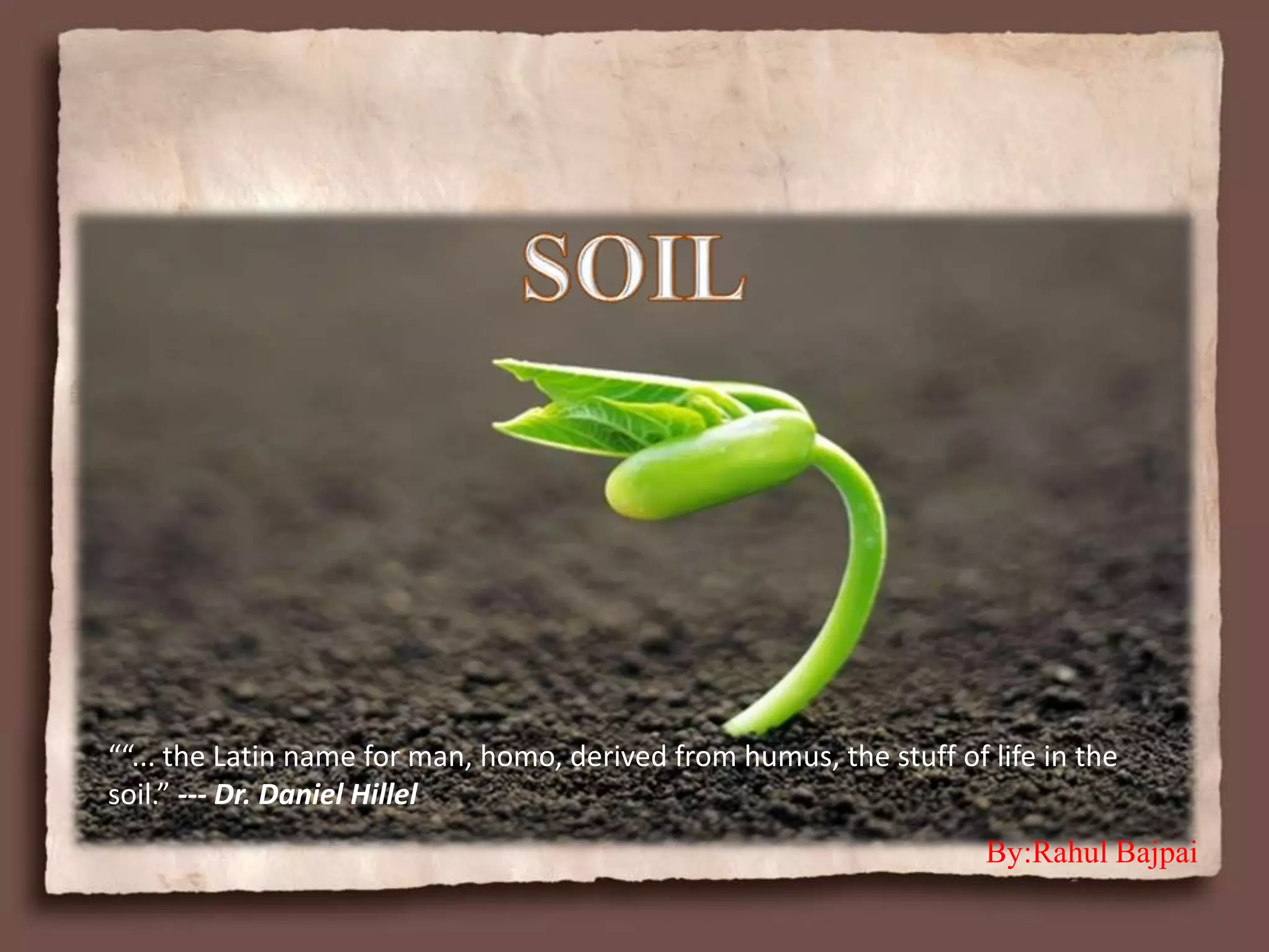
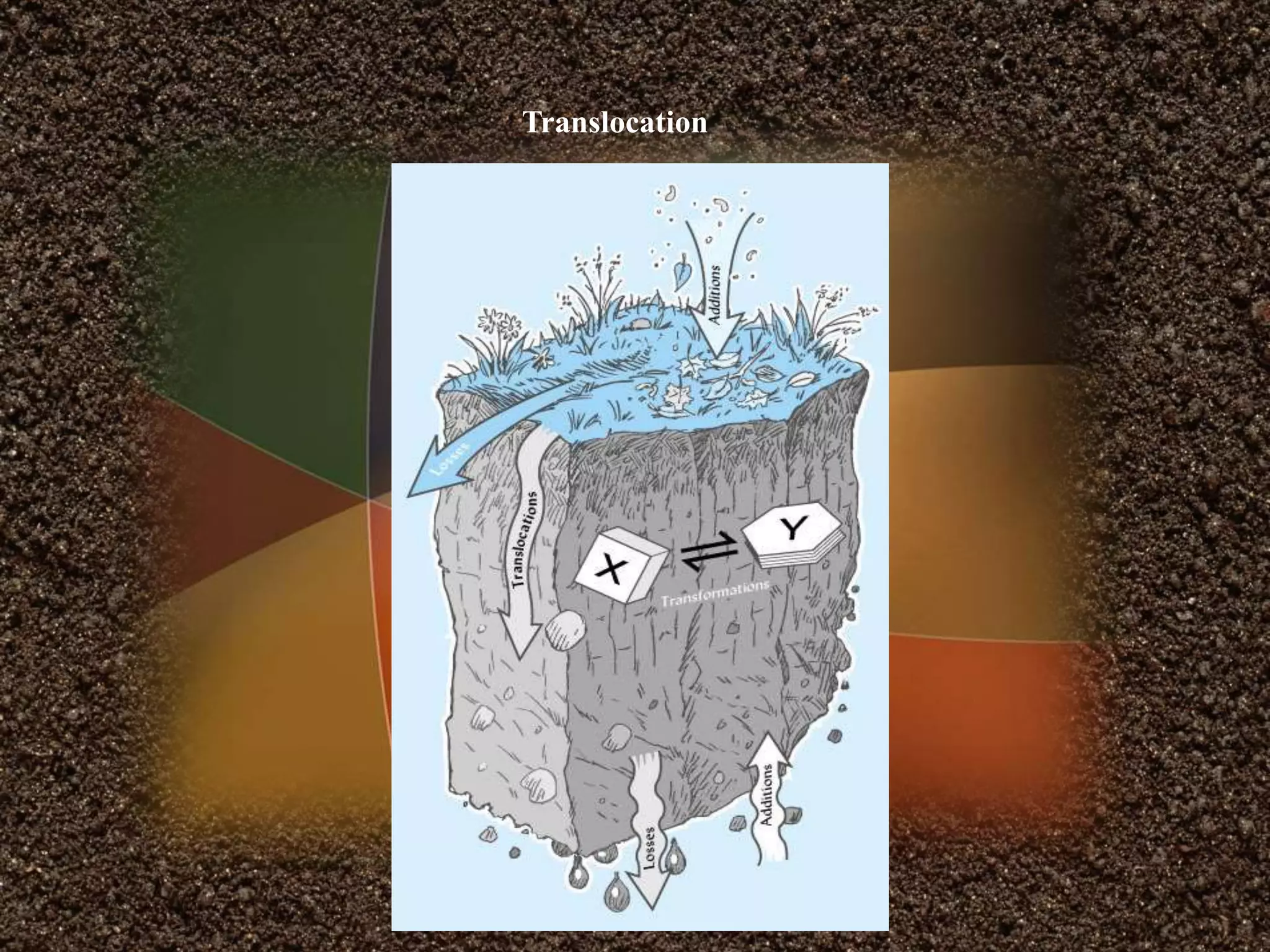
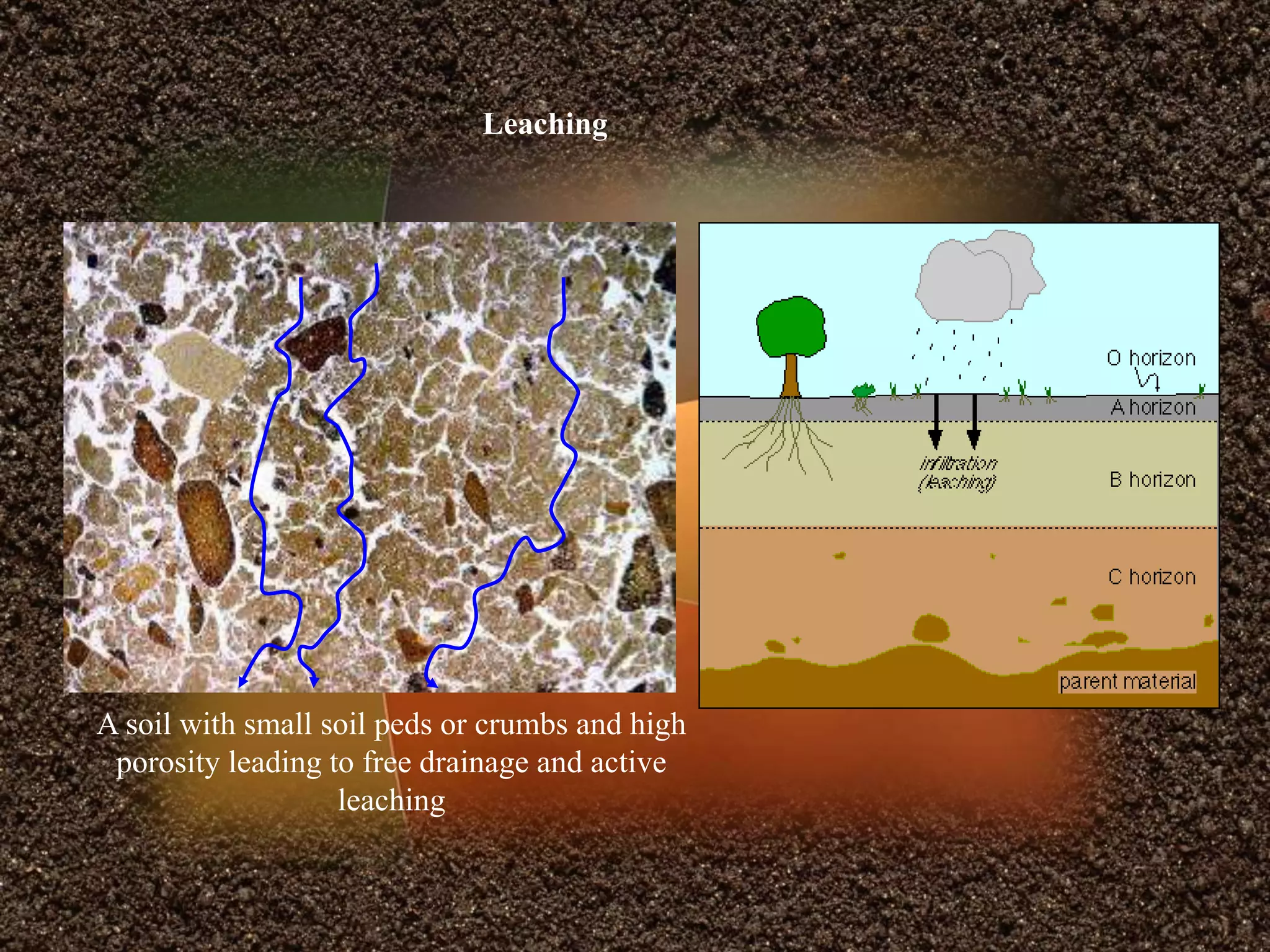
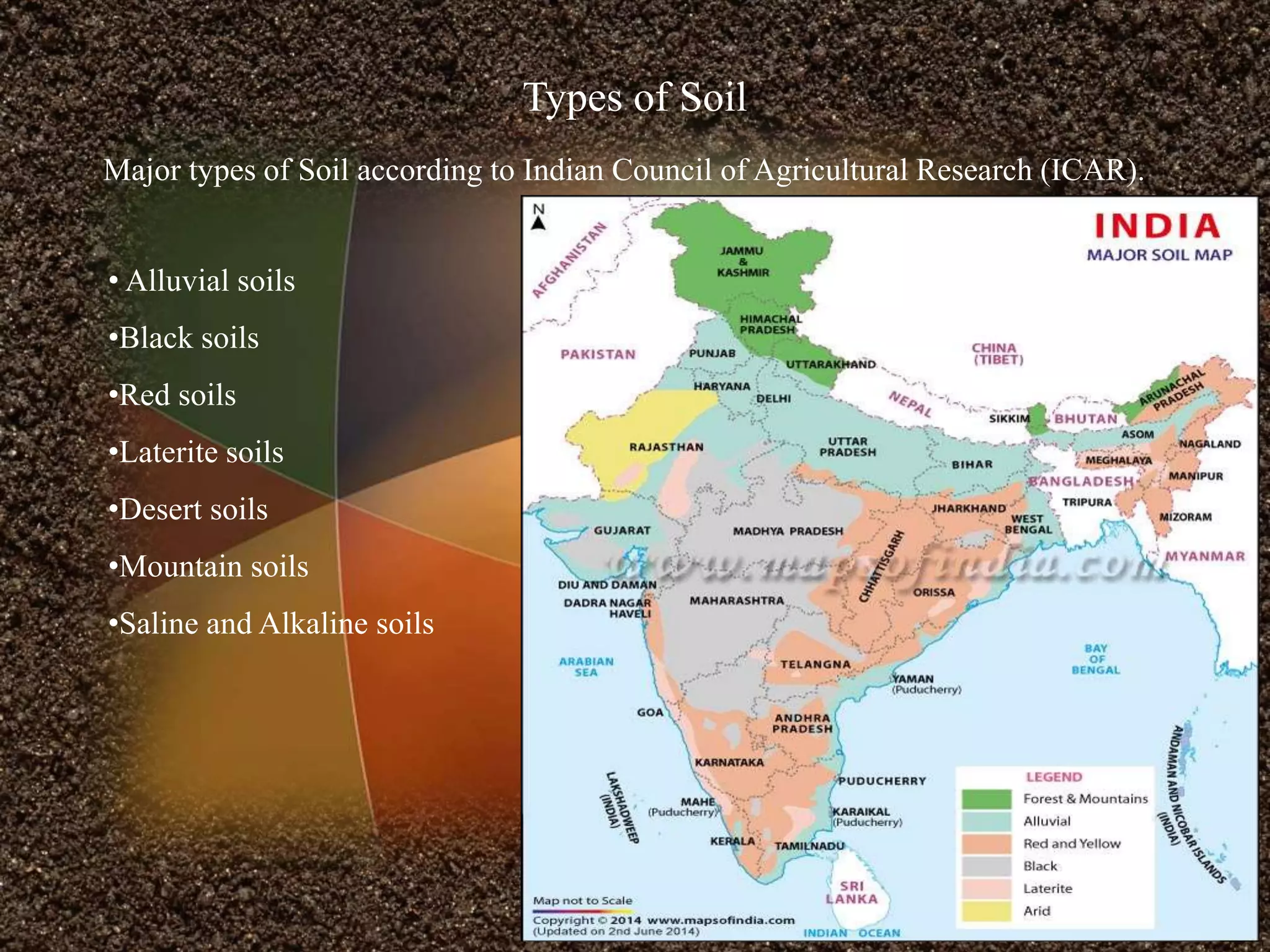
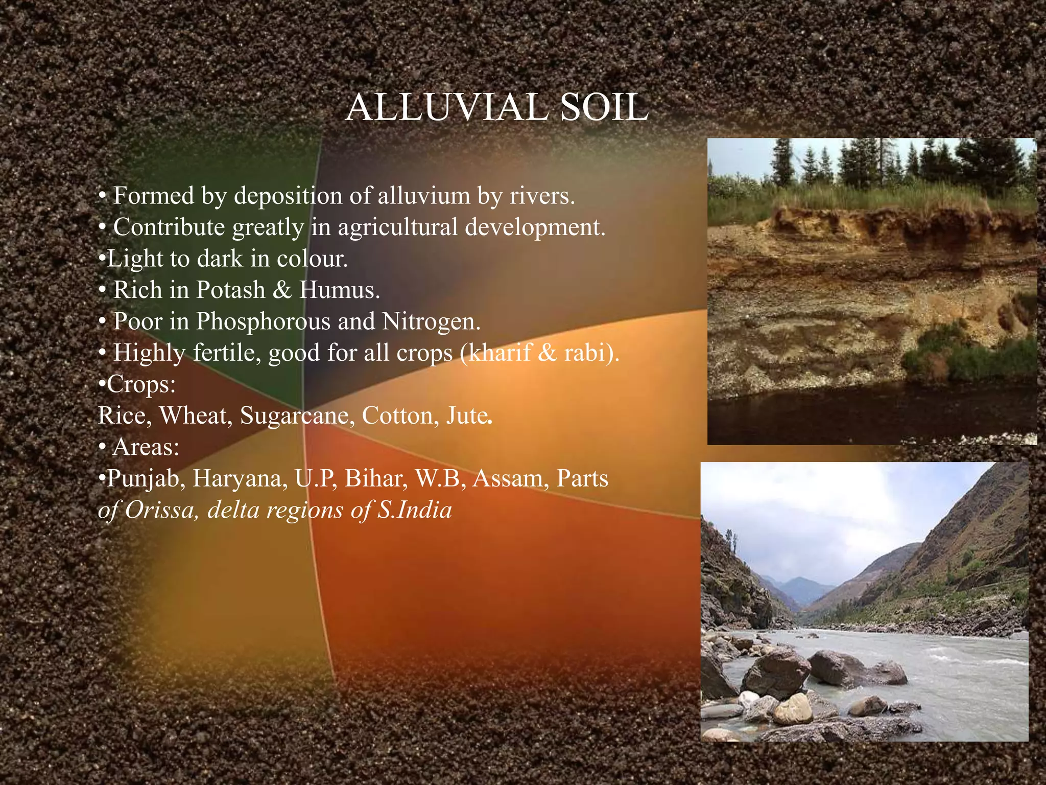
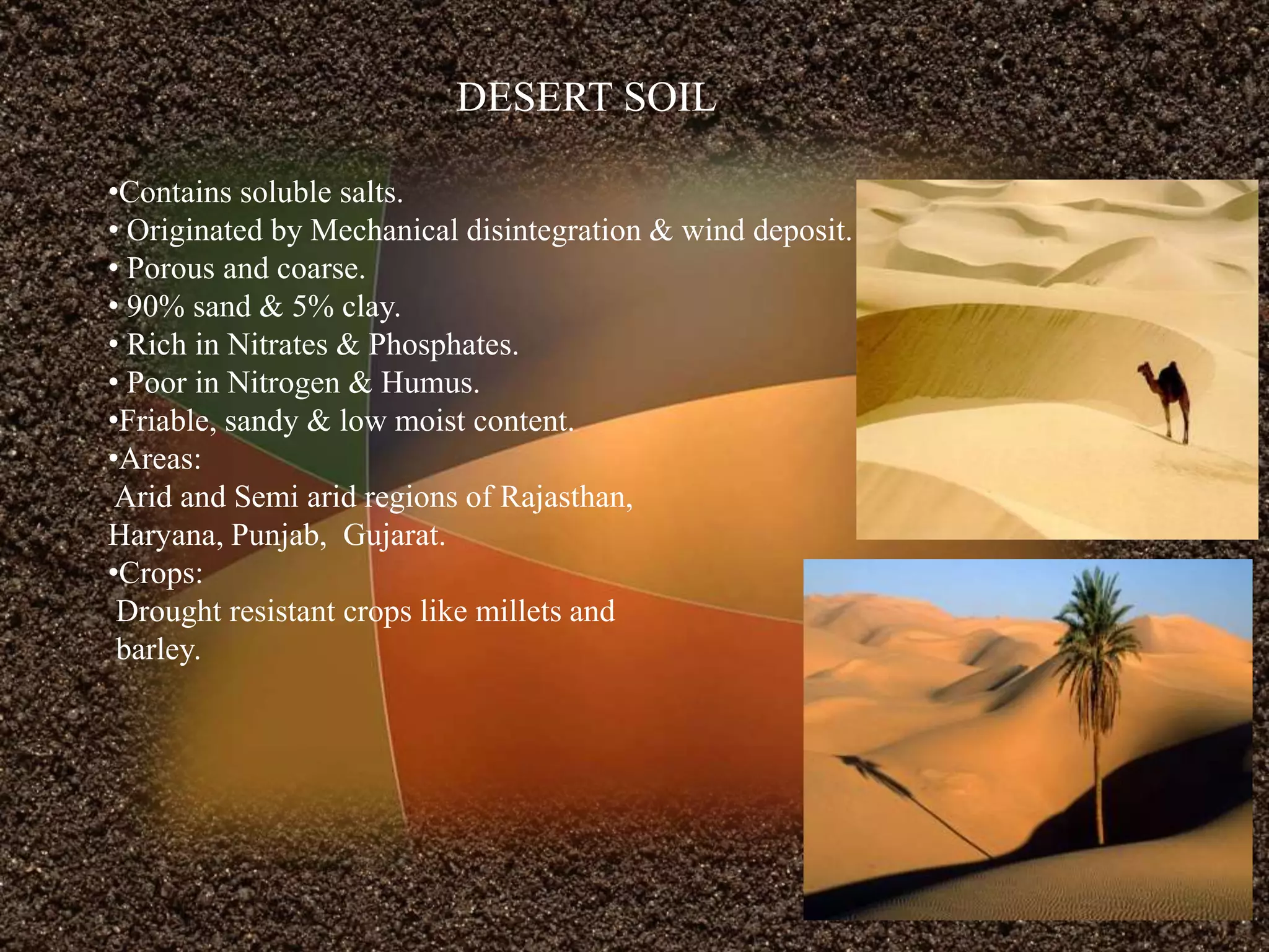
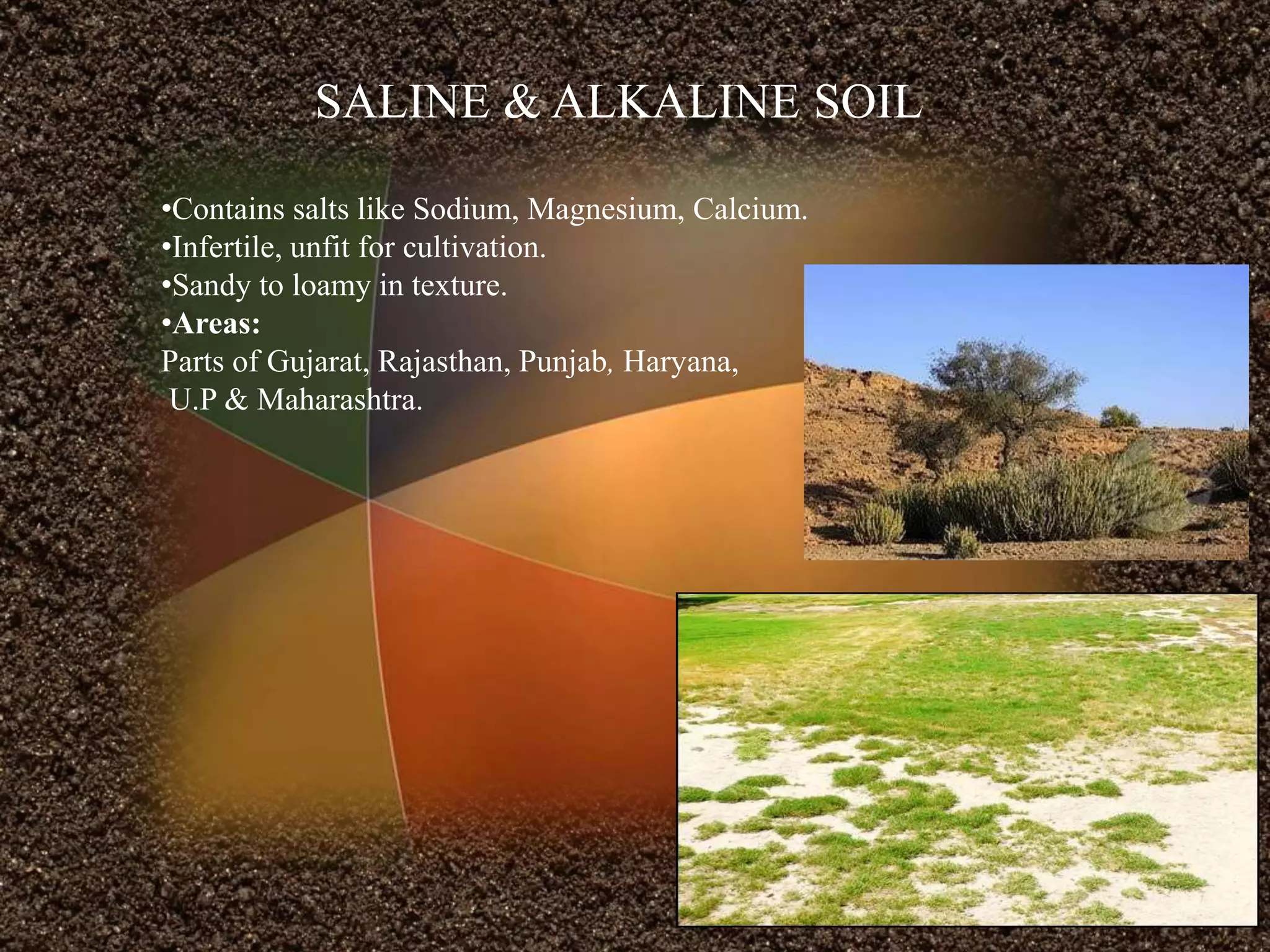
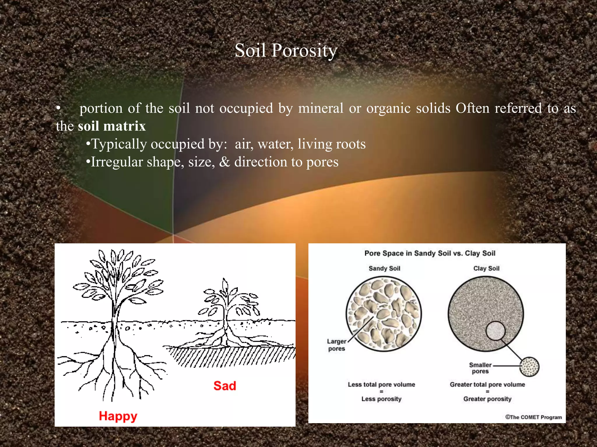
““... the Latin name for man, homo, derived from humus, the stuff of life in the
soil.” --- Dr. Daniel Hillel
By:Rahul Bajpai
.
TOPICS
•Introduction to Soil
•Soil Genesis
•Types of Soil
•Properties of Soil
•Soil Survey
•Soil Mapping And Classification
•Soil Plant Relationship
•Soil Erosion
•Spectral Response
•Soil Management
Introduction To Soil
Traditional definition:
Material which nourishes and supports growing plants; includes minerals, humus,
water and air.
Geologic definition:
Loose surface of the earth as distinguished from solid bedrock.
Civil Engineering:
Soil is the earth material that can be disaggregated in water by gentle agitation.
Agronomy definition:
Soil consists of the thin layers of the earth’s crust formed by surface weathering that
are able to support plant life.
Components of Soil
The percentage of composition of soil may vary with the variety of soil
Soil Forming Processes
Decomposition
Translocation
Leaching
SOIL PROCESSES
Weathering
parent rock
Weathering breaks the rock into
smaller and smaller pieces
soil
Freezing and
thawing of
water
Wind with sand
Running water
Heat and cold
Ice
Physical Weathering Chemical Weathering
Acids
Water
sand
silt
clay
Decomposition
Translocation
A soil with small soil peds or crumbs and high
porosity leading to free drainage and active
leaching
Leaching
Soil Profile
A series of horizontal layers of different chemical composition, physical
properties, particle size, water content and amount of organic matter.
Horizon
Each recognizable layer of the profile.
O. It's about an inch thick and is made up of
dead plants, animals and some humus
A. The A horizon called topsoil is made up of
humus (decomposed organic matter) mixed
with mineral materials.
E. This layer, between the A and B
Horizons is light in color and made up mostly
of sand and silt.
B. It contains clay and mineral (such as iron,
aluminum oxides, and calcium carbonate).
C. consists of broken-up bedrock that is only
slightly weathered .
R. Layer R is the unweathered rock (bedrock)
layer that is beneath all the other layers.
• Alluvial soils
•Black soils
•Red soils
•Laterite soils
•Desert soils
•Mountain soils
•Saline and Alkaline soils
Major types of Soil according to Indian Council of Agricultural Research (ICAR).
Types of Soil
ALLUVIAL SOIL
• Formed by deposition of alluvium by rivers.
• Contribute greatly in agricultural development.
•Light to dark in colour.
• Rich in Potash & Humus.
• Poor in Phosphorous and Nitrogen.
• Highly fertile, good for all crops (kharif & rabi).
•Crops:
Rice, Wheat, Sugarcane, Cotton, Jute.
• Areas:
•Punjab, Haryana, U.P, Bihar, W.B, Assam, Parts
of Orissa, delta regions of S.India
BLACK SOIL
•.Also known as Regur or Black Cotton soil.
• Dark grey to Black in colour.
•High clay content.
• Highly moist retentive.
• Highly suitable for cotton.
• Rich in iron, lime, calcium, Magnesium, carbonates,
and alumina.
•Poor in Phosphorous, Nitrogen and Organic matter.
• Areas:
Deccan Trap which includes: Maharastra,
M.P, Parts of A.P, Karnataka, Parts of T.N and
Rajasthan.
•Crops:
Cotton, Sugarcane, Groundnut, Millets, Rice,
Wheat, Oilseeds.
RED SOIL
• Formed due to weathering of old crystalline rocks.
• More sandy and less clayey.
• Rich in iron, small amount of Humus.
• Poor in phosphorus, nitrogen and lime.
• Slightly acidic and do not retain moisture.
•Area :
Tamil Nadu, Southern Karnataka, parts of
Madhya Pradesh, Maharashtra, West Bengal,
Eastern Rajasthan, North eastern States.
• Crops :
Ragi, Groundnut, millet, Tobacco, Potato,
Rice, Wheat, Sugarcane.
LATERITE SOIL
• Latin word meaning brick.
• Formed under high temperature and rainfall with wet and dry
spell.
•Silica is leached due to high rainfall
•Remnants of iron and aluminum oxides left behind is know as
Laterite.
• Brown to Yellowish colour.
•Becomes hard when exposed to atmosphere.
•Used as building material.
•Rich in Iron
Poor in Lime, Potash, & Magnesium.
•Areas:
Parts of Assam, Karnataka, T.N, A.P, M.P,
Kerala.
• Crops:
Tea, Coffee, Cashew, Rubber and Coconut.
DESERT SOIL
•Contains soluble salts.
• Originated by Mechanical disintegration & wind deposit.
• Porous and coarse.
• 90% sand & 5% clay.
• Rich in Nitrates & Phosphates.
• Poor in Nitrogen & Humus.
•Friable, sandy & low moist content.
•Areas:
Arid and Semi arid regions of Rajasthan,
Haryana, Punjab, Gujarat.
•Crops:
Drought resistant crops like millets and
barley.
MOUNTAIN SOIL
•Found in hill slopes.
• Formed by deposition of organic matter from forest.
•Rich in humus.
•Poor in Potash and Lime.
•Areas:
Assam, Kashmir, Sikkim & Arunachal
Pradesh.
• Crops:
Tea, Coffee, Spices & Tropical Fruits.
SALINE & ALKALINE SOIL
•Contains salts like Sodium, Magnesium, Calcium.
•Infertile, unfit for cultivation.
•Sandy to loamy in texture.
•Areas:
Parts of Gujarat, Rajasthan, Punjab, Haryana,
U.P & Maharashtra.
Properties of Soil
Soil
Physical properties
•Soil texture
•Soil Colour
•Soil Structure
•Soil Porosity
Chemical Properties
•Soil pH
•Cation exchange capacity (CEC)
•Nutrient Availability
Physical properties
Soil Texture
Soil Separates particle size groups of sand, silt, and clay
Soil Colour
White colors commonly salts or lime deposits are present
Mottles (rust colors) – soil may have periods of inadequate aeration
Gleying (bluish, grayish, greenish) – sub soils, prolonged periods of water logging
Darker colors – higher levels of organic matter
Soil Structure
A. Granular
B. Blocky
C. Prismatic or Columnar
D. Platy
E. Structure less(Single grain)
• portion of the soil not occupied by mineral or organic solids Often referred to as
the soil matrix
•Typically occupied by: air, water, living roots
•Irregular shape, size, & direction to pores
Soil Porosity
Chemical Properties
Soil pH
•This gives a measure of the acidity or basicity of a soil.
• 0-7 = acidic; 7-14 = basic.
•Acidity is measured by determining the concentration of Hydrogen (H+) ions in the soil.
•Higher concentration of H+ ions = high acidity, higher concentration of OH- ions = high
basicity.
•In general, the ideal pH for plant growth is about 5.5 in organic soils and about 6.5 in
mineral soils.
Cation Exchange capacity
The total number of cations a soil can hold or its total negative charge is the
soil’s cation exchange capacity
Most commonly held cations – Ca, K, Mg, H, Na, Al, NH4
Nutrients Availability
• The primary nutrients are Nitrogen , phosphorus and Potassium
• The intermediate nutrients are Sulfur,Magnisium and calcium.
SOIL EROSION
• Removal of top soil by different agents.
CAUSES
•Deforestation
• Overgrazing.
•Faulty method of Agriculture.
•Erosion by rivers.
• Removal of top soil (for bricks, pots, tiles etc)
•Shifting cultivation.
Types of Erosion
Wind Erosion Water Erosion
Types of Erosion are based on the agents of erosion
Soil surveys are the primary references available to help land
managers determine the potentials and limitations of the soils.
Soil surveys are a compilation of maps and interpretive data.
oil Survey
Purpose of a Soil Survey
Soil Survey
• Determine characteristics of the soils
• Classify the soils according to a
standard system of classification,
• Plot boundaries of the soils on a map,
and
• Make predictions about the behavior
and best management of the soils
(Interpretations).
Some of the applications of soil survey are given below.
•Sediment Yield Prediction
•Soil Erosion Modeling
•Soil Quality
•Crop Suitability
•Hydrology
• Global Change and Monitoring
•Soil and Water Conservation
• Ecological Model Land Use
•Environmental Quality
•Watershed management
Soil Mapping
Why would we want to map soils?
Communication of geographic information
Tools for land management and planning
Steps in mapping the soil of a given area
1. Define the scale and level of detail that is required.
2. Study existing information regarding the soil, geology,
topography, vegetation of the area.
3. Define soil units to be mapped.
4. Compile information about the nature of each soil.
5. Mark boundaries of where each soil unit occurs.
Soil Classification
Class I Soils
Can be used continuously for intensive crop production
good farming practices
Class II Soils
More limitations than Class I land for crop production
2-5% slope is main difference
Class III Soils
Severe limitations
Requires more special conservation practices than Class II to keep
it continually productive
Can have shallow soil
Slopes 6-10%
Shallow water tables
Class IV
Severe limitations for cropping use
Greater intensity of conservation practices for cultivated crops that Class III
Recommend permanent crops (e.g. pastures)
Slope 12-18%
Class V
Boulders, wetness, problems impractical to correct
Not necessarily erosion risk
Can’t be cultivated
Use for pasture, range, woodland, wildlife habitat
Class VI
Slope 18-30%
Same limitations as Class V soils, except more need for sustainable
management practices
Class VIII
Very severe limitations
Steep slopes, rock lands, swamps, etc.
Can only be used for wildlife, recreation, watersheds, aesthetic
appreciation
Class VII
Severe limitations
Extreme care to protect the soil
Even using grazing, wildlife, timber
Slope >30%
A. Anchorage – soil acts to provide a firm support as roots grow throughout the soil.
B. Water – soil provides nearly all of the water used by plants. Water is absorbed
through the plants’ roots.
C. Oxygen – nearly all organisms need oxygen. Roots don’t have ample supplies, so
they need good soil aeration to allow gas exchange.
D. Nutrients – of the 16 nutrients considered to be essential for plant growth, 13 are
obtained from the soil. Root hairs absorb the nutrients dissolved in soil water.
Soil - Plant Relationship
Spectral Signature of Soil
Soil Management
•Reduced Erosion
•Balanced pH
•Reduced Leaching
•Increased Nutrient
•Organic Manures
Increased
productivity
THANK YOU

Rahul Bajpai M.tech Remote sensing & GIS RSACUP

  • 1.
    ““... the Latinname for man, homo, derived from humus, the stuff of life in the soil.” --- Dr. Daniel Hillel By:Rahul Bajpai
  • 2.
    . TOPICS •Introduction to Soil •SoilGenesis •Types of Soil •Properties of Soil •Soil Survey •Soil Mapping And Classification •Soil Plant Relationship •Soil Erosion •Spectral Response •Soil Management
  • 3.
    Introduction To Soil Traditionaldefinition: Material which nourishes and supports growing plants; includes minerals, humus, water and air. Geologic definition: Loose surface of the earth as distinguished from solid bedrock. Civil Engineering: Soil is the earth material that can be disaggregated in water by gentle agitation. Agronomy definition: Soil consists of the thin layers of the earth’s crust formed by surface weathering that are able to support plant life.
  • 4.
    Components of Soil Thepercentage of composition of soil may vary with the variety of soil
  • 5.
  • 6.
    parent rock Weathering breaksthe rock into smaller and smaller pieces soil Freezing and thawing of water Wind with sand Running water Heat and cold Ice Physical Weathering Chemical Weathering Acids Water sand silt clay
  • 7.
  • 8.
  • 9.
    A soil withsmall soil peds or crumbs and high porosity leading to free drainage and active leaching Leaching
  • 10.
    Soil Profile A seriesof horizontal layers of different chemical composition, physical properties, particle size, water content and amount of organic matter. Horizon Each recognizable layer of the profile.
  • 12.
    O. It's aboutan inch thick and is made up of dead plants, animals and some humus A. The A horizon called topsoil is made up of humus (decomposed organic matter) mixed with mineral materials. E. This layer, between the A and B Horizons is light in color and made up mostly of sand and silt. B. It contains clay and mineral (such as iron, aluminum oxides, and calcium carbonate). C. consists of broken-up bedrock that is only slightly weathered . R. Layer R is the unweathered rock (bedrock) layer that is beneath all the other layers.
  • 13.
    • Alluvial soils •Blacksoils •Red soils •Laterite soils •Desert soils •Mountain soils •Saline and Alkaline soils Major types of Soil according to Indian Council of Agricultural Research (ICAR). Types of Soil
  • 14.
    ALLUVIAL SOIL • Formedby deposition of alluvium by rivers. • Contribute greatly in agricultural development. •Light to dark in colour. • Rich in Potash & Humus. • Poor in Phosphorous and Nitrogen. • Highly fertile, good for all crops (kharif & rabi). •Crops: Rice, Wheat, Sugarcane, Cotton, Jute. • Areas: •Punjab, Haryana, U.P, Bihar, W.B, Assam, Parts of Orissa, delta regions of S.India
  • 15.
    BLACK SOIL •.Also knownas Regur or Black Cotton soil. • Dark grey to Black in colour. •High clay content. • Highly moist retentive. • Highly suitable for cotton. • Rich in iron, lime, calcium, Magnesium, carbonates, and alumina. •Poor in Phosphorous, Nitrogen and Organic matter. • Areas: Deccan Trap which includes: Maharastra, M.P, Parts of A.P, Karnataka, Parts of T.N and Rajasthan. •Crops: Cotton, Sugarcane, Groundnut, Millets, Rice, Wheat, Oilseeds.
  • 16.
    RED SOIL • Formeddue to weathering of old crystalline rocks. • More sandy and less clayey. • Rich in iron, small amount of Humus. • Poor in phosphorus, nitrogen and lime. • Slightly acidic and do not retain moisture. •Area : Tamil Nadu, Southern Karnataka, parts of Madhya Pradesh, Maharashtra, West Bengal, Eastern Rajasthan, North eastern States. • Crops : Ragi, Groundnut, millet, Tobacco, Potato, Rice, Wheat, Sugarcane.
  • 17.
    LATERITE SOIL • Latinword meaning brick. • Formed under high temperature and rainfall with wet and dry spell. •Silica is leached due to high rainfall •Remnants of iron and aluminum oxides left behind is know as Laterite. • Brown to Yellowish colour. •Becomes hard when exposed to atmosphere. •Used as building material. •Rich in Iron Poor in Lime, Potash, & Magnesium. •Areas: Parts of Assam, Karnataka, T.N, A.P, M.P, Kerala. • Crops: Tea, Coffee, Cashew, Rubber and Coconut.
  • 18.
    DESERT SOIL •Contains solublesalts. • Originated by Mechanical disintegration & wind deposit. • Porous and coarse. • 90% sand & 5% clay. • Rich in Nitrates & Phosphates. • Poor in Nitrogen & Humus. •Friable, sandy & low moist content. •Areas: Arid and Semi arid regions of Rajasthan, Haryana, Punjab, Gujarat. •Crops: Drought resistant crops like millets and barley.
  • 19.
    MOUNTAIN SOIL •Found inhill slopes. • Formed by deposition of organic matter from forest. •Rich in humus. •Poor in Potash and Lime. •Areas: Assam, Kashmir, Sikkim & Arunachal Pradesh. • Crops: Tea, Coffee, Spices & Tropical Fruits.
  • 20.
    SALINE & ALKALINESOIL •Contains salts like Sodium, Magnesium, Calcium. •Infertile, unfit for cultivation. •Sandy to loamy in texture. •Areas: Parts of Gujarat, Rajasthan, Punjab, Haryana, U.P & Maharashtra.
  • 21.
    Properties of Soil Soil Physicalproperties •Soil texture •Soil Colour •Soil Structure •Soil Porosity Chemical Properties •Soil pH •Cation exchange capacity (CEC) •Nutrient Availability
  • 22.
    Physical properties Soil Texture SoilSeparates particle size groups of sand, silt, and clay Soil Colour White colors commonly salts or lime deposits are present Mottles (rust colors) – soil may have periods of inadequate aeration Gleying (bluish, grayish, greenish) – sub soils, prolonged periods of water logging Darker colors – higher levels of organic matter
  • 23.
    Soil Structure A. Granular B.Blocky C. Prismatic or Columnar D. Platy E. Structure less(Single grain)
  • 24.
    • portion ofthe soil not occupied by mineral or organic solids Often referred to as the soil matrix •Typically occupied by: air, water, living roots •Irregular shape, size, & direction to pores Soil Porosity
  • 25.
    Chemical Properties Soil pH •Thisgives a measure of the acidity or basicity of a soil. • 0-7 = acidic; 7-14 = basic. •Acidity is measured by determining the concentration of Hydrogen (H+) ions in the soil. •Higher concentration of H+ ions = high acidity, higher concentration of OH- ions = high basicity. •In general, the ideal pH for plant growth is about 5.5 in organic soils and about 6.5 in mineral soils.
  • 26.
    Cation Exchange capacity Thetotal number of cations a soil can hold or its total negative charge is the soil’s cation exchange capacity Most commonly held cations – Ca, K, Mg, H, Na, Al, NH4
  • 27.
    Nutrients Availability • Theprimary nutrients are Nitrogen , phosphorus and Potassium • The intermediate nutrients are Sulfur,Magnisium and calcium.
  • 28.
    SOIL EROSION • Removalof top soil by different agents. CAUSES •Deforestation • Overgrazing. •Faulty method of Agriculture. •Erosion by rivers. • Removal of top soil (for bricks, pots, tiles etc) •Shifting cultivation.
  • 29.
    Types of Erosion WindErosion Water Erosion Types of Erosion are based on the agents of erosion
  • 30.
    Soil surveys arethe primary references available to help land managers determine the potentials and limitations of the soils. Soil surveys are a compilation of maps and interpretive data. oil Survey Purpose of a Soil Survey Soil Survey • Determine characteristics of the soils • Classify the soils according to a standard system of classification, • Plot boundaries of the soils on a map, and • Make predictions about the behavior and best management of the soils (Interpretations).
  • 31.
    Some of theapplications of soil survey are given below. •Sediment Yield Prediction •Soil Erosion Modeling •Soil Quality •Crop Suitability •Hydrology • Global Change and Monitoring •Soil and Water Conservation • Ecological Model Land Use •Environmental Quality •Watershed management
  • 32.
    Soil Mapping Why wouldwe want to map soils? Communication of geographic information Tools for land management and planning Steps in mapping the soil of a given area 1. Define the scale and level of detail that is required. 2. Study existing information regarding the soil, geology, topography, vegetation of the area. 3. Define soil units to be mapped. 4. Compile information about the nature of each soil. 5. Mark boundaries of where each soil unit occurs.
  • 33.
  • 34.
    Class I Soils Canbe used continuously for intensive crop production good farming practices Class II Soils More limitations than Class I land for crop production 2-5% slope is main difference Class III Soils Severe limitations Requires more special conservation practices than Class II to keep it continually productive Can have shallow soil Slopes 6-10% Shallow water tables
  • 35.
    Class IV Severe limitationsfor cropping use Greater intensity of conservation practices for cultivated crops that Class III Recommend permanent crops (e.g. pastures) Slope 12-18% Class V Boulders, wetness, problems impractical to correct Not necessarily erosion risk Can’t be cultivated Use for pasture, range, woodland, wildlife habitat Class VI Slope 18-30% Same limitations as Class V soils, except more need for sustainable management practices
  • 36.
    Class VIII Very severelimitations Steep slopes, rock lands, swamps, etc. Can only be used for wildlife, recreation, watersheds, aesthetic appreciation Class VII Severe limitations Extreme care to protect the soil Even using grazing, wildlife, timber Slope >30%
  • 37.
    A. Anchorage –soil acts to provide a firm support as roots grow throughout the soil. B. Water – soil provides nearly all of the water used by plants. Water is absorbed through the plants’ roots. C. Oxygen – nearly all organisms need oxygen. Roots don’t have ample supplies, so they need good soil aeration to allow gas exchange. D. Nutrients – of the 16 nutrients considered to be essential for plant growth, 13 are obtained from the soil. Root hairs absorb the nutrients dissolved in soil water. Soil - Plant Relationship
  • 38.
  • 39.
    Soil Management •Reduced Erosion •BalancedpH •Reduced Leaching •Increased Nutrient •Organic Manures Increased productivity
  • 40.