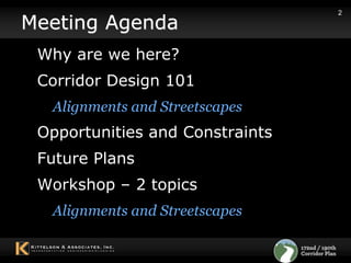
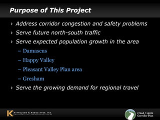
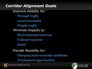
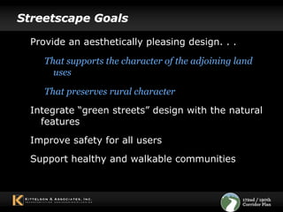
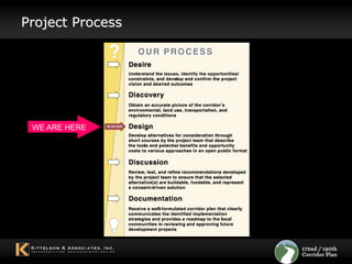
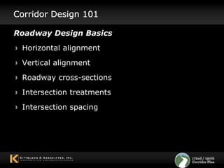
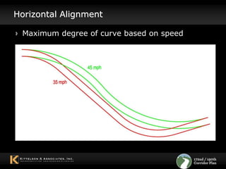
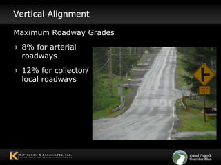
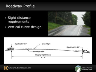
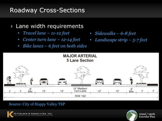
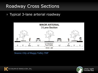
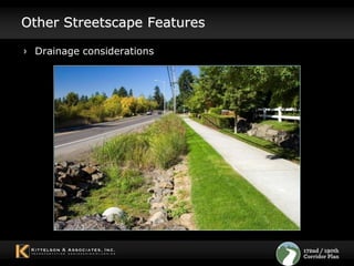
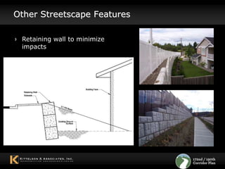
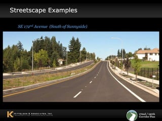
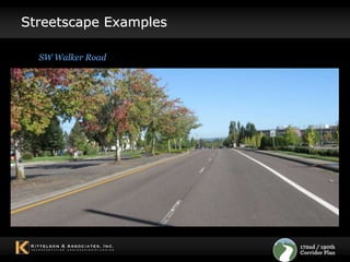
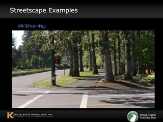
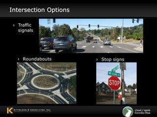
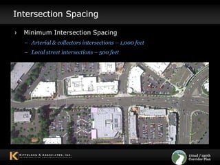
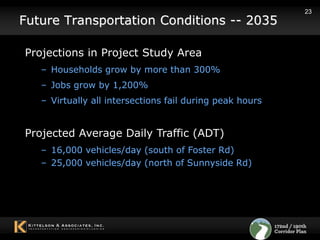
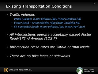
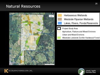
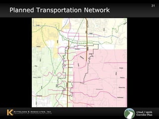
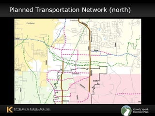
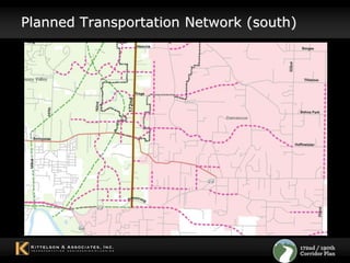
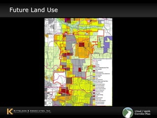
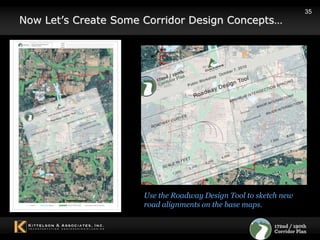
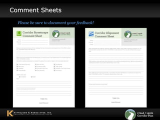
Public Workshop #2October 2010
2Meeting AgendaWhy are we here? Corridor Design 101 Alignments and StreetscapesOpportunities and Constraints Future Plans Workshop – 2 topics Alignments and Streetscapes
Why here? Why now? (See Project YouTube Video)
Purpose of This ProjectAddress corridor congestion and safety problems Serve future north-south trafficServe expected population growth in the areaDamascus Happy Valley Pleasant Valley Plan area GreshamServe the growing demand for regional travel
Corridor Alignment GoalsImprove mobility for:Through traffic  Local community Freight trafficMinimize impacts to:Environmental resources Cultural resourcesSocial Provide flexibility for:Changing socio-economic conditions Development opportunities
Streetscape GoalsProvide an aesthetically pleasing design. . . That supports the character of the adjoining land usesThat preserves rural characterIntegrate “green streets” design with the natural features Improve safety for all users Support healthy and walkable communities
Project ProcessWE ARE HERE
8Alternatives Development Process
Corridor Design 101Roadway Design BasicsHorizontal alignment  Vertical alignmentRoadway cross-sectionsIntersection treatmentsIntersection spacing
Horizontal AlignmentMaximum degree of curve based on speed
Vertical AlignmentMaximum Roadway Grades8% for arterial roadways12% for collector/local roadways
Roadway ProfileSight distance requirementsVertical curve design
Roadway Cross-SectionsLane width requirements Travel lane – 11-12 feet
Center turn lane – 12-14 feet
Bike lanes – 6 feet on both sides
Sidewalks – 6-8 feet
Landscape strip – 5-7 feetSource: City of Happy Valley TSP
Roadway Cross SectionsTypical 3-lane arterial roadwaySource: City of Happy Valley TSP
Other Streetscape FeaturesDrainage considerations
Other Streetscape FeaturesRetaining wall to minimize impacts
Streetscape ExamplesSE 172nd Avenue  (South of Sunnyside)
Streetscape ExamplesSW Walker Road
Streetscape ExamplesSW Kruse Way
Intersection OptionsTraffic signalsRoundaboutsStop signs
Intersection Spacing Minimum Intersection SpacingArterial & collectors intersections – 1,000 feet
Local street intersections – 500 feetCorridor Opportunities and ConstraintsDiscussed in Stakeholder interviewsMemos on existing conditionsMemos on projected future conditions
23Future Transportation Conditions -- 2035Projections in Project Study Area Households grow by more than 300%
Jobs grow by 1,200%
Virtually all intersections fail during peak hoursProjected Average Daily Traffic (ADT)16,000 vehicles/day (south of Foster Rd)
25,000 vehicles/day (north of Sunnyside Rd) 24Existing Transportation ConditionsTraffic volumes172nd Avenue:  8,500 vehicles /day (near Hemrick Rd)Foster Road :  7,500 vehicles /day (near Cheldelin Rd)SE Sunnyside Road:  9,000 vehicles /day (near 172nd Ave)All intersections operate acceptably except Foster Road/172nd Avenue (LOS F)Intersection crash rates are within normal levelsThere are no bike lanes or sidewalks
Topography
26Natural Resources
Existing Cross-Section172nd Avenue
Existing Cross-Section190th Avenue
29Other Opportunities and Constraints10 historical resources eligible for National Register of Historic PlacesGenerally located along Foster RdNo recorded archaeological sites
Future Plans for CorridorRegional Transportation System Plan Local Transportation System PlansLocal Comprehensive Plans 30
31Planned Transportation Network

Public Workshop #2