Do not include any personal information as all posted material on this site is considered to be part of a public record as defined by section 27 of the Municipal Freedom of Information and Protection of Privacy Act.
We reserve the right to remove inappropriate comments. Please see Terms of Use for City of Toronto Social Media Sites at http://www.toronto.ca/e-updates/termsofuse.htm.
Road Diet: Improving Safety, Livability, and Economic DevelopmentRPO America
Jessica Rich, Federal Highway Administration Tennessee Division, provided an in-depth look at what road diets are and how they improve safety for transportation users during the 2016 National Regional Transportation Conference.
Imagine Bickett Boulevard: Louisburg, North CarolinaRPO America
During the 2016 National Regional Transportation Conference, Ann Stroobant, Kerr-Tar Regional Council of Governments (NC), discussed the rural town corridor planning process for Bickett Boulevard in Louisburg, North Carolina.
Title: Aloha Streets: Complete Streets and Complete Communities in Hawai`i
Track: Connect
Format: 90 minute panel
Abstract: Residents and visitors of Hawai'i expect paradise, but find traffic. Find out how communities at different scales in the state are expanding viable transportation options and building complete, transit-oriented cities and towns.
Presenters:
Presenter: Evan Corey Nelson\Nygaard
Co-Presenter: Mark Garrity City of Honolulu Transportation Services
Co-Presenter: Michael Moule County of Kauai
South Park Blocks Parking - Portland Downtown Neighborhood Associationmazik
Explains the Portland (Oregon) Downtown Neighborhood Association's reasons for urging restoration of the 25-year ban on parking in the South Park Blocks.
Title: Taking Pedestrian and Bicycle Counting Programs to the Next Level
Track: Connect
Format: 90 minute panel
Abstract: Panelists will provide practical guidance for pedestrian and bicycle counting programs based on findings from NCHRP Project 07-19, "Methods and Technologies for Collecting Pedestrian and Bicycle Volume Data."
Presenters:
Presenter: Robert Schneider University of Wisconsin-Milwaukee
Co-Presenter: RJ Eldridge Toole Design Group, LLC
Co-Presenter: Conor Semler Kittelson & Associates, Inc.
On March 2015, the City of Summit initiated a Feasibility Study on the vision of converting the abandoned Rahway Valley Railroad into a rail trail more commonly referred to as the Summit Parkline. The Study develops feasible and economical concepts for a 1.2-mile trail and linear park on the existing railroad right-of-way. The Summit Parkline is a unique opportunity for the City to create a recreational amenity that has potential to be a major local and regional attraction and character-giving symbol for the community.
Federal Funding for Active Transportation and Recreation
Track: Connect
Format: 60 minute panel
Abstract: This session will provide an overview about federal transportation programs that can fund infrastructure for walking and bicycling.
Full Description: Federal programs provide funds to develop transportation, community, and recreation infrastructure for walking and bicycling and to connect communities and promote active living. Attendees will learn how about Federal programs to promote sustainable communities.
Learning Objectives:
Participants will learn about the Federal Partnership for Sustainable Communities.
Participants will learn about the Federal-aid surface transportation programs that benefit pedestrians and bicyclists.
Participants will be able to successfully write a competitive proposal.
Participants will understand how Federal, State, and local programs interact.
Presenter(s)
Presenter: Christopher Douwes Transportation Alternatives Program / Recreational Trails Program, FHWA
Co-Presenter: Wesley Blount Office of Planning, Environment & Realty FHWA
Title: Level of Service F for Grade A Streets
Track: Prosper
Format: 90 minute panel
Abstract: Relying solely on Level of Service criteria for street design, which evaluates vehicle congestion, leads to poor outcomes on many of our roadways. LOS F, far from a failure, creates opportunities to reallocate roadway space for more livable street designs. In this session, learn about projects in Cambridge and San Francisco that overcame opposition and generated community support in prioritizing better bicycling and walking over vehicle capacity during the peak hour of travel.
Presenters:
Presenter: Michael Sallaberry San Francisco Municipal Transportation Agency
Co-Presenter: Jeffrey Rosenblum City of Cambridge, MA
Creating a Safer System Through State Pedestrian and Bicycle Safety Campaigns
Hear about approaches used by North Carolina and Florida to develop, launch, and evaluate combined education and enforcement campaigns aimed at reducing pedestrian and bicyclists injuries and deaths.
Presenters:
Presenter: Laura Sandt Pedestrian and Bicycle Information Center
Co-Presenter: Lauren Blackburn North Carolina DOT
Co-Presenter: Lucas Cruse University of South Florida, Center for Urban Transportation Research
Co-Presenter: Billy Hattaway Florida DOT
The City of Stonnington is preparing a Structure Plan to plan
for and manage the future development and growth of the
Glenferrie Road and High Street activity centre to 2040. Council has recently completed the Draft Structure Plan and has undertaken the associated Stage 3 Consultation phase. The Draft Structure Plan sets out a vision for the look and feel of the Centre, and provides design guidance and parameters for potential future growth and change.
Designing & Planning for Cycling, Phil Jones & Adrian LordDesign South East
Presentation on Design and Planning for cycling from the Designing and Planning for Cycling workshop at MADE on 19th May 2015. Presentation by Phil Jones and Adrian Lord, Phil Jones Associates.
Re-shaping Urban Spaces - Public Realm Briefing PaperGraeme Moore
A briefing paper in order to brief officers and members of the economic and social benefits that could be achieved by investing in high quality public realm in Scunthorpe Town Centre. Evidence was sourced from work that was carried out by the former RDA's for the North West (RENEW Northwest) and East Midlands (EMDA) about the economic benefits of investing in the public realm.
TEDx Manchester: AI & The Future of WorkVolker Hirsch
TEDx Manchester talk on artificial intelligence (AI) and how the ascent of AI and robotics impacts our future work environments.
The video of the talk is now also available here: https://youtu.be/dRw4d2Si8LA
Portland's Complete Streets Policy - GSMSummit 2014, Bruce HymanGrowSmart Maine
Why plan for growth and change, when it seems so much easier to simply react?
When there is a distinct and shared vision for your community - when residents, businesses and local government anticipate a sustainable town with cohesive and thriving neighborhoods - you have the power to conserve your beautiful natural spaces, enhance your existing downtown or Main Street, enable rural areas to be productive and prosperous, and save money through efficient use of existing infrastructure.
This is the dollars and sense of smart growth.
Success is clearly visible in Maine, from the creation of a community-built senior housing complex and health center in Fort Fairfield to conservation easements creating Forever Farms to Rockland's revitalized downtown. Communities have options. We have the power to manage our own responses to growth and change.
After all, “Planning is a process of choosing among those many options. If we do not choose to plan, then we choose to have others plan for us.” - Richard I. Winwood
And in the end, this means that our children and their children will choose to make Maine home and our economy will provide the opportunities to do so.
The Summit offers you a wonderful opportunity to be a part of the transformative change in Maine that we’ve seen these gatherings produce. We encourage you to consider the value of being actively involved in growing Maine’s economy and protecting the reasons we choose to live here.
Do not include any personal information as all posted material on this site is considered to be part of a public record as defined by section 27 of the Municipal Freedom of Information and Protection of Privacy Act.
We reserve the right to remove inappropriate comments. Please see Terms of Use for City of Toronto Social Media Sites at http://www.toronto.ca/e-updates/termsofuse.htm.
James Daisa PE (transportation planning traffic engineering).rev 5.14jdaisa
Generic resume that summarizes broad categories of the type of work in my practice, plus highlights of technical specializations. The resume contains an attached compendium of specific projects by category.
Do not include any personal information as all posted material on this site is considered to be part of a public record as defined by section 27 of the Municipal Freedom of Information and Protection of Privacy Act.
We reserve the right to remove inappropriate comments. Please see
Terms of Use for City of Toronto Social Media Sites at http://www.toronto.ca/e-updates/termsofuse.htm.
Environmental and Social Management Framework (ESMF) - Karachi Neighborhood I...zubeditufail
Directorate of Urban Policy & Strategic Planning, Planning & Development Department, Government of Sindh
Karachi Neighborhood Improvement Project
Environmental and Social Management Framework (ESMF)
February 2017
Transportation planning is an integral part of overall urban planning and needs systematic approach.
Travel demand estimation is an important part of comprehensive transportation planning process.
However, planning does not end by predicting travel demand.
The ultimate aim of urban transport planning is to generate alternatives for improving transportation system to meet future demand and selecting the best alternative after proper evaluation.
For more information, see http://scarboroughsubwayextension.ca
Do not include any personal information as all posted material on this site is considered to be part of a public record as defined by section 27 of the Municipal Freedom of Information and Protection of Privacy Act.
We reserve the right to remove inappropriate comments. Please see Terms of Use for City of Toronto Social Media Sites at http://www.toronto.ca/e-updates/termsofuse.htm.
In a world of rapidly increasing urbanization, striving to develop more livable cities, the city’s streets designing and planning should be high on the agenda for policymakers, city planners and other practitioners, as well as researchers. Designing streets is not as easy as it might originally seem, however, done correctly it means that one third of the city was designed successfully with an immense impact on the rest of the city. The key challenge in developing sustainable and fulfilling streets is to develop an integrated approach in planning them, where it is necessary to consider all aspects involved. Meanwhile, efforts devoted to this topic vary considerably from place to place. Thus, this paper aims at discussing the main elements involved in designing streets for a livable city, in a comprehensive approach including pedestrians, vehicles, and parking areas.
Developing A Sustainable Transportation Environmental Improvement Plan_BazeleyRoger Bazeley, USA
Developing a Sustainable Transportation Environmental Improvement Plan; “All children deserve a safe and healthy trip to and from school; via all modes of transportation including walking, biking, public transportation, school bus, or by automobile.
Walking and biking are proven to increase activity for children and adults that reduces obesity and contributes to a more healthy life style, more livable and walkable communities with greater accessibility for all.”
The City of Toronto is in the final stages of detailed design for the new pedestrian / cycling bridge to be constructed over the Metrolinx Union Station Rail Corridor, from Douro Street to the western leg of Western Battery Road.
We invite you to view the latest drawings and information on our recently updated web page:
www.toronto.ca/king-liberty-bridge
The City of Toronto in partnership with Toronto and Region Conservation Authority(TRCA) is constructing a new 1.1km long multi-use trail south of Eglinton Avenue West and parallel to the Etobicoke Creek.
These panels were displayed at the Six Points Interchange Reconfiguration public event held on May 11, 2017 in Toronto. For assistance reading these files, contact rshyllit@toronto.ca 416-392-3358
Presentation slides from Community Workshop 1 for the Park Lawn Lake Shore Transportation Master Plan, that took place on November 24 and December 3 2016.
What is the point of small housing associations.pptxPaul Smith
Given the small scale of housing associations and their relative high cost per home what is the point of them and how do we justify their continued existance
Understanding the Challenges of Street ChildrenSERUDS INDIA
By raising awareness, providing support, advocating for change, and offering assistance to children in need, individuals can play a crucial role in improving the lives of street children and helping them realize their full potential
Donate Us
https://serudsindia.org/how-individuals-can-support-street-children-in-india/
#donatefororphan, #donateforhomelesschildren, #childeducation, #ngochildeducation, #donateforeducation, #donationforchildeducation, #sponsorforpoorchild, #sponsororphanage #sponsororphanchild, #donation, #education, #charity, #educationforchild, #seruds, #kurnool, #joyhome
Up the Ratios Bylaws - a Comprehensive Process of Our Organizationuptheratios
Up the Ratios is a non-profit organization dedicated to bridging the gap in STEM education for underprivileged students by providing free, high-quality learning opportunities in robotics and other STEM fields. Our mission is to empower the next generation of innovators, thinkers, and problem-solvers by offering a range of educational programs that foster curiosity, creativity, and critical thinking.
At Up the Ratios, we believe that every student, regardless of their socio-economic background, should have access to the tools and knowledge needed to succeed in today's technology-driven world. To achieve this, we host a variety of free classes, workshops, summer camps, and live lectures tailored to students from underserved communities. Our programs are designed to be engaging and hands-on, allowing students to explore the exciting world of robotics and STEM through practical, real-world applications.
Our free classes cover fundamental concepts in robotics, coding, and engineering, providing students with a strong foundation in these critical areas. Through our interactive workshops, students can dive deeper into specific topics, working on projects that challenge them to apply what they've learned and think creatively. Our summer camps offer an immersive experience where students can collaborate on larger projects, develop their teamwork skills, and gain confidence in their abilities.
In addition to our local programs, Up the Ratios is committed to making a global impact. We take donations of new and gently used robotics parts, which we then distribute to students and educational institutions in other countries. These donations help ensure that young learners worldwide have the resources they need to explore and excel in STEM fields. By supporting education in this way, we aim to nurture a global community of future leaders and innovators.
Our live lectures feature guest speakers from various STEM disciplines, including engineers, scientists, and industry professionals who share their knowledge and experiences with our students. These lectures provide valuable insights into potential career paths and inspire students to pursue their passions in STEM.
Up the Ratios relies on the generosity of donors and volunteers to continue our work. Contributions of time, expertise, and financial support are crucial to sustaining our programs and expanding our reach. Whether you're an individual passionate about education, a professional in the STEM field, or a company looking to give back to the community, there are many ways to get involved and make a difference.
We are proud of the positive impact we've had on the lives of countless students, many of whom have gone on to pursue higher education and careers in STEM. By providing these young minds with the tools and opportunities they need to succeed, we are not only changing their futures but also contributing to the advancement of technology and innovation on a broader scale.
Canadian Immigration Tracker March 2024 - Key SlidesAndrew Griffith
Highlights
Permanent Residents decrease along with percentage of TR2PR decline to 52 percent of all Permanent Residents.
March asylum claim data not issued as of May 27 (unusually late). Irregular arrivals remain very small.
Study permit applications experiencing sharp decrease as a result of announced caps over 50 percent compared to February.
Citizenship numbers remain stable.
Slide 3 has the overall numbers and change.
A process server is a authorized person for delivering legal documents, such as summons, complaints, subpoenas, and other court papers, to peoples involved in legal proceedings.
Jennifer Schaus and Associates hosts a complimentary webinar series on The FAR in 2024. Join the webinars on Wednesdays and Fridays at noon, eastern.
Recordings are on YouTube and the company website.
https://www.youtube.com/@jenniferschaus/videos
Jennifer Schaus and Associates hosts a complimentary webinar series on The FAR in 2024. Join the webinars on Wednesdays and Fridays at noon, eastern.
Recordings are on YouTube and the company website.
https://www.youtube.com/@jenniferschaus/videos
ZGB - The Role of Generative AI in Government transformation.pdfSaeed Al Dhaheri
This keynote was presented during the the 7th edition of the UAE Hackathon 2024. It highlights the role of AI and Generative AI in addressing government transformation to achieve zero government bureaucracy
Many ways to support street children.pptxSERUDS INDIA
By raising awareness, providing support, advocating for change, and offering assistance to children in need, individuals can play a crucial role in improving the lives of street children and helping them realize their full potential
Donate Us
https://serudsindia.org/how-individuals-can-support-street-children-in-india/
#donatefororphan, #donateforhomelesschildren, #childeducation, #ngochildeducation, #donateforeducation, #donationforchildeducation, #sponsorforpoorchild, #sponsororphanage #sponsororphanchild, #donation, #education, #charity, #educationforchild, #seruds, #kurnool, #joyhome
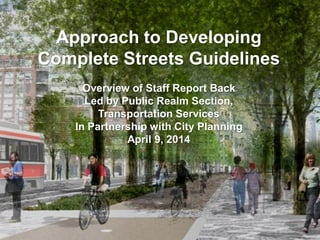
1. Approach to Developing Complete Streets Guidelines
Overview of Staff Report Back
Led by Public Realm Section,
Transportation Services
In Partnership with City Planning
April 9, 2014
2. Council Directions
In May 2013, City Council adopted a motion (PW22.10) requesting the Deputy City Manager, Cluster B, to develop Complete Streets Guidelines in consultation with the GM, Transportation Services and Chief Planner and ED, City Planning and report back on an approach. Council directed Transportation Services and City Planning to:
•Integrate existing plans, policies and bylaws
•Review the National Complete Streets Coalition’s “Policy Elements”
•Include stakeholders, such as the Disabilities Issues Committee in the process
3. All of the above motions affect the planning, design and construction of streets and are integrated into the proposed approach for developing Complete Streets Guidelines Council Directions
Also in 2013, City Council adopted a motion (PW25.7(4)) requesting Toronto Water; Transportation Services; Engineering and Construction Services; City Planning to develop “green infrastructure” standards for the public right-of-way for implementation in capital projects. In a motion (EX34.4(18)), Council requested information on international best practices for stormwater management and green infrastructure.
4. Complete streets are designed and operated to enable safe access for all users. Pedestrians, bicyclists, motorists, and public transportation users of all ages and abilities are able to safely move along and across a complete street. www.completestreets.org
choose
Official Plan Review consultations to update transportation policies
5. PG32.3 – PGM April 10, 2014 “New and existing City streets will incorporate a Complete Streets approach and be designed to perform their diverse roles” policy 3.1.1(5) “The "Complete Streets" approach recognizes that there is no single way in which to make a street "complete"… Guidelines for applying the "Complete Streets" approach will be developed” section 3.1 sidebar Official Plan Review
6. Priority Focus = Guidelines
Complete Streets Guidelines focus on the physical design of streets modal choice, priority-setting, space allocation, design standards, context-sensitive options and decision-making protocol
Phase I
7. Transportation Services
Toronto Water
Engineering and Construction
EMS
MCIC
Solid Waste Management
Private Utilities
TPA
Equity, Diversity and Human Rights
BIAs
City Planning
MLS
Fire Services
Toronto Police Service
Toronto Hydro
TTC
Parks, Forestry and Recreation
Economic Development and Culture
Environment and Energy
Astral Media Outdoor
COMPLETE STREETS Corporate Partners
Legal Services
Toronto Public Health
8. Project scoping (19 interviews with key internal/external partners & stakeholders)
Scan of precedents and internal policy documents
Project team and interdivisional committees set-up (Steering Committee: GM, Transportation Services; Chief Planner; ED, Engineering & Construction Services; GM, Toronto Water)
External stakeholder engagement
(presentations to Disability Issues Committee and stakeholder focus group – approx. 20 NGOs/interest groups)
Staff Report finalized “Approach to Developing Complete Streets Guidelines”
(includes above input and coordination with Feeling Congested, green infrastructure directions and other interdivisional initiatives)
April 9th PWIC and May 6th/7th City Council Meeting Work Done to Date
2013
Summer
2013
Fall
2014
Winter
2014
Spring
9. Project Management (roles, staffing, committees)
Steering Committee
(DCM, Cluster B; GM, Transportation Services; CP/ED, City Planning; ED Engineering and Construction Services; GM, Toronto Water)
Core Project Team
(staff from Transportation Services and City Planning)
Technical Committee(s)
(Transportation Services, City Planning, Toronto Water, Engineering & Construction, Fire, EMS, Parks & Forestry, Public Health, EcDev, Major Capital Infrastructure Coordination, Municipal Licensing and Standards, TTC, Toronto Parking Authority and others as needed)
Consultant Team
Stakeholders
10. Project Scoping – Interviews
15 City Divisions (numerous internal units) and 4 external organizations interviewed
•BILD
•City Planning
•Economic Development & Culture
•Engineering & Construction Services
•Emergency Medical Services
•Fire Services
•Infrastructure Operations Committee
•Major Capital Infrastructure Coordination
•Metrolinx
•Municipal Licensing & Standards
•Parks, Forestry & Recreation
•Right-of-Way Management
•Toronto Centre for Active Transportation
•Toronto Public Health
•Toronto Water
•Traffic Planning & Operations Management
•Transportation Infrastructure Management
•TTC
12. Scan of Precedents
•Jurisdictional scan and compilation of best practices
–Calgary, Edmonton, Waterloo
–Boston, Chicago, New York City, Philadelphia
–National Complete Streets best practices
–Others such as NACTO (National Association of City Transportation Officials)
13. •Official Plan (vision and policies)
•Complete Streets Guidelines (design guidance and decision-making process)
•Training and application to capital projects, EAs, development review, BIA projects, and smaller projects
•Monitoring and evaluation of key projects (metrics / data), and update Guidelines
•Engineering and construction standards
•Mapping, network analysis and planning “Family” of Tools
Education, outreach and engagement
Phase I
Phase 2
Phase 3
14. Audience
Who are Complete Streets Guidelines for?
The Street Design Manual provides policies and design guidelines to city agencies, design professionals, private developers, and community groups for the improvement of streets and sidewalks – New York
Complete Streets Guidelines will affect those who design, build and maintain streets, as well as citizens who live and travel on those streets – Edmonton
15. How the Guidelines apply
All new projects that significantly impact public and private streets should follow these guidelines - New York City
The Handbook will inform all projects that impact the public right-of-way in Philadelphia, including construction of new streets and improvements to existing streets – Philadelphia
16. • Reconstructions
• Resurfacings
• Water/Sewer/Stormwater Management
• Utility Cut Rehabilitations
• Safety/Local Improvements
• New Sidewalk Construction
• Bikeway Construction/Markings
• Street Furniture Installations
• Street Tree Planting/Operations
• BIA Work
• TTC/Metrolinx Projects
• Waterfront TO/PanAm Initiatives
• Private/Developer Sidewalk and Boulevard Improvements
• Environmental Assessments, Avenue Studies, etc.
How the Guidelines apply The Guidelines will inform planned projects – Not create new projects
17. Complete Streets Guidelines
A unifying and “umbrella” document for street planning and design, that consolidates city policies and standards for the right- of-way. It will set out a clear, coordinated process for street design and help provide design options based on context (e.g. land use, street function, etc.) and best practices.
18. Context-Sensitive Design
Land Use,
Street Function, Other Context and Input
Street Design Guidance
Clear, coordinated process for projects
Complete Streets Guidelines
Vision, principles, directions on who to involve and when (roles ), modal choice and priorities, space allocation, context assessment, design options & standards
Recommended Options
19. Recommendations for PWIC
1.Direct the General Manager, Transportation Services and Chief Planner and Executive Director, City Planning to develop Complete Streets Guidelines using the integrated approach as outlined in Attachment 1.
2.Report back in 2015 on the Complete Streets Guidelines and the completion of Phase 1: Development, Consultation and Delivery of Complete Streets Guidelines, with recommendations on the support that may be necessary for implementation. Budget is $300,000 to $350,000 to retain a consultant team to develop and produce the guidelines.
20. Integrated Approach – Attachment 1
Federal & Provincial
Transportation Association of Canada,
AODA, Highway Traffic Act, Metrolinx plan
City of Toronto
Official Plan (health, environment, equity, social & economic vibrancy)
Wet Weather Flow Master Plan
Transportation Strategic Plan (people & goods, emergency / utilities, work zones, right-of-way management, public space)
Strategic Forest Management Plan
Complete Streets Design Guide (mode choice, space allocation, street geometry, design options)
Street Tree Study
“Green Streets”
Equity, Diversity & Human Rights
Accessibility Design Guidelines
Streetscape Manual
2) Includes “links” to relevant technical details such as “Green Streets”, low impact development, street tree details, area-specific plans/BIA plans, approved EAs, and SPQA / DIPS (ECS standards)
1)Builds on & integrates key policies, bylaws, standards, guidelines affecting the right- of-way, such as Official Plan, Streetscape Manual, Vibrant Streets, Accessibility Design Guidelines, Bike Plan, Walking Strategy, Wet Weather Flow Guidelines, MLS Café bylaws, Streets bylaw, etc…
21. Integration of Green Infrastructure
•The Guidelines will integrate planning for “green infrastructure” (to manage stormwater and snow) as part of the street design process
•Detailed technical standards will be developed in tandem by Toronto Water; Engineering and Construction Services; City Planning and Transportation Services using pilot projects and best practices
Photo Courtesy of New York City
22. April 9th PWIC, May 6/7th City Council
Consultant RFP developed
Consultant selected
Consultation and engagement underway (internal partners and key stakeholders)
Existing policy inventory and summaries completed
Best practices review and recommendations completed
External consultation and engagement underway
Draft Guidelines produced
Context-sensitive, decision-making process developed
Consultation and engagement > refinement
Finalize Guidelines, preparation of implementation strategy
Report to PWIC on Phase 1 completion, Phase II initiation
Timeline & Key Milestones
2014 Spring
2014 Summer
2014 Fall
2015 Winter/ Spring
2015 Spring/ Summer
23. Thank You Complete Streets Core Project Team Fiona Chapman, Manager Pedestrian Projects, Transportation Services Janet Lo, Project Officer Public Realm, Transportation Services 416-397-4853 jlo3@toronto.ca Alka Lukatela, Program Manager Urban Design, City Planning Allison Reid, Urban Designer Urban Design, City Planning Daniel Egan, Manager Cycling Unit, Transportation Services David Kuperman, Project Manager, Infrastructure Planning, Transportation Services David Hunter, Senior Planner Transportation Planning, City Planning