Downloaded 10 times


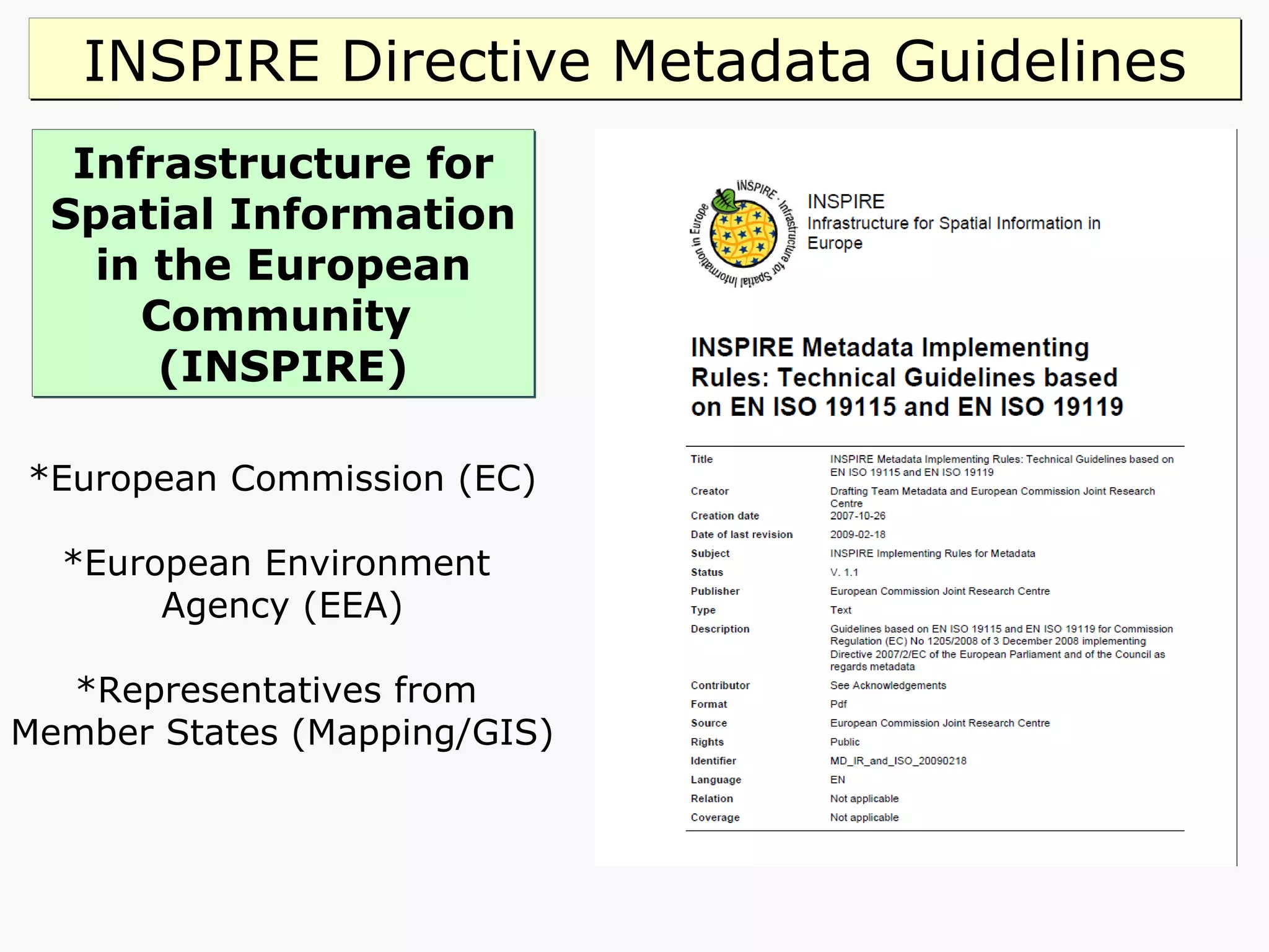
![INSPIRE Directive [2007 /2/ EC] T argets electronic spatial data and services for environmental information. Aims to create a European Spatial Data Infrastructure (SDI) based on Member States’ infrastructures, to improve interoperability of spatial information. These data and services to be delivered through initiatives across Europe. INSPIRE Regulations 2009 No 3157 came into force on 31 December 2009 and applies to England, Northern Ireland and Wales. Scotland’s Parliament enacted a complementary regulation which came into force on the same date. Public authorities will be obliged to produce and keep up to date ‘metadata’ for describing datasets, dataset series and geo services. Includes UK academia as it must comply with the Freedom of Information Act, 2000.](https://image.slidesharecdn.com/northumbria-geospatial-metadata-workshop20110505-110714085953-phpapp02/75/Northumbria-University-Geospatial-Metadata-Workshop-20110505-32-2048.jpg)

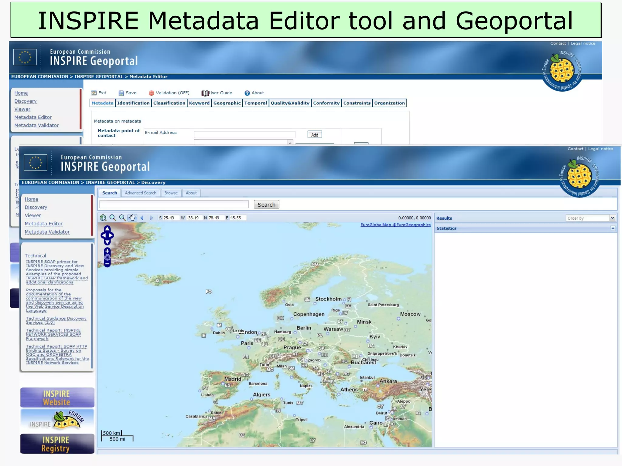


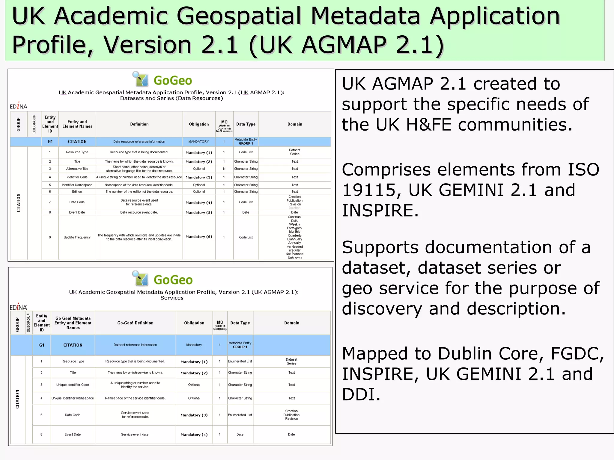
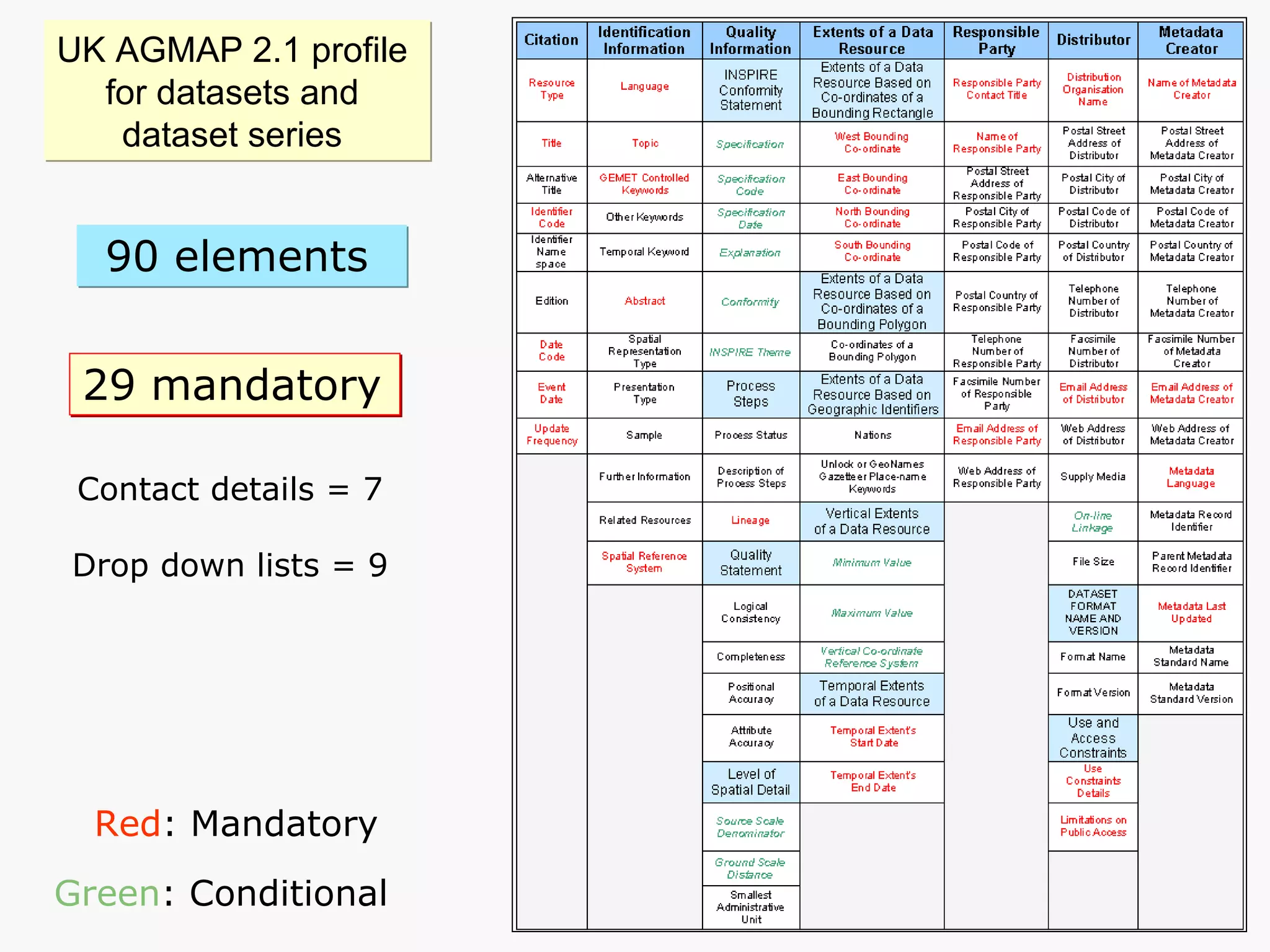

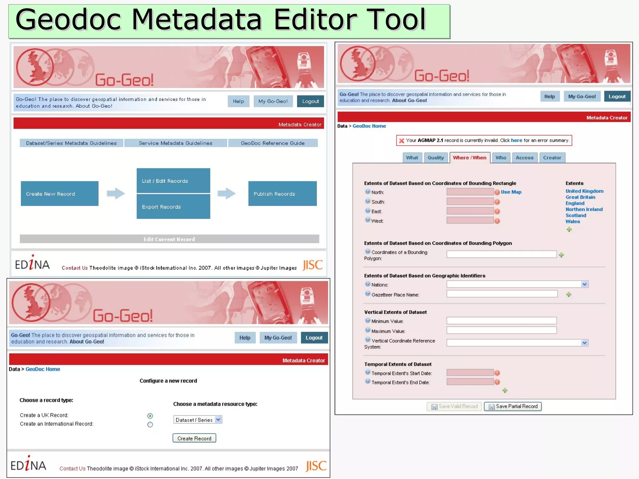
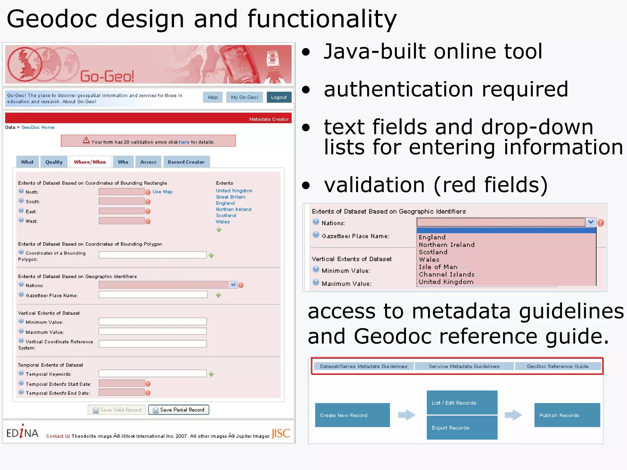
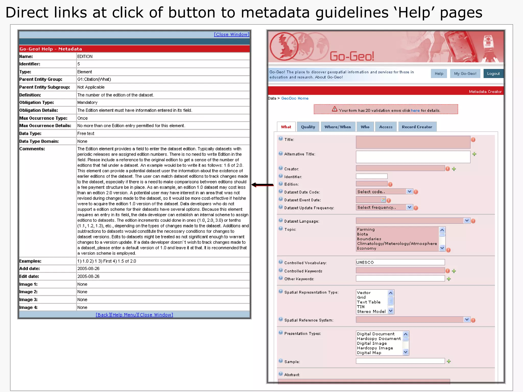
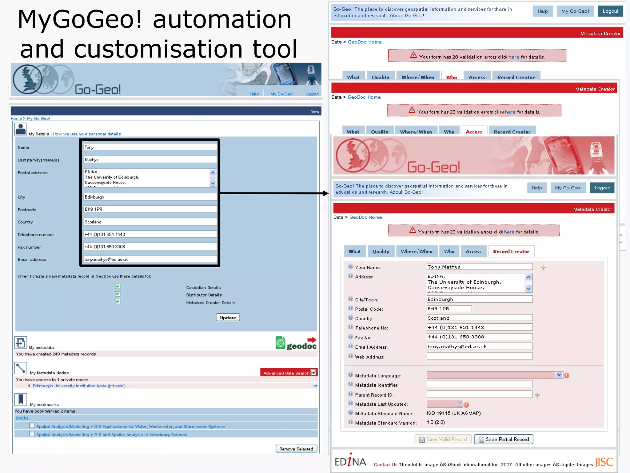
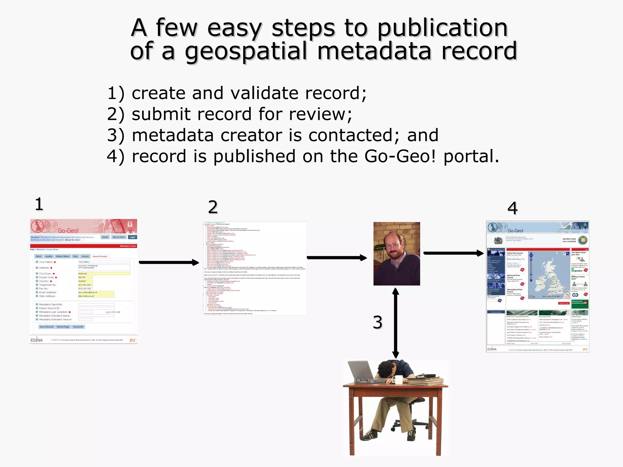
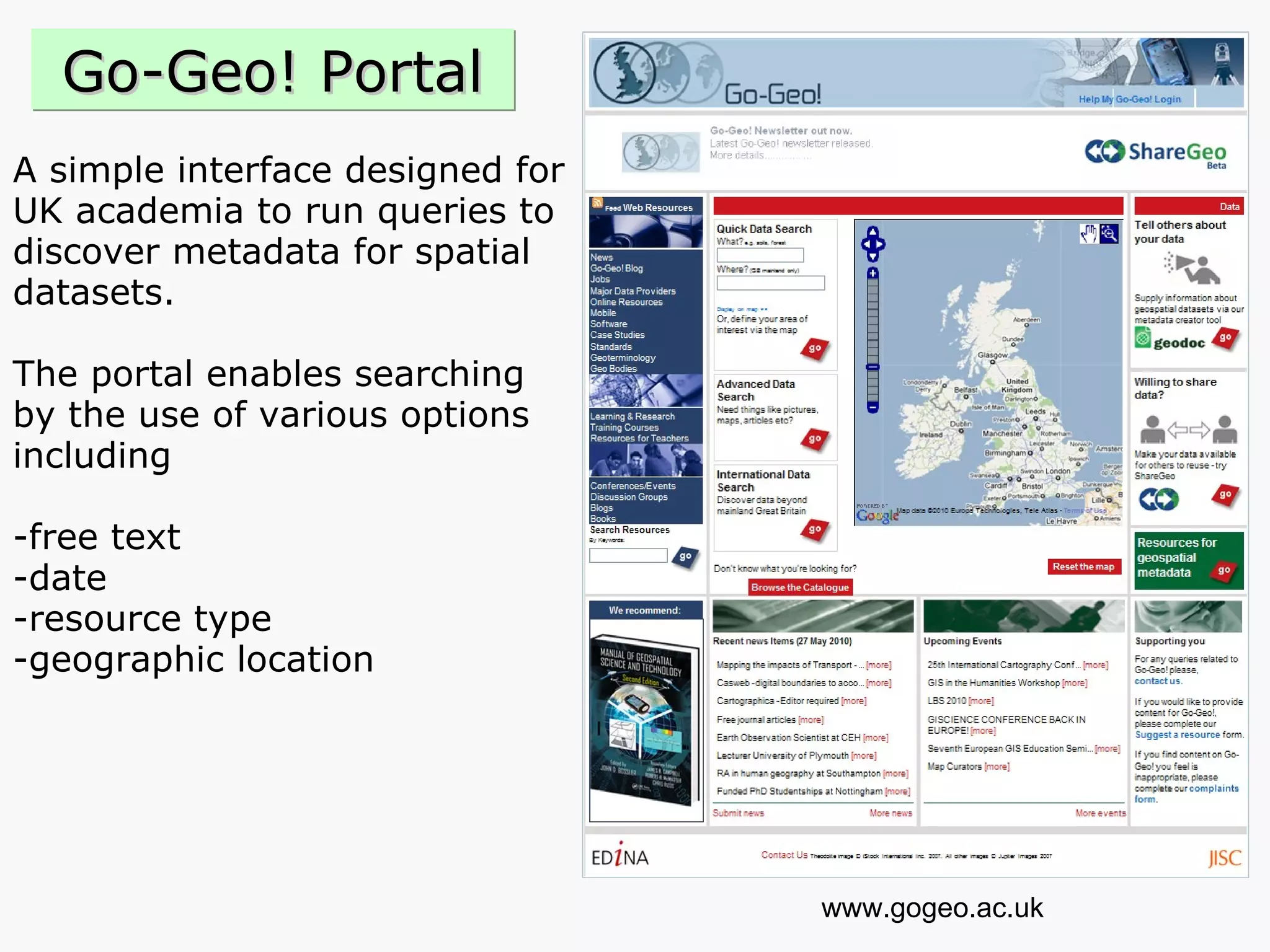
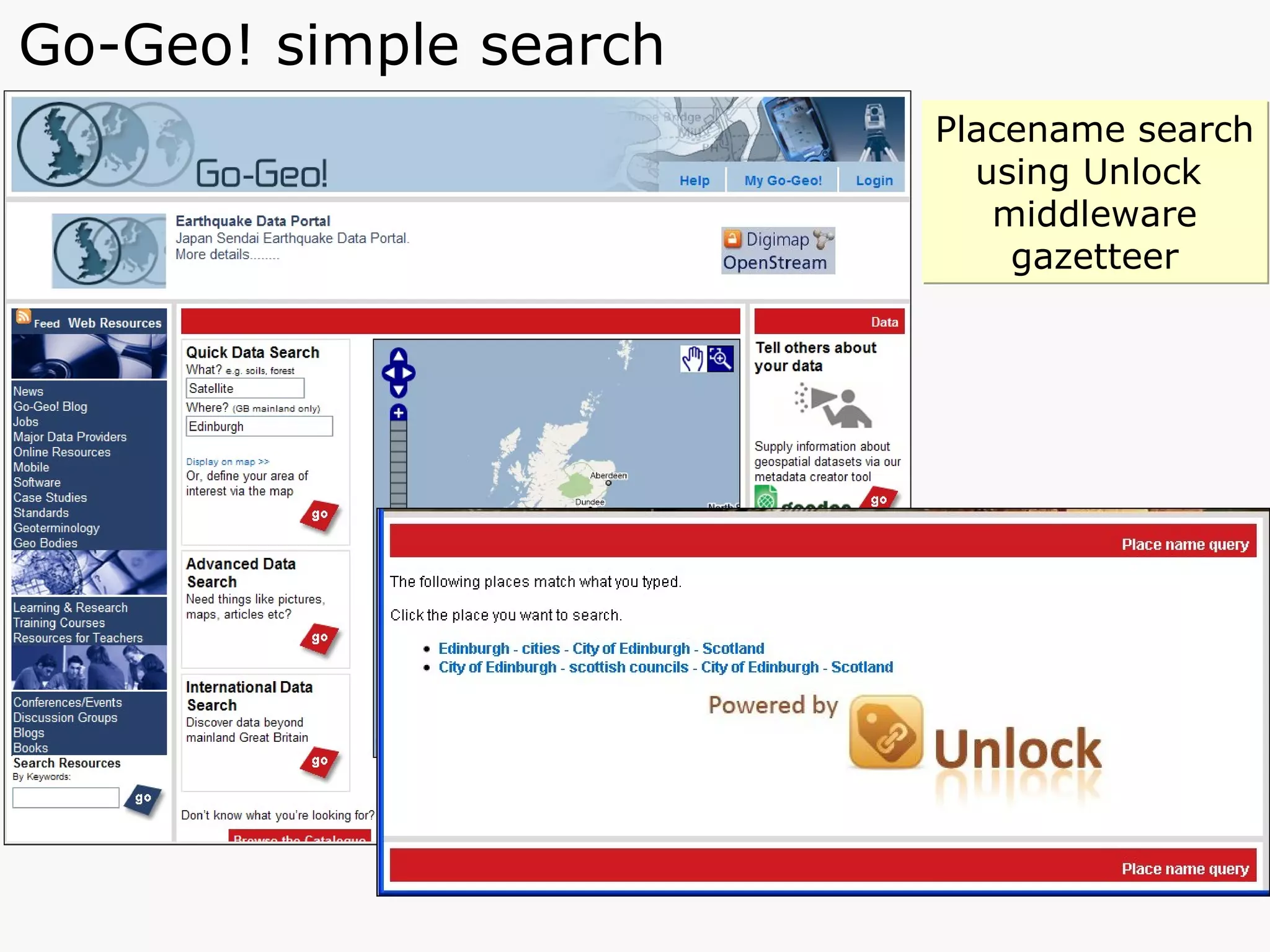
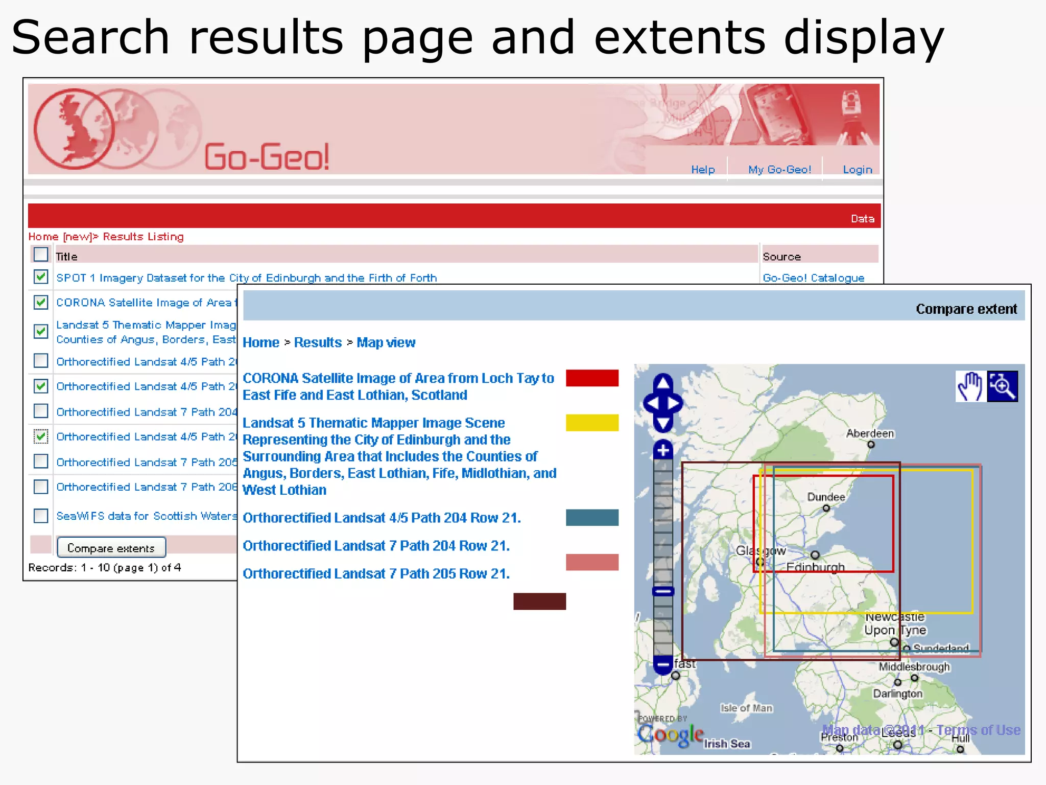
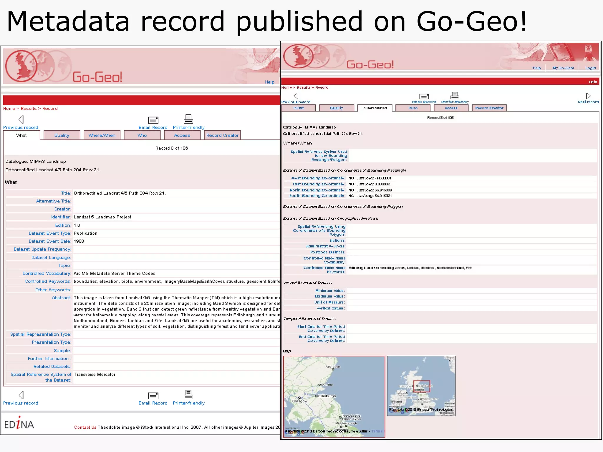
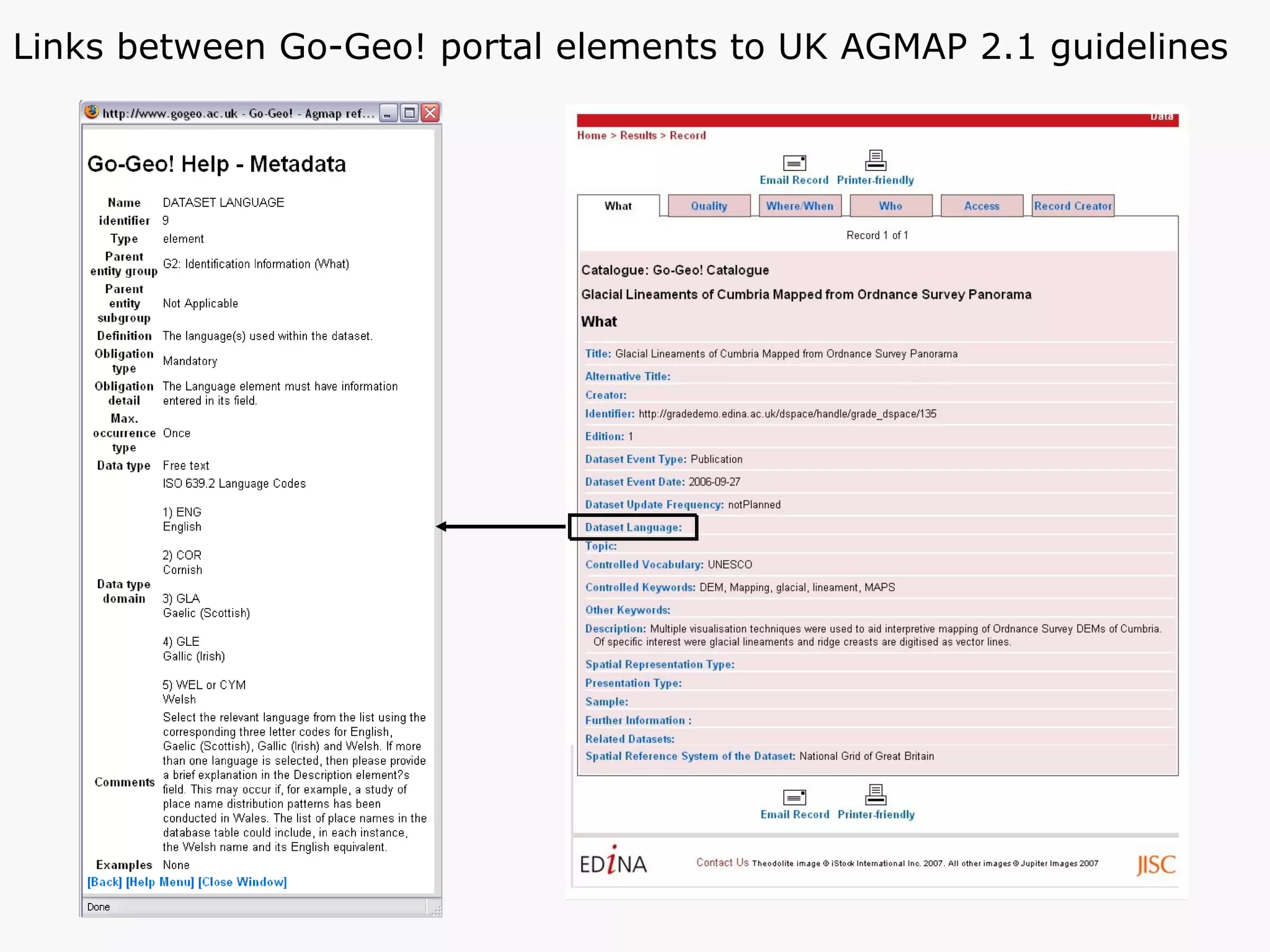
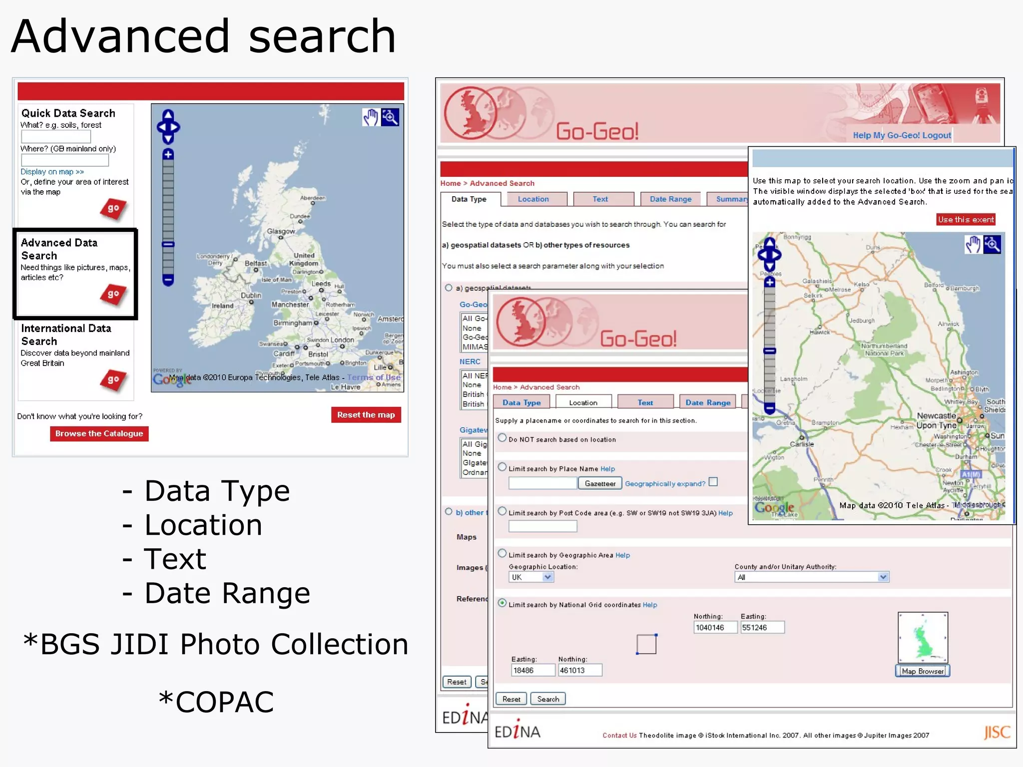
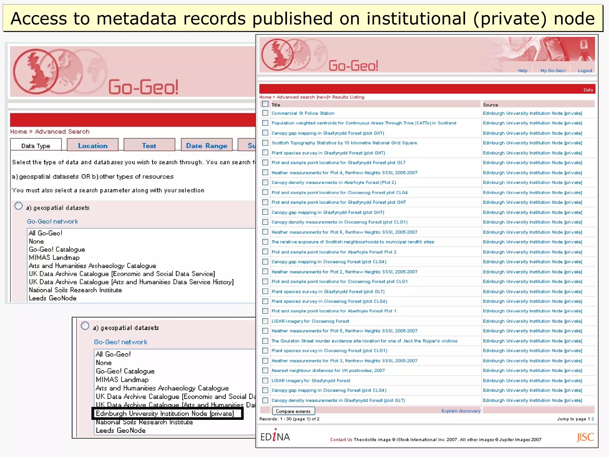

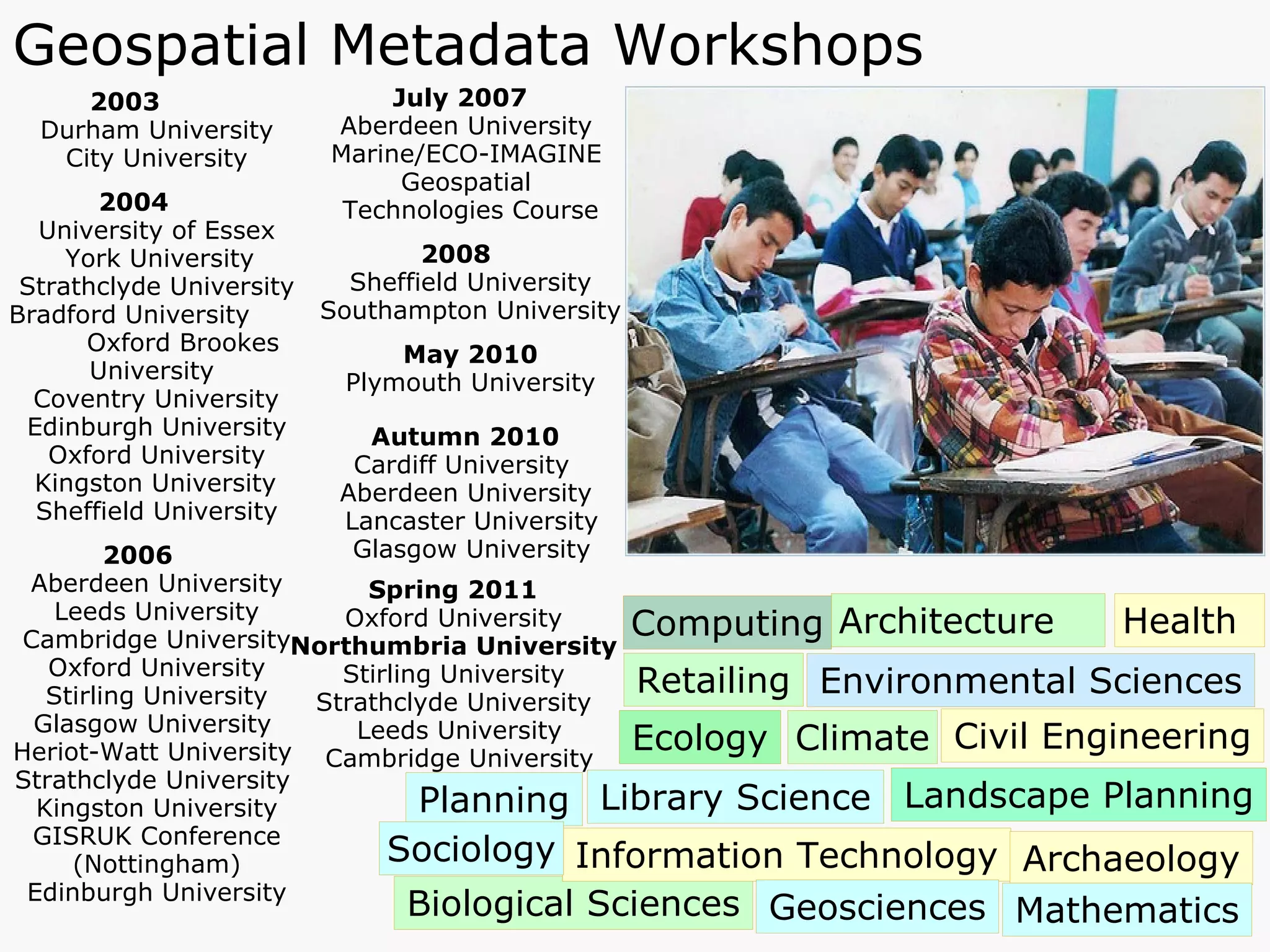
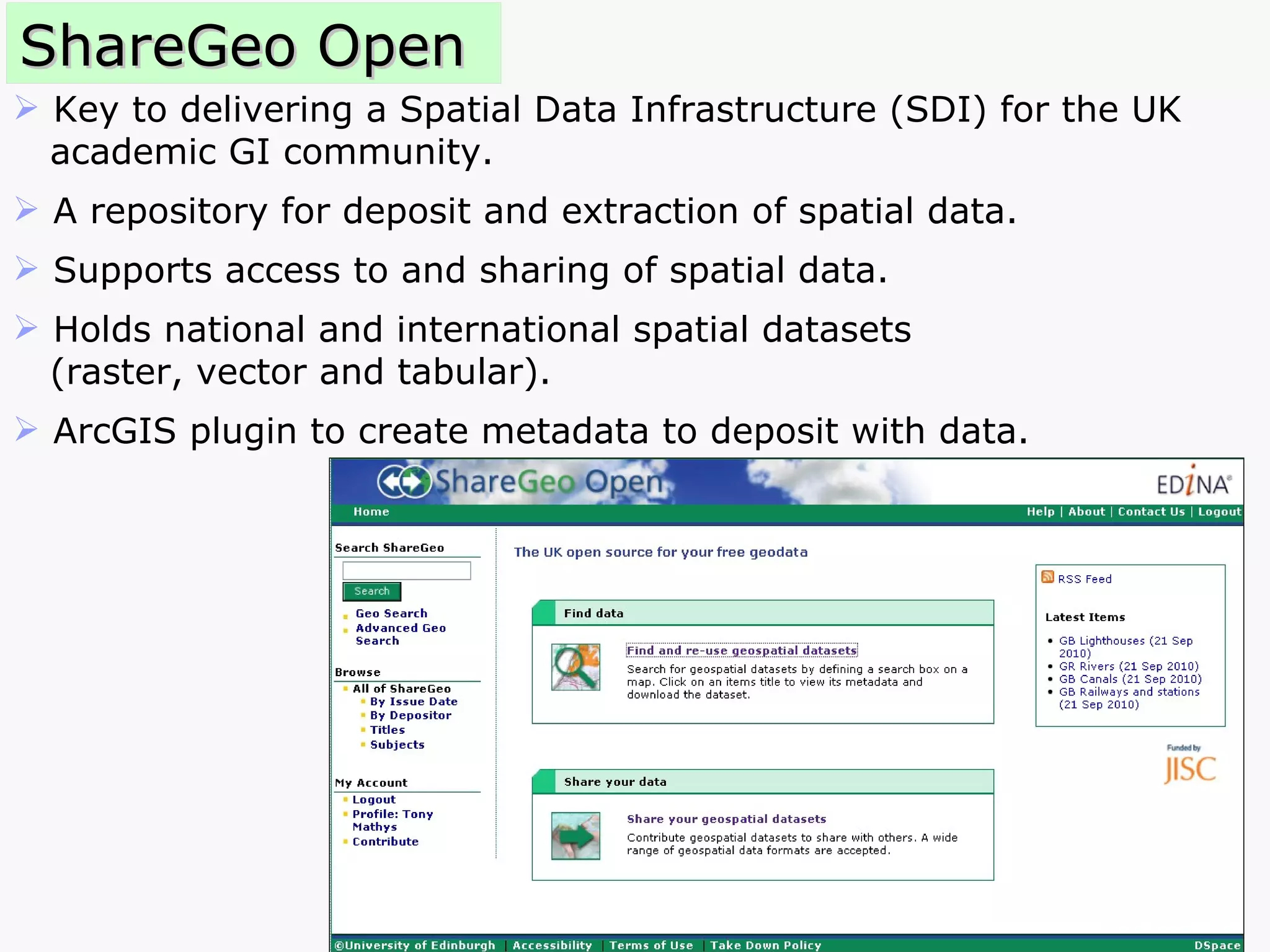
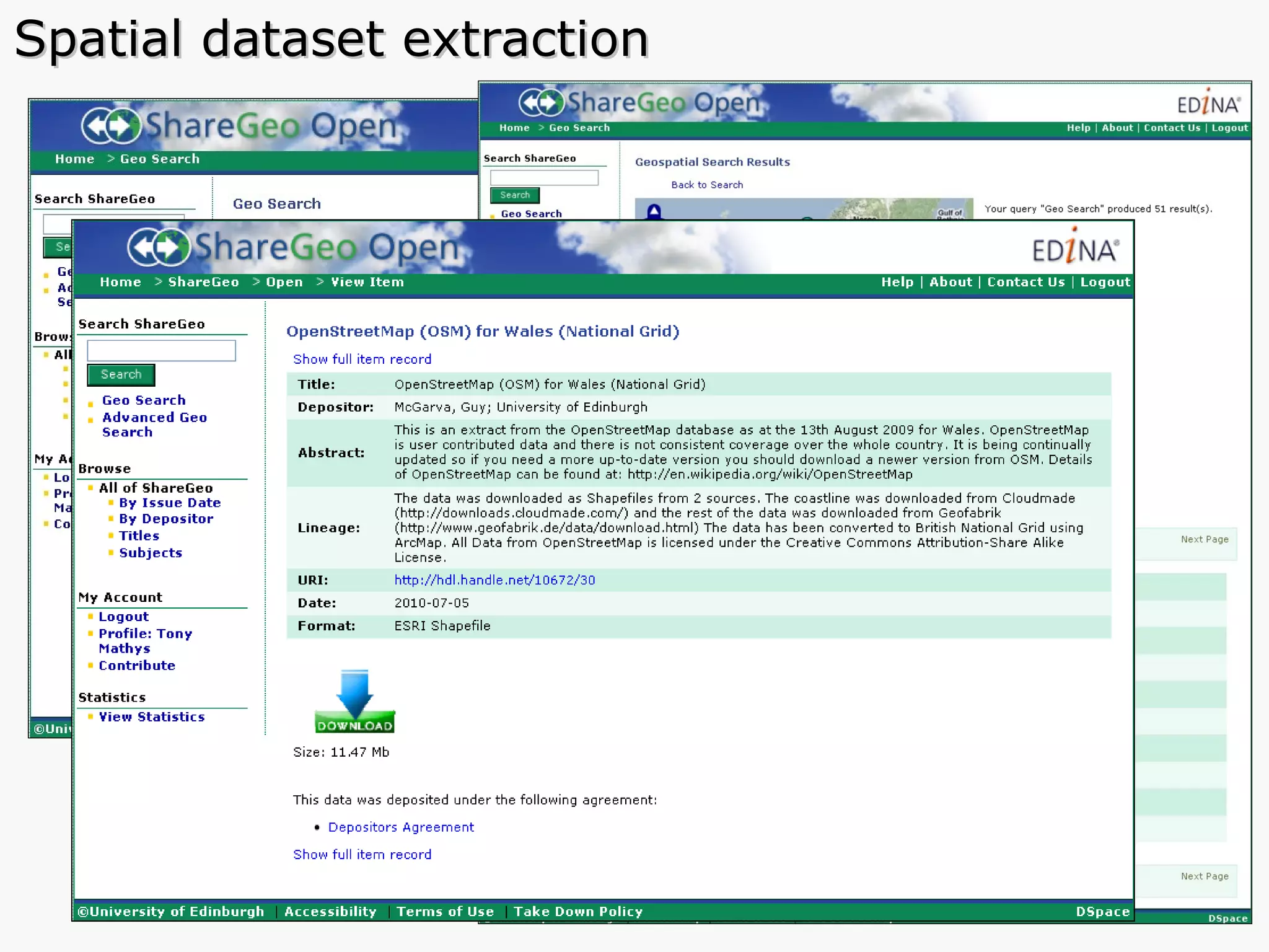
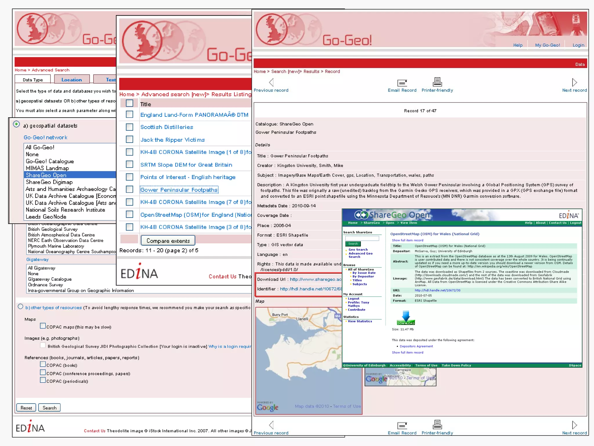
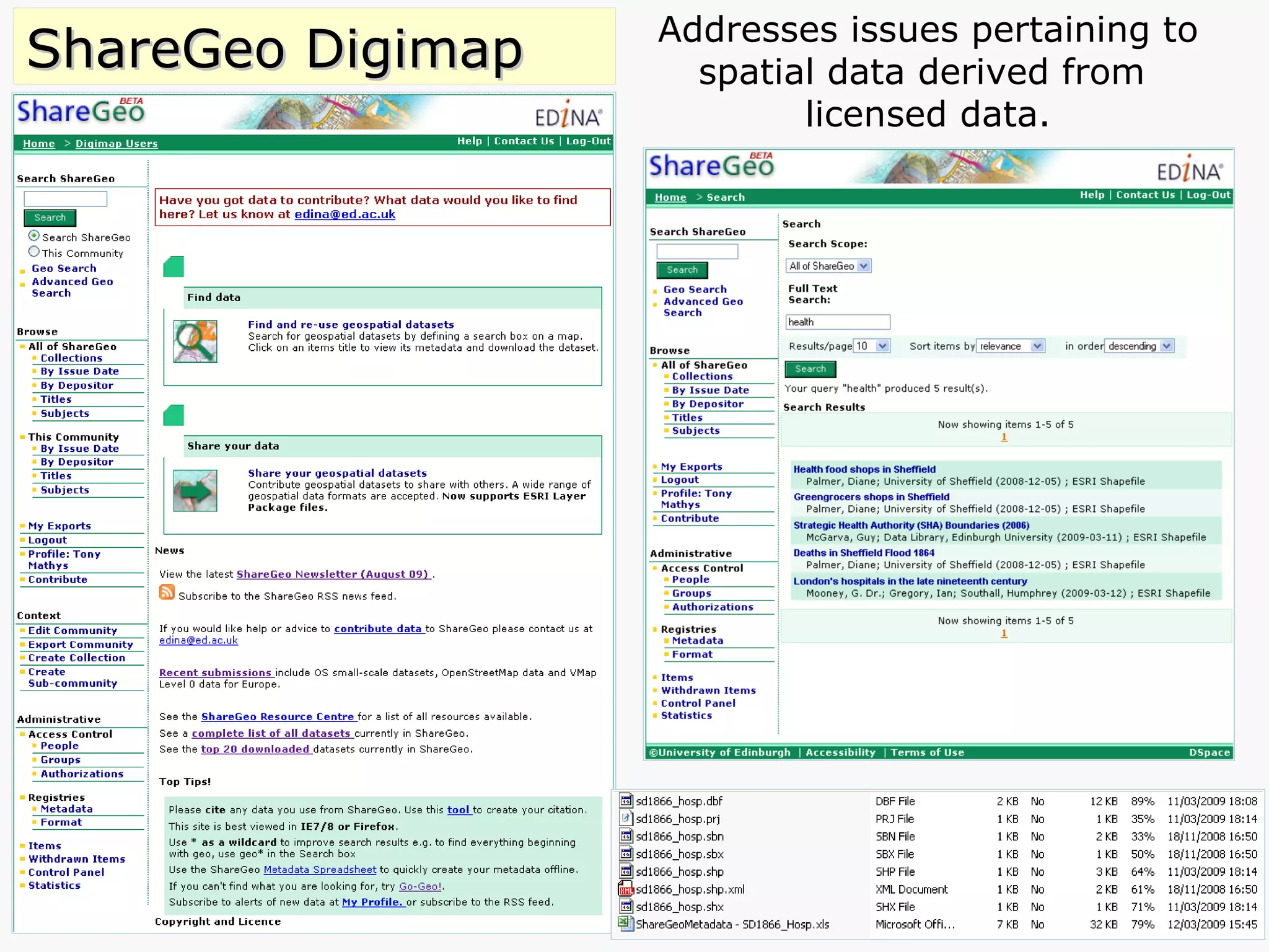


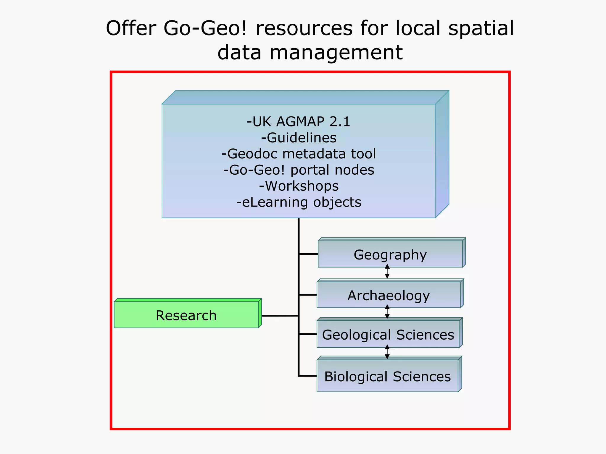

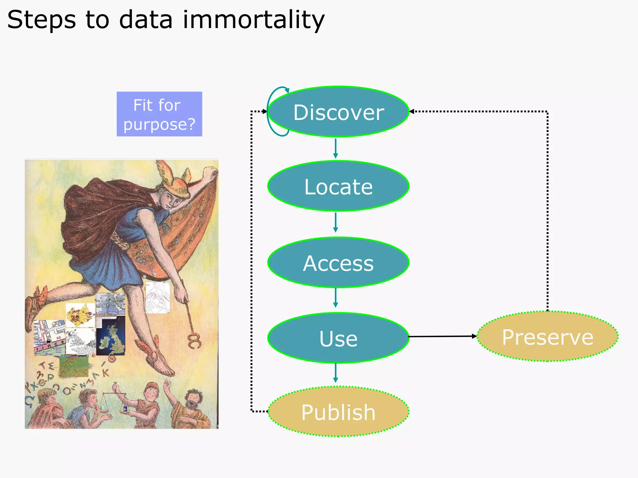

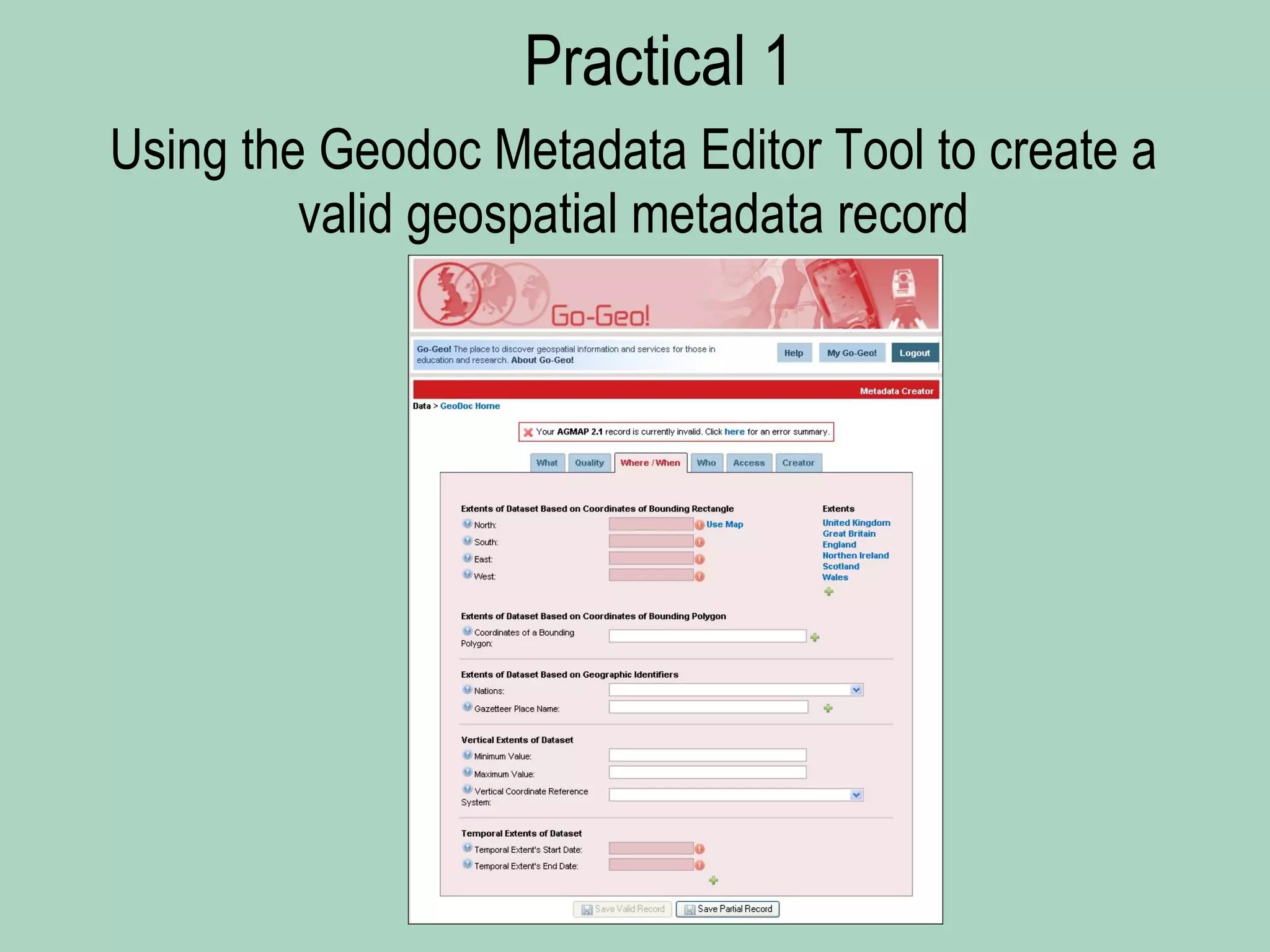
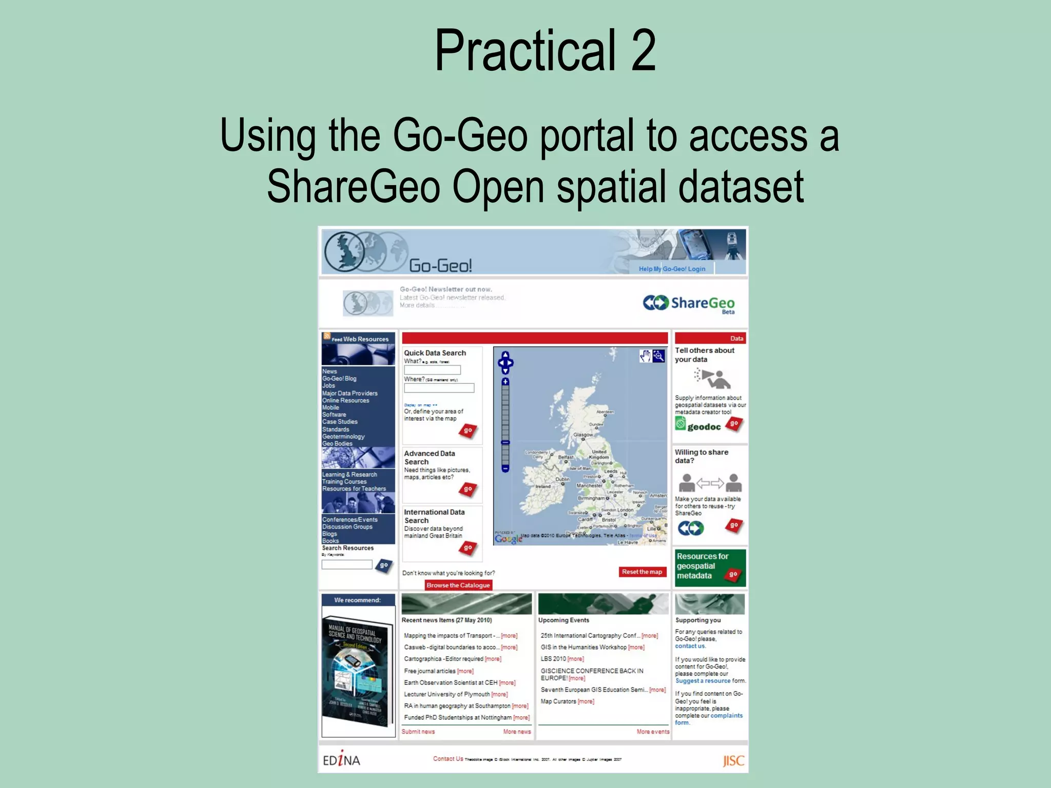

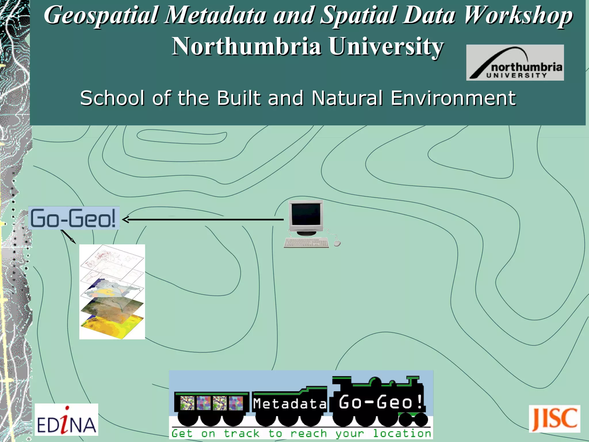
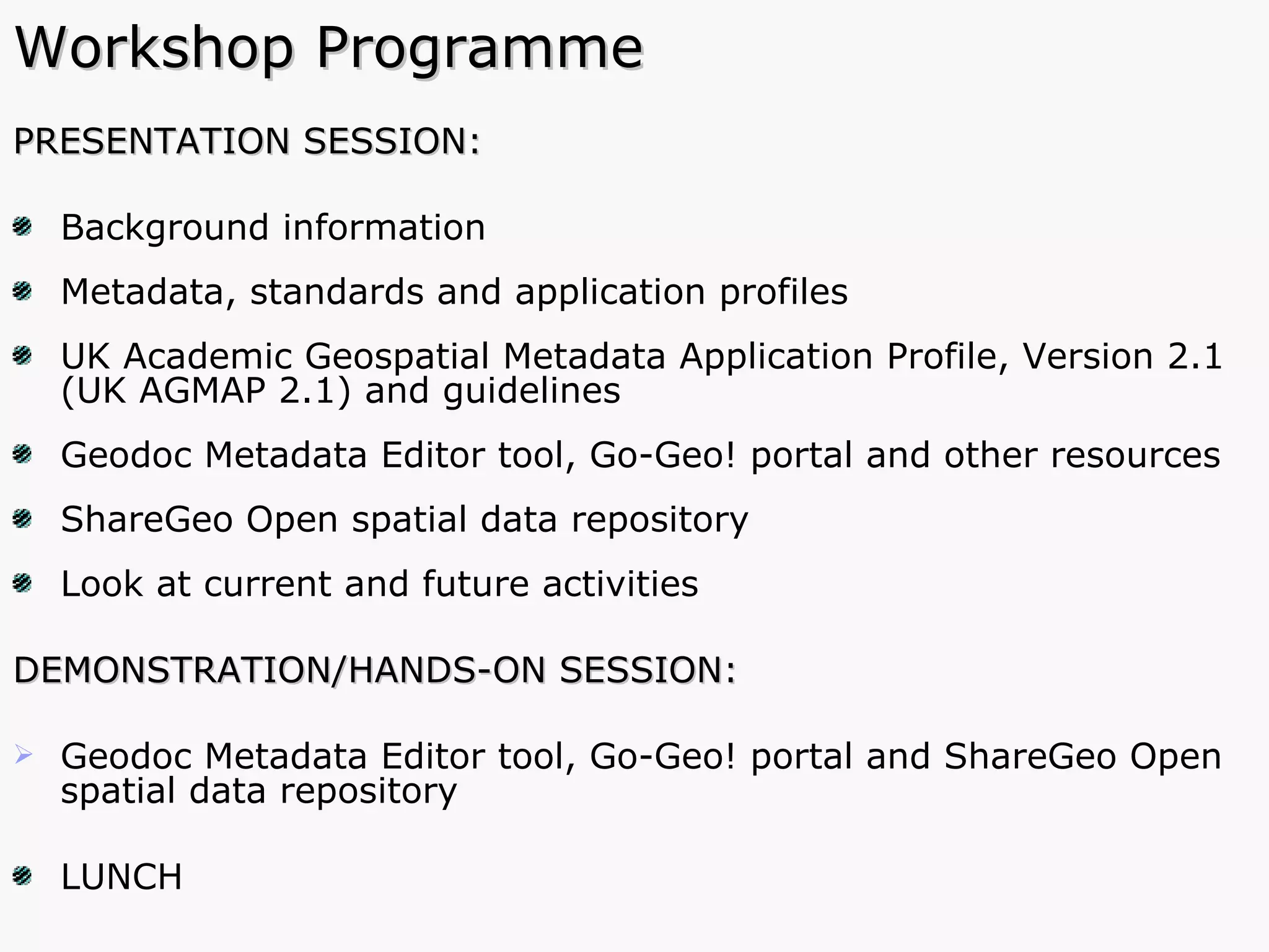
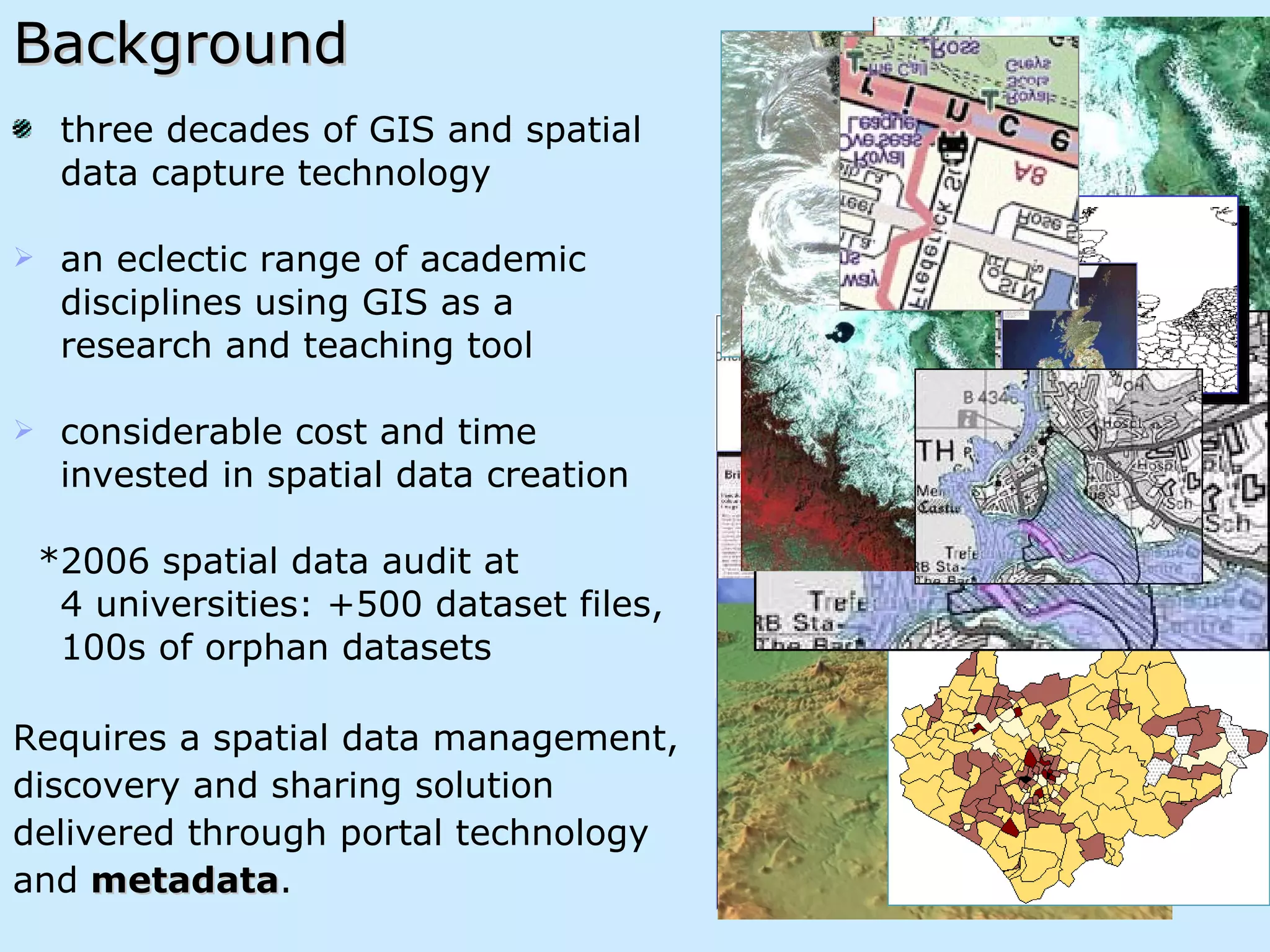
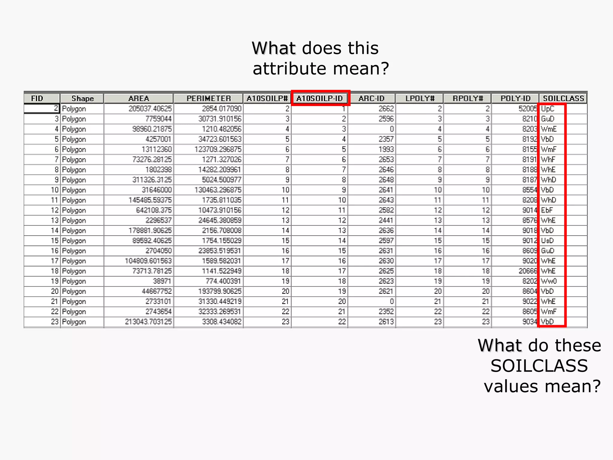
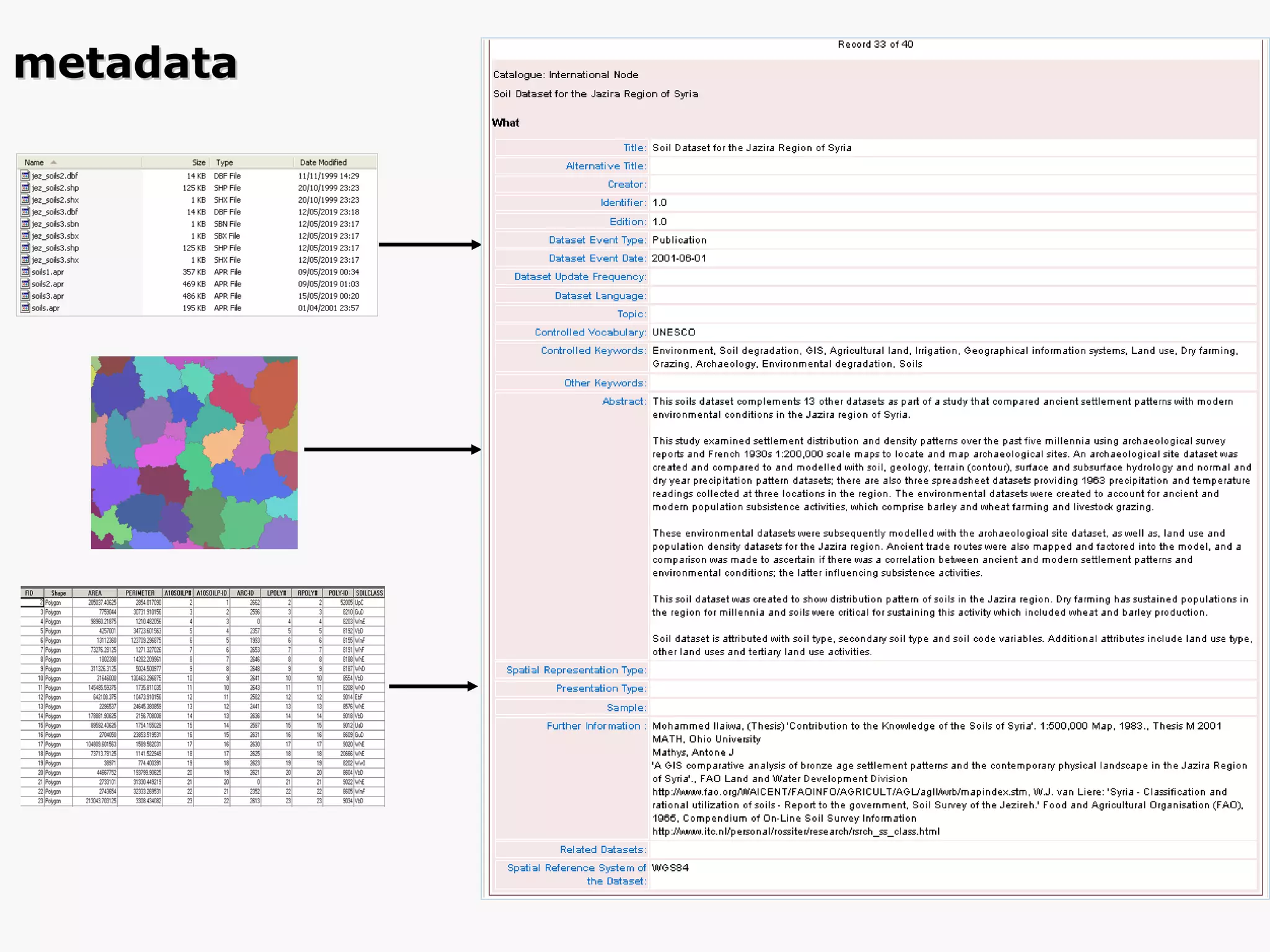
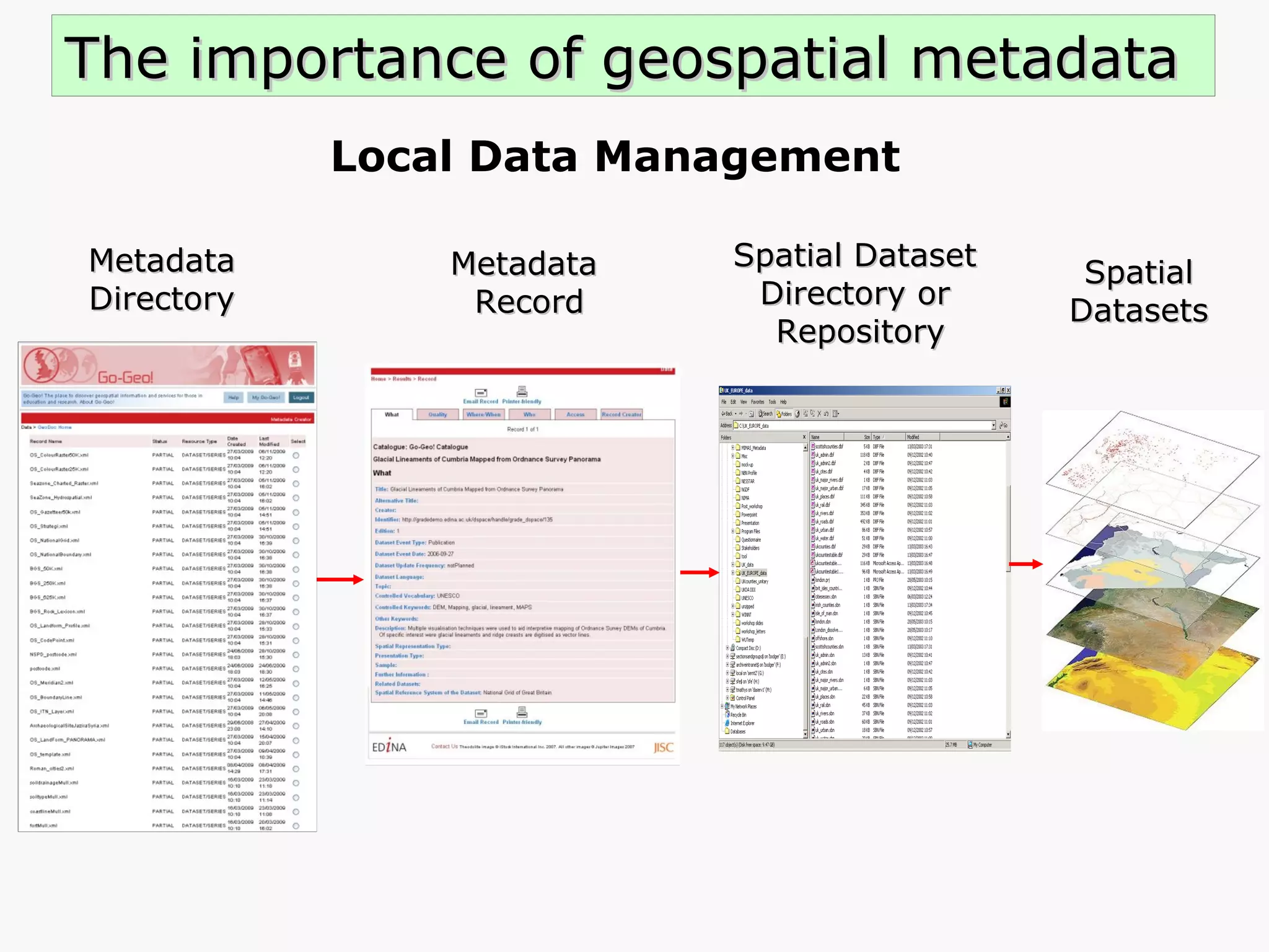
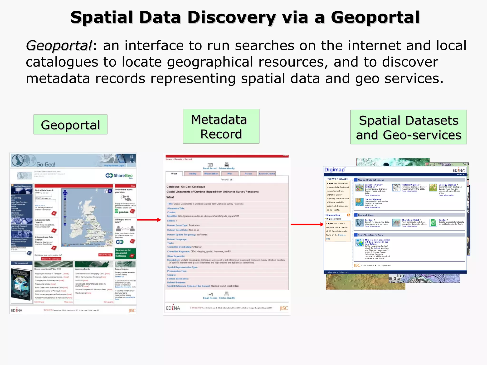
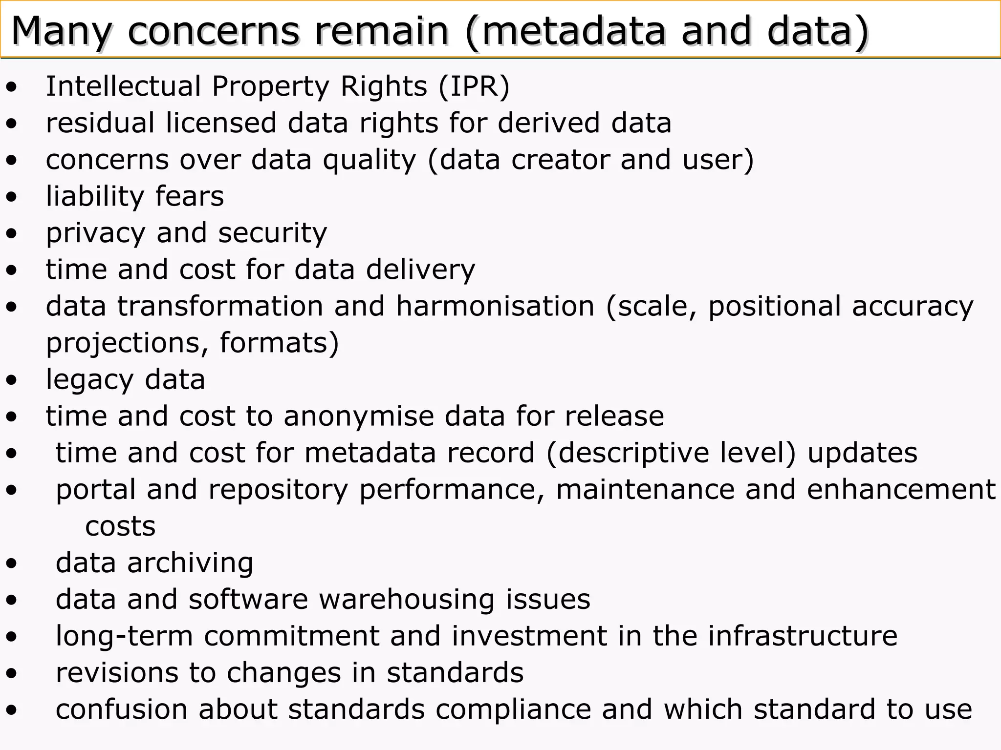
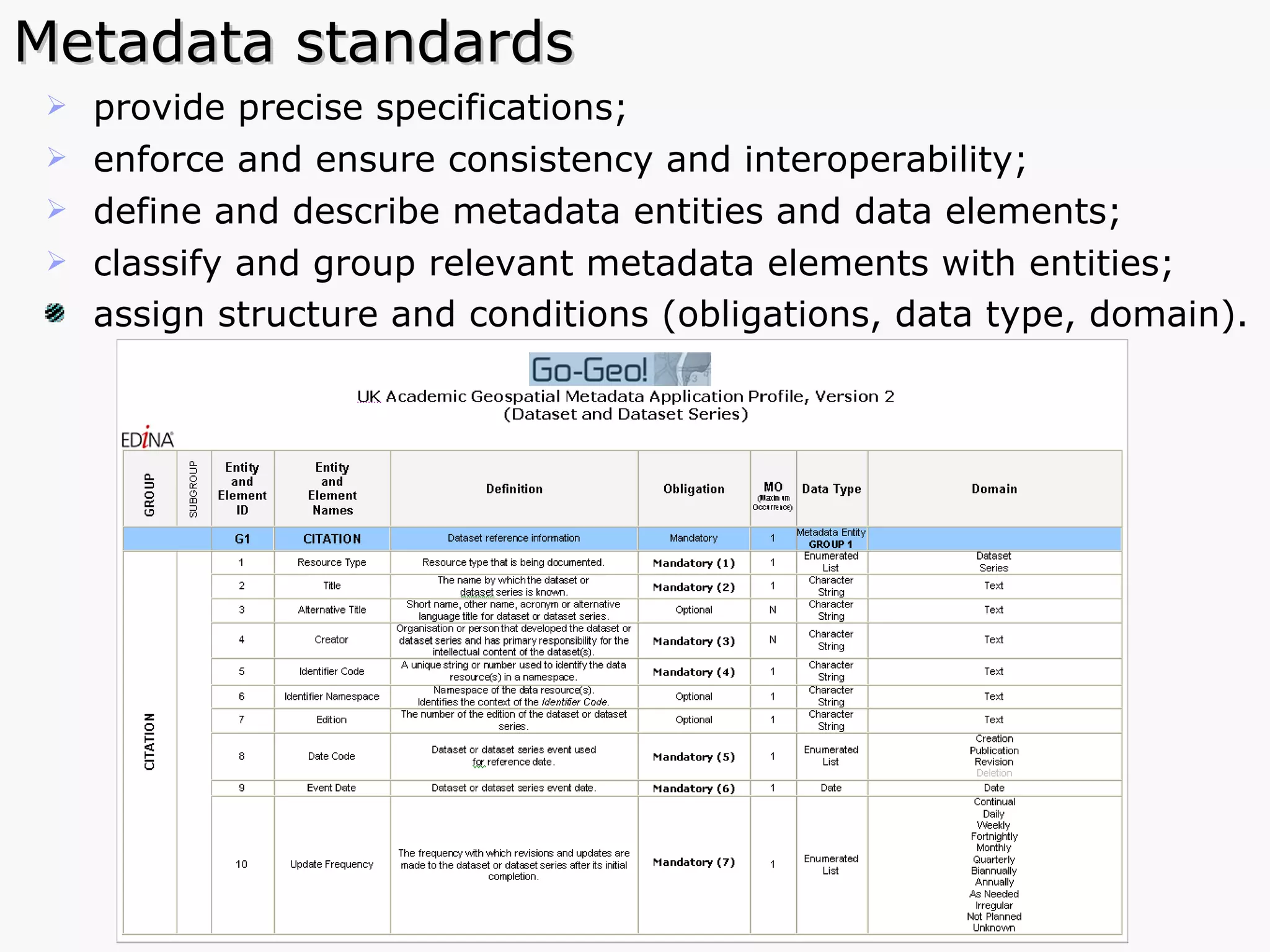
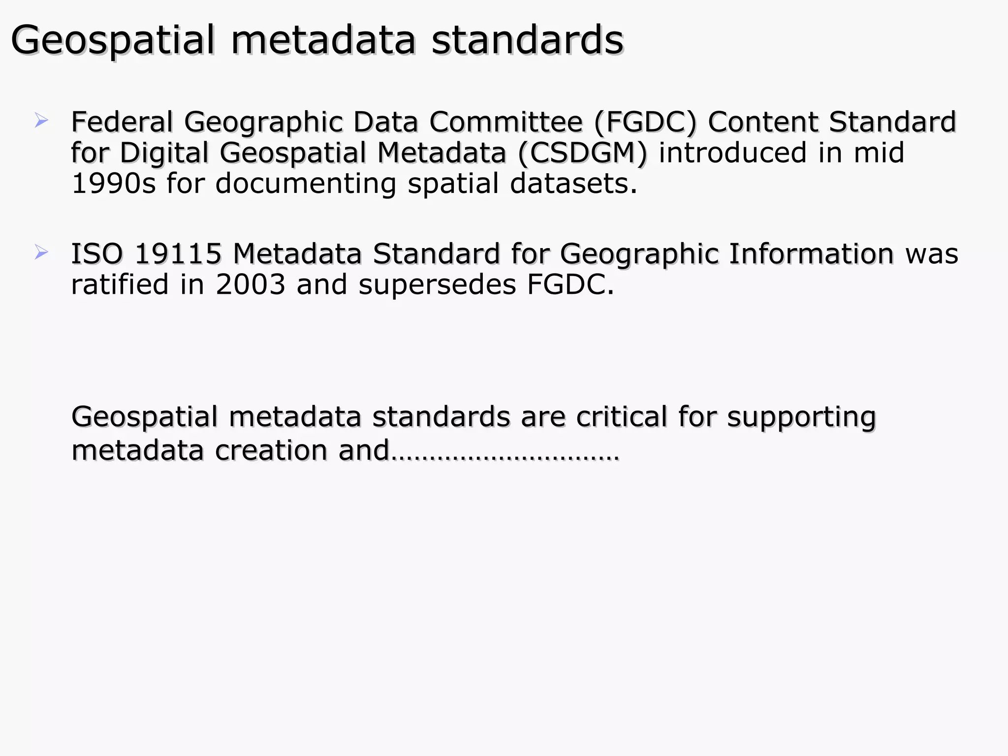
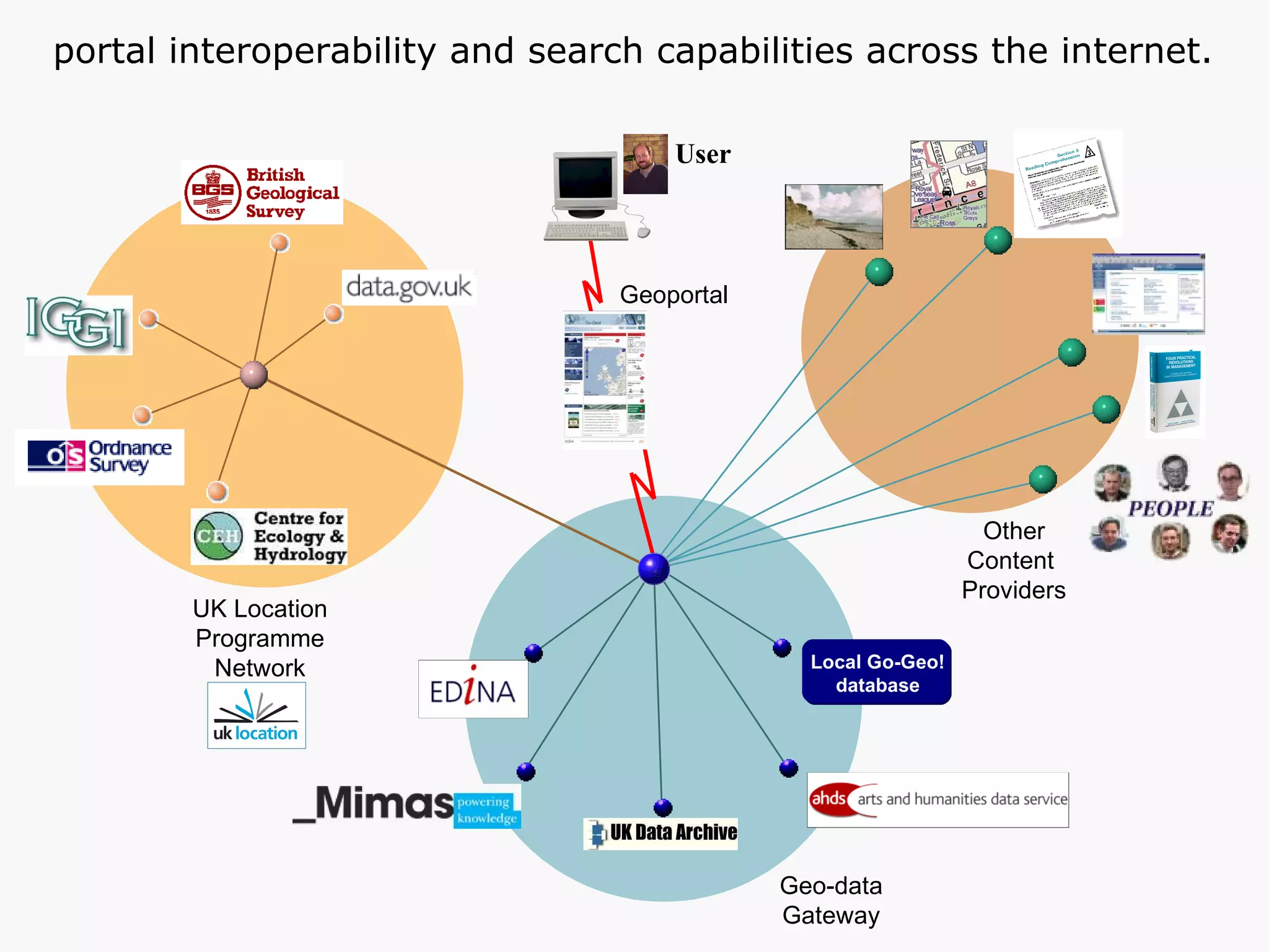
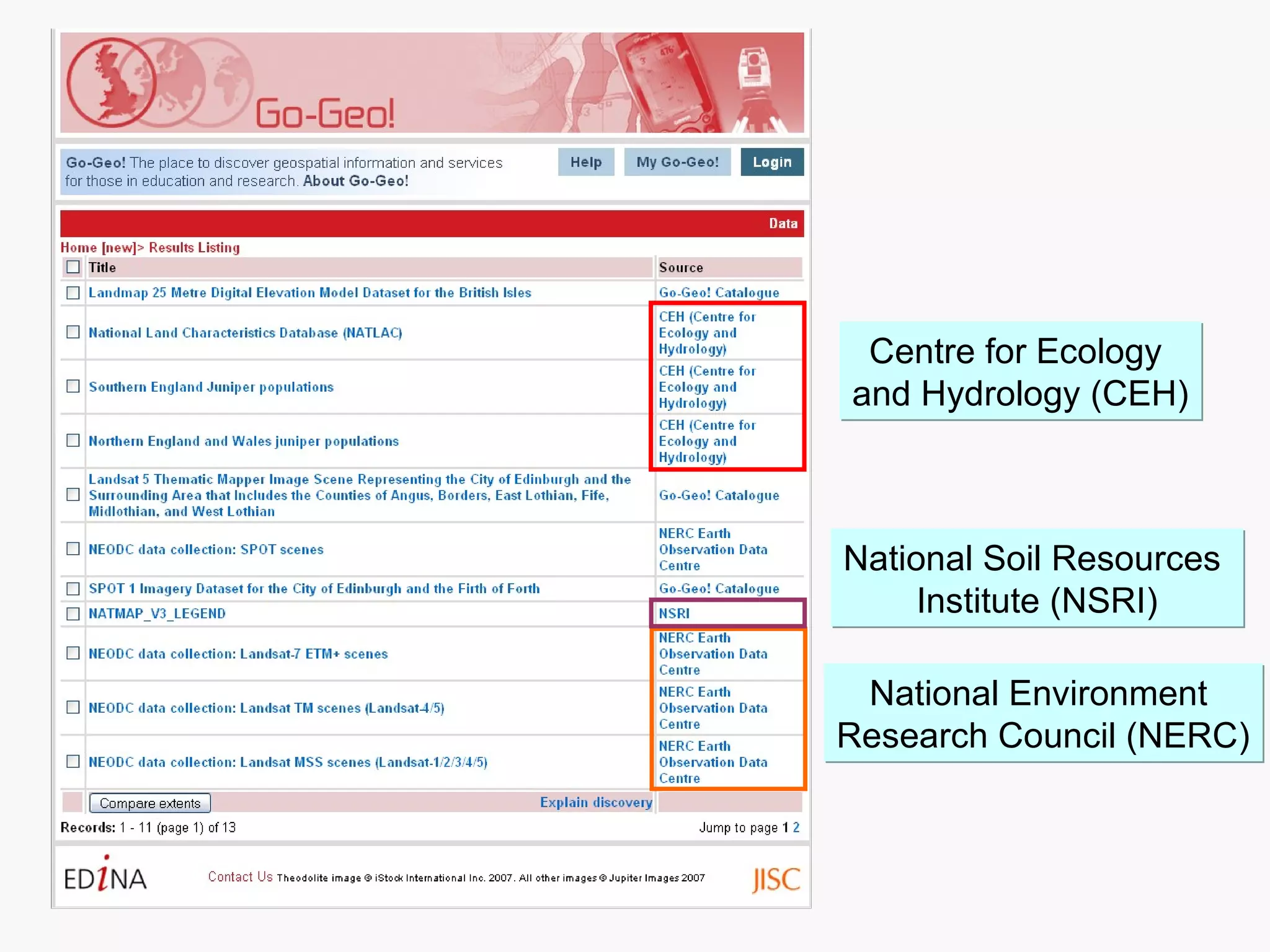
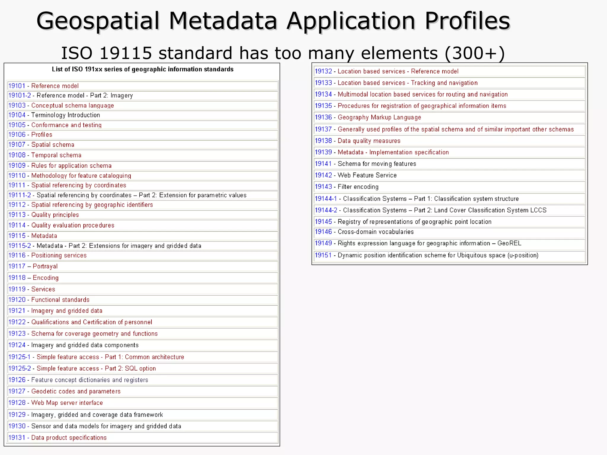
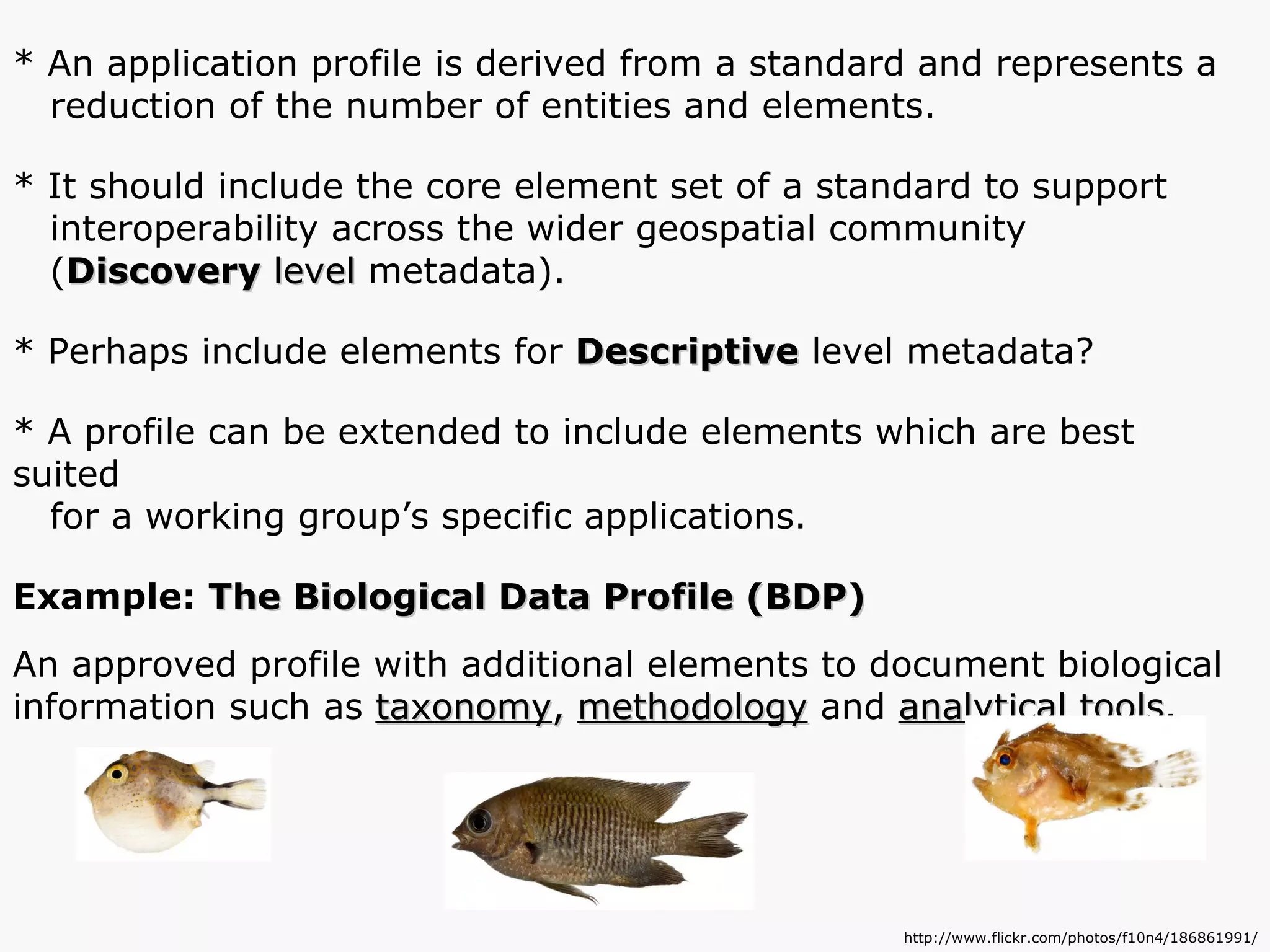
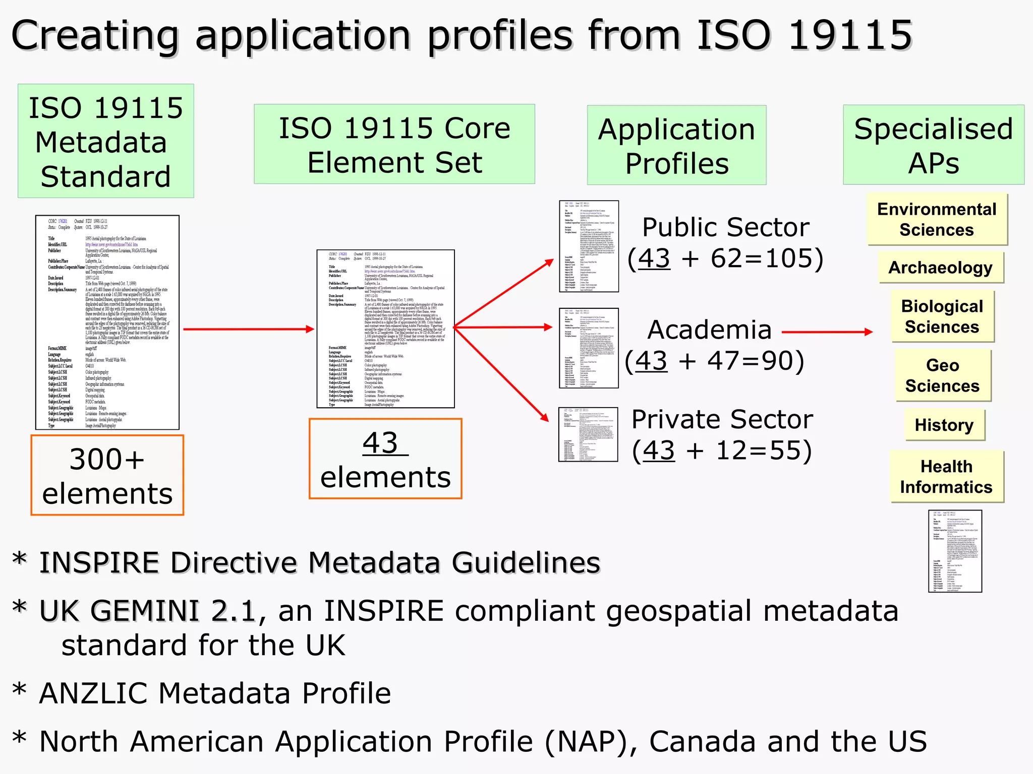
The document summarizes a workshop on geospatial metadata and spatial data. It discusses the importance of metadata for managing and sharing spatial datasets, providing key information about the data. It also covers metadata standards like FGDC, ISO 19115, and application profiles. The workshop includes presentations on the UK Academic Geospatial Metadata Application Profile and tools for creating metadata like the Geodoc Metadata Editor and Go-Geo portal.


![Who is doing what, and how do we know? [PEPRS]](https://cdn.slidesharecdn.com/ss_thumbnails/who-is-doing-what-100623032001-phpapp01-thumbnail.jpg?width=640&height=640&fit=bounds)


