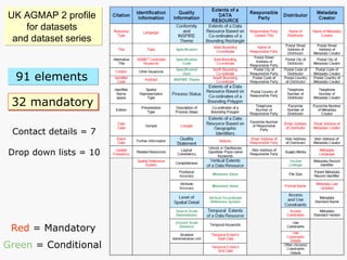
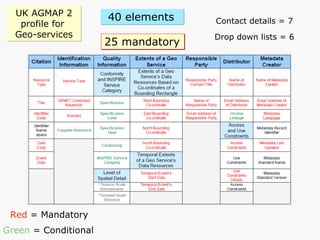
Downloaded 24 times


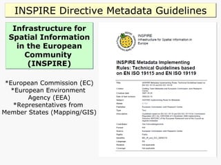
![INSPIRE Directive [2007 /2/ EC] T argets electronic spatial data and services for environmental information. Aims to create a European Spatial Data Infrastructure (SDI) based on Member States’ infrastructures, to improve interoperability of spatial information. These data and services to be delivered through initiatives across Europe. INSPIRE Regulations 2009 No 3157 came into force on 31 December 2009 and applies to England, Northern Ireland and Wales. Scotland’s Parliament enacted a complementary regulation which came into force on the same date. Public authorities will be obliged to produce and keep up to date ‘metadata’ for describing datasets, dataset series and geo services. Includes UK academia as it must comply with the Freedom of Information Act, 2000.](https://image.slidesharecdn.com/cardiffuniversitygeometadataworkshop-101209080239-phpapp01/85/Geospatial-Metadata-Workshop-26-320.jpg)

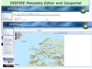
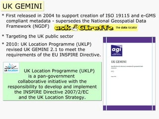
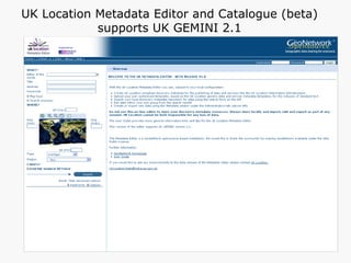


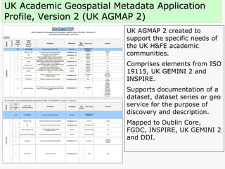
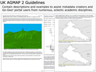

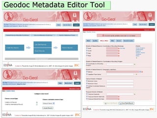
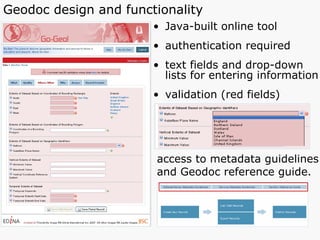
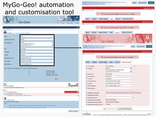
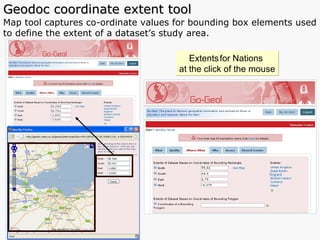


This document summarizes a geospatial metadata and spatial data workshop. The workshop included presentations on metadata standards and application profiles, demonstrations of metadata editing and portal tools, and discussions of current and future activities to support the use and sharing of geospatial data and metadata in UK academia.