This describes the components of JGrass-NewAGE, the system we went to develop for having a flexible set of modelling solutions to forecast the water cycle budgets of any basin.
Historical and Contemporary Trends in the Size, Drift, and Color of Jupiterʼs...Sérgio Sacani
Observations of Jupiter’s Great Red Spot (GRS) span more than 150 years. This allows for careful measurements
of its size and drift rate. High spatial resolution spacecraft data also allow tracking of its spectral characteristics and
internal dynamics and structure. The GRS continues to shrink in longitudinal length at an approximately linear rate
of 0°.194 yr−1 and in latitudinal width at 0°.048 yr−1. Its westward drift rate (relative to System III W. longitude)
has increased from ∼0°.26/day in the 1980s to ∼0°.36/day currently. Since 2014, the GRS’s short wavelength
(<650 nm) reflectance has continued to decrease, while it has become brighter at 890 nm, indicating a change in
clouds/haze at high altitudes. In addition, its north–south color asymmetry has decreased, and the dark core has
become smaller. Internal velocities have increased on its east and west edges, and decreased on the north and south,
resulting in decreased relative vorticity and circulation. The GRS’s color changes from 2014 to 2017 may be
explained by changes in stretching vorticity or divergence acting to balance the decrease in relative vorticity.
There is a small movement for change in development practices
Landscape Architect Ian McHargleads with new ideas for land planning
Understanding about the environment
Integration with environmental sciences
Addressing human adaptations to the environment
GSOC17 Introduction, Product specifications, Existing SOC maps and methodologiesFAO
This presentation was presented during the Workshop on Soil Cabon Mapping of the Global Soil Partnership (GSP) that took place at FAO headquarters 23 November 2016. The presentation was made by Rainer vargas
This presentation was presented during the Workshop on Soil Cabon Mapping of the Global Soil Partnership (GSP) that took place at FAO headquarters 23 November 2016. The presentation was made by Carlos Cruz-Gaistardo from the National Institute of Statistics and Geography, Mexico
This presentation was presented during the Workshop on Soil Cabon Mapping of the Global Soil Partnership (GSP) that took place at FAO headquarters 23 November 2016. The presentation was made by Neil McKenzie from the Commonwealth Scientific and Industrial Research Organisation, Australia
Almost the same as the talk given to Ph.D. students one year ago. It covers the problem of research reproducibility and the tools for doing it. First comes some "theoretical" arguments, then the enumeration of some tools.
Objectives
- Develop an integrated agricultural and urban modeling system
Characterize decadal and regional impacts associated with agriculture/urban expansion for selected regions in the continental US
- Examine socio-economic impacts associated with agri-urban development including urban farms/community gardens
- Educate next generation of interdisciplinary scientists
USING E-INFRASTRUCTURES FOR BIODIVERSITY CONSERVATION - Module 4Gianpaolo Coro
An e-Infrastructure is a distributed network of service nodes, residing on multiple sites and managed by one or more organizations. e-Infrastructures allow scientists residing at distant places to collaborate. They offer a multiplicity of facilities as-a-service, supporting data sharing and usage at different levels of abstraction, e.g. data transfer, data harmonization, data processing workflows etc. e-Infrastructures are gaining an important place in the field of biodiversity conservation. Their computational capabilities help scientists to reuse models, obtain results in shorter time and share these results with other colleagues. They are also used to access several and heterogeneous biodiversity catalogues.
In this course, the D4Science e-Infrastructure will be used to conduct experiments in the field of biodiversity conservation. D4Science hosts models and contributions by several international organizations involved in the biodiversity conservation field. The course will give students an overview of the models, the practices and the methods that large international organizations like FAO and UNESCO apply by means of D4Science. At the same time, the course will introduce students to the basic concepts under e-Infrastructures, Virtual Research Environments, data sharing and experiments reproducibility.
Evaluation of Groundwater Resource Potential using GIS and Remote Sensing App...IJERA Editor
Environment and Development are the two wheels of the cart. However, they become antagonists at some
points. It has been witnessed many a times that development is done at the cost of environment. Analysis and
assessment tools like GIS along with Remote Sensing have proved to be very efficient and effective and hence
useful for management of natural resources. Groundwater is a precious resource of limited extent. In order to
ensure a judicious use of groundwater, proper evaluation is required. There is an urgent need of planned and
optimal development of water resources. An appropriate strategy is required to develop water resources with
planning based on conjunctive use of surface and subsurface water resources. Integrated remote sensing and GIS
can provide the appropriate platform for convergent analysis of diverse data sets for decision making in
groundwater management and planning. Sustainable water resources development and management necessarily
depends on proper planning, implementation, operation and maintenance. The interpretation of remote sensing
data in conjunction with conventional data and sufficient ground truth information makes it possible to identify
and outline various ground features such as geological structures, geomorphic features and their hydrologic
characters that may serve as direct or indirect indicators of the presence of ground and surface water. Remotely
sensed data provides unbiased information on geology, geomorphology, structural pattern and recharging
conditions, which logically define the groundwater regime of an area. Groundwater resource potential has been
evaluated in Pulivendula-Sanivaripalli, Kadapa district, Andhra Pradesh, India, using remote sensing and
Geographic information system. Under this study, three thematic maps viz. Geological map (Lithology and
Structure), Geomorphological map and Hydro morphological maps were prepared. These thematic maps have
been integrated with the help of GIS. Appropriate weightage has been assigned to various factors controlling
occurrence of groundwater to assess the groundwater potential in each segment of the study area. The area has
been classified into high potential, moderate potential, low potential and non-potential zones landforms ground
water development on the basis of hydromorphological studies. Some of the favorable locations have been
suggested to impound the excessive run off so as to augment the ground water resources of the area.
This is the presentation given for the admission to his second year of Ph.D. studies by Michele Bottazzi. Besides sumamrizing the work done during the first year, Michele traces his pathways into the second year with an abrupt change of direction towards simulating and discussion transpiration from plants.
A five-year National Science Foundation-funded Research Coordination Network (RCN), the “OceanObs” RCN, is currently in its third year. The RCN, through a series of working groups continues to focus on key issues in ocean observations. Two outcomes are highlighted in this presentation. Recommendations for improvements in the joint use of in situ and remote sensing were developed by one of the RCN’s working groups; an exemplar use case considered observation of coastal waters. An RCN supported working group examined the maturity of sensors for ocean biology observations. This presentation reviews the outcomes of these working groups.
Listed are few questions related to the content, process, and structure for each paper explored in this presentation and the questions are meant to facilitate in-class discussions. Discussions were facilitated by Richard Maclean and Jenkins Macedo.
Spatial analysis of groundwater quality data using geoR and mgcv R-package (I...Dasapta Erwin Irawan
Author:
Irawan, DE.1, Prabowo, K.1, and Akter, F.2, Vervoort, W.2
Affiliation:
1 Faculty of Earth Sciences and Technology, Bandung Institute of Technology, Institut Teknologi Bandung,
Jl. Ganesa No. 10, Bandung, 40132
2 Faculty of Agriculture and Environment, University of Sydney
Biomedical Building, Australian Technology Park, NSW 2015
a)Irawan, DE: d.erwin.irawan@gmail.com
Abstract:
Quantitative-spatial analysis has been applied to 295 samples of shallow groundwater quality data from Bandung-Soreang Groundwater Basin (BSGwB) taken in 1997, 1998, 2007, 2010, and 2011. This paper discuss the use of variogram using geoR and generalised additive model (GAM) using mgcv R-package to identify the spatial distribution and mixing process betwee groundwater and Cikapundung river water. The variograms show significant water quality trend in north-south direction, and in the direction to the Cikapundung River. From the GAM tests using gaussian and gamma family, some significant elements can be identified: (1) geological control from Fe, Mn, Na concentration; (2) agricultural control from NO2, NO3 concentration; and (3) other surficial control from EC, CO3, CO2, SO4 concentration. Both analysis suggest the close interaction between groundwater and river water and the occurrence of mixing between both.
This is a short introduction to understand just a little how hydrological models and some hydraulics works. Much relies on the oral presentation. Unfortunately this is is Italian
A short introduction to some hydrological extreme phenomenaRiccardo Rigon
For high School teachers. Kept at MUSE on October 20th 2017. It covers the typology of some phenomena giving a little of explanation of the diverse dynamics. Is a product of LIFE FRANCA EU project
This is the presentation for his admission to the third year of his Ph.D.. It talks about the several direction his work had taken and look forward to the conclusion of some task in form of code release and published papers.
This contains a summary of the data available for torrente Meledrio. We are using it for the project SteepsStreams, and we want to estimate its water and sediment budgets.
This contains the talk given at the 2017 meeting of the SteepStream ERANET project. It is assumed to talk about the hydrological cycle of the Noce river in Val di Sole valley (Trentino, Italy). It is a preliminary view of what we are going to do in the project.
This contains some hints and discussions about how to implement Grids in a Object Oriented language. Specifically the discussion is made with Java in mind, but obviosly, not limited to it.
How to implement unstructured grids in Java (or BTW in another OO language). First start from understanding what grids are and how they are described in algebraic topology. Mathematics first, can be a good idea. No explicit implementation here, but concept and literature to study and start from..
This is the outstanding lecture given by Dani Or when receiving his Dalton Prize at 2017 Wien EGU General Assembly. It is a must-read for who deals with ET and good material also for teaching to students.
Projecting Climate Change Impacts on Water Resources in Regions of Complex To...Riccardo Rigon
The title describes it all. Jeremy Pal's student Brianna Pagàn and coworkers put an impressive set of tools to estimate the impacts of land use and climate change on water resources of south California.
This is the English translation, with some relevant corrections, of the talk I gave at University of Calabria, about the contemporary and post-contemporary flood forecasting.
Hydrological Extremes and Human societies Riccardo Rigon
This is the talk given by Giuliano di Baldassarre at the Summer School on Hydrological Modeling kept in Cagliari this here. The topic is very up-to-date and important. He presented an analysis of a few case studies and suggested some literature.
The Science of Water Transport and Floods from Theory to Relevant Application...Riccardo Rigon
This is the presentation given by Ricardo Mantilla at University of Iowa in 2017. It talks about the system implemented in Iowa for flood forecasting in real time
These are the slides presented at EGU 2017 General Meeting, the Pico session was entlited: Monitoring and modelling flow paths, supply and quality in a changing mountain cryosphere
Freezing Soil for the class of Environmental ModellingRiccardo Rigon
This is similar to the lecture Niccolò gave in Ottawa during his staying in Carleton University. This also contains further results from his Ph.D. thesis
Synthetic Fiber Construction in lab .pptxPavel ( NSTU)
Synthetic fiber production is a fascinating and complex field that blends chemistry, engineering, and environmental science. By understanding these aspects, students can gain a comprehensive view of synthetic fiber production, its impact on society and the environment, and the potential for future innovations. Synthetic fibers play a crucial role in modern society, impacting various aspects of daily life, industry, and the environment. ynthetic fibers are integral to modern life, offering a range of benefits from cost-effectiveness and versatility to innovative applications and performance characteristics. While they pose environmental challenges, ongoing research and development aim to create more sustainable and eco-friendly alternatives. Understanding the importance of synthetic fibers helps in appreciating their role in the economy, industry, and daily life, while also emphasizing the need for sustainable practices and innovation.
Acetabularia Information For Class 9 .docxvaibhavrinwa19
Acetabularia acetabulum is a single-celled green alga that in its vegetative state is morphologically differentiated into a basal rhizoid and an axially elongated stalk, which bears whorls of branching hairs. The single diploid nucleus resides in the rhizoid.
How to Make a Field invisible in Odoo 17Celine George
It is possible to hide or invisible some fields in odoo. Commonly using “invisible” attribute in the field definition to invisible the fields. This slide will show how to make a field invisible in odoo 17.
Welcome to TechSoup New Member Orientation and Q&A (May 2024).pdfTechSoup
In this webinar you will learn how your organization can access TechSoup's wide variety of product discount and donation programs. From hardware to software, we'll give you a tour of the tools available to help your nonprofit with productivity, collaboration, financial management, donor tracking, security, and more.
Safalta Digital marketing institute in Noida, provide complete applications that encompass a huge range of virtual advertising and marketing additives, which includes search engine optimization, virtual communication advertising, pay-per-click on marketing, content material advertising, internet analytics, and greater. These university courses are designed for students who possess a comprehensive understanding of virtual marketing strategies and attributes.Safalta Digital Marketing Institute in Noida is a first choice for young individuals or students who are looking to start their careers in the field of digital advertising. The institute gives specialized courses designed and certification.
for beginners, providing thorough training in areas such as SEO, digital communication marketing, and PPC training in Noida. After finishing the program, students receive the certifications recognised by top different universitie, setting a strong foundation for a successful career in digital marketing.
A Survey of Techniques for Maximizing LLM Performance.pptx
Marialaura Bancheri iemss2016
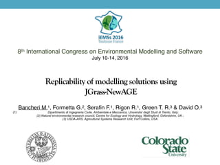
1. Replicability of modelling solutions using
JGrass-NewAGE
8th International Congress on Environmental Modelling and Software
July 10-14, 2016
Bancheri M.1, Formetta G.2, Serafin F.1, Rigon R.1, Green T. R.3 & David O.3
(1) Dipartimento di Ingegneria Civile, Ambientale e Meccanica, Universita’ degli Studi di Trento, Italy;
(2) Natural environmental research council, Centre for Ecology and Hydrology, Wallingford, Oxfordshire, UK ;
(3) USDA-ARS, Agricultural Systems Research Unit, Fort Collins, USA.
2. Outline
• GEOframe organization;
• Jgrass-NewAge hydrological system;
• Modelling solutions examples;
• Reproducibility and replicability.
Bancheri M. et al., Replicability of modelling solutions using JGrass-NewAge
4. JGrass-NewAge
Interpolations tools
Energy balance
Water balance
Solutes transport
Automatic calibration
Geomorphological tools
Formetta, G., et al. "The JGrass-NewAge system for forecasting and managing the hydrological budgets at the basin scale: models of
flow generation and propagation/routing." Geoscientific Model Development 4.4 (2011): 943-955.
Bancheri M. et al., Replicability of modelling solutions using JGrass-NewAge
6. Piave River, Italy Howland Forest, Maine, U.S.
Modelling solution example
Formetta, G., et al. "Modeling shortwave solar radiation using the JGrass-NewAge system." Geoscientific Model Development 6.4 (2013): 915-928.
Formetta, G., et al.: Site specific parameterizations of longwave radiation, Hydrol. Earth Syst. Sci. Discuss., doi:10.5194/hess-2016-227, in review, 2016.
Bancheri M. et al., Replicability of modelling solutions using JGrass-NewAge
7. Poudre River, Colorado, U.S. Little Washita River, Oklaoma, U.S.
Modelling solution example
Formetta, G., et al. "Hydrological modelling with components: A GIS-based open-source framework." Environmental Modelling & Software 55 (2014)
Formetta, Giuseppe, et al. "Snow water equivalent modeling components in NewAge-JGrass." Geoscientific Model Development 7.3 (2014)
Bancheri M. et al., Replicability of modelling solutions using JGrass-NewAge
8. Posina River, Italy
Modelling solution example
Rigon, R., Bancheri, M., and Green, T. R.: Age-ranked hydrological budgets and a travel time description of catchment hydrology, Hydrol. Earth Syst. Sci.
Discuss., doi:10.5194/hess-2016-210, in review, 2016.
Bancheri M. et al., Replicability of modelling solutions using JGrass-NewAge
9. 24 Ameriflux station in U.S.
Modelling solution example
Formetta, G., et al.: Site specific parameterizations of longwave radiation, Hydrol. Earth Syst. Sci. Discuss., doi:10.5194/hess-2016-227, in review, 2016.
Abera, W., Formetta, G., Brocca, L., and Rigon, R.: Water budget modelling of the Upper Blue Nile basin using the JGrass-NewAge model system and satellite
data, Hydrol. Earth Syst. Sci. Discuss., doi:10.5194/hess-2016-290, in review, 2016.
Bancheri M. et al., Replicability of modelling solutions using JGrass-NewAge
11. Modelling solution connections: OMS3
Bancheri M. et al., Replicability of modelling solutions using JGrass-NewAge
OMS3 console:
components, parameters and
connections
SWRB
LWRB
NET RAD
ETP
12. Recent Upgrades
JGrass-NewAge
More components: Rain-Snow
separation, Clearness-Index, Net
Radiation, WFIUH, root zone
model, groundwater model..
New version in JGrass-NewAge
(April, 2016)
New in JGrass-NewAge
(January, 2016)
Bancheri M. et al., Replicability of modelling solutions using JGrass-NewAge
13. Replicable research
Source code OMS projects
Community blog Documentation
Bancheri M. et al., Replicability of modelling solutions using JGrass-NewAge
15. Conclusions
• Thanks to its infrastructures, JGrass-NewAge allows the
end-users to create their own hydrological model with
simple components connections;
• The model was tested on several different test cases,
always with good performances;
• All the components are Java based and open-source, the
code is always available, commented and documented;
• Join the community!
Bancheri M. et al., Replicability of modelling solutions using JGrass-NewAge
17. References
Bancheri M. et al., Replicability of modelling solutions using JGrass-NewAge
Abera, W., Formetta, G., Brocca, L., and Rigon, R.: Water budget modelling of the Upper Blue Nile basin using the
JGrass-NewAge model system and satellite data, Hydrol. Earth Syst. Sci. Discuss., doi:10.5194/hess-2016-290, in
review, 2016.
Formetta, G., Mantilla, R., Franceschi, S., Antonello, A., and Rigon, R.: The JGrass-NewAge system for forecasting
and managing the hydrological budgets at the basin scale: models of flow generation and propagation/routing,
Geosci. Model Dev., 4, 943-955, doi:10.5194/gmd-4-943-2011, 2011
Formetta, G., Rigon, R., Chávez, J. L., and David, O.: Modeling short wave solar radiation using the JGrass-
NewAge System, Geosci. Model Dev. Discuss., 5, 4355-4393, doi:10.5194/gmdd-5-4355-2012, 2012.
Formetta, G., et al., Hydrological modelling with components: A GIS-based open-source framework. Environmental
Modelling & Software 55 (2014)
Formetta, Giuseppe, et al. "Snow water equivalent modeling components in NewAge-JGrass." Geoscientific Model
Development 7.3 (2014)
Formetta, G., et al.: Site specific parameterizations of longwave radiation, Hydrol. Earth Syst. Sci. Discuss., doi:
10.5194/hess-2016-227, in review, 2016.
Rigon R. , Bancheri M. , Formetta G. , deLavenne A. , The geomorphic unit hydrograph from a historical-critical
perspective, Earth Sci. Proc. and Landforms, 41(1), 27-37, 2016
Rigon, R., Bancheri, M., and Green, T. R.: Age-ranked hydrological budgets and a travel time description of
catchment hydrology, Hydrol. Earth Syst. Sci. Discuss., doi:10.5194/hess-2016-210, in review, 2016.