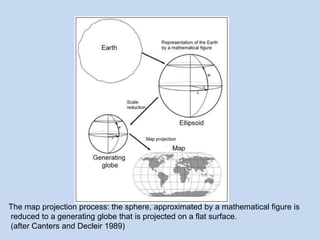
This document defines map projections and their basic concepts. It discusses that map projections are a means of depicting the earth's spherical surface on a flat plane. The key aspects covered are:
- Map projections transform the 3D globe onto a 2D surface through a process of generating a globe and projecting it onto a plane.
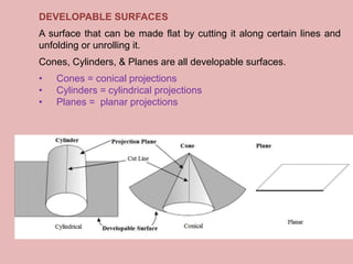
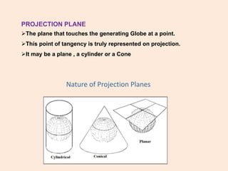
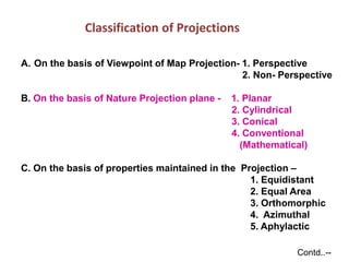
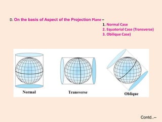
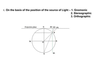
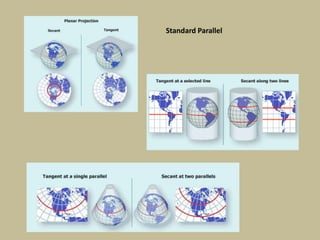
- The projection plane can be planar, cylindrical, or conical based on the surface used. Different properties are maintained based on the type of projection.
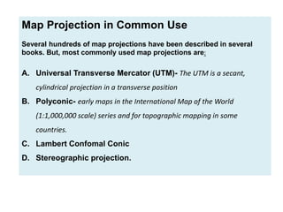
- Common map projections in use include the Universal Transverse Mercator, Polyconic, Lambert Conformal Conic, and Stereographic projections.


![CTR_ppresentation[1RRRRRRRRRRRRRRRRR].pptx](https://cdn.slidesharecdn.com/ss_thumbnails/ctrppresentation1-250330155714-ac87e8bd-thumbnail.jpg?width=640&height=640&fit=bounds)


![谷歌留痕技术 [ 𝙩𝙤𝙥 𝟮𝟯𝟯. 𝙘 𝙤𝙢 ]](https://cdn.slidesharecdn.com/ss_thumbnails/top233-260130174328-3833018c-thumbnail.jpg?width=640&height=640&fit=bounds)


