Geir Karsrud
Bachelor of Geomatics
Gjøvik University College
 Overview
 How it works
 Usages of LIDAR
Topics
What is it?
 optical remote sensing technology
 laser
 scanner and optics
 photodetector and receiver electronics
 position and navigation systems
Overview
How does it work?
 measuring the time delay between transmission of a pulse
and detection of the reflected signal gives range
 measuring light reflected back identifies surface types
 laser returns more detailed results than radar
ight mplification by timulated mission of adiation
How it works
What can it be used for?
 archaeology
 meterology
 geology
 physics and astronomy
 biology and conservation
 military and law enforcement
 vehicles
 imaging
 3D mapping
Usages of LIDAR

Light Detection And Ranging (useless in slideshare, must be downloaded to powerpoint)

  • 1.
    Geir Karsrud Bachelor ofGeomatics Gjøvik University College
  • 2.
     Overview  Howit works  Usages of LIDAR Topics
  • 3.
  • 4.
     optical remotesensing technology  laser  scanner and optics  photodetector and receiver electronics  position and navigation systems Overview
  • 5.
  • 6.
     measuring thetime delay between transmission of a pulse and detection of the reflected signal gives range  measuring light reflected back identifies surface types  laser returns more detailed results than radar ight mplification by timulated mission of adiation How it works
  • 7.
    What can itbe used for?
  • 8.
     archaeology  meterology geology  physics and astronomy  biology and conservation  military and law enforcement  vehicles  imaging  3D mapping Usages of LIDAR

Editor's Notes

  • #2 Hi, My name is Geir Karsrud and I’m studying for a Bachelor of Geomatics degree here at Gjøvik University College. I’m going to give a presentation about Light Detection And Ranging, commonly known by the term LIDAR.
  • #3 Due to the short length of the presentation, I will only cover the basics. But we’ll have a look at what, how and why.
  • #4 First, we’ll quickly look at just what LIDAR is.
  • #5 
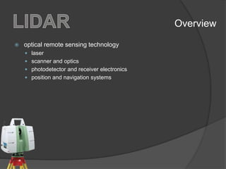
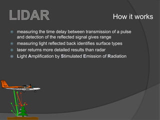
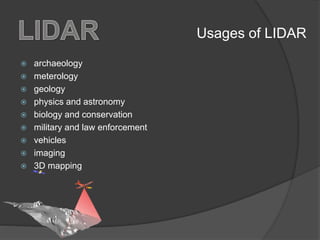
LIDAR is an optical remote sensing technology that measures properties of scattered light to find range and/or other information of a distant target using laser pulses. Some of the major components of a LIDAR system are a laser, scanner and optics, photodetector and receiver electronics, and position and navigation systems.
  • #6 So, how does it work? Let’s look at some of the basic workings of the technology.
  • #7 The range to an object is determined by measuring the time delay between transmission of a pulse and detection of the reflected signal while. measuring light reflected back identifies surface types. Scanners using a laser returns more detailed results than similar technologies such as radar, but the dense and focused beam must be directed by mirrors or/and scanner axis to cover the scene. Laser, short for Light Amplification by Stimulated Emission of Radiation, is electromagnetic radiation of any frequency focused into a very dense beam.
  • #8 Now, lets have a look at what it can be used for.
  • #9 The LIDAR technology is used in several contexts, most notably archaeology, meterology, geology, physics and astronomy, biology and conservation, military and law enforcement, vehicles, imaging and 3D mapping