Download to read offline

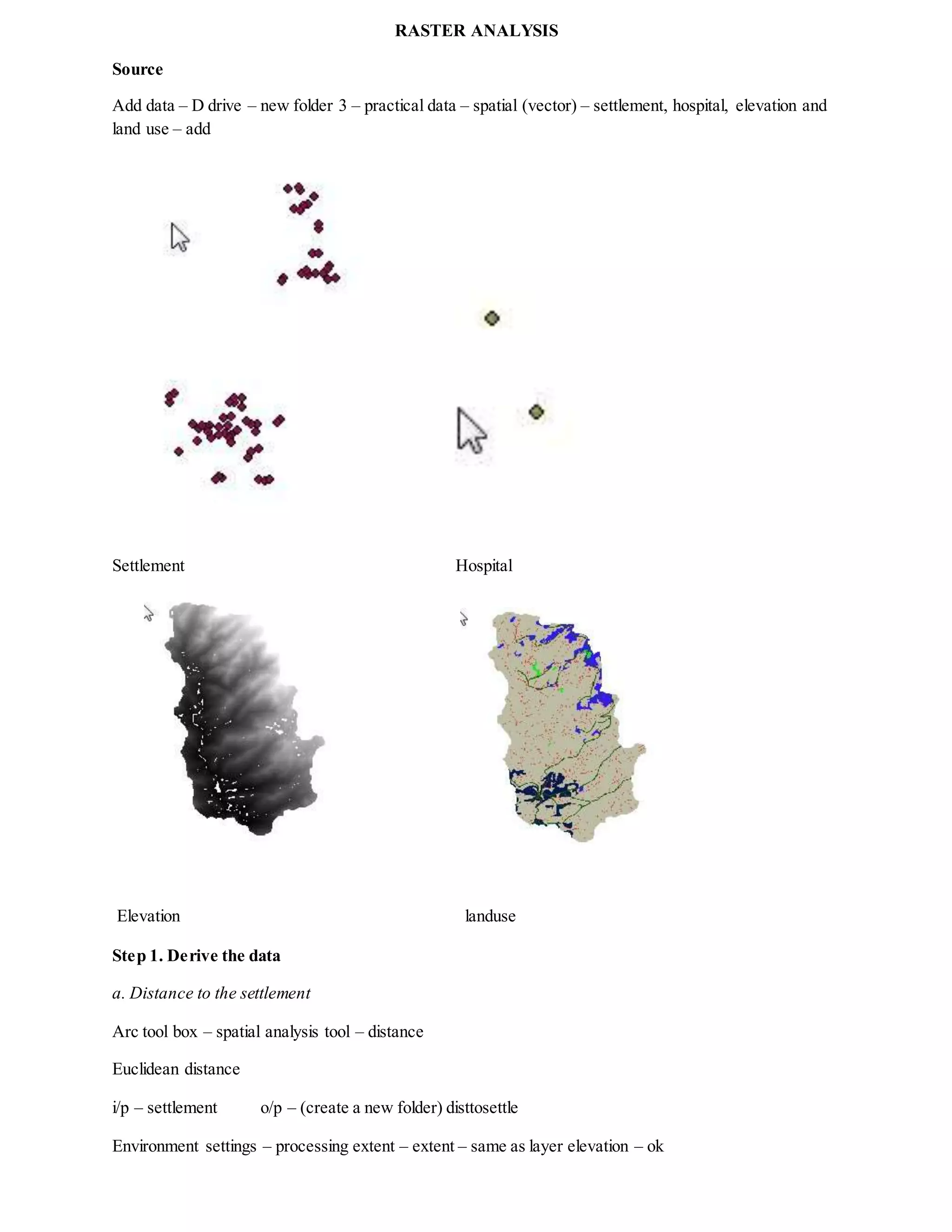
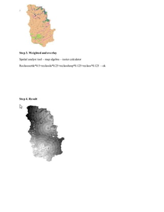


The document outlines a series of steps for conducting raster analysis using various spatial data layers, including settlement, hospital, elevation, and land use. It details the process of deriving distance measures and slope analysis, followed by reclassification of these layers using a specified method. Finally, it discusses the application of weighted overlays to combine the reclassified data into a single result.