International Journal of Engineering and Science Invention (IJESI) is an international journal intended for professionals and researchers in all fields of computer science and electronics. IJESI publishes research articles and reviews within the whole field Engineering Science and Technology, new teaching methods, assessment, validation and the impact of new technologies and it will continue to provide information on the latest trends and developments in this ever-expanding subject. The publications of papers are selected through double peer reviewed to ensure originality, relevance, and readability. The articles published in our journal can be accessed online.
Engineering Research Publication
Best International Journals, High Impact Journals,
International Journal of Engineering & Technical Research
ISSN : 2321-0869 (O) 2454-4698 (P)
www.erpublication.org
Land Use Land Cover Change Detection of Gulbarga City Using Remote Sensing an...ijsrd.com
Land use and land cover(LULC) recently these days became a major component to handle natural resources and managing changes occurring in the environment.which is due to expansion of the urban area it has lead to critical losses of agriculture land,vegetation land and water bodies.followed by this the urban sprawl created a environmental issues. For example :decreased air quality and increase in the temperature etc. Land use and land cover change is driven by human actions and also drives changes that limit availability of products and services for human and animals, and it can undermine ecological wellbeing also. Land use and land cover is an important component in understanding various interactions of the human activities with the environment and thus it is necessary to be able to simulate changes. Therefore, this study was aimed at understanding land use and land cover change in Gulbarga city. In this work we took Gulbarga city to study the urban expansion and LULC change that took place in 2001 and 2012 to know the changes happened in the year 2012 by comparing with data of 2001.remote sensing methodology is used in this study which provides major coverage mapping & classification of land cover features such as vegetation,soil,water,forest etc. A wide range of environmental parameters can be measured including the land use, vegetation types, surface temperatures , soil types, precipitation, phytoplankton, turbidity, surface elevation and geology.satellite images of two different years i.e 2001 and 2012 are taken in to consideration.after image processing classification is done so as to classify images in to various different land use categories.
land use land cover change detection in a part of ramganga river basin, at ...INFOGAIN PUBLICATION
The paper deals with the status of the land use/land cover change taken place in a part of Ramganga River Basin, at Bareilly district, Uttar Pradesh, India, by using remote sensing satellite data. The present study area is confined to latitude 28°10′ to 28054ʹ North and longitude 78°58′ to 78o58ʹ East, covering an area of 4120 km2. The satellite images of 1979 and 2009 have been obtained from global land cover facility (GLCF) and examined by unsupervised classification method. The general classification level has been adopted. The identified classes include Settlements, Croplands, Vegetation/Plantations, Water Bodies, and Waste Land. The result shows increasing trend of crop land and built up area and decreasing trend of vegetation and Plantation land.
LAND USE /LAND COVER CLASSIFICATION AND CHANGE DETECTION USING GEOGRAPHICAL I...IAEME Publication
Land use and land cover change has become a central component in current strategies for managing natural resources and monitoring environmental changes. Geographical information system and image processing techniques used for the analysis of land use/land cover and change detection of Sukhana Basin of Aurangabad District, Maharashtra state. The tools used ArcGIS10.1 and ERDAS IMAGINE9.1, landsat images of 1996, 2003and 2014. From land use / land cover change detection it is found that during 1996-2014, water bodies cover have loss of 4 Sq. Km. Barren land have 146 Sq.Km. loss and forest area with 96 Sq.Km. loss. It is found that urbanization area has gain of 51 Sq.Km. and agricultural land cover also have gain of 195 Sq.Km.
Landuse and Landcover Change Detection in Lalgudi Block, Tiruchirappalli Dist...IJERA Editor
In this paper an attempt has been carried out mapping and analysis the landuse and landcover change detection in Lalgudi block of Tiruchirappalli district using remote sensing and GIS techniques. The total area of the study area is 272.2 sq.km. It is located in the central part of Tamil Nadu. Landuse and Landcover change detection maps were generated and classified into agriculture land, built-up land, fallow land, natural vegetation, river sand, water bodies, and scrub without scrub land for the year 1990, 2000 and 2010 based on NRSA classification. Each landuse and landcover has been changed positively and negatively for the three decades, especially agriculture land, sandy area, natural vegetation and fallow land, which is about 19.62%, 6.56%, 13.16% and 14.91 percentages respectively.
GIS Mapping of Large Soil Groups, Current Land Use, Soil Depths and Slopes, E...Premier Publishers
This study was conducted within the scope of the spatial evaluation of the current land uses, large soil groups, soil depth and slope distributions and soil erosion data in Kırşehir province of Turkey. In the study, digital soil maps produced by the Abolished General Directorate of Rural Services in Turkey were used. Geographical Information Systems (GIS) (Arc GIS 10.3.1) software was used for the spatial evaluation of soil data in the study. According to the spatial analysis results; Dry marginal agricultural areas with 2857.7 km2 constitute a large part of the current land use of Kırşehir Province. This area covers 44% of the total. When the large soil groups of Kırşehir province are examined, brown soils constitute a large part of the region. It has been determined that brown soils correspond to 2710.4 km2 area and 41% of the existing area. The soil depth structure has been observed to be generally medium depth soils. Medium deep soils have an area of 2052.1 km2 and constitute 31% of the total area. As for the soil slope class, it was seen that a large part of the region was between the 2nd degree slope group (7-12%) and the 3rd degree slope group (13-20%). When the soil erosion degree was examined, it was seen that a large part of the region had 2nd degree erosion. Soils with 2nd degree erosion group constitute an area of 2294.3 km2 (35%). Sharing the digital land use data obtained in the study will provide significant contributions to the investor organizations that will invest in the region and contribute to agricultural production.
The present study focuses on the nature and pattern of urban expansion of Madurai city over its surrounding region during the period from 2003 to 2008. Based on its proximity to the Madurai city, Preparation of various thematic data such Land use and Land cover using Land sat data. Create a land use land cover map from satellite imagery using supervised classification. Find out the areas from the classified data. The study is based on secondary data, the satellite imagery has downloaded from GLCF (Global Land Cover Facility) web site, for the study area (path101 row 67), the downloaded imagery subset using Imagery software to clip the study area. The clipped satellite imagery has used to prepare the land use and land cover map using supervised classification.
Remote sensing is the acquiring of information from a distance and also the art and science of making measurements of the earth using airborne- or satellite-based sensors, is used in GIS. GIS is a collection of computer-based tools for organizing information from a variety of data sources to map and examine changes on Earth. Global Positioning System or GPS is a space-based radio navigation system that helps pinpoint a three-dimensional position to about a meter of accuracy (for example latitude, longitude and altitude) and provide nano-second precise time anywhere on Earth.
Land Use / Land Cover Classification of kanniykumari Coast, Tamilnadu, India....IJERA Editor
The land use/ land cover details of Kanniyakuamri coast which is Located in the southern part of Tamil Nadu (India) is studied. Satellite imagery is used to identify the Land use/ Land cover status of the study area. The software like ERDAS and Arc GIS are used to demarcate the land use / Land cover features of Kanniyakuamari coast. Remote sensing and GIS provided consistent and accurate base line information than many of the conventional surveys employed for such a task. The total area of Kanniyakumari coast is 715 sq.km. The land use / land cover classes of the study area has been categorized into thirteen such as Plantation, Sandy area, Water logged area, Scrub forest, Crop Land, Water bodies, Land with scrub, Reserve forest, Land without Scrub, Salt area, Beach Ridge, Settlement and Fallow land on the basis NRSA Classifications. Among these categories, land with scrub land is predominantly found all over the study area, It is occupied about 336.36 sq.km (44.61 percent), Crop Land 273.82 sq.km(38.29 percent), water bodies lands sharing about 20.44 sq.km (2.85 percent ), settlement occupied with 6.96 sq.km (0.97 percent), and Fallow land was occupied 13.98 sq.km ( 1.95 percent ).
GIS Applications for Smart Agriculture-Case Studies & Research Prospects.AdityaAllamraju1
My special webinar talk about 'GIS Applications for Smart Agriculture-Case Studies & Research Prospects’ is a part of the webinar series on October 31st, 2020 organized by the TGISlab, a GIS Consultancy that is an initiative to fill the gap in GIS/Remote Sensing field to aware people about space technology for Earth Science & its applications. TGISLab works on different GIS Applications work and offers training/webinars/workshops to a wider community. It is based at Ahmedabad in Gujarat, India.
Land use Land Cover Highlight for Jibia Local Government, Nigeriaijtsrd
Land use and land cover is very important for appropriate planning and budget of a community. In Jibia several activities are carried on the land without actually knowing the percentage of the land cover of features. Remote sensing and GIS technology are valuable tools in managing land use and land cover. This research described the land use and land cover coverage of the entire LGA land using Remote Sensing and GIS. Landsat Satellite imagery of 2009 of the study area was processed and classified into 5 groups namely Build up sharp sand, Farm Land trees, Vegetation shrubs, Water body and Barren land. Statistical analysis was employed to show the percentage distribution of the land. The study shows the percentage coverage of land physical feature which in turn describe the land use. The research revealed that agriculture is the major activity in the study area. It also concluded by recommending the need for adequate measures to avoid desert encroachment and government support to enhance agricultural produce. Lugga M. S | Babale Z. T | Yamel A. G "Land use Land Cover Highlight for Jibia Local Government, Nigeria" Published in International Journal of Trend in Scientific Research and Development (ijtsrd), ISSN: 2456-6470, Volume-4 | Issue-4 , June 2020, URL: https://www.ijtsrd.com/papers/ijtsrd31134.pdf Paper Url :https://www.ijtsrd.com/other-scientific-research-area/other/31134/land-use-land-cover-highlight-for-jibia-local-government-nigeria/lugga-m-s
Application of Remote Sensing Techniques for Change Detection in Land Use/ La...iosrjce
IOSR Journal of Applied Geology and Geophysics (IOSR-JAGG) is a double blind peer reviewed International Journal that provides rapid publication (within a month) of articles in all areas of Applied Geology and Geophysics. The journal welcomes publications of high quality papers on theoretical developments and practical applications in Applied Geology and Geophysics. Original research papers, state-of-the-art reviews, and high quality technical notes are invited for publications.
Change detection analysis of Cropland using Geospatial technique -A case Stud...IJEAB
Access to accurate and up-to-date information on the extent and distribution of individual crop types, associated with land use changes and practices, has significant value in intensively agricultural regions. Explicit information of croplands can be useful for sustainable water resources, land and agriculture planning and management. Remote sensing, has been proven to be a more cost-effective alternative to the traditional statistically-based ground surveys for crop coverage areas that are costly and provide insufficient information. Satellite images along with ground surveys can provide the necessary information of spatial coverage and spectral responses of croplands for sustainable agricultural management. This study strives to differentiate different crop types and agricultural practices to achieve a higher detailed crop map of the Narsinghpur district.
“Cadastral Maps for Socio-Economic Data Visualization and Integration for Lan...irjes
The impact of mining and mineral extraction activities can be significant on the surrounding land,
water and air bodies, in any operational area. The environmental degradation ranges from localized surface and
ground water contamination to the damaging effects of airborne pollutants on the regional ecosystem; which
need the properly designed geospatial database. The monitoring of these environmental impacts requires a userfriendly
and cost effective method to quantify the land cover changes over large time periods. Now-a-days, it
has become compulsory to use the remote sensing techniques for regular monitoring of these environmental
hazards in-and-around the mining areas using cadastral map. This paper provides a case study on the use of
geospatial techniques for environmental monitoring in the mining areas.
Land Use and Land Cover change monitoring of Surajpur Wetland, Uttar Pradesh:...Arnab Saha
Abstract:
Wetlands are extremely important areas throughout the world for wildlife protection, recreation, sediment control and flood prevention. Wetlands are important bird’s habitats and birds use them for feeding, roosting, nesting and rearing their young. In Surajpur Wetland are mainly used for agriculture, fisheries, reclamation for harboring and irrigation purposes. In this paper an attempt is made to study the changes in land use and land cover in Surajpur wetland area over 11 years’ period (2003-2014). LULC is an important component in understanding the interactions of the human activities with the environment and thus it is necessary to be able to simulate changes. The land cover mapping of study area was attempted using remotely sensed images of Landsat and Google Earth imagery. The study area was classified into five categories on the basis of field study, geographical conditions, and remote sensing data. LULC changes have been detected by image processing method in EDRAS imagine 2014 and ArcGIS 10.3. The eleven years’ time period of 2003-2014 shows the major type of land use change. Vegetation area that occupied about around 60 per cent of the Surajpur wetland area in 2003 has decreased to 34.25 percent in 2014. Wetland is increased 8.17 percent and Urban area, Fallow land and Water body also have experienced change. Finally, through the work it is recommended that the wetlands need detail mapping through the use of advance remote sensing techniques like microwave and LIDAR for restoration and management of wetland.
Keywords: LULC, ArcGIS, Surajpur, ERDAS, Remote Sensing
Land Use/Cover change Evaluation of Gibe III Dam in Southern Ethiopia by ayel...Space science
This article is worked by Ayele Akirso Adugna when he was AAU Graguate class student for his course project of Natural resource Mapping and monitoring in the year 2020, In Ethiopia.
International Journal of Engineering Research and DevelopmentIJERD Editor
• Electrical, Electronics and Computer Engineering,
• Information Engineering and Technology,
• Mechanical, Industrial and Manufacturing Engineering,
• Automation and Mechatronics Engineering,
• Material and Chemical Engineering,
• Civil and Architecture Engineering,
• Biotechnology and Bio Engineering,
• Environmental Engineering,
• Petroleum and Mining Engineering,
• Marine and Agriculture engineering,
• Aerospace Engineering.
ER Publication,
IJETR, IJMCTR,
Journals,
International Journals,
High Impact Journals,
Monthly Journal,
Good quality Journals,
Research,
Research Papers,
Research Article,
Free Journals, Open access Journals,
erpublication.org,
Engineering Journal,
Science Journals,
Study Of Impact Of Land Use ,Land Cover Change On Durg Block By Using Remote ...inventionjournals
Land use/cover change has become a central component in current strategies for managing natural resource and monitoring environmental changes (Tiwari and Saxena, 2011).Land use and land cover change (LULCC); also known as land change) is a general term for the human modification of Earth’s terrestrial surface. Though humans have been modifying land to obtain greater than ever in history, driving unprecedented changes in ecosystem and environmental processes at local, regional and global scales. These changes encompass the greatest environmental concerns of human populations today, including climate change, biodiversity loss and the pollution of water, soils and air (the encyclopedia of Earth). Land cover refers to the physical and biological cover over the surface of the land, including water, vegetation, bare soil, and /or artificial structure. Land use is a more complicated term. Natural scientists define land use in terms of syndromes of human activities such as agriculture, forestry and building construction that alter land surface processes including biogeochemistry, hydrology, forestry and biodiversity. (the encyclopedia of Earth). Remote Sensing data under GIS domain were utilized to evaluate the changes in land use/ land cover.In this research paper land use land cover changes is measured for short time period that is 6 years(2006 to 2012) . This technique is also applicable on long period LULC change measurement.
UiPath Test Automation using UiPath Test Suite series, part 3DianaGray10
Welcome to UiPath Test Automation using UiPath Test Suite series part 3. In this session, we will cover desktop automation along with UI automation.
Topics covered:
UI automation Introduction,
UI automation Sample
Desktop automation flow
Pradeep Chinnala, Senior Consultant Automation Developer @WonderBotz and UiPath MVP
Deepak Rai, Automation Practice Lead, Boundaryless Group and UiPath MVP
GraphRAG is All You need? LLM & Knowledge GraphGuy Korland
Guy Korland, CEO and Co-founder of FalkorDB, will review two articles on the integration of language models with knowledge graphs.
1. Unifying Large Language Models and Knowledge Graphs: A Roadmap.
https://arxiv.org/abs/2306.08302
2. Microsoft Research's GraphRAG paper and a review paper on various uses of knowledge graphs:
https://www.microsoft.com/en-us/research/blog/graphrag-unlocking-llm-discovery-on-narrative-private-data/
DevOps and Testing slides at DASA ConnectKari Kakkonen
My and Rik Marselis slides at 30.5.2024 DASA Connect conference. We discuss about what is testing, then what is agile testing and finally what is Testing in DevOps. Finally we had lovely workshop with the participants trying to find out different ways to think about quality and testing in different parts of the DevOps infinity loop.
PHP Frameworks: I want to break free (IPC Berlin 2024)Ralf Eggert
In this presentation, we examine the challenges and limitations of relying too heavily on PHP frameworks in web development. We discuss the history of PHP and its frameworks to understand how this dependence has evolved. The focus will be on providing concrete tips and strategies to reduce reliance on these frameworks, based on real-world examples and practical considerations. The goal is to equip developers with the skills and knowledge to create more flexible and future-proof web applications. We'll explore the importance of maintaining autonomy in a rapidly changing tech landscape and how to make informed decisions in PHP development.
This talk is aimed at encouraging a more independent approach to using PHP frameworks, moving towards a more flexible and future-proof approach to PHP development.
State of ICS and IoT Cyber Threat Landscape Report 2024 previewPrayukth K V
The IoT and OT threat landscape report has been prepared by the Threat Research Team at Sectrio using data from Sectrio, cyber threat intelligence farming facilities spread across over 85 cities around the world. In addition, Sectrio also runs AI-based advanced threat and payload engagement facilities that serve as sinks to attract and engage sophisticated threat actors, and newer malware including new variants and latent threats that are at an earlier stage of development.
The latest edition of the OT/ICS and IoT security Threat Landscape Report 2024 also covers:
State of global ICS asset and network exposure
Sectoral targets and attacks as well as the cost of ransom
Global APT activity, AI usage, actor and tactic profiles, and implications
Rise in volumes of AI-powered cyberattacks
Major cyber events in 2024
Malware and malicious payload trends
Cyberattack types and targets
Vulnerability exploit attempts on CVEs
Attacks on counties – USA
Expansion of bot farms – how, where, and why
In-depth analysis of the cyber threat landscape across North America, South America, Europe, APAC, and the Middle East
Why are attacks on smart factories rising?
Cyber risk predictions
Axis of attacks – Europe
Systemic attacks in the Middle East
Download the full report from here:
https://sectrio.com/resources/ot-threat-landscape-reports/sectrio-releases-ot-ics-and-iot-security-threat-landscape-report-2024/
The Art of the Pitch: WordPress Relationships and SalesLaura Byrne
Clients don’t know what they don’t know. What web solutions are right for them? How does WordPress come into the picture? How do you make sure you understand scope and timeline? What do you do if sometime changes?
All these questions and more will be explored as we talk about matching clients’ needs with what your agency offers without pulling teeth or pulling your hair out. Practical tips, and strategies for successful relationship building that leads to closing the deal.
Transcript: Selling digital books in 2024: Insights from industry leaders - T...BookNet Canada
The publishing industry has been selling digital audiobooks and ebooks for over a decade and has found its groove. What’s changed? What has stayed the same? Where do we go from here? Join a group of leading sales peers from across the industry for a conversation about the lessons learned since the popularization of digital books, best practices, digital book supply chain management, and more.
Link to video recording: https://bnctechforum.ca/sessions/selling-digital-books-in-2024-insights-from-industry-leaders/
Presented by BookNet Canada on May 28, 2024, with support from the Department of Canadian Heritage.
Software Delivery At the Speed of AI: Inflectra Invests In AI-Powered QualityInflectra
In this insightful webinar, Inflectra explores how artificial intelligence (AI) is transforming software development and testing. Discover how AI-powered tools are revolutionizing every stage of the software development lifecycle (SDLC), from design and prototyping to testing, deployment, and monitoring.
Learn about:
• The Future of Testing: How AI is shifting testing towards verification, analysis, and higher-level skills, while reducing repetitive tasks.
• Test Automation: How AI-powered test case generation, optimization, and self-healing tests are making testing more efficient and effective.
• Visual Testing: Explore the emerging capabilities of AI in visual testing and how it's set to revolutionize UI verification.
• Inflectra's AI Solutions: See demonstrations of Inflectra's cutting-edge AI tools like the ChatGPT plugin and Azure Open AI platform, designed to streamline your testing process.
Whether you're a developer, tester, or QA professional, this webinar will give you valuable insights into how AI is shaping the future of software delivery.
Builder.ai Founder Sachin Dev Duggal's Strategic Approach to Create an Innova...Ramesh Iyer
In today's fast-changing business world, Companies that adapt and embrace new ideas often need help to keep up with the competition. However, fostering a culture of innovation takes much work. It takes vision, leadership and willingness to take risks in the right proportion. Sachin Dev Duggal, co-founder of Builder.ai, has perfected the art of this balance, creating a company culture where creativity and growth are nurtured at each stage.
International Journal of Engineering and Science Invention (IJESI)
1. International Journal of Engineering Science Invention
ISSN (Online): 2319 – 6734, ISSN (Print): 2319 – 6726
www.ijesi.org Volume 2 Issue 7ǁ July. 2013 ǁ PP.49-53
www.ijesi.org 49 | Page
Land Use Change Detection in Baragaon Block, Varanasi District
Using Remote Sensing
Jitendra Kumar Jaiswal1
, Dr. Narender Verma2
1
(Research Scholar, Department of Geography, Banaras Hindu University, Varanasi, India)
2
(Assistant Professor, Department of Geography, Banaras Hindu University, Varanasi, India)
ABSTRACT : Land is a precious resource. Over 21% of the world’s population is living on cultivated land
constituting only 7% of the total area available on the earth (Wang, Jing et.al, 2012). Accurate and timely
information on land use and land use change at a national scale is crucial for long-term economic development
planning and for short-term land management (Zhang and Zhang, 2007). Baragaon block, Varanasi district, in
recent years, has been witnessing significant land use changes. On the one hand while there is a progressive
decline in area under agriculture, built up area has witnessed a prolific growth. Similarly area under
wasteland, forests and fallow land too has witnessed a decline. Space technology through Remote Sensing has
provided us with viable tool to assess such changes. The present paper highlights the changing trends and
pattern of land use in Baragaon Block, Varanasi District using two time frame Satellite data (IRS P-6 LISS III,
Standard FCC) of Rabi cropping season. The study is based on standard digital classification techniques and its
accuracy assessment.
KEYWORDS : Land Use, Change detection, Remote Sensing
I. INTRODUCTION
Land is a precious resource. Over 21% of the world’s population is living on cultivated land
constituting only 7% of the total area available on the earth. The state of a country’s land resources and
environment can significantly affect the sustainable development of the economy (Ma and Cui, 1987; Chen and
Peter, 2000; Lin, 2002; Ho and Lin, 2004). When the situation of land use has a negative impact on the
sustainable development, the government should enact new or adjust the existing regulations and laws to
strengthen effective management of land resources. Many researchers have attempted to analyze the effects of
land policies qualitatively (Cai, 2003; Ding, 2003; Ho and Lin, 2004; Lin and Ho, 2005; Lichtenberg and Ding,
2008), but few analysis was based on accurate and reliable data(c.f. Wang, Jing et.al, 2012). Accurate and
timely information on land use and land use change at a national scale is crucial for long-term economic
development planning and for short-term land management( Zhang and Zhang, 2007). A better understanding of
land resources and well-timed regulating and controlling of land use are crucial for sustainable development.
We must have a clear picture of the current state of various land-use types and of the changes in land use that
have occurred in the past. We need to be able to explain such changes and analyze the driving forces of land
policies and predict land-use changes in the future (Wang, Jing et.al, 2012).
Land use mapping has always been a time consuming and expensive process. Space technology in
recent years has emerged as a powerful tool for land use /land cover studies, particularly change detection.
Contrary to the traditional methods of field survey in which it took several years for the preparation and final
mapping of land use/ land cover of an area, remote sensing technology, due to synoptic view, map like format
and repetitive coverage, is a viable source of gathering quality land cover information at local, regional and
global scales (Csaplovics, 1998; Foody, 2002). Land use is a matter of continuous growth and change in pattern.
For economic development of a region, planners need up-to date information which can only be obtained
quickly, economically and accurately through remote sensing techniques (Gautam N. C. and Narayan L.R.A.
1983).
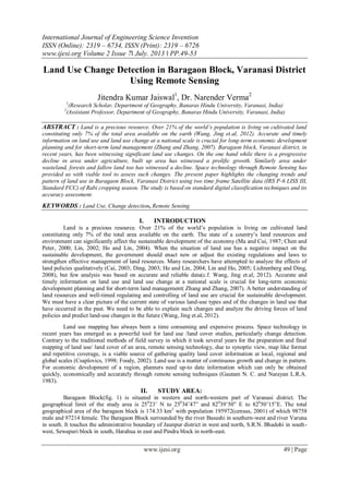
II. STUDY AREA:
Baragaon Block(fig. 1) is situated in western and north-western part of Varanasi district. The
geographical limit of the study area is 250
23’ N to 250
34’47” and 820
39’50” E to 820
50’15”E. The total
geographical area of the baragaon block is 174.33 km2
with population 195972(census, 2001) of which 98758
male and 97214 female. The Baragaon Block surrounded by the river Basushi in southern-west and river Varuna
in south. It touches the administrative boundary of Jaunpur district in west and north, S.R.N. Bhadohi in south-
west, Sewapuri block in south, Harahua in east and Pindra block in north-east.
2. Land Use Change Detection In Baragaon Block…
www.ijesi.org 50 | Page
As this area is located in Indo-Gangatic plain topographically, it is characterized by flat surface with
very little regional variation mostly ranging from 60 to 82 m and very little are below 60m above mean sea
level(derived from Asterdem). Slope of the study area have noted less variation and mostly comes under the
surface inclination of 0 to 70
. The direction of the slope is varying in multiple directions following the regional
trends of slope. Climatically the region has sub tropical monsoonal climate characterized by seasonal
extremities. January is the coldest month with mean maximum temperature of 23o
C. Occasionally, though, the
minimum temperature may drop down to around 5o
C during mid December and January coupled with
occurrence of dense fog. June is the hottest month with mean maximum temperature around 35o
C. However
temperatures’ soaring above 40o
C is not uncommon with occasional rise in mercury above 45o
C under the
impact of heat wave. The average annual rainfall of the district is around 110cms bulk of which is received from
the south west monsoons during June to September, August being the rainiest month.
fi. 1
3. Land Use Change Detection In Baragaon Block…
www.ijesi.org 51 | Page
III. OBJECTIVE OF THE STUDY
The main objective of the present study is to prepare the land use/Land Cover map with land use
statistics of the study area and detect changes in the pattern of land use/land cover for two years i.e. 2006 &
2012 using multi temporal satellite data.
IV. MATERIALS AND METHOD
In the present study geocoded ortho-rectified IRS P6 LISS-III(Resourcesat-II) satellite image (fig. 2)
Row 54 and path 102 having a resolution of 23.5 meters acquired from NRSC, Hyderabad of Rabi season dated
25th
January 2006 and 30th
January 2012 and Survey of India Toposheets Nos.63K/10, 63K/11, 63K/14 and
63K15 on 1: 50,000 scale have been used. A number of steps viz. image registration, generation of ancillary
data layers, unsupervised classification by considering 30 spectral classes followed by recoding the spectral
classes in land use/land cover thematic classes, accuracy assessment generation of change detection map, tables
etc. All the processing has been done on ERDAS Imagine and Arc GIS software. Field checks have been
performed for ascertaining the ground truth. Error Matrix for accuracy assessment has been generated and
finally the land use map and reports have been prepared.
V. RESULT AND DISCUSSION
Table-1 and Figure 3 shows the pattern of land utilization and the changes under each category of land
use in Baragaon Block, Varanasi district during 2006 and 2012 taking 2006 as base year. Following the Land
Use/Land cover classification scheme as developed by NRSC six land use/land cover classes’ viz. water bodies,
built up area, fallow land, area under agriculture, waste land and area under Plantation/Orchards have been
delineated for the study area. Agriculture constitutes the major economic activity in the study area. Owing to
fertile soil, availability of water and plain surface it is an intensely cultivated region. In 2006 around 34 percent
of the total area was under agriculture and the corresponding figure in 2012 was around 44 percent, this shows
the change of 1807 hectare which shows the around 30 percent increase in 2012 over 2006.
4. Land Use Change Detection In Baragaon Block…
www.ijesi.org 52 | Page
Table 1: Land Utilization in Baragaon Block in 2006 and 2012
Land Use Category Classified Pixels Area in 2006 Area in 2012 change
2006 2012 in ha in % in ha in % in ha in %
Water Bodies 4652 3494 268 1.524 201 1.14 -67 -
24,89
Plantation/Orchards 9075 16677 522.7 2.972 961 5.46 438 83.76
Built-up Land 17880 19755 1030 5.856 1138 6.47 108 10.87
Agricultural Fallow 123849 111433 7134 40.56 6419 36.5 -715 -
10.03
Agriculture 102869 134238 5925 33.69 7732 44 1806.85 30.49
Waste Land 46985 19773 2706 15.39 1139 6.48 -1567.4 -
57.92
Total 305310 305310 17586 100 17856 100 --- ---
Source: Computed by the authors from IRS P6 LISS III Satellite Image
Fallow land, described as agricultural area devoid of cropping at the time of the recording of the data covered
7133.70 hectares area in 2006 which was 28.97percent of the total area. In 2012 it declined to 6418.54 hectares
thereby declining by around 10 percent in 2012 over 2006. In relative terms it constituted 36.49 percent of the
total area in 2012 (Table-1).
Plantatioan/orchards includes the area under the tree canopy and social forestry etc. Unfortunately the
study area is devoid of significant forest cover. In 2006, 522.72 hectares constituting only 2.97 percent of the
total area was under forest cover. It further increased to around 960 hectares thereby showing an increase of
around 83 percent in 2012 over 2006. This is mainly due to social afforestation etc.
Built-up Land, defined as an area of human habitation developed due to non agricultural land use and
that has a cover of buildings, transport and communication, utilities in association with water vegetation and
vacant lands(NRSA 2006) constituted 5.85 percent of the total area in 2006. It increased to 6.47 percent in 2012.
It has recorded a 10.48 percent growth in 2012 over 2006 signifying a construction spree owing to expansion of
settlements and urbanization. Major concentration of the built up land can be observed in and around Baragon
Bolck Headqurter, the principal urban centre of the study area, new construction and around existing rural
settlements and service centres..Waste land is described as degraded land which can be brought under vegetative
cover with reasonable effort and which is currently under utilized and land which is deteriorating for lack of
appropriate water and soil management or on account of natural causes. It includes gullied land, scrub land,
sandy area, salt affected area barren rocky waste etc (NRSA 2006). Area under wasteland has declined by
around 57 percent in 2012 over 2006 which suggests that it has been reclaimed for varied utilization.
Water bodies includes the surface water bodies i.e. ponds, rivers, streams, canals etc. It accounted roughly 1.5
percent of the total area both in 2006 and around 1.14 in 2012. In terms of change it has recorded almost 24
percent decrease in 2012 over 2006.
VI. ACCURACY ASSESSMENT
No image classification is said to be complete unless its accuracy has been assessed. To determine the
accuracy of classification, a sample of testing pixels is selected on the classified image and their class identity is
compared with the reference data (ground truth). The choice of a suitable sampling scheme and the
determination of an appropriate sample size for testing data plays a key role in the assessment of classification
accuracy (Arora and Agarwal, 2002). The pixels of agreement and disagreement are generally compiled in the
form of an error matrix. It is a c x c matrix (c is the number of classes), the elements of which indicate the
number of pixels in the testing data. The columns of the matrix depict the number of pixels per class for the
reference data, and the rows show the number of pixels per class for the classified image. From this error matrix,
a number of accuracy measures such as overall accuracy, user’s and producer’s accuracy, may be determined
(Congalton, 1991). The overall accuracy is used to indicate the accuracy of whole classification (i.e. number of
correctly classified pixels divided by the total number of pixels in the error matrix), whereas the other two
measures indicate the accuracy of individual classes. User’s accuracy is regarded as the probability that a pixel
classified on the map actually represents that class on the ground or reference data, whereas producer’s accuracy
represents the probability that a pixel on reference data has been correctly classified.
5. Land Use Change Detection In Baragaon Block…
www.ijesi.org 53 | Page
Table-2: Accuracy Assessment of Classified Map
Class Name
Refere
nce
Totals
Refere
nce
Totals
Classifi
ed
Totals
Classifi
ed
Totals
Numb
er
Corre
ct
Numb
er
Corre
ct
Produc
ers
Accura
cy
Produc
ers
Accura
cy
Users
Accura
cy
Users
Accura
cy
2006 2012 2006 2012 2006 2012 2006 2012 2006 2012
Water
Bodies
1 2 1 1 1 1
100.00
%
50.00%
100.00
%
100.00
%
Plantation/
Orch
1 2 1 3 1 2
100.00
%
100.00
%
100.00
%
66.67%
Built-up
Land
5 3 3 3 2 2 40.00% 66.67% 66.67% 66.67%
Agriculture
15 22 17 22 15 22
100.00
%
100.00
%
88.24%
100.00
%
Agricultural
Fallow
18 15 20 18 15 15 83.33%
100.00
%
75.00% 83.33%
Waste
Land
10 6 8 3 8 3 80.00% 50.00%
100.00
%
100.00
%
Totals 50 50 50 50 42 45
Overall Classification Accuracy (2006)= 84.00%(2006), 90.00%(2012)
Overall Kappa Statistics = 0.7763 (2006), 0.8539 (2012)
Source: Computed by authors in ERDAS Imagine
In the present study, in order to assess the classification accuracy of classified images, 50 sample points
for both years 2006 and 2012 was selected using stratified random sampling in ERDAS. Sample points assigned
to each class of classified images were verified with reference image(ground truth) to derive producer & user
accuracy for each class and overall classification accuracy as depicted in Table-2. The overall classification
accuracy stands at 84% and 90% for the year 2006 and 2012 respectively.
VII. SUMMARY AND CONCLUSION
The present study aptly brings to light the changing trend in the pattern of land utilization in the study
area. Among different categories of land use, area under agriculture is predominant accounting for more than 40
percent area in both 2005-06 and 2011-12 followed by fallow land and built up area. Area under forests is
abysmally low accounting for not more than 2 percent of the total area. Change analysis shows a considerable
increase in the built up area which has grown by 10.87 percent signifying a spree in construction activity mainly
on account of rising demand for residential accommodation This however has had a negative impact on area
under agriculture. Area under plantation/orchards has increased around 440 hectare in 2012 over 2006. Under
waste land, there is a decline of 57 percent in 2012 over 2006. Thus, while reduction in the area under wasteland
is encouraging reduction in the agricultural area is a cause of concern. This is because reduction in agricultural
area means loss of fertile land and additional pressure on the existing agricultural area to meet the additional
food demand of the growing population in future.
VIII. ACKNOWLEDGEMENT
The authors are thankful to the National Remote Sensing Centre(NRSC), ISRO, Hyderabad for
providing the relevant satellite data for the purpose and University Grant Commission for the financial support
in the form of Junior Research Fellowship.
REFERENCES
[1] Anderson, J.R., Hardy, E.T., Roach, J.T. and Witmer, R.E. (1976). A land use and land cover classification system for use with remote sensing
data. Professional Paper 964, U.S. Geological Survey, Washington, D.C.
[2] Congalton, R G., A review of assessing the accuracy of classifications of remotely sensed data. Remote Sensing of Environment, 3( 7), 1991, 35-47
[3] Csaplovics, E., High Resolution space imagery for regional environmental monitoring — status quo and future trends. International Archives of
Photogrammetry and Remote Sensing, 32(7), 1998, 211-216.
[4] Foody, G. M. (2002). Status of Land Cover Classification Accuracy Assessment, Remote Sensing of Environment, 80, 2002, 185-201.
[5] Gautam N. C. and Narayan L.R.A., Landsat MSS Data for Land Use and Land Cover Inventory and Mapping: A Case Study of Andhra Pradesh,
Photonirvachak Journal of the Indian Society of Photo Interpretation and Remote Sensing, Springer, India. 1(3), 1983, 15-27.
[6] Manual of National Land Use Land Cover Mapping using Multi-temporal Satellite Data (May, 2006), National Remote Sensing Centre, Dept. of
Space, govt. of India, Hyderabad.
[7] Wang Jing; Chen, Yongqi; Shao, Xiaomei; Zhang, Yanyu; and Cao, Yingui. Land-use changes and policy dimension driving forces in
China:Present, trend and future. Land Use Policy 29, 2012, 737– 749.
[8] Zhang, Jixian and Zhang, Yonghong. Remote sensing research issues of the National Land UseChange Program of China. ISPRS Journal of
Photogrammetry & Remote Sensing 62, 2007, 461–472.