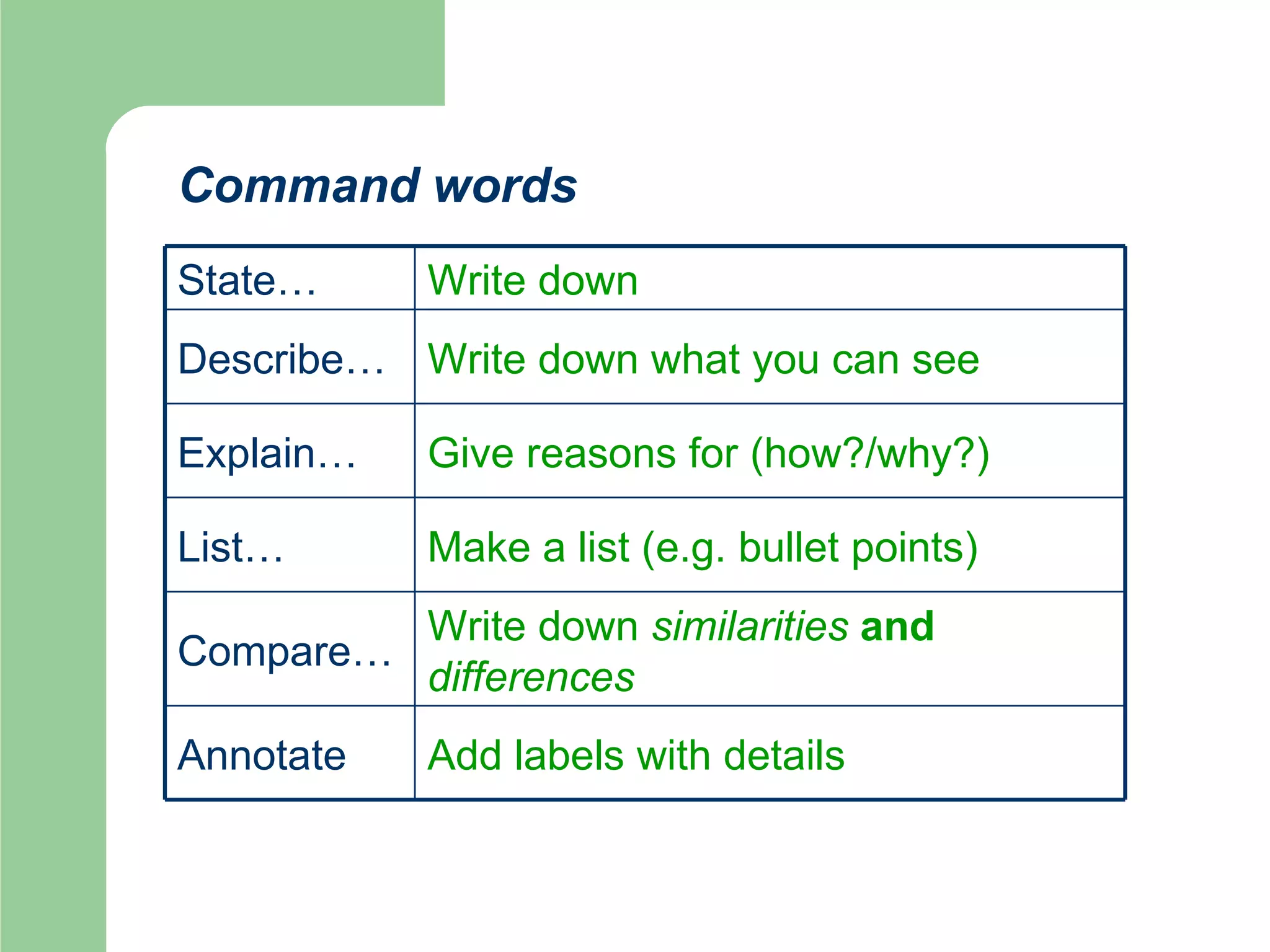
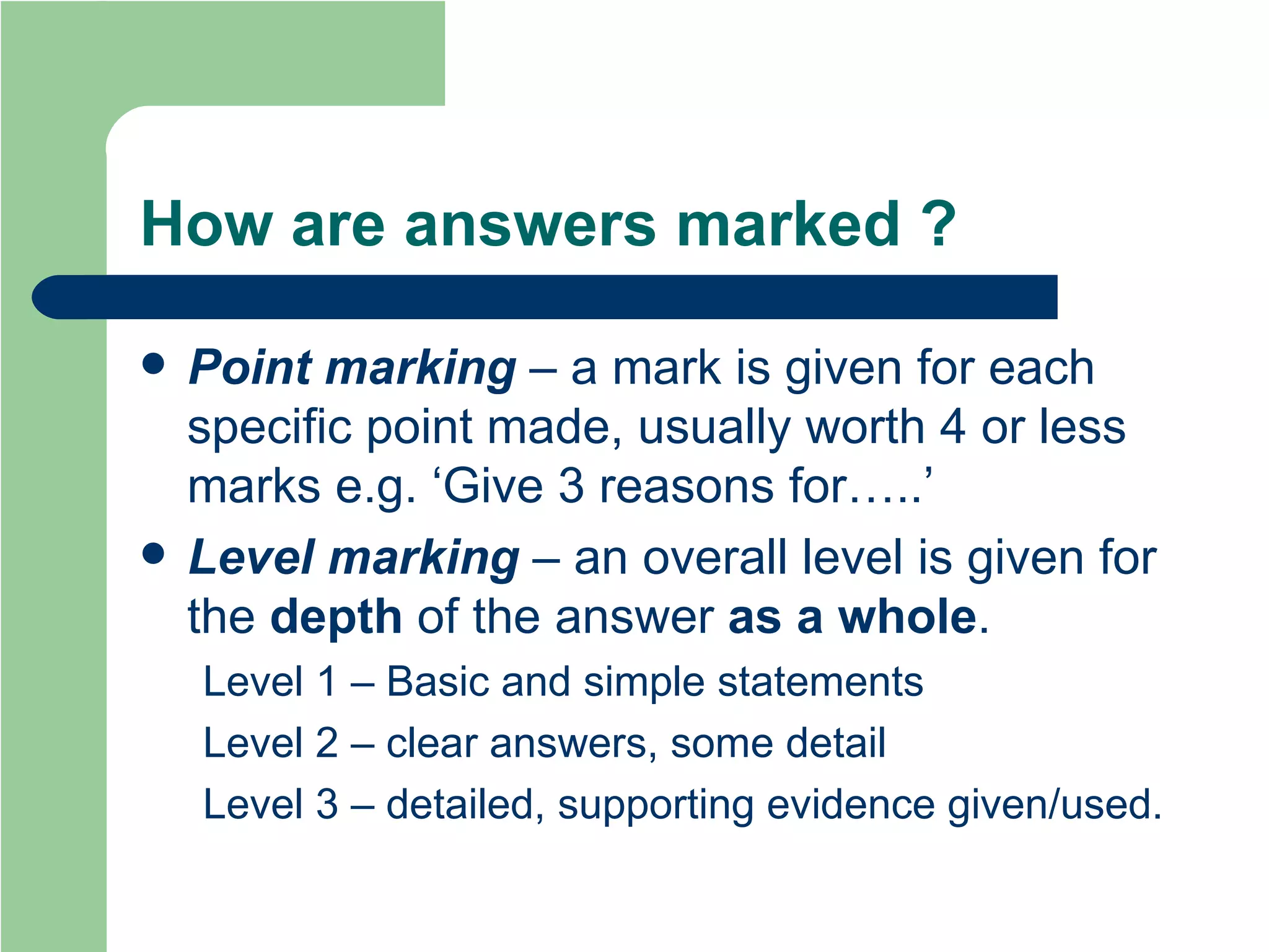
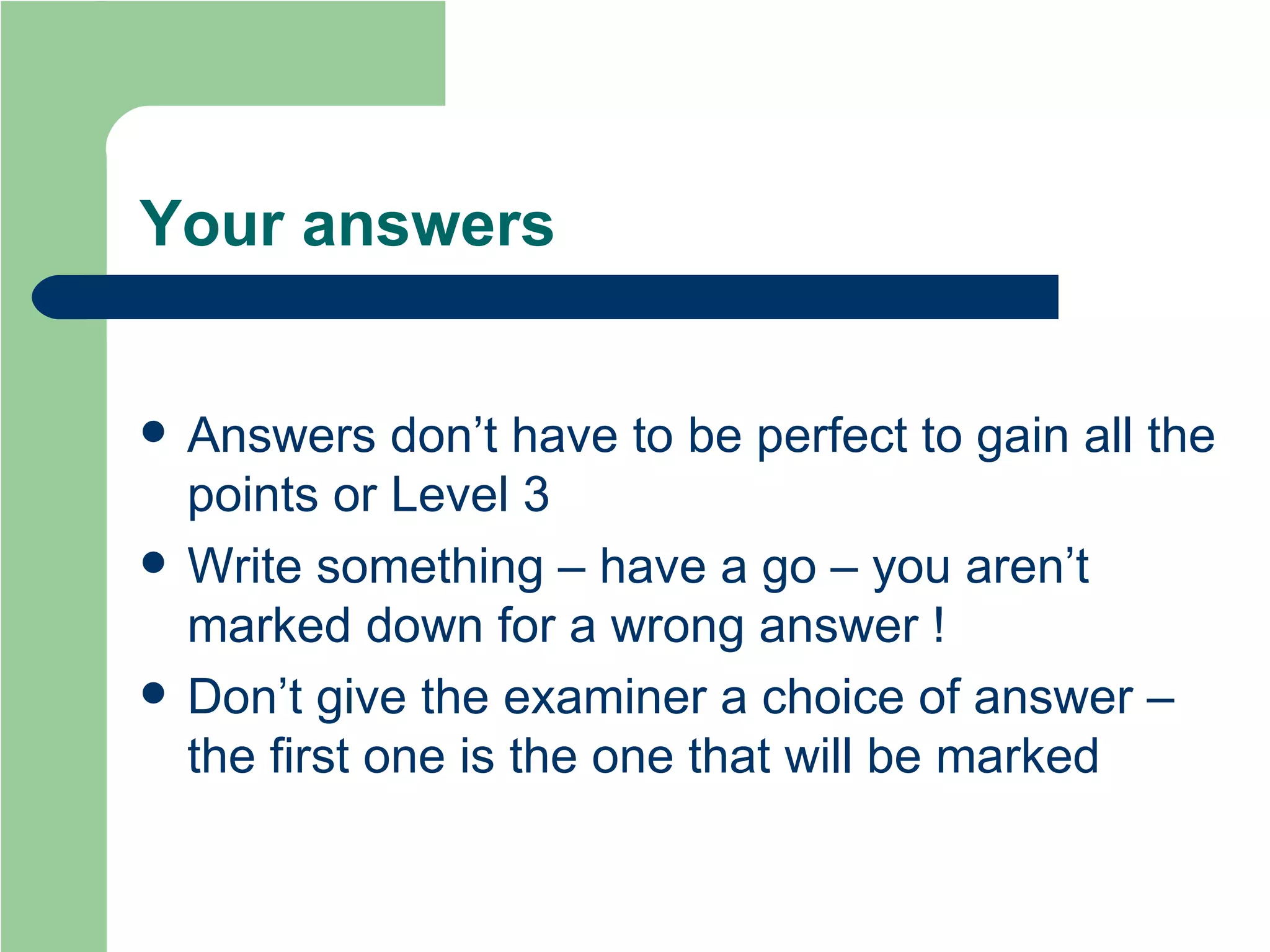
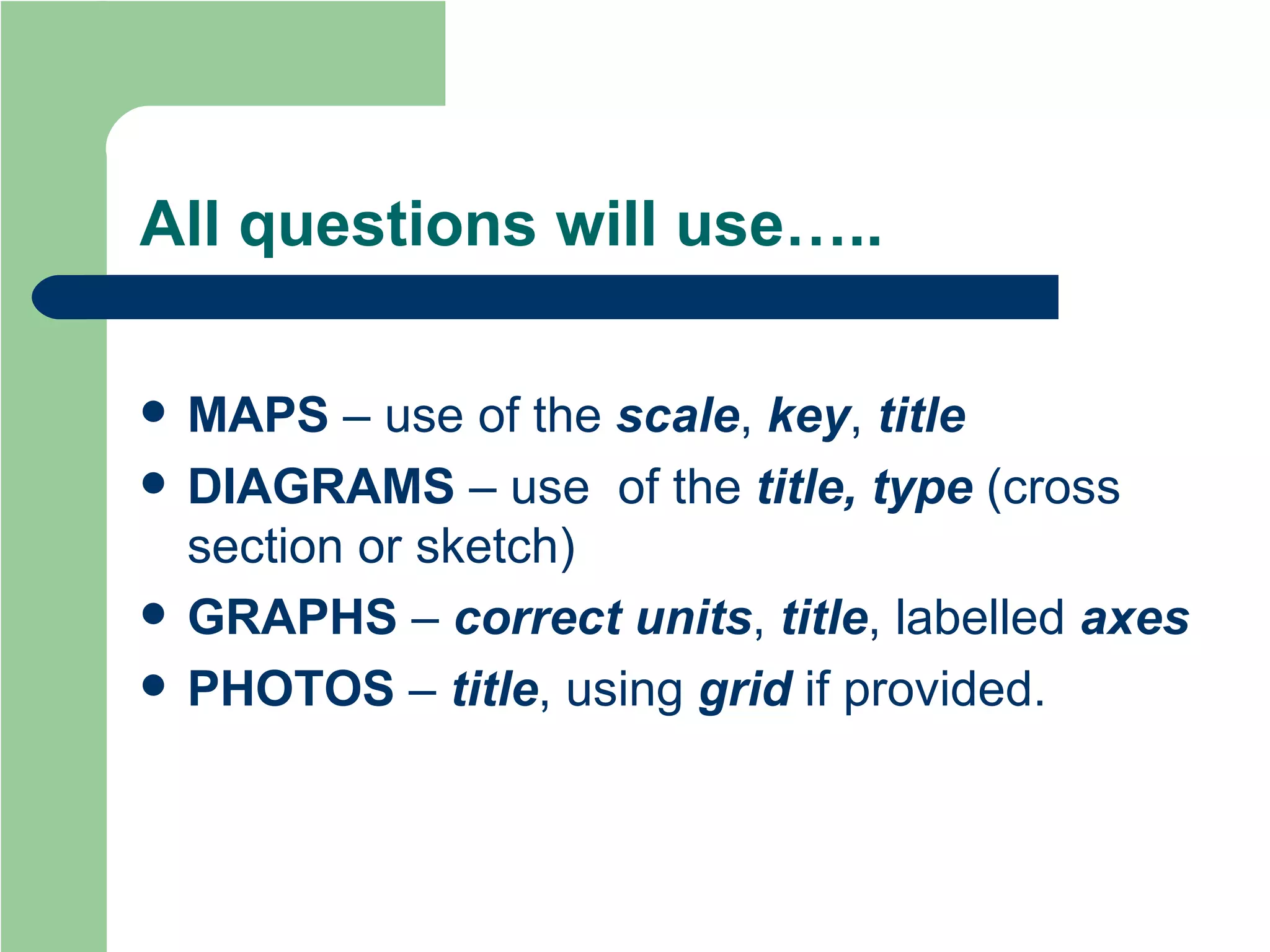
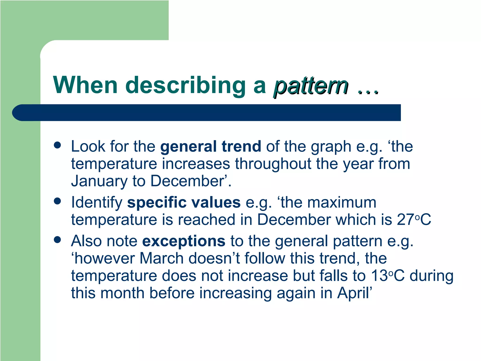
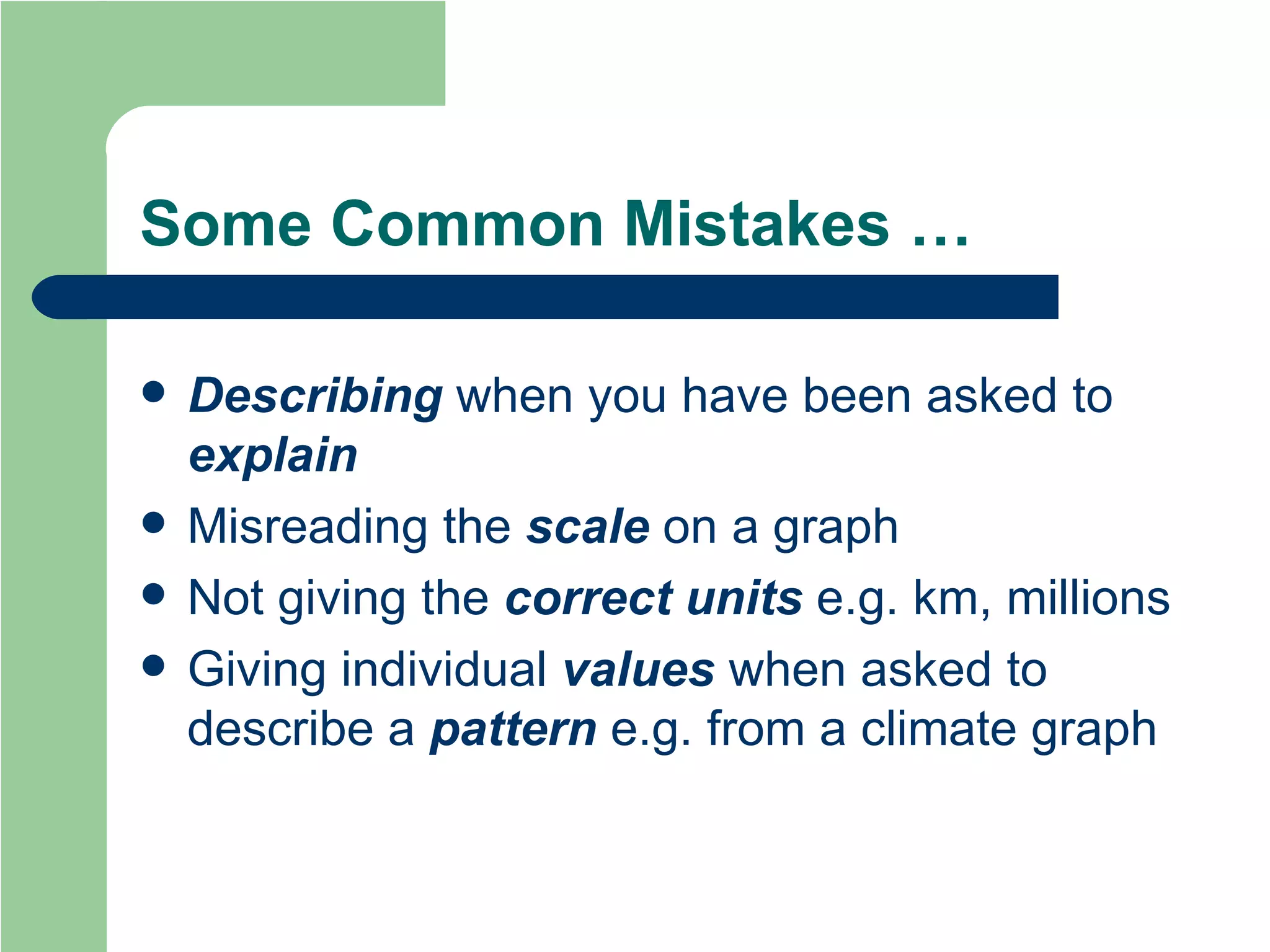
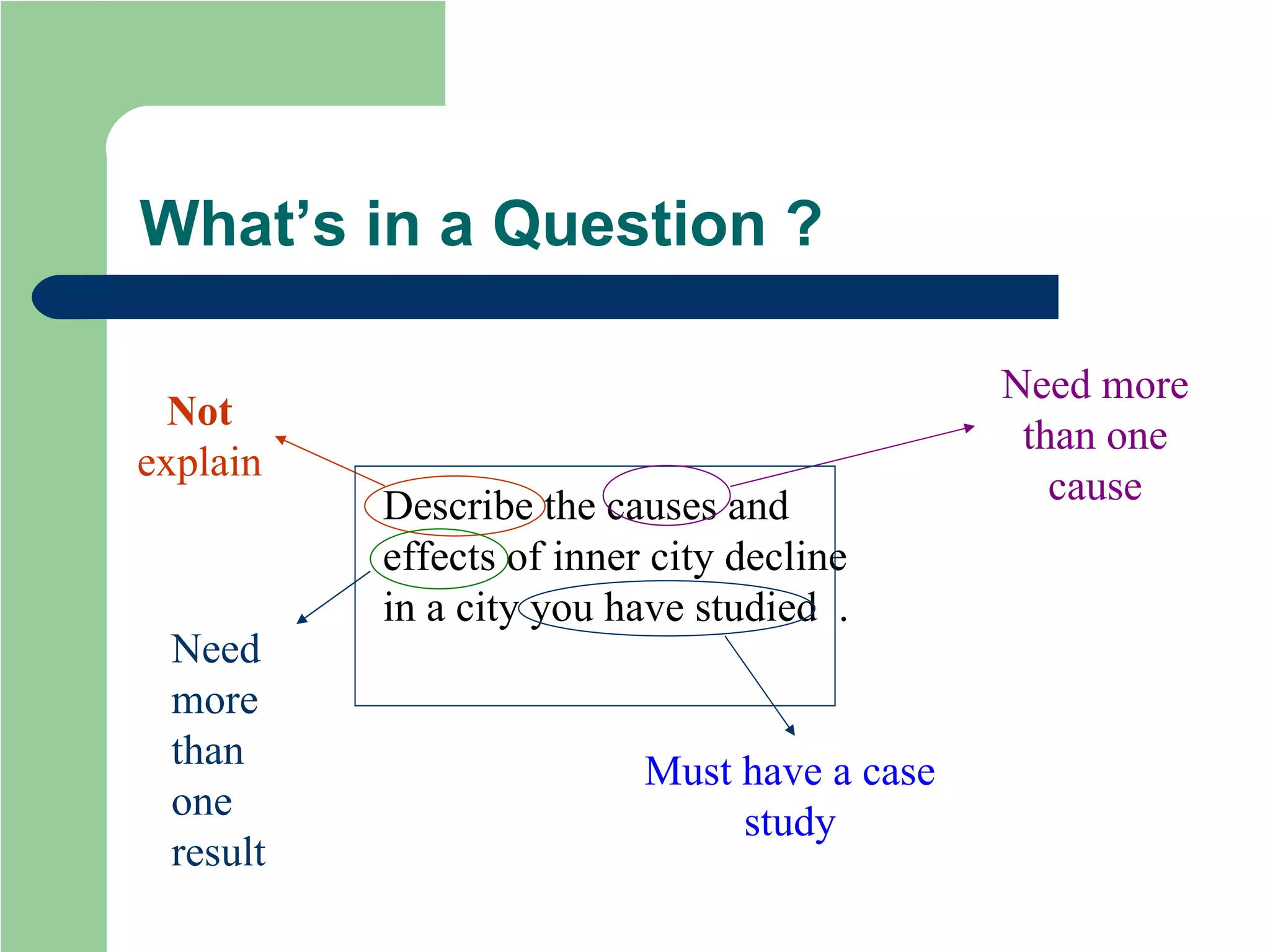
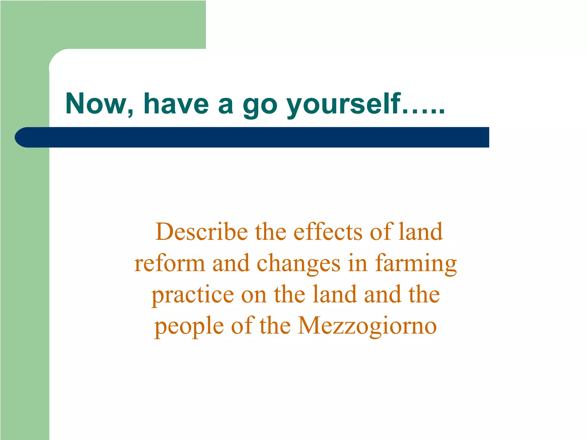
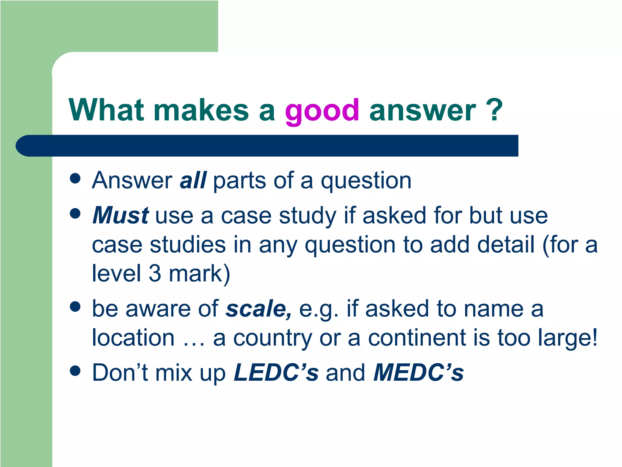
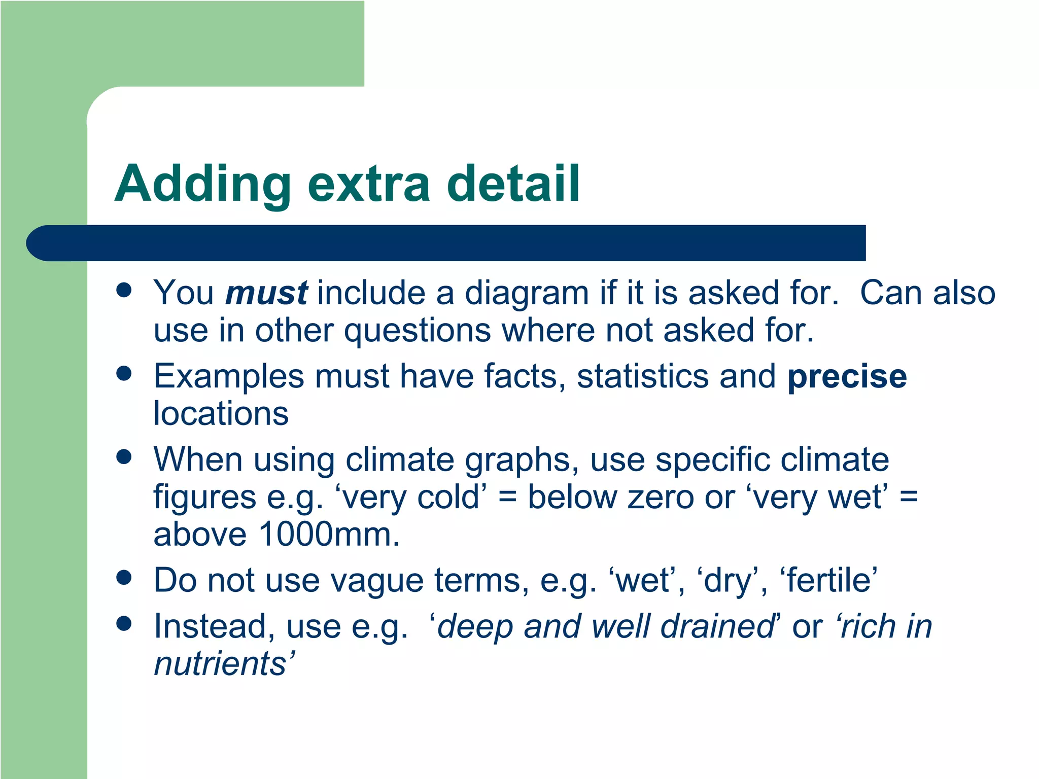
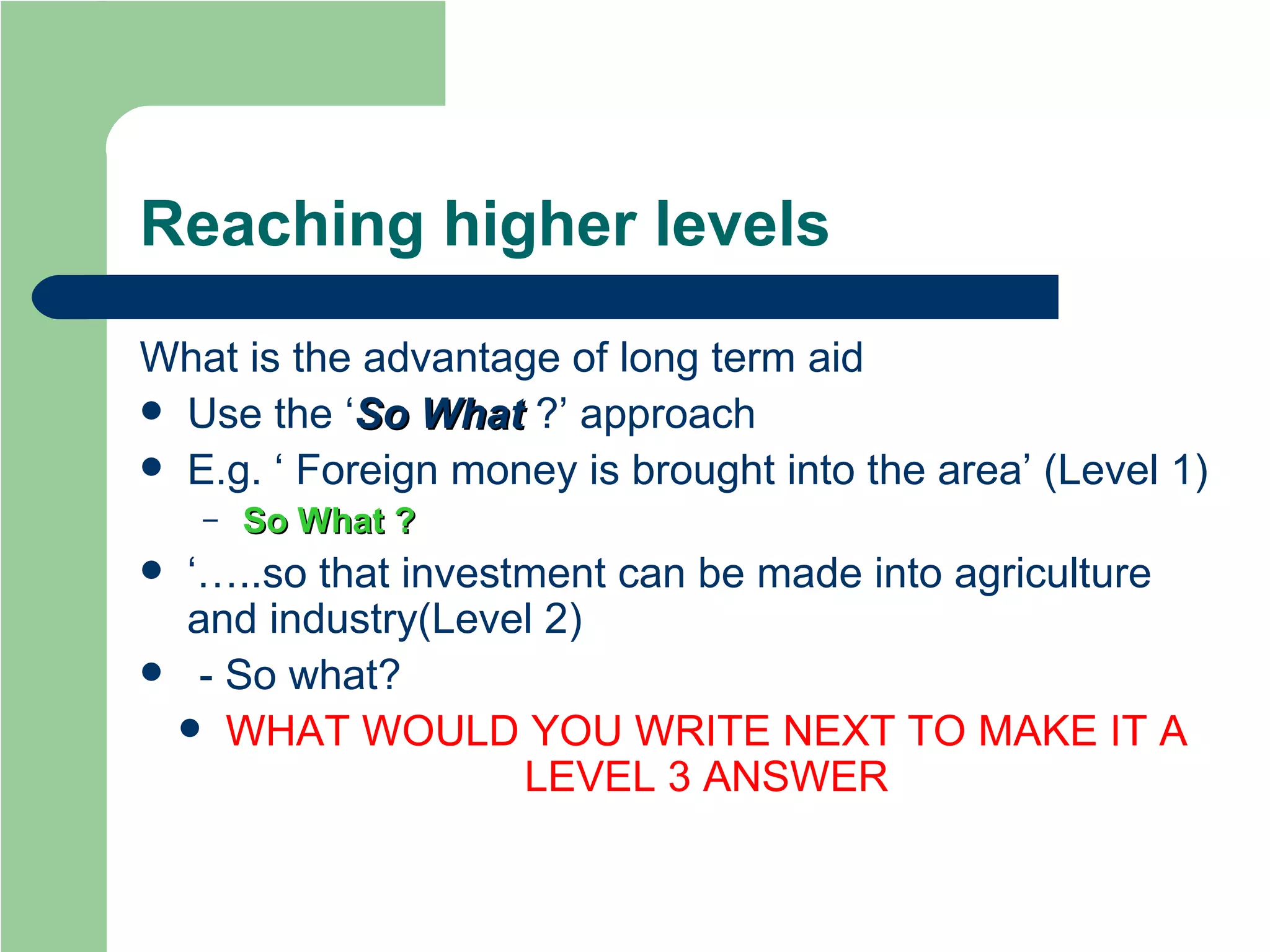
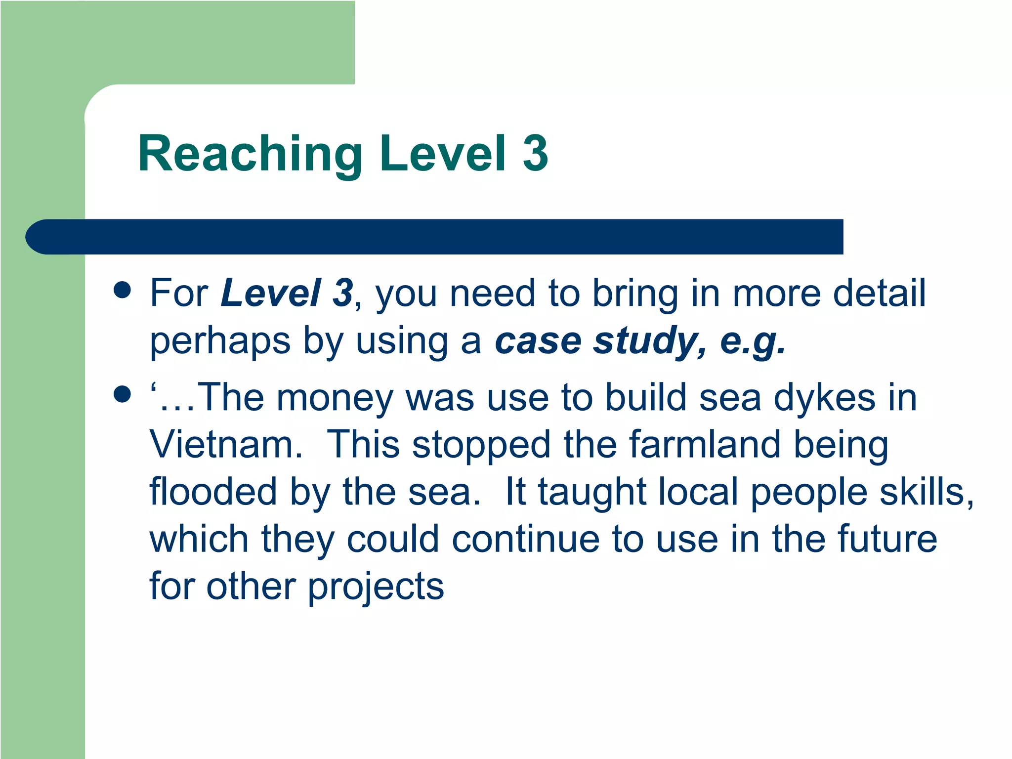
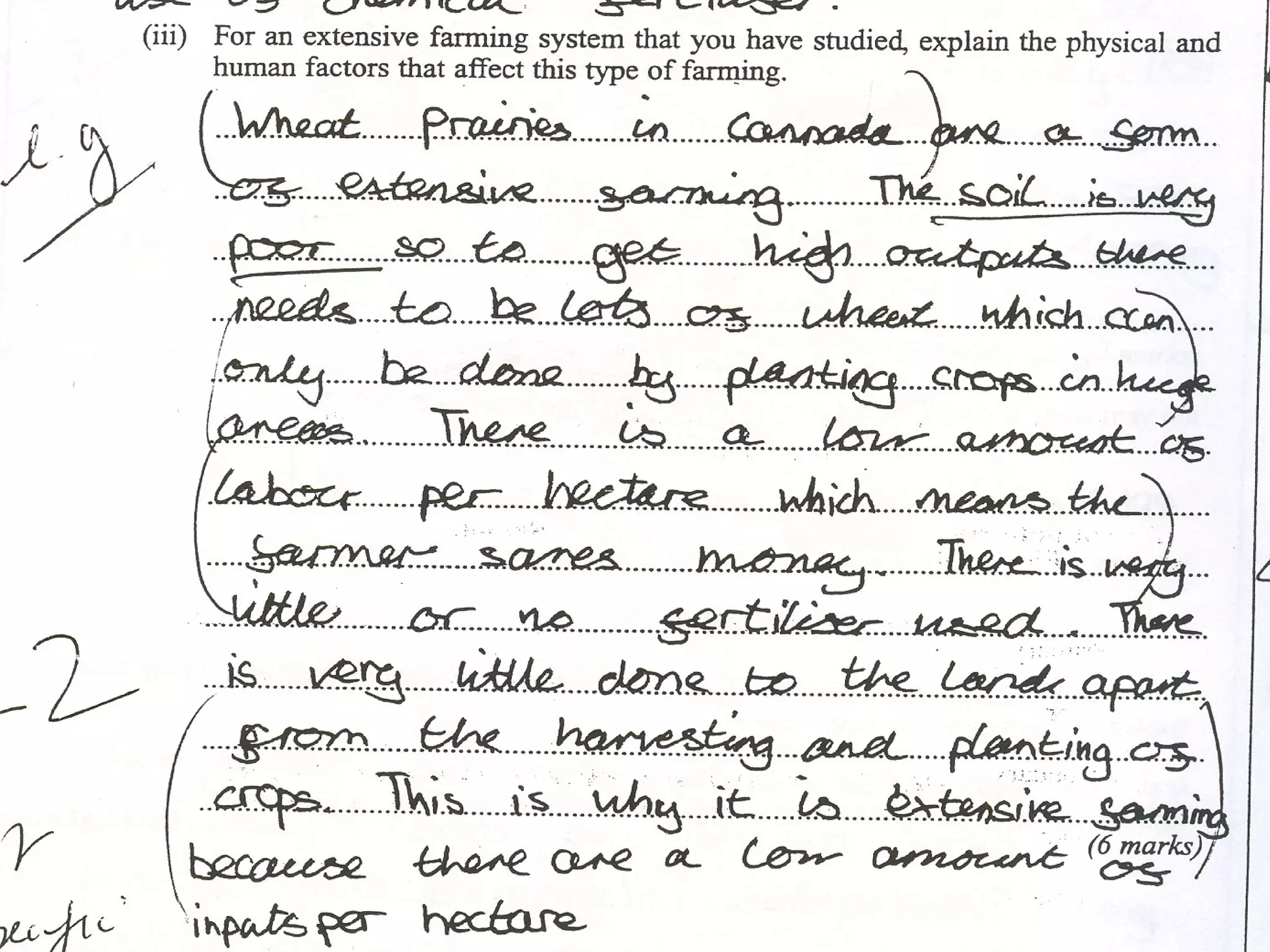
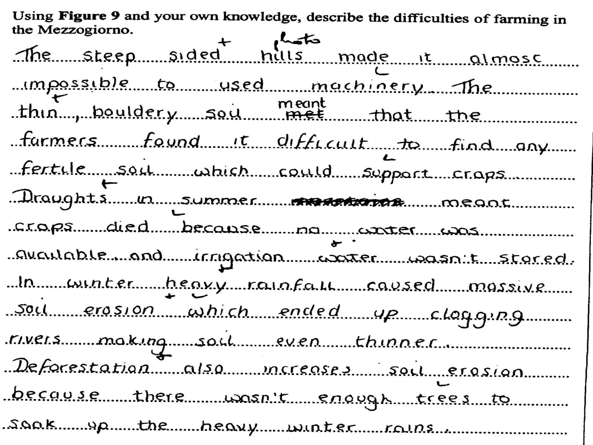
GCSE GEOGRAPHY REVISION Suggestions how you use the material you have learnt over the last two years to the best effect in the examination
Before you open the exam paper Read the information carefully on the front cover. Take notice of the instruction to use your case studies wherever possible
Open the exam booklet Don’t write anything yet! Read through the questions  Check if you need to use a  map  or  photo  sheet provided You may use them for more than one question.
What Next….? Now read through each question and highlight or  underline  the  command   word  – what is the question asking you to do?
Command words Write down what you can see Describe… Give reasons for (how?/why?) Explain… Add labels with details Annotate Write down  similarities   and   differences Compare… Make a list (e.g. bullet points) List… Write down State…
 
How are answers marked ? Point marking  – a mark is given for each specific point made, usually worth 4 or less marks e.g. ‘Give 3 reasons for…..’ Level marking  – an overall level is given for the  depth   of the answer  as a whole .  Level 1 – Basic and simple statements Level 2 – clear answers, some detail Level 3 – detailed, supporting evidence given/used.
Your answers Answers don’t have to be perfect to gain all the points or Level 3 Write something – have a go – you aren’t marked down for a wrong answer ! Don’t give the examiner a choice of answer – the first one is the one that will be marked
All questions will use….. MAPS  – use of the  scale ,  key ,  title DIAGRAMS   – use  of the  title, type  (cross section or sketch) GRAPHS   –  correct units ,  title , labelled  axes PHOTOS  –  title , using  grid  if provided.
When describing a  pattern … Look for the  general trend  of the graph e.g. ‘the temperature increases throughout the year from January to December’. Identify  specific values  e.g. ‘the maximum temperature is reached in December which is 27 o C Also note  exceptions  to the general pattern e.g. ‘however March doesn’t follow this trend, the temperature does not increase but falls to 13 o C during this month before increasing again in April’
 
Some Common Mistakes … Describing  when you have been asked to  explain Misreading the  scale  on a graph Not giving the  correct units  e.g. km, millions Giving individual  values  when asked to describe a  pattern  e.g. from a climate graph
What’s in a Question ?  Describe the causes and effects of inner city decline in a city you have studied  . Not  explain Need more than one cause Must have a case study Need more than one result
Now, have a go yourself….. Describe the effects of land reform and changes in farming practice on the land and the people of the Mezzogiorno
Now, have a go yourself….. “ Using an example of a flood in an MEDC, describe its effects on the land and the people.”
What makes a  good  answer ? Answer  all  parts of a question Must  use a case study if asked for but use case studies in any question to add detail (for a level 3 mark) be aware of  scale,  e.g. if asked to name a location … a country or a continent is too large! Don’t mix up  LEDC’s  and  MEDC’s
Adding extra detail You  must  include a diagram if it is asked for.  Can also use in other questions where not asked for. Examples must have facts, statistics and  precise  locations When using climate graphs, use specific climate figures e.g. ‘very cold’ = below zero or ‘very wet’ = above 1000mm. Do not use vague terms, e.g. ‘wet’, ‘dry’, ‘fertile’ Instead, use e.g.  ‘ deep and well drained ’ or  ‘rich in nutrients’
Reaching higher levels What is the advantage of long term aid Use the ‘ So What  ?’ approach E.g. ‘ Foreign money is brought into the area’ (Level 1) So What   ? ‘… ..so that investment can be made into agriculture and industry(Level 2) - So what? WHAT WOULD YOU WRITE NEXT TO MAKE IT A LEVEL 3 ANSWER
Reaching Level 3 For  Level 3 , you need to bring in more detail perhaps by using a  case study, e.g. ‘…The money was use to build sea dykes in Vietnam.  This stopped the farmland being flooded by the sea.  It taught local people skills, which they could continue to use in the future for other projects
Reaching Level 3 ‘…  For example, tourists from the UK visiting Kenya spend money on safari tours in game reserves such as Amboseli. This money is used to build hotels, providing jobs for local people as drivers, waiters and cleaners’ Look at the following answers one which was awarded level 3 and one that did not
 
Using case study knowledge Use your local knowledge and your coursework investigation to provide detail in your answer, e.g. use the names of local streets, shopping centres, rivers, valleys If your case study is too  general , you may not get more than a level 2!
Does Spelling Matter ? The quality of your geography determines what level you are given The spelling and grammar only affects your mark  within  the level
And Finally……. Good Luck !!!

How To Succeed At Gcse Geog

  • 1.
    GCSE GEOGRAPHY REVISIONSuggestions how you use the material you have learnt over the last two years to the best effect in the examination
  • 2.
    Before you openthe exam paper Read the information carefully on the front cover. Take notice of the instruction to use your case studies wherever possible
  • 3.
    Open the exambooklet Don’t write anything yet! Read through the questions Check if you need to use a map or photo sheet provided You may use them for more than one question.
  • 4.
    What Next….? Nowread through each question and highlight or underline the command word – what is the question asking you to do?
  • 5.
    Command words Writedown what you can see Describe… Give reasons for (how?/why?) Explain… Add labels with details Annotate Write down similarities and differences Compare… Make a list (e.g. bullet points) List… Write down State…
  • 6.
  • 7.
    How are answersmarked ? Point marking – a mark is given for each specific point made, usually worth 4 or less marks e.g. ‘Give 3 reasons for…..’ Level marking – an overall level is given for the depth of the answer as a whole . Level 1 – Basic and simple statements Level 2 – clear answers, some detail Level 3 – detailed, supporting evidence given/used.
  • 8.
    Your answers Answersdon’t have to be perfect to gain all the points or Level 3 Write something – have a go – you aren’t marked down for a wrong answer ! Don’t give the examiner a choice of answer – the first one is the one that will be marked
  • 9.
    All questions willuse….. MAPS – use of the scale , key , title DIAGRAMS – use of the title, type (cross section or sketch) GRAPHS – correct units , title , labelled axes PHOTOS – title , using grid if provided.
  • 10.
    When describing a pattern … Look for the general trend of the graph e.g. ‘the temperature increases throughout the year from January to December’. Identify specific values e.g. ‘the maximum temperature is reached in December which is 27 o C Also note exceptions to the general pattern e.g. ‘however March doesn’t follow this trend, the temperature does not increase but falls to 13 o C during this month before increasing again in April’
  • 11.
  • 12.
    Some Common Mistakes… Describing when you have been asked to explain Misreading the scale on a graph Not giving the correct units e.g. km, millions Giving individual values when asked to describe a pattern e.g. from a climate graph
  • 13.
    What’s in aQuestion ? Describe the causes and effects of inner city decline in a city you have studied . Not explain Need more than one cause Must have a case study Need more than one result
  • 14.
    Now, have ago yourself….. Describe the effects of land reform and changes in farming practice on the land and the people of the Mezzogiorno
  • 15.
    Now, have ago yourself….. “ Using an example of a flood in an MEDC, describe its effects on the land and the people.”
  • 16.
    What makes a good answer ? Answer all parts of a question Must use a case study if asked for but use case studies in any question to add detail (for a level 3 mark) be aware of scale, e.g. if asked to name a location … a country or a continent is too large! Don’t mix up LEDC’s and MEDC’s
  • 17.
    Adding extra detailYou must include a diagram if it is asked for. Can also use in other questions where not asked for. Examples must have facts, statistics and precise locations When using climate graphs, use specific climate figures e.g. ‘very cold’ = below zero or ‘very wet’ = above 1000mm. Do not use vague terms, e.g. ‘wet’, ‘dry’, ‘fertile’ Instead, use e.g. ‘ deep and well drained ’ or ‘rich in nutrients’
  • 18.
    Reaching higher levelsWhat is the advantage of long term aid Use the ‘ So What ?’ approach E.g. ‘ Foreign money is brought into the area’ (Level 1) So What ? ‘… ..so that investment can be made into agriculture and industry(Level 2) - So what? WHAT WOULD YOU WRITE NEXT TO MAKE IT A LEVEL 3 ANSWER
  • 19.
    Reaching Level 3For Level 3 , you need to bring in more detail perhaps by using a case study, e.g. ‘…The money was use to build sea dykes in Vietnam. This stopped the farmland being flooded by the sea. It taught local people skills, which they could continue to use in the future for other projects
  • 20.
    Reaching Level 3‘… For example, tourists from the UK visiting Kenya spend money on safari tours in game reserves such as Amboseli. This money is used to build hotels, providing jobs for local people as drivers, waiters and cleaners’ Look at the following answers one which was awarded level 3 and one that did not
  • 21.
  • 22.
    Using case studyknowledge Use your local knowledge and your coursework investigation to provide detail in your answer, e.g. use the names of local streets, shopping centres, rivers, valleys If your case study is too general , you may not get more than a level 2!
  • 23.
    Does Spelling Matter? The quality of your geography determines what level you are given The spelling and grammar only affects your mark within the level
  • 24.