SlideShare a Scribd company logo
1 of 26
Download to read offline
Wikimedia Italia
OpenStreetMap Italia
DRR and Geographic information
V-IOLA Project
Finale Emilia 2019 Sept.
Wikimedia Italia
http://www.wikimedia.it/
Wikimedia Italia is the italian chapter of the
no-profit Wikimedia Foundation.
Free information and culture for humankind
www.openstreetmap.org
OpenStreetMap is a worldwide collaborative project
The project that creates
and distributes
free geographic data
for the world
Better information
make
better decisions
Decisions sometimes are not easy
OpenStreetMap provides maps and data as well
Keep it simple stupid
Do you want many volunteers?
Keep the tasks as simple as possible
Why OpenStreetMap
Low cost tools
No special skills required
Local and remote volunteers
1% on the field can provide the
(sometimes raw) data to the ...
99% from remote
that can help working
on those data
Remote volunteers? Yes, please
They don’t interfere in field operations
They don’t feel the pressure
They can help whenever they can
They don’t have any cost
Simple tools
What is needed: a printer, a pencil, a
smartphone (or a scanner).
With Fieldpapers http://fieldpapers.org/
anyone can take down notes on
papers and other from remote can
transfer these note on a map.
For Mapillary (photo and video
collector) you need just a smartphone
with a decent camera.
A short recap about some Apps
FieldPapers http://fieldpapers.org
Vespucci https://vespucci.io
GeoPaparazzi on Play Google
OSM Contributor on Play Google
OsmAnd https://osmand.net/
Mapillary on Android and iOS store
OpenDataKit https://opendatakit.org/
Fieldpapers
Go to the website, create an atlas, go to the field
Easy to use, easy to contribute
The average tool is a smartphone with some apps.
This is Geopaparazzi, with input forms customizable
Mapillary
Mapillary doesn’t belong to OpenStreetMap project
Everyone can use it. On the Mapillary website ….
Mapillary
…. or through an OpenStreetMap editor
Mapillary
Without any effort you can collect a lot of data.
You can fix a smartphone on a car’s windshield
Be prepared!
Build your data infrastructure before emergencies happen
https://www.missingmaps.org/
Get OpenStreetMap data
Free data and maps always available to everyone
http://download.geofabrik.de/
From API etc...
Get OpenStreetMap data
https://export.hotosm.org
Humanitarian OpenStreetMap Team
https://hotosm.org
OpenStreetMap and the emergency
Collaborative tool for remote mapping
OpenStreetMap and the emergency
The day after we got updated satellite imagery and in a few hours we mapped
collapsed bridges, blocked roads and the first tent camps.
OpenStreetMap for several weeks was the only map with updated information.
United Nation open mapping project
The UN GIS unit has joined the OpenStreetMap community
and contribute to the project
mapping directly on OSM to make maps for U.N. missions
Best practises
Keep it open!
Whenever possible:
●
use open formats (e.g.: no Autocad DWG, …)
●
use open software: most of them don’t have license
fee so anybody can install and use
●
use open license (it makes reusable)
●
share data
●
publish data (not the confidentials of course)
Best practises
Keep in touch with local communities
Whenever possible:
Keeping a channel open with local communities help.
You should get a single point contact, instead of
manage hundreds contacts.
Activate H.O.T. tasks, they can provide validated data
in short times.
Thanks for your kindly attention
The simple rules in Openstreetmap are:
Don’t copy from data or maps not OdbL compatible
Have fun
Alessandro Palmas
United Nations G.I.S. consultant
(former) Project manager OpenStreetMap for Wikimedia Italia
OpenStreetMap mappers since Dec. 2007
@Ale_Zena_IT
This presentation is released under
Photos by: Alessandro Palmas, Francesco Giunta (@SotM2018)

More Related Content

What's hot

OpenStreetMap open data ecosystem between opportunities and legal conundrums
OpenStreetMap open data ecosystem between opportunities and legal conundrumsOpenStreetMap open data ecosystem between opportunities and legal conundrums
OpenStreetMap open data ecosystem between opportunities and legal conundrumsMaurizio Napolitano
 
OpenStreetMap Using, Tools, Services & Hows its changed Humanitarian Response
OpenStreetMap Using, Tools, Services & Hows its changed Humanitarian ResponseOpenStreetMap Using, Tools, Services & Hows its changed Humanitarian Response
OpenStreetMap Using, Tools, Services & Hows its changed Humanitarian Responsechippy
 
Introduction to OpenStreetMap and Humanitarian OSM Team for Plan Internationa...
Introduction to OpenStreetMap and Humanitarian OSM Team for Plan Internationa...Introduction to OpenStreetMap and Humanitarian OSM Team for Plan Internationa...
Introduction to OpenStreetMap and Humanitarian OSM Team for Plan Internationa...chippy
 
Haiti Qake2010 Bar Camp Canberra2010
Haiti Qake2010 Bar Camp Canberra2010Haiti Qake2010 Bar Camp Canberra2010
Haiti Qake2010 Bar Camp Canberra2010Shoaib Burq
 
Is there a new cartography? - icc2013
Is there a new cartography? - icc2013Is there a new cartography? - icc2013
Is there a new cartography? - icc2013Steve Chilton
 
Leeds Data Thing OpenStreetMap and Other Geo Visualization Stuff
Leeds Data Thing OpenStreetMap and Other Geo Visualization StuffLeeds Data Thing OpenStreetMap and Other Geo Visualization Stuff
Leeds Data Thing OpenStreetMap and Other Geo Visualization Stuffchippy
 
OSM di Indonesia 2011-2016
OSM di Indonesia 2011-2016OSM di Indonesia 2011-2016
OSM di Indonesia 2011-2016Yantisa Akhadi
 
#CRISIS: USING SOCIAL MEDIA AS COMMUNICATION TOOLS IN HUMANITARIAN RESPONSE S...
#CRISIS: USING SOCIAL MEDIA AS COMMUNICATION TOOLS IN HUMANITARIAN RESPONSE S...#CRISIS: USING SOCIAL MEDIA AS COMMUNICATION TOOLS IN HUMANITARIAN RESPONSE S...
#CRISIS: USING SOCIAL MEDIA AS COMMUNICATION TOOLS IN HUMANITARIAN RESPONSE S...Alex Spiers
 
THE WIKIPEDIA OF MAPPING: Open- streetmaps!
THE WIKIPEDIA OF MAPPING: Open- streetmaps! THE WIKIPEDIA OF MAPPING: Open- streetmaps!
THE WIKIPEDIA OF MAPPING: Open- streetmaps! kerrygallivan
 
Waag Society overview UNDP
Waag Society overview UNDPWaag Society overview UNDP
Waag Society overview UNDPIvonne Jansen
 
Working with hot for community mapping pilot in
Working with hot for community mapping pilot inWorking with hot for community mapping pilot in
Working with hot for community mapping pilot inEmir Hartato
 

What's hot (16)

OpenStreetMap open data ecosystem between opportunities and legal conundrums
OpenStreetMap open data ecosystem between opportunities and legal conundrumsOpenStreetMap open data ecosystem between opportunities and legal conundrums
OpenStreetMap open data ecosystem between opportunities and legal conundrums
 
PoliMappers
PoliMappers PoliMappers
PoliMappers
 
OpenStreetMap Using, Tools, Services & Hows its changed Humanitarian Response
OpenStreetMap Using, Tools, Services & Hows its changed Humanitarian ResponseOpenStreetMap Using, Tools, Services & Hows its changed Humanitarian Response
OpenStreetMap Using, Tools, Services & Hows its changed Humanitarian Response
 
Atlas of Innovation Spaces
Atlas of Innovation SpacesAtlas of Innovation Spaces
Atlas of Innovation Spaces
 
Introduction to OpenStreetMap and Humanitarian OSM Team for Plan Internationa...
Introduction to OpenStreetMap and Humanitarian OSM Team for Plan Internationa...Introduction to OpenStreetMap and Humanitarian OSM Team for Plan Internationa...
Introduction to OpenStreetMap and Humanitarian OSM Team for Plan Internationa...
 
Haiti Qake2010 Bar Camp Canberra2010
Haiti Qake2010 Bar Camp Canberra2010Haiti Qake2010 Bar Camp Canberra2010
Haiti Qake2010 Bar Camp Canberra2010
 
Is there a new cartography? - icc2013
Is there a new cartography? - icc2013Is there a new cartography? - icc2013
Is there a new cartography? - icc2013
 
GEM's Mission and Vision [Sep 2012]
GEM's Mission and Vision [Sep 2012]GEM's Mission and Vision [Sep 2012]
GEM's Mission and Vision [Sep 2012]
 
Leeds Data Thing OpenStreetMap and Other Geo Visualization Stuff
Leeds Data Thing OpenStreetMap and Other Geo Visualization StuffLeeds Data Thing OpenStreetMap and Other Geo Visualization Stuff
Leeds Data Thing OpenStreetMap and Other Geo Visualization Stuff
 
OSM di Indonesia 2011-2016
OSM di Indonesia 2011-2016OSM di Indonesia 2011-2016
OSM di Indonesia 2011-2016
 
#CRISIS: USING SOCIAL MEDIA AS COMMUNICATION TOOLS IN HUMANITARIAN RESPONSE S...
#CRISIS: USING SOCIAL MEDIA AS COMMUNICATION TOOLS IN HUMANITARIAN RESPONSE S...#CRISIS: USING SOCIAL MEDIA AS COMMUNICATION TOOLS IN HUMANITARIAN RESPONSE S...
#CRISIS: USING SOCIAL MEDIA AS COMMUNICATION TOOLS IN HUMANITARIAN RESPONSE S...
 
Crisis Mapping
Crisis MappingCrisis Mapping
Crisis Mapping
 
Whats neo?
Whats neo?Whats neo?
Whats neo?
 
THE WIKIPEDIA OF MAPPING: Open- streetmaps!
THE WIKIPEDIA OF MAPPING: Open- streetmaps! THE WIKIPEDIA OF MAPPING: Open- streetmaps!
THE WIKIPEDIA OF MAPPING: Open- streetmaps!
 
Waag Society overview UNDP
Waag Society overview UNDPWaag Society overview UNDP
Waag Society overview UNDP
 
Working with hot for community mapping pilot in
Working with hot for community mapping pilot inWorking with hot for community mapping pilot in
Working with hot for community mapping pilot in
 

Similar to 2019 09 - drr and geographic information - wikimedia italia presentation

Philippine Geospatial Forum Presentation 20130311
Philippine Geospatial Forum Presentation 20130311Philippine Geospatial Forum Presentation 20130311
Philippine Geospatial Forum Presentation 20130311esambale
 
OpenStreetMap (OSM): Mapping from the crowd and on the field open data prepa...
OpenStreetMap (OSM):  Mapping from the crowd and on the field open data prepa...OpenStreetMap (OSM):  Mapping from the crowd and on the field open data prepa...
OpenStreetMap (OSM): Mapping from the crowd and on the field open data prepa...Severin Menard
 
HOT OSM Community mapping in Lower Shire, Malawi
HOT OSM Community mapping in Lower Shire, MalawiHOT OSM Community mapping in Lower Shire, Malawi
HOT OSM Community mapping in Lower Shire, MalawiSeverin Menard
 
Open Geo Data in Italy and the OpenStreetMap case
Open Geo Data in Italy and the OpenStreetMap caseOpen Geo Data in Italy and the OpenStreetMap case
Open Geo Data in Italy and the OpenStreetMap caseMaurizio Napolitano
 
Participatory mapping with OSM in Ulan Bator, Mongolia: general presentation ...
Participatory mapping with OSM in Ulan Bator, Mongolia: general presentation ...Participatory mapping with OSM in Ulan Bator, Mongolia: general presentation ...
Participatory mapping with OSM in Ulan Bator, Mongolia: general presentation ...Severin Menard
 
GA 2015 Digital Earth Workshop
GA 2015 Digital Earth WorkshopGA 2015 Digital Earth Workshop
GA 2015 Digital Earth WorkshopKarl Donert
 
How Crowdsourcing Changed Disaster Relief Forever (Web 2.0 Summit Ignite vers...
How Crowdsourcing Changed Disaster Relief Forever (Web 2.0 Summit Ignite vers...How Crowdsourcing Changed Disaster Relief Forever (Web 2.0 Summit Ignite vers...
How Crowdsourcing Changed Disaster Relief Forever (Web 2.0 Summit Ignite vers...Schuyler Erle
 
H.O.T at UNGIWG 10
H.O.T at UNGIWG 10H.O.T at UNGIWG 10
H.O.T at UNGIWG 10mikel_maron
 
OpenStreetMap-Introduction
OpenStreetMap-IntroductionOpenStreetMap-Introduction
OpenStreetMap-IntroductionPhilippe Rieffel
 
Openstreetmap and its value during emergencies
Openstreetmap and its value during emergenciesOpenstreetmap and its value during emergencies
Openstreetmap and its value during emergenciesErvin Malicdem
 
GeoForAll: a successful OSGeo Initiative
GeoForAll: a successful OSGeo InitiativeGeoForAll: a successful OSGeo Initiative
GeoForAll: a successful OSGeo InitiativeMaria Antonia Brovelli
 
Crowd Soucing And VGI
Crowd Soucing And VGICrowd Soucing And VGI
Crowd Soucing And VGIpentadij
 
Talk: "Using Open Data and Crowdsourcing to develop CycleStreets"
Talk: "Using Open Data and Crowdsourcing to develop CycleStreets"Talk: "Using Open Data and Crowdsourcing to develop CycleStreets"
Talk: "Using Open Data and Crowdsourcing to develop CycleStreets"CycleStreets
 
OpenStreetMap and CycleStreets: collaborative map-making and cartography in t...
OpenStreetMap and CycleStreets: collaborative map-making and cartography in t...OpenStreetMap and CycleStreets: collaborative map-making and cartography in t...
OpenStreetMap and CycleStreets: collaborative map-making and cartography in t...CycleStreets
 
Introduction to OpenStreetMap, its extracts, and relation to Project NOAH
Introduction to OpenStreetMap, its extracts, and relation to Project NOAHIntroduction to OpenStreetMap, its extracts, and relation to Project NOAH
Introduction to OpenStreetMap, its extracts, and relation to Project NOAHErvin Malicdem
 
Map kathmandu osm nepal presentation - public
Map kathmandu osm nepal presentation - publicMap kathmandu osm nepal presentation - public
Map kathmandu osm nepal presentation - publicRajeev Amatya
 
OpenStreetMap at Wikimania
OpenStreetMap at WikimaniaOpenStreetMap at Wikimania
OpenStreetMap at Wikimaniamikel_maron
 
The Golden Age of GIS - Keynote for GIS day 2019
The Golden Age of GIS - Keynote for GIS day 2019The Golden Age of GIS - Keynote for GIS day 2019
The Golden Age of GIS - Keynote for GIS day 2019Martijn van Exel
 
13th UNGIWG Plenary Meeting - Introduction to OpenStreetMap
13th UNGIWG Plenary Meeting - Introduction to OpenStreetMap13th UNGIWG Plenary Meeting - Introduction to OpenStreetMap
13th UNGIWG Plenary Meeting - Introduction to OpenStreetMapOrkut Murat Yılmaz
 

Similar to 2019 09 - drr and geographic information - wikimedia italia presentation (20)

Philippine Geospatial Forum Presentation 20130311
Philippine Geospatial Forum Presentation 20130311Philippine Geospatial Forum Presentation 20130311
Philippine Geospatial Forum Presentation 20130311
 
OpenStreetMap (OSM): Mapping from the crowd and on the field open data prepa...
OpenStreetMap (OSM):  Mapping from the crowd and on the field open data prepa...OpenStreetMap (OSM):  Mapping from the crowd and on the field open data prepa...
OpenStreetMap (OSM): Mapping from the crowd and on the field open data prepa...
 
HOT OSM Community mapping in Lower Shire, Malawi
HOT OSM Community mapping in Lower Shire, MalawiHOT OSM Community mapping in Lower Shire, Malawi
HOT OSM Community mapping in Lower Shire, Malawi
 
Open Geo Data in Italy and the OpenStreetMap case
Open Geo Data in Italy and the OpenStreetMap caseOpen Geo Data in Italy and the OpenStreetMap case
Open Geo Data in Italy and the OpenStreetMap case
 
Participatory mapping with OSM in Ulan Bator, Mongolia: general presentation ...
Participatory mapping with OSM in Ulan Bator, Mongolia: general presentation ...Participatory mapping with OSM in Ulan Bator, Mongolia: general presentation ...
Participatory mapping with OSM in Ulan Bator, Mongolia: general presentation ...
 
OpenStreetMap
OpenStreetMapOpenStreetMap
OpenStreetMap
 
GA 2015 Digital Earth Workshop
GA 2015 Digital Earth WorkshopGA 2015 Digital Earth Workshop
GA 2015 Digital Earth Workshop
 
How Crowdsourcing Changed Disaster Relief Forever (Web 2.0 Summit Ignite vers...
How Crowdsourcing Changed Disaster Relief Forever (Web 2.0 Summit Ignite vers...How Crowdsourcing Changed Disaster Relief Forever (Web 2.0 Summit Ignite vers...
How Crowdsourcing Changed Disaster Relief Forever (Web 2.0 Summit Ignite vers...
 
H.O.T at UNGIWG 10
H.O.T at UNGIWG 10H.O.T at UNGIWG 10
H.O.T at UNGIWG 10
 
OpenStreetMap-Introduction
OpenStreetMap-IntroductionOpenStreetMap-Introduction
OpenStreetMap-Introduction
 
Openstreetmap and its value during emergencies
Openstreetmap and its value during emergenciesOpenstreetmap and its value during emergencies
Openstreetmap and its value during emergencies
 
GeoForAll: a successful OSGeo Initiative
GeoForAll: a successful OSGeo InitiativeGeoForAll: a successful OSGeo Initiative
GeoForAll: a successful OSGeo Initiative
 
Crowd Soucing And VGI
Crowd Soucing And VGICrowd Soucing And VGI
Crowd Soucing And VGI
 
Talk: "Using Open Data and Crowdsourcing to develop CycleStreets"
Talk: "Using Open Data and Crowdsourcing to develop CycleStreets"Talk: "Using Open Data and Crowdsourcing to develop CycleStreets"
Talk: "Using Open Data and Crowdsourcing to develop CycleStreets"
 
OpenStreetMap and CycleStreets: collaborative map-making and cartography in t...
OpenStreetMap and CycleStreets: collaborative map-making and cartography in t...OpenStreetMap and CycleStreets: collaborative map-making and cartography in t...
OpenStreetMap and CycleStreets: collaborative map-making and cartography in t...
 
Introduction to OpenStreetMap, its extracts, and relation to Project NOAH
Introduction to OpenStreetMap, its extracts, and relation to Project NOAHIntroduction to OpenStreetMap, its extracts, and relation to Project NOAH
Introduction to OpenStreetMap, its extracts, and relation to Project NOAH
 
Map kathmandu osm nepal presentation - public
Map kathmandu osm nepal presentation - publicMap kathmandu osm nepal presentation - public
Map kathmandu osm nepal presentation - public
 
OpenStreetMap at Wikimania
OpenStreetMap at WikimaniaOpenStreetMap at Wikimania
OpenStreetMap at Wikimania
 
The Golden Age of GIS - Keynote for GIS day 2019
The Golden Age of GIS - Keynote for GIS day 2019The Golden Age of GIS - Keynote for GIS day 2019
The Golden Age of GIS - Keynote for GIS day 2019
 
13th UNGIWG Plenary Meeting - Introduction to OpenStreetMap
13th UNGIWG Plenary Meeting - Introduction to OpenStreetMap13th UNGIWG Plenary Meeting - Introduction to OpenStreetMap
13th UNGIWG Plenary Meeting - Introduction to OpenStreetMap
 

More from Ale ZenaIT

Torino 20171014 presentazione OpenStreetMap
Torino 20171014 presentazione OpenStreetMapTorino 20171014 presentazione OpenStreetMap
Torino 20171014 presentazione OpenStreetMapAle ZenaIT
 
Public archeology - Verona 2017-05-18
Public archeology - Verona 2017-05-18Public archeology - Verona 2017-05-18
Public archeology - Verona 2017-05-18Ale ZenaIT
 
Cai2017 intervento - OpenStreetMap in montagna
Cai2017  intervento - OpenStreetMap in montagnaCai2017  intervento - OpenStreetMap in montagna
Cai2017 intervento - OpenStreetMap in montagnaAle ZenaIT
 
Cai 2017 workshop - introduzione a OpenStreetMap e operazioni di editing
Cai 2017 workshop - introduzione a OpenStreetMap e operazioni di editingCai 2017 workshop - introduzione a OpenStreetMap e operazioni di editing
Cai 2017 workshop - introduzione a OpenStreetMap e operazioni di editingAle ZenaIT
 
Festival delle geografie - Levanto 7 aprile 2017 - OpenStreetMap
Festival delle geografie - Levanto 7 aprile 2017 - OpenStreetMapFestival delle geografie - Levanto 7 aprile 2017 - OpenStreetMap
Festival delle geografie - Levanto 7 aprile 2017 - OpenStreetMapAle ZenaIT
 
Parma al centro 2017 02-16
Parma al centro 2017 02-16Parma al centro 2017 02-16
Parma al centro 2017 02-16Ale ZenaIT
 
Foss4g 2017 introduzione a openstreetmap
Foss4g 2017  introduzione a openstreetmapFoss4g 2017  introduzione a openstreetmap
Foss4g 2017 introduzione a openstreetmapAle ZenaIT
 
FOSS4g-IT 2017 editing avanzato in openstreetmap
FOSS4g-IT 2017 editing avanzato in openstreetmapFOSS4g-IT 2017 editing avanzato in openstreetmap
FOSS4g-IT 2017 editing avanzato in openstreetmapAle ZenaIT
 
CIMA Foundation - 1 dicembre 2016 - seconda parte
CIMA Foundation - 1 dicembre 2016 - seconda parteCIMA Foundation - 1 dicembre 2016 - seconda parte
CIMA Foundation - 1 dicembre 2016 - seconda parteAle ZenaIT
 
CIMA Foundation - presentazione 1 dicembre 2016 - prima parte
CIMA Foundation - presentazione  1 dicembre 2016 - prima parteCIMA Foundation - presentazione  1 dicembre 2016 - prima parte
CIMA Foundation - presentazione 1 dicembre 2016 - prima parteAle ZenaIT
 
Linux day 2016 - Genova
Linux day 2016 - GenovaLinux day 2016 - Genova
Linux day 2016 - GenovaAle ZenaIT
 
Introduzione al progetto OpenStreetMap - Mappalonga2016
 Introduzione al progetto OpenStreetMap - Mappalonga2016 Introduzione al progetto OpenStreetMap - Mappalonga2016
Introduzione al progetto OpenStreetMap - Mappalonga2016Ale ZenaIT
 
OpenStreetMap, mappare e raccontare il territorio polimi 2015-12-03
OpenStreetMap, mappare e raccontare il territorio polimi 2015-12-03OpenStreetMap, mappare e raccontare il territorio polimi 2015-12-03
OpenStreetMap, mappare e raccontare il territorio polimi 2015-12-03Ale ZenaIT
 
Open Genova - Corso Mappatura: usare i dati OpenStreetMap e creare mappe
Open Genova - Corso Mappatura: usare i dati OpenStreetMap e creare mappeOpen Genova - Corso Mappatura: usare i dati OpenStreetMap e creare mappe
Open Genova - Corso Mappatura: usare i dati OpenStreetMap e creare mappeAle ZenaIT
 
Open Genova - Corso Mappatura: inserire e modificare dati su OpenStreetMap
Open Genova - Corso Mappatura: inserire e modificare dati su OpenStreetMapOpen Genova - Corso Mappatura: inserire e modificare dati su OpenStreetMap
Open Genova - Corso Mappatura: inserire e modificare dati su OpenStreetMapAle ZenaIT
 
Open Genova - Corso Mappatura: introduzione
Open Genova - Corso Mappatura: introduzioneOpen Genova - Corso Mappatura: introduzione
Open Genova - Corso Mappatura: introduzioneAle ZenaIT
 
Open Genova - Corso Mappatura: raccolta dati
Open Genova - Corso Mappatura: raccolta datiOpen Genova - Corso Mappatura: raccolta dati
Open Genova - Corso Mappatura: raccolta datiAle ZenaIT
 
Linux day 2014 utilizzo dati geografici aperti
Linux day 2014 utilizzo dati geografici apertiLinux day 2014 utilizzo dati geografici aperti
Linux day 2014 utilizzo dati geografici apertiAle ZenaIT
 
Openstreetmap la libertà nelle mappe - Linux Day 2013 di Genova
Openstreetmap la libertà nelle mappe  - Linux Day 2013 di GenovaOpenstreetmap la libertà nelle mappe  - Linux Day 2013 di Genova
Openstreetmap la libertà nelle mappe - Linux Day 2013 di GenovaAle ZenaIT
 
Introduzione a openstreetmap - LUG Govonis - Valleggia (SV) 15.06.2013
Introduzione a openstreetmap - LUG Govonis - Valleggia (SV) 15.06.2013Introduzione a openstreetmap - LUG Govonis - Valleggia (SV) 15.06.2013
Introduzione a openstreetmap - LUG Govonis - Valleggia (SV) 15.06.2013Ale ZenaIT
 

More from Ale ZenaIT (20)

Torino 20171014 presentazione OpenStreetMap
Torino 20171014 presentazione OpenStreetMapTorino 20171014 presentazione OpenStreetMap
Torino 20171014 presentazione OpenStreetMap
 
Public archeology - Verona 2017-05-18
Public archeology - Verona 2017-05-18Public archeology - Verona 2017-05-18
Public archeology - Verona 2017-05-18
 
Cai2017 intervento - OpenStreetMap in montagna
Cai2017  intervento - OpenStreetMap in montagnaCai2017  intervento - OpenStreetMap in montagna
Cai2017 intervento - OpenStreetMap in montagna
 
Cai 2017 workshop - introduzione a OpenStreetMap e operazioni di editing
Cai 2017 workshop - introduzione a OpenStreetMap e operazioni di editingCai 2017 workshop - introduzione a OpenStreetMap e operazioni di editing
Cai 2017 workshop - introduzione a OpenStreetMap e operazioni di editing
 
Festival delle geografie - Levanto 7 aprile 2017 - OpenStreetMap
Festival delle geografie - Levanto 7 aprile 2017 - OpenStreetMapFestival delle geografie - Levanto 7 aprile 2017 - OpenStreetMap
Festival delle geografie - Levanto 7 aprile 2017 - OpenStreetMap
 
Parma al centro 2017 02-16
Parma al centro 2017 02-16Parma al centro 2017 02-16
Parma al centro 2017 02-16
 
Foss4g 2017 introduzione a openstreetmap
Foss4g 2017  introduzione a openstreetmapFoss4g 2017  introduzione a openstreetmap
Foss4g 2017 introduzione a openstreetmap
 
FOSS4g-IT 2017 editing avanzato in openstreetmap
FOSS4g-IT 2017 editing avanzato in openstreetmapFOSS4g-IT 2017 editing avanzato in openstreetmap
FOSS4g-IT 2017 editing avanzato in openstreetmap
 
CIMA Foundation - 1 dicembre 2016 - seconda parte
CIMA Foundation - 1 dicembre 2016 - seconda parteCIMA Foundation - 1 dicembre 2016 - seconda parte
CIMA Foundation - 1 dicembre 2016 - seconda parte
 
CIMA Foundation - presentazione 1 dicembre 2016 - prima parte
CIMA Foundation - presentazione  1 dicembre 2016 - prima parteCIMA Foundation - presentazione  1 dicembre 2016 - prima parte
CIMA Foundation - presentazione 1 dicembre 2016 - prima parte
 
Linux day 2016 - Genova
Linux day 2016 - GenovaLinux day 2016 - Genova
Linux day 2016 - Genova
 
Introduzione al progetto OpenStreetMap - Mappalonga2016
 Introduzione al progetto OpenStreetMap - Mappalonga2016 Introduzione al progetto OpenStreetMap - Mappalonga2016
Introduzione al progetto OpenStreetMap - Mappalonga2016
 
OpenStreetMap, mappare e raccontare il territorio polimi 2015-12-03
OpenStreetMap, mappare e raccontare il territorio polimi 2015-12-03OpenStreetMap, mappare e raccontare il territorio polimi 2015-12-03
OpenStreetMap, mappare e raccontare il territorio polimi 2015-12-03
 
Open Genova - Corso Mappatura: usare i dati OpenStreetMap e creare mappe
Open Genova - Corso Mappatura: usare i dati OpenStreetMap e creare mappeOpen Genova - Corso Mappatura: usare i dati OpenStreetMap e creare mappe
Open Genova - Corso Mappatura: usare i dati OpenStreetMap e creare mappe
 
Open Genova - Corso Mappatura: inserire e modificare dati su OpenStreetMap
Open Genova - Corso Mappatura: inserire e modificare dati su OpenStreetMapOpen Genova - Corso Mappatura: inserire e modificare dati su OpenStreetMap
Open Genova - Corso Mappatura: inserire e modificare dati su OpenStreetMap
 
Open Genova - Corso Mappatura: introduzione
Open Genova - Corso Mappatura: introduzioneOpen Genova - Corso Mappatura: introduzione
Open Genova - Corso Mappatura: introduzione
 
Open Genova - Corso Mappatura: raccolta dati
Open Genova - Corso Mappatura: raccolta datiOpen Genova - Corso Mappatura: raccolta dati
Open Genova - Corso Mappatura: raccolta dati
 
Linux day 2014 utilizzo dati geografici aperti
Linux day 2014 utilizzo dati geografici apertiLinux day 2014 utilizzo dati geografici aperti
Linux day 2014 utilizzo dati geografici aperti
 
Openstreetmap la libertà nelle mappe - Linux Day 2013 di Genova
Openstreetmap la libertà nelle mappe  - Linux Day 2013 di GenovaOpenstreetmap la libertà nelle mappe  - Linux Day 2013 di Genova
Openstreetmap la libertà nelle mappe - Linux Day 2013 di Genova
 
Introduzione a openstreetmap - LUG Govonis - Valleggia (SV) 15.06.2013
Introduzione a openstreetmap - LUG Govonis - Valleggia (SV) 15.06.2013Introduzione a openstreetmap - LUG Govonis - Valleggia (SV) 15.06.2013
Introduzione a openstreetmap - LUG Govonis - Valleggia (SV) 15.06.2013
 

Recently uploaded

Designing IA for AI - Information Architecture Conference 2024
Designing IA for AI - Information Architecture Conference 2024Designing IA for AI - Information Architecture Conference 2024
Designing IA for AI - Information Architecture Conference 2024Enterprise Knowledge
 
Tech-Forward - Achieving Business Readiness For Copilot in Microsoft 365
Tech-Forward - Achieving Business Readiness For Copilot in Microsoft 365Tech-Forward - Achieving Business Readiness For Copilot in Microsoft 365
Tech-Forward - Achieving Business Readiness For Copilot in Microsoft 3652toLead Limited
 
SQL Database Design For Developers at php[tek] 2024
SQL Database Design For Developers at php[tek] 2024SQL Database Design For Developers at php[tek] 2024
SQL Database Design For Developers at php[tek] 2024Scott Keck-Warren
 
Scanning the Internet for External Cloud Exposures via SSL Certs
Scanning the Internet for External Cloud Exposures via SSL CertsScanning the Internet for External Cloud Exposures via SSL Certs
Scanning the Internet for External Cloud Exposures via SSL CertsRizwan Syed
 
Benefits Of Flutter Compared To Other Frameworks
Benefits Of Flutter Compared To Other FrameworksBenefits Of Flutter Compared To Other Frameworks
Benefits Of Flutter Compared To Other FrameworksSoftradix Technologies
 
Unleash Your Potential - Namagunga Girls Coding Club
Unleash Your Potential - Namagunga Girls Coding ClubUnleash Your Potential - Namagunga Girls Coding Club
Unleash Your Potential - Namagunga Girls Coding ClubKalema Edgar
 
Key Features Of Token Development (1).pptx
Key  Features Of Token  Development (1).pptxKey  Features Of Token  Development (1).pptx
Key Features Of Token Development (1).pptxLBM Solutions
 
Vertex AI Gemini Prompt Engineering Tips
Vertex AI Gemini Prompt Engineering TipsVertex AI Gemini Prompt Engineering Tips
Vertex AI Gemini Prompt Engineering TipsMiki Katsuragi
 
New from BookNet Canada for 2024: BNC BiblioShare - Tech Forum 2024
New from BookNet Canada for 2024: BNC BiblioShare - Tech Forum 2024New from BookNet Canada for 2024: BNC BiblioShare - Tech Forum 2024
New from BookNet Canada for 2024: BNC BiblioShare - Tech Forum 2024BookNet Canada
 
Gen AI in Business - Global Trends Report 2024.pdf
Gen AI in Business - Global Trends Report 2024.pdfGen AI in Business - Global Trends Report 2024.pdf
Gen AI in Business - Global Trends Report 2024.pdfAddepto
 
Science&tech:THE INFORMATION AGE STS.pdf
Science&tech:THE INFORMATION AGE STS.pdfScience&tech:THE INFORMATION AGE STS.pdf
Science&tech:THE INFORMATION AGE STS.pdfjimielynbastida
 
Install Stable Diffusion in windows machine
Install Stable Diffusion in windows machineInstall Stable Diffusion in windows machine
Install Stable Diffusion in windows machinePadma Pradeep
 
Bluetooth Controlled Car with Arduino.pdf
Bluetooth Controlled Car with Arduino.pdfBluetooth Controlled Car with Arduino.pdf
Bluetooth Controlled Car with Arduino.pdfngoud9212
 
Understanding the Laravel MVC Architecture
Understanding the Laravel MVC ArchitectureUnderstanding the Laravel MVC Architecture
Understanding the Laravel MVC ArchitecturePixlogix Infotech
 
Connect Wave/ connectwave Pitch Deck Presentation
Connect Wave/ connectwave Pitch Deck PresentationConnect Wave/ connectwave Pitch Deck Presentation
Connect Wave/ connectwave Pitch Deck PresentationSlibray Presentation
 
Tampa BSides - Chef's Tour of Microsoft Security Adoption Framework (SAF)
Tampa BSides - Chef's Tour of Microsoft Security Adoption Framework (SAF)Tampa BSides - Chef's Tour of Microsoft Security Adoption Framework (SAF)
Tampa BSides - Chef's Tour of Microsoft Security Adoption Framework (SAF)Mark Simos
 
CloudStudio User manual (basic edition):
CloudStudio User manual (basic edition):CloudStudio User manual (basic edition):
CloudStudio User manual (basic edition):comworks
 

Recently uploaded (20)

Designing IA for AI - Information Architecture Conference 2024
Designing IA for AI - Information Architecture Conference 2024Designing IA for AI - Information Architecture Conference 2024
Designing IA for AI - Information Architecture Conference 2024
 
DMCC Future of Trade Web3 - Special Edition
DMCC Future of Trade Web3 - Special EditionDMCC Future of Trade Web3 - Special Edition
DMCC Future of Trade Web3 - Special Edition
 
Tech-Forward - Achieving Business Readiness For Copilot in Microsoft 365
Tech-Forward - Achieving Business Readiness For Copilot in Microsoft 365Tech-Forward - Achieving Business Readiness For Copilot in Microsoft 365
Tech-Forward - Achieving Business Readiness For Copilot in Microsoft 365
 
SQL Database Design For Developers at php[tek] 2024
SQL Database Design For Developers at php[tek] 2024SQL Database Design For Developers at php[tek] 2024
SQL Database Design For Developers at php[tek] 2024
 
Scanning the Internet for External Cloud Exposures via SSL Certs
Scanning the Internet for External Cloud Exposures via SSL CertsScanning the Internet for External Cloud Exposures via SSL Certs
Scanning the Internet for External Cloud Exposures via SSL Certs
 
Benefits Of Flutter Compared To Other Frameworks
Benefits Of Flutter Compared To Other FrameworksBenefits Of Flutter Compared To Other Frameworks
Benefits Of Flutter Compared To Other Frameworks
 
Unleash Your Potential - Namagunga Girls Coding Club
Unleash Your Potential - Namagunga Girls Coding ClubUnleash Your Potential - Namagunga Girls Coding Club
Unleash Your Potential - Namagunga Girls Coding Club
 
Hot Sexy call girls in Panjabi Bagh 🔝 9953056974 🔝 Delhi escort Service
Hot Sexy call girls in Panjabi Bagh 🔝 9953056974 🔝 Delhi escort ServiceHot Sexy call girls in Panjabi Bagh 🔝 9953056974 🔝 Delhi escort Service
Hot Sexy call girls in Panjabi Bagh 🔝 9953056974 🔝 Delhi escort Service
 
Key Features Of Token Development (1).pptx
Key  Features Of Token  Development (1).pptxKey  Features Of Token  Development (1).pptx
Key Features Of Token Development (1).pptx
 
Vertex AI Gemini Prompt Engineering Tips
Vertex AI Gemini Prompt Engineering TipsVertex AI Gemini Prompt Engineering Tips
Vertex AI Gemini Prompt Engineering Tips
 
New from BookNet Canada for 2024: BNC BiblioShare - Tech Forum 2024
New from BookNet Canada for 2024: BNC BiblioShare - Tech Forum 2024New from BookNet Canada for 2024: BNC BiblioShare - Tech Forum 2024
New from BookNet Canada for 2024: BNC BiblioShare - Tech Forum 2024
 
Gen AI in Business - Global Trends Report 2024.pdf
Gen AI in Business - Global Trends Report 2024.pdfGen AI in Business - Global Trends Report 2024.pdf
Gen AI in Business - Global Trends Report 2024.pdf
 
Science&tech:THE INFORMATION AGE STS.pdf
Science&tech:THE INFORMATION AGE STS.pdfScience&tech:THE INFORMATION AGE STS.pdf
Science&tech:THE INFORMATION AGE STS.pdf
 
Install Stable Diffusion in windows machine
Install Stable Diffusion in windows machineInstall Stable Diffusion in windows machine
Install Stable Diffusion in windows machine
 
Bluetooth Controlled Car with Arduino.pdf
Bluetooth Controlled Car with Arduino.pdfBluetooth Controlled Car with Arduino.pdf
Bluetooth Controlled Car with Arduino.pdf
 
Understanding the Laravel MVC Architecture
Understanding the Laravel MVC ArchitectureUnderstanding the Laravel MVC Architecture
Understanding the Laravel MVC Architecture
 
Connect Wave/ connectwave Pitch Deck Presentation
Connect Wave/ connectwave Pitch Deck PresentationConnect Wave/ connectwave Pitch Deck Presentation
Connect Wave/ connectwave Pitch Deck Presentation
 
Tampa BSides - Chef's Tour of Microsoft Security Adoption Framework (SAF)
Tampa BSides - Chef's Tour of Microsoft Security Adoption Framework (SAF)Tampa BSides - Chef's Tour of Microsoft Security Adoption Framework (SAF)
Tampa BSides - Chef's Tour of Microsoft Security Adoption Framework (SAF)
 
Vulnerability_Management_GRC_by Sohang Sengupta.pptx
Vulnerability_Management_GRC_by Sohang Sengupta.pptxVulnerability_Management_GRC_by Sohang Sengupta.pptx
Vulnerability_Management_GRC_by Sohang Sengupta.pptx
 
CloudStudio User manual (basic edition):
CloudStudio User manual (basic edition):CloudStudio User manual (basic edition):
CloudStudio User manual (basic edition):
 

2019 09 - drr and geographic information - wikimedia italia presentation

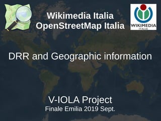
  • 1. Wikimedia Italia OpenStreetMap Italia DRR and Geographic information V-IOLA Project Finale Emilia 2019 Sept.
  • 2. Wikimedia Italia http://www.wikimedia.it/ Wikimedia Italia is the italian chapter of the no-profit Wikimedia Foundation. Free information and culture for humankind
  • 3. www.openstreetmap.org OpenStreetMap is a worldwide collaborative project The project that creates and distributes free geographic data for the world
  • 5. OpenStreetMap provides maps and data as well
  • 6. Keep it simple stupid Do you want many volunteers? Keep the tasks as simple as possible
  • 7. Why OpenStreetMap Low cost tools No special skills required
  • 8. Local and remote volunteers 1% on the field can provide the (sometimes raw) data to the ... 99% from remote that can help working on those data
  • 9. Remote volunteers? Yes, please They don’t interfere in field operations They don’t feel the pressure They can help whenever they can They don’t have any cost
  • 10. Simple tools What is needed: a printer, a pencil, a smartphone (or a scanner). With Fieldpapers http://fieldpapers.org/ anyone can take down notes on papers and other from remote can transfer these note on a map. For Mapillary (photo and video collector) you need just a smartphone with a decent camera.
  • 11. A short recap about some Apps FieldPapers http://fieldpapers.org Vespucci https://vespucci.io GeoPaparazzi on Play Google OSM Contributor on Play Google OsmAnd https://osmand.net/ Mapillary on Android and iOS store OpenDataKit https://opendatakit.org/
  • 12. Fieldpapers Go to the website, create an atlas, go to the field
  • 13. Easy to use, easy to contribute The average tool is a smartphone with some apps. This is Geopaparazzi, with input forms customizable
  • 14. Mapillary Mapillary doesn’t belong to OpenStreetMap project Everyone can use it. On the Mapillary website ….
  • 15. Mapillary …. or through an OpenStreetMap editor
  • 16. Mapillary Without any effort you can collect a lot of data. You can fix a smartphone on a car’s windshield
  • 17. Be prepared! Build your data infrastructure before emergencies happen https://www.missingmaps.org/
  • 18. Get OpenStreetMap data Free data and maps always available to everyone http://download.geofabrik.de/ From API etc...
  • 21. OpenStreetMap and the emergency Collaborative tool for remote mapping
  • 22. OpenStreetMap and the emergency The day after we got updated satellite imagery and in a few hours we mapped collapsed bridges, blocked roads and the first tent camps. OpenStreetMap for several weeks was the only map with updated information.
  • 23. United Nation open mapping project The UN GIS unit has joined the OpenStreetMap community and contribute to the project mapping directly on OSM to make maps for U.N. missions
  • 24. Best practises Keep it open! Whenever possible: ● use open formats (e.g.: no Autocad DWG, …) ● use open software: most of them don’t have license fee so anybody can install and use ● use open license (it makes reusable) ● share data ● publish data (not the confidentials of course)
  • 25. Best practises Keep in touch with local communities Whenever possible: Keeping a channel open with local communities help. You should get a single point contact, instead of manage hundreds contacts. Activate H.O.T. tasks, they can provide validated data in short times.
  • 26. Thanks for your kindly attention The simple rules in Openstreetmap are: Don’t copy from data or maps not OdbL compatible Have fun Alessandro Palmas United Nations G.I.S. consultant (former) Project manager OpenStreetMap for Wikimedia Italia OpenStreetMap mappers since Dec. 2007 @Ale_Zena_IT This presentation is released under Photos by: Alessandro Palmas, Francesco Giunta (@SotM2018)