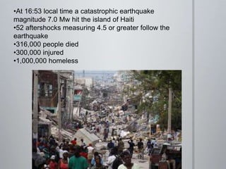
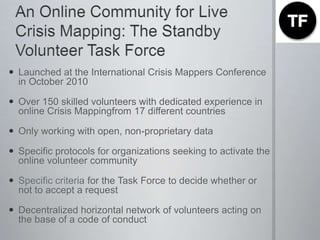
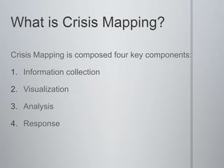
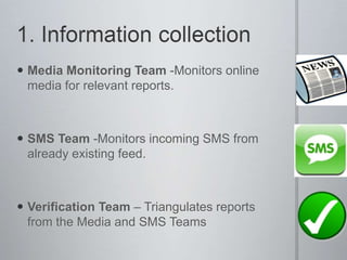
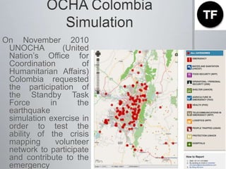
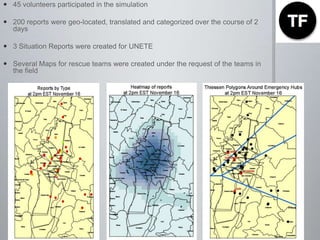
Introducing the Standby Volunteer Task Force: An Online Community for Live Crisis MappingAnahi Ayala Iacuccianahi@crisismappers.netInternational Network of Crisis Mappers
January12, 2010: Haiti
At 16:53 local time a catastrophic earthquake magnitude 7.0 Mw hit the island of Haiti
52 aftershocks measuring 4.5 or greater follow the earthquake
316,000 people died
300,000 injured
1,000,000 homeless14th Jan: Flecther SchoolCredit Patrick Meier
All around the worldCredit: Rob Munro
Ushaidi Haiti
Credit Patrick Meier
February 27, 2010: Chile
At 03:34 local time, a earthquake rating a magnitude of 8.8 and lasting up to 3 minutes hit Chile
The earthquake triggered a tsunami which devastated several coastal towns in south-central Chile
By March 6, more than 130 aftershocks had been registered, including thirteen above magnitude 6.0
723 people were reported killed
Nearly half the places in the country were declared "catastrophe zones", and curfews were imposed in some areas of looting and public disorder29th Feb: SIPA, Columbia University
Ushahidi Chile
July 2010: Pakistan
The 2010 Pakistan floods began in late July 2010 following heavy monsoon rains in the Khyber Pakhtunkhwa, Sindh, Punjab and Balochistan regions of Pakistan and affected the Indus River basin
Approximately one-fifth of Pakistan's total land area underwater
20 million people directly affected
death toll close to 2,000
More than 500,000 people displaced from their homes in the first month
CROWDFLOWER
PakReport
The crowd is always there…and it is ready to help!Why wait for an emergency to happen?
An Online Community for Live Crisis Mapping: The Standby Volunteer Task ForceLaunched at the International Crisis Mappers Conference in October 2010Over 150 skilled volunteers with dedicated experience in online Crisis Mappingfrom 17 different countriesOnly working with open, non-proprietary dataSpecific protocols for organizations seeking to activate the online volunteer community Specific criteria for the Task Force to decide whether or not to accept a requestDecentralized horizontal network of volunteers acting on the base of a code of conduct
What is Crisis Mapping?Crisis Mapping is composed four key components:Information collectionVisualizationAnalysisResponse
1. Information collectionMedia Monitoring Team -Monitors online media for relevant reports.SMS Team -Monitors incoming SMS from already existing feed.Verification Team – Triangulates reports from the Media and SMS Teams
2. VisualizationTranslation Team – Translates Media and SMS reports from/to English.Geo-Location Team – Finds GPS coordinates for Media and SMS report.Report Team – Categorize and approve reports after they have been translated and geo-locatedTechnology Team – Responsible for all technical tasks
3. AnalisysAnalysis Team -Provides summary reports based on the incoming dataAnalysis Mapping Team – will provide PDF maps, printable maps and GIS maps for the teams in the field
4. ResponseHumanitarian Team – Comprises existing professional humanitarians who liaise between the Task Force and humanitarian organizations.

Standby Task Force

  • 1.
    Introducing the StandbyVolunteer Task Force: An Online Community for Live Crisis MappingAnahi Ayala Iacuccianahi@crisismappers.netInternational Network of Crisis Mappers
  • 2.
  • 3.
    At 16:53 localtime a catastrophic earthquake magnitude 7.0 Mw hit the island of Haiti
  • 4.
    52 aftershocks measuring4.5 or greater follow the earthquake
  • 5.
  • 6.
  • 7.
    1,000,000 homeless14th Jan:Flecther SchoolCredit Patrick Meier
  • 8.
    All around theworldCredit: Rob Munro
  • 9.
  • 10.
  • 11.
  • 12.
    At 03:34 localtime, a earthquake rating a magnitude of 8.8 and lasting up to 3 minutes hit Chile
  • 13.
    The earthquake triggereda tsunami which devastated several coastal towns in south-central Chile
  • 14.
    By March 6,more than 130 aftershocks had been registered, including thirteen above magnitude 6.0
  • 15.
    723 people werereported killed
  • 16.
    Nearly half theplaces in the country were declared "catastrophe zones", and curfews were imposed in some areas of looting and public disorder29th Feb: SIPA, Columbia University
  • 18.
  • 19.
  • 20.
    The 2010 Pakistanfloods began in late July 2010 following heavy monsoon rains in the Khyber Pakhtunkhwa, Sindh, Punjab and Balochistan regions of Pakistan and affected the Indus River basin
  • 21.
    Approximately one-fifth ofPakistan's total land area underwater
  • 22.
    20 million peopledirectly affected
  • 23.
  • 24.
    More than 500,000people displaced from their homes in the first month
  • 25.
  • 26.
  • 28.
    The crowd isalways there…and it is ready to help!Why wait for an emergency to happen?
  • 29.
    An Online Communityfor Live Crisis Mapping: The Standby Volunteer Task ForceLaunched at the International Crisis Mappers Conference in October 2010Over 150 skilled volunteers with dedicated experience in online Crisis Mappingfrom 17 different countriesOnly working with open, non-proprietary dataSpecific protocols for organizations seeking to activate the online volunteer community Specific criteria for the Task Force to decide whether or not to accept a requestDecentralized horizontal network of volunteers acting on the base of a code of conduct
  • 30.
    What is CrisisMapping?Crisis Mapping is composed four key components:Information collectionVisualizationAnalysisResponse
  • 31.
    1. Information collectionMediaMonitoring Team -Monitors online media for relevant reports.SMS Team -Monitors incoming SMS from already existing feed.Verification Team – Triangulates reports from the Media and SMS Teams
  • 32.
    2. VisualizationTranslation Team– Translates Media and SMS reports from/to English.Geo-Location Team – Finds GPS coordinates for Media and SMS report.Report Team – Categorize and approve reports after they have been translated and geo-locatedTechnology Team – Responsible for all technical tasks
  • 33.
    3. AnalisysAnalysis Team-Provides summary reports based on the incoming dataAnalysis Mapping Team – will provide PDF maps, printable maps and GIS maps for the teams in the field
  • 34.
    4. ResponseHumanitarian Team– Comprises existing professional humanitarians who liaise between the Task Force and humanitarian organizations.

Editor's Notes

  • #26 BE VERY CLEAR THAT WE ARE “IN THE PROCESS” OF DEVELOPPING PARTERSHIPS WITH THESE PEOPLE 