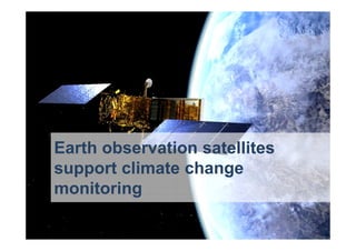
During the 2016 Green Day conference organized by AGOL and LUISS University, Massimo Comparini, CEO of e-Geos introduced us on how satellite technology can support climate change monitoring
This ppt is about the basic information about Remote Sensing and GIS and their Apps. in Environmental Management (Prepared by Mandeep Poonia at GJU S&T, Hisar (Haryana) ,India)
Lidar is an acronym for light detection and ranging. It is an optical remote sensing technology that can measure the distance to, or other properties of a target by illuminating the target with light, often using pulses from a laser.
Lidar (also written LIDAR, LiDAR or LADAR) is a remote sensing technology that measures distance by illuminating a target with a laser and analyzing the reflected light. Although thought by some to be an acronym of Light Detection And Ranging,[1] the term lidar was actually created as a portmanteau of "light" and "radar".[2][3] Lidar is popularly used as a technology to make high-resolution maps, with applications in geodesy, geomatics, archaeology, geography, geology, geomorphology, seismology, forestry, remote sensing, atmospheric physics,[4] airborne laser swath mapping (ALSM), laser altimetry, and contour mapping.
LiDAR acronym as Light Detection and Ranging is remote sensing technology having several technical and socialite advantages. This technology is basically used to make high resolution digital map to provide the real time data. This data can be processed and used to extract the useful information. A typical LIDAR system consists of three main components, a GPS system to provide position information, an INS unit for attitude determination, and a LASER system to provide range (distance) information between the LASER firing point and the ground point. In addition to range data, modern LIDAR systems can capture intensity images over the mapped area. Therefore, LIDAR is being more extensively used in mapping and GIS applications.
Multispectral remote sensors such as the Landsat Thematic Mapper and SPOT XS produce
images with a few relatively broad wavelength bands. Hyperspectral remote sensors, on the
other hand, collect image data simultaneously in dozens or hundreds of narrow, adjacent
spectral bands. These measurements make it possible to derive a continuous spectrum for each
image cell, as shown in the illustration below. After adjustments for sensor, atmospheric, and
terrain effects are applied, these image spectra can be compared with field or laboratory
reflectance spectra in order to recognize and map surface materials such as particular types of
vegetation or diagnostic minerals associated with ore deposits.
Cyber trust: cornerstone of a digital worldLeonardo
During Cybertech 2016 Andrea Biraghi, Security & Information Systems Division Managing Director, took part at the panel "Leader's Vision in the Cyber Era" presenting Leonardo's view on the cyber business
MSPO - Leonardo Aircraft Division: M-346, the dual role conceptLeonardo
At MSPO 2016 Leonardo Aircraft Division hosted a presentation on the M-346FT (Fighter Trainer), the latest variant of the platform, ideal to train next generation of fighter pilots
SESAR Project Awards - Best in class Nomination for Pj14.01.04Leonardo
The team led by Finmeccanica has been award for the valiable technical specifications representing a core element of the SWIM Concept.
SESAR SWIM definition (adopted also by ICAO): SWIM consists of standards, infrastructure and governance enabling the management of ATM information and its exchange between qualified parties via interoperable services.
SWIM is about to provide the right information to right stakeolder at the right time.
Helitech - Leonardo Helicopters Division: Through-Life approach to the customerLeonardo
During Helitech 2016 Leonardo Helicopters Division presented the through-life approach to the customer: an overview of how Leonardo Helicopters is helping Customers master their helicopter operations
FIA16: Leonardo Aircraft Division: M-346 programme - the dual role conceptLeonardo
During 2016 edition of the Farnborough Airshow, Leonardo Aircraft Division presented the M-346FT (Fighter Trainer), the latest variant of the platform, ideal to train next generation of fighter pilots
Telespazio Geoinformation platform for Defense and Intelligence: Maritime Dom...Leonardo
During the Defence Geospatial Intelligence 2017 Telespazio and e-Geos presented the Geoinformation platform for Defense and Intelligence success story of Maritime Domain
From Finmeccanica to Leonardo: a new brand that defines the change of the company and its transformation from a financial holding company to an operational, integrated and innovative industrial entity.
Chosen for its strong evocative significance, the new name is inspired by Leonardo da Vinci, a universally recognised symbol of creativity and innovation.
Leonardo is a global high-tech company and one of the key players in the Aerospace, Defence and Security sectors. Headquartered in Italy, the company employs more than 47,000 employees worldwide.
At ITASEC17, the first italian conference on Cyber Security, Giorgio Mosca, Strategy and Technology Director of Leonardo's Security & Information Systems Division presented the company's approach to the cyber business
Border security: a physical and digital challengeLeonardo
At SMi's Border Security confernce, Giorgio Mosca, Strategy and Technology Director of Leonardo's Security & Information Systems Division presented the company's integrated and intelligent platforms enhancing border security approach
The Record of Sea Level Change From Satellite Measurements: What Have We Lea...dallasmasters
2005 American Geophysical Union Bowie Lecture: The Record of Sea Level Change From Satellite Measurements: What Have We Learned? presented by Professor R. Steven Nerem of the University of Colorado at Boulder.
Helitech - Leonardo Helicopters Division: Technology for SafetyLeonardo
During Helitech 2016 Leonardo Helicopters Division held a presentation called "Technology for Safety" focused on:
- Ergonomics & Human Machine Interface;
- Dry Run Transmission Capabilities;
- Design to Performance;
- OGP standards compliance across different roles.
Remote sensing (RS) and geographical information systems (GIS) are revolutionising irrigation management. They represent a relatively cheap and rapid method of acquiring up-to-date information over a large geographical area. and are the only practical way to obtain data from inaccessible regions. At small scales, regional phenomena which are invisible from the ground can be clearly visible. Presented at the 1st World Irrigation Forum, 2013, Mardin, Turkey.
drought monitoring and management using remote sensingveerendra manduri
Monitoring drought and its management became easier with the help of remote sensing..several drought monitoring indices can be used to monitor drought condition. this ppt consists of information regarding droughts in relation to agriculture and their monitoring with the help of remotely sense based indices.
Drought monitoring, Precipitation statistics, and water balance with freely a...AngelosAlamanos
The aim of this study is to showcase and discuss these new technologies for hydrometeorological studies. Six of NASA’s web-repositories that can be used to freely download and
visualise such spatial and/or time-series factors are listed and explained with examples for Ireland: ways
to access hydrological, meteorological, soil, vegetation and socio-economic data are shown, and
estimations of various precipitations statistics, anomalies, and water balance are presented for monthly
and seasonal analyses. The advantages, disadvantages and limitations of the satellite datasets are
discussed to provide useful recommendations about their proper use, based on purpose, scale, precision,
time requirement, and modelling-expansion criteria.
1st Leonardo Helicopters SAR Workshop - AW139 SAR Overview and UpdatesLeonardo
During our first Leonardo Helicopters SAR Workshop we gave a brief overview and update on the AW139, with a special focus on new capabilities and mission kits dedicated to SAR operations.
European Rotors - Certification by SimulationLeonardo
During European Rotors we presented our view and experience on certification by simulation with a look at the RoCS (Rotorcraft Certification by Simulation) project
European Rotors - Mission Management System’s Capabilities for Law Enforcemen...Leonardo
Leonardo attended at European Rotors the Police Aviation Conference illustrating its Mission Management System’s capabilities for Law Enforcement Operators
European Rotors - Rotorcraft and VTOL SymposiumLeonardo
Leonardo attended at European Rotors the Rotorcraft and VTOL Symposium 2021 sharing its vision for the present, the impending challenges, and the outlooks for the future
European Rotors - Contributing to the Swiss Innovation Day Leonardo
Leonardo attended European Rotors presenting its contribution to the Swiss Innovation Day illustrating a possible roadmap from the first Swiss helicopter to the first Swiss hybrid helicopter
Smart TV Buyer Insights Survey 2024 by 91mobiles.pdf91mobiles
91mobiles recently conducted a Smart TV Buyer Insights Survey in which we asked over 3,000 respondents about the TV they own, aspects they look at on a new TV, and their TV buying preferences.
Securing your Kubernetes cluster_ a step-by-step guide to success !KatiaHIMEUR1
Today, after several years of existence, an extremely active community and an ultra-dynamic ecosystem, Kubernetes has established itself as the de facto standard in container orchestration. Thanks to a wide range of managed services, it has never been so easy to set up a ready-to-use Kubernetes cluster.
However, this ease of use means that the subject of security in Kubernetes is often left for later, or even neglected. This exposes companies to significant risks.
In this talk, I'll show you step-by-step how to secure your Kubernetes cluster for greater peace of mind and reliability.
Why You Should Replace Windows 11 with Nitrux Linux 3.5.0 for enhanced perfor...SOFTTECHHUB
The choice of an operating system plays a pivotal role in shaping our computing experience. For decades, Microsoft's Windows has dominated the market, offering a familiar and widely adopted platform for personal and professional use. However, as technological advancements continue to push the boundaries of innovation, alternative operating systems have emerged, challenging the status quo and offering users a fresh perspective on computing.
One such alternative that has garnered significant attention and acclaim is Nitrux Linux 3.5.0, a sleek, powerful, and user-friendly Linux distribution that promises to redefine the way we interact with our devices. With its focus on performance, security, and customization, Nitrux Linux presents a compelling case for those seeking to break free from the constraints of proprietary software and embrace the freedom and flexibility of open-source computing.
Generative AI Deep Dive: Advancing from Proof of Concept to ProductionAggregage
Join Maher Hanafi, VP of Engineering at Betterworks, in this new session where he'll share a practical framework to transform Gen AI prototypes into impactful products! He'll delve into the complexities of data collection and management, model selection and optimization, and ensuring security, scalability, and responsible use.
The Metaverse and AI: how can decision-makers harness the Metaverse for their...Jen Stirrup
The Metaverse is popularized in science fiction, and now it is becoming closer to being a part of our daily lives through the use of social media and shopping companies. How can businesses survive in a world where Artificial Intelligence is becoming the present as well as the future of technology, and how does the Metaverse fit into business strategy when futurist ideas are developing into reality at accelerated rates? How do we do this when our data isn't up to scratch? How can we move towards success with our data so we are set up for the Metaverse when it arrives?
How can you help your company evolve, adapt, and succeed using Artificial Intelligence and the Metaverse to stay ahead of the competition? What are the potential issues, complications, and benefits that these technologies could bring to us and our organizations? In this session, Jen Stirrup will explain how to start thinking about these technologies as an organisation.
Welcome to the first live UiPath Community Day Dubai! Join us for this unique occasion to meet our local and global UiPath Community and leaders. You will get a full view of the MEA region's automation landscape and the AI Powered automation technology capabilities of UiPath. Also, hosted by our local partners Marc Ellis, you will enjoy a half-day packed with industry insights and automation peers networking.
📕 Curious on our agenda? Wait no more!
10:00 Welcome note - UiPath Community in Dubai
Lovely Sinha, UiPath Community Chapter Leader, UiPath MVPx3, Hyper-automation Consultant, First Abu Dhabi Bank
10:20 A UiPath cross-region MEA overview
Ashraf El Zarka, VP and Managing Director MEA, UiPath
10:35: Customer Success Journey
Deepthi Deepak, Head of Intelligent Automation CoE, First Abu Dhabi Bank
11:15 The UiPath approach to GenAI with our three principles: improve accuracy, supercharge productivity, and automate more
Boris Krumrey, Global VP, Automation Innovation, UiPath
12:15 To discover how Marc Ellis leverages tech-driven solutions in recruitment and managed services.
Brendan Lingam, Director of Sales and Business Development, Marc Ellis
Essentials of Automations: The Art of Triggers and Actions in FMESafe Software
In this second installment of our Essentials of Automations webinar series, we’ll explore the landscape of triggers and actions, guiding you through the nuances of authoring and adapting workspaces for seamless automations. Gain an understanding of the full spectrum of triggers and actions available in FME, empowering you to enhance your workspaces for efficient automation.
We’ll kick things off by showcasing the most commonly used event-based triggers, introducing you to various automation workflows like manual triggers, schedules, directory watchers, and more. Plus, see how these elements play out in real scenarios.
Whether you’re tweaking your current setup or building from the ground up, this session will arm you with the tools and insights needed to transform your FME usage into a powerhouse of productivity. Join us to discover effective strategies that simplify complex processes, enhancing your productivity and transforming your data management practices with FME. Let’s turn complexity into clarity and make your workspaces work wonders!
Enhancing Performance with Globus and the Science DMZGlobus
ESnet has led the way in helping national facilities—and many other institutions in the research community—configure Science DMZs and troubleshoot network issues to maximize data transfer performance. In this talk we will present a summary of approaches and tips for getting the most out of your network infrastructure using Globus Connect Server.
State of ICS and IoT Cyber Threat Landscape Report 2024 previewPrayukth K V
The IoT and OT threat landscape report has been prepared by the Threat Research Team at Sectrio using data from Sectrio, cyber threat intelligence farming facilities spread across over 85 cities around the world. In addition, Sectrio also runs AI-based advanced threat and payload engagement facilities that serve as sinks to attract and engage sophisticated threat actors, and newer malware including new variants and latent threats that are at an earlier stage of development.
The latest edition of the OT/ICS and IoT security Threat Landscape Report 2024 also covers:
State of global ICS asset and network exposure
Sectoral targets and attacks as well as the cost of ransom
Global APT activity, AI usage, actor and tactic profiles, and implications
Rise in volumes of AI-powered cyberattacks
Major cyber events in 2024
Malware and malicious payload trends
Cyberattack types and targets
Vulnerability exploit attempts on CVEs
Attacks on counties – USA
Expansion of bot farms – how, where, and why
In-depth analysis of the cyber threat landscape across North America, South America, Europe, APAC, and the Middle East
Why are attacks on smart factories rising?
Cyber risk predictions
Axis of attacks – Europe
Systemic attacks in the Middle East
Download the full report from here:
https://sectrio.com/resources/ot-threat-landscape-reports/sectrio-releases-ot-ics-and-iot-security-threat-landscape-report-2024/
The Art of the Pitch: WordPress Relationships and SalesLaura Byrne
Clients don’t know what they don’t know. What web solutions are right for them? How does WordPress come into the picture? How do you make sure you understand scope and timeline? What do you do if sometime changes?
All these questions and more will be explored as we talk about matching clients’ needs with what your agency offers without pulling teeth or pulling your hair out. Practical tips, and strategies for successful relationship building that leads to closing the deal.
Alt. GDG Cloud Southlake #33: Boule & Rebala: Effective AppSec in SDLC using ...James Anderson
Effective Application Security in Software Delivery lifecycle using Deployment Firewall and DBOM
The modern software delivery process (or the CI/CD process) includes many tools, distributed teams, open-source code, and cloud platforms. Constant focus on speed to release software to market, along with the traditional slow and manual security checks has caused gaps in continuous security as an important piece in the software supply chain. Today organizations feel more susceptible to external and internal cyber threats due to the vast attack surface in their applications supply chain and the lack of end-to-end governance and risk management.
The software team must secure its software delivery process to avoid vulnerability and security breaches. This needs to be achieved with existing tool chains and without extensive rework of the delivery processes. This talk will present strategies and techniques for providing visibility into the true risk of the existing vulnerabilities, preventing the introduction of security issues in the software, resolving vulnerabilities in production environments quickly, and capturing the deployment bill of materials (DBOM).
Speakers:
Bob Boule
Robert Boule is a technology enthusiast with PASSION for technology and making things work along with a knack for helping others understand how things work. He comes with around 20 years of solution engineering experience in application security, software continuous delivery, and SaaS platforms. He is known for his dynamic presentations in CI/CD and application security integrated in software delivery lifecycle.
Gopinath Rebala
Gopinath Rebala is the CTO of OpsMx, where he has overall responsibility for the machine learning and data processing architectures for Secure Software Delivery. Gopi also has a strong connection with our customers, leading design and architecture for strategic implementations. Gopi is a frequent speaker and well-known leader in continuous delivery and integrating security into software delivery.
DevOps and Testing slides at DASA ConnectKari Kakkonen
My and Rik Marselis slides at 30.5.2024 DASA Connect conference. We discuss about what is testing, then what is agile testing and finally what is Testing in DevOps. Finally we had lovely workshop with the participants trying to find out different ways to think about quality and testing in different parts of the DevOps infinity loop.
8. Imm concept irrigazione
Massive water consumption
Due to the higher temperatures,
irrigation in agriculture is increasing,
threatening water balances
9. Radar satellites help to monitor and
control farm planning in order to preserve
natural resources
Massive water consumption
10. Radar data are suitable for
measuring soil changes due to
soil water quantity for
agriculture activity
Intensive activity
related to crops:
vegetation growth
Set aside fields.
Natural vegetation
Uncultivated terrain Harvested fields
11. Imm concept deforestation
Uncontrolled deforestation
Extensive forest cuts and intentional fires
and are often used to create new land for
pasture and intensive agriculture
12. The infrared satellite sensors
allow the measurement of
burned and deforested areas
Uncontrolled deforestation
13. Red color range highlights
the index of vegetation
Uncontrolled deforestation
18. Desertification
Climate change is accelerating
the expansion rate of the deserts
and also the reduction of ecosystem services.
But desertification itself also
impacts on climate change
35. Leveraging on their polar orbit,
COSMO-SkyMed Radar satellites
are able to acquire images of both north
and south Poles.
The high revisit time of the constellation
allows the acquisition of a huge series of
images of icebergs behavior
and trend analysis glacier
36. Satellites can detect and follow glacier
movements and evolution,
as well as ice surface reduction
Melting ice
37.
38. Melting ice
High revisit time of the Italian radar
constellation enables continuous
monitoring of iceberg movements
51. No Radar penetration
5mt
20 mt
10 mt
Signal
Penetration
Up to 20 mt
COSMO-SkyMedLandsat 7
RADAR provides
Better
measurement of
land/water limit !
Optical Signal RADAR Signal
54. Radar technology clearly allows water
detection, even through clouds, during
the night.
COSMO-SkyMed constellation acquires
up to 4 images/day for rapid damage
assessment maps
Natural disasters