The document discusses SEPA's classification of obstacles to fish migration under the Water Framework Directive. It provides details on SEPA's progress in assessing barriers on river networks in Scotland since 2008. It also outlines future developments, such as including additional culvert data and wetted area in the Water Network Layer. The presentation concludes by inviting questions from the audience.
This document summarizes a study on the effects of navigational dams on the feeding morphology of two predatory fish species in the Ohio River. Measurements of mouth morphology, such as jaw length and gape width, were collected from specimens of freshwater drum (Aplodinotus grunniens) and bluegill (Lepomis macrochirus) caught from different pools. Principal component analysis found the freshwater drum from the glaciated valley pool had differing mouth morphology compared to those from alluvial valley pools, indicating differences in available prey. Jaw length was the most influential morphological measurement and varies between life stages and prey selection. Further research is needed to better understand differences in diet between populations.
The document discusses artificial reefs and Martin County's artificial reef program. It describes the purposes of artificial reefs which include increasing habitat for marine organisms and decreasing stress on natural reefs. It also outlines the types of artificial reef materials and reef designs used, including individual units, rubble mounds, and recycled materials. Finally, it provides details on Martin County's past and planned artificial reef projects in partnership with other organizations.
Carbon Sequestration: Potential of the Early Pennsylvanian Breathitt Group, P...rpgrimm
The document summarizes research on the potential for carbon sequestration in the Early Pennsylvanian Breathitt Group located in the central Appalachian Basin. The research aims to characterize reservoir properties and investigate storage capacities of shales and sandstones in the region. Core samples and outcrop measurements were analyzed alongside geophysical well log data to develop a sequence stratigraphy model identifying regional lithologies suitable for CO2 storage and sealing. The model found broad flooding surfaces and discontinuities indicating opportunities for targeted sequestration in the Pocahontas Basin. Further work will focus on the interplay of forces controlling basin development.
The document provides an overview of streams and stream restoration. It defines what a stream is and discusses fluvial geomorphology and forms. Key concepts covered include meandering streams, bankfull stage, stream ecosystems and functions. The effects of urbanization on streams and symptoms of "urban stream syndrome" are outlined. Factors that contribute to a healthy stream are identified, such as bed stability, sediment transport balance, in-stream habitat, bank stability, riparian buffers, active floodplains, and watershed health. Stream restoration planning and components involving channel morphology, floodplain structure, hydrologic analysis, in-stream structures, habitats and vegetation are summarized. Case studies of stream restoration projects are presented.
The Williams Fork Formation in the Piceance Basin of Colorado contains tight sandstone reservoirs that are an important source of natural gas. The reservoirs have low porosity and permeability but natural fractures enhance permeability. Gas is stored in thick, continuously gas-saturated sandstones and migrates through the extensive natural fracture network. These fractures formed due to overpressuring from coal seams and folding related to basement faults. Integrating seismic data, remote sensing, and modeling can effectively identify fracture-prone areas for gas production from these low-permeability reservoirs.
The document summarizes assessments of stream restoration and stormwater projects funded by the CWMTF. It discusses the types of restoration and stormwater projects funded, methods used to assess the projects, findings from site visits by field representatives, and presentations made on various project types including stream restoration, wetland restoration, agricultural BMPs, and stormwater BMPs. Key highlights include that most funded projects showed water quality benefits and compliance with goals, though some required maintenance and repairs, and presentations provided examples and findings on different best management practices.
This document discusses various components of stream restoration including:
1. In-stream structures like logs, rocks, and vanes that provide bank protection, habitat, and sediment transport.
2. Streambank stabilization techniques including temporary matting, root wads, and bioengineering with living plants.
3. Riparian buffers of grasses, wetland plants, shrubs, and trees along the stream banks.
This document provides the 2013 annual report for the Okanogan Basin Monitoring and Evaluation Program (OBMEP). Some key findings from the report include:
- Steelhead spawning estimates in the Okanogan subbasin have increased since 2005 and are approaching recovery goals. Abundance of juveniles remains low in the mainstem but is higher in tributaries.
- Recent studies using electrofishing, PIT tagging and mark-recapture provide improved estimates of juvenile steelhead abundance compared to past methods. Data from Omak Creek show high juvenile numbers.
- Habitat modeling found capacity for steelhead is reduced from historical levels, with high temperatures limiting mainstem habitat. Tributaries like Salmon
Pohick Creek Watershed: Dam Rehabilitation Dredging and Lake RestorationFairfax County
The document discusses plans to rehabilitate dams and dredge lakes in the Pohick Creek Watershed in Fairfax County, Virginia. It details work already completed at Royal Lake, Woodglen Lake, and Lake Barton dams and spillways. It also outlines upcoming projects to dredge Huntsman Lake and Royal Lake to restore sediment storage capacity and water quality. Rehabilitation of Huntsman Lake dam is scheduled for fall 2013.
This document summarizes the 2011 State of Buzzards Bay report. The overall score for Buzzards Bay remained at 45 out of 100, as improvements in reducing old pollution sources were offset by increasing nitrogen pollution from development. Specifically:
- Nitrogen pollution decreased the score 3 points to 53, as septic systems continue to be the largest source of nitrogen entering the bay.
- Bacteria levels improved 5 points to 62, though shellfish harvesting remains closed in many areas due to contamination.
- Toxics improved 5 points to 52, though legacy pollution continues to impact areas like New Bedford Harbor.
- Forest and wetland coverage showed little change, while development continues to destroy coastal habitats.
This document provides an overview of stream restoration project implementation. It discusses the components of a healthy stream system and reasons why streams may become unhealthy. The key components of restoration projects are then outlined, including reconfiguring the channel and floodplain connection, installing in-stream structures, stabilizing streambanks, establishing riparian buffers, managing stormwater, improving stream crossings, monitoring and maintenance, and providing public access and education. Specific restoration techniques are illustrated with photos from case studies. The document emphasizes the importance of designing projects based on reference streams and ensuring projects are properly constructed and maintained.
Fairfax police academy pond improvement projectFairfax County
The Fairfax Police Academy pond improvement project will help to ensure the pond provides the water quality benefits that it was designed for. The Maintenance and Stormwater Management Division of Public Works and Environmental Services coordinated with the Fairfax County Police Department’s Wildlife Management team to assist displaced fish and turtles living in the pond.
Royal Lake Dredging and Restoration Project Update-June 2014Fairfax County
The meeting agenda covered the Royal Lake restoration project, including dredging phases to remove sediment, alternatives for wet or dry dredging, and habitat and shoreline restoration. The project goals are to restore sediment capacity, improve water quality and habitat, and provide long-term maintenance. Final design is underway with dredging projected to start in late summer 2015.
The document outlines practical considerations for developing brackish groundwater resources in Texas, noting that an estimated 2.7 billion acre-feet of brackish groundwater exists statewide but requires significant characterization. It discusses the need to balance brackish groundwater production with impacts to freshwater resources and mentions challenges defining legally binding production zones. Production must follow rules to prevent waste, promote conservation, and control subsidence while allowing highest practical usage of groundwater.
Nottoway Park Stormwater and Water Quality Improvements Phases 1, 2, & 3Fairfax County
This document discusses stormwater management improvements at Nottoway Park in Fairfax County, Virginia. It outlines a multi-phase plan to install various best management practices (BMPs) like bioretention cells, engineered dry swales, step pool conveyances, and wetland creation. Phase 1 includes outfall stabilization and step pools at two locations. Future phases will implement additional BMPs like floodplain reconnection, dry swales with check dams, and converting a dry detention basin into a wetland. The project aims to improve water quality in Accotink Creek and address drainage issues while enhancing the park environment.
This document summarizes findings from multiple watershed-scale studies on the effects of conservation practices conducted between 2004-2018 as part of the USDA CEAP program. Key findings include:
1) The implementation of conservation practices like cover crops, riparian buffers, and nutrient management plans effectively reduced nutrients and sediments in surface waters in several watersheds across the country.
2) Models were used to identify priority areas for conservation and predict load reductions, however watershed responses were complex and variations in practices and conditions made broad effects difficult to detect.
3) While edge-of-field water quality often improved with conservation practices, stream impacts were more dependent on factors like bank erosion and riparian conditions.
Reconstructing Water Levels in the Lake Michigan Basin from Embayed LakesSERC at Carleton College
This document discusses reconstructing past water levels in the Lake Michigan basin from sediment cores taken from embayed lakes. Lake level histories can be determined from geomorphic evidence like stranded shorelines and submerged forests, as well as sedimentological evidence like layers of sand, peat, marl, and gyttja in cores. Cores from small embayed lakes can preserve records of fluctuations in large lake levels over thousands of years. Comparing data from multiple sites allows development of a composite lake level curve for the region.
The document summarizes surveys of Deer Creek's floodplain and side channels conducted by University of Oregon students before implementation of a floodplain enhancement project. The surveys found a low amount of activated secondary channels and small/medium woody debris during spring. Future surveys after adding large woody debris to Deer Creek will assess whether the project improved water quality and salmonid habitat. The project aims to make Deer Creek's floodplain slower, colder, and more diverse to enhance habitat for Chinook salmon and bull trout.
This document summarizes research on classifying coral reef and seagrass habitats in the Pearl Cays region of Nicaragua using Landsat 8 satellite imagery. The objectives were to map these critical marine habitats and evaluate Landsat 8 for this application. The methodology involved preprocessing two Landsat 8 images, developing training sites, classifying the full scene and sectors using multiple classifiers, and comparing classifications to high resolution imagery. The results found that using image sectors provided more detailed coral classifications and reduced misclassification of sand as coral or seagrass. It was suggested that using multiple images and high resolution data could improve future classifications of these dynamic marine habitats.
The Babson Court Outfall Restoration Project in Fairfax County, VA restored a 324-foot outfall channel and 66-foot tributary to address erosion and public safety concerns. The restoration incorporated natural stream design techniques like step pools, rock steps, and riffles. It also removed 250 cubic yards of sediment from a dry pond, which was re-vegetated. The project is expected to reduce nitrogen, phosphorus, and suspended solid pollution in stormwater runoff.
The Lazy Creek Court Outfall Restoration Project in Fairfax County, Virginia restored 159 linear feet of an eroded outfall channel. The project addressed public safety concerns and stabilized the channel using natural stream design techniques like stone steps and plantings. This provides enhanced water quality through reduced nitrogen, phosphorus, and solid pollutants. The project was completed in August 2017 through collaboration between the Department of Public Works, a design firm, construction crews, and landscaping contractors.
1) The study modifies the geometry of the Fraser River in a numerical ocean model to improve simulations of tides and the Fraser River plume.
2) Extending and deepening the river channel generated stronger cross-strait surface currents that better matched observations, and tidal amplitudes in the estuary corresponded well with measurements.
3) Reducing vertical mixing parameters, such as eddy viscosity and diffusivity, produced weaker along-strait flow and surface current patterns closer to drifter data, further improving the model results.
The document provides information about the Bass River watershed on Cape Cod, Massachusetts. It summarizes that the watershed covers 10,331 acres across 11,800 parcels in Dennis, Yarmouth, and other towns. Developed land in those towns increased 58.7% and 56.3% from 1971 to 1999. The watershed includes features like Long Pond and is impacted by nitrogen pollution from septic systems, fertilizers, and other sources. Studies show some surface waters and subwatersheds exceed nitrogen limits, threatening ecosystem health. Solutions discussed include the Cape Cod Regional Wastewater Management Plan and a mix of decentralized and centralized wastewater infrastructure projects over 20-30 years.
Water Quality Presentation given by Angelo Liberti, Chief of Surface Water Protection, Office of Water Quality, RI DEM at the Shellfish Management Plan March Stakeholder meeting.
Kachemak Bay Research Reserve Management planalalderfer
The document outlines the vision, goals, and strategic focus areas of the Kachemak Bay National Estuarine Research Reserve (KBNERR) for 2012-2016. The KBNERR is committed to conducting coastal research, education, and training to understand and promote sustainable use of Alaskan coastal resources. Key areas of focus include climate change impacts, harvested species, and engaging stakeholders in decision-making. The reserve aims to be a leader in coastal science through partnerships and programs in research, education, coastal training, and administration.
The Record of Sea Level Change From Satellite Measurements: What Have We Lea...dallasmasters
2005 American Geophysical Union Bowie Lecture: The Record of Sea Level Change From Satellite Measurements: What Have We Learned? presented by Professor R. Steven Nerem of the University of Colorado at Boulder.
Green Day 2016 - Earth Observation satellites support climate change monitoringLeonardo
During the 2016 Green Day conference organized by AGOL and LUISS University, Massimo Comparini, CEO of e-Geos introduced us on how satellite technology can support climate change monitoring
Cyber trust: cornerstone of a digital worldLeonardo
During Cybertech 2016 Andrea Biraghi, Security & Information Systems Division Managing Director, took part at the panel "Leader's Vision in the Cyber Era" presenting Leonardo's view on the cyber business
Soil erosion is the removal of topsoil by various factors like water and wind. It is a natural process that has been accelerated 10-40 times by human activities like intensive agriculture, deforestation, roads, and climate change. This excessive erosion causes on-site issues like decreased productivity and off-site issues like sedimentation of waterways. The rate of erosion is affected by climate, soil properties, vegetation cover, and topography - with factors like heavy rainfall, lack of vegetation, and steep slopes increasing rates. Preventing erosion requires increasing vegetative cover through practices like terracing and windbreaks.
Climate change is happening as the Earth is warming due to increased greenhouse gas emissions. The average global temperature has risen 0.85°C from 1880 to 2012 and is projected to exceed 2°C by 2100. Small changes in average temperature can lead to large shifts in climate and weather. Evidence shows changes in rainfall patterns, more extreme weather events, rising sea levels, and impacts on ecosystems. The document then provides details on climate change impacts expected for India, such as changes in weather patterns, sea level rise, impacts on agriculture and food security. Case studies on projected climate trends and impacts in Bhubaneswar, India are also presented, along with proposed resilience actions.
This document discusses soil erosion, its causes, impacts, and methods for measuring and addressing it. It provides context on the development of the Universal Soil Loss Equation to quantitatively predict erosion. While useful, the USLE does not capture extreme weather events that cause most erosion. Direct measurements are most accurate but also most resource-intensive. The document outlines various on-site and off-site impacts of erosion and early efforts to address the problem through the Soil Conservation Service and projects like Coon Creek Watershed.
Soil erosion is caused by both natural processes like wind and water, as well as human activities such as deforestation, overgrazing, monoculture farming, and removing windbreaks. This accelerated erosion decreases soil fertility and crop production. Several methods can limit soil erosion, including terracing to hold soil and water, contour ploughing across slopes, planting shelter belts to protect soil, using strip farming to minimize bare soil, and installing stone lines along contours to reduce runoff.
Climate change poses serious threats to Indian agriculture that could undermine food security. Studies project cereal production may decrease 10-40% by 2100 due to increased temperatures, with wheat facing greater losses. Every 1°C rise in temperature could reduce wheat production by 4-5 million tons. Adaptation strategies like new crop varieties, water management, and insurance can help minimize impacts but require significant research and policy support. Immediate action is needed on low-cost adaptation options while determining costs and policies for long-term mitigation through practices like agroforestry and soil carbon sequestration. Failure to act risks substantial economic and social damages from climate impacts on India's agricultural sector and food system.
This document summarizes efforts to upgrade shellfish growing area classifications in local waters. Water quality and shellfish surveys identified potential geoduck and horse clam beds. Sediment and shellfish tissue samples found no human health risks from contaminants. Dye studies showed limited water circulation, informing recommendations to restrict harvesting near sewage sources. Upstream stewardship programs and the surveys together allowed areas to be reclassified, expanding sustainable shellfish harvesting opportunities.
The RRS James Cook will depart in May 2012 on an expedition to study cold-water coral ecosystems in the shallow reefs of Mingulay and deeper coral mounds and reefs on Rockall Bank. The international scientific crew will conduct research to further understand the functional ecology of these ecosystems, both historically and into the future, including coral, sponge, and invertebrate sampling, sediment profiling, oxygen exchange measurements, coral feeding experiments, and carbonate flux measurements. Shipboard experiments will examine the effects of ocean acidification and warming on corals, sponges, and other invertebrates. Outreach activities during the expedition will include features on BBC Scotland and The One Show, and allowing schoolchildren to
This presentation was given by Sue OHalloran of University of Wisconsin, Superior - Extension at the September 17th meeting of the Lake Superior Binational Forum. Amy Elliot of the Lake Superior Research Institute co-authored this presentation on Lake Superior Citizen Environmental Monitoring.
Mapping Tools to Support Protected Area Managementreo-southamerica
• Bathymetry
• Biological and habitat information
• Management zones
• Oil and gas activities
• Oceanographic data
• Remotely-operated vehicle tracks
• Underwater photographs
Marine Invasives of Kachemak Bay, AlaskaKBay Council
This document discusses marine invasives of concern in Kachemak Bay, Alaska. It describes characteristics of successful invaders like green crabs and tunicates, which are able to establish due to a lack of natural predators and broad tolerances. Shipping ballast water is identified as the primary vector introducing over 80% of non-native species to North America. The document advocates for monitoring programs aimed at early detection of invaders, as well as regulatory actions like mid-ocean ballast exchange, as the most effective approaches for preventing and responding to marine invasives in Kachemak Bay.
Dams and barrages have environmental impacts while also providing benefits. Dams generate power, supply water, stabilize flows for irrigation, prevent floods, reclaim land, and create recreation areas. However, they can cause seepage, affect groundwater, trap sediments, and change river ecology. Reservoirs can introduce invasive species and changes in water quality impact fertility, pollution, diseases, and species extinction. Large dams have even caused the Earth's rotation to speed up. Barrages similarly control water flows but have impacts like increased turbidity, altered sediment movement, and breeding of mosquitoes.
Marine Biological Association Conference 2012, University College Cork, Oral ...Shane Reilly
This study characterized the microbial community structure of a dormant pockmark on the Malin Shelf off the coast of Ireland. Analysis showed distinct bacterial and archaeal populations compared to known high-activity methane seep sites. Psychrobacter and Sulfitobacter species dominated the bacterial communities and exhibited genetic divergence between sediment depths. Minor groups related to active seepage were also present, suggesting low ongoing methane seepage. The lack of known sulfate-reducing bacteria and dominance of heterotrophic proteobacteria feeding on organic matter suggests this dormant pockmark community is in a transitional stage following reduced fluid flow.
1. This document describes a study that developed a protocol using underwater videography to quantify trout populations. Video recordings were taken and analyzed from multiple cameras suspended in pools in Pauma Creek, part of the San Luis Rey River system in Southern California. This provided more accurate population data than other survey methods and was less detrimental to the imperiled fish populations.
2. The goal was to establish a lightweight camera system that could be easily deployed in remote areas to survey trout populations in less than an hour, as an alternative to electrofishing, netting, or snorkel surveys which can stress or harm the fish. The study focused on quantifying the native trout population in Pauma Creek, which historically contained coastal steelhead
This document discusses various types of marine pollution including petroleum hydrocarbons from oil spills, plastics, pesticides, heavy metals, sewage, radioactive waste, and thermal effluents from power plants. Specific examples are provided of oil spills such as from the Exxon Valdez and BP Deepwater Horizon rig. Plastics pollution in the oceans is discussed along with the Great Pacific Garbage Patch. The document also covers pollution from sewage, nutrients, toxic metals like mercury and lead, nuclear testing, ocean dumping of waste, and non-point source pollution from sediment and agricultural/urban runoff.
This document summarizes a geology lab field assignment to Lake Kaweah and the Kaweah River. It describes the animal life including bass fish that have adapted to live in deeper waters instead of shallow rivers, and waterfowl that migrate to the lake and have evolved to stay underwater longer to feed in deeper areas. It also covers the plant life, geological history, rock examples, geography, and geological formations of the area.
Three birds with one stone- Tidal wetland restoration carbon seqNathan Moore
This document summarizes a presentation given at the 2014 Salish Sea Ecosystem Conference that examined tidal wetland restoration efforts in the Snohomish River Estuary in Washington state. The study looked at carbon sequestration rates and sediment accretion rates in natural tidal wetlands, restored sites, and potential restoration sites. It found that natural sites were accreting sediment at a rate that could keep pace with rising sea levels, while diked or drained sites showed evidence of subsidence. Restored sites had high carbon storage and accumulation rates, demonstrating the potential for tidal wetland restoration to enhance resilience to sea level rise through carbon sequestration and sediment accretion.
The current status of ASR Technology: Firming up Victoria's water supplyThe Texas Network, LLC
This document discusses the current status of Aquifer Storage and Recovery (ASR) technology. It provides an overview of ASR including its historical development and global implementation. Key points include that over 544 ASR wells exist across 133 wellfields in the US. The document discusses various water sources and aquifer types used for ASR storage. It also outlines several potential objectives for ASR systems, such as seasonal storage, emergency storage, and water quality improvement. Cost comparisons show ASR can be less expensive than other new water supply options. The remainder of the document discusses various ASR applications and case studies in more detail.
This document contains two chapters that summarize research on bowfin and northern sunfish populations. The first chapter describes a study of a bowfin population in Lake Ontario that found they grew slower than populations at lower latitudes. It also investigated captive breeding and found bowfin require induced breeding. The second chapter examines the status of the last wild northern sunfish population in a New York creek and changes in the fish community including hybridization with bluegill.
Zero discharge salmon & trout raceways, 2013warecki
In-pond recirculating aquaculture system (RAS), simplified, more reliable, patented, durable, critter-proof, mobile, highly cost effective, high efficiency, for hatcheries or commercial grow-out, or backyard ponds, with zero net discharge ability, listed in Best Management Practices, and available as "kits" or complete packages with unsurpassed client support from www.superiorraceways.com .
Kayak-based Video Mapping - Paul Ayers, PhD, Biosystems Engineering, Universi...rshimoda2014
Recent GPS, GIS, sensor and video technologies have provided the opportunity to map river systems foot by foot for complete georeferenced management. A kayak-based videomapping system utilizes above and below water video, GPS, river depth and width sensors to acquire georeferenced mechanical and biological attributes of river conditions.
Karney green beach_mvsg_great marsh symposiumgreenbelt82
Martha’s Vineyard Shellfish Group, Inc. – Demonstration of Living Shoreline Technology and Development of Ribbed Mussel Seed Production to Protect and Restore Salt Marsh in Coastal MA
Rick Karney, Shellfish Biologist/Director, Martha’s Vineyard Shellfish Group, Inc.
Emma Green-Beach, Special Projects Coordinator, Martha’s Vineyard Shellfish Group, Inc.
The document discusses the proposed Keystone XL pipeline that would transport crude oil from Canada through the U.S. to Texas. It notes concerns about the pipeline's proposed route through Nebraska's ecologically sensitive Sandhills region, which contains important wetlands and groundwater resources. While the pipeline may provide economic benefits, there are environmental risks like contamination from potential oil spills that could harm the Sandhills and Ogallala Aquifer. The document examines these issues and potential impacts through maps, photos from the Sandhills region, and discussions of previous pipeline oil spills.
The document summarizes the Urban Assembly New York Harbor School's oyster restoration and research project. It details the school's history with oyster restoration since 2003, including building floating upweller systems and reefs holding hundreds of thousands of oysters. It describes the school's remote setting process which resulted in over 2 million oysters, and its nursery and growout activities. It also outlines the design of constructed reefs, monitoring techniques, and diving protocols developed to safely deploy and monitor oysters in New York Harbor.
Similar to Climate Change - Coastal Erosion/Glacial Retreat (20)
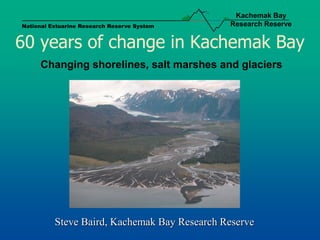
1. Kachemak Bay
National Estuarine Research Reserve System Research Reserve
60 years of change in Kachemak Bay
Changing shorelines, salt marshes and glaciers
Steve Baird, Kachemak Bay Research Reserve
2. Kachemak Bay
National Estuarine Research Reserve System Research Reserve
Coastal Erosion
Why are people interested in coastal erosion?
12. Kachemak Bay
National Estuarine Research Reserve System Research Reserve
Coastal Erosion and Climate Change
• Erosion rates will be affected by frequency of
waves impacting bluff
• Frequency, intensity, and direction of storms
• Relative sea-level
18. Kachemak Bay
National Estuarine Research Reserve System Research Reserve
Shifting Salt Marshes
• Sensitive to changes in elevation / sea-level
• Affected by sedimentation rates
25. Kachemak Bay
National Estuarine Research Reserve System Research Reserve
Glacial Thinning
Chris Larsen, Geophysical Institute, UAF
26. Kachemak Bay
National Estuarine Research Reserve System Research Reserve
Summary
• Erosion along Homer shoreline an ongoing concern
• Salt marshes are sensitive to changes in elevation & sedimentation
• Glaciers are receding and thinning, at an accelerating rate
• To predict climate-change impacts, we need to understand:
• Balance between coastal uplift rates and sea-level rise
• Whether uplift rates are uniform; relation to underlying geology
• Changes in frequency, intensity, and direction of storm events
• Changes in glacial melt and sedimentation rates
• For salt marsh habitats, the importance of these habitats to a
wide range of species