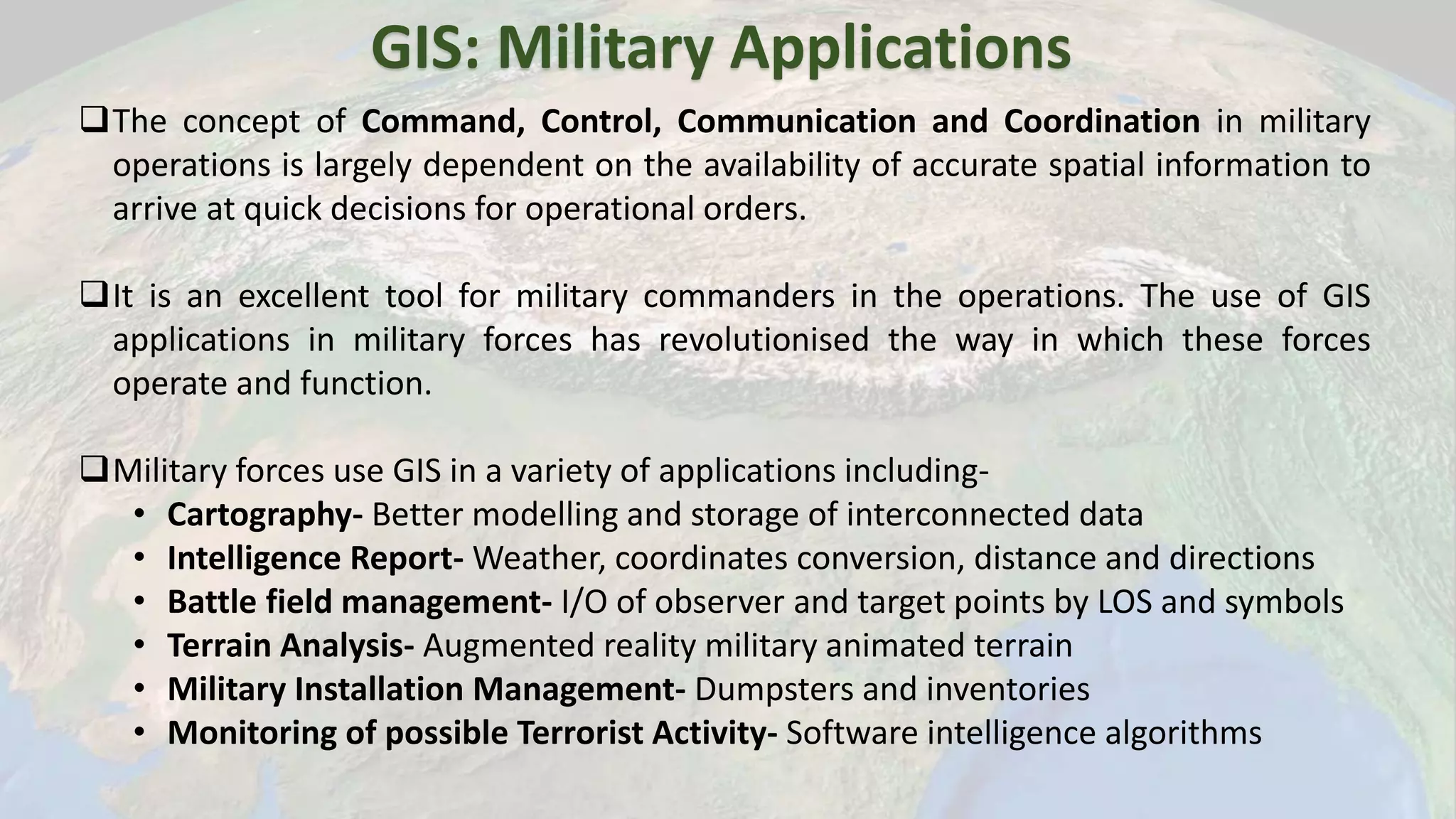
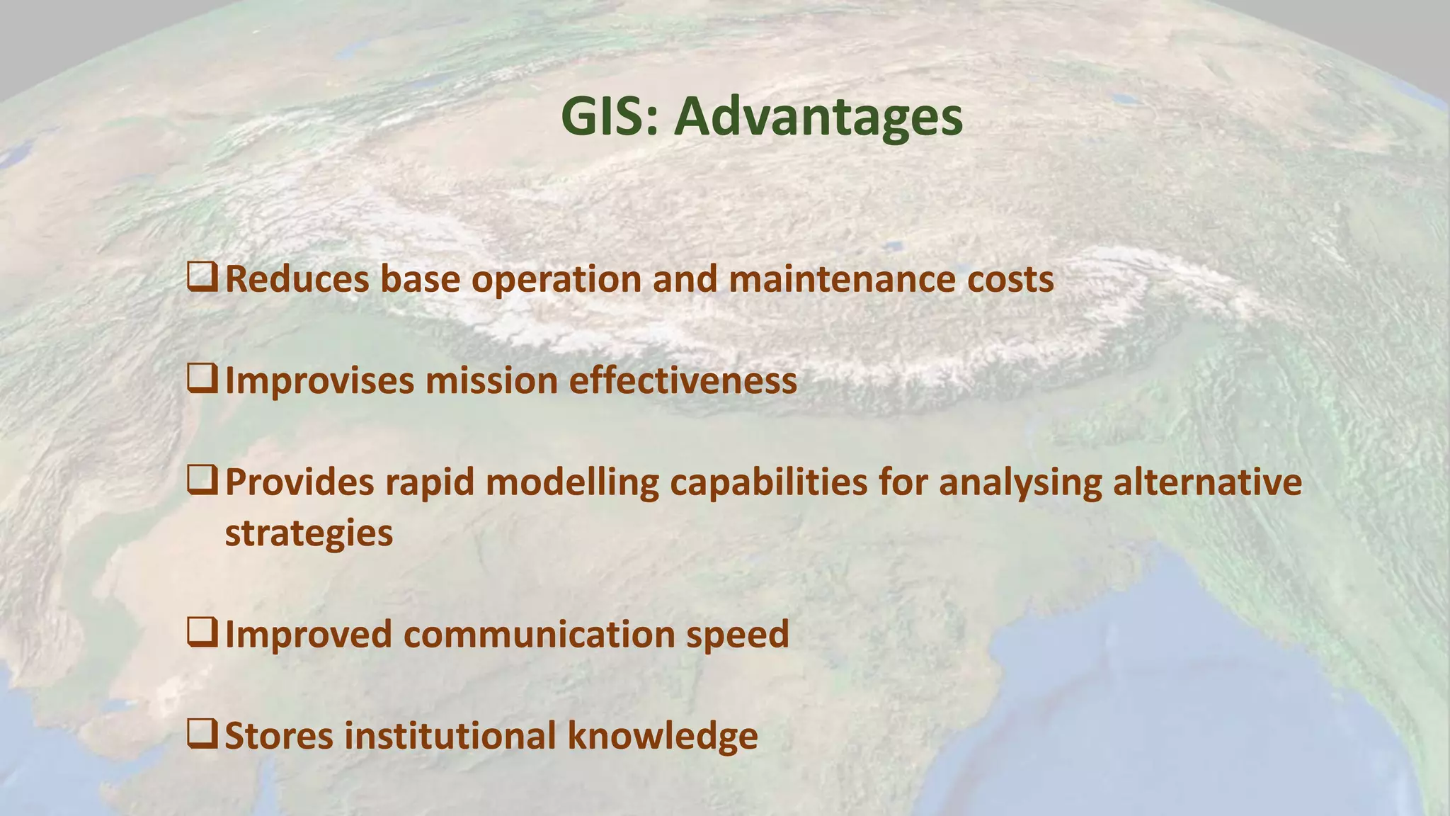
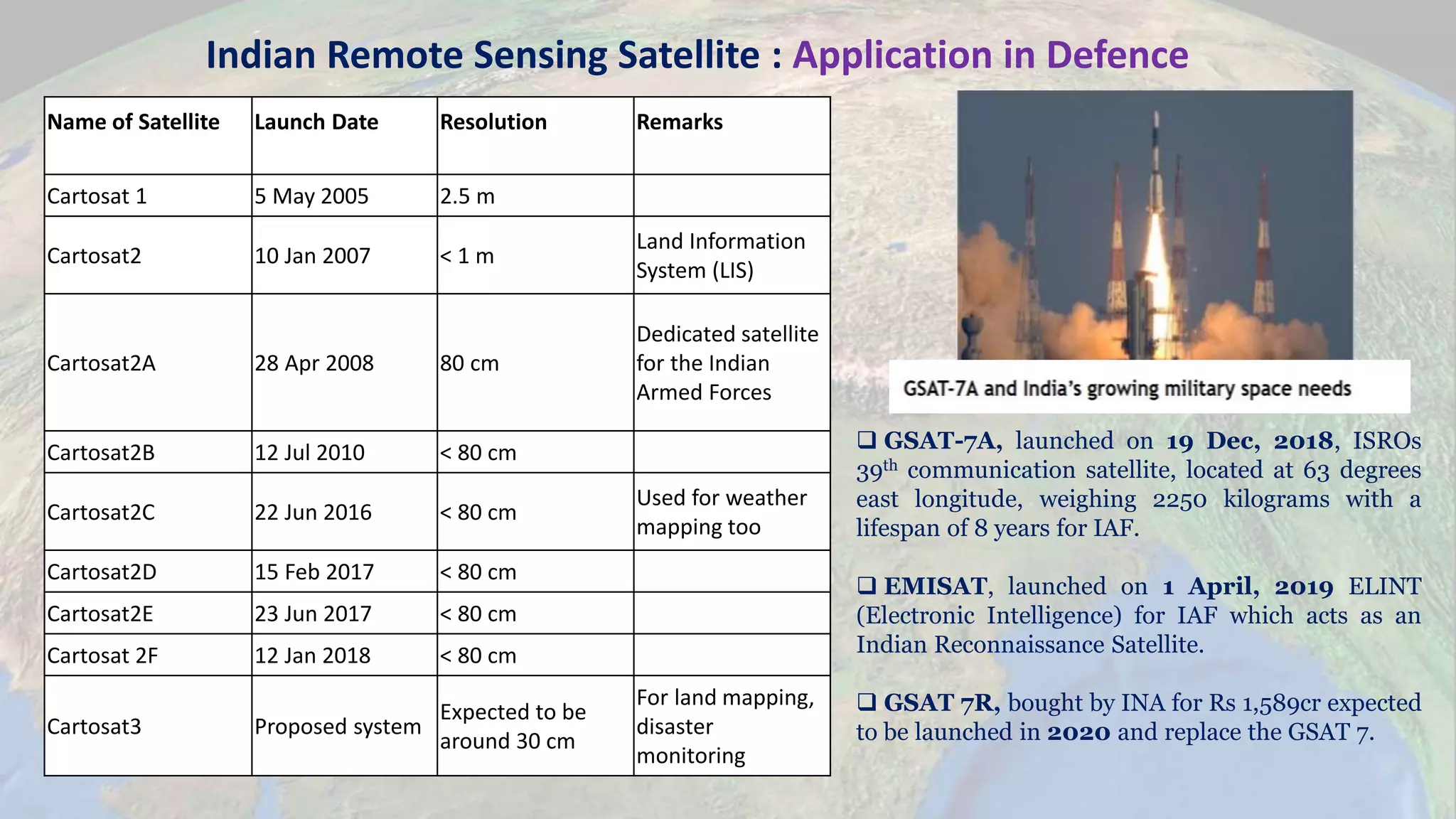
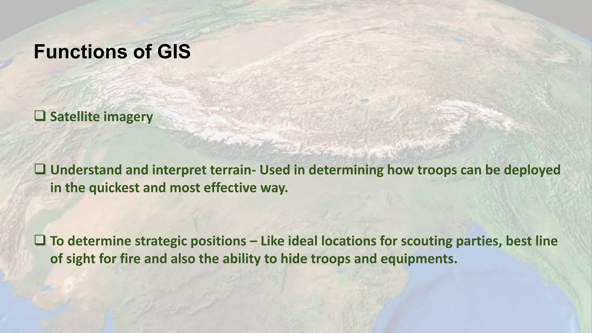
The document discusses the significance of Geographic Information Systems (GIS) in military operations, highlighting its role in improving decision-making through spatial data management. It covers various military applications of GIS, such as battlefield management, terrain analysis, and logistics, emphasizing the advantages like cost reduction and enhanced mission effectiveness. Additionally, it outlines the importance of satellite technology and weather information in optimizing military strategies.
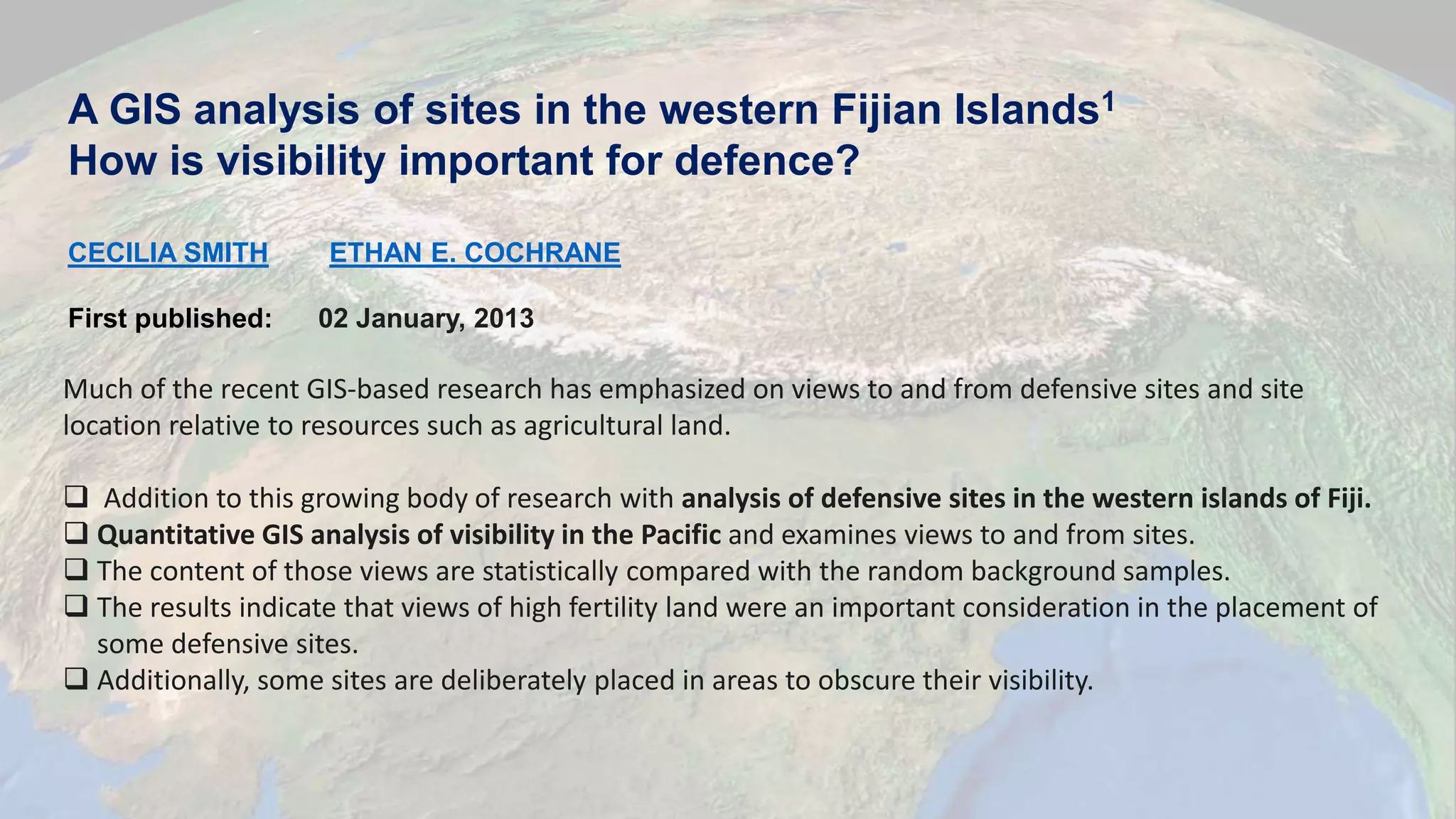
![[1] Cecilia Smith, Ethan E.Cochrane. A GIS analysis of sites in
western Fijian islands.
[2]Google Scholar
[3]NPTEL Online course on Remote Sensing
References and Citations](https://image.slidesharecdn.com/presentationgis-190918051454/75/GIS-application-in-Defense-12-2048.jpg)