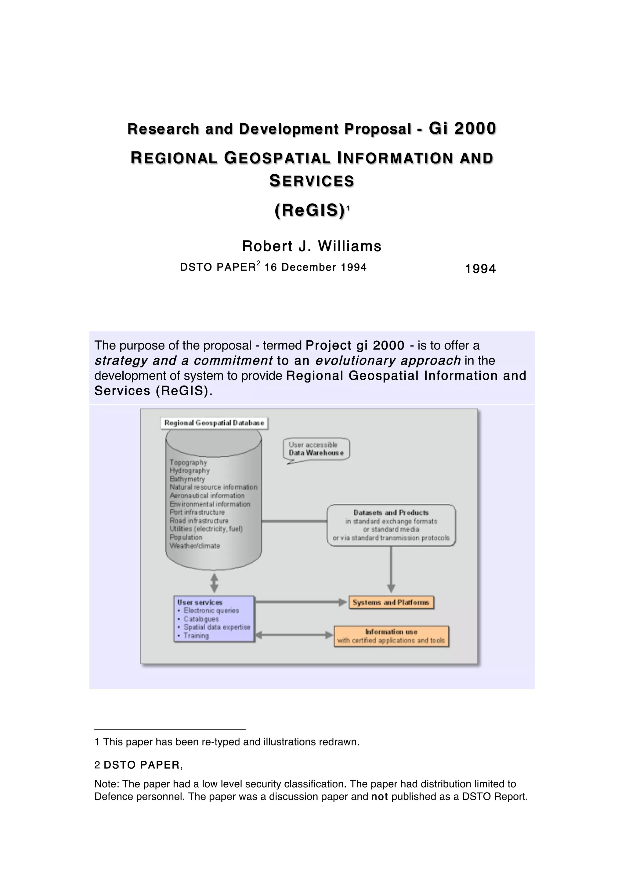
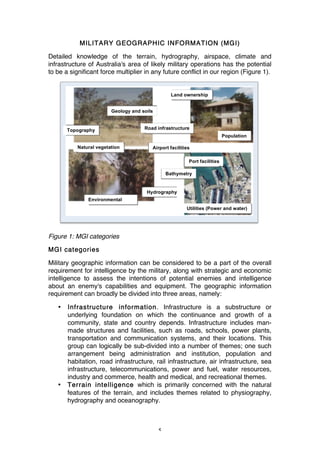
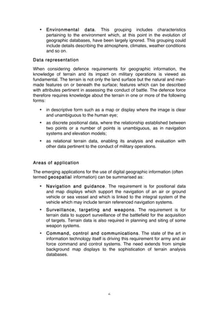
Download to read offline

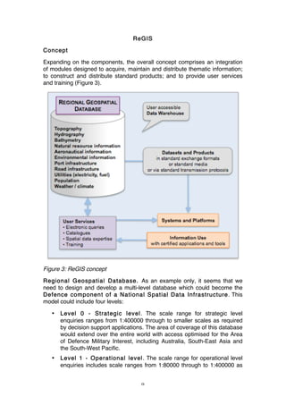


The proposal, termed Project GI 2000, aims to develop a system for providing regional geospatial information and services (REGIS) to enhance military operations and strategic planning. This initiative seeks to establish a national spatial data infrastructure by integrating geospatial data management, promoting standards and guidelines, and improving collaboration with academia and industry. By emphasizing the importance of accurate and timely geographic information, the project intends to support military functions such as navigation, surveillance, and operational planning in a digital format.


![Future Defence Geospatial Environment Future [2000]](https://cdn.slidesharecdn.com/ss_thumbnails/futuregeoenv2000-210923064710-thumbnail.jpg?width=640&height=640&fit=bounds)


![Polymer [ बहुलक ] Chemistry Notes PDF - Irfanullah Mehar - JJ Sir Chemistry.pdf](https://cdn.slidesharecdn.com/ss_thumbnails/polymerchemistrynotespdf-irfanullahmehar-jjsirchemistry-260210172118-3f9b37f7-thumbnail.jpg?width=640&height=640&fit=bounds)


