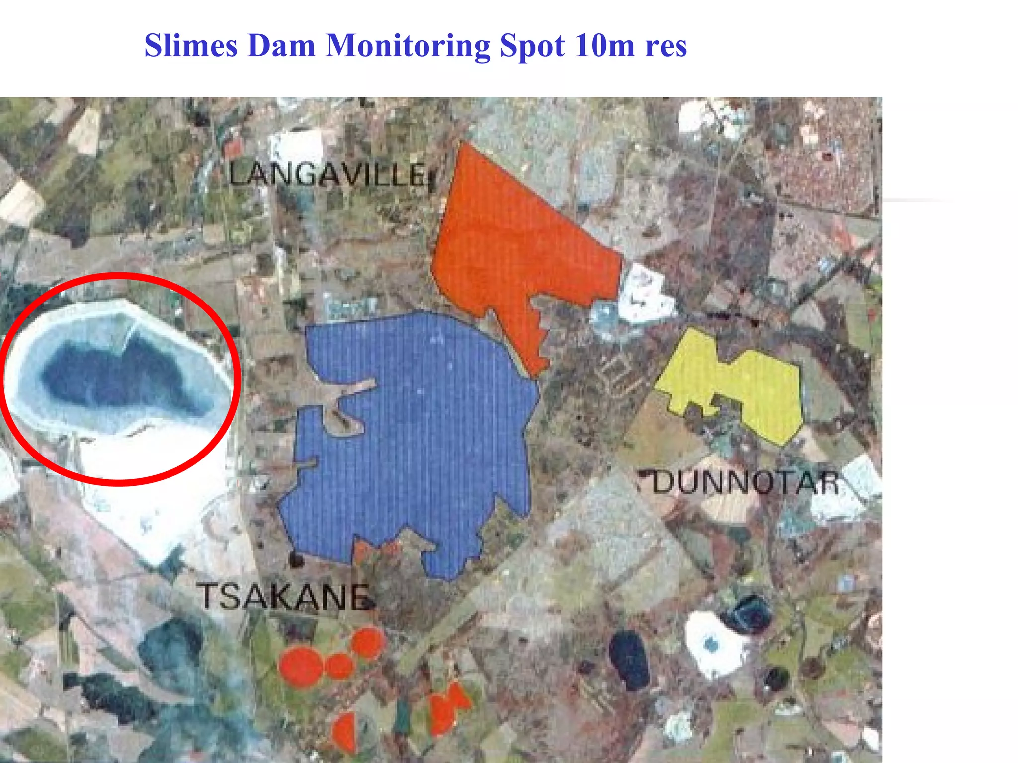
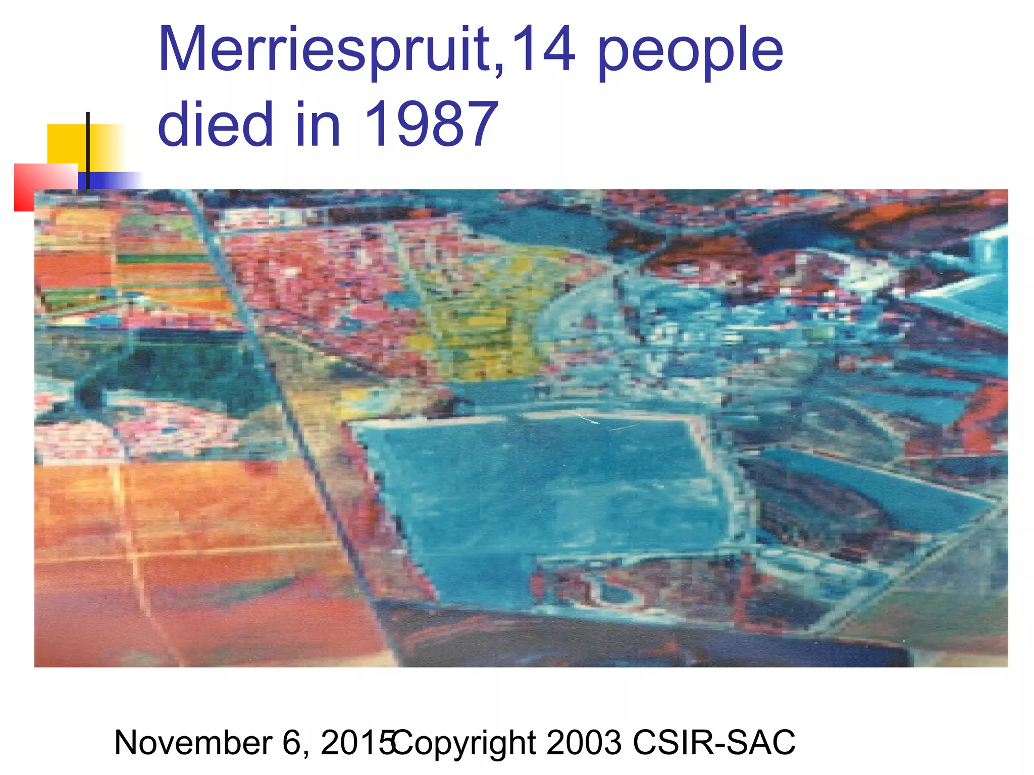
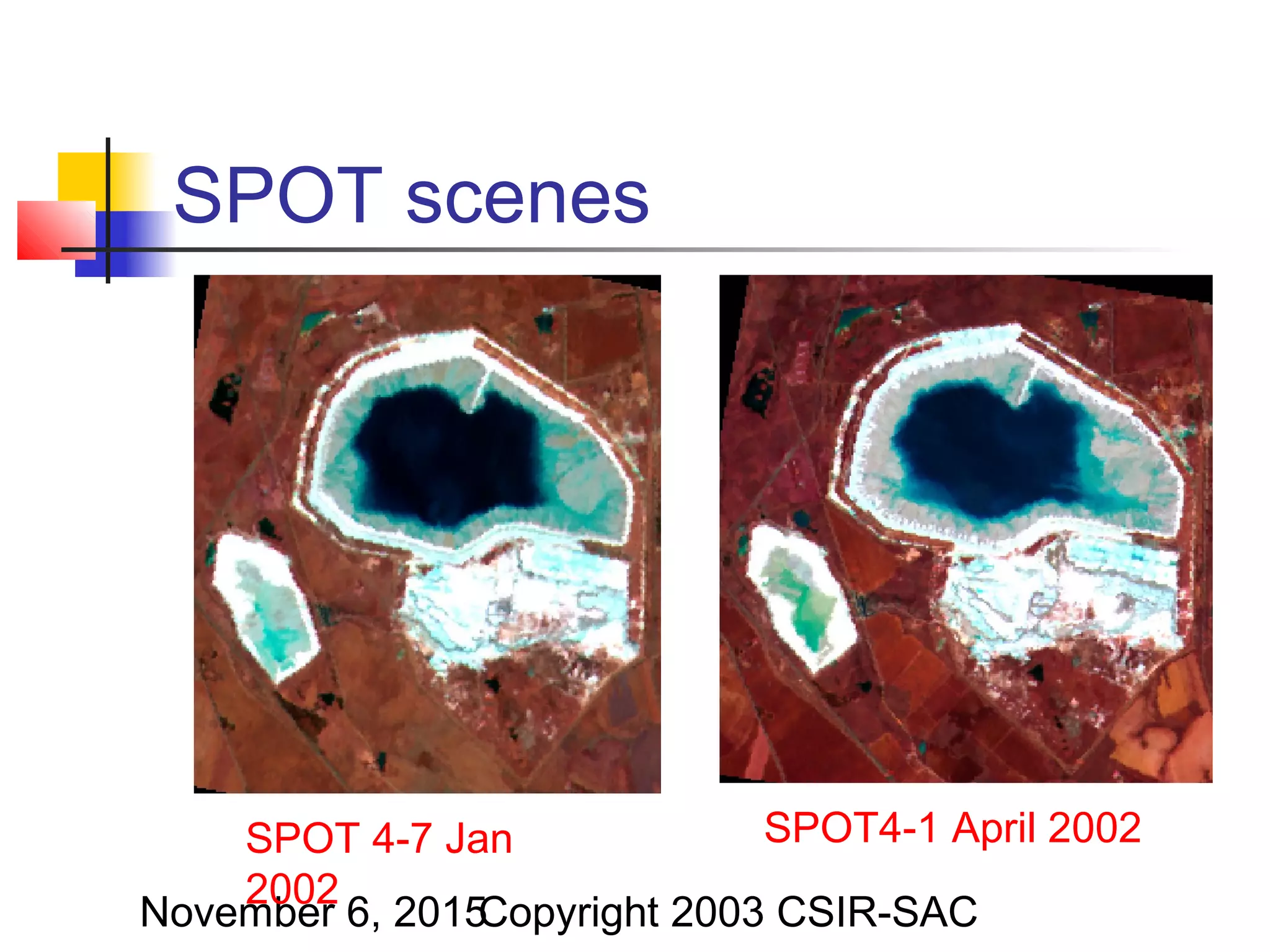
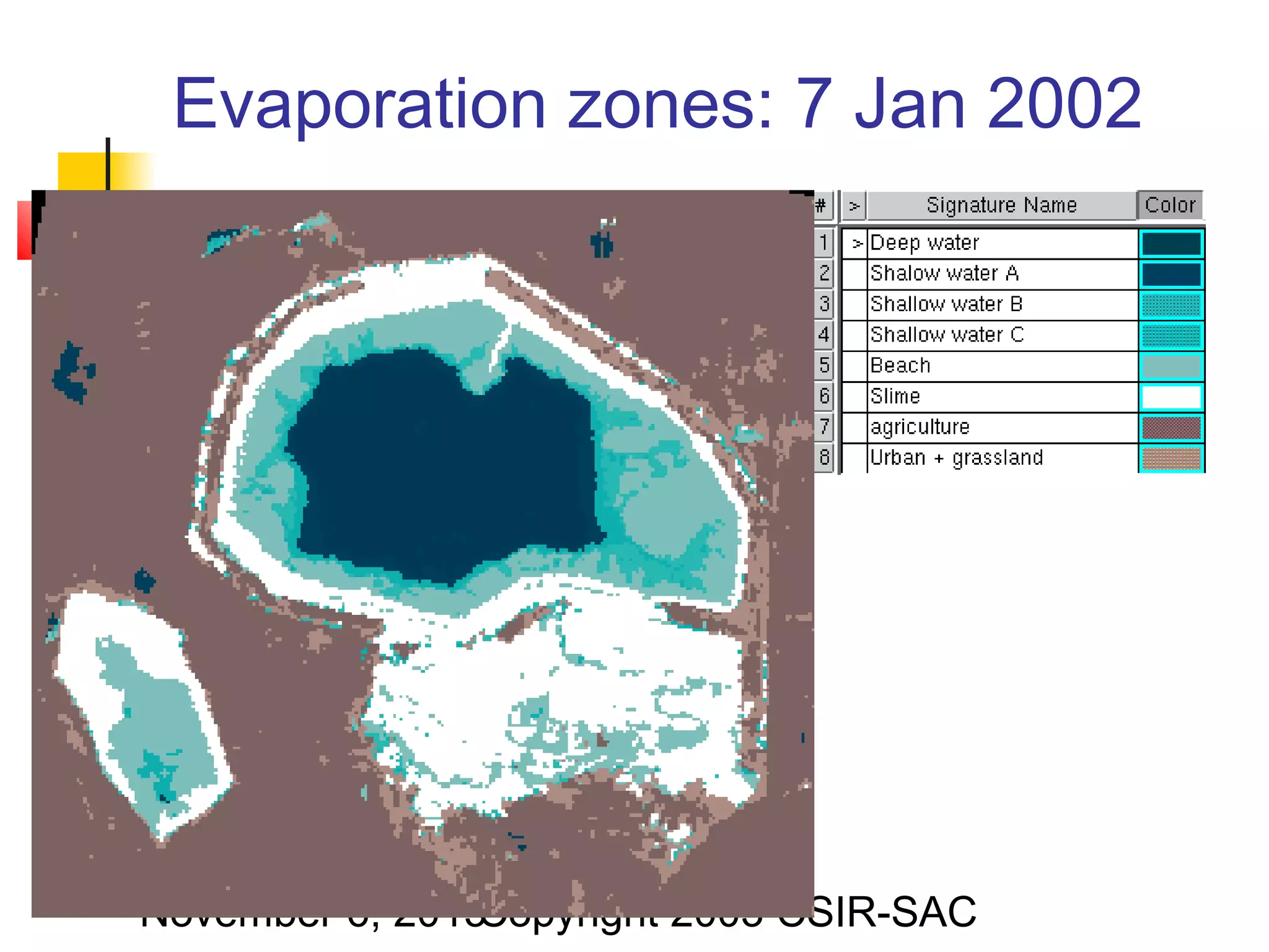
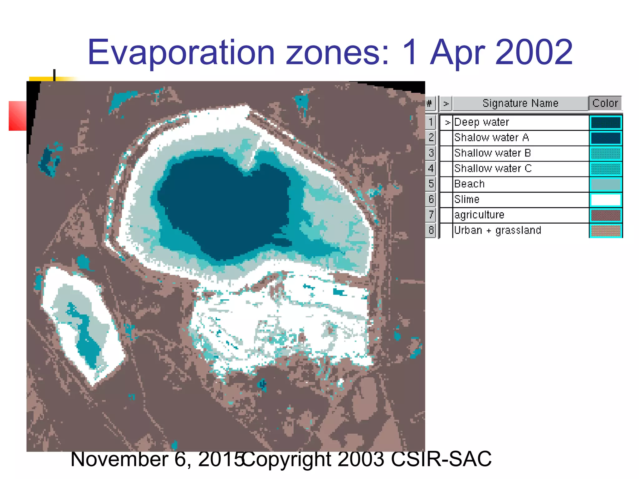
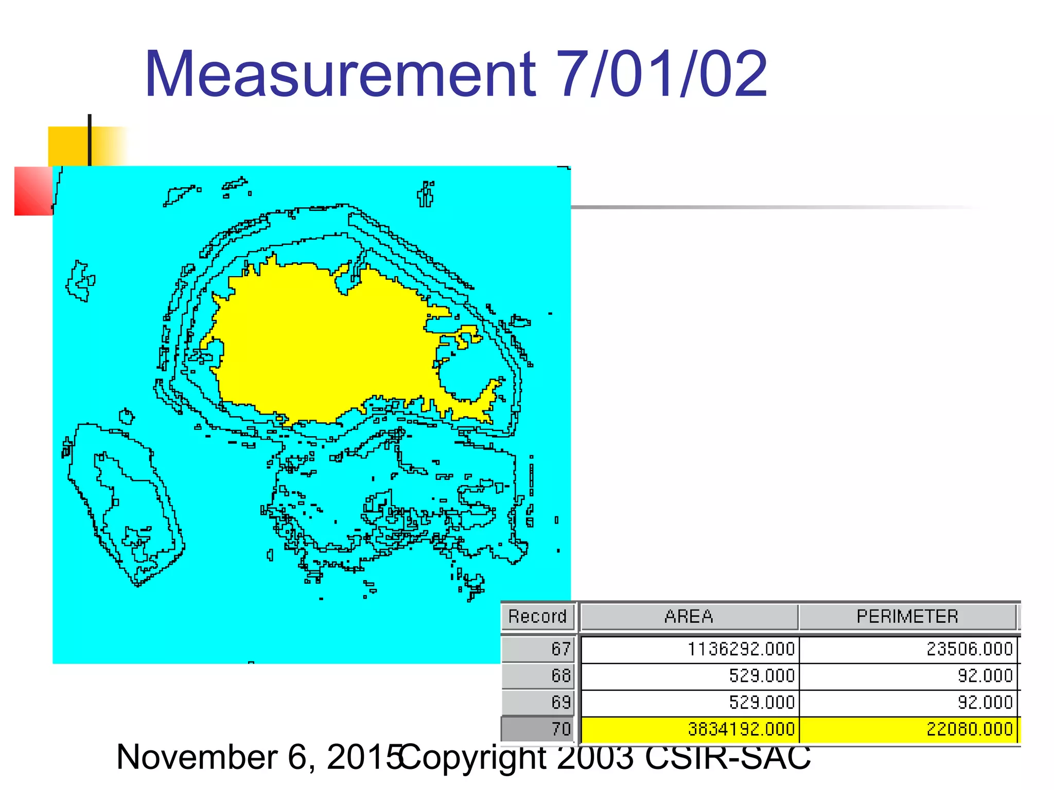
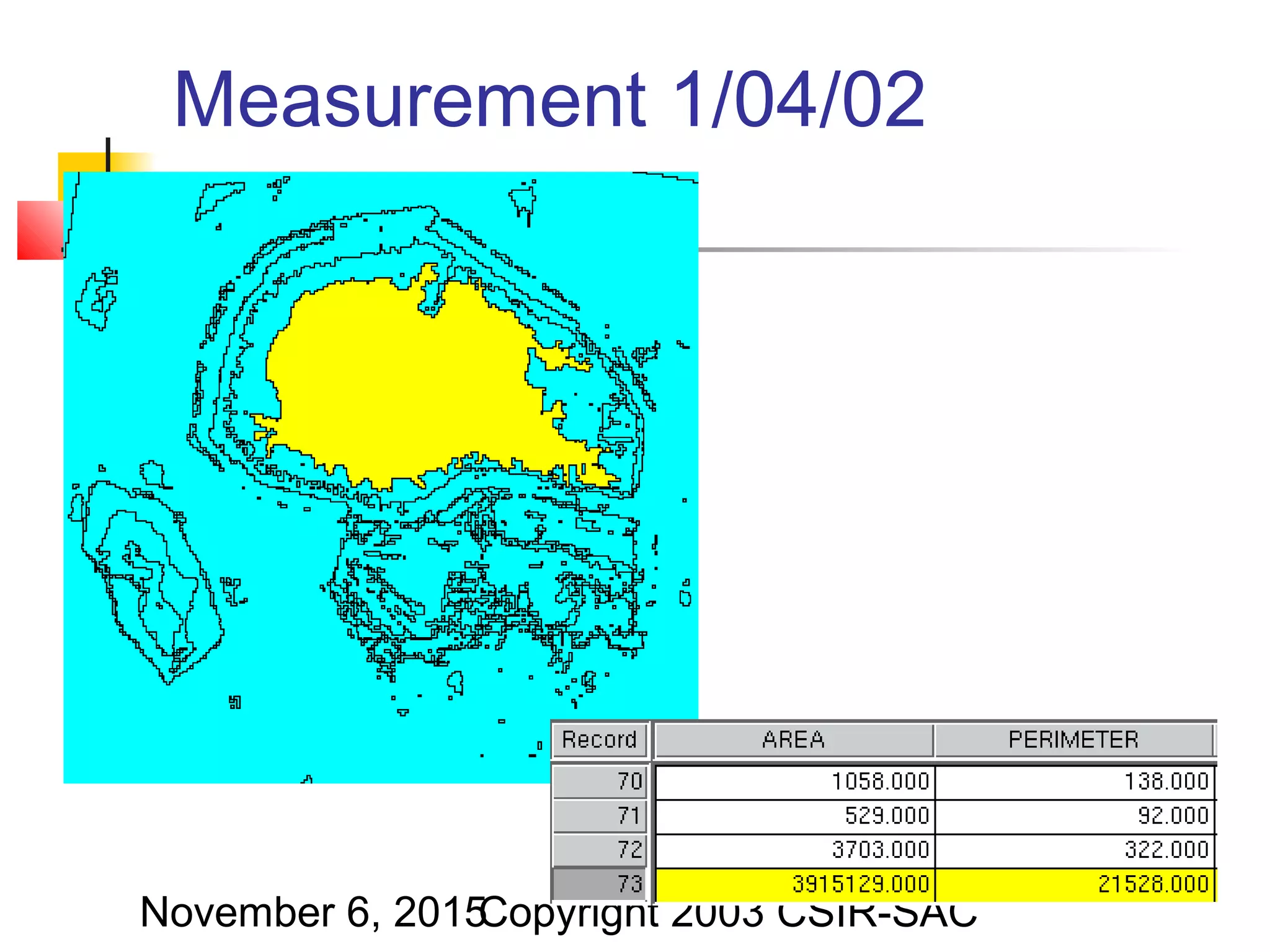
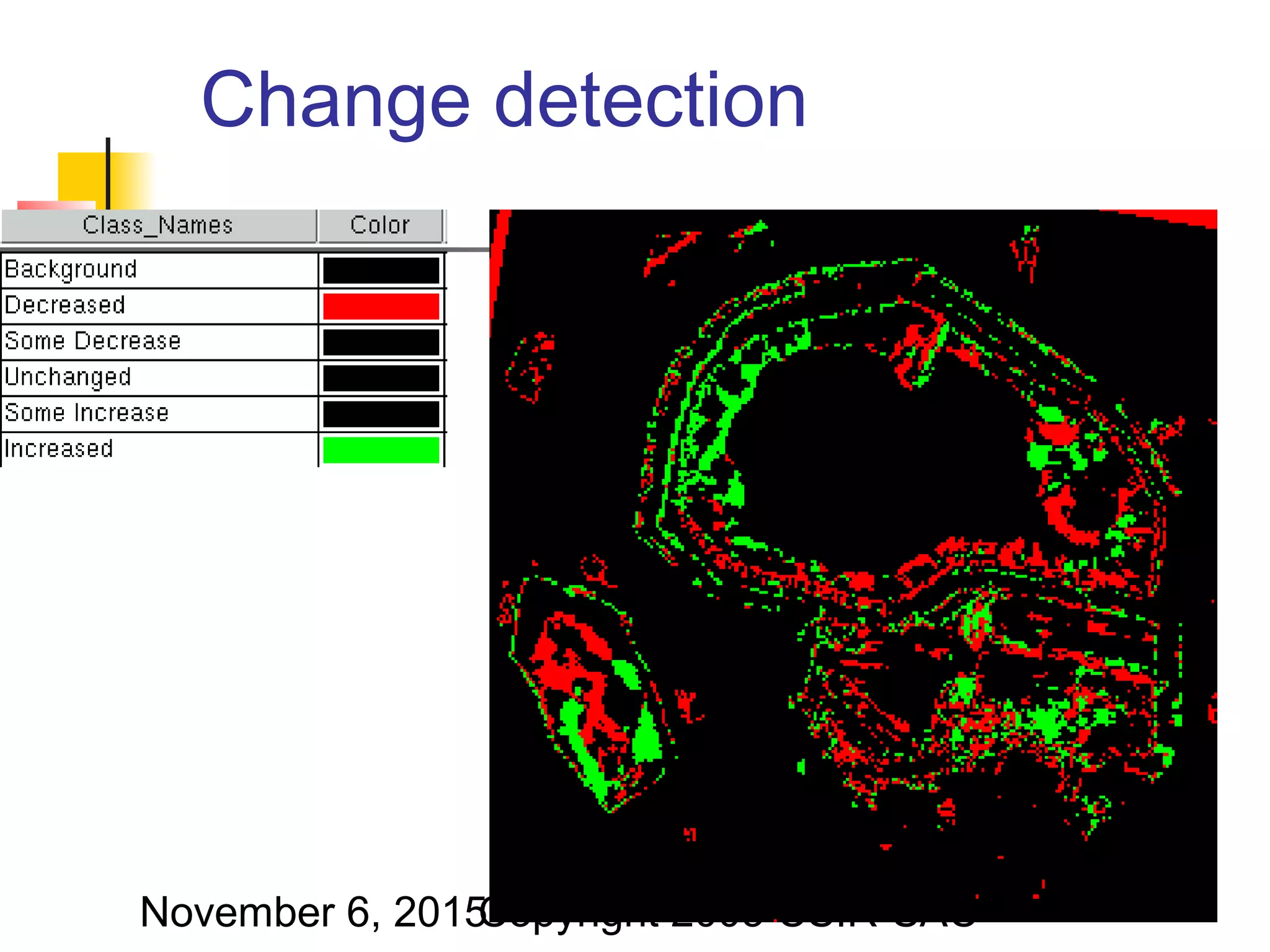
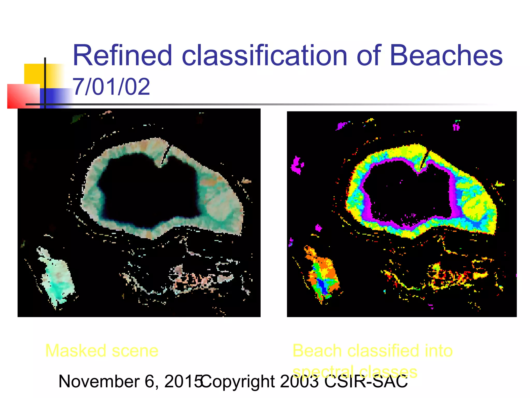
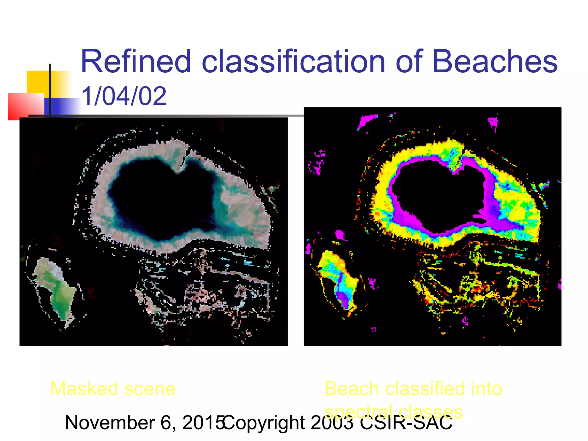
The document discusses the use of remote sensing technologies and satellite imagery for geological applications like tailings dam monitoring. It presents SPOT satellite images from January 2002 and April 2002 of evaporation zones and beaches around a slimes dam. Changes are detected between the two dates and the beaches are classified into spectral classes in order to refine monitoring of the dam over time.


![Soil mechanics a[1].ppt](https://cdn.slidesharecdn.com/ss_thumbnails/soilmechanicsa1-ppt-100508140703-phpapp02-thumbnail.jpg?width=640&height=640&fit=bounds)


![Remote sensing [compatibility mode]](https://cdn.slidesharecdn.com/ss_thumbnails/remotesensingcompatibilitymode-131231034635-phpapp02-thumbnail.jpg?width=640&height=640&fit=bounds)


