GeoServer is an open source server that allows users to share and edit geospatial data. It can handle raster and vector files from different data sources and supports common standards like WMS, WFS, and WCS. It has tools for styling maps and integrating geospatial data with other systems. GeoServer is highly configurable, supports many data formats, and continues to add new features through its active development community.
GeoServer, GeoNetwork and INSPIRE: where we are and what is missingGeoSolutions
GeoSolutions' presentation for the PTA Interreg 2012 wrkshop in La Salle, Aosta (ITALY) about GeoServer, GeoNetwork and the status for INSPIRE Compliancy
GeoServer, GeoNetwork and INSPIRE: where we are and what is missingGeoSolutions
GeoSolutions' presentation for the PTA Interreg 2012 wrkshop in La Salle, Aosta (ITALY) about GeoServer, GeoNetwork and the status for INSPIRE Compliancy
Using GeoServer for spatio-temporal data management with examples for MetOc a...GeoSolutions
This presentation will provide detailed information on how to ingest and configure spatio-temporal data in GeoServer, to be served using OGC services, with examples from WMS and WCS services.
GeoSolutions contributions to the CUSTOM ProjectGeoSolutions
Slides describing GeoSolutions contribution to the CUSTOM project, a cloud platform to support cultural heritage and tourism needs.
This presentation includes also a short introduction to the GeoServer platform.
GeoServer, an introduction for beginnersGeoSolutions
This presentation will provide an introduction to the GeoServer project and its abilities to publish data with a mix of well known OGC protocols and other pupolar protocol and data formats, including:
* Setting up vector and raster data from the GeoServer administration control
* Publishing data via WMS, WFS and WCS
* Styling layers using desktop tools, with a carousel of GeoServer mapping abilities
* Tile caching with WMTS
* Moving to data processing with WPS
* Brief introduction to security
GeoServer The Open Source Solution for the interoperable management of geos...GeoSolutions
GeoServer is an open source geo-spatial server written in Java, following the common Java Enterprise practices, allowing for the handling, distribution and analysis of geospatial data.
GeoServer allows to distribute, handle and analyses data using the most widely accepted OGC standards (WMS, WFS, WCS and WPS), without forgetting specific extensions for a transparent interacting with clients such as Google Earth and commercial software in general, and providing support for the now common protocols based on REST and GeoJSON for the distribution of simple vector based data.
The presentation will give the audience an exhaustive introduction to the GeoServer functionalities for the creation of interoperable Spatial Data Infrastructures, with particular focus on the new functionalities introduced with the upcoming GeoServer 2.4 release, the WPS 1.0 spatial data analysis capabilities as well as on the level of INSPIRE Compliancy.
GeoServer in Production: we do it, here is how!GeoSolutions
The presentation will describe how to setup a production system based on GeoServer from the points of view of performance, availability and security. The suggestions will start covering how a single node GeoServer should be prepared for internet usage, tuning logging, connection pools, security, data and JVM preparation, keeping disk, memory and CPU usage in check within the limits of the available resources. We’ll then move to tools used to monitor the production instances, ranging from probes to request auditing and watch-dogs. Finally the presentation will cover setting up a cluster of server and the strategies for keeping them in synch, from the traditional multi-tier setup (testing vs production) to the systems that need to keep an ever evolving catalog of layers constantly on-line and in synch.
GeoServer an introduction for beginnersGeoSolutions
This presentation will provide an introduction to the GeoServer project and its abilities to publish data with a mix of well-known OGC protocols and other popular protocols and data formats.
Mastering Security with GeoServer and GeoFence - FOSS4G EU 2017GeoSolutions
The presentation will provide an introduction to GeoServer own authentication and authorization subsystems. We’ll cover the supported authentication protocols, such as from basic/digest authentication and CAS support, check through the various identity providers, such as local config files, database tables and LDAP servers, and how it’s possible to combine the various bits in a single comprehensive authentication tool, as well as providing examples of custom authentication plugins for GeoServer, integrating it in a home grown security architecture. We’ll then move on to authorization, describing the GeoServer pluggable authorization mechanism and comparing it with proxy based solution, and check the built in service and data security system, reviewing its benefits and limitations. Finally we’ll explore the advanced authentication provider, GeoFence, explore the levels on integration with GeoServer, from the simple and seamless direct integration to the more sophisticated external setup, and see how it can provide GeoServer with complex authorization rules over data and OGC services, taking into account the current user, OGC request and requested layers to enforce spatial filters and alphanumeric filters, attribute selection as well as cropping raster data to areas of interest.
Enterprise class deployment for GeoServer and GeoWebcache Optimizing perform...GeoSolutions
Setting up a GeoServer can sometimes be deceptively simple. However, going from proof of concept to production requires a number of steps to be taken in order to optimize the server in terms of availability, performance and scalability. This presentation will show how to get from a basic set up to a battle ready, rock solid installation by showing the ropes an advanced user already mastered.
Creating Stunning Maps in GeoServer: mastering SLD and CSS stylesGeoSolutions
Various software can style maps and generate a proper SLD document for OGC compliant WMS like GeoServer to use. However, in most occasions, the styling allowed by the graphical tools is pretty limited and not good enough to achieve good looking, readable and efficient cartographic output. For those that like to write their own styles CSS also represents a nice alternatives thanks to its compactness and expressiveness.
Several topics will be covered, providing examples in both SLD and CSS for each, including: mastering multi-scale styling, using GeoServer extensions to build common hatch patterns, line styling beyond the basics, such as cased lines, controlling symbols along a line and the way they repeat, leveraging TTF symbol fonts and SVGs to generate good looking point thematic maps, using the full power of GeoServer label lay-outing tools to build pleasant, informative maps on both point, polygon and line layers, including adding road plates around labels, leverage the labeling subsystem conflict resolution engine to avoid overlaps in stand alone point symbology, blending charts into a map, dynamically transform data during rendering to get more explicative maps without the need to pre-process a large amount of views.
The presentation aims to provide the attendees with enough information to master SLD/CSS documents and most of GeoServer extensions to generate appealing, informative, readable maps that can be quickly rendered on screen.
Advanced GeoServer Security with GeoFenceGeoSolutions
This presentation will provide an introduction to GeoFence, an open source tool to configure and use complex authorization rules to protect data served by GeoServer OGC services.
State of GeoServer provides an update on our community and reviews the new and noteworthy features for the Project. The community keeps an aggressive six month release cycle with GeoServer 2.8 and 2.9 being released this year.
Each releases bring together exciting new features. This year a lot of work has been done on the user interface, clustering, security and compatibility with the latest Java platform. We will also take a look at community research into vector tiles, multi-resolution raster support and more.
Attend this talk for a cheerful update on what is happening with this popular OSGeo project. Whether you are an expert user, a developer, or simply curious what these projects can do for you, this talk is for you.
SIG Libre 2013 Girona. Cuso Online de SIG y CooperaciónFrancisco Puga
Presentación del curso online de SIG y Cooperación para el congreso de SIG Libre de Girona 2013 en el que participaron Ingeniería Sin Fronteras, iCarto, Laborate y Cartolab
Advanced Security with GeoServer - FOSS4G 2015GeoSolutions
The presentation will provide an introduction to GeoServer own authentication and authorization subsystems. We’ll cover the supported authentication protocols, such as from basic/digest authentication and CAS support, check through the various identity providers, such as local config files, database tables and LDAP servers, and how it’s possible to combine the various bits in a single comprehensive authentication tool, as well as providing examples of custom authentication plugins for GeoServer, integrating it in a home grown security architecture.
We’ll then move on to authorization, describing the GeoServer pluggable authorization mechanism and comparing it with proxy based solution, and check the built in service and data security system, reviewing its benefits and limitations.
Finally we’ll explore the advanced authentication provider, GeoFence, explore the levels on integration with GeoSErver, from the simple and seamless direct integration to the more sophisticated external setup, and see how it can provide GeoServer with complex authorization rules over data and OGC services, taking into account the current user, OGC request and requested layers to enforce spatial filters and alphanumeric filters, attribute selection as well as cropping raster data to areas of interest.
Mapping the world beyond web mercator - FOSS4G 2015GeoSolutions
Most popular mapping presentations today, ranging from clients to servers, show and discuss only maps in EPSG:3857, the popular Mercator derived projection used by OSM as well as
most commercial tiles providers.
There is however an interesting, exciting world of map projections out there, that are still being used in a variety of context. This presentation will introduce the advancement made in GeoTools and GeoServer to handle those use cases, where users have a worldwide data set, and need to view all or part of it in multiple projections, some of which valid in a limited area, and requiring the software to perform a proper display of it on the fly, without any preparation.
We’ll discuss GeoTools/GeoServer “advanced projection handling” manages to deal with these cases, wrapping data, dealing with the poles and the dateline, cutting on the fly excess data, densifying on the fly long lines as needed to ensure a smooth reprojection, for a variety of cases, ranging from seemingly innocuous datum shifts, maps having the prime meridian over the pacific, and the various tricks to properly handle stereographic, transverse mercator, Lambert conic and other limited area projections against world wide source data sets.
The following presentation was held by GeoSolutions founder and managing director Simone Giannecchini at GeoSpatial World Forum INSPIRE Conference in Lisbon, 2015.
The workshop will provide a hands on introduction to the basic GeoServer concepts, as well as usage and configuration, with particular attention to the setup of INSPIRE compliant view services with a demonstration set of data in various formats, both raster and vector.
Setting up a GeoServer can sometimes be deceptively simple. However, going from proof-of-concept to production requires a number of steps to be taken in order to optimize the server in terms of availability, performance and scalability. The presentation will show how to get from a basic setup to a battle-ready, rock-solid installation.
Setting up a GeoServer can sometimes be deceptively simple. However, going from proof of concept to production requires a number of steps to be taken in order to optimize the server in terms of availability, performance and scalability. The presentation will show how to get from a basic set up to a battle ready, rock solid installation by showing the ropes an advanced user already mastered.
Serving earth observation data with GeoServer: addressing real world requirem...GeoSolutions
The presentation will cover GeoSolutions experience in setting up GeoServer based production systems providing access to earth observation products, with indications of technical challenges, solutions, and deployment suggestion. The presentations will cover topics such as setting up a single unified mosaic from all the available data sources, tailoring access to it to different users, determining the most appropriate stacking order, dealing with multiresolution, different coordinate systems, multiband data, SAR integration, searching for the most appropriate products using a mix of WFS, CSW and so on, serving imagery with high performance WMS and WMTS, performing small and large data extractions with WCS and WPS, closing up with deployment examples and suggestions.
State of GeoServer, GeoTools and Friends 2014Jody Garnett
GeoServer and the Java toolkit GeoTools comprise one of OSGeo’s fastest moving mapping ecosystems. In addition to this core we will cover java-stack developments in JTS, GeoWebCache and ImageIO-Ext.
First up is “State of GeoServer” reviewing the new and noteworthy features introduced in the past year. Our six month release cycle sees GeoServer 2.5 and 2.6 being released this year. These releases bring together exciting new features: WCS 2.0 and WCS 2.0 Earth Observation profile, batch importer, and a fresh implementation of GetFeatureInfo.
Switching to technical for a GeoTools update. A passion for performance sees improvements in PNG and JPEG encoding, rendering from PostGIS and experimental JDK work. This presentation provides a review of new features, api changes and community modules. We have simplified the core FeatureCollection interface, introduced partial 3D support, structured grid coverages, multiple grid coverages and extended JTS Geometry with Curves.
Data formats support continues to grow with the latest GeoPackage, native NetCDF support and a new shapefile and wfs client implementation. Database users have table and index management methods to look forward to. Extensions have seen a lot of activity with WMS client improvements, vector grids, and a transform extension for dynamic feature collection processing.
Attend this talk for a cheerful update on what is happening with these great OSGeo projects! Whether you are an expert user, a developer, or simply curious what these projects can do for you, this talk is for you.
Presentation about GeoServer helded by GeoSolutions technical lead Mauro Bartolomeoli at GeoBusiness 2015, London.
Main topics:
-Quick intro to GeoServer
-What’s new in the 2.6.x and 2.7.x series
-What’s cooking for the future
GeoServer is the start of a great open source success story. This talk introduces the core GeoServer application and explores the ecosystem that has developed around this beloved OSGeo application.
This talks draws on the GeoServer ecosystem for use-cases and examples of how the application has been used successfully by a wide range of organizations.
Andrea Amie from GeoSolutions is on hand to share success stories highlighting GeoServer use in managing vulnerable ecosystems, agriculture information management, and marine data management.
Jody Garnett will look at how GeoServer enables Boundless products including Boundless Server and Boundless Server Enterprise.
We will look at GeoServer use at OSGeo with both GeoNetwork and GeoNode making use of the technology.
LocationTech is not ignored with the “big data” players in the form of GeoMesa and GeoWave bridging to cloud data sources of epic proportion
We use each use-case to highlights a capability of GeoServer providing an overview of the application drawn from practical examples.
Attend this talk for inspiration on what is possible with GeoServer and open source.
State of GeoServer provides an update on our community and reviews the new and noteworthy features for 2018. GeoServer is a web service for publishing your geospatial data. using industry standards for vector, raster and mapping.
We have an active community and a lot to cover for 2.12 and 2.13 release, as well what is cooking in September’s 2.14 release.
Each release provides exciting new features, this talk covers diverse improvements across GeoServer:
* OGC compliance work for WFS 2.0 and WMTS 1.0, WFS 3.0 support
* improvements for cloud deployments
* cascade WMTS services
* progress in NetCDF support
* getting ready for the Java 18.9 roadmap
* And much more…
Attend this talk for a cheerful update on what is happening with this popular OSGeo project. Whether you are an expert user, a developer, or simply curious what GeoServer can do for you.
The Construction of the Internet Geological Data System Using WWW+Java+DB Tec...Channy Yun
YUN, SEOKCHAN, 1997, The Construction of the Internet Geological Data System Using WWW+Java+DB Technique, Tertiary Deposits of Korea, AAPG Annual Convention Abstracts, Association of American Petroleum Geologists 1997.4.23-26, Dallas, TX, USA, p.420
Presentations from IMGS at Local Government User Group session on 11/09/2012.
Includes presentations on Location Publisher updates, GeoMedia Smartclient, Leica Geosystems and ERDAS Imagine and Apollo
Raster Data In GeoServer And GeoTools: Achievements, Issues And Future Develo...GeoSolutions
The purpose of this presentation is to discuss the developments during last years in raster data support in GeoTools and GeoServer, and also to introduce and discuss future development directions.
MapStore 2, modern mashups with OL3, Leaflet and ReactGeoSolutions
MapStore 2 is an overhaul of the existing MapStore with the goal of creating a webmapping framework which is more lightweight but still modular and easy to work with. It can leverage both OpenLayers 3 or Leaflet as the mapping engine and uses ReactJS and Redux as the core JavaScript libraries. Moreover a 3D viewer based on CesiumJS is available.
MapStore 2 is both a framework and a standalone application. You can use it as a framework to develop your custom WebGis application composing MapStore ReactJS components and components from other libraries (like React Bootstrap), choosing the best mapping library for your purposes. You can also use the MapStore2 application directly, to create, save, and share in a simple and intuitive way maps and mashups created by selecting content from the server such as Google Maps, OpenStreetMap or WMS and WMTS.
The MapStore 2 application consists of two main components MapManager and GeoStore, respectively front-end and back-end. MapManager allows through a unique interface to create, modify, delete and search on maps definition as well as generate a univoque link to embed a map in an external website, share your own maps with the others. GeoStore implements a flexible Java Enterprise infrastructure to manage and search maps with proper management of authentication and authorization.
The presentation will give the audience an extensive overview of the MapStore 2 functionalities for the creation of mapping portals. Eventually, a range of GeoSolutions case studies of MapStore 2 will be presented.
With the open source Geo2tag platform, developers can use JSON or XML to manage location references in apps for Nokia X and Nokia Asha phones. In this webinar, we’ll show how to use the Geo2tag API and how to manage a local database of georeferences. We’ll begin the training by introducing the fundamentals of Location Based Services and the REST API of Geo2Tag LBS Platform (www.geo2tag.org). We’ll focus on networking, JSON and web services. Then we will demonstrate several applications developed on top of Geo2Tagand share the newest enhancements to the platform. We’ll end the training with a discussion of integrating Geo2Tag and third-party map widgets.
MapStore 2 is an Open Source webmapping framework which uses ReactJS, Redux, OpenLayers, Leaflet and Cesium.
It supports various OGC Protocols like CSW, WMS, WFS and WMTS and allows end users to create charts and dashboards thanks to its integration with GeoServer.
GeoSolutions has been involved into a number of projects, ranging from local administrations to global institutions, involving GeoNode deployments, customizations and enhancements. A gallery of projects and use cases will showcase the versatility and effectiveness of GeoNode, both as a standalone application and as a service component, for building secured geodata catalogs and web mapping services. Lastly, ongoing and future developments will be presented ranging from the upcoming integration with MapStore to the monitoring and analytics dashboard or the support for time series data.
This presentation has been prepared with the objective to give readers a quick introduction to the Open Source GeoNode platform and its functionalities for the creation of a Spatial Data Infrastructure completely based on open Source components.
Serving earth observation data with GeoServer: addressing real world requirem...GeoSolutions
Information on the latest developments in GeoServer for the support for Earth Observation data with support for the various OGC services and OpenSearch.
This presentation goes over the most important features of GeoServer in order to give the reader an intro about what is good and what is super-good about GeoServer!
The current version reflects the presentation given at FOSS4G 2017 in Boston.
State of GeoServer provides an update on our community and reviews the new and noteworthy features for the Project. The community keeps an aggressive six month release cycle with GeoServer 2.11 and 2.12 being released this year. Each releases bring together exciting new features. This year a lot of work has been done on startup times, large catalogs, REST configuration upgrades, styling languages, styling interface, security,just to name a few. We will also take a look at community research into satellite imagery search and delivery, multi-resolution raster support and more. Attend this talk for a cheerful update on what is happening with this popular OSGeo project. Whether you are an expert user, a developer, or simply curious what these projects can do for you, this talk is for you.
Crunching Data In GeoServer: Mastering Rendering Transformations, WPS Process...GeoSolutions
This presentation will provide the attendee with an introduction to data processing in GeoServer by means of WPS, rendering transformations and SQL views, describing real applications and how these facilities were used in them.
We'll start with the basic WPS capabilities, showing how to build processing request based on existing processes and how to build new processes leveraging scripting languages, and introducing unique GeoServer integration features, showing how processing can seamlessly integrate directly in the GeoServer data sources and complement existing services.
We'll also discuss how to integrate on the fly processing in WMS requests, achieving high performance data displays without having to pre-process the data in advance, and allowing the caller to interactively choose processing parameters.
While the above shows how to make GeoServer perform the work, the processing abilities of spatial databases should not be forgotten, so we’ll show how certain classes of processing can be achieved directly in the database.
At the end the attendee will be able to easily issue WPS requests both for Vectors and Rasters to GeoServer through the WPS Demo Builder, enrich SLDs with on-the-fly rendering transformations and play with SQL views in order to create dynamic layers.
Raster Data In GeoServer and GeoTools: Achievements, Issues And Future Develo...GeoSolutions
The purpose of this presentation is, on a side, to dissect the developments performed during last year as far as raster data support in GeoTools and GeoServer is concerned, while on the other side to introduce and discuss the future development directions.
Advancements and improvements for the management of multidimensional raster data (NetCDF, GRIB, HDF) and mosaic thereof will be introduced, as well as the available ways to manage sliding windows of data via the REST API and importer.
Extensive details will be provided on the latest updates for the management of multidimensional raster data used in the Remote Sensing and MetOc fields, including support for WCS EO and WMS EO, and some considerations on the WCS MetOc extensions.
The presentation will also introduce and provide updates on jai-ext, imageio-ext, and JAITools. jai-ext provides extended JAI operators that correctly handle NODATA and regione of interests (masks), JAITools provides a number of new raster data analysis operators, including powerful and fast raster algebra support, while ImageIO-Ext bridges the gap across the Java world and native raster data access libraries providing high performance access to GDAL, Kakadu and other libraries.
The presentation will wrap up providing an overview of unresolved issues and challenges that still need to be addressed, suggesting tips and workarounds allowing to leverage the full potential of the systems.
GeoServer for Spatio-temporal Data Handling With Examples For MetOc And Remot...GeoSolutions
This presentation will provide detailed information on how to ingest and configure SpatioTemporal in GeoServer to be served using OGC services, with examples from WMS and WCS services.
Topics covered are as follows:
- Discussion over existing data formats and how to preprocess them for best serving with GeoServer
- Configuring SpatioTemporal raster and vector data in GeoServer
- Serving SpatioTemporal raster and vector data with OGC Services
- Tips and techniques to optimize performance and allow maximum exploitation of the available data
The attendees will be provided with the basic knowledge needed to preprocess and ingest the most common spatiotemporal data from the MetOc and Remote Sensing field for serving via GeoServer.
Advanced Cartographic Map Rendering in GeoServerGeoSolutions
Various software can style maps and generate a proper SLD document for OGC compliant WMS like GeoServer to use. However, in most occasions, the styling allowed by the graphical tools is pretty limited and not good enough to achieve good looking, readable and efficient cartographic output. For those that like to write their own styles CSS also represents a nice alternatives thanks to its compact-ness and expressiveness.
Several topics will be covered, providing examples in both SLD and CSS for each, including: mastering multi-scale styling, using GeoServer extensions to build common hatch patterns, line styling beyond the basics, such as cased lines, controlling symbols along a line and the way they repeat, leveraging TTF symbol fonts and SVGs to generate good looking point thematic maps, using the full power of GeoServer label lay-outing tools to build pleasant, informative maps on both point, polygon and line layers, including adding road plates around labels, leverage the labelling subsystem conflict resolution engine to avoid overlaps in stand alone point symbology, blending charts into a map, dynamically transform data during rendering to get more explicative maps without the need to pre-process a large amount of views. The presentation aims to provide the attendees with enough information to master SLD/CSS documents and most of GeoServer extensions to generate appealing, informative, readable maps that can be quickly rendered on screen.
Spatio-temporal Data Handling With GeoServer for MetOc And Remote SensingGeoSolutions
This presentation will provide detailed information on how to handle SpatioTemporal metadata in GeoServer for serving with OGC Services, with a particular focus on WMS and WCS.
The following presentation "Building Interoperable SDIs with Open Source Products" was held by GeoSolutions' founder and managing director at GeoSpatial World Forum 2015, Lisbon.
Main topics:
- GeoSolutions' presentation
- GeoSolutions' expertise
- GeoSolutions' products (GeoServer, GeoNetwork, MapStore)
- GeoSolutions' main clients
Introduzione a GeoServer ed ai servizi OGCGeoSolutions
Slide di Introduzione al GeoServer con particolare enfasi sui protocolli OGC da esso supportati.
La presentazione ripercorre con buon livello di dettaglio le funzionalità offerte da GeoServer proponendo dove necessario una breve introduzione ai servizi OGC da esso implementati in modo da rendere l'utente autonomo per quanto riguarda la comprensione dei concetti alla base delle funzionalità di GeoServer stesso.
Raster data in GeoServer and GeoTools: Achievements, issues and future devel...GeoSolutions
The purpose of this presentation is, on a side, to dissect the developments performed during last year as far as raster data support in GeoTools and GeoServer is concerned, while on the other side to introduce and discuss the future development directions.
Advancements and improvements for the management of raster mosaic and pyramids will be introduced and analyzed, as well as the latest developments for the exploitation of GDAL raster sources.
Extensive details will be provided on the latest updates for the management of multidimensional raster data used in the Remote Sensing and MetOc fields.
The presentation will also introduce and provide updates on the JAITools and ImageIO-Ext projects. JAITools provides a number of new raster data analysis operators, including powerful and fast raster algebra support. ImageIO-Ext bridges the gap across the Java world and native raster data access libraries providing high performance access to GDAL, Kakadu and other libraries.
The presentation will wrap up providing an overview of unresolved issues and challenges that still need to be addressed, suggesting tips and workarounds allowing to leverage the full potential of the systems.
The presentation will provide an introduction to GeoServer own authentication and authorization subsystems. We’ll cover the supported authentication protocols, such as from basic/digest authentication and CAS support, check through the various identity providers, such as local config files, database tables and LDAP servers, and how it’s possible to combine the various bits in a single comprehensive authentication tool, as well as providing examples of custom authentication plugins for GeoServer, integrating it in a home grown security architecture.
We’ll then move on to authorization, describing the GeoServer pluggable authorization mechanism and comparing it with proxy based solution, and check the built in service and data security system, reviewing its benefits and limitations.
Finally we’ll explore an advanced authentication tool called GeoFence, and see how it can plug into GeoServer to provide graphical configuration abilities for use complex authorization rules over data and OGC services, taking into account spatial filters, attribute filters, attribute hiding as well as cropping raster data to areas of interest. Finally we’ll show how using LDAP both GeoFence and GeoServer can use a common users database, simplifying administrators job, and provide some real world examples.
GeoServer on Steroids at FOSS4G Europe 2014GeoSolutions
Setting up a GeoServer can sometimes be deceptively simple. However, going from proof of concept to production requires a number of steps to be taken in order to optimize the server in terms of availability, performance and scalability.
The presentation will show how to get from a basic setup to a battle ready, rock solid installation by showing the ropes an advanced user already mastered.
Connector Corner: Automate dynamic content and events by pushing a buttonDianaGray10
Here is something new! In our next Connector Corner webinar, we will demonstrate how you can use a single workflow to:
Create a campaign using Mailchimp with merge tags/fields
Send an interactive Slack channel message (using buttons)
Have the message received by managers and peers along with a test email for review
But there’s more:
In a second workflow supporting the same use case, you’ll see:
Your campaign sent to target colleagues for approval
If the “Approve” button is clicked, a Jira/Zendesk ticket is created for the marketing design team
But—if the “Reject” button is pushed, colleagues will be alerted via Slack message
Join us to learn more about this new, human-in-the-loop capability, brought to you by Integration Service connectors.
And...
Speakers:
Akshay Agnihotri, Product Manager
Charlie Greenberg, Host
Neuro-symbolic is not enough, we need neuro-*semantic*Frank van Harmelen
Neuro-symbolic (NeSy) AI is on the rise. However, simply machine learning on just any symbolic structure is not sufficient to really harvest the gains of NeSy. These will only be gained when the symbolic structures have an actual semantics. I give an operational definition of semantics as “predictable inference”.
All of this illustrated with link prediction over knowledge graphs, but the argument is general.
Transcript: Selling digital books in 2024: Insights from industry leaders - T...BookNet Canada
The publishing industry has been selling digital audiobooks and ebooks for over a decade and has found its groove. What’s changed? What has stayed the same? Where do we go from here? Join a group of leading sales peers from across the industry for a conversation about the lessons learned since the popularization of digital books, best practices, digital book supply chain management, and more.
Link to video recording: https://bnctechforum.ca/sessions/selling-digital-books-in-2024-insights-from-industry-leaders/
Presented by BookNet Canada on May 28, 2024, with support from the Department of Canadian Heritage.
Securing your Kubernetes cluster_ a step-by-step guide to success !KatiaHIMEUR1
Today, after several years of existence, an extremely active community and an ultra-dynamic ecosystem, Kubernetes has established itself as the de facto standard in container orchestration. Thanks to a wide range of managed services, it has never been so easy to set up a ready-to-use Kubernetes cluster.
However, this ease of use means that the subject of security in Kubernetes is often left for later, or even neglected. This exposes companies to significant risks.
In this talk, I'll show you step-by-step how to secure your Kubernetes cluster for greater peace of mind and reliability.
State of ICS and IoT Cyber Threat Landscape Report 2024 previewPrayukth K V
The IoT and OT threat landscape report has been prepared by the Threat Research Team at Sectrio using data from Sectrio, cyber threat intelligence farming facilities spread across over 85 cities around the world. In addition, Sectrio also runs AI-based advanced threat and payload engagement facilities that serve as sinks to attract and engage sophisticated threat actors, and newer malware including new variants and latent threats that are at an earlier stage of development.
The latest edition of the OT/ICS and IoT security Threat Landscape Report 2024 also covers:
State of global ICS asset and network exposure
Sectoral targets and attacks as well as the cost of ransom
Global APT activity, AI usage, actor and tactic profiles, and implications
Rise in volumes of AI-powered cyberattacks
Major cyber events in 2024
Malware and malicious payload trends
Cyberattack types and targets
Vulnerability exploit attempts on CVEs
Attacks on counties – USA
Expansion of bot farms – how, where, and why
In-depth analysis of the cyber threat landscape across North America, South America, Europe, APAC, and the Middle East
Why are attacks on smart factories rising?
Cyber risk predictions
Axis of attacks – Europe
Systemic attacks in the Middle East
Download the full report from here:
https://sectrio.com/resources/ot-threat-landscape-reports/sectrio-releases-ot-ics-and-iot-security-threat-landscape-report-2024/
Dev Dives: Train smarter, not harder – active learning and UiPath LLMs for do...UiPathCommunity
💥 Speed, accuracy, and scaling – discover the superpowers of GenAI in action with UiPath Document Understanding and Communications Mining™:
See how to accelerate model training and optimize model performance with active learning
Learn about the latest enhancements to out-of-the-box document processing – with little to no training required
Get an exclusive demo of the new family of UiPath LLMs – GenAI models specialized for processing different types of documents and messages
This is a hands-on session specifically designed for automation developers and AI enthusiasts seeking to enhance their knowledge in leveraging the latest intelligent document processing capabilities offered by UiPath.
Speakers:
👨🏫 Andras Palfi, Senior Product Manager, UiPath
👩🏫 Lenka Dulovicova, Product Program Manager, UiPath
GraphRAG is All You need? LLM & Knowledge GraphGuy Korland
Guy Korland, CEO and Co-founder of FalkorDB, will review two articles on the integration of language models with knowledge graphs.
1. Unifying Large Language Models and Knowledge Graphs: A Roadmap.
https://arxiv.org/abs/2306.08302
2. Microsoft Research's GraphRAG paper and a review paper on various uses of knowledge graphs:
https://www.microsoft.com/en-us/research/blog/graphrag-unlocking-llm-discovery-on-narrative-private-data/
Essentials of Automations: Optimizing FME Workflows with ParametersSafe Software
Are you looking to streamline your workflows and boost your projects’ efficiency? Do you find yourself searching for ways to add flexibility and control over your FME workflows? If so, you’re in the right place.
Join us for an insightful dive into the world of FME parameters, a critical element in optimizing workflow efficiency. This webinar marks the beginning of our three-part “Essentials of Automation” series. This first webinar is designed to equip you with the knowledge and skills to utilize parameters effectively: enhancing the flexibility, maintainability, and user control of your FME projects.
Here’s what you’ll gain:
- Essentials of FME Parameters: Understand the pivotal role of parameters, including Reader/Writer, Transformer, User, and FME Flow categories. Discover how they are the key to unlocking automation and optimization within your workflows.
- Practical Applications in FME Form: Delve into key user parameter types including choice, connections, and file URLs. Allow users to control how a workflow runs, making your workflows more reusable. Learn to import values and deliver the best user experience for your workflows while enhancing accuracy.
- Optimization Strategies in FME Flow: Explore the creation and strategic deployment of parameters in FME Flow, including the use of deployment and geometry parameters, to maximize workflow efficiency.
- Pro Tips for Success: Gain insights on parameterizing connections and leveraging new features like Conditional Visibility for clarity and simplicity.
We’ll wrap up with a glimpse into future webinars, followed by a Q&A session to address your specific questions surrounding this topic.
Don’t miss this opportunity to elevate your FME expertise and drive your projects to new heights of efficiency.
LF Energy Webinar: Electrical Grid Modelling and Simulation Through PowSyBl -...DanBrown980551
Do you want to learn how to model and simulate an electrical network from scratch in under an hour?
Then welcome to this PowSyBl workshop, hosted by Rte, the French Transmission System Operator (TSO)!
During the webinar, you will discover the PowSyBl ecosystem as well as handle and study an electrical network through an interactive Python notebook.
PowSyBl is an open source project hosted by LF Energy, which offers a comprehensive set of features for electrical grid modelling and simulation. Among other advanced features, PowSyBl provides:
- A fully editable and extendable library for grid component modelling;
- Visualization tools to display your network;
- Grid simulation tools, such as power flows, security analyses (with or without remedial actions) and sensitivity analyses;
The framework is mostly written in Java, with a Python binding so that Python developers can access PowSyBl functionalities as well.
What you will learn during the webinar:
- For beginners: discover PowSyBl's functionalities through a quick general presentation and the notebook, without needing any expert coding skills;
- For advanced developers: master the skills to efficiently apply PowSyBl functionalities to your real-world scenarios.
Leading Change strategies and insights for effective change management pdf 1.pdf
GeoServer presentation @ Italian GFOSS day 2008
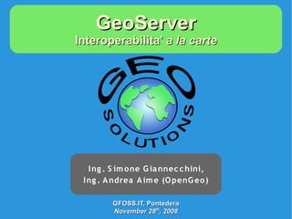
1. GeoServer
Interoperabilita' a la carte
I ng . S im one G ia nnec c hini,
I ng . A ndrea A im e (O penG eo )
GFOSS.IT, Pontedera
November 28th, 2008
2. Outline
● Cosa è GeoServer
● Come è fatto GeoServer
● Cosa fa GeoServer
● Cosa fara' GeoServer
● Chi fa GeoServer
GFOSS.IT, Pontedera
November 28th, 2008
3. Cosa è GeoServer
● GeoSpatial enterprise gateway
– Management dati raster e vettoriali
● Standards compliant
– OGC WCS 1.0 - 1.1.1 (RI)
– OGC WFS 1.0 - 1.1 (RI)
– OGC WMS 1.1.1
● Google support
– KML, GeoSearch, etc..
● Enterprise ready (almost!)
GFOSS.IT, Pontedera
November 28th, 2008
4. Chi è GeoServer
GeoWeb 2.0
KML WCS
WFSv WFS
GeoSearch WMS
REST
Enterprise
Oracle
PostGIS
ArcSDE
GeoTiff MrSID,ECW
GFOSS.IT, Pontedera
November 28th, 2008
5. ----------
----------
----------
Cosa fa GeoServer
Shapefile ---------
----------
----------
Shapefile.zip
---------
---------- WFSv* GML2
GML3
Vector files GeoRSS
PostGIS WFS 1.0 Raw vector
data
GeoJSON
DB2 CSV/XLS
Oracle WFS 1.1
MySql PNG, GIF
GeoServer
JPEG
DBMS WMS TIFF,
1.1.1
GeoTIFF
SVG, PDF
ArcSDE Google* Styled KML/KMZ
maps
WFS
WCS GeoTIFF
Servers 1.0
GeoTIFF ArcGrid
ArcGrid WCS GTopo30
GTopo30 1.1.1 Raw raster
Img+World
Img+world data
Mosaic Raster files KML superoverlays
MrSID GWC Google maps tiles
JPEG 2000
ECW,Pyramid
1.7.1
GFOSS.IT, Pontedera
November 28th, 2008
6. Come è fatto GeoServer
WCS WMS WFS WFSv REST Google GWC
GeoTools
Spring
Spring
ImageIO JAI JTS
GDAL JMagick
Vector Style Raster
GFOSS.IT, Pontedera
November 28th, 2008
9. Per-layer Security
● Specificare regole su singoli layer
● Configurazione semplificata con liste di
regole
namespace.layer.mode=role1,role2,...
A name, or * to r: read The roles that will
mean “any” w: write be authorized to
access the data
under this rule
GFOSS.IT, Pontedera
November 28th, 2008
10. Per-layer Security
*.*.r=*
RDONLY
*.*.w=NO_ONE lock down
private.*.r=TRUSTED_ROLE
private.*.w=TRUSTED_ROLE Per-layer
override
topp.districts.w=LEGISLATORS
topp. Other
private.* topp.* districts layers
TRUSTED_ROLE r/w r r r
LEGISLATORS (no access) r r/w r
(all other users) (no access) r r r
GFOSS.IT, Pontedera
November 28th, 2008
11. Integrazione GDAL
● Started with GSOC 2006-2007
● ImageIO integration via ImageIO-ext
– Estensione SUN ImageIO framework
– JPEG2000,MrSID, ECW, BigTIFF*, ERDAS
Image, HDF4,etc...
– Non (ancora!) facile configurazione
● Problemi di licenza con ECW (?)
GFOSS.IT, Pontedera
November 28th, 2008
12. RasterSymbolizer
● Supporto tematizzazione raster con SLD
256 colori
64
K
co
lo
ri
GFOSS.IT, Pontedera
November 28th, 2008