Download as PDF, PPTX


The document outlines various projects and developments related to Geonode, an open-source platform for geospatial data management. It highlights key projects such as C-READ, risk analysis tools for Afghanistan, and UNESCO's water information system, along with strategies for customization and scalability. Future initiatives include leveraging Docker for deployment and enhancing user interfaces and APIs for more effective geospatial data applications.
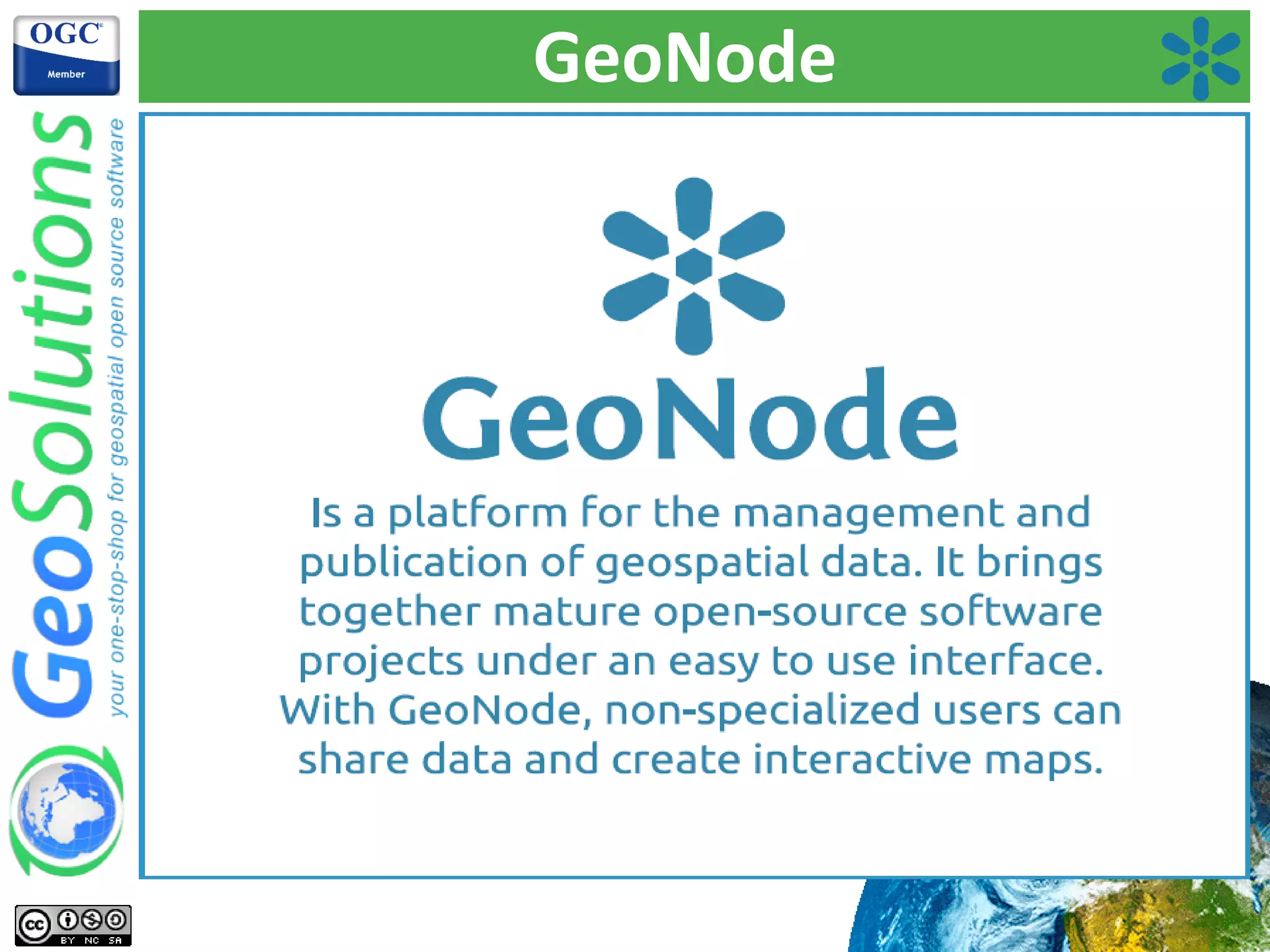
Introduction of speakers and the vision of GeoNode, highlighting its collaborative potential.
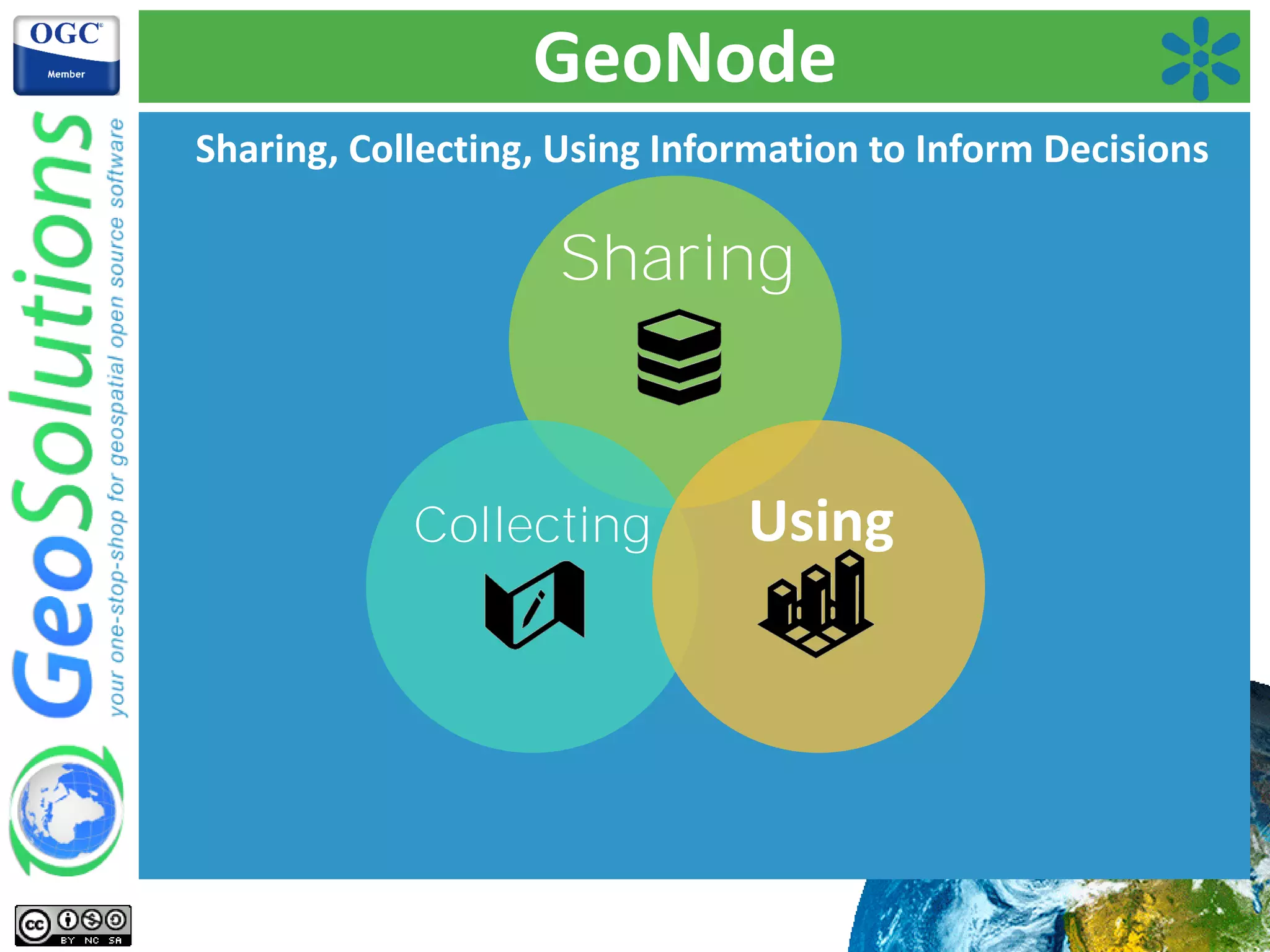
Highlighting the functionalities of GeoNode: sharing, collecting, and using information. Emphasis on its open-source nature.
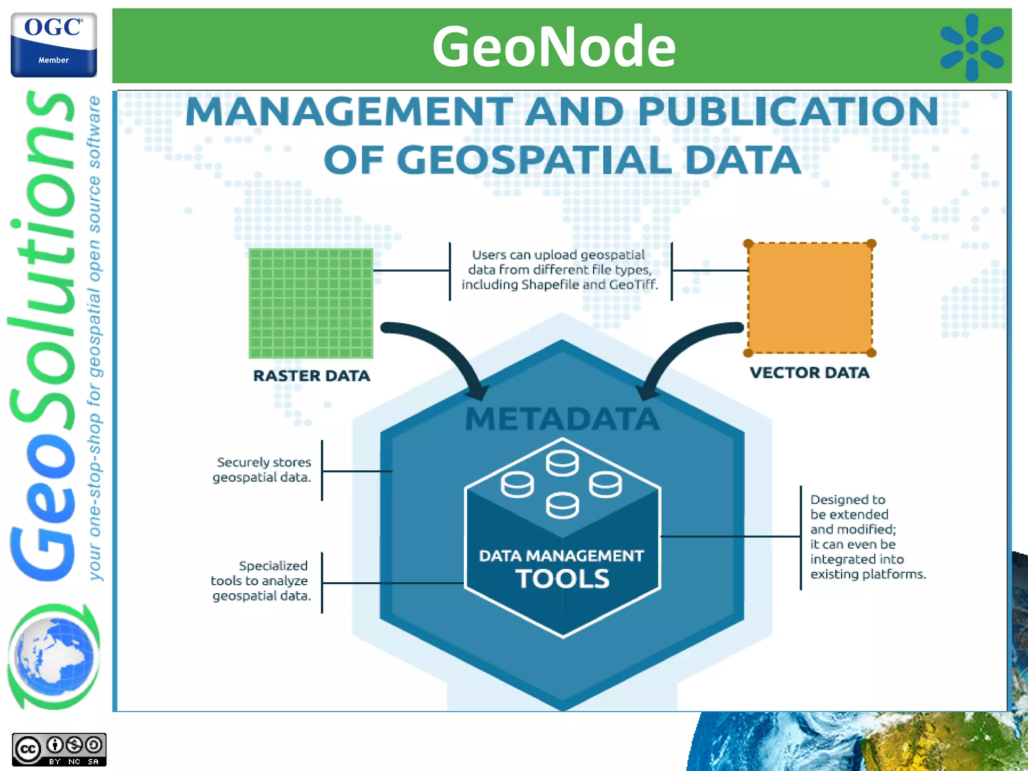
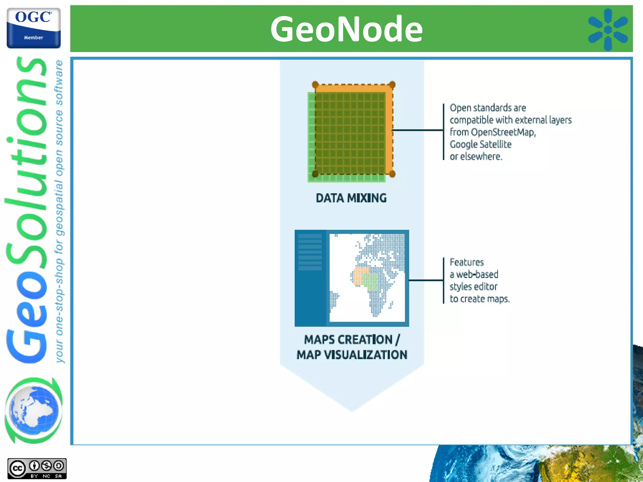
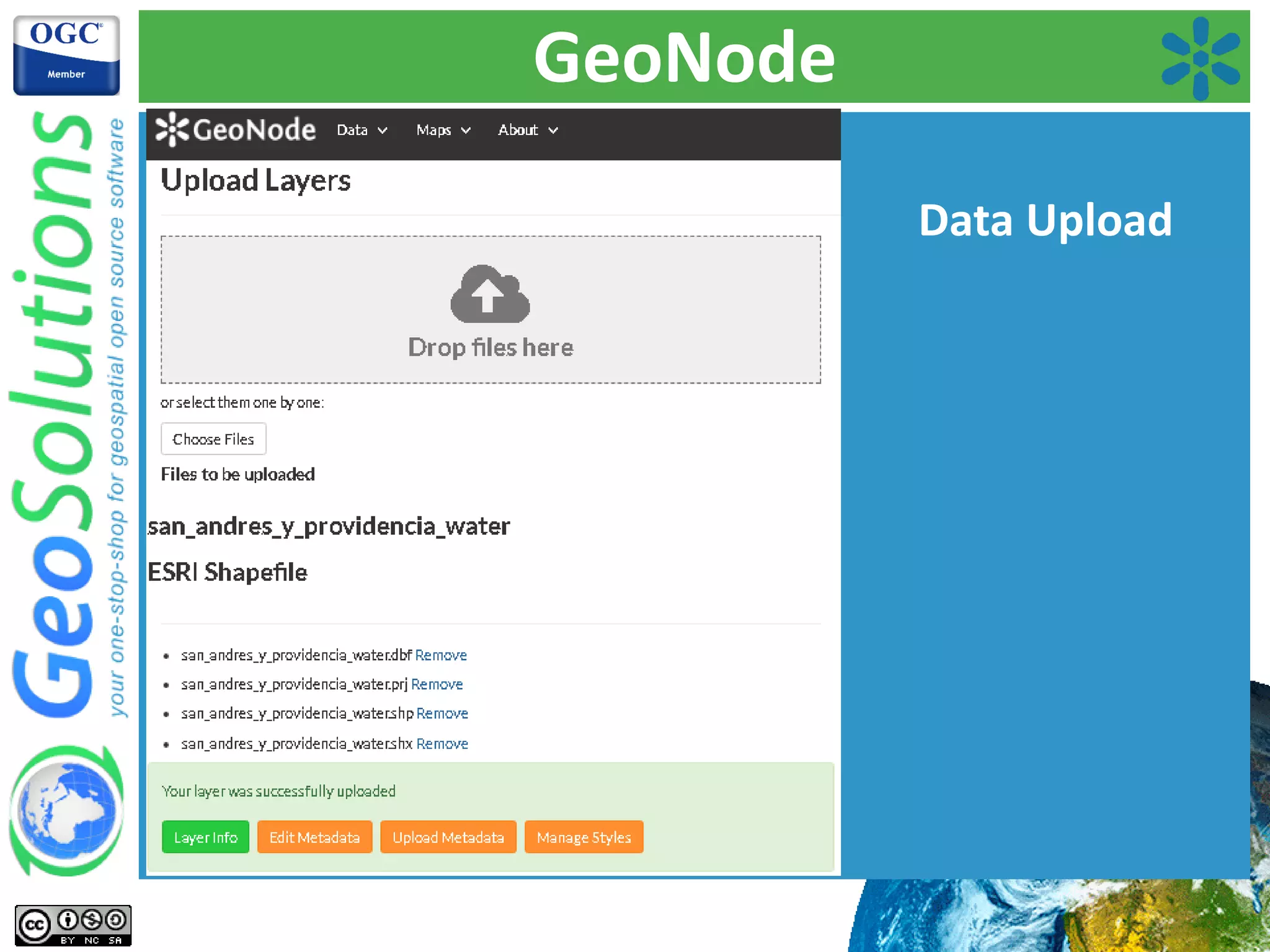
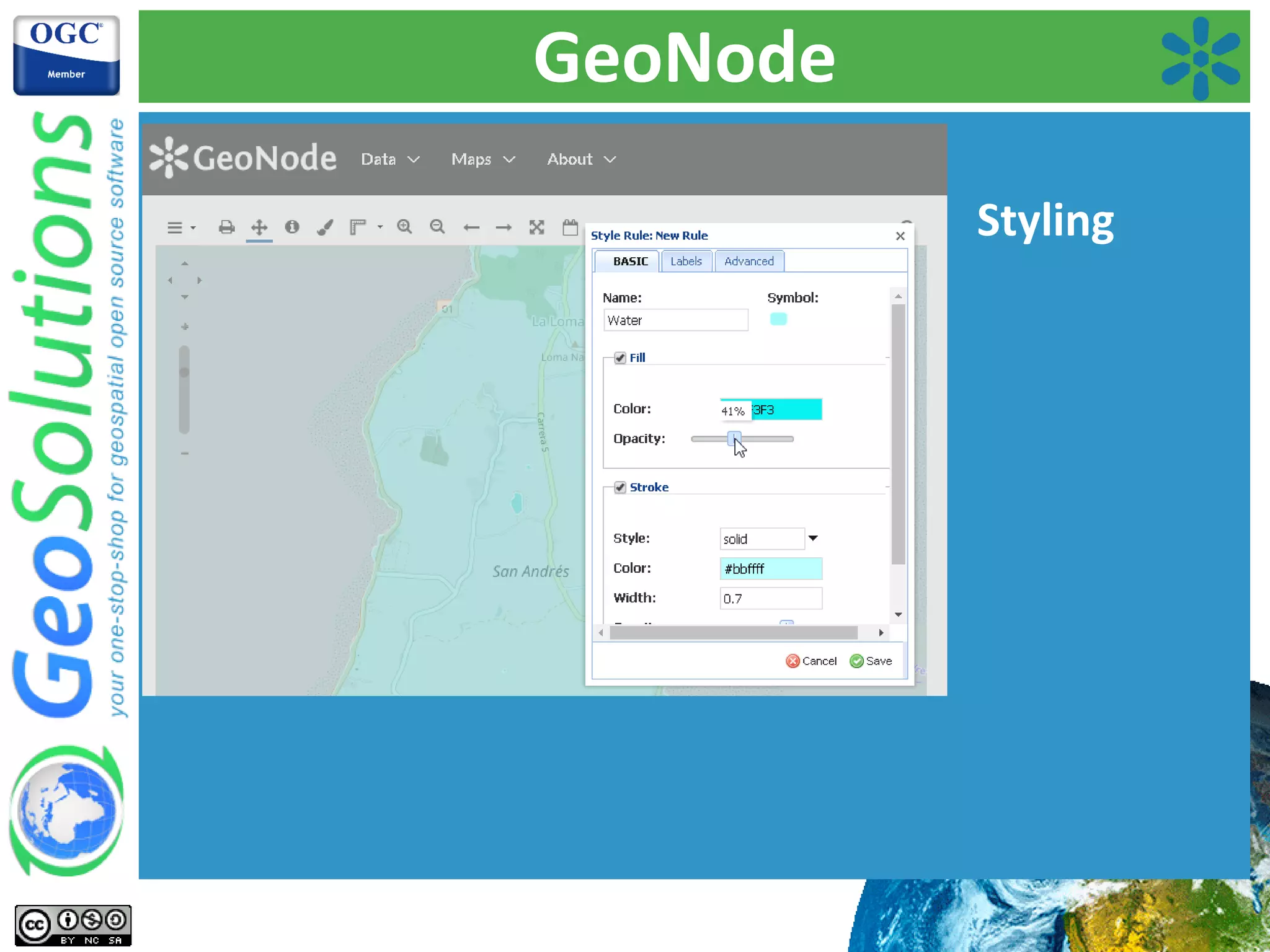
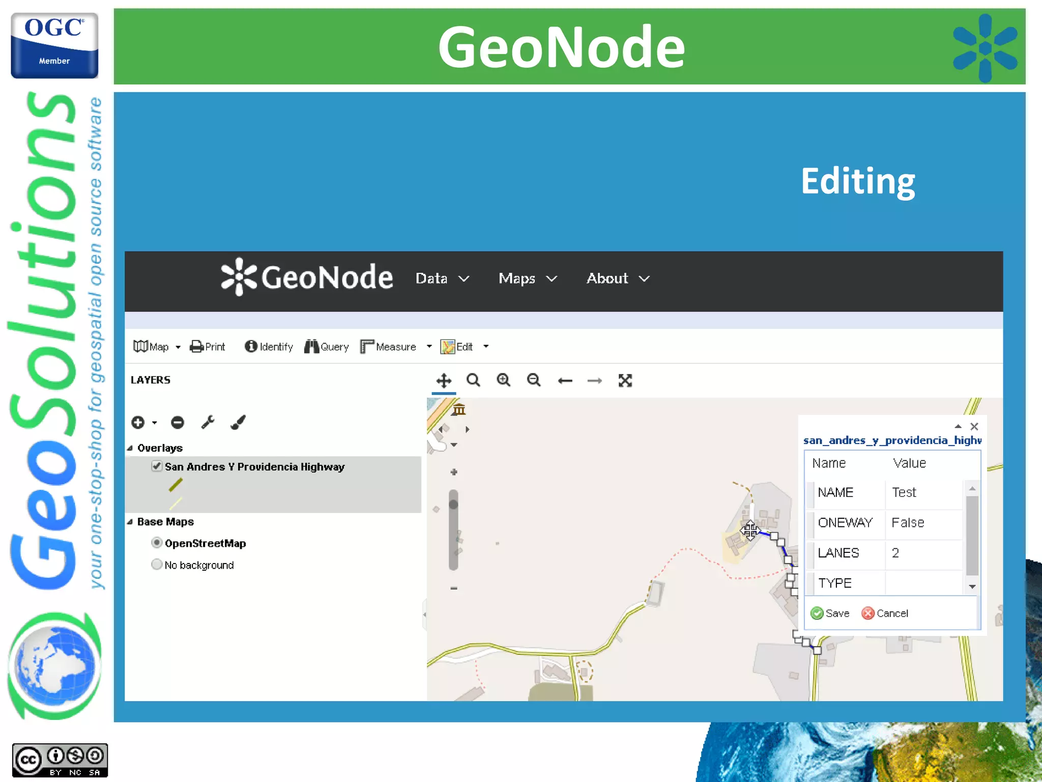
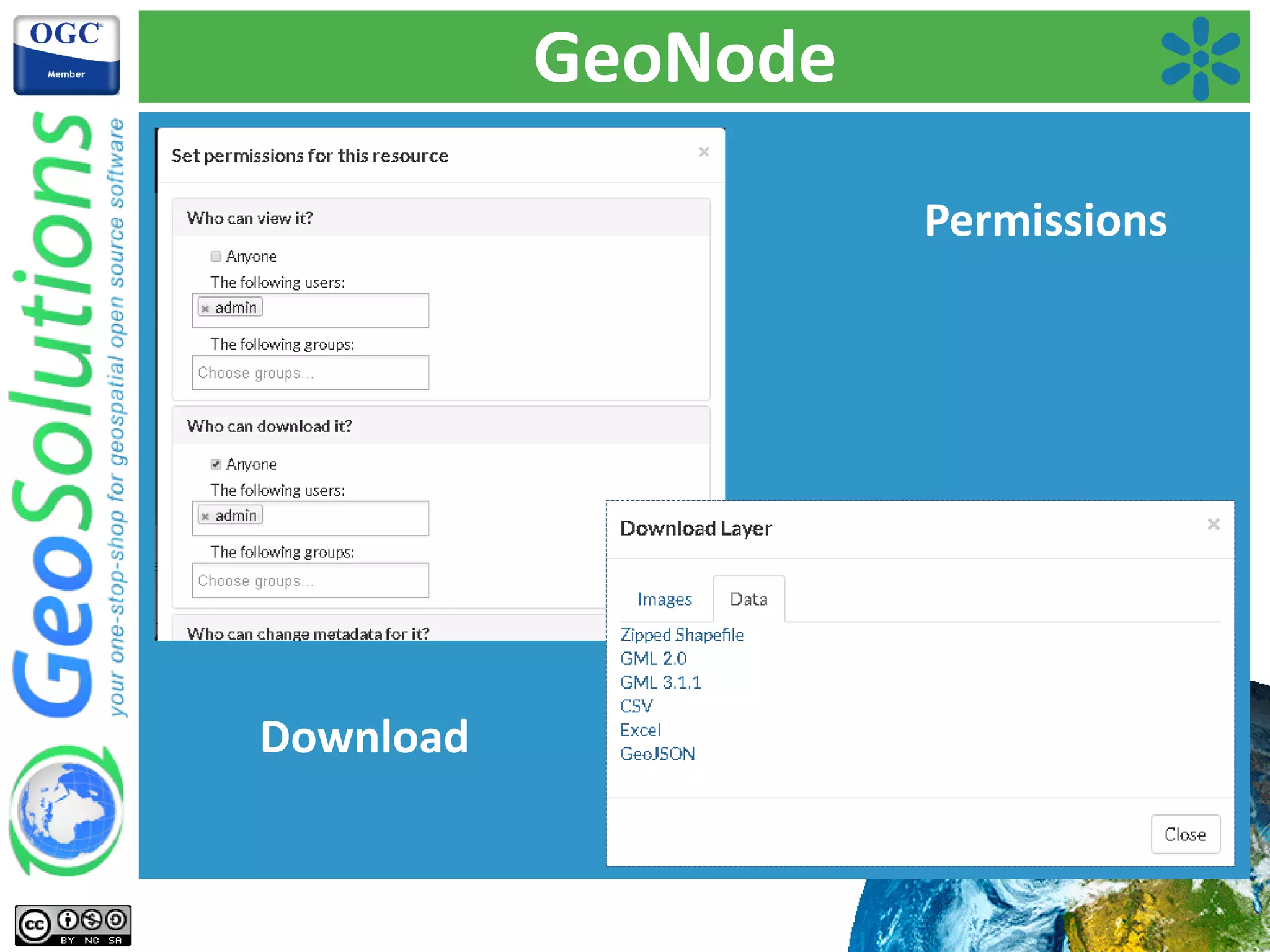
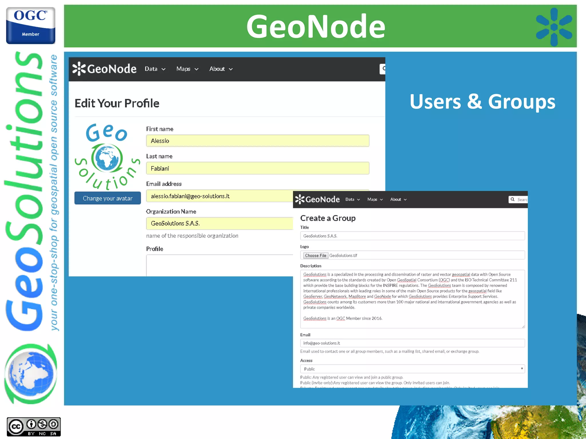
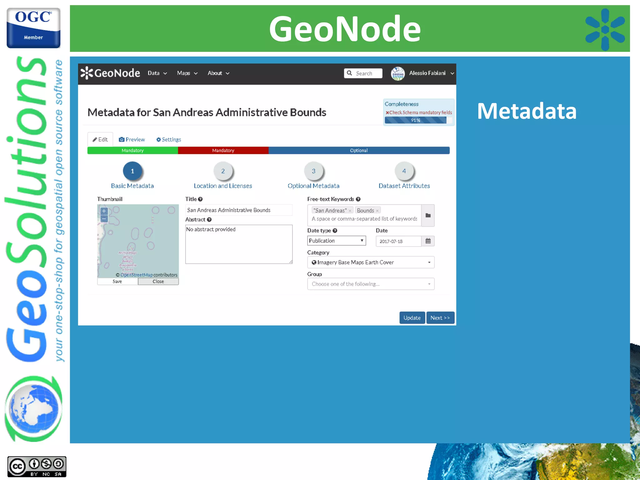
Capabilities of GeoNode including data upload, styling, editing, permissions, and metadata management.
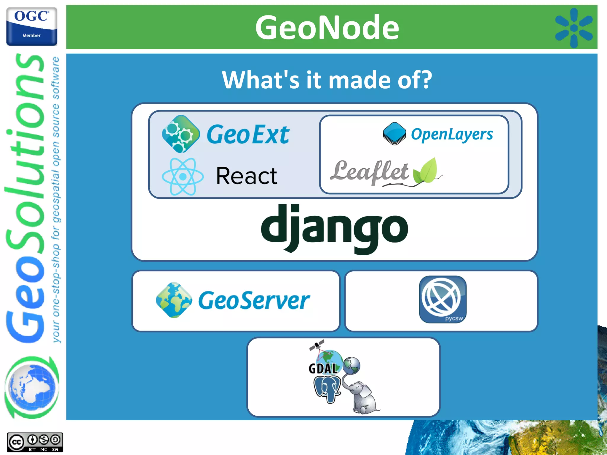
Discussion on the composition of GeoNode, emphasizing its architecture with a focus on multiple instances.
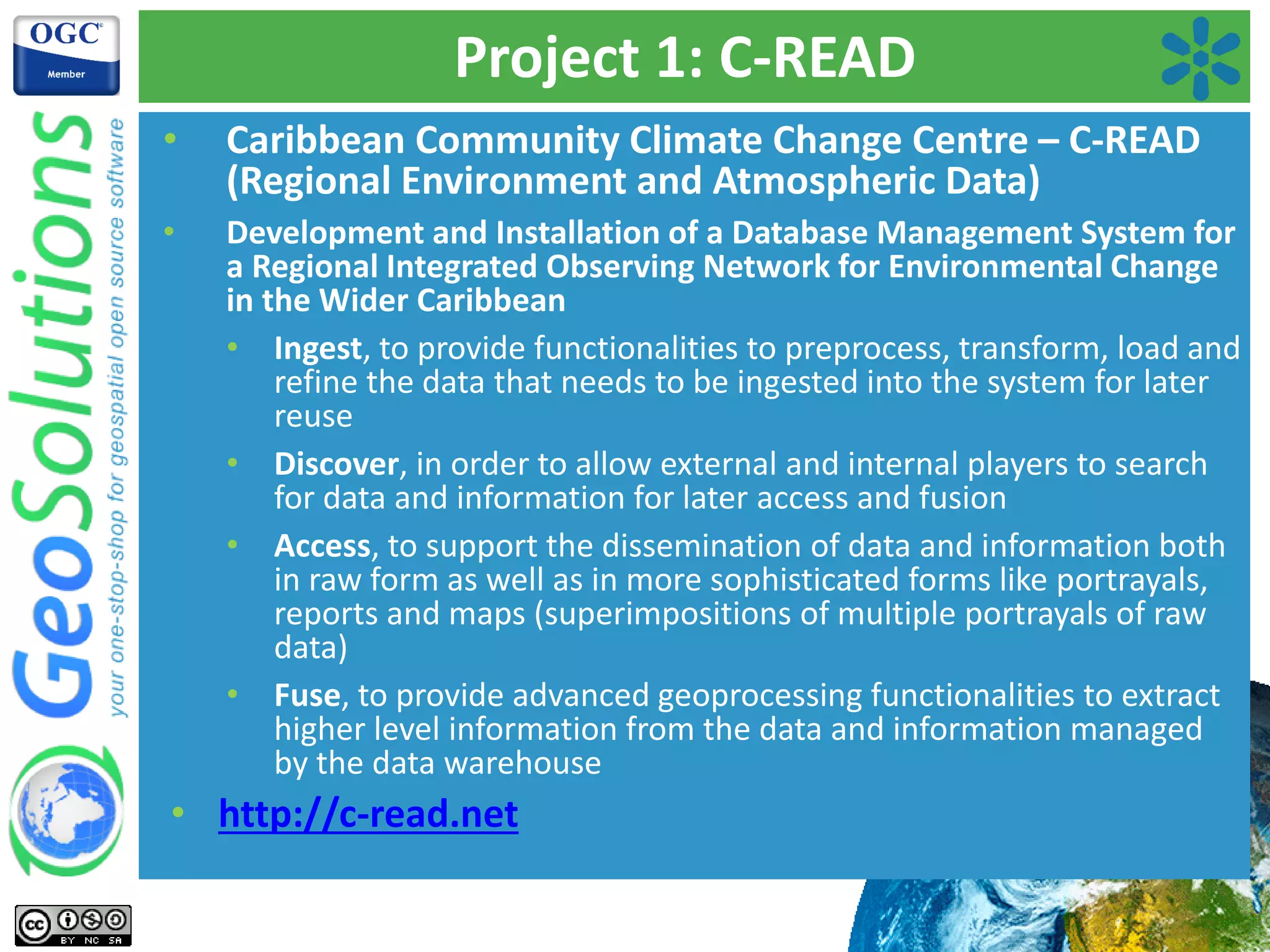
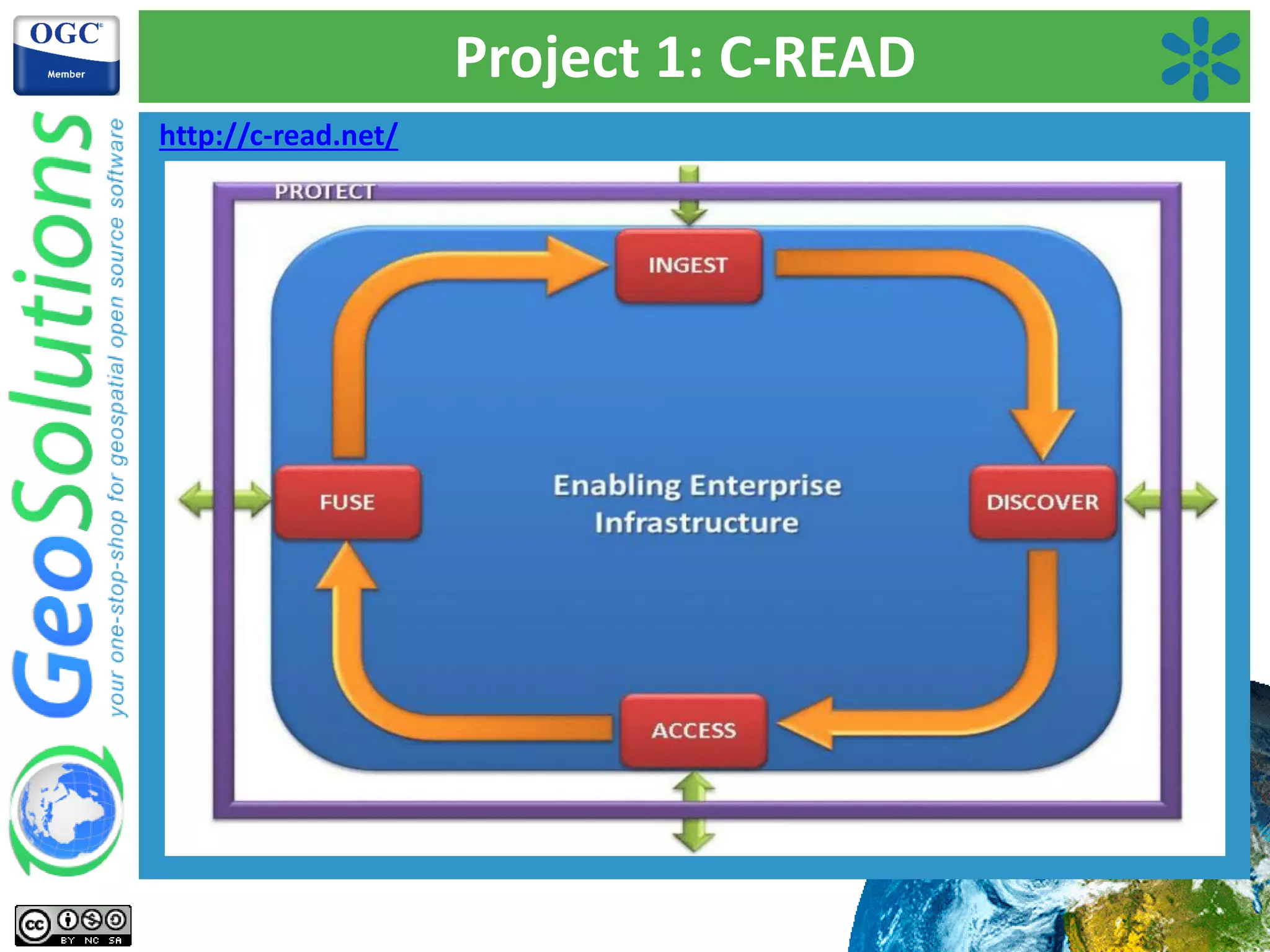
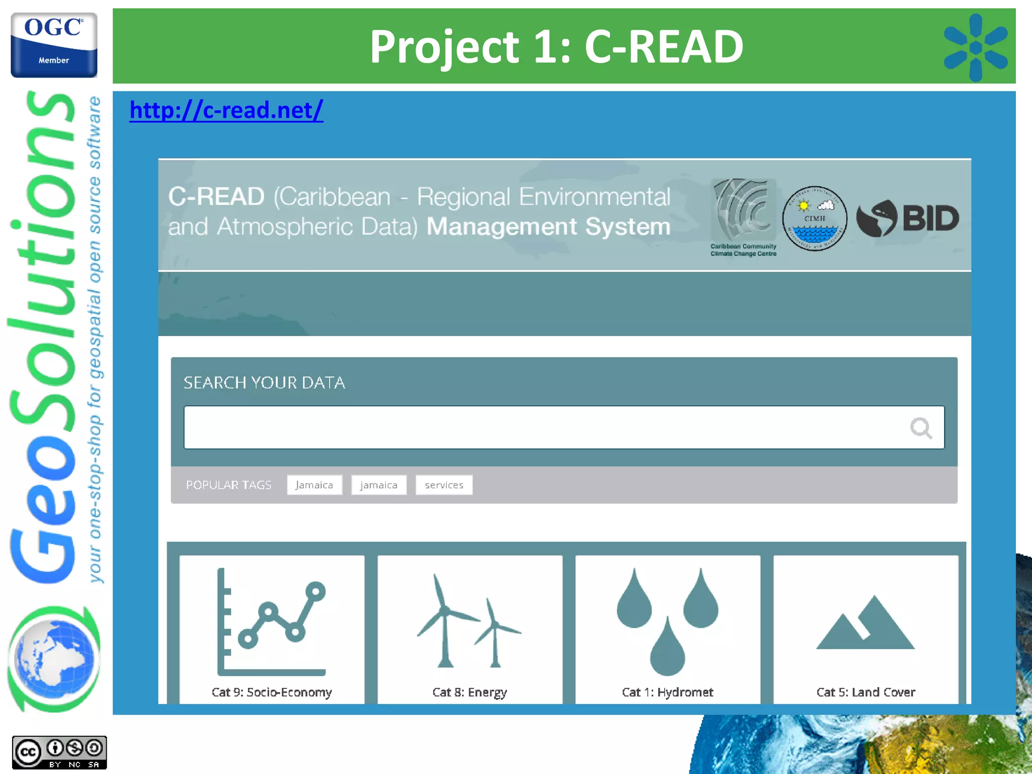
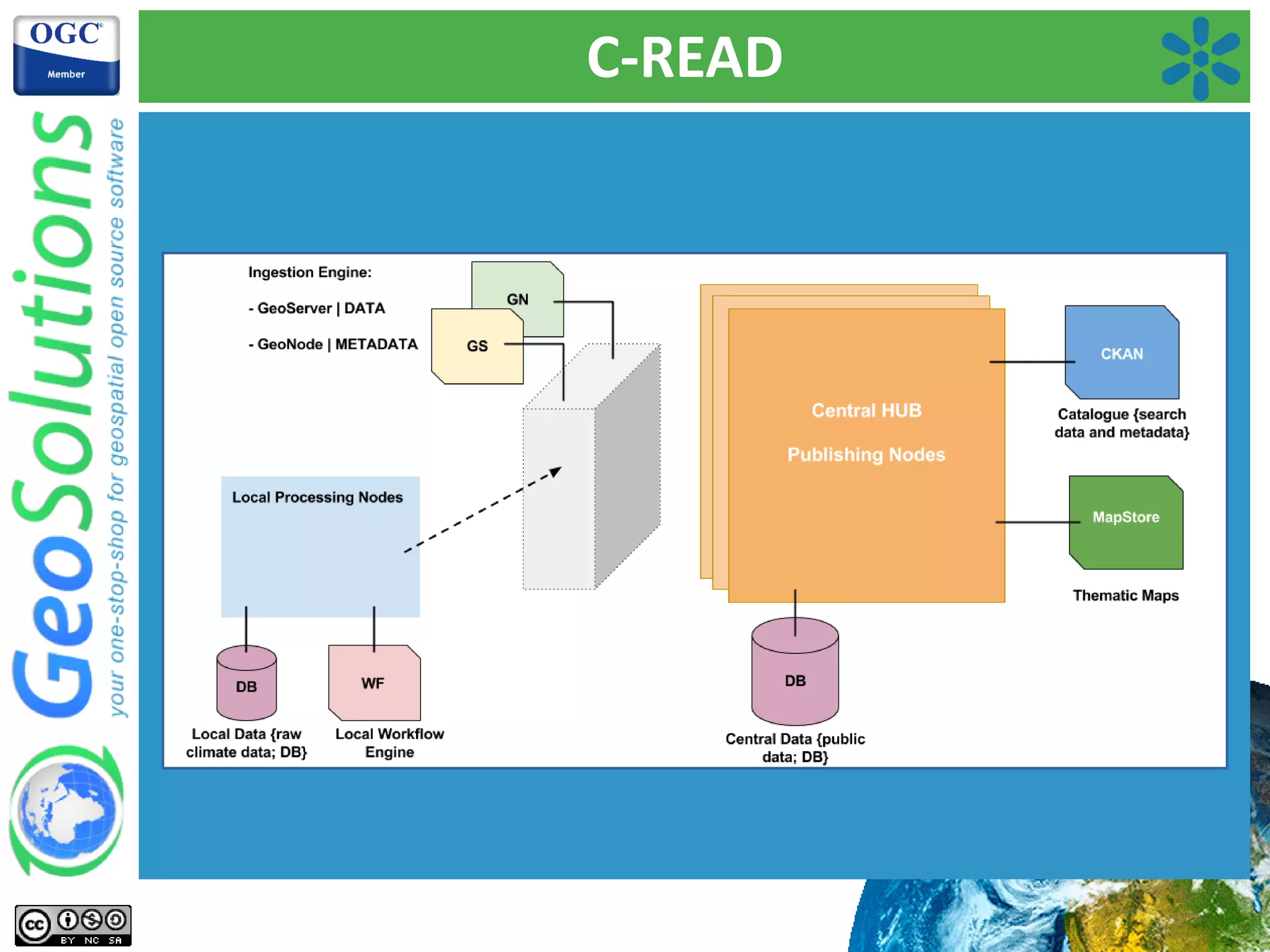
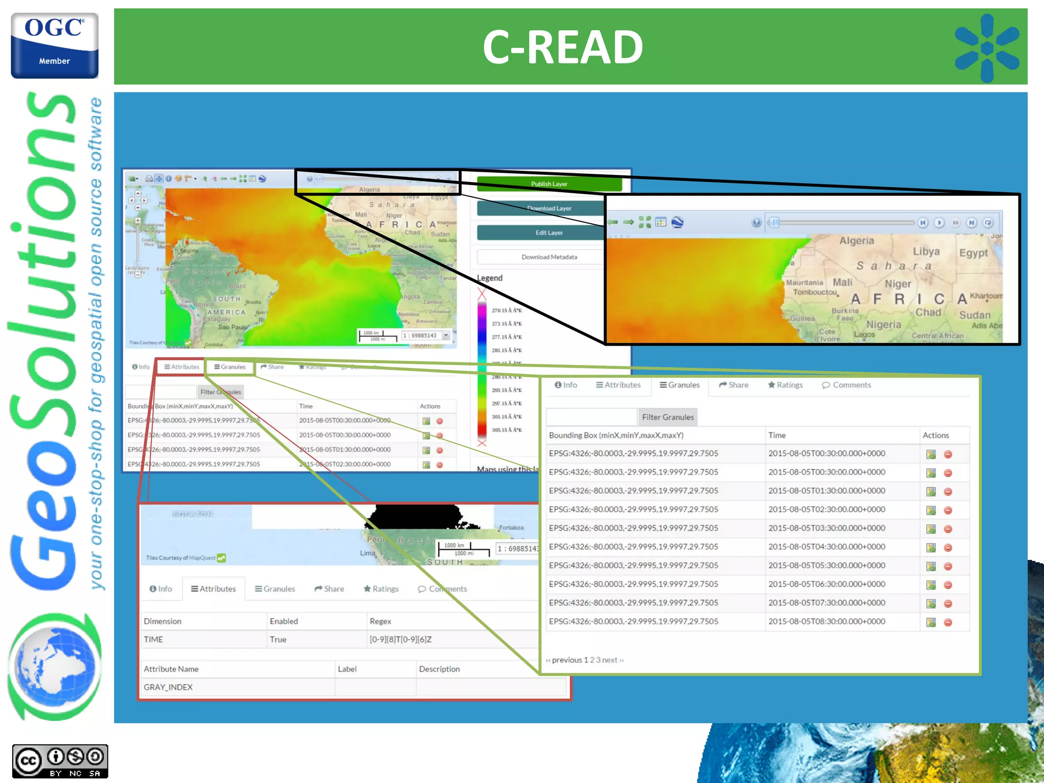
Custom applications based on GeoNode, enabling flexible deployment and addressing specific use cases.Details on C-READ, a project for Caribbean environmental data management, focusing on data ingestion and access.
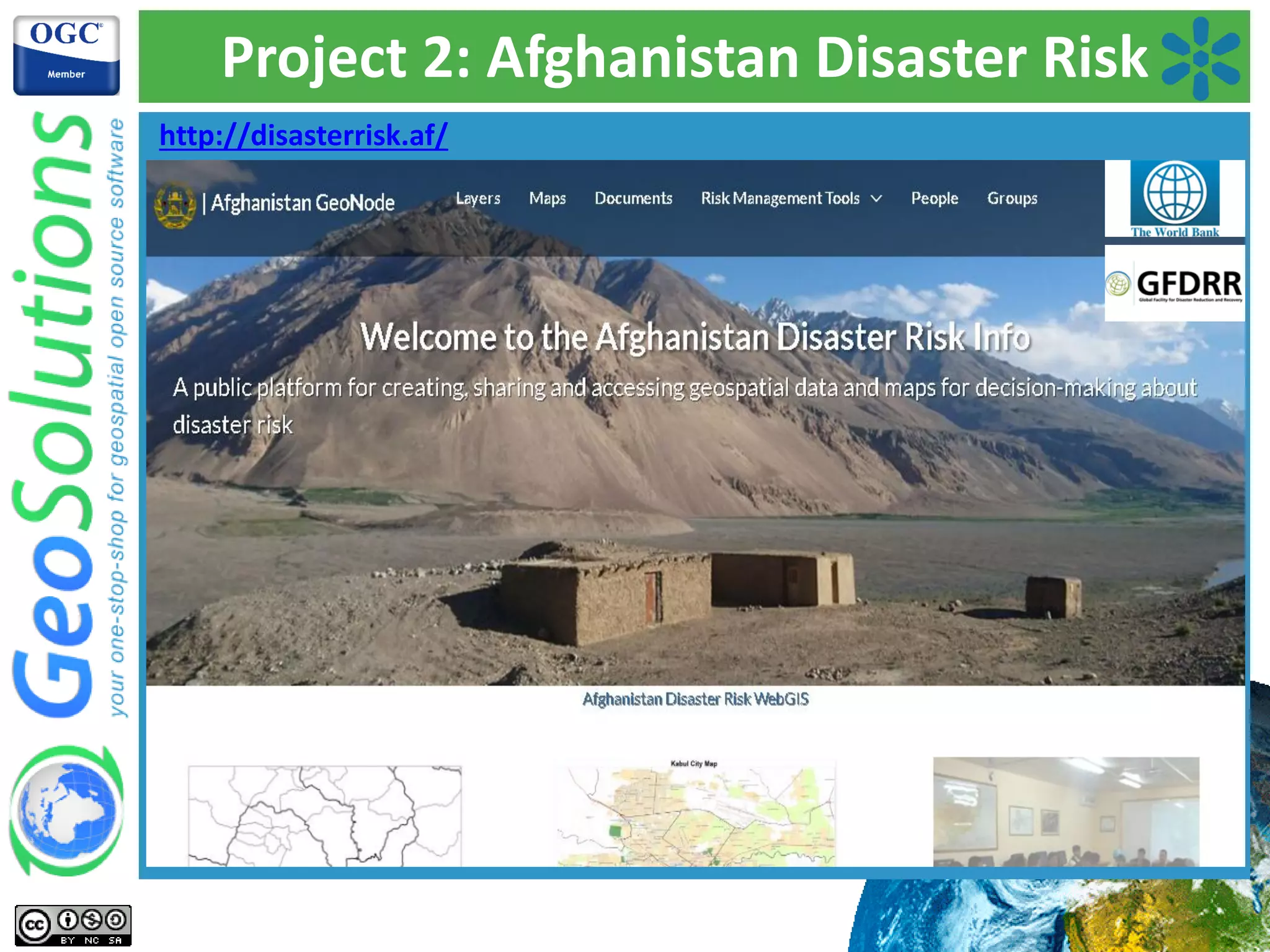
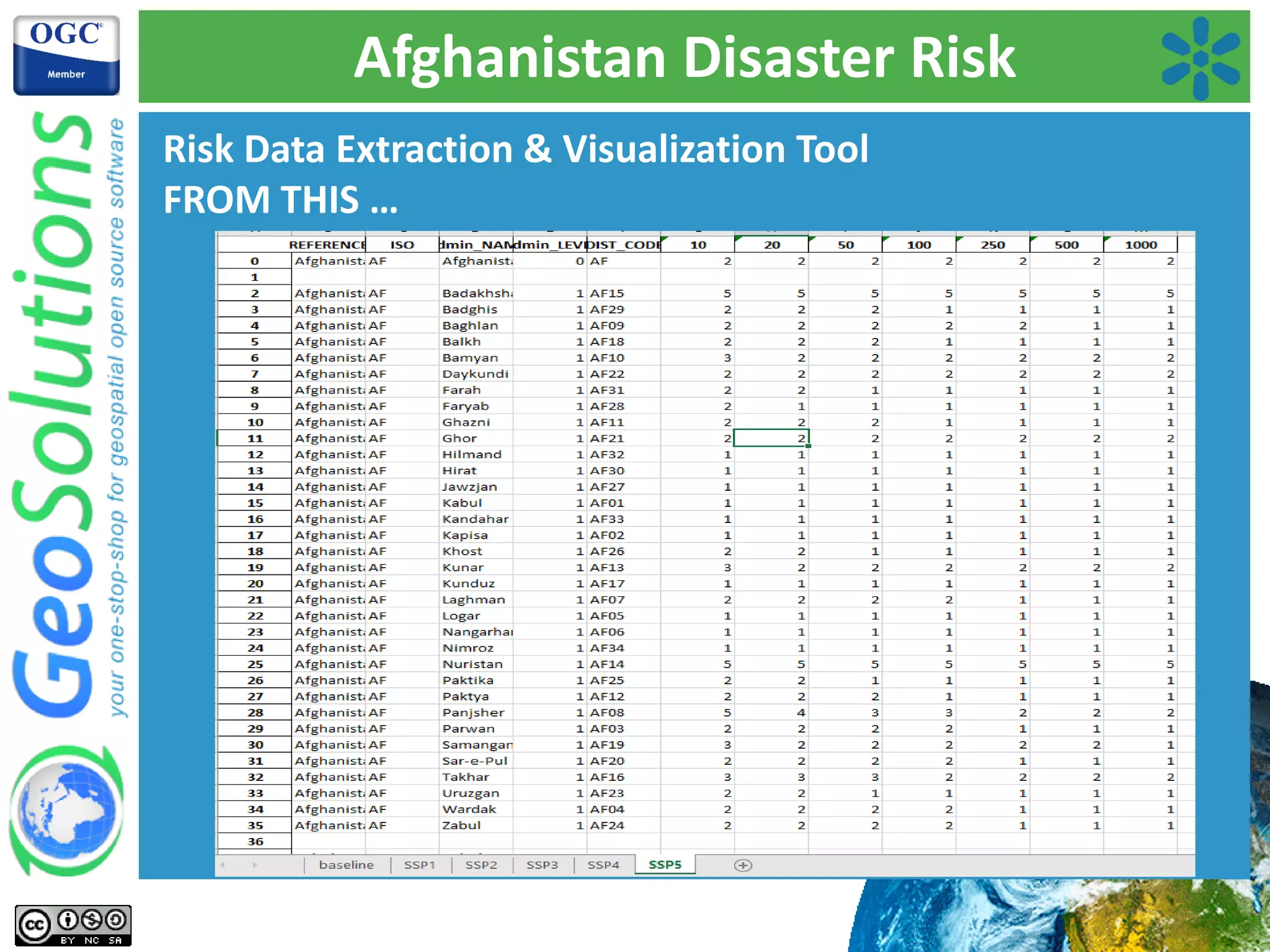
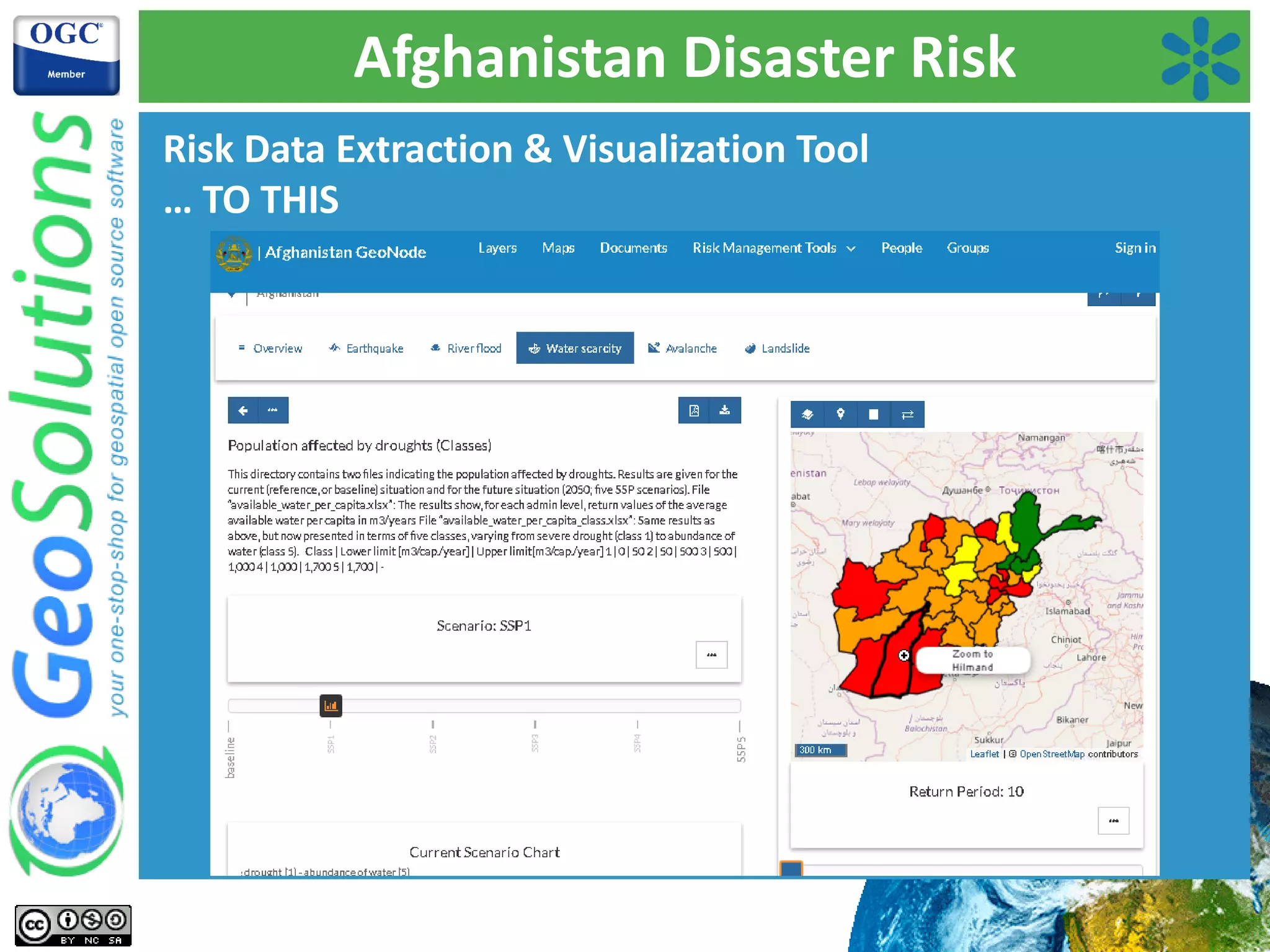
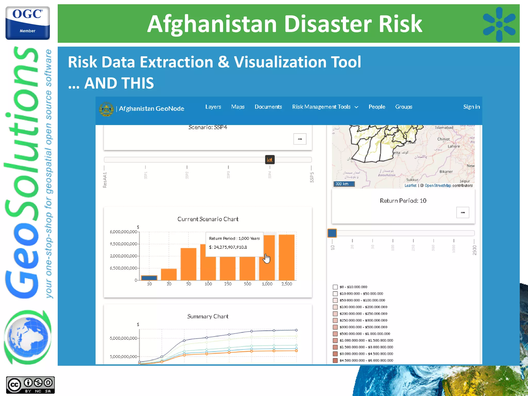
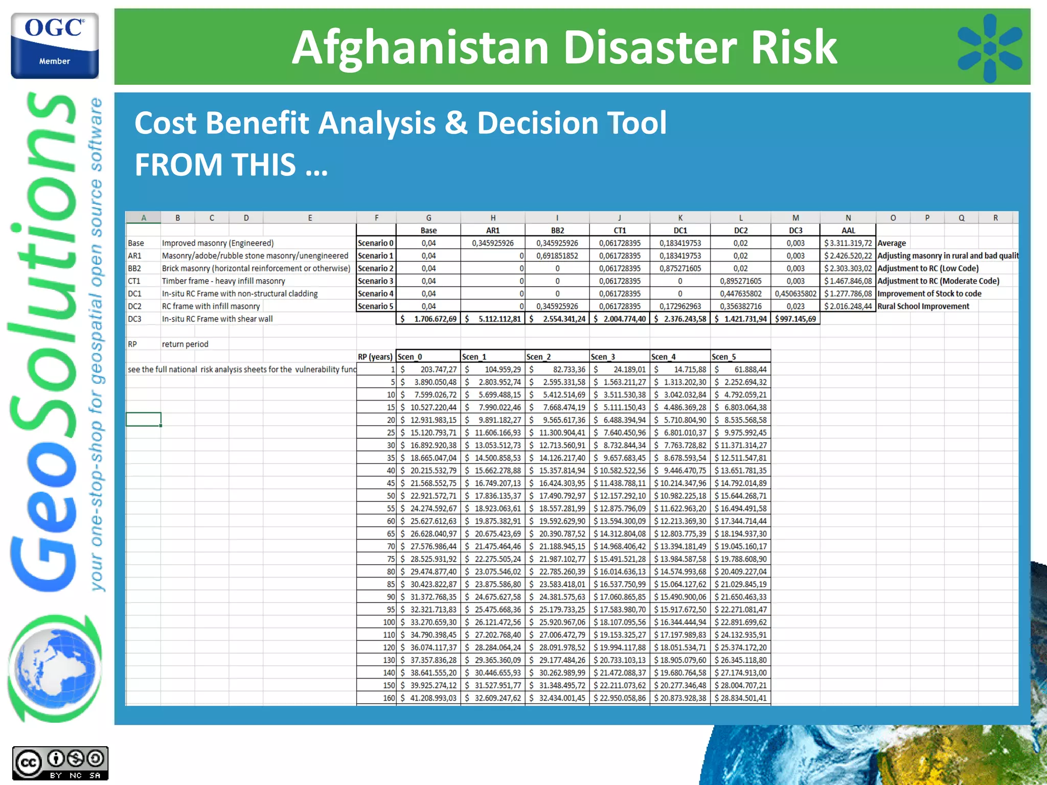
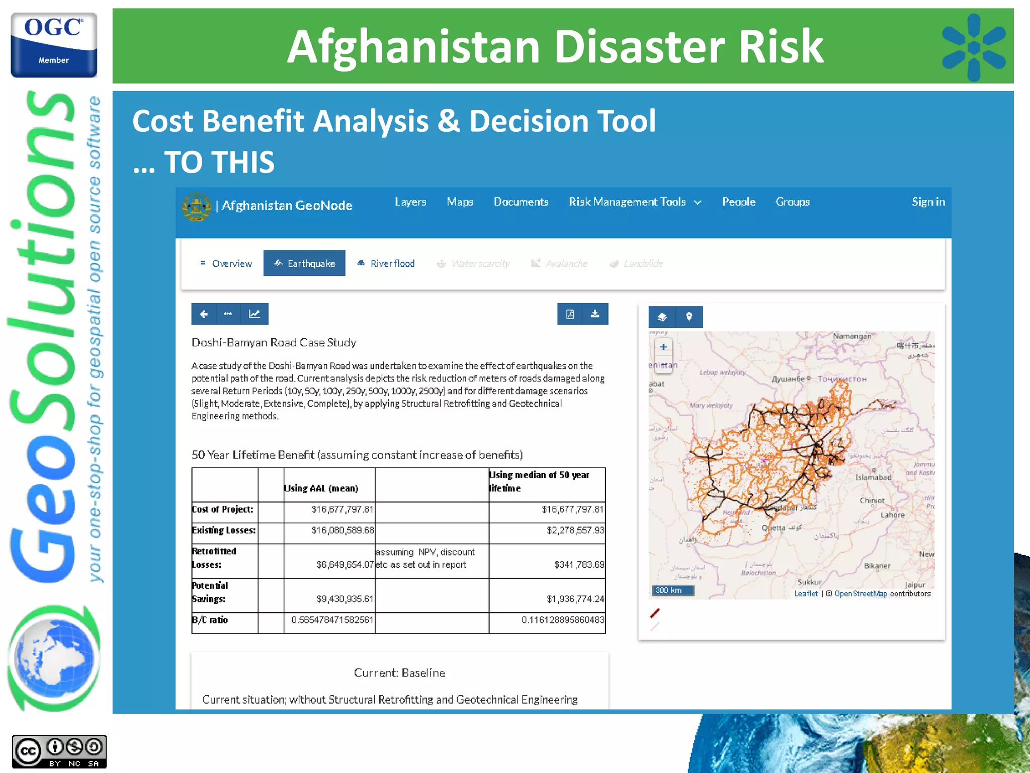
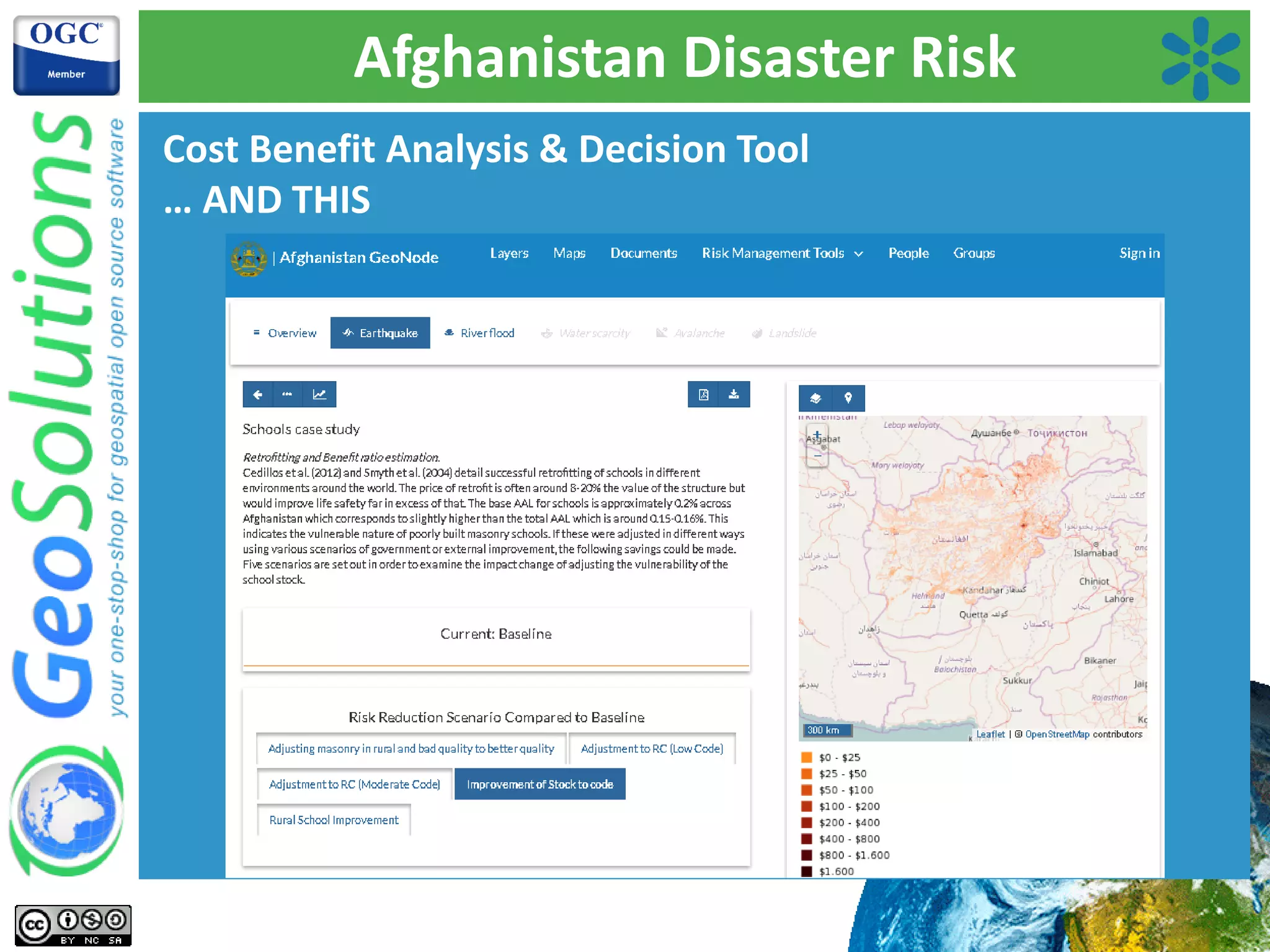
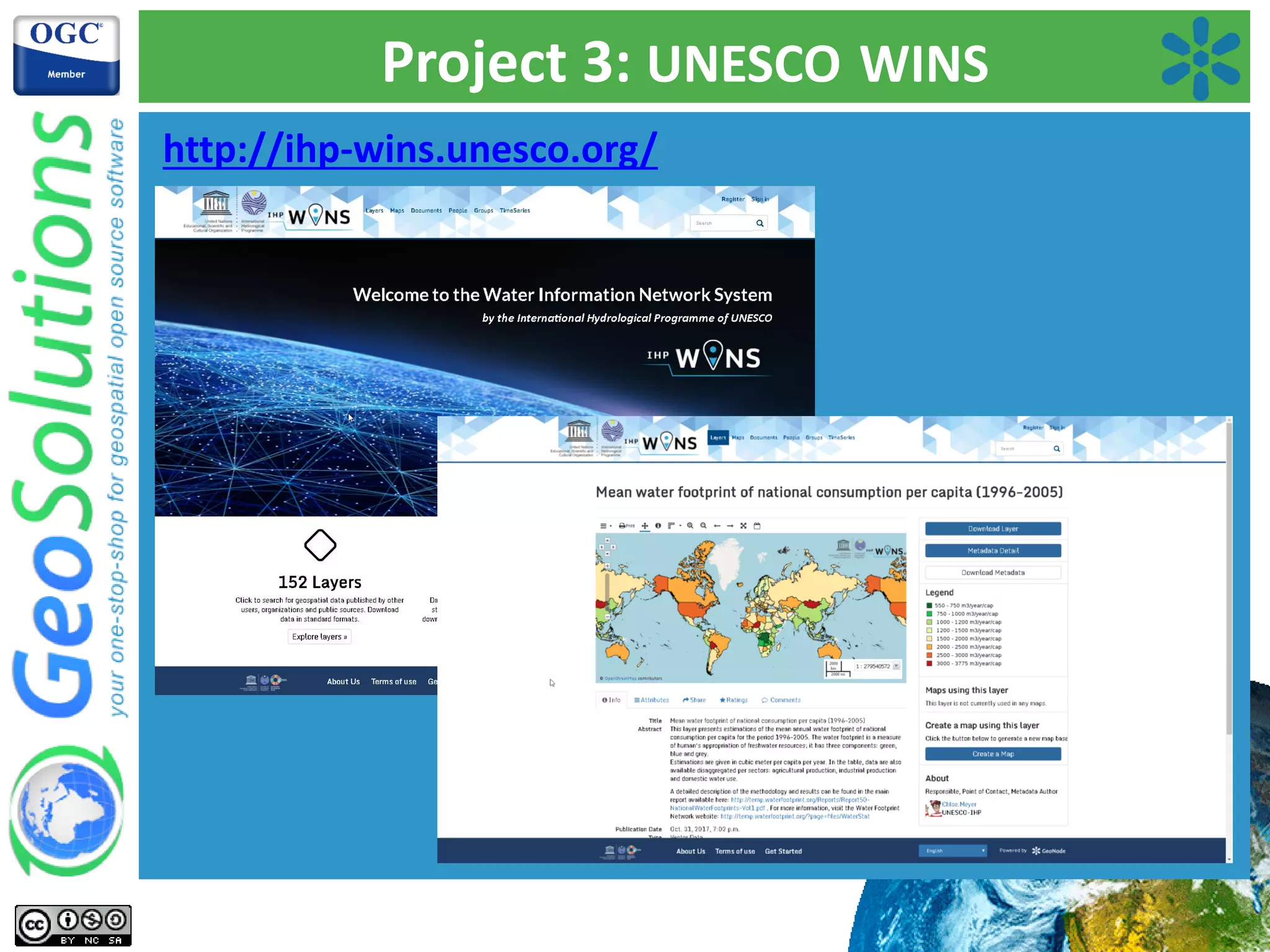
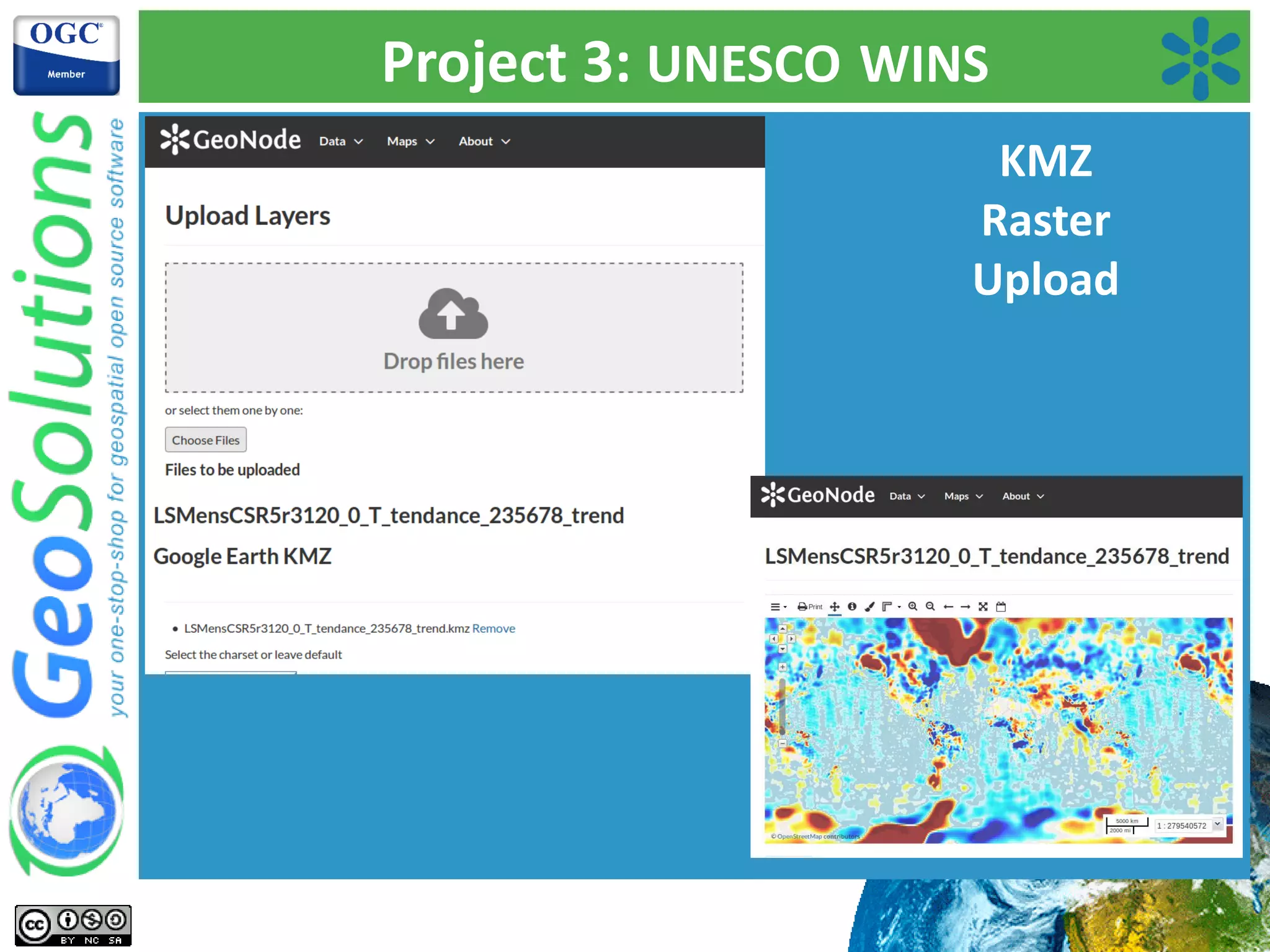
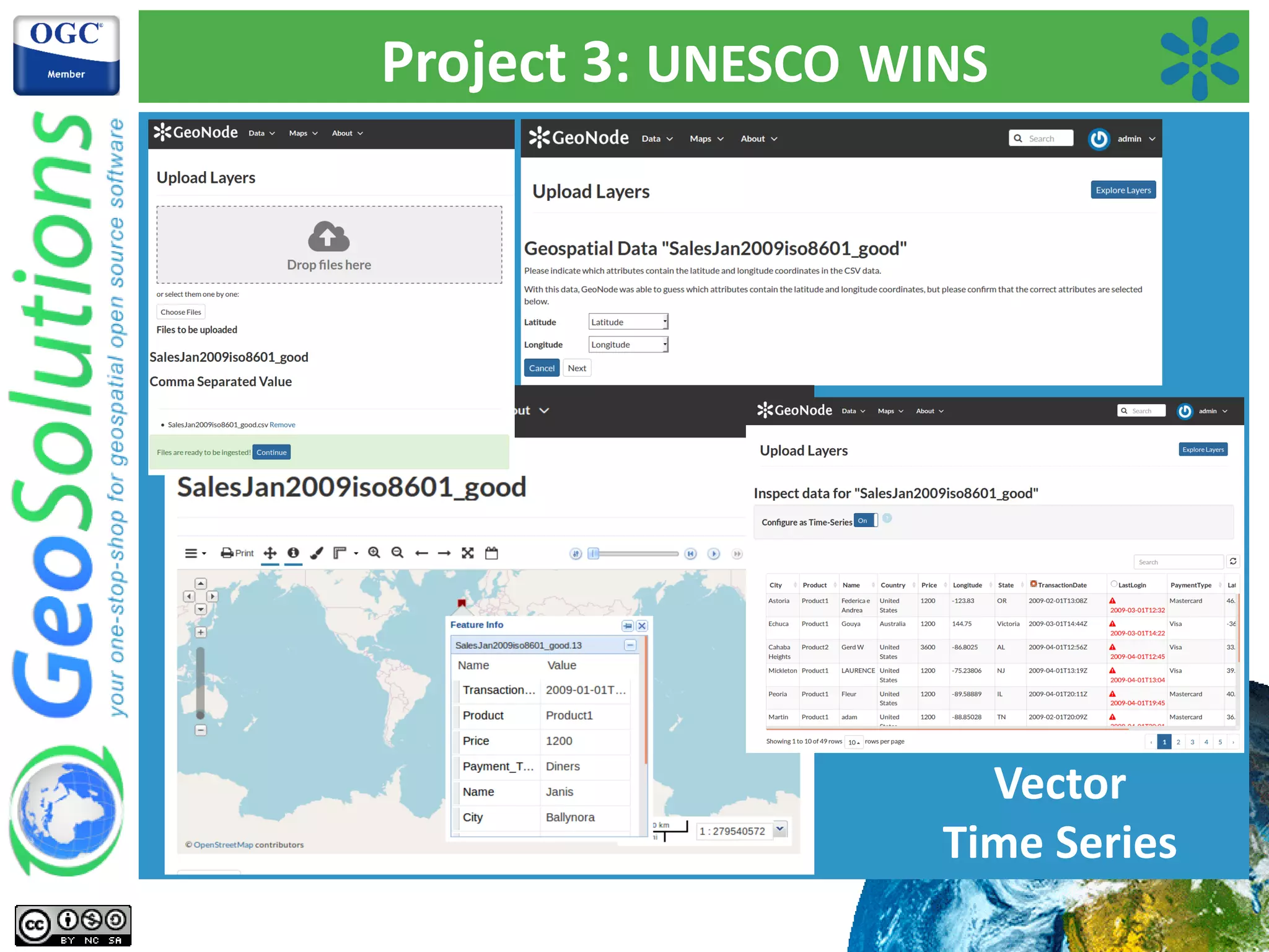
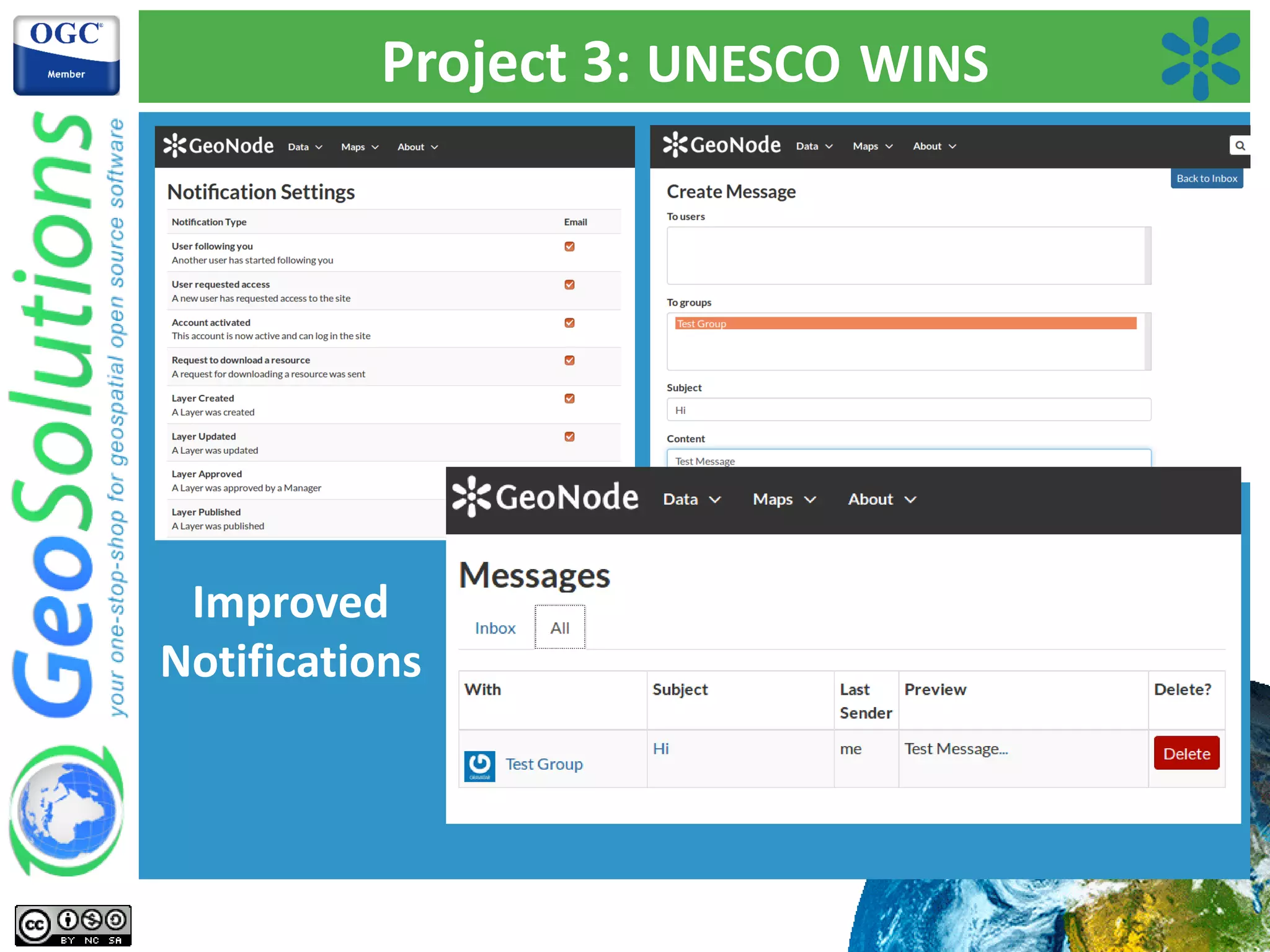
Overview of Afghanistan Disaster Risk project, focusing on risk management modules, data visualization, and decision tools.UNESCO's initiative for water information management, enhancing data publishing workflows and user experience.
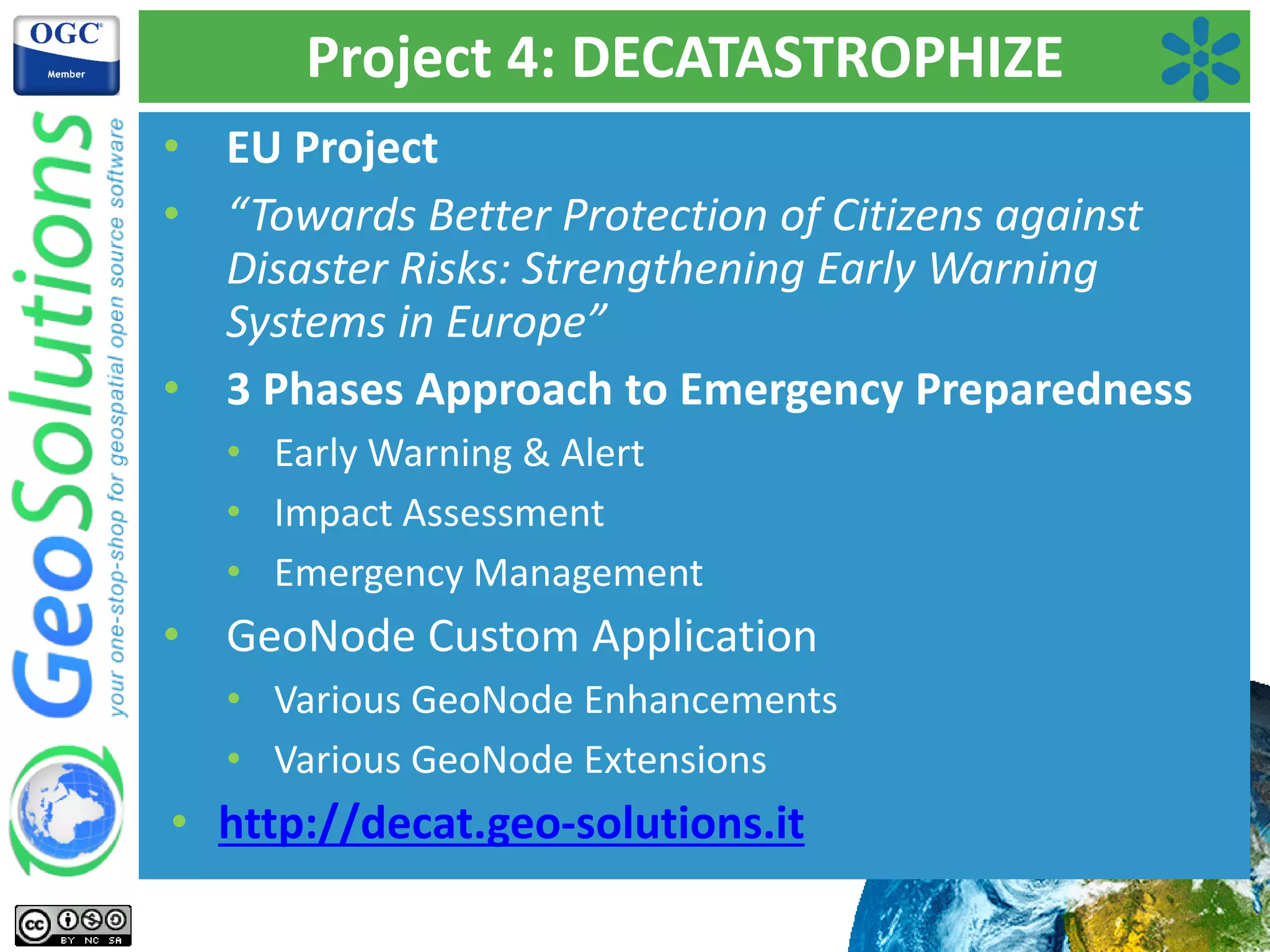
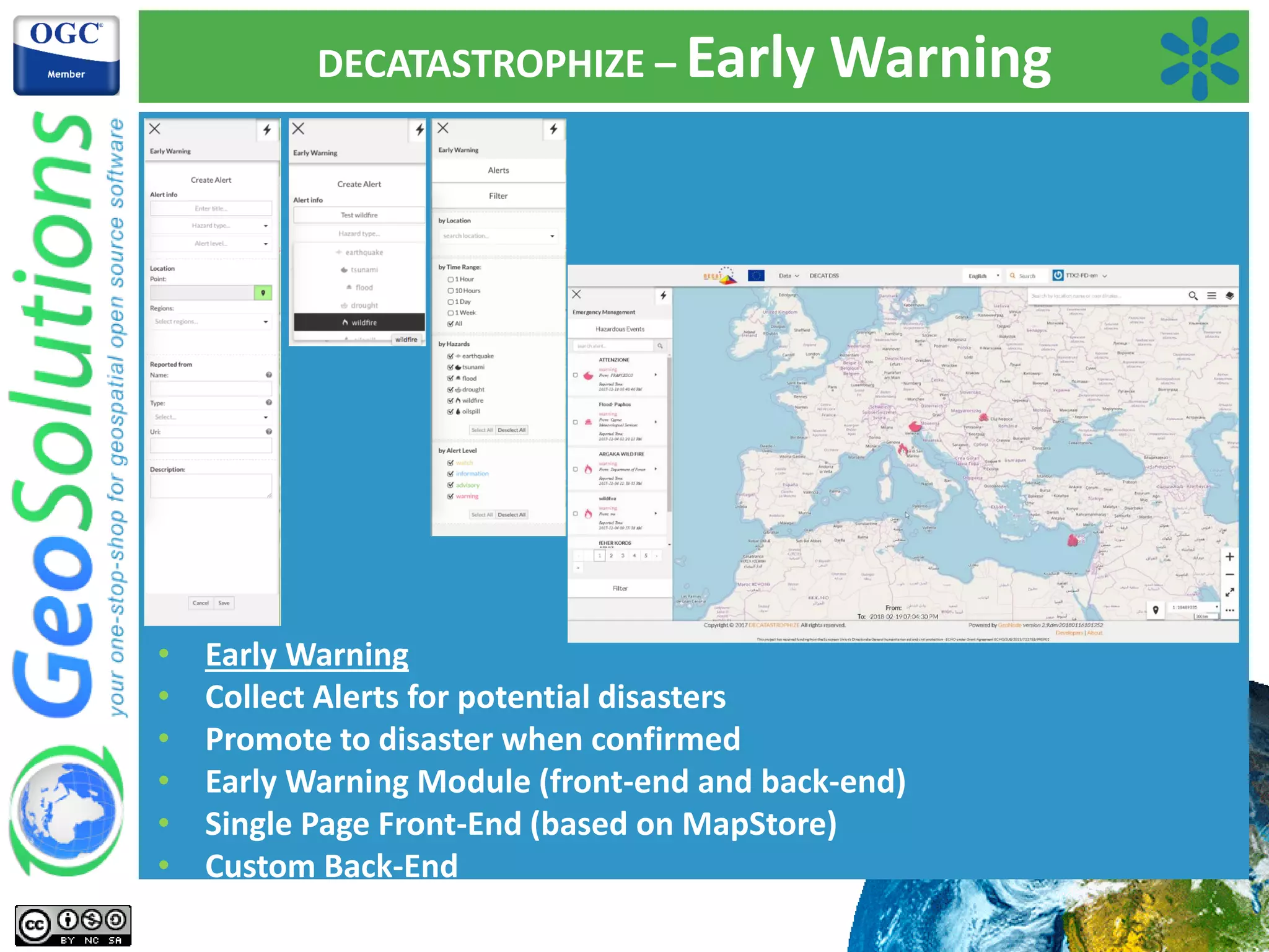
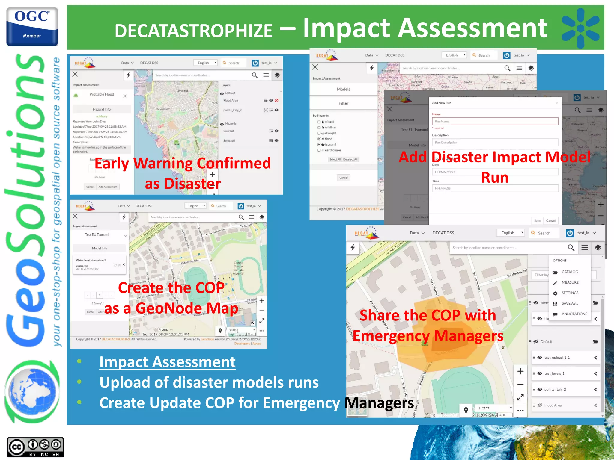
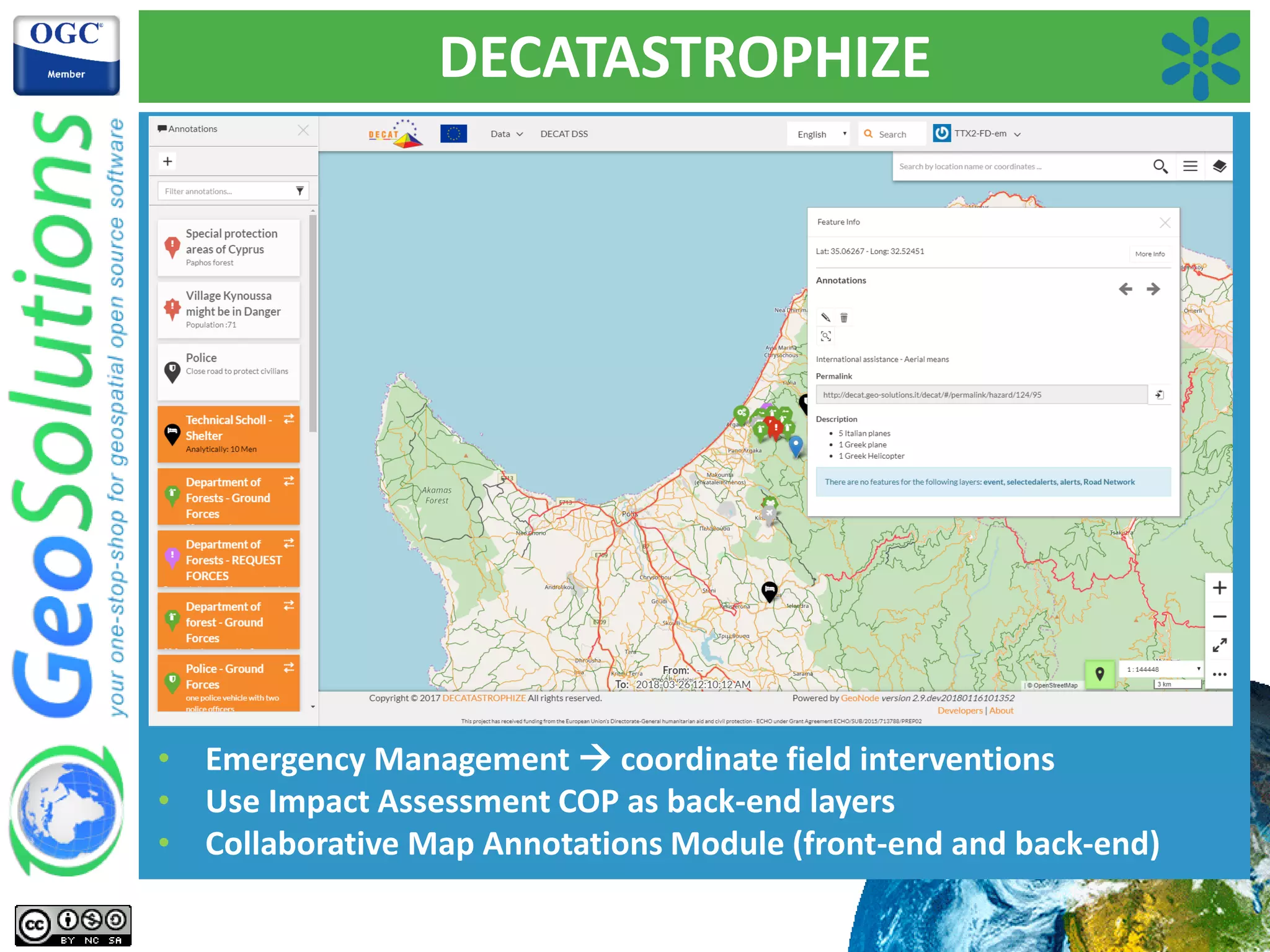
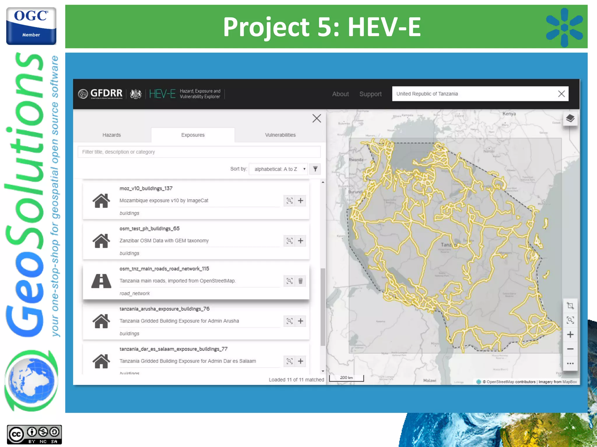
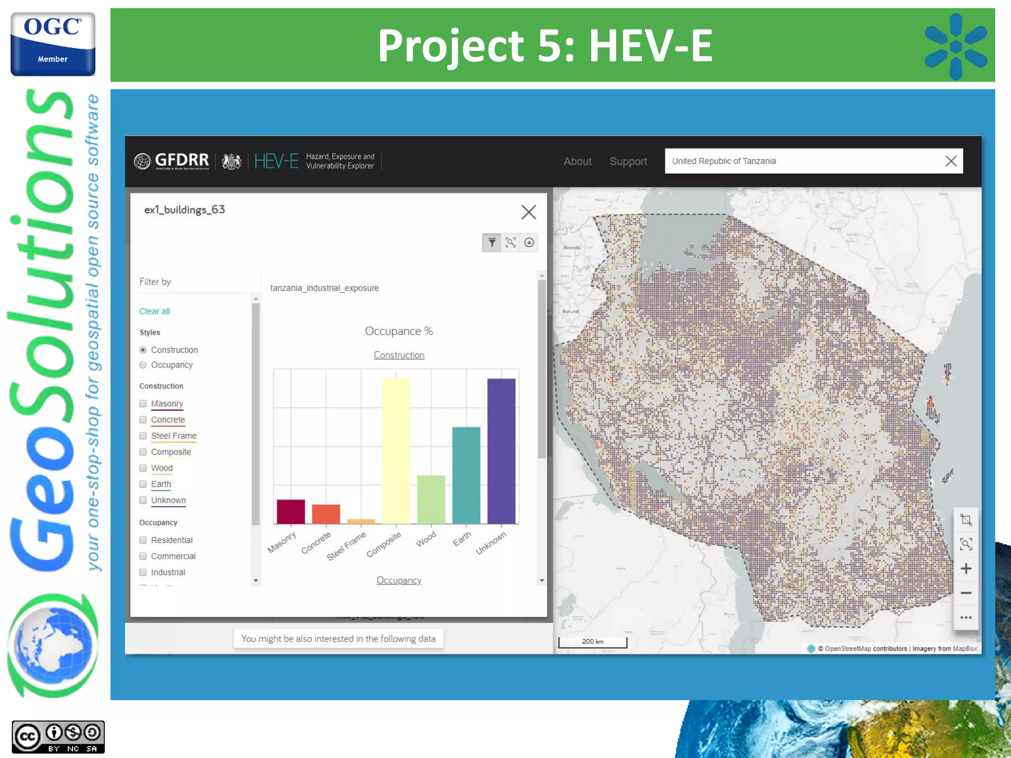
EU project aiming for better disaster risk protection through GeoNode applications and emergency preparedness.Development of a global hazard exposure and vulnerability explorer, integrating GeoNode custom applications.
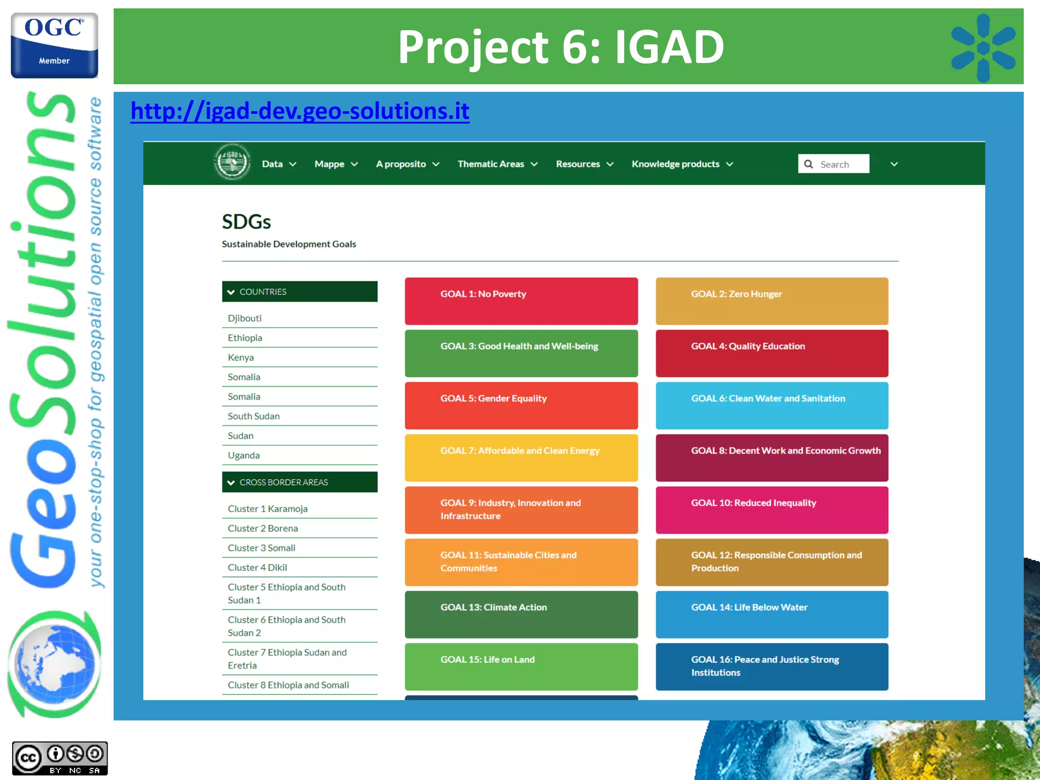
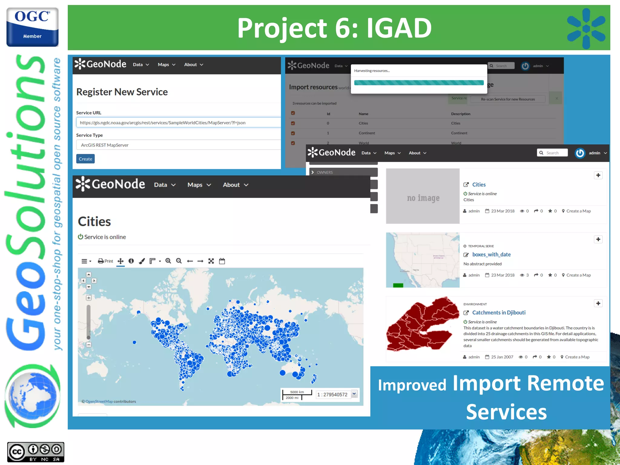
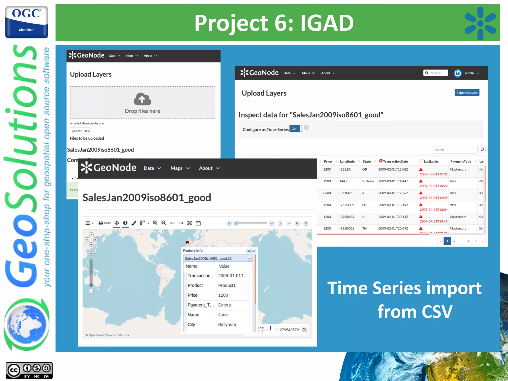
IGAD integrated geoportal project for biodiversity, highlighting thematic categorization and enhanced data management.
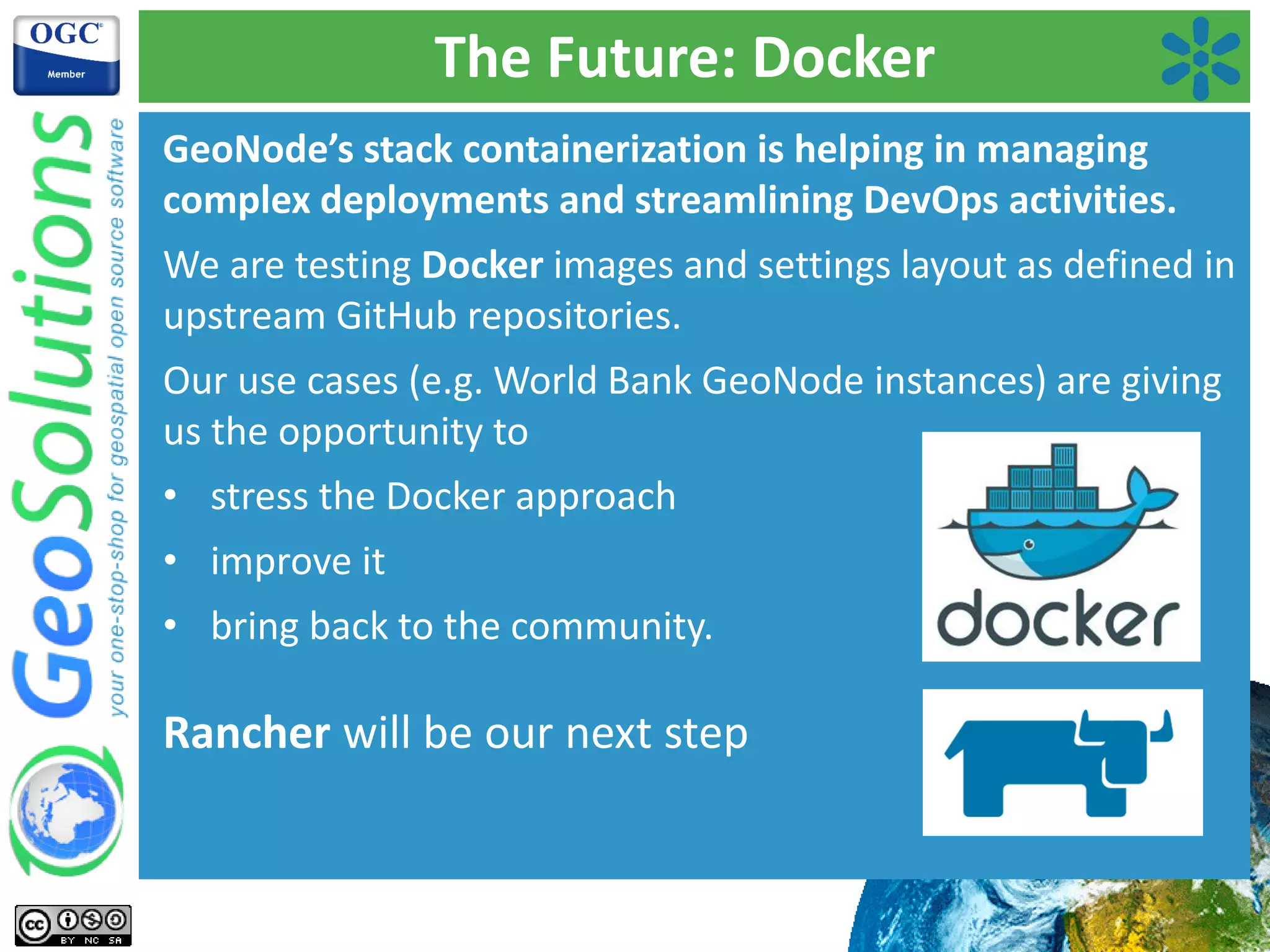
Discussion on future needs including Docker for deployment and developing modular frameworks in GeoNode.
Final remarks and contact details for further information.


![[FOSS4G Korea 2021]Workshop-QGIS-TIPS-20211028](https://cdn.slidesharecdn.com/ss_thumbnails/foss4gkorea2021workshop-qgis-mapplus-20211028-211031033351-thumbnail.jpg?width=640&height=640&fit=bounds)