Downloaded 26 times


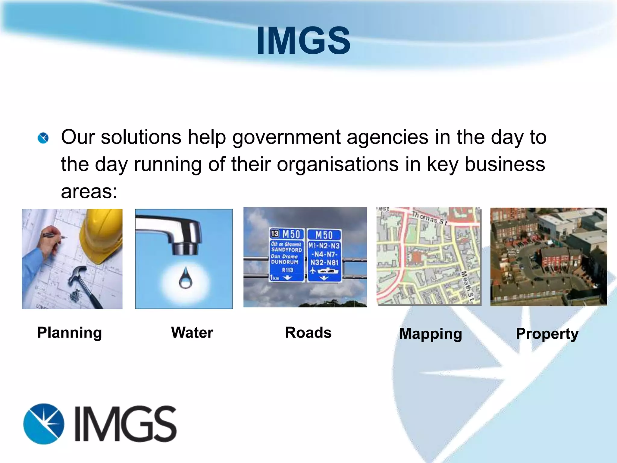
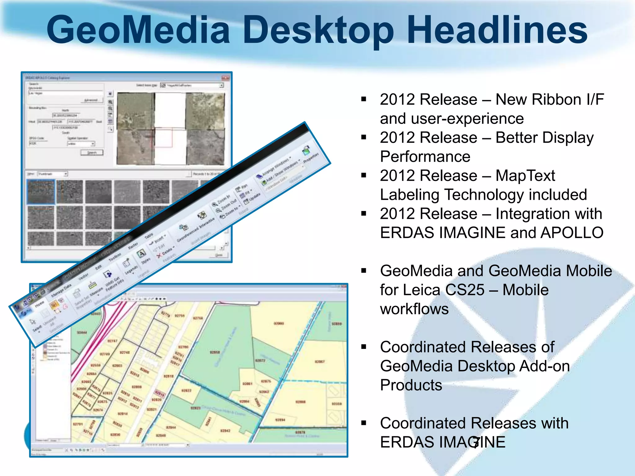
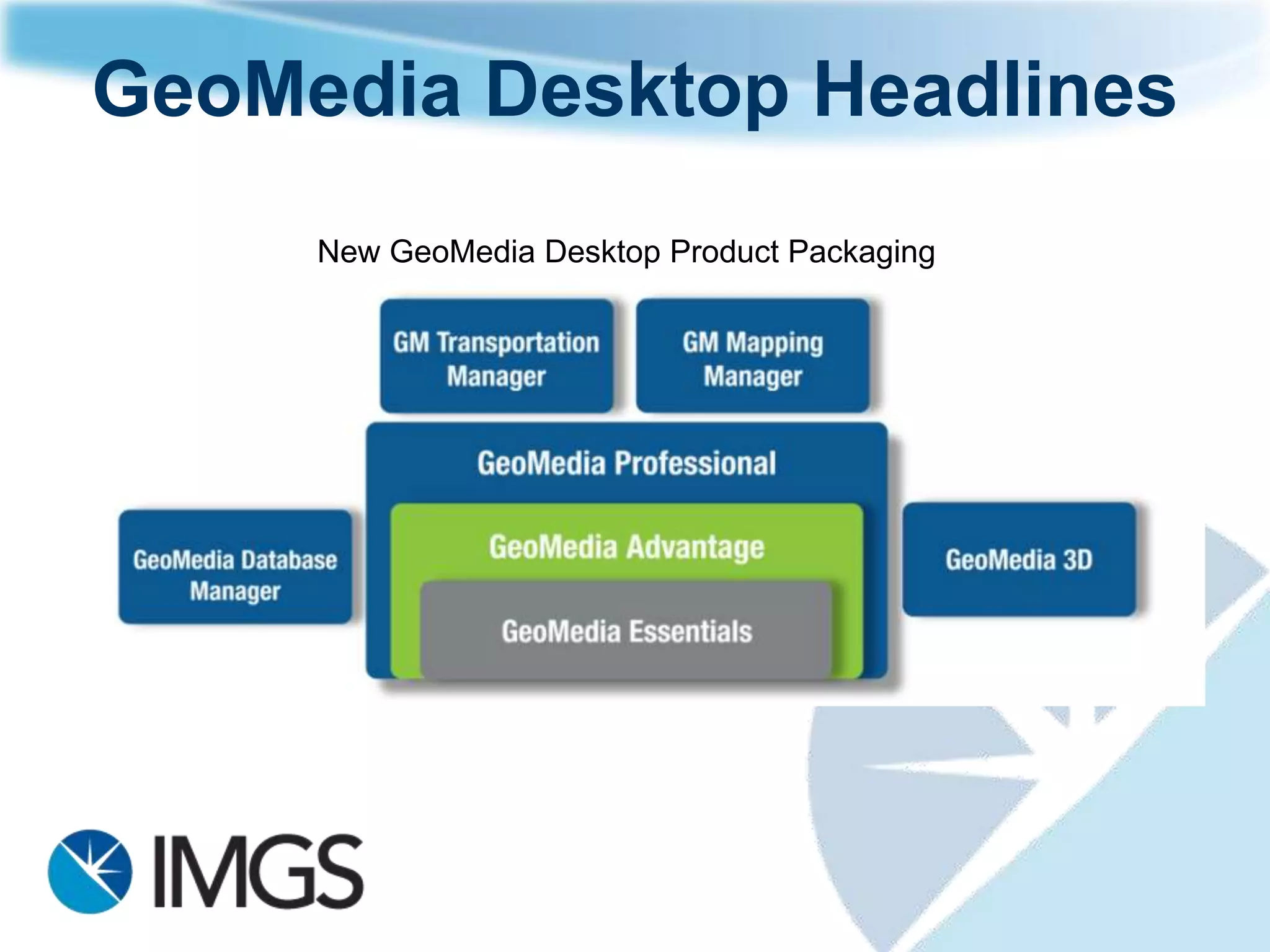
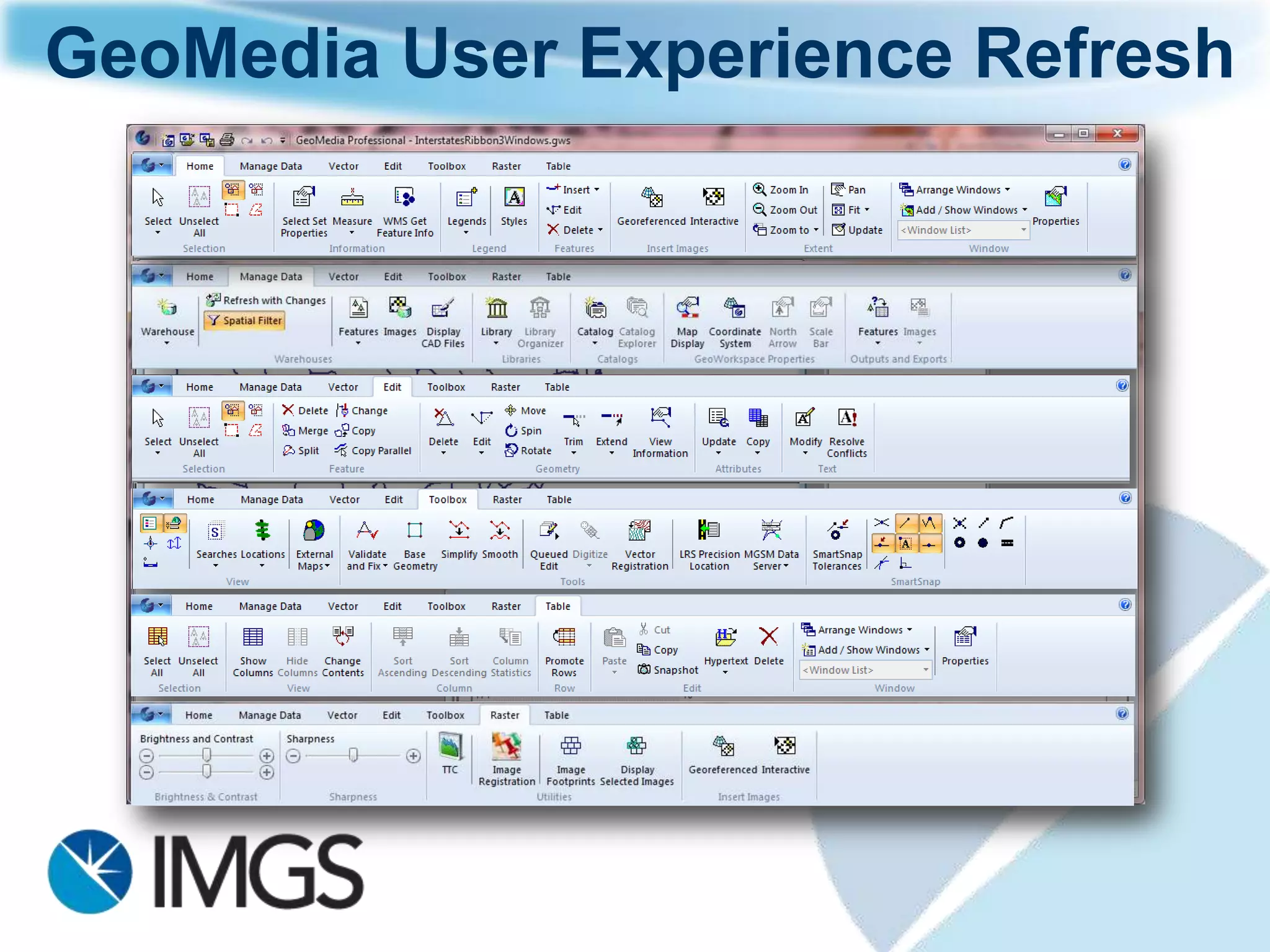
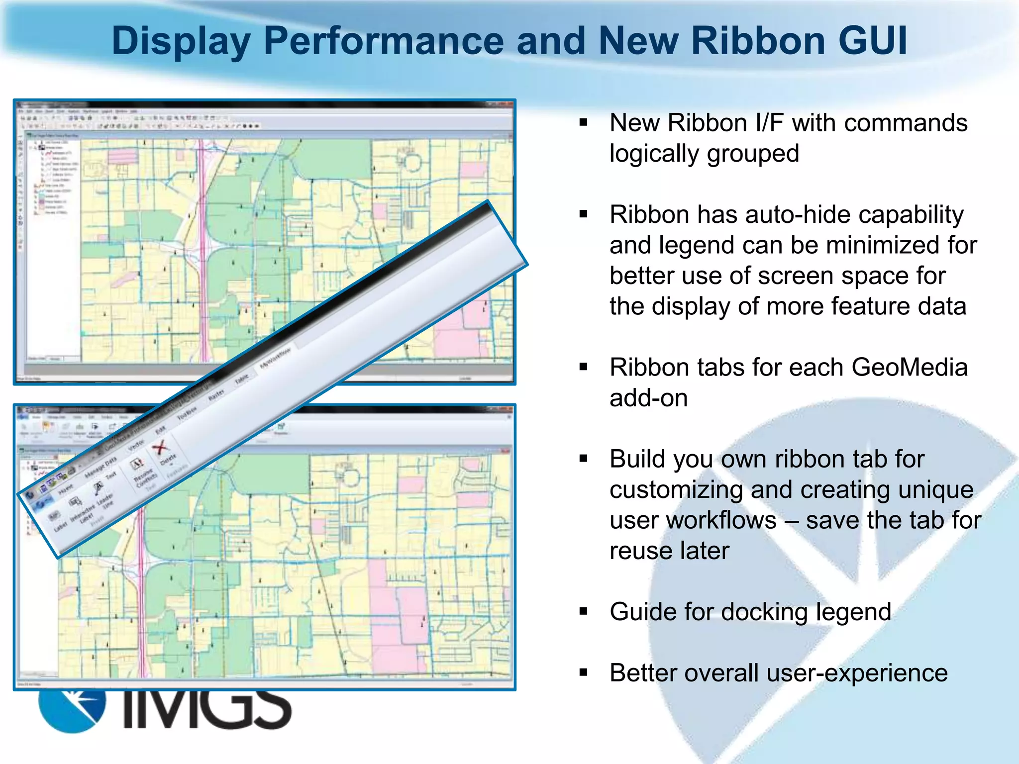
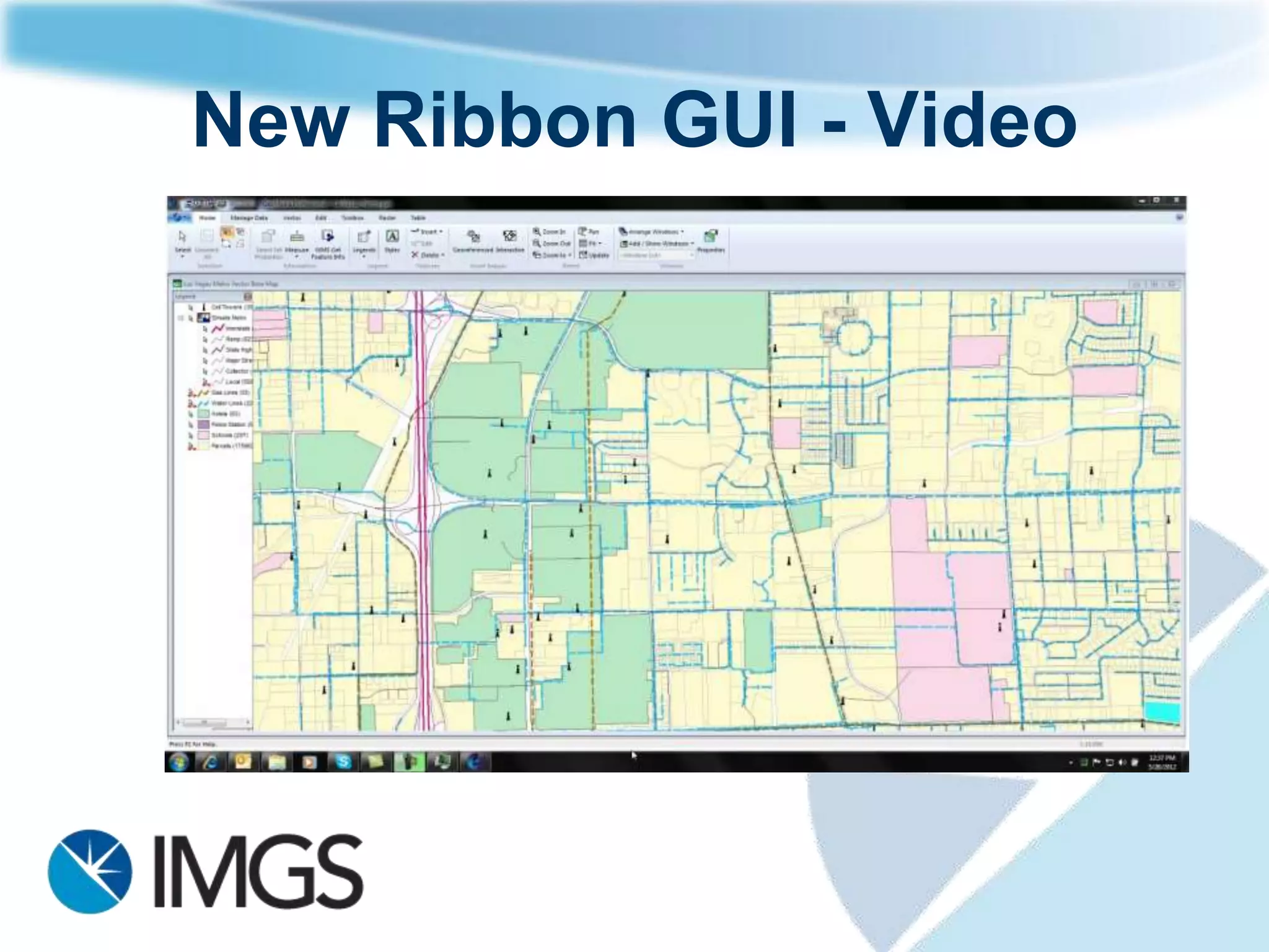
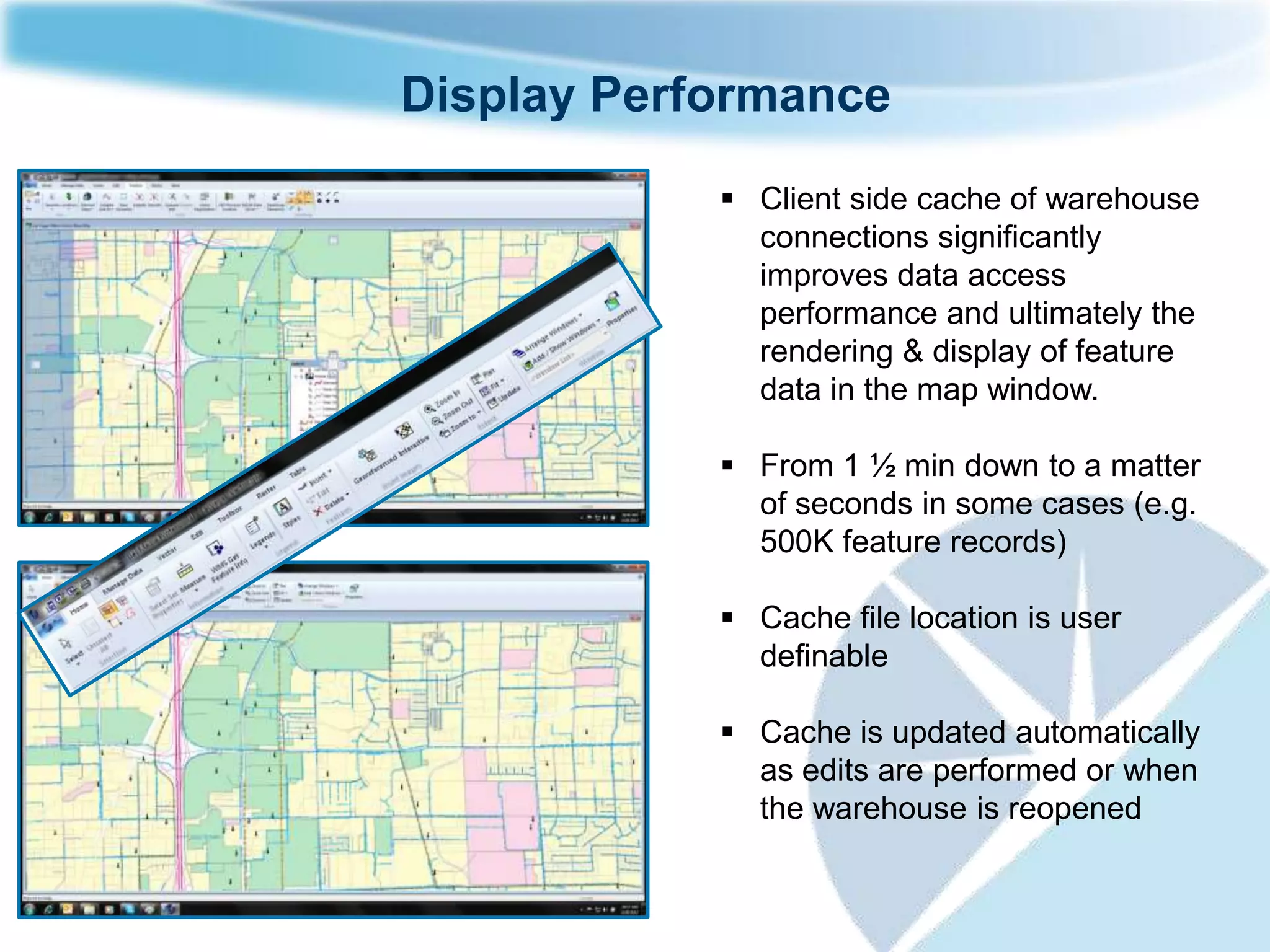
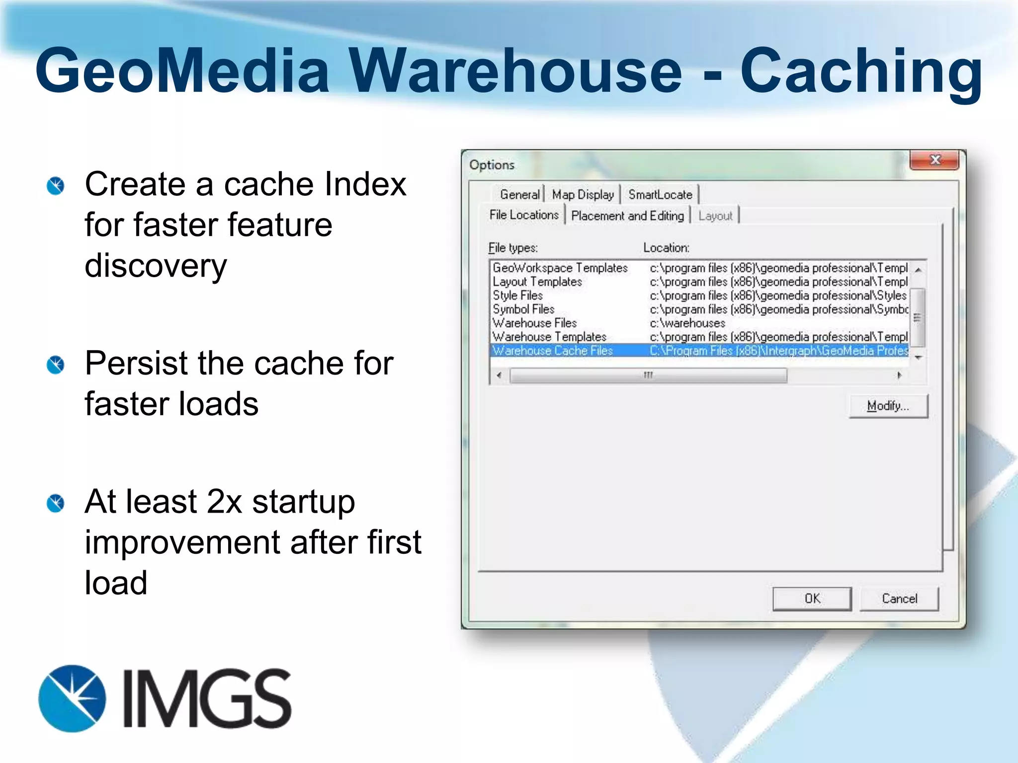
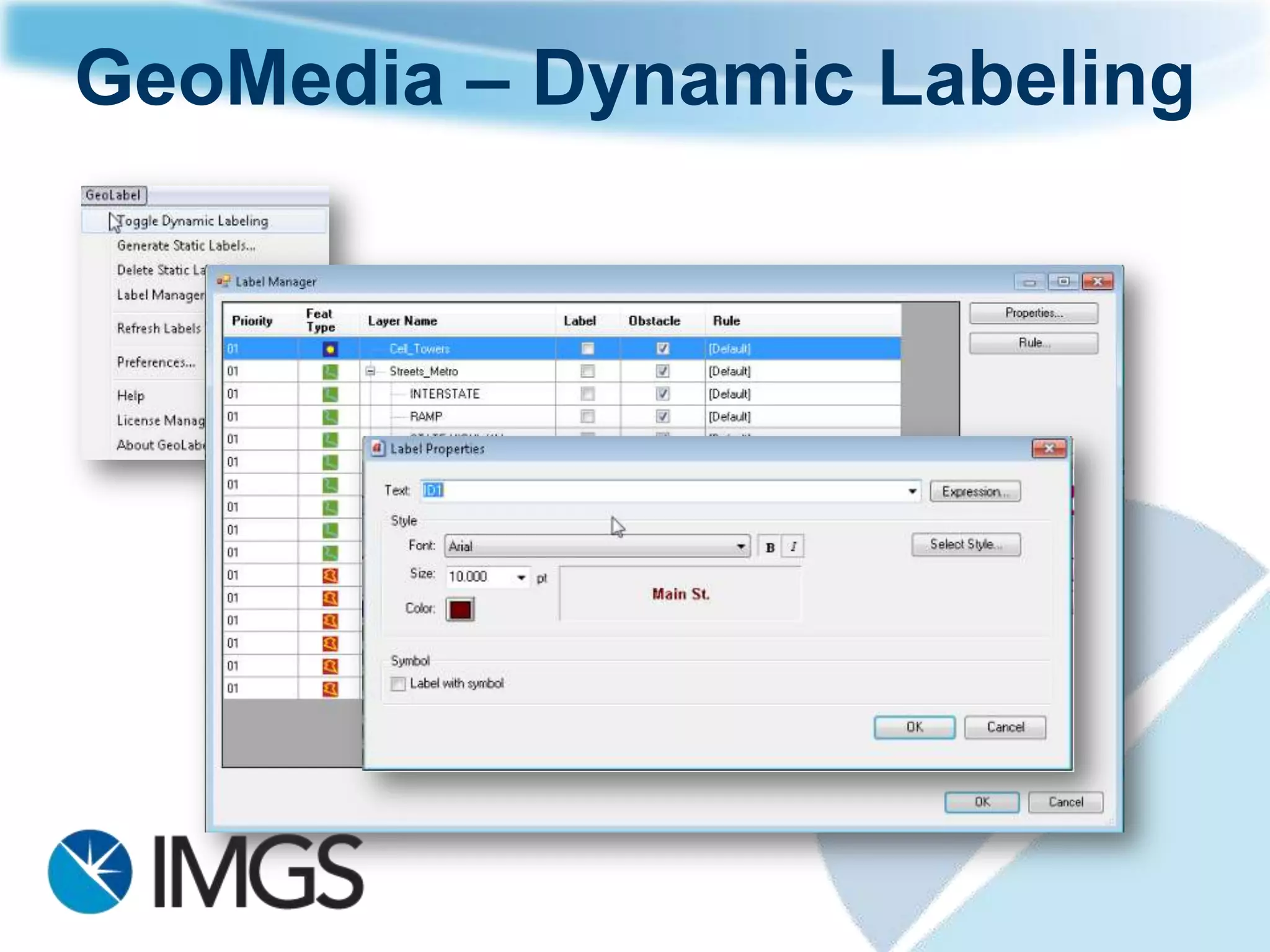
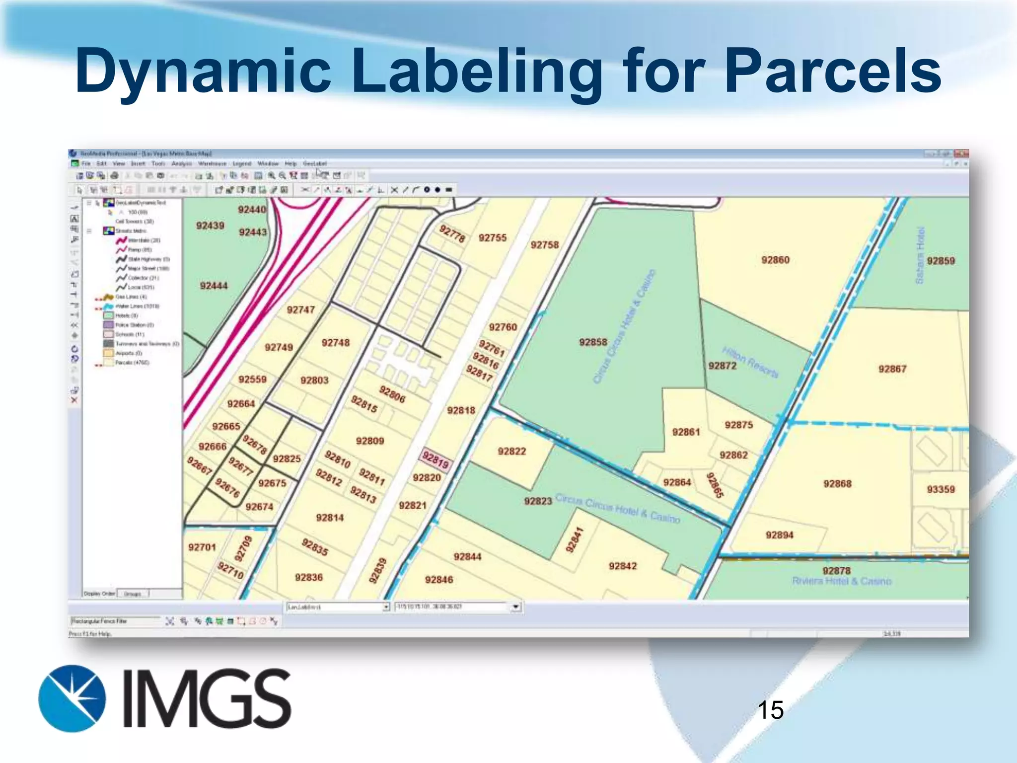
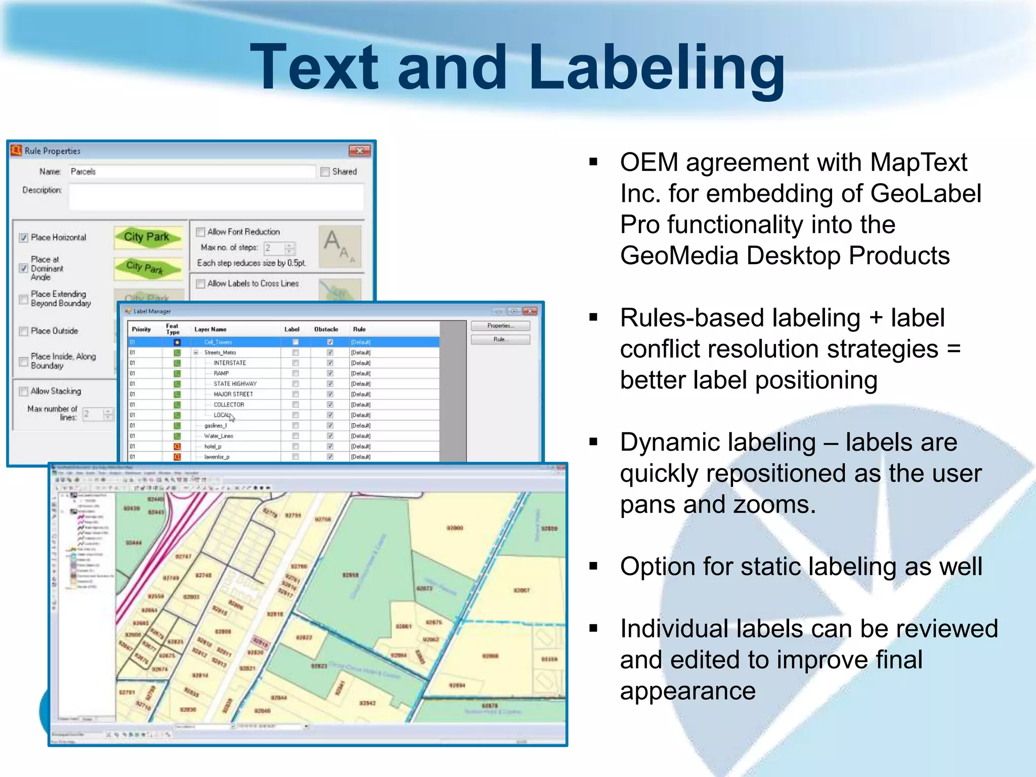
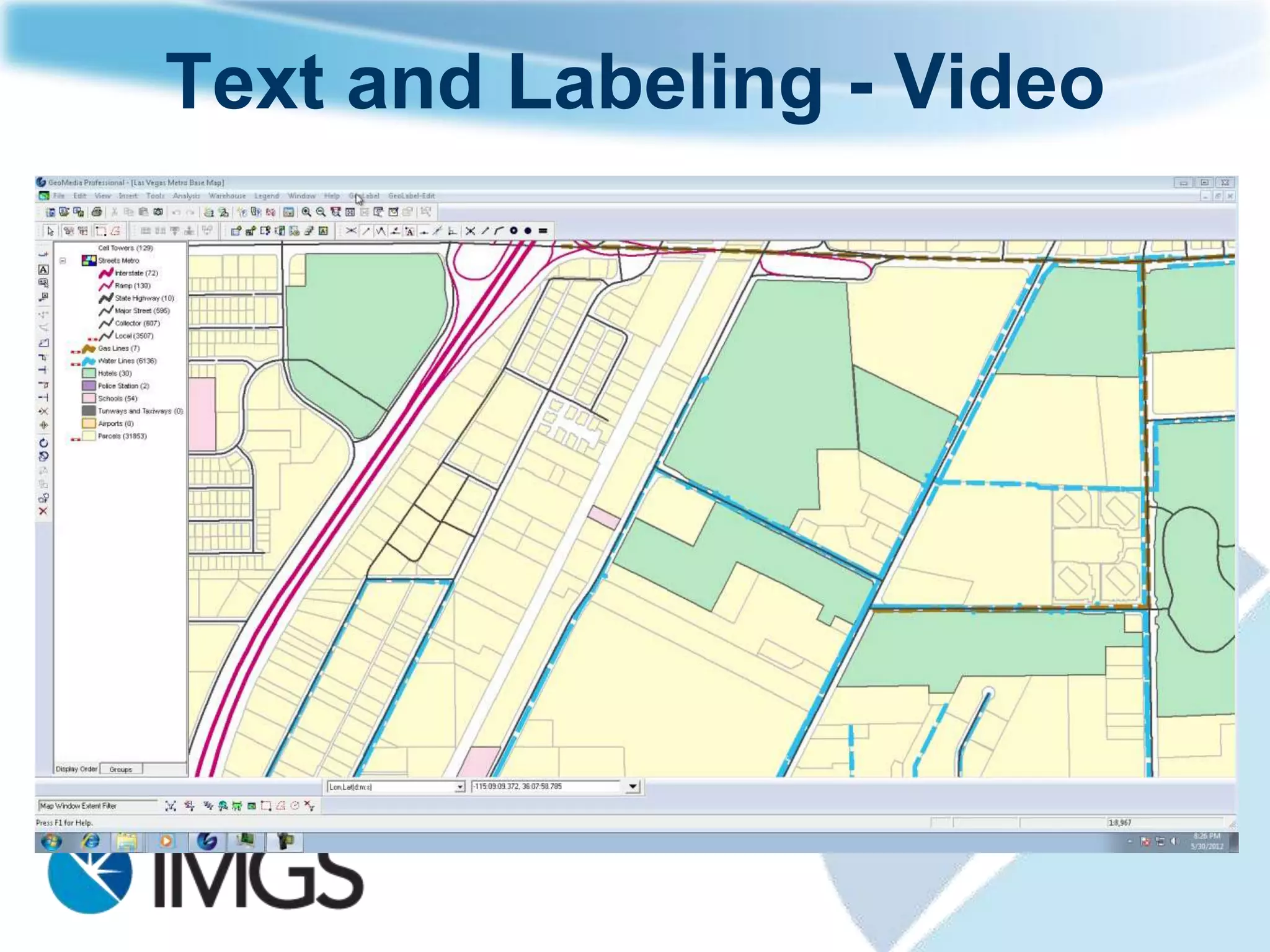
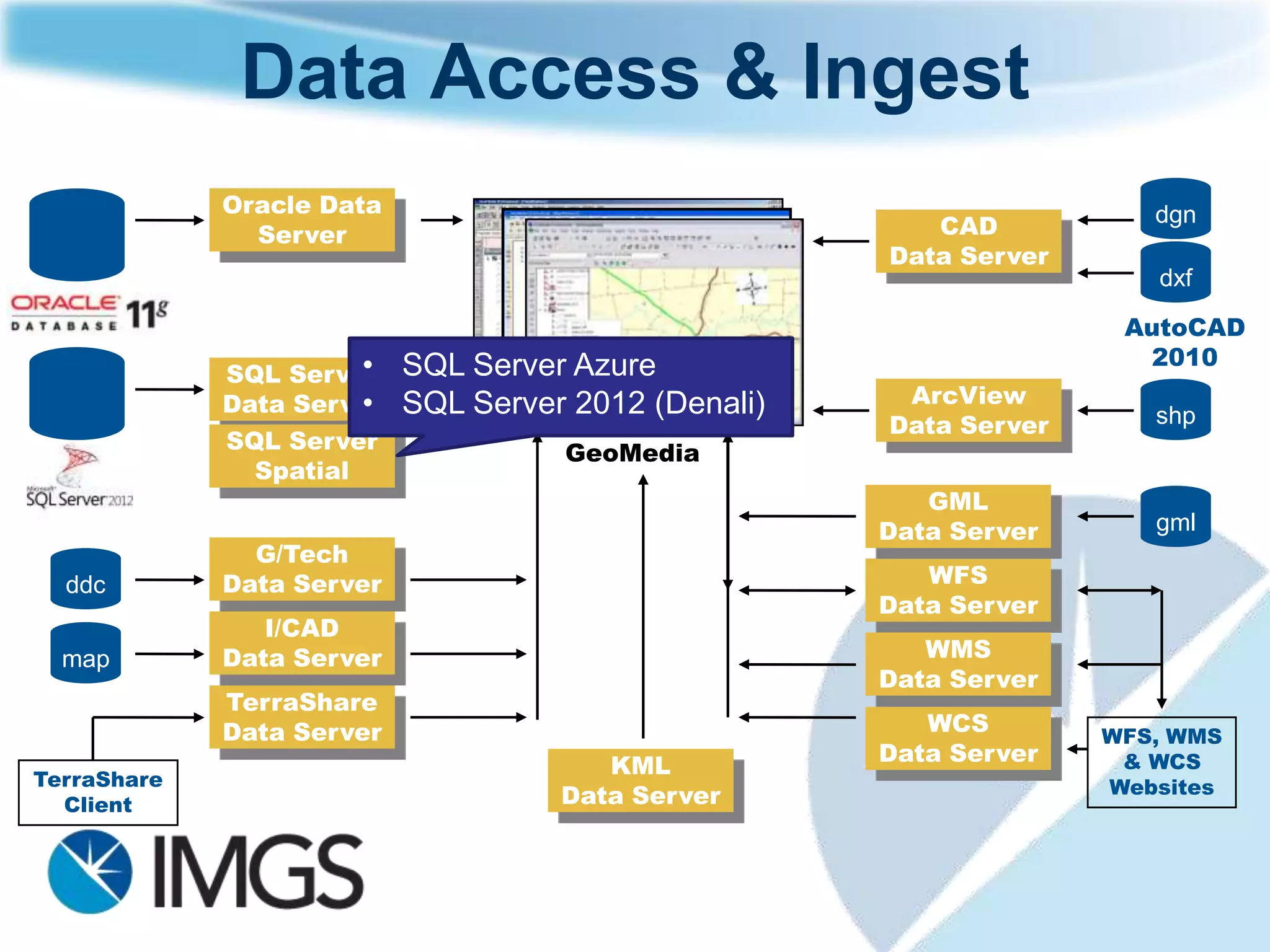


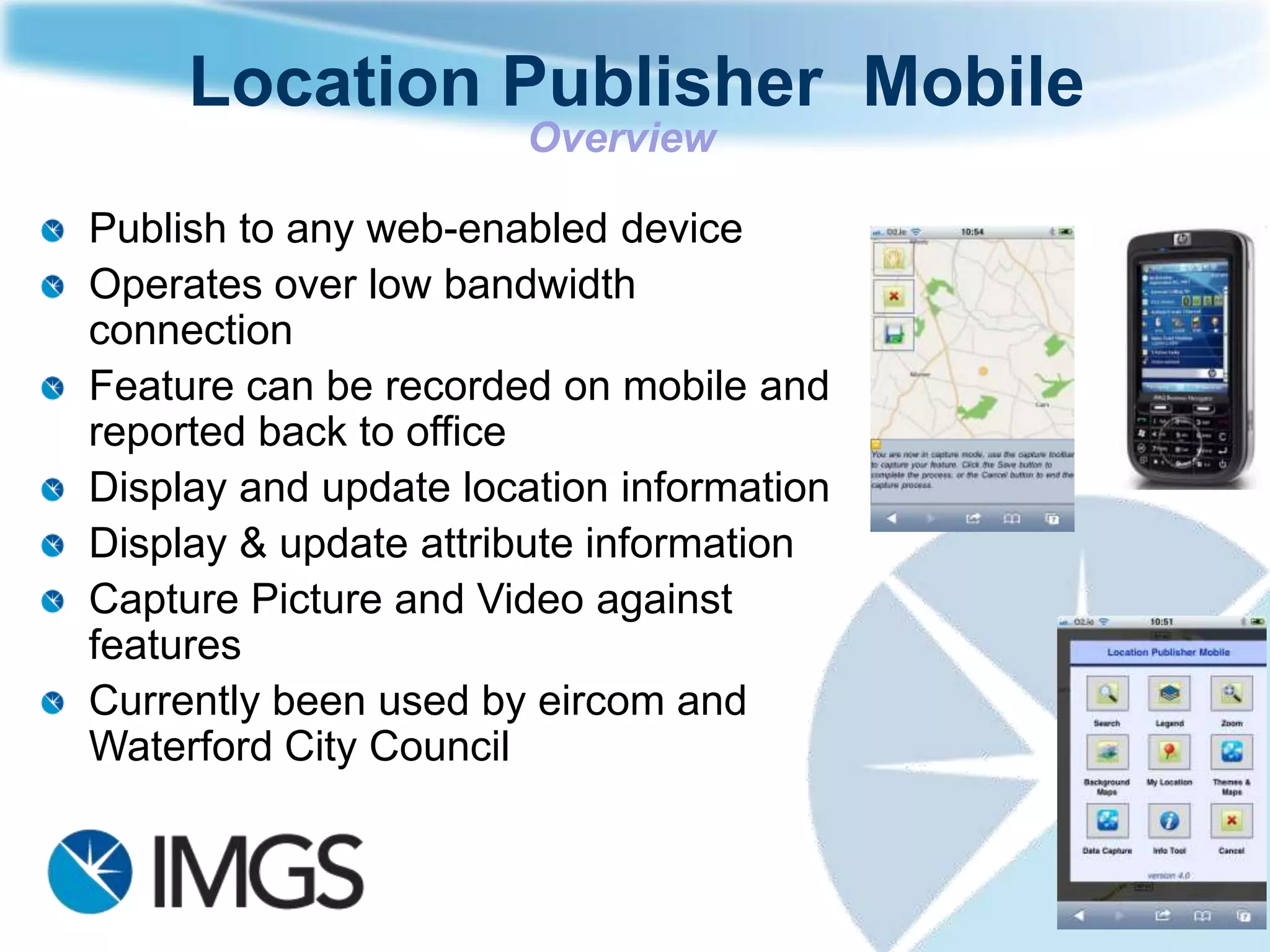
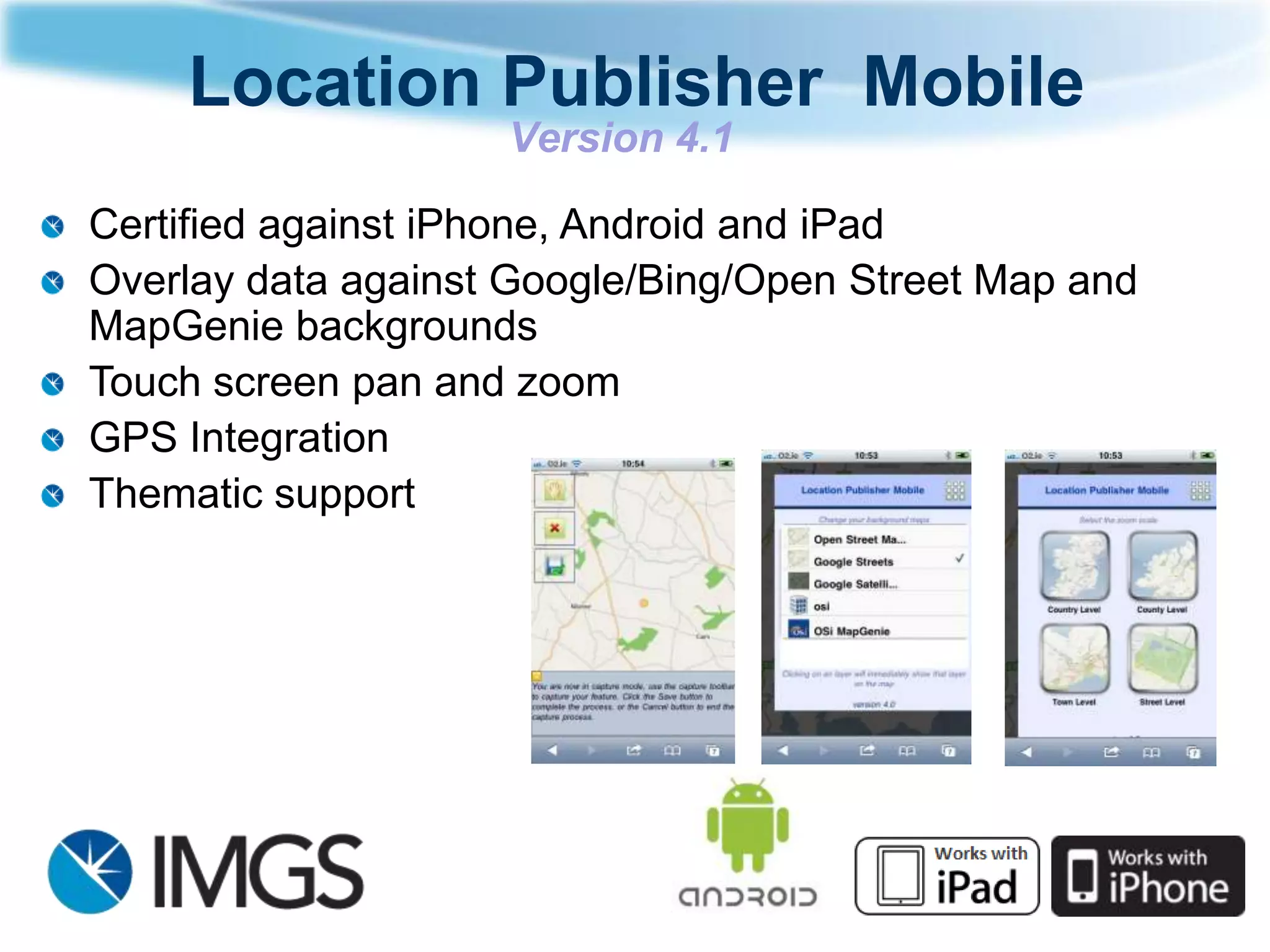
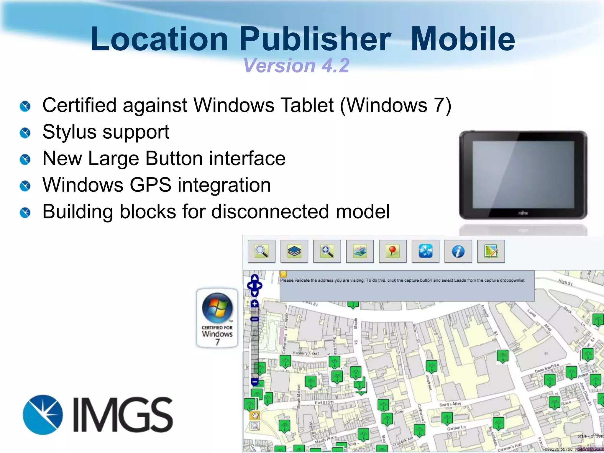
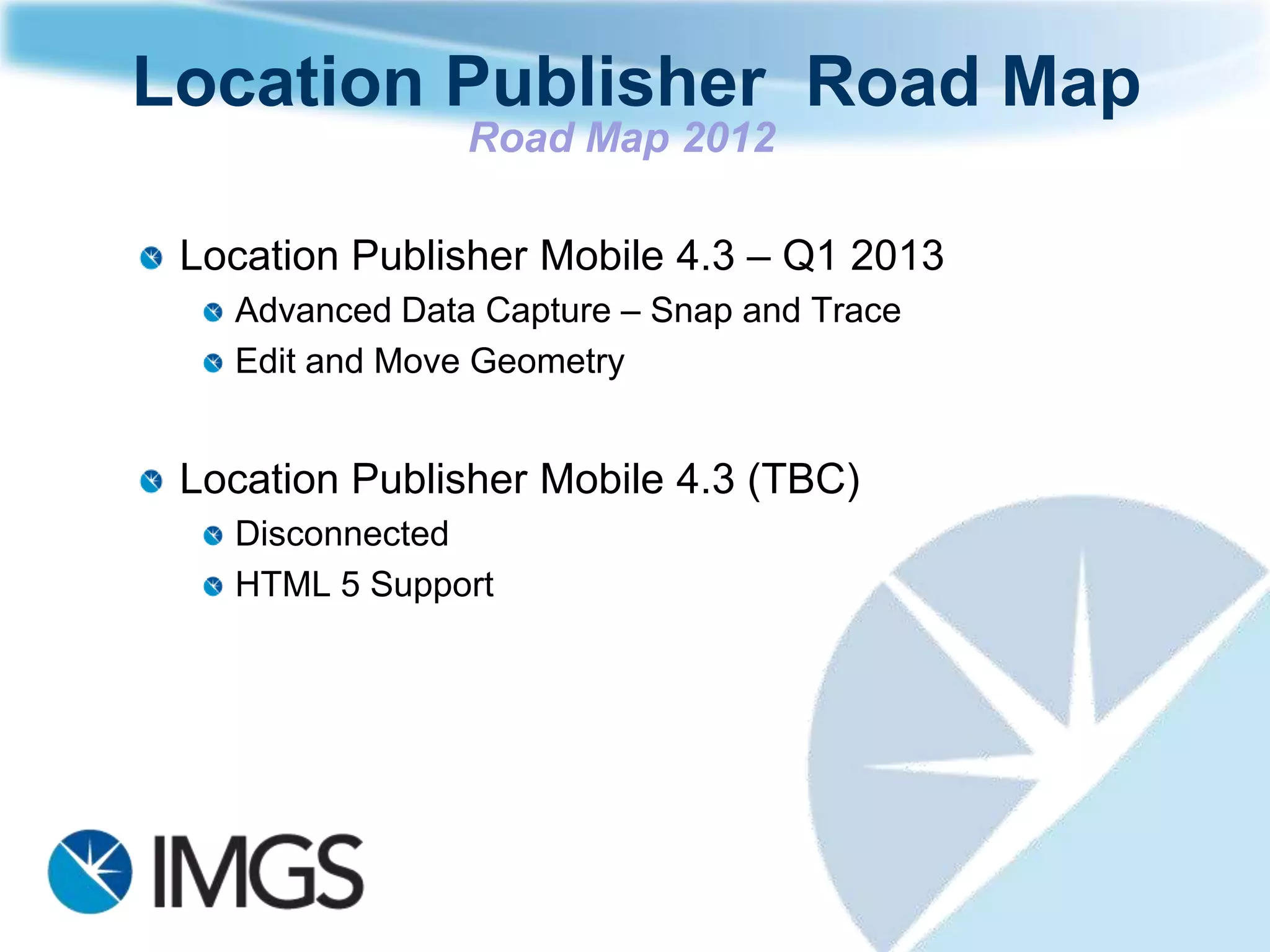


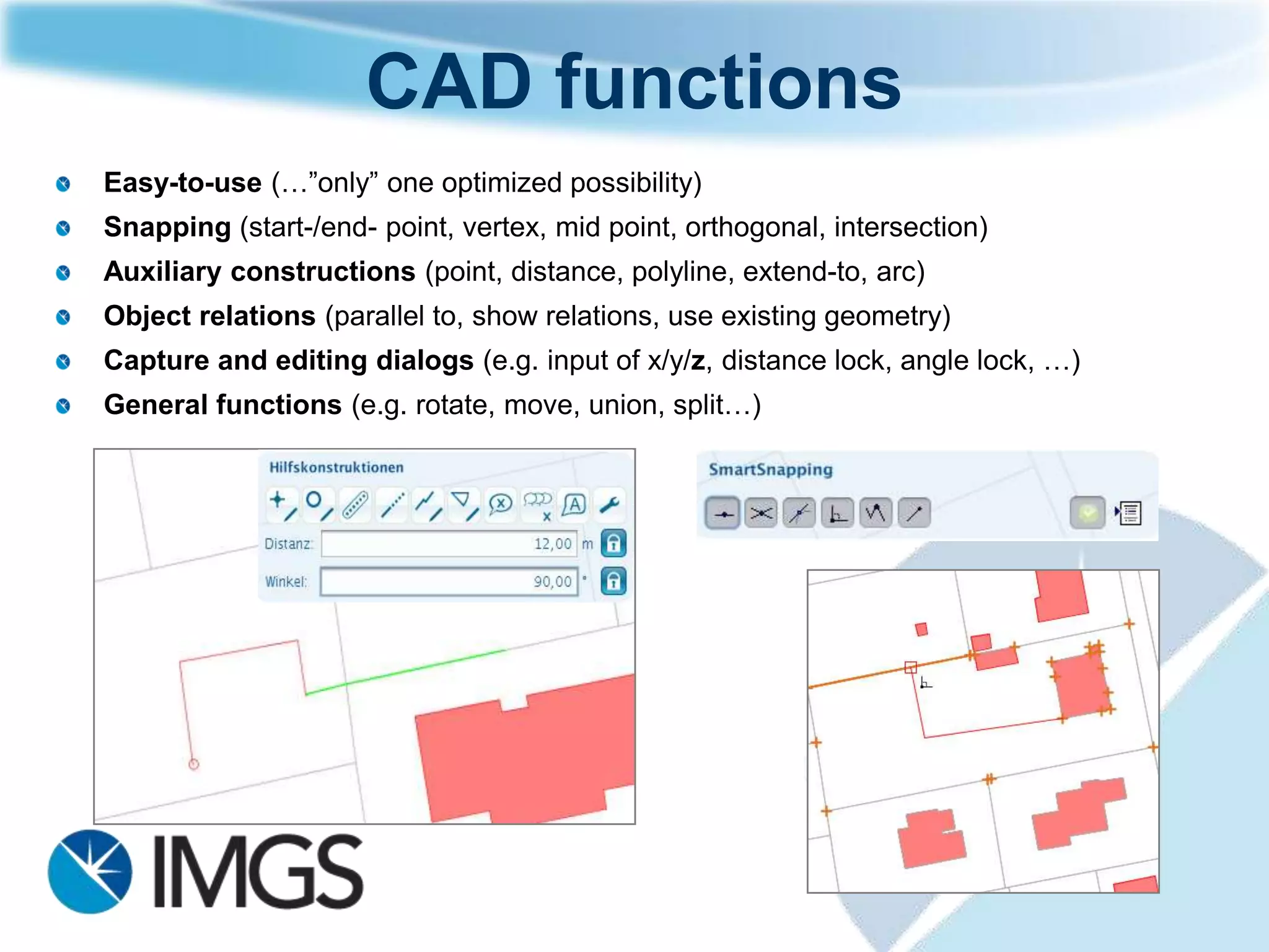
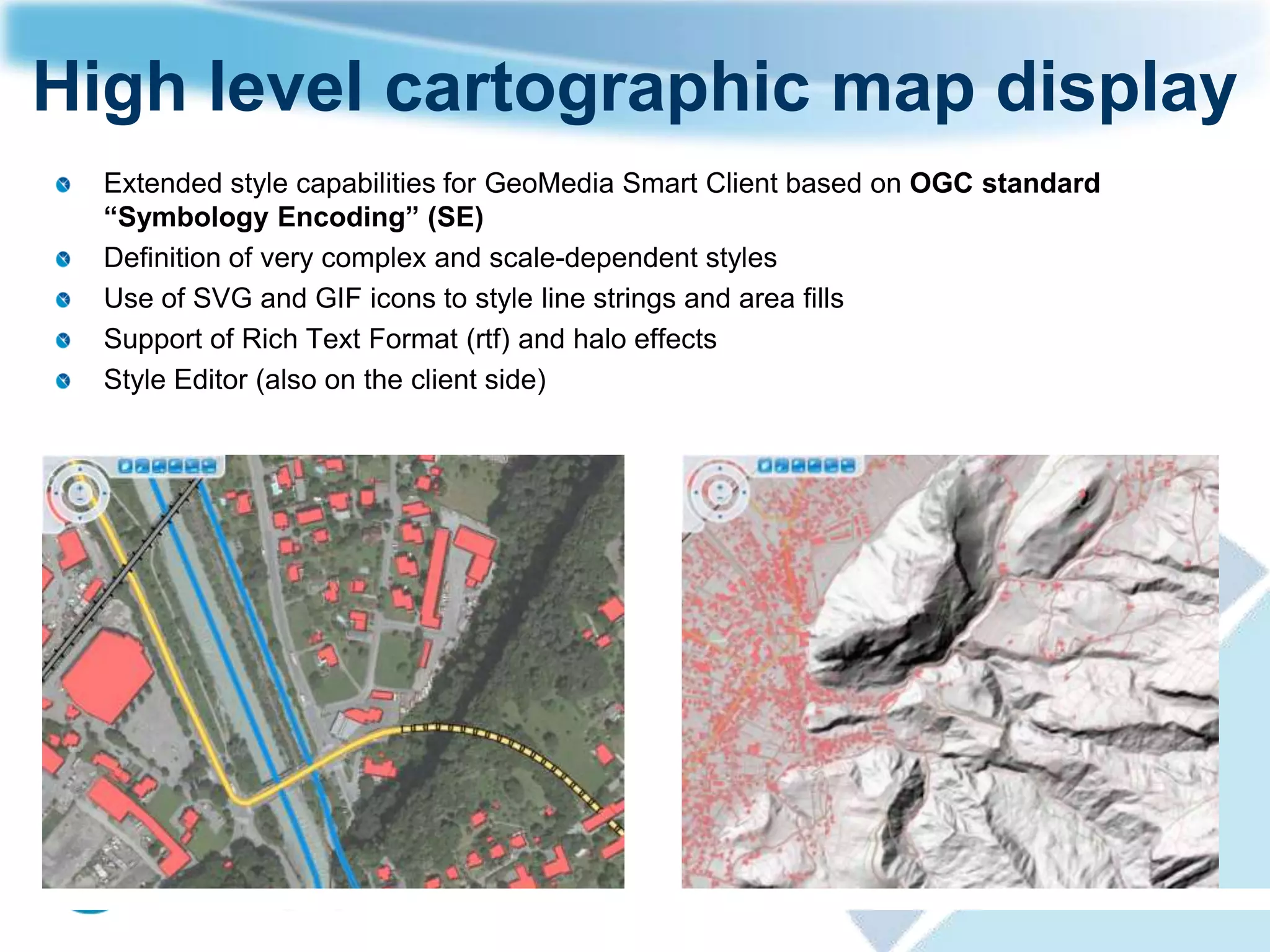
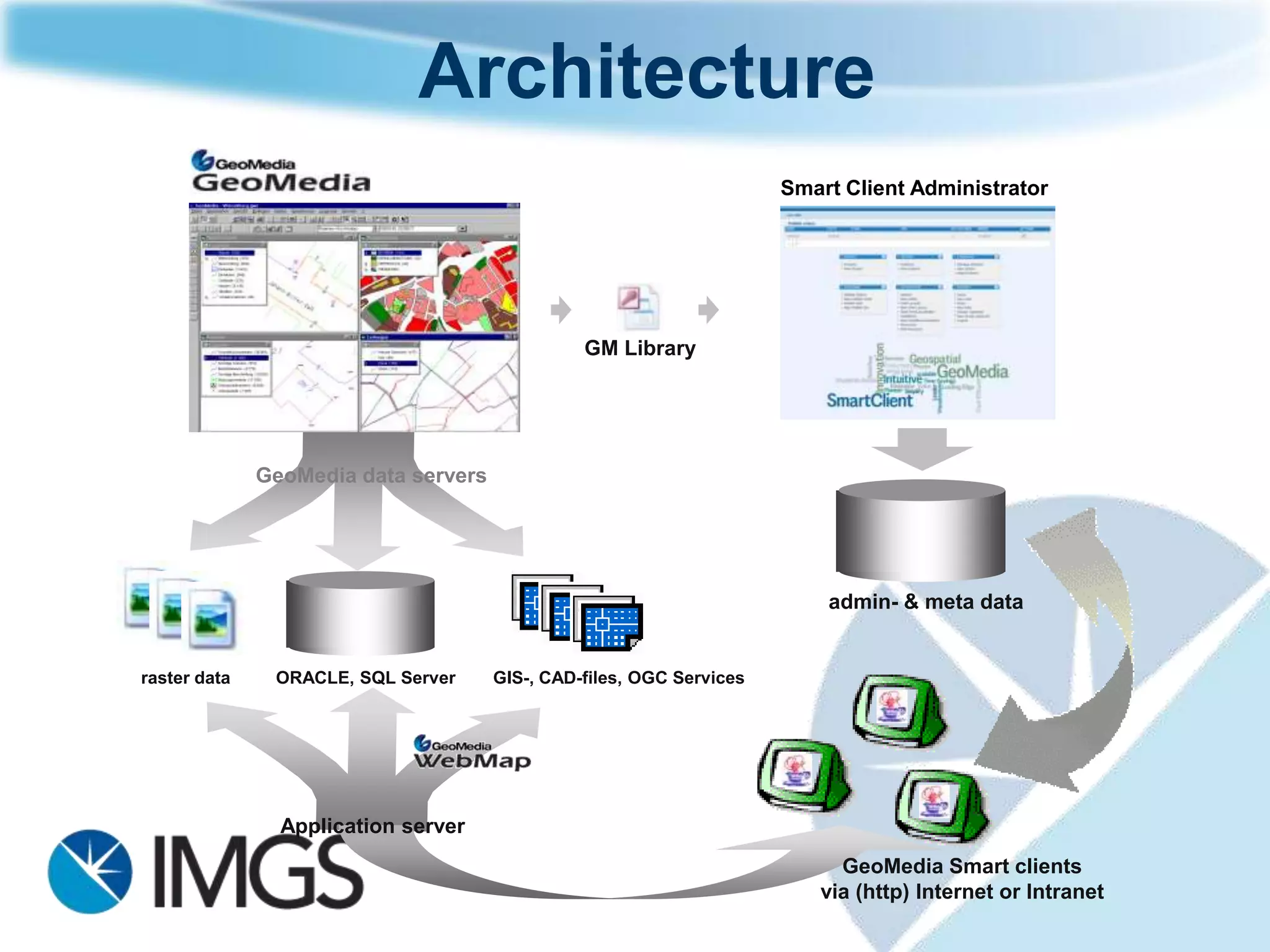
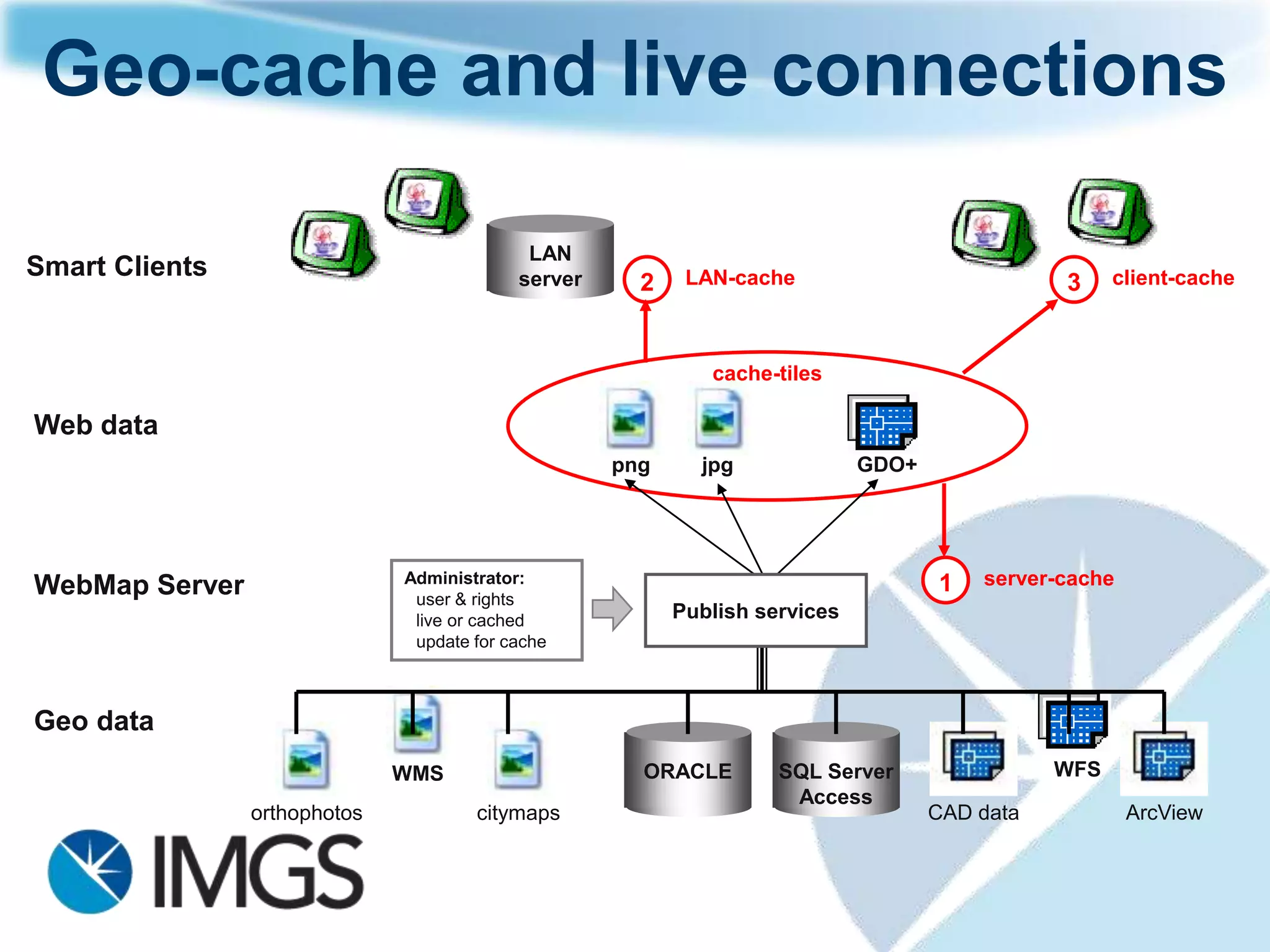


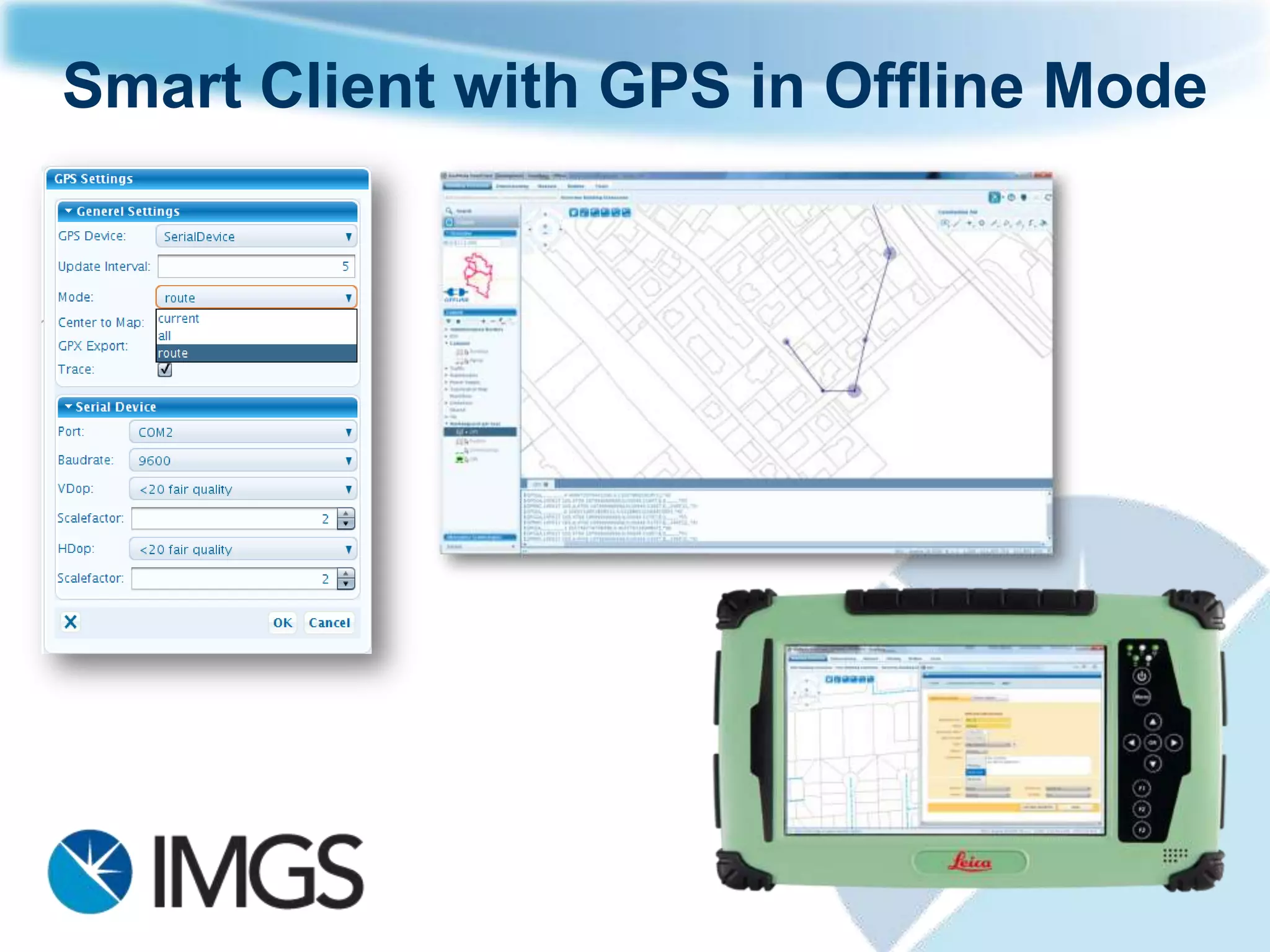

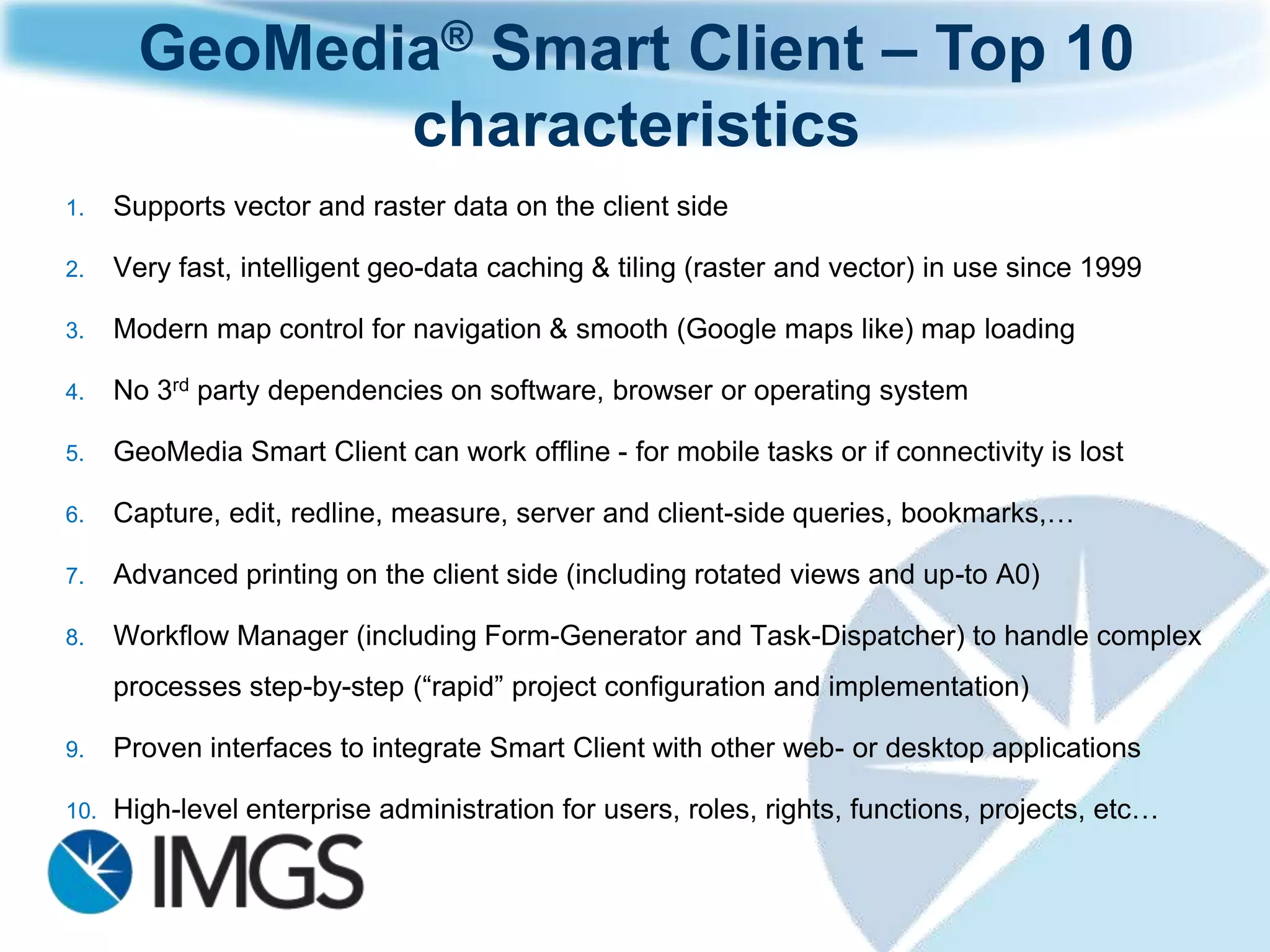


The document outlines the 2012 agenda for an IMG Government User Group, focusing on innovative spatial solutions for desktop, web, and mobile applications tailored for Irish government and mapping agencies. Key highlights include updates on GeoMedia products and their enhancements, such as improved user interface, performance, and labeling technologies, as well as advancements in Location Publisher and asset management systems. The integration of various data servers and the emphasis on operational efficiency address the needs of organizations in planning, property mapping, and other administrative functions.


