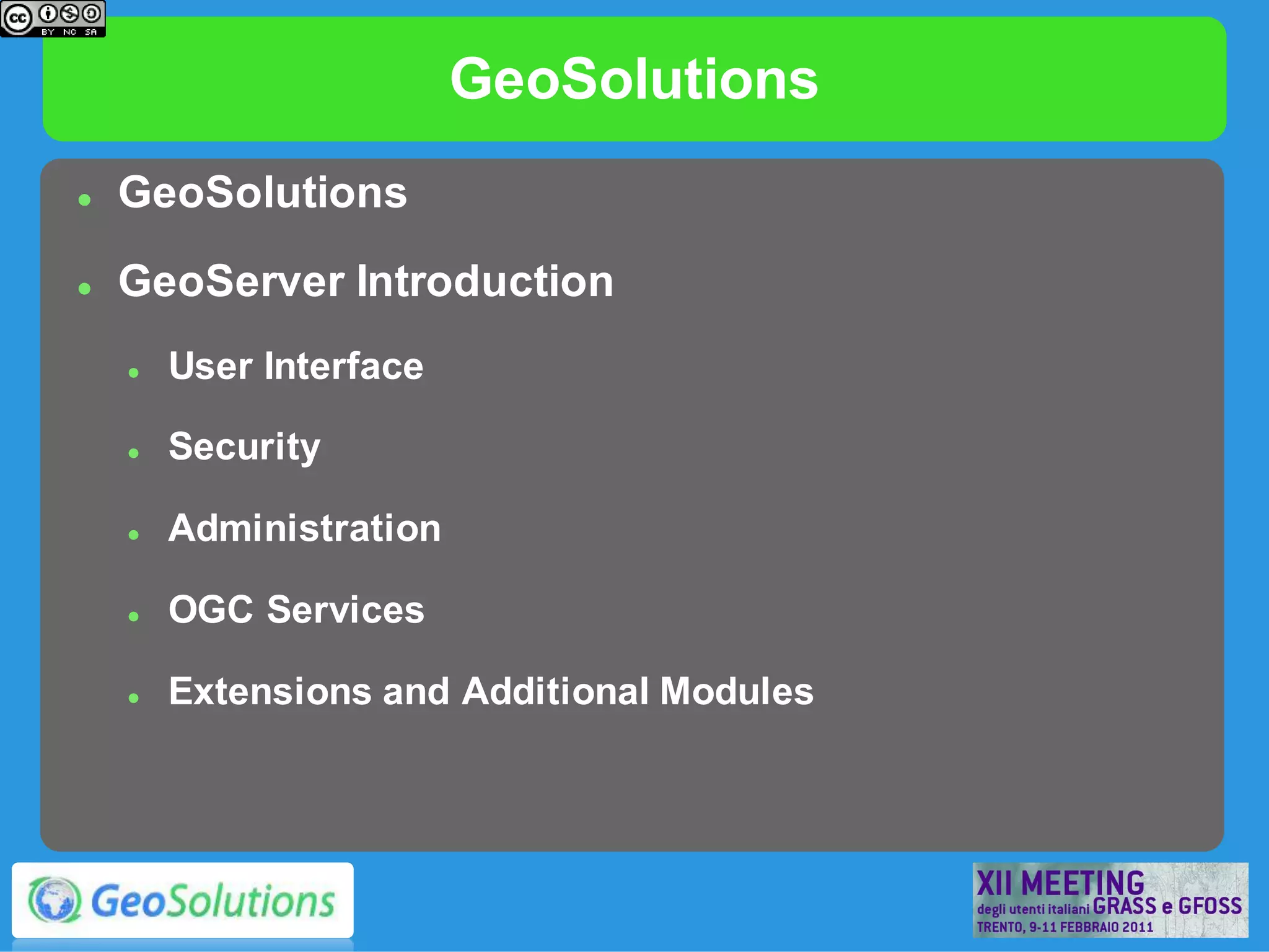
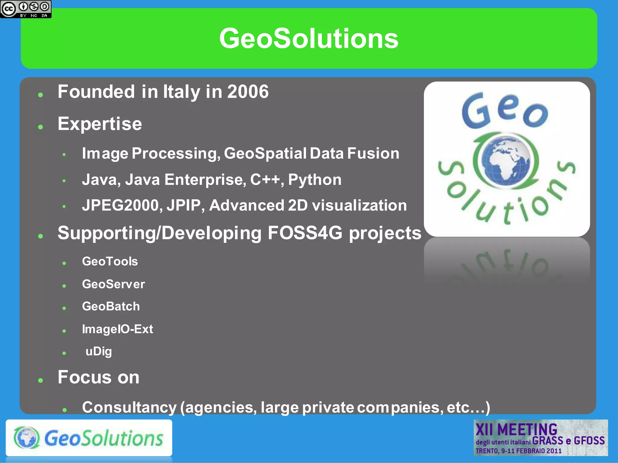
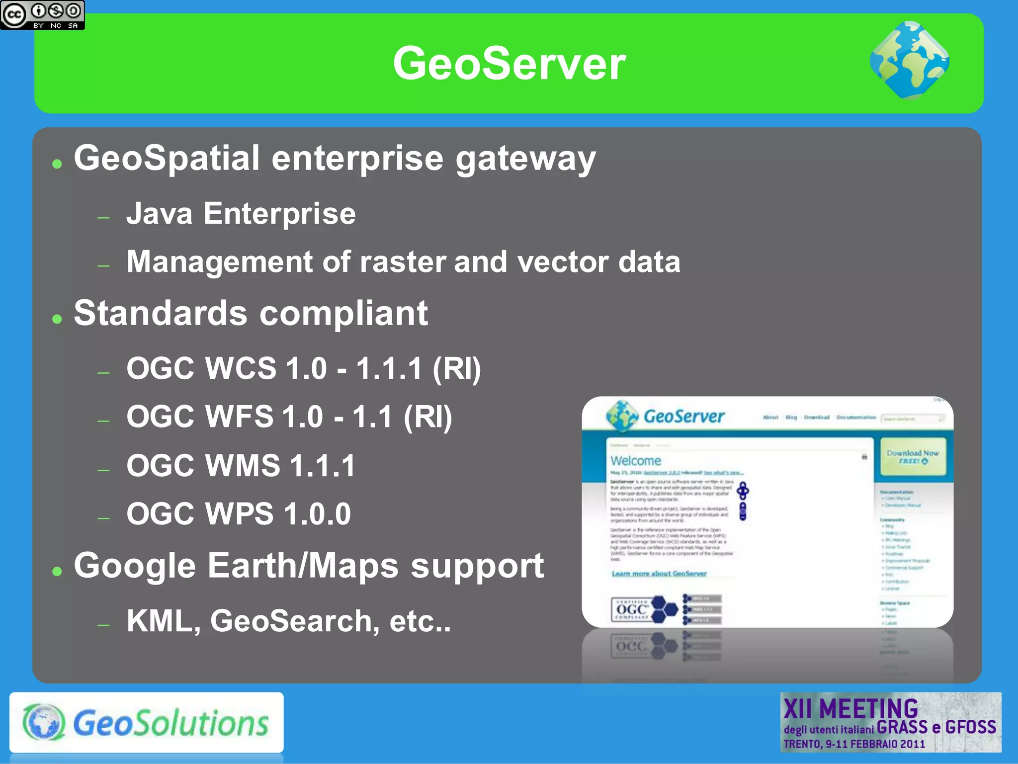
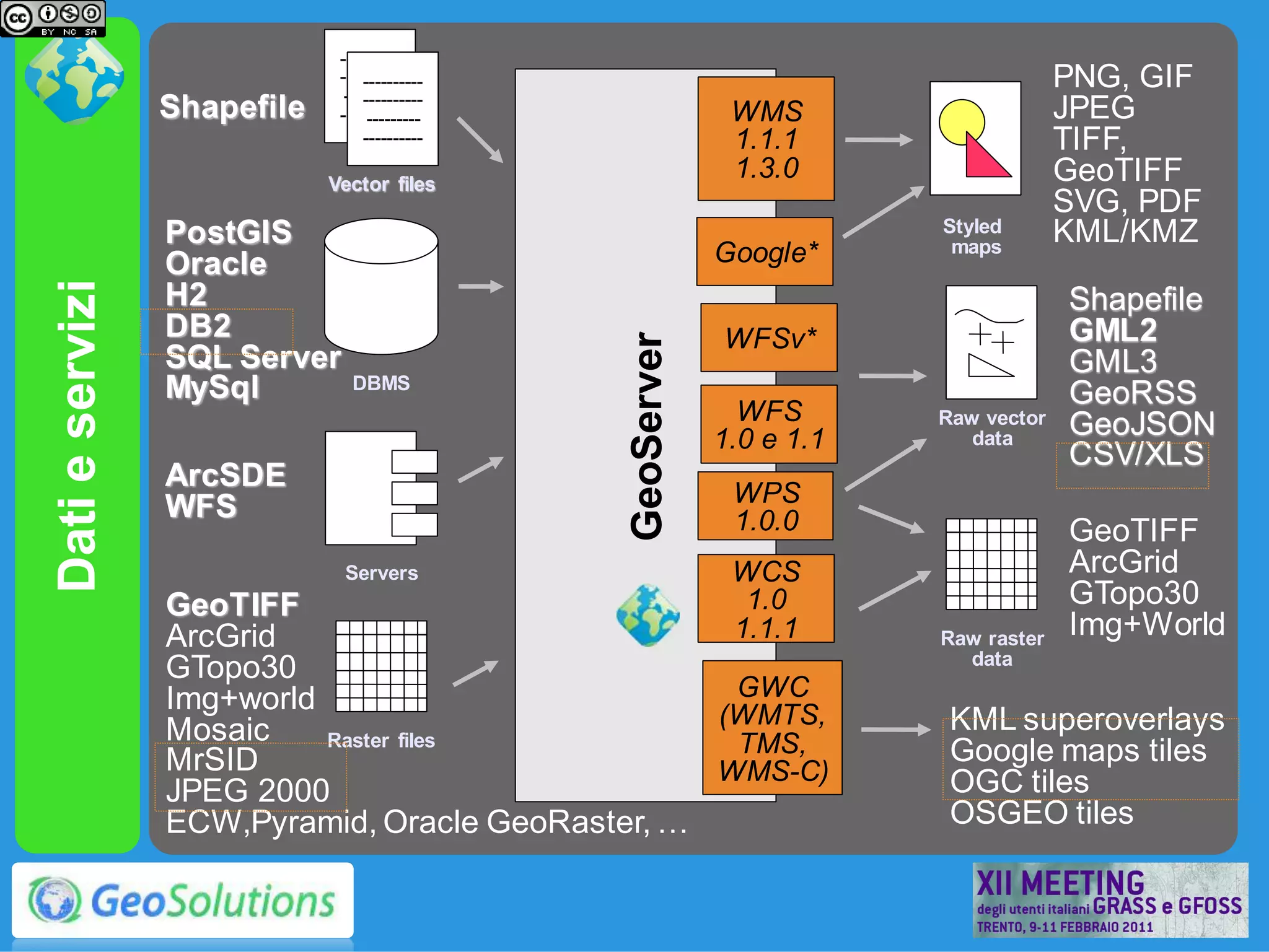
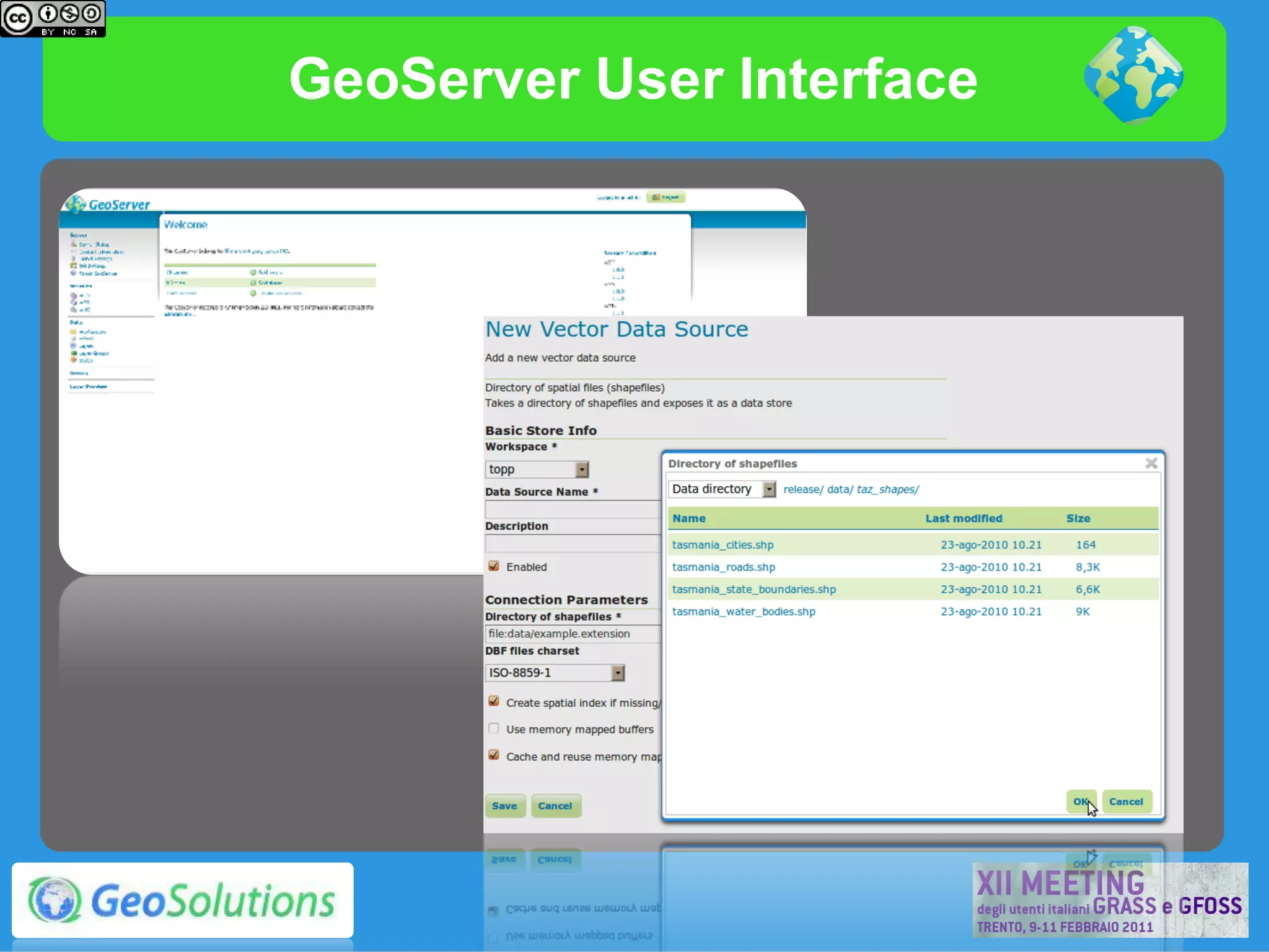
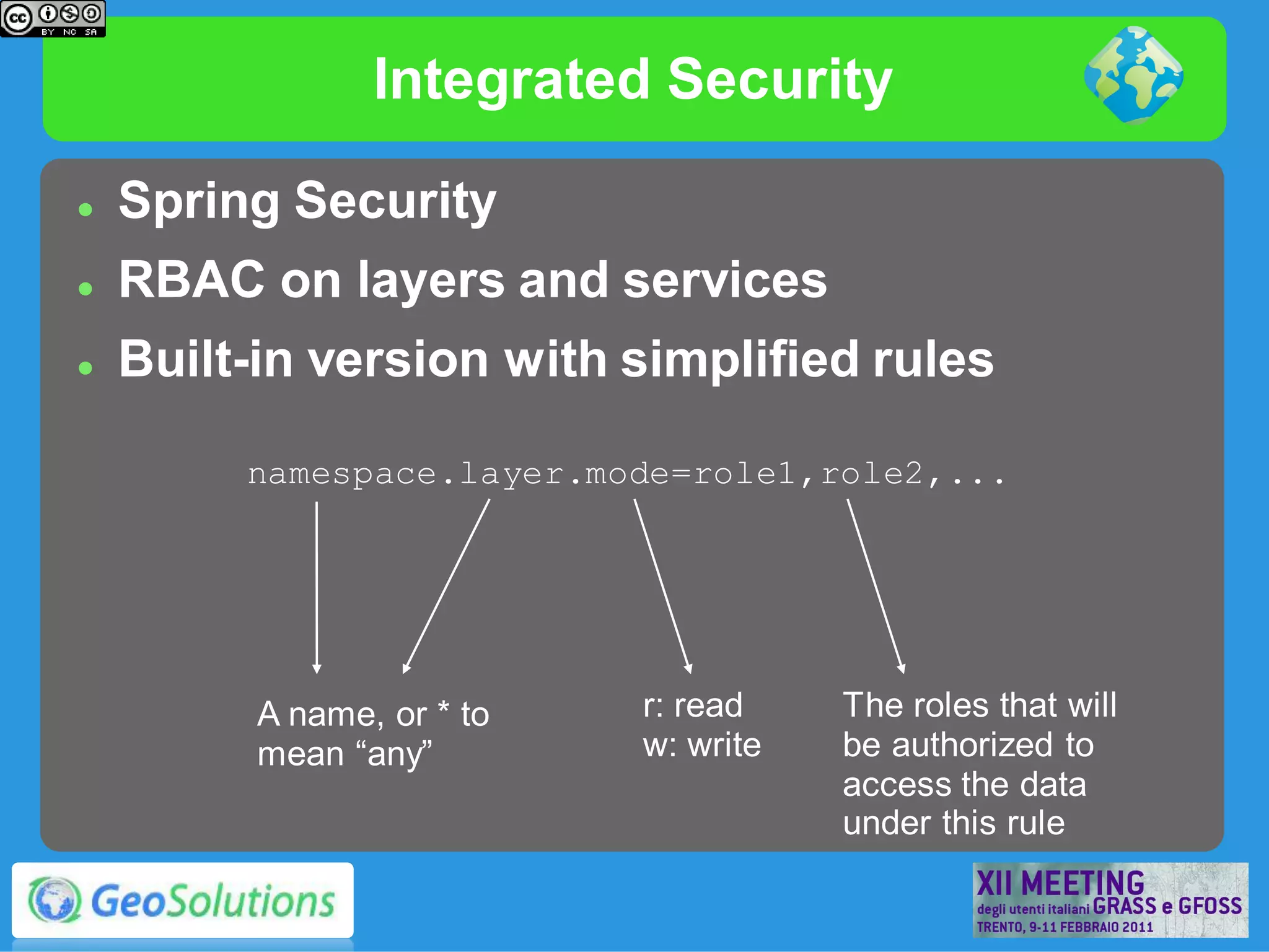
GeoServer,
     The Open Source Solution
for the interoperable management
          of geospatial data

      Ing. Andrea Aime, GeoSolutions
 Ing. Simone Giannecchini, GeoSolutions
GeoSolutions
   GeoSolutions
   GeoServer Introduction
       User Interface

       Security

       Administration

       OGC Services

       Extensions and Additional Modules
GeoSolutions
   Founded in Italy in 2006
   Expertise
    •   Image Processing, GeoSpatial Data Fusion
    •   Java, Java Enterprise, C++, Python
    •   JPEG2000, JPIP, Advanced 2D visualization
   Supporting/Developing FOSS4G projects
       GeoTools
       GeoServer
       GeoBatch
       ImageIO-Ext
       uDig

   Focus on
       Consultancy (agencies, large private companies, etc…)
GeoServer
   GeoSpatial enterprise gateway
        Java Enterprise
        Management of raster and vector data
   Standards compliant
        OGC WCS 1.0 - 1.1.1 (RI)
        OGC WFS 1.0 - 1.1 (RI)
        OGC WMS 1.1.1
        OGC WPS 1.0.0
   Google Earth/Maps support
        KML, GeoSearch, etc..
----------
                              ----------
                                  ----------
                               ---------
                                                                                    PNG, GIF
                                  ----------
                 Shapefile    ----------
                                   ---------                WMS                     JPEG
                                  ----------                1.1.1                   TIFF,
                             Vector files
                                                            1.3.0                   GeoTIFF
                                                                                    SVG, PDF
                 PostGIS                                               Styled       KML/KMZ
                                                           Google*      maps
                 Oracle
Dati e servizi


                 H2                                                                 Shapefile
                 DB2                                       WFSv*                    GML2


                                               GeoServer
                 SQL Server                                                         GML3
                 MySql          DBMS
                                                                                    GeoRSS
                                                             WFS       Raw vector   GeoJSON
                                                           1.0 e 1.1      data
                                                                                    CSV/XLS
                 ArcSDE
                 WFS                                        WPS
                                                            1.0.0                   GeoTIFF
                              Servers                       WCS                     ArcGrid
                 GeoTIFF                                     1.0                    GTopo30
                 ArcGrid                                    1.1.1      Raw raster
                                                                                    Img+World
                                                                         data
                 GTopo30
                 Img+world                         GWC
                                                  (WMTS,                KML superoverlays
                 Mosaic    Raster files            TMS,
                 MrSID                                                  Google maps tiles
                                                  WMS-C)                OGC tiles
                 JPEG 2000
                 ECW,Pyramid, Oracle GeoRaster, …                       OSGEO tiles
GeoServer User Interface
Integrated Security

   Spring Security
   RBAC on layers and services
   Built-in version with simplified rules

         namespace.layer.mode=role1,role2,...


          A name, or * to   r: read    The roles that will
          mean “any”        w: write   be authorized to
                                       access the data
                                       under this rule
GUI: security configuration
Security Developments in 2.1

   Security Management at the feature level
    (record in DBMS)  read and write filtering
   Hide sensible attributes
   Discriminate visible areas on a per-user
    basis
   Rules for services and layers
   Server side framework available, open
    source implementation needed!
RESTConfig

   Programmatic configuration of layers via
    REST calls
          Workspaces
          DataStores/CoverageStores
          Layers and Styles
   Exposing internal configuration to remote
    clients
          Ajax-JavaScript friendly
   “Core” Module since 2.1
   Integrated Security
RESTConfig

       Automatic Configuration      Styles
       of recurring flows of data            Javascript
                                               client
GeoBatch


                        GeoServer

Server side                                   Desktop
  scripts      Mass
                                                app
               publishing of
               Layers                   Layers
                                      Publishing
WFS
   Dissemination and filtering of vector data
   WFS 1.0 and 1.1 support with transactions
   Formats:
         GML 2, 3.1 e 3.2
         GeoRSS, GeoJSON
         Shapefile (zipped)
         OGR (configurable)

   Extensions
         CQL
         WFS 1.0 with on-the-fly reprojection
Complex Feature*
   Application/community schemas
   Complex Features
         Attributes as sub-features
         Attributes as list of features
         Tree-like structure
   Heterogeneous data sources
   INSPIRE!
WCS*
   Raster data dissemination
         Raw raster data useful for analysis, no maps!
         Support for TIME and ELEVATION (via ImageMosaic plugin)

   WCS 1.0 e 1.1
   Output formats
         GeoTiff, ArcGrid
         GDAL based formats*

   Extensions
         ELEVATION as band management*
WMS 1.3.0 e SE 1.1

   WMS 1.3 support (INSPIRE)
   Basic support for SLD 1.1 and SE 1.1
   Full support for SLD 1.0
   Many rendering extensions available!
WMS – Dynamic symbolizers
WMS – raster symbolizer


Raw                           256
Data                         Colors


                  65536
                  Colors
WMS – Advanced Styling


                            Geometry
Filter Functions         Transformations


                                 Drop
      Number                    Shadow
     Formatting
Advanced Projection Handling


      Management of dateline
      Change and
      map-wrapping


                               Cutting unreprojectable
                               geometries
Rendering transformations

   On-the-fly data transformations
   Calling WPS processes from SLD docs
                   Optimized for performance
Rendering transformations

   Point feature extraction from two band
    raster data (e.g. Wind(u,v))
   Computation of direction and module from
    SLD
KML/KMZ


              TEMPORAL SERIES


KML EXTRUDE               KML SUPEROVERLAY
ImageIO-Ext Support
   JAI ImageIO Extension
   Plugins:
         BigTiff*, netCDF-CF,GriB1,MatFile 5, HDF4
         JP2000 (Kakadu)
         GDAL 1.7.3


   GDAL integration via ImageIO-ext
             JPEG2000,MrSID, ECW
             BigTIFF, ERDAS Image, HDF4
GeoWebCache Integration
                           Direct calls to GeoServer
    GeoServer               rendering engine
                           Support for layers modified
                            through WFT-T
  GeoWebCache              Support for various tile
                            protocols
                                    GMap, Gearth
                                    OpenLayers, VEarth,
                                     Bing
                           Speed-up factor 10/100
                           Disk quota support
Persistent raster/KML
      tile cache
WMS* Cascading
            GetMap and
             GetFeatureInfo
             Cascading
            Suppport for
             reprojection on-the-
             fly
            GUI based mass
             import of remote
             layers
WPS*
   WPS 1.0
   Official Extension
   Raster and Vector data support
   High performance processes development (raster/vector
    statistics, raster/vector format conversions and more)
   Integrated WPS
         Automatic publishing of results in WPS
         Embedding WPS processes into SLD styles
WPS: demo builder
WPS*
   Deficiencies
          Asynchronous requests
          Missing request limits enforcements (e.g. input/output
           maximum dimensions)
   Wish list:
          Scripting (Jython, GeoScript)
          Sextante, IDL, JGrass (Grass?) integration
          Improved robustness
          Jiffle (jai-tools) based raster algebra
Cross-Layer filtering
   “querylayer” community module
   “Find all sites within 100 meters from roads”
   Single CQL filter with WMS:
                                      DWITHIN(
                                       the_geom,
                                       collectGeometries(
                                          queryCollection('roads',
                                                         'the_geom',
                                                         'INCLUDE')
                                       ),
                                       200, meters)
The End


        Questions?
   andrea.aime@geo-solutions.it
simone.giannecchini@geo-solutions.it

Foss4g it-2011 (english)

  • 1.
    GeoServer, The Open Source Solution for the interoperable management of geospatial data Ing. Andrea Aime, GeoSolutions Ing. Simone Giannecchini, GeoSolutions
  • 2.
    GeoSolutions  GeoSolutions  GeoServer Introduction  User Interface  Security  Administration  OGC Services  Extensions and Additional Modules
  • 3.
    GeoSolutions  Founded in Italy in 2006  Expertise • Image Processing, GeoSpatial Data Fusion • Java, Java Enterprise, C++, Python • JPEG2000, JPIP, Advanced 2D visualization  Supporting/Developing FOSS4G projects  GeoTools  GeoServer  GeoBatch  ImageIO-Ext  uDig  Focus on  Consultancy (agencies, large private companies, etc…)
  • 4.
    GeoServer  GeoSpatial enterprise gateway  Java Enterprise  Management of raster and vector data  Standards compliant  OGC WCS 1.0 - 1.1.1 (RI)  OGC WFS 1.0 - 1.1 (RI)  OGC WMS 1.1.1  OGC WPS 1.0.0  Google Earth/Maps support  KML, GeoSearch, etc..
  • 5.
    ---------- ---------- ---------- --------- PNG, GIF ---------- Shapefile ---------- --------- WMS JPEG ---------- 1.1.1 TIFF, Vector files 1.3.0 GeoTIFF SVG, PDF PostGIS Styled KML/KMZ Google* maps Oracle Dati e servizi H2 Shapefile DB2 WFSv* GML2 GeoServer SQL Server GML3 MySql DBMS GeoRSS WFS Raw vector GeoJSON 1.0 e 1.1 data CSV/XLS ArcSDE WFS WPS 1.0.0 GeoTIFF Servers WCS ArcGrid GeoTIFF 1.0 GTopo30 ArcGrid 1.1.1 Raw raster Img+World data GTopo30 Img+world GWC (WMTS, KML superoverlays Mosaic Raster files TMS, MrSID Google maps tiles WMS-C) OGC tiles JPEG 2000 ECW,Pyramid, Oracle GeoRaster, … OSGEO tiles
  • 6.
  • 7.
    Integrated Security  Spring Security  RBAC on layers and services  Built-in version with simplified rules namespace.layer.mode=role1,role2,... A name, or * to r: read The roles that will mean “any” w: write be authorized to access the data under this rule
  • 8.
  • 9.
    Security Developments in2.1  Security Management at the feature level (record in DBMS)  read and write filtering  Hide sensible attributes  Discriminate visible areas on a per-user basis  Rules for services and layers  Server side framework available, open source implementation needed!
  • 10.
    RESTConfig  Programmatic configuration of layers via REST calls  Workspaces  DataStores/CoverageStores  Layers and Styles  Exposing internal configuration to remote clients  Ajax-JavaScript friendly  “Core” Module since 2.1  Integrated Security
  • 11.
    RESTConfig Automatic Configuration Styles of recurring flows of data Javascript client GeoBatch GeoServer Server side Desktop scripts Mass app publishing of Layers Layers Publishing
  • 12.
    WFS  Dissemination and filtering of vector data  WFS 1.0 and 1.1 support with transactions  Formats:  GML 2, 3.1 e 3.2  GeoRSS, GeoJSON  Shapefile (zipped)  OGR (configurable)  Extensions  CQL  WFS 1.0 with on-the-fly reprojection
  • 13.
    Complex Feature*  Application/community schemas  Complex Features  Attributes as sub-features  Attributes as list of features  Tree-like structure  Heterogeneous data sources  INSPIRE!
  • 14.
    WCS*  Raster data dissemination  Raw raster data useful for analysis, no maps!  Support for TIME and ELEVATION (via ImageMosaic plugin)  WCS 1.0 e 1.1  Output formats  GeoTiff, ArcGrid  GDAL based formats*  Extensions  ELEVATION as band management*
  • 15.
    WMS 1.3.0 eSE 1.1  WMS 1.3 support (INSPIRE)  Basic support for SLD 1.1 and SE 1.1  Full support for SLD 1.0  Many rendering extensions available!
  • 16.
    WMS – Dynamicsymbolizers
  • 17.
    WMS – rastersymbolizer Raw 256 Data Colors 65536 Colors
  • 18.
    WMS – AdvancedStyling Geometry Filter Functions Transformations Drop Number Shadow Formatting
  • 19.
    Advanced Projection Handling Management of dateline Change and map-wrapping Cutting unreprojectable geometries
  • 20.
    Rendering transformations  On-the-fly data transformations  Calling WPS processes from SLD docs  Optimized for performance
  • 21.
    Rendering transformations  Point feature extraction from two band raster data (e.g. Wind(u,v))  Computation of direction and module from SLD
  • 22.
    KML/KMZ TEMPORAL SERIES KML EXTRUDE KML SUPEROVERLAY
  • 23.
    ImageIO-Ext Support  JAI ImageIO Extension  Plugins:  BigTiff*, netCDF-CF,GriB1,MatFile 5, HDF4  JP2000 (Kakadu)  GDAL 1.7.3  GDAL integration via ImageIO-ext  JPEG2000,MrSID, ECW  BigTIFF, ERDAS Image, HDF4
  • 24.
    GeoWebCache Integration  Direct calls to GeoServer GeoServer rendering engine  Support for layers modified through WFT-T GeoWebCache  Support for various tile protocols  GMap, Gearth  OpenLayers, VEarth, Bing  Speed-up factor 10/100  Disk quota support Persistent raster/KML tile cache
  • 25.
    WMS* Cascading  GetMap and GetFeatureInfo Cascading  Suppport for reprojection on-the- fly  GUI based mass import of remote layers
  • 26.
    WPS*  WPS 1.0  Official Extension  Raster and Vector data support  High performance processes development (raster/vector statistics, raster/vector format conversions and more)  Integrated WPS  Automatic publishing of results in WPS  Embedding WPS processes into SLD styles
  • 27.
  • 28.
    WPS*  Deficiencies  Asynchronous requests  Missing request limits enforcements (e.g. input/output maximum dimensions)  Wish list:  Scripting (Jython, GeoScript)  Sextante, IDL, JGrass (Grass?) integration  Improved robustness  Jiffle (jai-tools) based raster algebra
  • 29.
    Cross-Layer filtering  “querylayer” community module  “Find all sites within 100 meters from roads”  Single CQL filter with WMS: DWITHIN( the_geom, collectGeometries( queryCollection('roads', 'the_geom', 'INCLUDE') ), 200, meters)
  • 30.
    The End Questions? andrea.aime@geo-solutions.it simone.giannecchini@geo-solutions.it