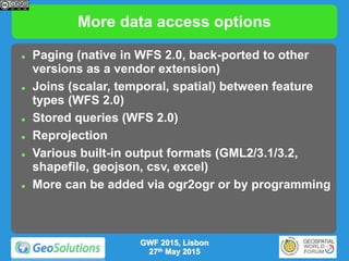
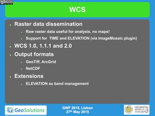
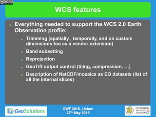
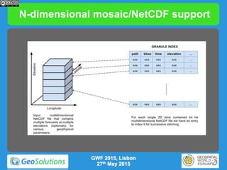
Downloaded 101 times
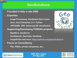


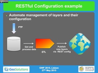


![Spatiotemporal Raster Management
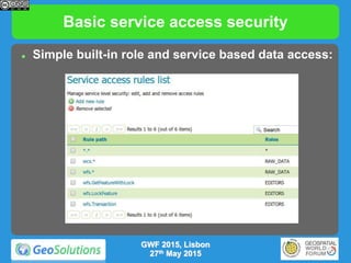
REST support to expose a image mosaic internal structure
Dimensions
Granules
Dimensions: list, edit, create, remove
/workspaces/<ws>/coveragestores/<cs>/coverages/<mosaic>/dimensions
/workspaces/<ws>/coveragestores/<cs>/coverages/<mosaic>/dimensions/<dimension>[.format]
TODO paging and query of dimension domain
Granules: list, edit, create, remove
/workspaces/<ws>/coveragestores/<cs>/coverages/<mosaic>/index
/workspaces/<ws>/coveragestores/<cs>/coverages/<mosaic>/index/pageN
/workspaces/<ws>/coveragestores/<cs>/coverages/<mosaic>/index/pageN/granuleM
GWF 2015, Lisbon
27th May 2015](https://image.slidesharecdn.com/gsbeginnersgwf2015-150608140459-lva1-app6892/85/GeoServer-beginners-gwf_2015-40-320.jpg)


The document serves as an introduction to GeoServer, a geospatial enterprise gateway developed by Geosolutions, detailing its capabilities in managing and disseminating raster and vector data. It outlines key features such as support for Open Geospatial Consortium standards and various data formats, administration capabilities, and security mechanisms. Additionally, it highlights the importance of community involvement and the company's consultancy services for custom solutions.


![[FOSS4G 2017 Boston]Development of an extension of Geoserver for handling 3D ...](https://cdn.slidesharecdn.com/ss_thumbnails/v2oglr9ztj6rozsfllyr-signature-7a758961d3f50ce339111f96a982ffa97fdeafa443a72eaf3f00f44b1d62f961-poli-170822063420-thumbnail.jpg?width=640&height=640&fit=bounds)


