GEOGRAPHY IGCSE: POPULATION DENSITY AND DISTRIBUTION. It contains: factors influencing the density and distribution, case studies: Singapore and Sahel.
GEOGRAPHY IGCSE: POPULATION STRUCTURE. Types of population structure. Population pyramids. Demographic transition model. Case studies: UK (MEDC) and MOZAMBIQUE (LEDC).
GEOGRAPHY IGCSE: POPULATION DENSITY AND DISTRIBUTIONGeorge Dumitrache
This document discusses factors that influence population density and distribution around the world. It provides examples of areas with high and low population densities, such as Singapore being very densely populated due to its small land area, while countries in the Sahel region of Africa have sparse populations partly due to large desert areas. Environmental factors like climate, land type and resources can attract or discourage settlement, affecting population distribution patterns locally and globally.
GEOGRAPHY IGCSE: POPULATION DYNAMICS. It contains: increase in the world's population, over and under population, anti and pro-natalist policies, China's one child policy, France population strategies, Bristol case study.
CAMBRIDGE AS GEOGRAPHY - CASE STUDY: CHINA'S ONE CHILD POLICYGeorge Dumitrache
The one-child policy was introduced in China in 1979 to curb rapid population growth and prevent future shortages. The policy aimed to reduce China's population to 700 million by 2080 by limiting couples to only one child. It was enforced through incentives like education benefits for only children as well as punishments like fines for additional children. The policy was effective because of government influence over daily life. It led to a dramatic drop in birth rates, preventing 200-400 million births, and is expected to cause China's population to peak at 1.4 billion in 2030 and then decline.
CAMBRIDGE AS GEOGRAPHY REVISION: POPULATION - 4.4 THE MANAGEMENT OF NATURAL I...George Dumitrache
Population policies aim to influence population size, growth, distribution or composition through incentives or deterrents. China has operated the strictest population control policy since 1979 through its one-child policy, which aims to control natural increase. The one-child policy has been most effective in urban areas and has significantly reduced China's population growth, preventing over 300 million births. However, it has also led to negative social consequences like an aging population and skewed sex ratios with more boys than girls. While some praise its role in China's economic growth, many see it as a violation of civil liberties.
CAMBRIDGE GEOGRAPHY AS ULTRA REVISION TEST 2 ATMOSPHERE AND WEATHERGeorge Dumitrache
Cambridge Geography AS Ultra Revision Test 2, with questions and answers for chapter 2 Atmosphere and Weather. This is a test with 30 questions, 2 minutes each.
This document discusses ways to measure development between countries, including economic development indicators like GDP and human development indicators like health, education, and quality of life. It provides examples of development data for different countries and notes that while some countries may appear developed based on economic statistics, human development indicators provide a more complete picture of overall societal progress. Development happens unevenly and indices must be used carefully as averages may mask inequalities within countries.
AS Level Human Geography - Urbanization and SettlementArm Punyathorn
In this chapter, we will discuss how our cities/ villages are shaped. We will look at how residential factors can affect incomes and poverty, migration and population.
CAMBRIDGE AS GEOGRAPHY REVISION: ATMOSPHERE AND WEATHER - 2.3 WEATHER PROCESS...George Dumitrache
This document defines key terms related to weather processes and phenomena. It discusses topics like adiabatic lapse rates, air masses, altitude, clouds, condensation, humidity, instability, precipitation and more. Weather results from changes in atmospheric conditions, such as temperature and moisture levels, which can cause air masses to rise or fall. Various types of precipitation form through different processes, like convectional rainfall from rising warm air or orographic rainfall on the windward sides of mountains. Fog occurs when air is cooled to its dew point through advection or radiation.
A2 CAMBRIDGE GEOGRAPHY: HAZARDOUS ENVIRONMENTS - HAZARDS RESULTING FROM ATMOSPHERIC DISTURBANCES. It contain case studies: Hurricane Katrina 2005, Cloud Seeding in New Zealand 1950-1970.
AS GEOGRAPHY REVISION - MIGRATION - 5.3 INTERNATIONAL MIGRATIONGeorge Dumitrache
This document discusses different types of international migration. It defines voluntary migration as migration by choice and forced migration as migration with little choice, such as refugees fleeing persecution. It describes source areas as regions where migrants originate and receiving areas as where they migrate to. Remittances refer to money migrants send back home. Diasporas are dispersed populations from a common origin. Racial assimilation involves integrating into the host community through economic, social, and political means. Ethnic villages show evidence of migrant groups through shops, places of worship, and other facilities. International migration has large impacts on both donor and receiving countries. Globalization has increased mobility and awareness of opportunities abroad. Forced migration, including internal displacement, involves millions of people annually
CAMBRIDGE AS GEOGRAPHY REVISION: SETTLEMENTS - 6.3 THE CHANGING STRUCTURE OF ...George Dumitrache
A comprehensive presentation of subchapter 6.3 The Changing Structure of Urban Settlements, from the third chapter of Human Geography, AS Cambridge, Settlements.
The document discusses key concepts relating to population, including birth rate, mortality rate, life expectancy, and population density. It summarizes the views of Thomas Malthus and Ester Boserup on the relationship between population growth and food supply. It also describes and compares the rural area of Longton and inner-city area of Fishwick in Preston, highlighting differences in housing, ethnicity, age, wealth, employment, and services between the two locations. Finally, it discusses impacts and issues relating to an aging population in the UK and pros and cons of using the Demographic Transition Model to understand population change over time.
AS Level Physical Geography - Rocks and WeatheringArm Punyathorn
The earth's surface is an ever-changing entity. With the forces of weather and climate and tectonic variability, the rocks and minerals that make up the earth are always changing in size, shape and forms - a fascinating, ancient, never-ending process.
AS Level Human Geography - Migration of Population Arm Punyathorn
This chapter has very recently been expanded from being a mere part of the population dynamic topic. A good call since migration has become a pretty big issue in the world today as population mobility has greatly increased in the 21st century.
AS GEOGRAPHY REVISION - MIGRATION - 5.2 INTERNAL MIGRATIONGeorge Dumitrache
In 3 sentences:
Rural-urban and peripheral-core region migration are most common, though rural-rural migration occurs in developing nations for reasons like employment, family, and marriage. Migration between urban areas involves step migration up the hierarchy as migrants' knowledge and finances increase, alongside other urban-urban moves for education and jobs. Reasons for relocation can be viewed at macro, meso, and micro scales focusing on socioeconomics, origin/destination factors, and individual circumstances, respectively.
A2 CAMBRIDGE GEOGRAPHY: COASTAL ENVIRONMENTS - CORAL REEFS. It contains: what are coral reefs, the development of corals, growth rates, polyps and algae, reef formation, fringing reefs, barrier reefs, atolls, threats to coral.
A2 Human Geography - Economic transitionnazeema khan
This document provides information about economic transitions and changes in employment structures in different countries and regions. It discusses:
- The primary, secondary, tertiary, and quaternary sectors and how employment has shifted away from primary and secondary towards tertiary and quaternary.
- How employment structures have changed in high-income countries (HICs) due to outsourcing and a shift to services, resulting in HICs being called post-industrial societies.
- Differences in employment structures between low-income countries (LICs), newly industrialized countries (NICs), and HICs, and how structures have changed over time.
This document discusses topics related to population geography, including population growth rates, distribution, and density. It provides definitions and factors that influence high and low population growth rates. Countries with low economic development often have high growth rates due to high birth rates and low death rates. Developed countries typically have low growth rates because of low birth and death rates, attributed to factors like access to family planning, health care, and nutrition. The document also examines actions taken to control high or low growth rates and the consequences of each.
The world population distribution, density and growthAshaJegadeesan
The document discusses key topics related to world population including:
1. The current world population is 7.8 billion as of 2020 and is unevenly distributed across the world.
2. Population density varies based on factors like climate, resources, and level of development. densely populated areas have over 200 people per square km while sparsely populated areas have under 1 person per square km.
3. Population growth is influenced by birth rates, death rates, and migration patterns. Most countries have experienced a demographic transition from high birth/death rates to low birth/death rates as development increased.
Population studies involve acquiring knowledge about factors influencing population and its distribution. Population refers to the number of people in a given area. Population geography studies the distribution of human populations in a location. Population dynamics examines changes in population numbers due to factors like fertility, mortality, and migration. Population is both impacted by development processes and environmental factors, and influences development as a resource that transforms the environment. Key population terms include aging population, life expectancy, child and infant mortality rates, fertility rates, and dependency ratios. Physical factors like climate and terrain, and human factors like economic opportunities and transportation influence population distribution and density.
The document discusses human resources and population distribution, density, and composition. It notes that over 90% of the world's population lives in 30% of the land area, with dense populations in South and Southeast Asia, Europe, and Northeastern North America. Population distribution is affected by geographical features like climate and resources. The average global population density is 51 people per square km, with South-Central Asia having the highest density. Population composition examines factors like age, sex, occupation, and can be viewed through population pyramids.
This document discusses factors that affect population distribution on Earth. Physical factors like climate, topography, soil quality, and access to water influence where people live. Temperate areas near water with fertile land tend to be most populated. Human factors like economic opportunities, technology, and government policies also impact population distribution. The document provides examples of how population density is calculated and lists the most and least densely populated countries. It concludes by discussing issues related to population growth, aging populations, and development inequalities between wealthy and poor nations.
The document discusses factors that affect population distribution on Earth. Physical factors like climate, topography, soil, and water availability influence where people live. Human factors such as political, economic, and technological developments also impact population settlement patterns. Most humans live in only 20% of the world's land, while 43% is sparsely populated. Population density calculations show large disparities in concentrations of people around the globe. Differences in population growth rates between developed and developing nations also contribute to uneven distribution.
The document discusses various topics relating to world population, including:
1. The current world population is approximately 7 billion as of 2012 and is expected to reach 11 billion by 2100. Global population growth is around 80 million people annually.
2. Population growth rates vary significantly between countries, with some experiencing major increases and others experiencing declines. A nation's population can increase through higher birth rates than death rates or through immigration.
3. The distribution of the world's population is uneven, with some areas being sparsely populated and others being densely populated. Tokyo has a population of over 25 million people.
This document discusses human population distribution and key issues related to demographics. It notes that three quarters of the world's population lives in only 5% of the land area, with two thirds living near oceans or rivers. Major population concentrations exist in East Asia including China, South Asia including India, Europe, and North America's northeast corridor. The document outlines the demographic transition from high birth and death rates to low rates, fueled by improved agriculture and medicine. It analyzes population growth trends, policies, and impacts of aging and disease using population pyramids.
This document discusses factors that affect population distribution and differences in global population patterns. Physical factors like climate, topography, soil quality, and access to water influence where people live. Human factors such as economic opportunities, political decisions, and technology development also impact population distribution. There are large inequalities in population numbers and characteristics between more developed and less developed regions. Asia has the largest population while Oceania has the smallest population. Most countries in Africa and Asia have high population growth rates while rates are lower in Europe, North America, and Oceania.
- There are over 7 billion people living unequally distributed across Earth's surface due to physical and human factors. Physical factors like climate, topography, soil and water availability influence where people live. Human factors like political, economic and technological decisions also impact population distribution.
- Asia has the largest population due to high birth rates and increased life expectancy. Africa has a young population with high birth rates, though also high death rates. Europe and North America have stabilized populations with low birth and death rates. There are global disparities in development between wealthy developed nations and poorer developing nations.
The document discusses factors that influence global and local population distributions. It notes that over 90% of Brazil's population lives along the eastern coast in a 500km wide strip, accounting for less than 25% of the country's land area. Population density declines rapidly moving inland to the northwest. Areas of low density exist where environmental conditions like drought, heat, poor soils and lack of resources make inhabitation difficult. Historical, economic, political and cultural factors have all contributed to Brazil's uneven population distribution.
The document discusses factors that influence global and local population distributions. It notes that over 90% of Brazil's population lives along the eastern coast in a 500km wide strip, accounting for less than 25% of the country's land area. Population density declines rapidly moving inland to the northwest. Areas of low density exist where environmental conditions like drought, heat, poor soils and lack of resources make living difficult. Historical, economic, political and cultural factors have all contributed to Brazil's uneven population distribution.
Housing shortages occur for several reasons: rapid population growth through high birth rates and rural-urban migration has increased demand for housing, especially in cities. However, limited land supply and competing uses for land have constrained new housing development. As a result, many urban areas in developing countries experience overcrowded slums and squatter settlements that lack basic services and safe shelter. Cities like Mumbai, Dharavi and Nairobi have struggled to provide adequate housing for the large populations living in poor conditions in their slums. Land-scarce cities like Singapore and Hong Kong also face housing shortages due to physical space constraints.
More than 90% of the world's population lives in just 30% of the land area, with 60% residing in 10 countries alone. Population density refers to the number of people per unit area and is affected by geographical factors like climate, soil fertility, availability of water, and presence of minerals. Social, cultural, and economic considerations also influence population distribution patterns. Population change is driven by birth and death rates as well as migration patterns. Composition of a population can be understood by analyzing factors such as age, sex, education level, occupation, income, and health status using tools like population pyramids.
There are many factors that affect the uneven distribution of the global population across Earth's surface. Physical factors like climate, topography, soil fertility, and water availability influence where people settle. Human factors such as political, economic, and technological developments also impact population patterns. Most of humanity lives in only 20% of the total land area, while vast sparsely populated areas account for 43% of land but only 2% of people. Population density calculations show large differences between overpopulated and underpopulated regions around the world. Developed countries have low birth rates and aging populations while developing nations experience high population growth that strains resources. Significant inequalities exist between developed and developing areas in terms of economic indicators, technology, education, healthcare access,
Grade 11 STUDENT - Population Distribution ,Density and Structure 3.pptxDamariomchugh4
This document provides information about factors that influence population distribution and density. It discusses how population is unevenly spread worldwide and defines key terms like population distribution, density, and growth. Population distribution is influenced by physical factors like relief, climate, drainage, and soils as well as human factors like agriculture, mining, and urbanization. Population density is calculated by dividing the total population by the land area. Countries in the Caribbean have varying densities, with the highest in Bermuda and lowest in Guyana. Choropleth maps can be used to display differences in density across areas. World population has grown significantly from 1.65 billion in 1900 to over 7 billion currently, influenced by birth rates, death rates, and fertility rates.
There are many factors that affect the uneven distribution of the world's 7.3 billion human population across Earth's surface. Physical factors like climate, topography, soil quality, and water availability influence where people live. Human factors such as political, economic, and technological developments also impact population patterns. Most people live in only 20% of the total land area, while 43% is sparsely populated. Population density calculations show vast differences between overpopulated and near-empty regions. While developed countries have low birth rates, developing countries experience high population growth, straining resources. This leads to issues like aging populations in developed nations and migration pressures in developing ones.
Similar to GEOGRAPHY IGCSE: POPULATION DENSITY AND DISTRIBUTION (20)
07. DEPTH STUDY GERMANY: NAZI REGIME - REICHSTAG FIRE SOURCESGeorge Dumitrache
07. DEPTH STUDY GERMANY: NAZI REGIME - REICHSTAG FIRE
On February 27, 1933, the German parliament (Reichstag) building burned down. The Nazi leadership and its coalition partners used the fire to claim that Communists were planning a violent uprising. They claimed that emergency legislation was needed to prevent this. The resulting act, commonly known as the Reichstag Fire Decree, abolished a number of constitutional protections and paved the way for Nazi dictatorship.
05. DEPTH STUDY GERMANY: NAZI REGIME - HITLER CONSOLIDATING POWER 1933-34.PPTXGeorge Dumitrache
05. DEPTH STUDY GERMANY: NAZI REGIME - HITLER CONSOLIDATING POWER 1933-34.PPTX
Following Hitler’s appointment as chancellor the Nazis were finally in a position of power.
However, this power was limited, as the Nazis were just one party in a three party coalition government, under President Hindenburg.
This topic will explore how the Nazis managed to eliminate their opposition and consolidate ultimate power over Germany, whilst maintaining an illusion of democracy.
It will first explore this topic in chronological order, from the Reichstag Fire through to the death of President Hindenburg, and then explore it thematically in the last section. On the 31 January 1933, Hitler, conscious of his lack of a majority in the Reichstag, immediately called for new elections to try and strengthen his position. The Nazis aimed to increase their share of the vote so that they would have a majority in the Reichstag. This would allow them to rule unopposed and unhindered by coalition governments.
Over the next two months, they launched themselves into an intense election campaign.
On 27 February 1933, as the campaign moved into its final, frantic days, the Reichstag, the German Parliament building, was set on fire and burnt down. An atmosphere of panic and terror followed the event.
This continued when a young Dutch communist, Van der Lubbe was arrested for the crime.
The Nazi Party used the atmosphere of panic to their advantage, encouraging anti-communism. Göring declared that the communists had planned a national uprising to overthrow the Weimar Republic. This hysteria helped to turn the public against the communists, one of the Nazis main opponents, and 4000 people were imprisoned.
The day after the fire, Hindenburg signed the Emergency Decree for the Protection of the German People. On the 28 February 1933, President Hindenburg signed the Emergency Decree for the Protection of the German People. This decree suspended the democratic aspects of the Weimar Republic and declared a state of emergency.
This decree gave the Nazis a legal basis for the persecution and oppression of any opponents, who were be framed as traitors to the republic. People could be imprisoned for any or no reason.
The decree also removed basic personal freedoms, such as the freedom of speech, the right to own property, and the right to trial before imprisonment.
Through these aspects the Nazis suppressed any opposition to their power, and were able to start the road from democracy to a dictatorship. The atmosphere of uncertainty following the Reichstag Fire secured many voters for the Nazi party.
The SA also ran a violent campaign of terror against any and all opponents of the Nazi regime. Many were terrified of voting of at all, and many turned to voting for the Nazi Party out of fear for their own safety. The elections were neither free or fair.
On the 5 March 1933, the elections took place, with an extremely high turnout of 89%.
The Nazis secured 43.9% of the vote.
DEPTH STUDY GERMANY: NAZI REGIME - 04. HITLER BECOMING CHANCELLOR 1933George Dumitrache
Hitler was not immediately appointed chancellor after the success of the July 1932 elections, despite being leader of the largest party in the Reichstag. It took the economic and political instability (with two more chancellors failing to stabilise the situation) to worsen, and the support of the conservative elite, to convince Hindenburg to appoint Hitler.
Hitler was sworn in as the chancellor of Germany on the 30 January 1933. The Nazis were now in power.
DEPTH STUDY GERMANY: NAZI REGIME - 03. NAZI'S LITTLE SUCCESSGeorge Dumitrache
The document discusses the early success of the Nazi party in Germany. It notes that while the party made progress in organization and membership in its early years after 1919, it had little impact in elections initially. The Nazis received only 6.5% of the vote in their first national election in 1924. Later elections in 1928 saw their support decline further to just 2.6% as the German economy and political situation stabilized under Stresemann. While the Nazis appealed to specific groups frustrated with the Weimar Republic, they remained a small party with less than 30,000 members by 1925.
DEPTH STUDY GERMANY: NAZI REGIME - 02. NAZI PARTY IDEOLOGY IN 1920George Dumitrache
The document provides background information on the origins and early development of the Nazi party in Germany during the 1920s. It describes how the party began as the German Workers' Party led by Anton Drexler before Hitler joined in 1919 and became the leader in 1921. It also outlines some of the key aspects of the Nazi party platform outlined in the 25-point program, including nationalism, anti-Semitism, and a desire for more territory. Finally, it discusses Hitler's failed Munich Putsch coup attempt in 1923 and how he wrote Mein Kampf while in prison.
1) Post-war instability and economic crisis weakened established political systems in countries like Germany and Italy. 2) A sense of nationalism was used by fascist leaders to promote unity and scapegoat others for the nation's problems. 3) Charismatic leaders like Hitler and Mussolini were able to gain followers by promoting fascism as an alternative to communism and liberal democracy.
DEPTH STUDY GERMANY: WEIMAR REPUBLIC - 10. THE FALL OF WEIMAR 1930-1933George Dumitrache
The document provides background information on the rise of the Nazi party in Germany between 1930-1933. It discusses how Germany's economic dependence on American loans led to the collapse of German industry following the 1929 Wall Street crash. This caused widespread unemployment, with over 6 million people jobless by 1932. As economic conditions deteriorated, support grew for the Nazis as they promised strong leadership and blamed Jews and communists for Germany's problems. The Nazis increased their Reichstag seats in elections in 1933 after Hitler became Chancellor, and he then used emergency powers to crush opposition and establish a one-party Nazi state in Germany.
DEPTH STUDY GERMANY: WEIMAR REPUBLIC - 09. TABLES AND CARTOONSGeorge Dumitrache
The document discusses the Weimar Republic in Germany through tables and cartoons as part of a Cambridge IGCSE depth study on Germany. It provides information on the political and economic challenges faced by the Weimar Republic between 1919-1933 through statistical tables and illustrations. The depth study uses multiple visual elements to summarize key events and issues like inflation, unemployment, and the rise of extremism during this period of German history.
DEPTH STUDY GERMANY: WEIMAR REPUBLIC - 08. NAZIS IN THE WILDERNESSGeorge Dumitrache
The “Lean Years” (also called the "wilderness" years) of Hitler and the Nazi Party in Germany refer to the period between 1924 and 1928 when the Nazi party did not have high levels of support and still suffered from humiliation over the Munich Putsch. Why where these years “lean”?
DEPTH STUDY GERMANY: WEIMAR REPUBLIC - 07. STRESEMMAN ERA 1924-1929George Dumitrache
Gustav Stresemann was appointed Chancellor of Germany in 1923 during the Weimar Republic period. As Chancellor and later as Foreign Minister, he implemented policies that helped stabilize Germany's economy and improve its international standing. This included establishing a new currency to end hyperinflation, crushing communist uprisings, and pursuing diplomatic agreements like the Locarno Pact to normalize Germany's relations with other European powers. However, the economic and political stability of the Weimar Republic remained fragile.
DEPTH STUDY GERMANY: WEIMAR REPUBLIC - 06. THE BEER HALL PUTSCH 1923George Dumitrache
The Beer Hall Putsch, also known as the Munich Putsch, was a failed coup d'état by Nazi Party (Nationalsozialistische Deutsche Arbeiterpartei or NSDAP) leader Adolf Hitler, Generalquartiermeister Erich Ludendorff and other Kampfbund leaders in Munich, Bavaria, on 8–9 November 1923, during the Weimar Republic. Approximately two thousand Nazis marched on the Feldherrnhalle, in the city centre, but were confronted by a police cordon, which resulted in the deaths of 16 Nazi Party members and four police officers. Hitler escaped immediate arrest and was spirited off to safety in the countryside. After two days, he was arrested and charged with treason. The putsch brought Hitler to the attention of the German nation for the first time and generated front-page headlines in newspapers around the world. His arrest was followed by a 24-day trial, which was widely publicised and gave him a platform to express his nationalist sentiments to the nation. Hitler was found guilty of treason and sentenced to five years in Landsberg Prison, where he dictated Mein Kampf to fellow prisoners Emil Maurice and Rudolf Hess. On 20 December 1924, having served only nine months, Hitler was released. Once released, Hitler redirected his focus towards obtaining power through legal means rather than by revolution or force, and accordingly changed his tactics, further developing Nazi propaganda.
DEPTH STUDY GERMANY: WEIMAR REPUBLIC - 05. HYPERINFLATIONGeorge Dumitrache
Hyperinflation affected the German Papiermark, the currency of the Weimar Republic, between 1921 and 1923, primarily in 1923. It caused considerable internal political instability in the country, the occupation of the Ruhr by France and Belgium, and misery for the general populace.
DEPTH STUDY GERMANY: WEIMAR REPUBLIC - 03. THE TREATY OF VERSAILLES IMPACT ON...George Dumitrache
Thanks to the Treaty of Versailles, Germany's ability to produce revenue-generating coal and iron ore decreased. As war debts and reparations drained its coffers, the German government was unable to pay its debts. Some of the former World War I Allies didn't buy Germany's claim that it couldn't afford to pay.
DEPTH STUDY GERMANY: WEIMAR REPUBLIC - 02. THE NOVEMBER REVOLUTION 1918George Dumitrache
The German Revolution or November Revolution was a civil conflict in the German Empire at the end of the First World War that resulted in the replacement of the German federal constitutional monarchy with a democratic parliamentary republic that later became known as the Weimar Republic. The revolutionary period lasted from November 1918 until the adoption of the Weimar Constitution in August 1919. Among the factors leading to the revolution were the extreme burdens suffered by the German population during the four years of war, the economic and psychological impacts of the German Empire's defeat by the Allies, and growing social tensions between the general population and the aristocratic and bourgeois elite.
DEPTH STUDY GERMANY: WEIMAR REPUBLIC - 01. THE EFFECT OF WW1 ON GERMANYGeorge Dumitrache
The document summarizes the impact of World War 1 on Germany. It discusses how Germany initially found success on the Eastern Front and made advances on the Western Front in 1918 but was eventually overwhelmed as the US joined the war effort. Germany experienced political instability, economic devastation from blockades, widespread hunger and disease, and psychological trauma from defeat. The German people bitterly blamed leaders for the defeat, sowing seeds for the rise of the Nazis in the unstable Weimar Republic that followed the war.
QUESTIONS AND ANSWERS - LEAGUE OF NATIONS. The League of Nations was an international organization, headquartered in Geneva, Switzerland, created after the First World War to provide a forum for resolving international disputes.
This cartoon was likely published after the Stresa Pact was signed in early 1935, when Britain and France failed to raise the issue of Abyssinia with Mussolini and were perceived as turning a blind eye to his plans in hopes of keeping Italy as an ally against Germany. The cartoon directly criticizes the British and French policy of appeasing Mussolini, so the purpose was to criticize, not just inform. By criticizing the policy, the hope would be to influence and change the policy by swaying public opinion.
Manchurian Crisis. On September 18, 1931, an explosion destroyed a section of railway track near the city of Mukden. The Japanese, who owned the railway, blamed Chinese nationalists for the incident and used the opportunity to retaliate and invade Manchuria.
05. LEAGUE OF NATIONS - Great Depression and LON.pptxGeorge Dumitrache
GREAT DEPRESSION AND THE LEAGUE OF NATIONS. The Great Depression of 1930-33 meant people turned to extremist dictators such as Hitler and Mussolini, who were keen to invade other countries. This made it hard for the League to maintain peace. The League had some very ambitious plans and ideals – to stop war and make the world a better place.
This slide is special for master students (MIBS & MIFB) in UUM. Also useful for readers who are interested in the topic of contemporary Islamic banking.
This presentation was provided by Steph Pollock of The American Psychological Association’s Journals Program, and Damita Snow, of The American Society of Civil Engineers (ASCE), for the initial session of NISO's 2024 Training Series "DEIA in the Scholarly Landscape." Session One: 'Setting Expectations: a DEIA Primer,' was held June 6, 2024.
How to Build a Module in Odoo 17 Using the Scaffold MethodCeline George
Odoo provides an option for creating a module by using a single line command. By using this command the user can make a whole structure of a module. It is very easy for a beginner to make a module. There is no need to make each file manually. This slide will show how to create a module using the scaffold method.
This document provides an overview of wound healing, its functions, stages, mechanisms, factors affecting it, and complications.
A wound is a break in the integrity of the skin or tissues, which may be associated with disruption of the structure and function.
Healing is the body’s response to injury in an attempt to restore normal structure and functions.
Healing can occur in two ways: Regeneration and Repair
There are 4 phases of wound healing: hemostasis, inflammation, proliferation, and remodeling. This document also describes the mechanism of wound healing. Factors that affect healing include infection, uncontrolled diabetes, poor nutrition, age, anemia, the presence of foreign bodies, etc.
Complications of wound healing like infection, hyperpigmentation of scar, contractures, and keloid formation.
How to Manage Your Lost Opportunities in Odoo 17 CRMCeline George
Odoo 17 CRM allows us to track why we lose sales opportunities with "Lost Reasons." This helps analyze our sales process and identify areas for improvement. Here's how to configure lost reasons in Odoo 17 CRM
How to Make a Field Mandatory in Odoo 17Celine George
In Odoo, making a field required can be done through both Python code and XML views. When you set the required attribute to True in Python code, it makes the field required across all views where it's used. Conversely, when you set the required attribute in XML views, it makes the field required only in the context of that particular view.
Chapter wise All Notes of First year Basic Civil Engineering.pptxDenish Jangid
Chapter wise All Notes of First year Basic Civil Engineering
Syllabus
Chapter-1
Introduction to objective, scope and outcome the subject
Chapter 2
Introduction: Scope and Specialization of Civil Engineering, Role of civil Engineer in Society, Impact of infrastructural development on economy of country.
Chapter 3
Surveying: Object Principles & Types of Surveying; Site Plans, Plans & Maps; Scales & Unit of different Measurements.
Linear Measurements: Instruments used. Linear Measurement by Tape, Ranging out Survey Lines and overcoming Obstructions; Measurements on sloping ground; Tape corrections, conventional symbols. Angular Measurements: Instruments used; Introduction to Compass Surveying, Bearings and Longitude & Latitude of a Line, Introduction to total station.
Levelling: Instrument used Object of levelling, Methods of levelling in brief, and Contour maps.
Chapter 4
Buildings: Selection of site for Buildings, Layout of Building Plan, Types of buildings, Plinth area, carpet area, floor space index, Introduction to building byelaws, concept of sun light & ventilation. Components of Buildings & their functions, Basic concept of R.C.C., Introduction to types of foundation
Chapter 5
Transportation: Introduction to Transportation Engineering; Traffic and Road Safety: Types and Characteristics of Various Modes of Transportation; Various Road Traffic Signs, Causes of Accidents and Road Safety Measures.
Chapter 6
Environmental Engineering: Environmental Pollution, Environmental Acts and Regulations, Functional Concepts of Ecology, Basics of Species, Biodiversity, Ecosystem, Hydrological Cycle; Chemical Cycles: Carbon, Nitrogen & Phosphorus; Energy Flow in Ecosystems.
Water Pollution: Water Quality standards, Introduction to Treatment & Disposal of Waste Water. Reuse and Saving of Water, Rain Water Harvesting. Solid Waste Management: Classification of Solid Waste, Collection, Transportation and Disposal of Solid. Recycling of Solid Waste: Energy Recovery, Sanitary Landfill, On-Site Sanitation. Air & Noise Pollution: Primary and Secondary air pollutants, Harmful effects of Air Pollution, Control of Air Pollution. . Noise Pollution Harmful Effects of noise pollution, control of noise pollution, Global warming & Climate Change, Ozone depletion, Greenhouse effect
Text Books:
1. Palancharmy, Basic Civil Engineering, McGraw Hill publishers.
2. Satheesh Gopi, Basic Civil Engineering, Pearson Publishers.
3. Ketki Rangwala Dalal, Essentials of Civil Engineering, Charotar Publishing House.
4. BCP, Surveying volume 1
How to Fix the Import Error in the Odoo 17Celine George
An import error occurs when a program fails to import a module or library, disrupting its execution. In languages like Python, this issue arises when the specified module cannot be found or accessed, hindering the program's functionality. Resolving import errors is crucial for maintaining smooth software operation and uninterrupted development processes.
This presentation includes basic of PCOS their pathology and treatment and also Ayurveda correlation of PCOS and Ayurvedic line of treatment mentioned in classics.
How to Add Chatter in the odoo 17 ERP ModuleCeline George
In Odoo, the chatter is like a chat tool that helps you work together on records. You can leave notes and track things, making it easier to talk with your team and partners. Inside chatter, all communication history, activity, and changes will be displayed.
Main Java[All of the Base Concepts}.docxadhitya5119
This is part 1 of my Java Learning Journey. This Contains Custom methods, classes, constructors, packages, multithreading , try- catch block, finally block and more.
A review of the growth of the Israel Genealogy Research Association Database Collection for the last 12 months. Our collection is now passed the 3 million mark and still growing. See which archives have contributed the most. See the different types of records we have, and which years have had records added. You can also see what we have for the future.
GEOGRAPHY IGCSE: POPULATION DENSITY AND DISTRIBUTION
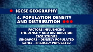
1. IGCSE GEOGRAPHY
4. POPULATION DENSITY
AND DISTRIBUTION
FACTORS INFLUENCING
THE DENSITY AND DISTRIBUTION
CASE STUDIES
SINGAPORE – DENSELY POPULATED
SAHEL – SPARSELY POPULATED
2. The way in which people are spread
across a given area is known as
population distribution.
Geographers study population
distribution patterns at different scales:
local, regional, national, and global.
Patterns of population distribution tend
to be uneven.
For example, in the UK there are more
people living in south-east England than
in Wales.
5. The following map shows patterns of
population density on a global scale.
6. Areas of high and low population
density are unevenly spread across the
world.
The majority of places with high
population densities are found in the
northern hemisphere.
The population density of a country has
very little to do with its level of
economic development.
For example, both Bangladesh and Japan
are very densely populated, but
Bangladesh is a LEDC and Japan is a
MEDC.
7. Environmental and human factors
affect the spread of people across
the world.
Factors attracting settlement
Temperate climate - eg the UK.
Low-lying flat fertile land - eg the
Bangladesh Delta.
Good supplies of natural resources
- eg building resources.
11. Factors such as the availability of jobs
and comparatively high wages can
contribute to high population density
through migration.
For example, from 2004 the UK has seen
an influx of migrants from countries that
have recently joined the EU, such as
Poland.
12. Civil war, eg in the Darfur region of Sudan, can contribute to
lower population densities as people become refugees and
leave an area.
13.
14. Singapore population: 5.2 million people
Land area: 710 sq km
Population density: 7300 people/ sq km
GDP per capita: $50.000
From these statistics, it is evident that
Singapore is already an extremely dense
country.
However, it is important not to forget that
Singapore, having an urbanisation rate of
100%, resembles more of a city rather than a
country, due to its small land area.
15.
16. These 10 countries span over 7 million
square km and have close to 135 million
inhabitants.
Some of the larger countries that contain
extensive expanses of desert (Mali and
Niger) have low population densities of
fewer than 20 people per square km.
Other geographically smaller countries that
have access to the sea (such as Senegal)
have population densities of 50 people or
more per square km.
Landlocked Burkina Faso has a population
density of 65 people per square km.
Only Gambia has more than 150 people per
square km.