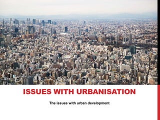
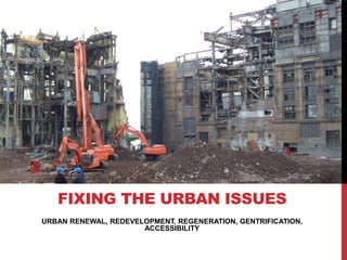
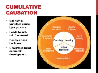
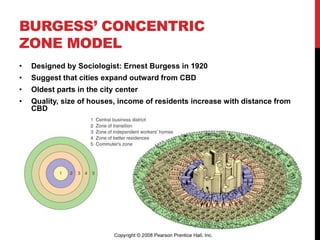
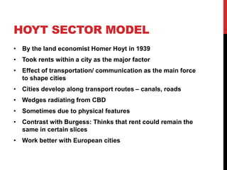
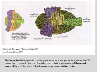
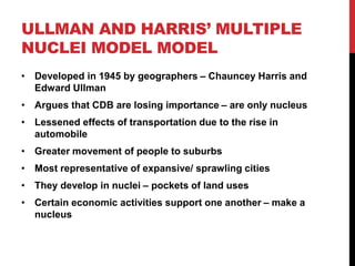
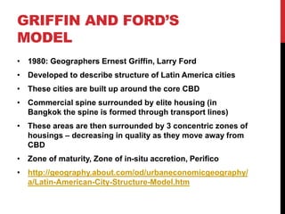
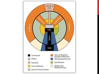
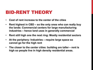
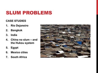
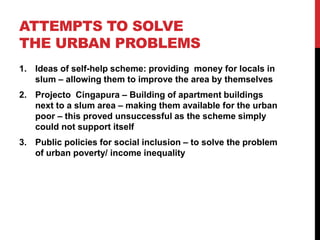
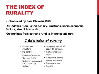
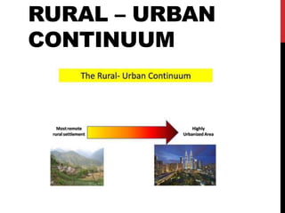
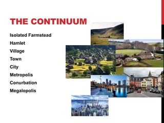
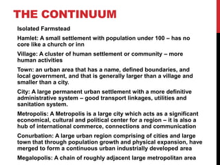
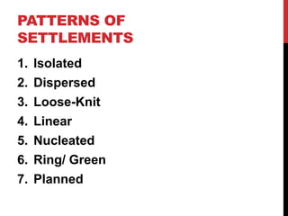
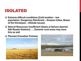
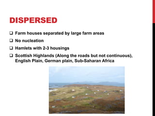
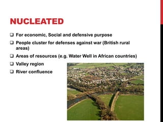
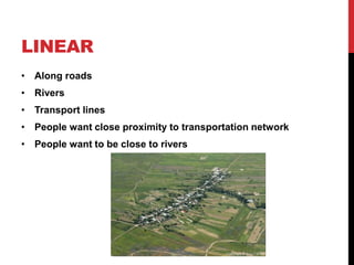
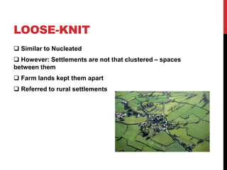
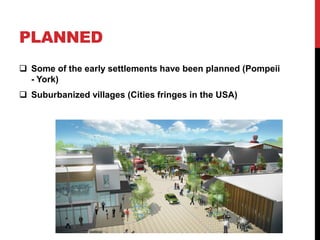
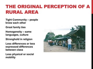
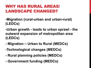
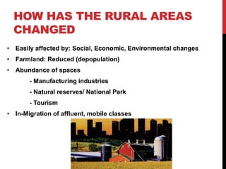
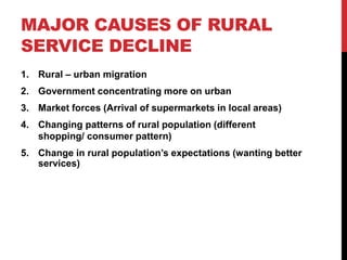
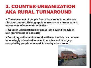
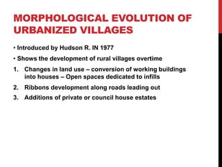
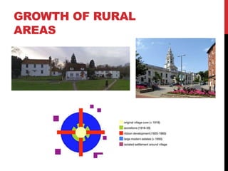
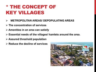
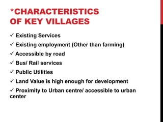
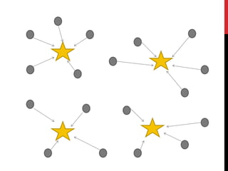
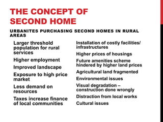
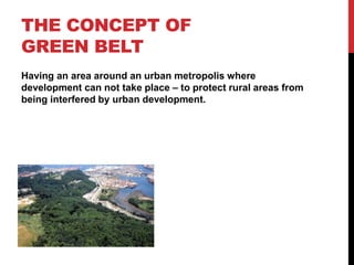
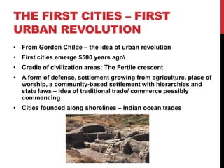
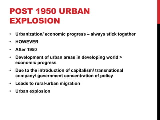
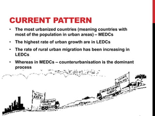
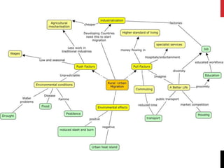
SETTLEMENT
DYNAMIC
HUMAN GEOGRAPHY TOPIC 3
CHANGES IN
RURAL
SETTLEMENT
PART 1:
DEFINITIONS
Rural Landscape: A mental/ visual picture of a countryside as
how it is perceived.
Green Belt: Areas of open land retained around city where
development is restricted.
Counterurbanisation: The process of decentralization where
an increasing number of urbanites, especially the affluent
ones, move from large urban areas to smaller urban areas and
rural areas.
Rural Depopulation: The decrease in population of rural areas
– by out-migration and falling birth rates (as young people
moved away to urban areas).
Urbanization of Poverty: The increasing concentration of
poverty in urban area sometimes due to rural-urban migration
DEFINITIONS
Counter-urbanization: A process of population de-
centralization where an increasing number of people move
out of large urban areas to rural areas or smaller urban
settlement – RURAL POPULATION TURNAROUND
Urban Revolution: A major change in the form and growth of
settlement due to technological advance.
Urbanization: A process whereby an increasing proportion of
the population in a geographical area lives in urban
settlements
Urban growth: The absolute increase in physical size and
total population of urban areas
DEFINITIONS
The Cycle of Urbanization: A model comprising of urban
changes from the growth of a city to counterurbanisation
through to reurbanization
Suburbanization: The outward growth of town and cities to
engulf surrounding villages/ rural areas
Reurbanization: A process where a population of a city, after
a period of clear decline, begins to rise again
Land use Zoning: A mapping exercise by local government
which decides how land should be used in the various parts
of a ton or city
DEFINITIONS
Gentrification: A process in which wealthier people move
into, renovate and restore run-down housing in an inner city
or other neglected area. Such former housing may be
occupied by lower income group –with tenure shifting from
private rented to owner occupied.
Accessibility: The relative ease with which a place can be
reached from other locations
Global city: A city that is judged to be an important nodal
point in the global economic system
WHAT IS A RURAL
AREA
Less densely populated land – recognized by the visual
countryside look
Identified by the Social, Demographic, Economic Factor
Economy dependent on Primary activity
RURAL URBAN CONTINUUM
• Used to explain the fact that there is no sharp difference
between a rural area and an urban area
• Instead – there’s a gradation
THE INDEX OF
RURALITY
• Introduced by Paul Cloke in 1979
•16 Indexes (Population density, functions, socio-economic
factors, size of towns etc.)
•Determines from extreme rural to intermediate rural
RURAL – URBAN
CONTINUUM
THE CONTINUUM
Isolated Farmstead
Hamlet
Village
Town
City
Metropolis
Conurbation
Megalopolis
THE CONTINUUM
Isolated Farmstead
Hamlet: A small settlement with population under 100 – has no
core like a church or inn
Village: A cluster of human settlement or community – more
human activities
Town: an urban area that has a name, defined boundaries, and
local government, and that is generally larger than a village and
smaller than a city.
City: A large permanent urban settlement with a more definitive
administrative system – good transport linkages, utilities and
sanitation system.
Metropolis: A Metropolis is a large city which acts as a significant
economical, cultural and political center for a region – it is also a
hub of international commerce, connections and communication
Conurbation: A large urban region comprising of cities and large
town that through population growth and physical expansion, have
merged to form a continuous urban industrially developed area
Megalopolis: A chain of roughly adjacent large metropolitan area
PATTERNS OF
SETTLEMENTS
1. Isolated
2. Dispersed
3. Loose-Knit
4. Linear
5. Nucleated
6. Ring/ Green
7. Planned
ISOLATED
 Extreme difficult conditions (Cold weather – low
population, Dangerous Rainforest – Amazon tribes, Bases
of the Himalayas – Altitude issues)
 Natural Resources insufficient (Oasis at Sahara deserts/
Silk Roads/ Kalahari) …. Extreme rural areas may have
this as well
 Planned (Canadian Prairies)
DISPERSED
 Farm houses separated by large farm areas
 No nucleation
 Hamlets with 2-3 housings
 Scottish Highlands (Along the roads but not continuous),
English Plain, German plain, Sub-Saharan Africa
NUCLEATED
 For economic, Social and defensive purpose
 People cluster for defenses against war (British rural
areas)
 Areas of resources (e.g. Water Well in African countries)
 Valley region
 River confluence
LINEAR
• Along roads
• Rivers
• Transport lines
• People want close proximity to transportation network
• People want to be close to rivers
LOOSE-KNIT
 Similar to Nucleated
 However: Settlements are not that clustered – spaces
between them
 Farm lands kept them apart
 Referred to rural settlements
PLANNED
 Some of the early settlements have been planned (Pompeii
- York)
 Suburbanized villages (Cities fringes in the USA)
GREEN - RING
 A village built surrounding a circular field
 For communal/ religious purposes
 E.g. Maasai in Serengeti
THE ORIGINAL PERCEPTION OF A
RURAL AREA
Tight Community – people
know each other
Great family ties
Homogeneity – same
languages, culture
Stronghold in religion
Less differences or less
expressed differences
between class
Less physical or social
mobility
WHY HAS RURAL AREAS/
LANDSCAPE CHANGED?
-Migration (rural-urban and urban-rural)
(LEDCs)
-Urban growth - leads to urban sprawl - the
outward expansion of metropolitan area
(LEDCs)
- Migration – Urban to Rural (MEDCs)
-Technological changes (MEDCs)
- Rural planning policies (MEDCs)
- Government funding (MEDCs)
HOW HAS THE RURAL AREAS
CHANGED
• Easily affected by: Social, Economic, Environmental changes
• Farmland: Reduced (depopulation)
• Abundance of spaces
- Manufacturing industries
- Natural reserves/ National Park
- Tourism
• In-Migration of affluent, mobile classes
HOW RURAL AREAS
CHANGED - MEDC
1. Rural-urban migration – people in rural areas move out
of villages
2. Movement of people in the cities into rural areas (due to:
Counterurbanisation, gentrification, Urban Sprawl) –
middle class people exploiting the cheap land cost
3. Changes in services/ industries – recreations, tourism,
natural conservation
4. Housing prices are pushed up due to increased
demands
5. Changes in agriculture – less employment in primary
sector
6. Farm diversification
7. Decline in services/ public transport due to lower pop.
density
1. CHANGES IN
AGRICULTURE
 Increase in Farm sizes – leads to less hedgerow – an
important ecological network
 Wages reduced – farmers are among the poorest people
 A decline in farm works (ESPECIALLY IN MEDCS)
 Leads to farm diversification – uses of farm areas for other
industries (Tourism)
 If too many farms diversify
Then: Oversupply - decline
2. RURAL SERVICES
DECLINE
• Services: Shops, Post offices, Healthcare, Activities,
transport
• Basis for a community
• A sense of belonging and sustainable future (keeps people
from moving out)
• The recent decline in services: Cause the reduction in
quality of life
• ‘Forgotten city of disadvantage’
PROCESS OF RURAL
SERVICE DECLINE
MAJOR CAUSES OF RURAL
SERVICE DECLINE
1. Rural – urban migration
2. Government concentrating more on urban
3. Market forces (Arrival of supermarkets in local areas)
4. Changing patterns of rural population (different
shopping/ consumer pattern)
5. Change in rural population’s expectations (wanting better
services)
3. COUNTER-URBANIZATION
AKA RURAL TURNAROUND
 The movement of people from urban areas to rural areas
(Socio-economic, Demographic reasons – to a lesser extent:
movements of economic activities)
 Counter-urbanization may occur just beyond the Green
Belt (commuting is possible)
Dormitory settlement - a rural settlement which has become
increasingly urbanized in recent decades and is largely
occupied by people who work in nearby urban areas.
MORPHOLOGICAL EVOLUTION OF
URBANIZED VILLAGES
• Introduced by Hudson R. IN 1977
• Shows the development of rural villages overtime
1. Changes in land use – conversion of working buildings
into houses – Open spaces dedicated to infills
2. Ribbons development along roads leading out
3. Additions of private or council house estates
GROWTH OF RURAL
AREAS
* THE CONCEPT OF
KEY VILLAGES
 METROPOLITAN AREAS/ DEPOPULATING AREAS
 The concentration of services
 Amenities in an area can satisfy
 Essential needs of the villages/ hamlets around the area.
 Assured threshold population
 Reduce the decline of services
*CHARACTERISTICS
OF KEY VILLAGES
 Existing Services
 Existing employment (Other than farming)
 Accessible by road
 Bus/ Rail services
 Public Utilities
 Land Value is high enough for development
 Proximity to Urban centre/ accessible to urban
center
THE CONCEPT OF
SECOND HOME
URBANITES PURCHASING SECOND HOMES IN RURAL
AREAS
Larger threshold
population for rural
services
Higher employment
Improved landscape
Exposure to high price
market
Less demand on
resources
Taxes increase finance
of local communities
Installation of costly facilities/
infrastructures
Higher prices of housings
Future amenities scheme
hindered by higher land prices
Agricultural land fragmented
Environmental issues
Visual degradation –
construction done wrongly
Distraction from local works
Cultural issues
THE CONCEPT OF
GREEN BELT
Having an area around an urban metropolis where
development can not take place – to protect rural areas from
being interfered by urban development.
RURAL TRANSPORT
PROBLEM
• Increase in Car ownership
• Public Transport Decline
• Isolates the poor, the elderly, the young (those without cars)
• Reduction in public transport affected low income
household
• Prices of fuel increase – worsened the situations
URBAN TRENDS
AND ISSUES OF
URBANIZATION
PART 2
THE FIRST CITIES – FIRST
URBAN REVOLUTION
• From Gordon Childe – the idea of urban revolution
• First cities emerge 5500 years ago
• Cradle of civilization areas: The Fertile crescent
• A form of defense, settlement growing from agriculture, place of
worship, a community-based settlement with hierarchies and
state laws – idea of traditional trade/ commerce possibly
commencing
• Cities founded along shorelines – Indian ocean trades
THE INDUSTRIAL
REVOLUTION
• In the 19th Century
• The second urban revolution – a result of industrialization
• Mass production caused by industrialization
• Led to concentration of economic activities, employment, and hence
population
• Industrialization/ urbanization – hand in hand
POST 1950 URBAN
EXPLOSION
• Urbanization/ economic progress – always stick together
• HOWEVER
• After 1950
• Development of urban areas in developing world >
economic progress
• Due to the introduction of capitalism/ transnational
company/ government concentration of policy
• Leads to rural-urban migration
• Urban explosion
CURRENT PATTERN
• The most urbanized countries (meaning countries with
most of the population in urban areas) – MEDCs
• The highest rate of urban growth are in LEDCs
• The rate of rural urban migration has been increasing in
LEDCs
• Whereas in MEDCs – counterurbanisation is the dominant
process
CURRENT PATTERN
• By 2025 – 80% of urban dwellers – developing world
• Since 1970 – urban growth has been declining in MEDCs
THE CYCLE OF
URBANIZATION
• A model to show the development of urban settlement in
modern periods
1. Urbanization
2. Suburbanization
3. Counterurbanisation
4. Reurbanization
SUBURBANIZATION
• Can occur due to improvement in transport
• Can occur with government policies
• Usually a middle class phenomenon
• Growth of suburban area – leads to council housing/
housing projects – usually more expensive
• Goes hand in hand with growth of infrastructures,
services, commerce
• https://en.wikipedia.org/wiki/Suburbanization
• https://www.boundless.com/sociology/textbooks/boundles
s-sociology-textbook/population-and-urbanization-
17/urban-problems-and-policy-125/suburbanization-707-
10233/
SUBURBANIZATION
REASONS FOR SUBURB GROWTH:
1. Government support house building – subsidies (may
want to solve inner urban area problems)
2. Local authority provides standard amenities
3. Low Interest rates
4. Public transport route
5. Road networks
(TO LINK TO CBD)
REURBANIZATION
• When an area in a city experience urban decay
• Urban decay can arise from pollution, overpopulation,
unemployment, inadequate housing [Processes alluded to
constraints]
• Government’s incentives and projects allow movement of
people back into these areas
• Redevelopment/ Renewal may play a part
• May also be the result of immigrants moving in e.g. London –
inner cities attract young migrants
• Natural Increase
• http://www.academia.edu/2950073/REURBANIZATION_AS_AN
_OPPORTUNITY_TO_ENHANCE_URBAN_RESILIENCE_THE_
CASE_OF_NORTHWESTERN_IBERIAN_PENINSULA
The issues with urban development
ISSUES WITH URBANISATION
COMPETITION FOR
LAND
• All urban areas see this competition for land areas
• Measures: Land prices, rental cost
• A result of free market – however urban areas are not
always shaped by free market
• Land use Zoning by government can affect this
LAND USE ZONING -
SINGAPORE
URBAN RENEWAL, REDEVELOPMENT, REGENERATION, GENTRIFICATION,
ACCESSIBILITY
FIXING THE URBAN ISSUES
URBAN
REDEVELOPMENT
• The complete clearance of existing buildings and site
infrastructure and construction of new buildings
• After urban decay
• Destruction by disasters – first world war
URBAN RENEWAL
• Keeps the best element of the previous urban area
• That was safeguarded by planning regulation
• Improving them to be sustainable
• Adapts to new usage
URBAN
REGENERATION
• Urban regeneration
• Development of urban areas in a large scale
• After 2nd world war for example
1. London Docklands Development Corporation (1981)
2. Reconstruction of Canary Wharf
3. For the 2012 Olympic – Lea Valley
CUMULATIVE
CAUSATION
• Economic
impulses cause
by a process
• Leads to self-
reinforcement
• Positive feed
back loop
• Upward spiral of
economic
development
GENTRIFICATION
• There are 2 reasons why
inner city areas are
occupied by high socio-
economic status
1. Originally fashionable –
accessible to CBD – large
open space – high quality
housing – proximity to
services
2. Others – became so due to
Gentrification
• Gentrification: A process
coined by Sociologist Ruth
Glass
GENTRIFICATION
• Gentrification: A
process in which
wealthier people move
into, renovate and restore
run-down housing in an
inner city or other
neglected area. Such
former housing may be
occupied by lower
income group –with
tenure shifting from
private rented to owner
occupied.
• People with money to buy
houses
• New houses – rent prices
increase
GENTRIFICATION
• Areas that can be gentrified:
1. Attractive park – attractive to the higher classes
2. Larger houses – good for investments, can be developed
3. Proximity to transport route – of course
• Evidences of gentrification
1. Many houses renovated
2. House prices rising faster in the area in question
3. Trendier shops appearing
https://sites.google.com/site/gg2wpdermotmitchell/history-
and-explanation-of-gentrification
CHANGING
ACCESSIBILITIES/
LIFESTYLE
• As cities spread
• There are less concentration of population
• People enjoy higher quality of life
• Better transport routes
• Rise of accessibility to the Urban inner areas
CHANGING
ACCESSIBILITIES/
LIFESTYLE
• Increase in personal cars – mean transport system must
be developed alongside
• Reasons for this:
1. Rising real incomes
2. Decentralization – forces people to use cars for
commuting
3. Growth in number of households – more trips
4. Changes in family – more people working
5. Secondary schools/ university larger – less local – more
trips at further distances
6. Perceived high cost/ low quality of public transport
A city that is judged to be an important nodal point in the global economic system
GLOBAL CITIES
WHAT ARE THEY?
• These are cities that
have influences on the
global economy –
Stock markets
• Affects the
international politics
• Are culturally diverse
• Conglomeration of
modern cultures
• Technological
developments
• Overall: they
represent
globalization
CHARACTERISTICS
• Demographic trend: Large population clusters, high rates
of natural increase, in-migrations
• Economically developed: Manufacturing/ service centers
to be found that have importance in a continental/ regional
level – key nodes in global trading systems
• Cultural/ Social status: Cultural facilities attract foreign
investments
• Political importance: Capital cities – benefits from high
level of investment and infrastructures/ activities
MODERN
CITIES
FORCES AT WORK WITH MODERN CITIES AND
URBAN MODELS
Burgess, Hoyt, Ullman-Harris, Griffin/-Ford
URBAN LAND USE MODEL
MODELS FOR CITIES
• Cities are complex entities
• They are ever-changing and unpredictable with various
forces at work
• They go through cycles discussed in the previous section
of this presentation: The Cycle of urbanization -
Urbanization, Suburbanization, Counter-urbanization,
Reurbanization
• Various processes at work: Gentrification in inner regions,
competition for land, growth of economy
• Therefore it is difficult to come up with models for the
cities
• Those that were actually invented do not represent all the
cities, but give rough ideas about how cities grow
BURGESS’ CONCENTRIC
ZONE MODEL
• Designed by Sociologist: Ernest Burgess in 1920
• Suggest that cities expand outward from CBD
• Oldest parts in the city center
• Quality, size of houses, income of residents increase with distance from
CBD
HOYT SECTOR MODEL
• By the land economist Homer Hoyt in 1939
• Took rents within a city as the major factor
• Effect of transportation/ communication as the main force
to shape cities
• Cities develop along transport routes – canals, roads
• Wedges radiating from CBD
• Sometimes due to physical features
• Contrast with Burgess: Thinks that rent could remain the
same in certain slices
• Work better with European cities
ULLMAN AND HARRIS’ MULTIPLE
NUCLEI MODEL MODEL
• Developed in 1945 by geographers – Chauncey Harris and
Edward Ullman
• Argues that CDB are losing importance – are only nucleus
• Lessened effects of transportation due to the rise in
automobile
• Greater movement of people to suburbs
• Most representative of expansive/ sprawling cities
• They develop in nuclei – pockets of land uses
• Certain economic activities support one another – make a
nucleus
GRIFFIN AND FORD’S
MODEL
• 1980: Geographers Ernest Griffin, Larry Ford
• Developed to describe structure of Latin America cities
• These cities are built up around the core CBD
• Commercial spine surrounded by elite housing (in
Bangkok the spine is formed through transport lines)
• These areas are then surrounded by 3 concentric zones of
housings – decreasing in quality as they move away from
CBD
• Zone of maturity, Zone of in-situ accretion, Perifico
• http://geography.about.com/od/urbaneconomicgeography/
a/Latin-American-City-Structure-Model.htm
BID-RENT THEORY
• Cost of rent increase to the center of the cities
• Rent highest in CBD – so the only ones who can really buy
the lands: Commercial centers for large manufacturing
industries – hence land uses in generally commercial
• Rent still high one the next ring: Mostly residential sectors
• At the periphery: Industries – require large space so
cannot go for the high rent
• The closer to the center cities: building are taller – rent is
high so people live in high density residential areas.
CBD, Inner City, Spatial competition
CHARACTERISTICS OF CBDS
HISTORY OF CBD
• A lot of CBDs are simply market town that has grown to a
certain extent
• These areas provide sites for cities
• Areas for exchange, trades
• CBDs soon become of fixed locations
• Points where most infrastructures are concentrated
• Where there is the highest commercial activities: Large
population threshold
• Goods with large sphere of influence appear here e.g
supermarkets, railways, sky trains
• High amount of workers available
CBDS
Over time, the CBD developed into a center of finance and
control or government as well as office space. In the early
1900s, European and American cities had CBDs that featured
primarily retail and commercial cores.
In the mid-20th century, the CBD expanded to include office
space and commercial businesses while retail took a back
seat.
OLD CORE
 According to Burgess and most
other models – cities start in the
CBD
 Hence the core of CBDs tend to
have the oldest/ tallest buildings
 Lots of historical sites
 Urban renewal may also change
this together with
suburbanization
VERY ACCESSIBLE
• All roads lead to, or in a sense, grow out of the CBD
• Traffics restriction placed due to high pedestrian density
during work days
HIGH LAND VALUES
• According to the Bid-Rent Theory
• Due to high accessibility
• And high market importance
• Central Market square!
THEREFORE:
• Minimal residential uses – too expensive
• Multistory buildings
• Shopping malls, banks, office buildings, government
administration – accessibility and capability of affairs
• Entertainment areas/ Historical sites
POPULATION OF THE
CBDS
• The experts of the city are often located at workplaces or
institutions in the CBD – lawyers, doctors, academics,
government officials and bureaucrats, entertainers
• CBD has been given new life with gentrification in inner
city regions
• Mega malls, theatres, museums, stadiums
• Most people do not live here
• They commute here to work
PLVI (PEAK LAND VALUE
INTERSECTION)
• The intersection with the most valuable real estate in the
city
• City’s tallest, most valuable skyscrapers
• Public Transits/ Highways converge at CBD (For Bangkok:
Sathorn district – where BTS and MRT converges)
• Convergence of road networks
EDGE CITIES/
SUBURBAN CBDS
• Development through suburbanization
• Spatial competition may have forced the commercial
activities to relocate elsewhere
• For some metropolitan areas – they become an even
larger magnet than CBD
Spatial Competition, Urban decline, Pollution, traffic congestion
CITIES PROBLEMS
SPATIAL
COMPETITION
• Occurs usually in CBDs
• Accessibility and central location of CBD = high density
land use
• Cost of land is very high
• Dominated by large capital markets
• Smaller stores do not have the capacity to expand here
URBAN DECLINE
• This can result from high density in CBDs
• High density may force some large stores to relocate
elsewhere – to edge cities or suburban areas
• Quality of buildings in inner areas decrease
• Vacant building – sites of crime/ vandalism – Ubran decay
ensue
• Development of inner city slum
TRAFFIC
CONGESTION
• CBD – easy to access
• High car ownership in
the city
• Traffic problems
• Can affect the amount
of pollution
• Can slow down traffic
movements
• Can cause stress
POLLUTION
• Large amount of automobile
• Release a lot of Sulfur dioxide/ Nitrogen dioxide
• May cause smog
• May cause acid rain
• Chemical weathering of the pavement
POLLUTION
• Land Pollution
• Large amount of rubbish being produced by the residents
• In LEDCs where social cleanliness is not well funded by
the government – large amount of trash
• Land fill sites
• Visual pollution may also affect tourism as well as
becoming a push factor for migration out o the city
POLLUTION
• Water Pollution
• In canal cities e.g. London in the 19th Century - goo
• Large amount of domestic wastes may be dumped into the
river
• EUTROPHICATION
• Trash may be thrown into the river
• Acid rain can affect the water content
• Damage the ecological system
HEAT ISLAND EFFECT
• Nature of the city means it absorbs more heat
• Large building affects wind patterns – causing warm wind
to circulate in the city
INNER CITIES
• Lack of open space
• High Crime rate
• Unemployment
• Decayed housing with no government funding for
development
• Declining industries
• Growth of slums
SLUM PROBLEMS
CASE STUDIES
1. Rio Dejaneiro
2. Bangkok
3. India
4. China no slum – and
the Hukou system
5. Egypt
6. Mexico cities
7. South Africa
SLUMS
• A heavily populated urban informal settlement characterized by
substandard housing and squalor.
• With rural-urban migration/ natural increase : urban population peak
• This creates a constraint of land/ jobs/ housings/ waste disposals
etc.
•Such overpopulation of urban area tends to lead to higher land cost
in the cities, usually increasing to the centre (Bid-rent theory)
•This leads to formation of slums and areas of informal housing
CAUSES OF SLUMS
E.G. IN SAO PAULO
• Income inequality – capitalist market typical of a city
• Lack of economic growth (especially in LEDCs) – resulting
in rural-urban migration
Poverty among urban population
Lack of affordable housings
People having to live in slums
SLUMS
• The Urban poor had to sought for any unwanted and/or
unprotected areas in the cities – they may be able to live
without being taxed or paying rent
• Near industrial areas, in decayed housings, on the river, on
the river bank, on hill slopes
• Housings may not have electricity, plumbing services and
security may be low
ATTEMPTS TO SOLVE
THE URBAN PROBLEMS
1. Ideas of self-help scheme: providing money for locals in
slum – allowing them to improve the area by themselves
2. Projecto Cingapura – Building of apartment buildings
next to a slum area – making them available for the urban
poor – this proved unsuccessful as the scheme simply
could not support itself
3. Public policies for social inclusion – to solve the problem
of urban poverty/ income inequality

AS Level Human Geography - Urbanization and Settlement

  • 1.
  • 2.
  • 3.
    DEFINITIONS Rural Landscape: Amental/ visual picture of a countryside as how it is perceived. Green Belt: Areas of open land retained around city where development is restricted. Counterurbanisation: The process of decentralization where an increasing number of urbanites, especially the affluent ones, move from large urban areas to smaller urban areas and rural areas. Rural Depopulation: The decrease in population of rural areas – by out-migration and falling birth rates (as young people moved away to urban areas). Urbanization of Poverty: The increasing concentration of poverty in urban area sometimes due to rural-urban migration
  • 4.
    DEFINITIONS Counter-urbanization: A processof population de- centralization where an increasing number of people move out of large urban areas to rural areas or smaller urban settlement – RURAL POPULATION TURNAROUND Urban Revolution: A major change in the form and growth of settlement due to technological advance. Urbanization: A process whereby an increasing proportion of the population in a geographical area lives in urban settlements Urban growth: The absolute increase in physical size and total population of urban areas
  • 5.
    DEFINITIONS The Cycle ofUrbanization: A model comprising of urban changes from the growth of a city to counterurbanisation through to reurbanization Suburbanization: The outward growth of town and cities to engulf surrounding villages/ rural areas Reurbanization: A process where a population of a city, after a period of clear decline, begins to rise again Land use Zoning: A mapping exercise by local government which decides how land should be used in the various parts of a ton or city
  • 6.
    DEFINITIONS Gentrification: A processin which wealthier people move into, renovate and restore run-down housing in an inner city or other neglected area. Such former housing may be occupied by lower income group –with tenure shifting from private rented to owner occupied. Accessibility: The relative ease with which a place can be reached from other locations Global city: A city that is judged to be an important nodal point in the global economic system
  • 7.
    WHAT IS ARURAL AREA Less densely populated land – recognized by the visual countryside look Identified by the Social, Demographic, Economic Factor Economy dependent on Primary activity
  • 8.
    RURAL URBAN CONTINUUM •Used to explain the fact that there is no sharp difference between a rural area and an urban area • Instead – there’s a gradation
  • 9.
    THE INDEX OF RURALITY •Introduced by Paul Cloke in 1979 •16 Indexes (Population density, functions, socio-economic factors, size of towns etc.) •Determines from extreme rural to intermediate rural
  • 10.
  • 11.
  • 12.
    THE CONTINUUM Isolated Farmstead Hamlet:A small settlement with population under 100 – has no core like a church or inn Village: A cluster of human settlement or community – more human activities Town: an urban area that has a name, defined boundaries, and local government, and that is generally larger than a village and smaller than a city. City: A large permanent urban settlement with a more definitive administrative system – good transport linkages, utilities and sanitation system. Metropolis: A Metropolis is a large city which acts as a significant economical, cultural and political center for a region – it is also a hub of international commerce, connections and communication Conurbation: A large urban region comprising of cities and large town that through population growth and physical expansion, have merged to form a continuous urban industrially developed area Megalopolis: A chain of roughly adjacent large metropolitan area
  • 13.
    PATTERNS OF SETTLEMENTS 1. Isolated 2.Dispersed 3. Loose-Knit 4. Linear 5. Nucleated 6. Ring/ Green 7. Planned
  • 14.
    ISOLATED  Extreme difficultconditions (Cold weather – low population, Dangerous Rainforest – Amazon tribes, Bases of the Himalayas – Altitude issues)  Natural Resources insufficient (Oasis at Sahara deserts/ Silk Roads/ Kalahari) …. Extreme rural areas may have this as well  Planned (Canadian Prairies)
  • 15.
    DISPERSED  Farm housesseparated by large farm areas  No nucleation  Hamlets with 2-3 housings  Scottish Highlands (Along the roads but not continuous), English Plain, German plain, Sub-Saharan Africa
  • 16.
    NUCLEATED  For economic,Social and defensive purpose  People cluster for defenses against war (British rural areas)  Areas of resources (e.g. Water Well in African countries)  Valley region  River confluence
  • 17.
    LINEAR • Along roads •Rivers • Transport lines • People want close proximity to transportation network • People want to be close to rivers
  • 18.
    LOOSE-KNIT  Similar toNucleated  However: Settlements are not that clustered – spaces between them  Farm lands kept them apart  Referred to rural settlements
  • 19.
    PLANNED  Some ofthe early settlements have been planned (Pompeii - York)  Suburbanized villages (Cities fringes in the USA)
  • 20.
    GREEN - RING A village built surrounding a circular field  For communal/ religious purposes  E.g. Maasai in Serengeti
  • 21.
    THE ORIGINAL PERCEPTIONOF A RURAL AREA Tight Community – people know each other Great family ties Homogeneity – same languages, culture Stronghold in religion Less differences or less expressed differences between class Less physical or social mobility
  • 22.
    WHY HAS RURALAREAS/ LANDSCAPE CHANGED? -Migration (rural-urban and urban-rural) (LEDCs) -Urban growth - leads to urban sprawl - the outward expansion of metropolitan area (LEDCs) - Migration – Urban to Rural (MEDCs) -Technological changes (MEDCs) - Rural planning policies (MEDCs) - Government funding (MEDCs)
  • 23.
    HOW HAS THERURAL AREAS CHANGED • Easily affected by: Social, Economic, Environmental changes • Farmland: Reduced (depopulation) • Abundance of spaces - Manufacturing industries - Natural reserves/ National Park - Tourism • In-Migration of affluent, mobile classes
  • 25.
    HOW RURAL AREAS CHANGED- MEDC 1. Rural-urban migration – people in rural areas move out of villages 2. Movement of people in the cities into rural areas (due to: Counterurbanisation, gentrification, Urban Sprawl) – middle class people exploiting the cheap land cost 3. Changes in services/ industries – recreations, tourism, natural conservation 4. Housing prices are pushed up due to increased demands 5. Changes in agriculture – less employment in primary sector 6. Farm diversification 7. Decline in services/ public transport due to lower pop. density
  • 26.
    1. CHANGES IN AGRICULTURE Increase in Farm sizes – leads to less hedgerow – an important ecological network  Wages reduced – farmers are among the poorest people  A decline in farm works (ESPECIALLY IN MEDCS)  Leads to farm diversification – uses of farm areas for other industries (Tourism)  If too many farms diversify Then: Oversupply - decline
  • 27.
    2. RURAL SERVICES DECLINE •Services: Shops, Post offices, Healthcare, Activities, transport • Basis for a community • A sense of belonging and sustainable future (keeps people from moving out) • The recent decline in services: Cause the reduction in quality of life • ‘Forgotten city of disadvantage’
  • 28.
  • 29.
    MAJOR CAUSES OFRURAL SERVICE DECLINE 1. Rural – urban migration 2. Government concentrating more on urban 3. Market forces (Arrival of supermarkets in local areas) 4. Changing patterns of rural population (different shopping/ consumer pattern) 5. Change in rural population’s expectations (wanting better services)
  • 30.
    3. COUNTER-URBANIZATION AKA RURALTURNAROUND  The movement of people from urban areas to rural areas (Socio-economic, Demographic reasons – to a lesser extent: movements of economic activities)  Counter-urbanization may occur just beyond the Green Belt (commuting is possible) Dormitory settlement - a rural settlement which has become increasingly urbanized in recent decades and is largely occupied by people who work in nearby urban areas.
  • 31.
    MORPHOLOGICAL EVOLUTION OF URBANIZEDVILLAGES • Introduced by Hudson R. IN 1977 • Shows the development of rural villages overtime 1. Changes in land use – conversion of working buildings into houses – Open spaces dedicated to infills 2. Ribbons development along roads leading out 3. Additions of private or council house estates
  • 32.
  • 33.
    * THE CONCEPTOF KEY VILLAGES  METROPOLITAN AREAS/ DEPOPULATING AREAS  The concentration of services  Amenities in an area can satisfy  Essential needs of the villages/ hamlets around the area.  Assured threshold population  Reduce the decline of services
  • 34.
    *CHARACTERISTICS OF KEY VILLAGES Existing Services  Existing employment (Other than farming)  Accessible by road  Bus/ Rail services  Public Utilities  Land Value is high enough for development  Proximity to Urban centre/ accessible to urban center
  • 36.
    THE CONCEPT OF SECONDHOME URBANITES PURCHASING SECOND HOMES IN RURAL AREAS Larger threshold population for rural services Higher employment Improved landscape Exposure to high price market Less demand on resources Taxes increase finance of local communities Installation of costly facilities/ infrastructures Higher prices of housings Future amenities scheme hindered by higher land prices Agricultural land fragmented Environmental issues Visual degradation – construction done wrongly Distraction from local works Cultural issues
  • 37.
    THE CONCEPT OF GREENBELT Having an area around an urban metropolis where development can not take place – to protect rural areas from being interfered by urban development.
  • 38.
    RURAL TRANSPORT PROBLEM • Increasein Car ownership • Public Transport Decline • Isolates the poor, the elderly, the young (those without cars) • Reduction in public transport affected low income household • Prices of fuel increase – worsened the situations
  • 40.
    URBAN TRENDS AND ISSUESOF URBANIZATION PART 2
  • 41.
    THE FIRST CITIES– FIRST URBAN REVOLUTION • From Gordon Childe – the idea of urban revolution • First cities emerge 5500 years ago • Cradle of civilization areas: The Fertile crescent • A form of defense, settlement growing from agriculture, place of worship, a community-based settlement with hierarchies and state laws – idea of traditional trade/ commerce possibly commencing • Cities founded along shorelines – Indian ocean trades
  • 42.
    THE INDUSTRIAL REVOLUTION • Inthe 19th Century • The second urban revolution – a result of industrialization • Mass production caused by industrialization • Led to concentration of economic activities, employment, and hence population • Industrialization/ urbanization – hand in hand
  • 43.
    POST 1950 URBAN EXPLOSION •Urbanization/ economic progress – always stick together • HOWEVER • After 1950 • Development of urban areas in developing world > economic progress • Due to the introduction of capitalism/ transnational company/ government concentration of policy • Leads to rural-urban migration • Urban explosion
  • 44.
    CURRENT PATTERN • Themost urbanized countries (meaning countries with most of the population in urban areas) – MEDCs • The highest rate of urban growth are in LEDCs • The rate of rural urban migration has been increasing in LEDCs • Whereas in MEDCs – counterurbanisation is the dominant process
  • 46.
    CURRENT PATTERN • By2025 – 80% of urban dwellers – developing world • Since 1970 – urban growth has been declining in MEDCs
  • 47.
    THE CYCLE OF URBANIZATION •A model to show the development of urban settlement in modern periods 1. Urbanization 2. Suburbanization 3. Counterurbanisation 4. Reurbanization
  • 48.
    SUBURBANIZATION • Can occurdue to improvement in transport • Can occur with government policies • Usually a middle class phenomenon • Growth of suburban area – leads to council housing/ housing projects – usually more expensive • Goes hand in hand with growth of infrastructures, services, commerce • https://en.wikipedia.org/wiki/Suburbanization • https://www.boundless.com/sociology/textbooks/boundles s-sociology-textbook/population-and-urbanization- 17/urban-problems-and-policy-125/suburbanization-707- 10233/
  • 49.
    SUBURBANIZATION REASONS FOR SUBURBGROWTH: 1. Government support house building – subsidies (may want to solve inner urban area problems) 2. Local authority provides standard amenities 3. Low Interest rates 4. Public transport route 5. Road networks (TO LINK TO CBD)
  • 50.
    REURBANIZATION • When anarea in a city experience urban decay • Urban decay can arise from pollution, overpopulation, unemployment, inadequate housing [Processes alluded to constraints] • Government’s incentives and projects allow movement of people back into these areas • Redevelopment/ Renewal may play a part • May also be the result of immigrants moving in e.g. London – inner cities attract young migrants • Natural Increase • http://www.academia.edu/2950073/REURBANIZATION_AS_AN _OPPORTUNITY_TO_ENHANCE_URBAN_RESILIENCE_THE_ CASE_OF_NORTHWESTERN_IBERIAN_PENINSULA
  • 51.
    The issues withurban development ISSUES WITH URBANISATION
  • 52.
    COMPETITION FOR LAND • Allurban areas see this competition for land areas • Measures: Land prices, rental cost • A result of free market – however urban areas are not always shaped by free market • Land use Zoning by government can affect this
  • 54.
    LAND USE ZONING- SINGAPORE
  • 55.
    URBAN RENEWAL, REDEVELOPMENT,REGENERATION, GENTRIFICATION, ACCESSIBILITY FIXING THE URBAN ISSUES
  • 56.
    URBAN REDEVELOPMENT • The completeclearance of existing buildings and site infrastructure and construction of new buildings • After urban decay • Destruction by disasters – first world war
  • 57.
    URBAN RENEWAL • Keepsthe best element of the previous urban area • That was safeguarded by planning regulation • Improving them to be sustainable • Adapts to new usage
  • 58.
    URBAN REGENERATION • Urban regeneration •Development of urban areas in a large scale • After 2nd world war for example 1. London Docklands Development Corporation (1981) 2. Reconstruction of Canary Wharf 3. For the 2012 Olympic – Lea Valley
  • 59.
    CUMULATIVE CAUSATION • Economic impulses cause bya process • Leads to self- reinforcement • Positive feed back loop • Upward spiral of economic development
  • 60.
    GENTRIFICATION • There are2 reasons why inner city areas are occupied by high socio- economic status 1. Originally fashionable – accessible to CBD – large open space – high quality housing – proximity to services 2. Others – became so due to Gentrification • Gentrification: A process coined by Sociologist Ruth Glass
  • 61.
    GENTRIFICATION • Gentrification: A processin which wealthier people move into, renovate and restore run-down housing in an inner city or other neglected area. Such former housing may be occupied by lower income group –with tenure shifting from private rented to owner occupied. • People with money to buy houses • New houses – rent prices increase
  • 62.
    GENTRIFICATION • Areas thatcan be gentrified: 1. Attractive park – attractive to the higher classes 2. Larger houses – good for investments, can be developed 3. Proximity to transport route – of course • Evidences of gentrification 1. Many houses renovated 2. House prices rising faster in the area in question 3. Trendier shops appearing https://sites.google.com/site/gg2wpdermotmitchell/history- and-explanation-of-gentrification
  • 63.
    CHANGING ACCESSIBILITIES/ LIFESTYLE • As citiesspread • There are less concentration of population • People enjoy higher quality of life • Better transport routes • Rise of accessibility to the Urban inner areas
  • 64.
    CHANGING ACCESSIBILITIES/ LIFESTYLE • Increase inpersonal cars – mean transport system must be developed alongside • Reasons for this: 1. Rising real incomes 2. Decentralization – forces people to use cars for commuting 3. Growth in number of households – more trips 4. Changes in family – more people working 5. Secondary schools/ university larger – less local – more trips at further distances 6. Perceived high cost/ low quality of public transport
  • 65.
    A city thatis judged to be an important nodal point in the global economic system GLOBAL CITIES
  • 66.
    WHAT ARE THEY? •These are cities that have influences on the global economy – Stock markets • Affects the international politics • Are culturally diverse • Conglomeration of modern cultures • Technological developments • Overall: they represent globalization
  • 67.
    CHARACTERISTICS • Demographic trend:Large population clusters, high rates of natural increase, in-migrations • Economically developed: Manufacturing/ service centers to be found that have importance in a continental/ regional level – key nodes in global trading systems • Cultural/ Social status: Cultural facilities attract foreign investments • Political importance: Capital cities – benefits from high level of investment and infrastructures/ activities
  • 69.
    MODERN CITIES FORCES AT WORKWITH MODERN CITIES AND URBAN MODELS
  • 70.
    Burgess, Hoyt, Ullman-Harris,Griffin/-Ford URBAN LAND USE MODEL
  • 71.
    MODELS FOR CITIES •Cities are complex entities • They are ever-changing and unpredictable with various forces at work • They go through cycles discussed in the previous section of this presentation: The Cycle of urbanization - Urbanization, Suburbanization, Counter-urbanization, Reurbanization • Various processes at work: Gentrification in inner regions, competition for land, growth of economy • Therefore it is difficult to come up with models for the cities • Those that were actually invented do not represent all the cities, but give rough ideas about how cities grow
  • 72.
    BURGESS’ CONCENTRIC ZONE MODEL •Designed by Sociologist: Ernest Burgess in 1920 • Suggest that cities expand outward from CBD • Oldest parts in the city center • Quality, size of houses, income of residents increase with distance from CBD
  • 73.
    HOYT SECTOR MODEL •By the land economist Homer Hoyt in 1939 • Took rents within a city as the major factor • Effect of transportation/ communication as the main force to shape cities • Cities develop along transport routes – canals, roads • Wedges radiating from CBD • Sometimes due to physical features • Contrast with Burgess: Thinks that rent could remain the same in certain slices • Work better with European cities
  • 75.
    ULLMAN AND HARRIS’MULTIPLE NUCLEI MODEL MODEL • Developed in 1945 by geographers – Chauncey Harris and Edward Ullman • Argues that CDB are losing importance – are only nucleus • Lessened effects of transportation due to the rise in automobile • Greater movement of people to suburbs • Most representative of expansive/ sprawling cities • They develop in nuclei – pockets of land uses • Certain economic activities support one another – make a nucleus
  • 76.
    GRIFFIN AND FORD’S MODEL •1980: Geographers Ernest Griffin, Larry Ford • Developed to describe structure of Latin America cities • These cities are built up around the core CBD • Commercial spine surrounded by elite housing (in Bangkok the spine is formed through transport lines) • These areas are then surrounded by 3 concentric zones of housings – decreasing in quality as they move away from CBD • Zone of maturity, Zone of in-situ accretion, Perifico • http://geography.about.com/od/urbaneconomicgeography/ a/Latin-American-City-Structure-Model.htm
  • 78.
    BID-RENT THEORY • Costof rent increase to the center of the cities • Rent highest in CBD – so the only ones who can really buy the lands: Commercial centers for large manufacturing industries – hence land uses in generally commercial • Rent still high one the next ring: Mostly residential sectors • At the periphery: Industries – require large space so cannot go for the high rent • The closer to the center cities: building are taller – rent is high so people live in high density residential areas.
  • 81.
    CBD, Inner City,Spatial competition CHARACTERISTICS OF CBDS
  • 82.
    HISTORY OF CBD •A lot of CBDs are simply market town that has grown to a certain extent • These areas provide sites for cities • Areas for exchange, trades • CBDs soon become of fixed locations • Points where most infrastructures are concentrated • Where there is the highest commercial activities: Large population threshold • Goods with large sphere of influence appear here e.g supermarkets, railways, sky trains • High amount of workers available
  • 83.
    CBDS Over time, theCBD developed into a center of finance and control or government as well as office space. In the early 1900s, European and American cities had CBDs that featured primarily retail and commercial cores. In the mid-20th century, the CBD expanded to include office space and commercial businesses while retail took a back seat.
  • 84.
    OLD CORE  Accordingto Burgess and most other models – cities start in the CBD  Hence the core of CBDs tend to have the oldest/ tallest buildings  Lots of historical sites  Urban renewal may also change this together with suburbanization
  • 85.
    VERY ACCESSIBLE • Allroads lead to, or in a sense, grow out of the CBD • Traffics restriction placed due to high pedestrian density during work days
  • 86.
    HIGH LAND VALUES •According to the Bid-Rent Theory • Due to high accessibility • And high market importance • Central Market square! THEREFORE: • Minimal residential uses – too expensive • Multistory buildings • Shopping malls, banks, office buildings, government administration – accessibility and capability of affairs • Entertainment areas/ Historical sites
  • 87.
    POPULATION OF THE CBDS •The experts of the city are often located at workplaces or institutions in the CBD – lawyers, doctors, academics, government officials and bureaucrats, entertainers • CBD has been given new life with gentrification in inner city regions • Mega malls, theatres, museums, stadiums • Most people do not live here • They commute here to work
  • 88.
    PLVI (PEAK LANDVALUE INTERSECTION) • The intersection with the most valuable real estate in the city • City’s tallest, most valuable skyscrapers • Public Transits/ Highways converge at CBD (For Bangkok: Sathorn district – where BTS and MRT converges) • Convergence of road networks
  • 89.
    EDGE CITIES/ SUBURBAN CBDS •Development through suburbanization • Spatial competition may have forced the commercial activities to relocate elsewhere • For some metropolitan areas – they become an even larger magnet than CBD
  • 90.
    Spatial Competition, Urbandecline, Pollution, traffic congestion CITIES PROBLEMS
  • 91.
    SPATIAL COMPETITION • Occurs usuallyin CBDs • Accessibility and central location of CBD = high density land use • Cost of land is very high • Dominated by large capital markets • Smaller stores do not have the capacity to expand here
  • 92.
    URBAN DECLINE • Thiscan result from high density in CBDs • High density may force some large stores to relocate elsewhere – to edge cities or suburban areas • Quality of buildings in inner areas decrease • Vacant building – sites of crime/ vandalism – Ubran decay ensue • Development of inner city slum
  • 93.
    TRAFFIC CONGESTION • CBD –easy to access • High car ownership in the city • Traffic problems • Can affect the amount of pollution • Can slow down traffic movements • Can cause stress
  • 94.
    POLLUTION • Large amountof automobile • Release a lot of Sulfur dioxide/ Nitrogen dioxide • May cause smog • May cause acid rain • Chemical weathering of the pavement
  • 95.
    POLLUTION • Land Pollution •Large amount of rubbish being produced by the residents • In LEDCs where social cleanliness is not well funded by the government – large amount of trash • Land fill sites • Visual pollution may also affect tourism as well as becoming a push factor for migration out o the city
  • 96.
    POLLUTION • Water Pollution •In canal cities e.g. London in the 19th Century - goo • Large amount of domestic wastes may be dumped into the river • EUTROPHICATION • Trash may be thrown into the river • Acid rain can affect the water content • Damage the ecological system
  • 97.
    HEAT ISLAND EFFECT •Nature of the city means it absorbs more heat • Large building affects wind patterns – causing warm wind to circulate in the city
  • 98.
    INNER CITIES • Lackof open space • High Crime rate • Unemployment • Decayed housing with no government funding for development • Declining industries • Growth of slums
  • 99.
    SLUM PROBLEMS CASE STUDIES 1.Rio Dejaneiro 2. Bangkok 3. India 4. China no slum – and the Hukou system 5. Egypt 6. Mexico cities 7. South Africa
  • 100.
    SLUMS • A heavilypopulated urban informal settlement characterized by substandard housing and squalor. • With rural-urban migration/ natural increase : urban population peak • This creates a constraint of land/ jobs/ housings/ waste disposals etc. •Such overpopulation of urban area tends to lead to higher land cost in the cities, usually increasing to the centre (Bid-rent theory) •This leads to formation of slums and areas of informal housing
  • 101.
    CAUSES OF SLUMS E.G.IN SAO PAULO • Income inequality – capitalist market typical of a city • Lack of economic growth (especially in LEDCs) – resulting in rural-urban migration Poverty among urban population Lack of affordable housings People having to live in slums
  • 102.
    SLUMS • The Urbanpoor had to sought for any unwanted and/or unprotected areas in the cities – they may be able to live without being taxed or paying rent • Near industrial areas, in decayed housings, on the river, on the river bank, on hill slopes • Housings may not have electricity, plumbing services and security may be low
  • 103.
    ATTEMPTS TO SOLVE THEURBAN PROBLEMS 1. Ideas of self-help scheme: providing money for locals in slum – allowing them to improve the area by themselves 2. Projecto Cingapura – Building of apartment buildings next to a slum area – making them available for the urban poor – this proved unsuccessful as the scheme simply could not support itself 3. Public policies for social inclusion – to solve the problem of urban poverty/ income inequality