This document provides an overview of free and open source GIS software. It discusses what open source GIS is, including the four basic freedoms it provides. It outlines some major open source GIS projects like QGIS, GRASS, PostGIS, GeoServer, and OpenLayers. The document explains why one would use and teach open source GIS, including low costs, community support, and driving innovation. It also addresses some common misconceptions about open source GIS software.
This document provides an introduction to Geographic Information Systems (GIS). It defines GIS as a computer system for capturing, storing, manipulating, analyzing and presenting spatially-referenced data. The document discusses examples of GIS applications, the history of GIS from the 1970s to present, and its use in fields like urban planning, hydrological modeling and the water sector. It also compares open source GIS software like QGIS to proprietary software like ESRI ArcGIS, and reviews some key open source GIS tools including GDAL, Python and OSGeo4W.
New tools are being developed by Czech Living Lab WirelessInfo, which allow users to easily publish their data and metadata as part of a Spatial Data Infrastructure (SDI). The paper describes the design of a Technological Infrastructure on the basis of ISO and OGC Standards and also the implementation of a prototype and first experiences. The solution is designed in distributed system form, which provides the connection to metadata about spatial data and services. This solution tests the principle of catalogue services at both national and international level which could be used in the UN SDI context. A catalogue portal is one of the independent components of GeoHosting complex system for raster and vector spatial data sharing. The catalogue portal provides data source searching on the basis of their metadata records through structure queries. The portal also contains edit functionality for new metadata records creating or editing. The metadata catalogue system corresponds to ISO 19115/19119/19139 standards [1], [2], [3], [4] and provides for cascade searching on the other standardized catalogue systems. The difference is, there exist different other initiatives offering publishing of own content like Google technology or OpenStreet Map, that GeoHosting is based fully on INSPIRE European standards and support establishing of network of distributed servers.
Whitebox GAT - an introduction by its developerRobin Lovelace
John Lindsay, the main developer of the little known but extremely powerful GIS program Whitebox Geospatial Analysis Tools, describes his software at GISRUK 2014 in Glasgow.
Use of Open Source in Education Sector.pptxswaranjaggi
The document discusses open source geographic information systems (GIS) software as an alternative to proprietary GIS software in education and application development. It provides an overview of open source GIS software such as QGIS and GRASS, their advantages for education including no licensing fees and ability to customize, and potential startup opportunities using open source GIS. Example open source GIS applications are also summarized such as R-ArcGIS, QGIS, GRASS, SAGA, GeoServer, and OpenLayers.
The document discusses open source software that can be used for digital soil mapping, including SAGA GIS, QGIS, R, and RStudio. It provides information on downloading and installing each software, describes some of their basic features and functionality, and gives examples of packages that can be used in R for tasks like spatial analysis, modeling, mapping and plotting related to digital soil mapping. The document is intended as a guide for training participants on how to obtain and set up the recommended open source software for digital soil mapping procedures and analyses.
Commercially use GIS & REMOTE SENSING Softwareanuj4849
This document lists and describes several open source GIS and remote sensing software packages. It discusses desktop GIS programs like GRASS GIS and gvSIG that provide tools for spatial data analysis. It also outlines remote sensing software for processing satellite imagery, including SAGA GIS, Opticks, GRASS, PolSARPro, ORFEO, OSSIM, and ILWIS, that support functions like image classification, filtering, and change detection. Many of these programs offer large libraries of processing modules and capabilities for handling different data formats and projections.
Leo Hsu and Regina Obe
We'll demonstrate integrating PostGIS in both PHP and ASP.NET applications.
We'll demonstrate using the new PostGIS 1.5 geography offering to extend existing web applications with proximity analysis.
More advanced use to display maps and stats using OpenLayers, WMS/WFS services and roll your own WFS like service using the PostGIS KML/GML/and or GeoJSON output functions.
open concept in GIS and open source software for GIS analysisBinod Poudel
This document introduces open source software concepts in GIS and provides examples of open source software for GIS analysis. It defines GIS as a system for storing and working with spatially referenced data. Municipalities, utilities and emergency services are examples of users who need GIS. Open source software is code that anyone can modify and share. Benefits include more user control, security, and community contributions to updates. The open source concept allows sharing of geographic data online to generate maps for disaster response. Examples of open source GIS software presented include SAGA GIS, GeoDa, GRASS GIS, QGIS and OpenJump.
The document provides instructions for installing and using open source geographic information systems (GIS) software, including SAGA GIS, QGIS, R, and RStudio. It discusses downloading, extracting, and manually configuring the software for digital soil mapping. Standard modules, functions, and advantages of each program are outlined. Steps for obtaining and installing R and RStudio on different operating systems are also detailed.
This document provides an overview and instructions for PostGIS, an open source spatial database extender for PostgreSQL object-relational database. It discusses that PostGIS was developed by Refractions Research Inc to support GIS functionality and is now maintained by OSGeo. It also provides information on installing PostGIS, frequently asked questions, using PostGIS for data management and queries, raster data, and building applications using PostGIS geometry with MapServer.
This document summarizes Jo Cook's presentation on open source geospatial software and the OSGeo Foundation. It discusses Oxford Archaeology's use of open source software and open standards to fulfill requirements of preserving archaeological data in perpetuity. Key points include:
1) Oxford Archaeology has adopted an "open ethos" using open access to data, open standards, and open source software like QGIS, GeoServer, and PostGIS to meet needs as an educational charity.
2) They aim to ensure archaeological data can always be accessed and use open formats to avoid re-formatting costs.
3) Oxford Archaeology contributes to open source software development and formed a consultancy, OA Digital, to market their open source
GIS allows users to capture, store, analyze and display spatially referenced data. It integrates hardware, software and data to analyze information tied to a spatial location. Popular open source GIS software includes Quantum GIS, uDig and gvSIG, which allow customization and run on multiple platforms. Commercial programs like Manifold provide full GIS capabilities like spatial SQL and map servers. Overall, GIS is a useful system to visualize, query and understand spatial relationships in data.
Osgeo Live CD/DVD provides a collection of open source geospatial software tools that can be run from a live bootable DVD or USB drive without installing anything. It contains applications for storage, viewing, analysis and manipulation of geospatial data. OSSIM is a high performance open source software for remote sensing, image processing, GIS and photogrammetry. It supports parallel processing, sensor modeling, map projections and advanced image processing. OssimPlanet builds on OSSIM and OpenSceneGraph to provide 3D geospatial visualization capabilities and supports various data formats and services. PlanetSasha is a project to develop a plugin for OssimPlanet to interface with other open source GIS software like Grass and Q
Open Source Geospatial Tools: Enabling Decision MakersEcotrust
The document discusses open source geospatial tools that are useful for ecosystem-based management (EBM). It describes the different types of open source tools available, including open source GIS base tools, web apps, and desktop apps. Some benefits of open source tools for EBM include reduced costs, flexibility, and community involvement. Specific open source tools mentioned that are useful for EBM tasks include QGIS, GRASS, web-based decision support tools, OpenOceanMap, and PostGIS. The document provides many links for learning more about various open source tools, standards, and communities.
With the general availability of the MapR Converged Data Platform 5.2, we’d like to invite our customers and partners to this webinar in which members of the MapR product team will share details about this exciting new release.
MapR 5.2: Getting More Value from the MapR Converged Community EditionMapR Technologies
Please join us to learn about the recent developments during the past year in the MapR Community Edition. In these slides, we will cover the following platform updates:
-Taking cluster monitoring to the next level with the Spyglass Initiative
-Real-time streaming with MapR Streams
-MapR-DB JSON document database and application development with OJAI
-Securing your data with access control expressions (ACEs)
The Whitebox Geospatial-Analyisis Tools Project and Open-Access GISGolgi Alvarez
The document discusses Whitebox GAT, an open-source GIS software package for processing geospatial data. It was created in 2009 and contains over 372 tools for analyzing DEMs, raster images, vector data, and LiDAR. These tools include functions for terrain analysis, hydrology, remote sensing, and LiDAR processing. The author advocates for Whitebox GAT as an "open-access GIS" that is designed to reduce barriers that discourage users from examining algorithms and implementations. It has been downloaded over 1,500 times from 91 countries in the last 17 weeks.
MapR 5.2: Getting More Value from the MapR Converged Data PlatformMapR Technologies
End of maintenance for MapR 4.x is coming in January, so now is a good time to plan your upgrade. Please join us to learn about the recent developments during the past year in the MapR Platform that will make the upgrade effort this year worthwhile.
DSD-INT 2015 - RSS Sentinel Toolbox - J. Manuel Delgado BlascoDeltares
The RSS team provides processing services for Sentinel-1 data exploitation including:
(1) Processing services on demand through the G-POD platform and RSS Cloud Toolbox. These services allow users to process large datasets in a flexible cloud environment.
(2) The SNAP/Sentinels Toolbox which contains tools for processing SAR data from multiple missions including calibration, filtering, coregistration, and interferometry.
(3) Examples showed processing of Sentinel-1A data including TOPSAR interferometry and assembling and processing multiple slices into a georeferenced product subset.
This document provides an introduction to Geographic Information Systems (GIS) and the open-source GIS software Quantum GIS (QGIS). It discusses what GIS is, its components and uses, and gives an overview of QGIS's interface and functions. The document then demonstrates how to load shapefiles and join CSV files in QGIS, and provides examples of creating graduated, hot spot and density maps. Finally, it discusses QGIS installation, documentation, file formats and a practical assignment on mapping immunization data.
Esri Geoportal Server is an open source product that enables discovery and use of geospatial resources like datasets, rasters, and web services. It helps organizations manage and publish metadata for their geospatial resources so users can discover and connect to those resources. Geoportal Server supports standards-based clearinghouse and metadata discovery applications to make geospatial resources more accessible for improved discovery, use, and collaboration.
WORLDMAP: A SPATIAL INFRASTRUCTURE TO SUPPORT TEACHING AND RESEARCH (BROWN BA...Micah Altman
The WorldMap platform http://worldmap.harvard.edu is the largest open source collaborative mapping system in the world, with over 13,000 map layers contributed by thousands of users from Harvard and around the world. Researchers may upload large spatial datasets to the system, create data-driven visualizations, edit data, and control access. Users may keep their data private, share it in groups, or publish to the world.
The user base is interdisciplinary, including scholars from the humanities, social sciences, sciences, public health, design, planning, etc. All are able to access, view, and use one another’s data, either online, via map services, or by downloading.
Current work is underway to create and maintain a global registry of map services and take us a step closer to one-stop-access for public geospatial data. Another project is working on tools to support the visualization of spatial datasets with over a billion features. Current collaborations are underway with groups inside Harvard, such as Dataverse, HarvardX, and various departments, and with groups outside Harvard, such as Cornell University and the University of Pennsylvania. Major additional contributors to the underlying source code include the WorldBank, the U.S. State Department, and the United Nations.
The source code for the WorldMap platform is available on GitHub https://github.com/cga-harvard/cga-worldmap.
Location: E25-202
Discussant: Ben Lewis is system architect and project manager for WorldMap, an open source infrastructure that supports collaborative research centered on geospatial information. Before joining Harvard, Ben was a project manager with Advanced Technology Solutions of Pennsylvania, where he led the company in adopting platform independent approaches to GIS system development. Ben studied Chinese at the University of Wisconsin and has a Masters in Planning from the University of Pennsylvania. After Penn, Ben helped start the GIS Lab at U.C. Berkeley, founded the GIS group for transportation engineering firm McCormick Taylor, and coordinated the Land Acquisition Mapping System for South Florida Water Management District. Ben is especially interested in technologies that lower the barrier to spatial technology access.
Information Science Brown Bag talks, hosted by the Program on Information Science, consists of regular discussions and brainstorming sessions on all aspects of information science and uses of information science and technology to assess and solve institutional, social and research problems. These are informal talks. Discussions are often inspired by real-world problems being faced by the lead discussant.
Application of OpenStreetMap in Disaster Risk ManagementNopphawanTamkuan
This content presents the four procedures were investigated in detail with an emphasis on simplicity for application to disaster management (download from OSM website, download using QGIS plugin, download a file converted to a universal file format (shapefile) and adding rendered map in the background). The use of these data for resilient urban planning are demonstrated including setting a hazard layer (flood Model), setting an exposure layer (population) and exposure analysis using InaSAFE plugin.
1. Unmanned aerial vehicles (UAVs) equipped with sensors can quickly collect geospatial data through mobile mapping. This allows accurate 3D modeling of disaster sites from different vantage points.
2. The document describes a UAV-based mapping system developed between 2003-2009 that integrates positioning sensors, cameras, and laser scanners. It provides examples of UAV models and discusses how the system can be used for search and rescue, surveillance, law enforcement, infrastructure inspection, and aerial mapping.
3. Applications discussed include creating high-resolution digital surface models (DSMs) and maps of landslides in Japan and flooded areas in Thailand to support disaster assessment and monitoring. Multi-sensor integration and
This content presents a guide to access satellite (Landsat-8) and microsatellite (Diwata), and how to use gdal and AROSIC (Python-based open-source software) for co-registration.
This content describes Call Detail Records (CDR) data format, data acquisition method, visualize in Mobmap and the applications for disaster management.
Disaster Damage Assessment and Recovery Monitoring Using Night-Time Light on GEENopphawanTamkuan
This content shows the possibility and useful cases of night-time light data to assess disaster damages and recovery in post-disaster situations such as Hokkaido earthquake, dam eruption in Laos and Kerala flood in India. Moreover, how to browse and profiling night-time light on GEE are demonstrated here.
This content presents for basic of Synthetic Aperture Radar (SAR) including its geometry, how the image is created, essential parameters, interpretation, SAR sensor specification, and advantages and disadvantages.
Differential SAR Interferometry Using Sentinel-1 Data for Kumamoto EarthquakeNopphawanTamkuan
This content presents step by step of Differential SAR Interferometry or DInSAR analysis in SNAP. The case study is Kumamoto Earthquake using Sentinel-1.
Earthquake Damage Detection Using SAR Interferometric CoherenceNopphawanTamkuan
This content presents how to apply interferometric analysis for damage detection. The case study is the Kumamoto earthquake in 2016. ALOS-2 images are used to calculate interferometric coherence, and estimate coherence change of images between before- and during earthquake to estimate possible degree of damage areas.
How to better understand SAR, interpret SAR products and realize the limitationsNopphawanTamkuan
This content shows how to better understand SAR (how to interpret SAR images and read SAR interferogram ). Moreover, capacities and limitations of SAR are discussed for each disaster emergency mapping (Flood, Landslide and Earthquake).
This content presents how to detect water or flood areas using ALOS-2 images before and during floods. First, it shows how to calibrate intensity to dB, find threshold value and apply to images.
Differential SAR Interferometry Using ALOS-2 Data for Nepal EarthquakeNopphawanTamkuan
This content presents Differential SAR Interferometry or DInSAR analysis with GMTSAR (on Linux based OS, download DEM, prepare directories for processing). The case study is Nepal earthquake in 2015 using ALOS-2.
This content shows geospatial data sources for Japan and global data, coordinate reference system, and create a map of population density (Vector analysis: dissolve vector, join table, calculate area and population density.
Raster Analysis (Color Composite and Remote Sensing Indices)NopphawanTamkuan
This content shows how to download data from USGS explorer, color composition for Landsat-8 and Sentinel-2, extract specific area, and remote sensing indices (NDVI and NDWI) using raster calculator.
This content presents how to classify satellite image by QGIS Semi-automatic classification plugin. It includes pre-processing, create a region of interest (AOI), and applying classification methods.
বাংলাদেশের অর্থনৈতিক সমীক্ষা ২০২৪ [Bangladesh Economic Review 2024 Bangla.pdf] কম্পিউটার , ট্যাব ও স্মার্ট ফোন ভার্সন সহ সম্পূর্ণ বাংলা ই-বুক বা pdf বই " সুচিপত্র ...বুকমার্ক মেনু 🔖 ও হাইপার লিংক মেনু 📝👆 যুক্ত ..
আমাদের সবার জন্য খুব খুব গুরুত্বপূর্ণ একটি বই ..বিসিএস, ব্যাংক, ইউনিভার্সিটি ভর্তি ও যে কোন প্রতিযোগিতা মূলক পরীক্ষার জন্য এর খুব ইম্পরট্যান্ট একটি বিষয় ...তাছাড়া বাংলাদেশের সাম্প্রতিক যে কোন ডাটা বা তথ্য এই বইতে পাবেন ...
তাই একজন নাগরিক হিসাবে এই তথ্য গুলো আপনার জানা প্রয়োজন ...।
বিসিএস ও ব্যাংক এর লিখিত পরীক্ষা ...+এছাড়া মাধ্যমিক ও উচ্চমাধ্যমিকের স্টুডেন্টদের জন্য অনেক কাজে আসবে ...
Communicating effectively and consistently with students can help them feel at ease during their learning experience and provide the instructor with a communication trail to track the course's progress. This workshop will take you through constructing an engaging course container to facilitate effective communication.
How to Make a Field Mandatory in Odoo 17Celine George
In Odoo, making a field required can be done through both Python code and XML views. When you set the required attribute to True in Python code, it makes the field required across all views where it's used. Conversely, when you set the required attribute in XML views, it makes the field required only in the context of that particular view.
Temple of Asclepius in Thrace. Excavation resultsKrassimira Luka
The temple and the sanctuary around were dedicated to Asklepios Zmidrenus. This name has been known since 1875 when an inscription dedicated to him was discovered in Rome. The inscription is dated in 227 AD and was left by soldiers originating from the city of Philippopolis (modern Plovdiv).
Gender and Mental Health - Counselling and Family Therapy Applications and In...PsychoTech Services
A proprietary approach developed by bringing together the best of learning theories from Psychology, design principles from the world of visualization, and pedagogical methods from over a decade of training experience, that enables you to: Learn better, faster!
Philippine Edukasyong Pantahanan at Pangkabuhayan (EPP) CurriculumMJDuyan
(𝐓𝐋𝐄 𝟏𝟎𝟎) (𝐋𝐞𝐬𝐬𝐨𝐧 𝟏)-𝐏𝐫𝐞𝐥𝐢𝐦𝐬
𝐃𝐢𝐬𝐜𝐮𝐬𝐬 𝐭𝐡𝐞 𝐄𝐏𝐏 𝐂𝐮𝐫𝐫𝐢𝐜𝐮𝐥𝐮𝐦 𝐢𝐧 𝐭𝐡𝐞 𝐏𝐡𝐢𝐥𝐢𝐩𝐩𝐢𝐧𝐞𝐬:
- Understand the goals and objectives of the Edukasyong Pantahanan at Pangkabuhayan (EPP) curriculum, recognizing its importance in fostering practical life skills and values among students. Students will also be able to identify the key components and subjects covered, such as agriculture, home economics, industrial arts, and information and communication technology.
𝐄𝐱𝐩𝐥𝐚𝐢𝐧 𝐭𝐡𝐞 𝐍𝐚𝐭𝐮𝐫𝐞 𝐚𝐧𝐝 𝐒𝐜𝐨𝐩𝐞 𝐨𝐟 𝐚𝐧 𝐄𝐧𝐭𝐫𝐞𝐩𝐫𝐞𝐧𝐞𝐮𝐫:
-Define entrepreneurship, distinguishing it from general business activities by emphasizing its focus on innovation, risk-taking, and value creation. Students will describe the characteristics and traits of successful entrepreneurs, including their roles and responsibilities, and discuss the broader economic and social impacts of entrepreneurial activities on both local and global scales.
How to Setup Warehouse & Location in Odoo 17 InventoryCeline George
In this slide, we'll explore how to set up warehouses and locations in Odoo 17 Inventory. This will help us manage our stock effectively, track inventory levels, and streamline warehouse operations.
How to Setup Warehouse & Location in Odoo 17 Inventory
Free remote sensing and GIS data
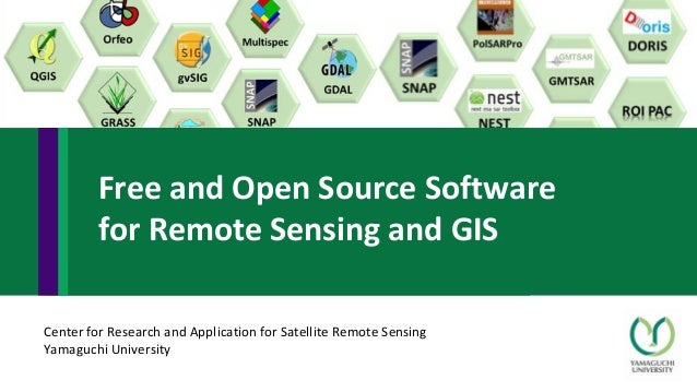
1. Center for Research and Application for Satellite Remote Sensing
Yamaguchi University
Free and Open Source Software
for Remote Sensing and GIS
2. • Free software means the users have the freedom to run, copy, distribute, study, change and
improve the software.
• Open source software is defined as software that has the source code freely available and is
licensed so that it can be freely distributed and modified as long as appropriate credit is
provided to the developers. There are several licensing options for open source software but all
of them follow these basic rules. More information about open source software is available at
the Open Source Initiative web page (http://www.opensource.org/).
• Free and open-source software (FOSS) is software that can be classified as both free
software and open-source software. That is, anyone is freely licensed to use, copy, study, and
change the software in any way, and the source code is openly shared so that people are
encouraged to voluntarily improve the design of the software. This is in contrast to proprietary
software, where the software is under restrictive copyright and the source code is usually
hidden from the users.
Open source and free software
4. SAR remote sensing free software
• NEST (ESA)
• Sentinel 1A (SNAP)
• DORIS
• PolSARPro
• GMTSAR
• ROI_PAC
• Let’s SAR
ROI
PAC
SNAP
PolSARPro
NEST
GMTSAR
DORIS
Let's SAR
Contents
5. • QGIS is a professional GIS application that is built on top of and proud to be itself
Free and Open Source Software (FOSS).
• QGIS is a user friendly Open Source Geographic Information System (GIS)
licensed under the GNU General Public License. QGIS is an official project of the
Open Source Geospatial Foundation (OSGeo). It supports numerous vector,
raster, and database formats and functionalities.
• OS: runs on Linux, Unix, Mac OSX, Windows and Android
• Features: View data, Explore data and compose maps, Create, edit, manage and
export data, Analyze data, Publish maps on the Internet, Extend QGIS
functionality through plugins, Core Plugins, External Python Plugins, Python
Console
• Information: http://www.qgis.org/en/site/
QGIS
6. The QGIS GUI is divided
into five components:
1. Menu Bar
2. Toolbars
3. Panels
4. Map View
5. Status Bar
QGIS user guide: http://docs.qgis.org/2.18/en/docs/user_manual/index.html
1
2
4
3
2
5
QGIS (2)
7. QGIS can work with other
toolboxes:
• GRASS GIS (see 2)
• Orfeo toolbox (see 4)
• SAGA (see 3)
QGIS (3)
8. • GRASS GIS, commonly referred to as GRASS (Geographic Resources Analysis
Support System), is a free and open source Geographic Information System (GIS)
software suite used for geospatial data management and analysis, image
processing, graphics and maps production, spatial modeling, and visualization.
GRASS GIS is currently used in academic and commercial settings around the
world, as well as by many governmental agencies and environmental consulting
companies. It is a founding member of the Open Source Geospatial
Foundation (OSGeo).
• OS: Linux, Mac OSX, Windows
• Features: Raster analysis, 3D-Raster (voxel) analysis, Vector analysis, Point data
analysis, Image processing, DTM-Analysis, Geocoding, Visualization, Map
creation, SQL-support, Geostatistics, Temporal framework and furthermore.
• Information: https://grass.osgeo.org/
GRASS
10. • SAGA is the abbreviation for System for Automated Geoscientific Analyses
• SAGA is a Geographic Information System (GIS) software
• SAGA has been designed for an easy and effective implementation of spatial
algorithms
• SAGA offers a comprehensive, growing set of geoscientific methods
• SAGA provides an easily approachable user interface with many visualization
options
• SAGA runs under Windows and Linux operating systems
• SAGA is a Free Open Source Software (FOSS)
• Features: Data import and export, vector analysis tool, raster analysis tools,
terrain analysis, projection tools, image analysis, geostatistic tools.
• Information: http://www.saga-gis.org/en/index.html
SAGA
12. • Orfeo ToolBox (OTB) is an open-source project for state-of-the-art remote sensing. Built
on the shoulders of the open-source geospatial community,
• ORFEO Toolbox Library (OTB) is a high-performance image processing library. It is
primarily used for processing large remote sensing images such as those gathered by
radars, satellites and aerial photography. OTB provides tools for optic and radar images
(tridimensional aspects, segmentation, classification, changes detection, texture
analysis, pattern matching, and optic/radar complementarities), many of which can be
run on limited-resourced laptops.
• Features: it can process high resolution optical, multispectral and radar images at the
terabyte scale. A wide variety of applications are available: calibration, feature
extraction, geometry (ortho-rectification, pan-sharpening), image filtering, image
manipulation, miscellaneous, segmentation, stereo and all the way to classification and
SAR processing
• OS: Windows, Mac OS X, Linux
• Information: https://www.orfeo-toolbox.org/
• https://live.osgeo.org/en/overview/otb_overview.html
Orfeo Toolbox
16. • gvSIG is a geographic information system (GIS), that is, a desktop
application designed for capturing, storing, handling, analyzing and
deploying any kind of referenced geographic information in order to solve
complex management and planning problems. gvSIG is known for having a
user-friendly interface, being able to access the most common formats,
both vector and raster ones. It features a wide range of tools for working
with geographic-like information (query tools, layout creation,
geoprocessing, networks, etc.).
• Features: Windows, Mac OS X, Linux
• Information: http://www.gvsig.com/en
gvSIG
18. • GDAL is a translator library for raster and vector geospatial data formats
that is released under an X/MIT style Open Source license by the Open
Source Geospatial Foundation. As a library, it presents a single raster
abstract data model and single vector abstract data model to the calling
application for all supported formats. It also comes with a variety of useful
command line utilities for data translation and processing.
• Information: http://www.gdal.org/
GDAL Geospatial Data Abstraction Library
19. • ESA is developing free open source toolboxes for the scientific
exploitation of the Sentinel missions.
• Information: https://sentinel.esa.int/web/sentinel/toolboxes
• Sentinel-1 Toolbox (S1TBX)
The Sentinel-1 Toolbox (S1TBX) consists of a collection of processing
tools, data product readers and writers and a display and analysis
application to support the large archive of data from ESA SAR missions
including Sentinel-1, ERS-1 & 2 and Envisat, as well as third party SAR
data from ALOS PALSAR, TerraSAR-X, COSMO-SkyMed and RADARSAT-2.
SeNtinel’s Application Platform (SNAP)
20. • Sentinel-2 Toolbox (S2TBX)
The Sentinel-2 Toolbox consists of a rich set of visualisation, analysis and processing tools for the
exploitation of MSI data from the upcoming Sentinel-2 mission. As a multi-mission remote
sensing toolbox, S2TBX supports the ESA missions Envisat (MERIS & AATSR), ERS (ATSR), as well
as third party data from RapidEye, SPOT, MODIS (Aqua and Terra), Landsat (TM), ALOS (AVNIR &
PRISM) and others. The various tools can be run from an intuitive desktop application or via a
command-line interface.
• Sentinel-3 Toolbox (S3TBX)
The Sentinel-3 Toolbox consists of a rich set of visualisation, analysis and processing tools for the
exploitation of OLCI and SLSTR data from the upcoming Sentinel-3 mission. As a multi-mission
remote sensing toolbox, S3TBX supports the ESA missions Envisat (MERIS & AATSR), ERS (ATSR),
SMOS as well as third party data from MODIS (Aqua and Terra), Landsat (TM), ALOS (AVNIR &
PRISM) and others.
• Other software: Sentinel Atmospheric Toolbox, Sentinel Altimetry toolbox and other tools
SeNtinel’s Application Platform (SNAP) (2)
21. • A common architecture for all Sentinel Toolboxes is being jointly
developed by Brockmann Consult, Array Systems Computing and C-S
called the Sentinel Application Platform (SNAP).
SeNtinel’s Application Platform (SNAP) (3)
22. • The Next ESA SAR Toolbox (NEST) is an ESA open source toolbox under the
GNU GPL licence for reading, processing, analysing and visualising ESA
(ERS-1/2, ENVISAT, SENTINEL-1) and other spaceborne* (TerraSAR-X,
RADARSAT 1-2, COSMO-SkyMed, JERS-1, ALOS PALSAR) SAR data
processed to Level-1 or higher.
• OS: NEST is programmed in Java™ to allow a maximum portability. The
NEST software has been successfully tested under MS Windows™ XP®,
Vista and 7 as well as under Linux, Solaris® and Mac OS X operating
systems.
• Information: https://earth.esa.int/web/nest/home/
NEST (ESA)
23. • The Delft Institute of Earth Observation and Space Systems of Delft University of
Technology has developed an Interferometric Synthetic Aperture Radar (InSAR) processor
named Doris (Delft object-oriented radarinterferometric software). The Doris software can be
downloaded freely from this site for non-commercial applications (conditions).
• Interferometric products and endproducts such as Digital Elevation Models and displacement
maps can be generated with this software from Single Look Complex data. Data from the
satellites ERS, ENVISAT (first ENVISAT interferogram, 54kB, DEM, 107kB, and perspective view,
177kB), JERS (first JERS interferogram), and RADARSAT (first RADARSAT interferogram) can be
processed with the Doris software.
• OS: It is running on X86 linux machines and MS-windows, SUN, SGI, HP.
• Features: Processing upto complex interferogram and coherence map has been implemented.
Unwrapping has to be performed with external software. Module for geocoding of the
unwrapped phase values is provided.
• Information: http://doris.tudelft.nl/
DORIS
24. The Polarimetric SAR Data Processing and Educational Tool aims to facilitate
the accessibility and exploitation of multi-polarised SAR datasets including
those from ESA (Envisat ASAR Alternating Polarisation mode products and
Sentinel-1) and Third Party Missions (ALOS-1 PALSAR, ALOS-2 PALSAR,
COSMO-SkyMed, RADARSAT-2, RISAT, TerraSAR-X and Tandem-X).
OS: Windows (x86 architecture only, Windows 98, ME, 2000, XP) Linux and
Unix-Solaris (x86 architecture only and Tcl-Tk version) Mac OS (Parallels
Desktop 4.0 technology)
Information: https://earth.esa.int/web/polsarpro/home
PolSARpro
25. GMTSAR is an open source (GNU General Public License) InSAR processing system
designed for users familiar with Generic Mapping Tools (GMT). The code is written
in C and will compile on any computer where GMT and NETCDF are installed. The
system has three main components:
1. a preprocessor for each satellite data type (ERS-1/2, Envisat, ALOS-1, TerraSAR-X,
COSMOS-SkyMed, Radarsat-2, Sentinel-1A/B, and ALOS-2) to convert the native format
and orbital information into a generic format;
2. an InSAR processor to focus and align stacks of images, map topography into phase, and
form the complex interferogram;
3. a postprocessor, mostly based on GMT, to filter the interferogram and construct
interferometric products of phase, coherence, phase gradient, and line-of sight
displacement in both radar and geographic coordinates
Information:
http://topex.ucsd.edu/gmtsar/
http://gmt.soest.hawaii.edu/projects/gmt5sar/wiki
GMTSAR
26. • ROI_PAC (Repeat Orbit Interferometry PACkage) is a powerful open source
software package for processing diverse satellite interferometric synthetic
aperture radar (InSAR) data, and has been used in numerous geophysical
applications around the world
• OS: Linux
• Information:
http://www.geo.cornell.edu/eas/PeoplePlaces/Faculty/matt/roi_pac.html
/
ROI_PAC
27. • Let's SAR is a simple tool package to use SAR data such as ALOS PALSAR
mosaics for forest classification, change detection, and other major
applications. The aim of the tool is providing the first step in the use of
SAR to more people and expanding the utilization of SAR data.
• Currently, the following two functions are provided:
• LUC (Land Use/cover Classification): a tool for image classification with object-
based machine learning algorithms.
• Gamma-zero change: a tool for extracting changes such as deforestation using
differences of backscattering coefficients observed at two different times.
• OS: Microsoft Windows 7/8 64 bit.
• http://www.eorc.jaxa.jp/ALOS-2/en/doc/pal2_tool.htm
Let’s SAR