SlideShare a Scribd company logo
1 of 22
Download to read offline
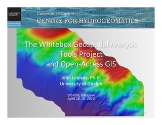
The	
  Whitebox	
  Geospa/al	
  Analysis	
  
Tools	
  Project	
  	
  
and	
  Open-­‐Access	
  GIS	
  
John	
  Lindsay,	
  Ph.D.	
  
University	
  of	
  Guelph	


GISRUK,	
  Glasgow	
  	
  
April	
  16-­‐18,	
  2014	
  
1	
  
What	
  is	
  Whitebox	
  GAT?	
  
2	
  
hIp://www.uoguelph.ca/~hydrogeo/Whitebox/	
  
•  Origins	
  in	
  the	
  Terrain	
  Analysis	
  System	
  (TAS)	
  
•  Whitebox	
  GAT	
  project	
  started	
  in	
  2009	
  
•  Free	
  and	
  open-­‐source	
  GIS	
  and	
  remote	
  sensing	
  
soUware	
  package	
  
•  Google	
  code	
  repository	
  
•  Mul/-­‐plaXorm	
  soUware	
  
•  Translated	
  into	
  11	
  languages	
  
3	
  
Whitebox	
  
•  Currently	
  contains	
  372	
  tools	
  for	
  processing	
  DEMs,	
  
raster	
  images,	
  vector	
  data,	
  and	
  LiDAR.	
  
•  New	
  tools	
  can	
  be	
  added	
  as	
  plugins	
  developed	
  using	
  
any	
  JVM	
  programming	
  language	
  (Java,	
  Groovy,	
  
Python).	
  
•  Useful	
  as	
  a	
  powerful	
  geoprocessing	
  engine	
  
4	
  
Basic	
  GIS	
  and	
  Vector	
  Data	
  Analysis	
  
5	
  
Terrain	
  Analysis	
  Toolbox	
  
•  Tools	
  for	
  extrac/ng	
  informa/on	
  
from	
  DEMs.	
  
•  Surface	
  deriva/ves	
  (slope,	
  aspect,	
  
curvature)	
  
•  Hillshading	
  and	
  visibility	
  analysis	
  
•  Rela/ve	
  landscape	
  posi/on	
  
•  Landform	
  classifica/on	
  
•  Topographic	
  index,	
  sediment	
  
transport	
  index,	
  etc.	
  
6	
  
LiDAR	
  represents	
  the	
  state	
  of	
  the	
  science	
  for	
  
topographic	
  and	
  canopy	
  mapping.	
  
7	
  
LiDAR	
  Toolbox	
  
LiDAR	
  Toolbox	
  
•  Whitebox	
  contains	
  tools	
  to	
  	
  
– interpolate	
  LAS	
  files,	
  	
  
– mosaic	
  /les,	
  	
  
– fill	
  in	
  missing	
  data	
  gaps,	
  	
  
– remove	
  off-­‐terrain	
  objects	
  
– model	
  vegeta/on	
  canopy	
  
8	
  
9	
  
Removing	
  Off-­‐terrain	
  Objects	
  
10	
  
Original	
  last-­‐return	
  LiDAR	
  DEM	
   Bare-­‐Earth	
  DEM	
  created	
  using	
  	
  
‘remove	
  off-­‐terrain	
  objects’	
  tool	
  
Processing	
  Massive	
  DEM	
  Datasets	
  
11	
  
This	
  file	
  was	
  mosaiced	
  from	
  4200	
  LiDAR	
  
/les	


It	
  consists	
  of	
  4.25	
  billion	
  grid	
  cells	
  and	
  a	
  
file	
  of	
  15.8GB	
  
Hydrology	
  Toolbox	
  
Flow	
  accumula/on	
  image	
  derived	
  from	
  a	
  DEM	
  
•  Flow-­‐path	
  enforcement	
  
•  Flow	
  algorithms	
  	
  
•  D8,	
  FD8,	
  D∞,	
  MD∞	
  
•  flow	
  direc/on	
  
•  flow	
  accumula/on	
  
•  Flow-­‐path	
  length	
  
•  Watershed	
  delinea/on	
  	
  
•  Sub-­‐basin	
  delinea/on	
  
•  Hillslope	
  mapping	
  
12	
  
13	
  
Surface	
  Flow-­‐path	
  Enforcement	
  
Depression	
  Filling	
  
Depression	
  Breaching	
  
Road	
  blocks	
  flow	
  in	
  DEM	
  
X	
  
X	
  
Filling	
   Breaching	
  
Stream	
  Network	
  Analysis	
  Toolbox	
  
•  DEM-­‐based	
  automated	
  stream	
  
mapping	
  
–  Algorithms	
  based	
  on	
  either	
  valley	
  
recogni/on	
  methods	
  (i.e.	
  DEM	
  
shape)	
  or	
  channel	
  ini/a/on	
  
methods	
  (i.e.	
  contribu/ng	
  area	
  
thresholding)	
  
•  Link	
  length	
  and	
  slope	
  
•  Stream	
  ordering	
  	
  
•  Long	
  profiles	
  
•  Link	
  classifica/on	
  
14	
  
Remote	
  Sensing	
  Applica/ons	
  
•  Numerous	
  spa/al	
  filters	
  
•  Contrast	
  stretching	
  
•  Change	
  detec/on	
  algorithms	
  
•  PCA	
  and	
  inverse	
  PCA	
  
•  Image	
  classifica/on,	
  feature-­‐space	
  plomng	
  
•  Photogrammetry	
  
15	
  
Whitebox	
  as	
  an	
  ‘Open-­‐Access	
  GIS’	
  
•  The	
  poten/al	
  benefits	
  of	
  O-­‐S	
  GIS	
  include	
  wider	
  community	
  
involvement,	
  deeper	
  user	
  knowledge,	
  and	
  rapid	
  innova/on	
  
in	
  the	
  field.	
  
•  The	
  inten/on	
  of	
  O-­‐S	
  GIS	
  is	
  good	
  but	
  we	
  could	
  realize	
  even	
  
more	
  benefits	
  if	
  we	
  altered	
  the	
  implementa/on.	
  
•  The	
  poten/al	
  benefit	
  of	
  OSS	
  is	
  oUen	
  defeated	
  by	
  the	
  
barriers	
  that	
  are	
  in	
  place	
  as	
  a	
  result	
  of	
  the	
  implementa/on	
  
of	
  the	
  O-­‐S	
  model.	
  
•  Open-­‐Access	
  GIS:	
  soUware	
  should	
  be	
  designed	
  in	
  a	
  way	
  
that	
  reduces	
  the	
  barriers	
  that	
  oUen	
  discourage	
  or	
  disallow	
  
end-­‐users	
  from	
  examining	
  the	
  algorithm	
  design	
  and	
  
implementa/on	
  associated	
  with	
  specific	
  geospa/al	
  tools.	
  
16	
  
Whitebox	
  as	
  an	
  ‘Open-­‐Access	
  GIS’	
  
17	
  
Whitebox	
  as	
  an	
  ‘Open-­‐Access	
  GIS’	
  
18	
  
Whitebox	
  as	
  an	
  ‘Open-­‐Access	
  GIS’	
  
19	
  
Whitebox	
  Usage	
  
20	
  
•  Downloaded	
  1573	
  /mes	
  in	
  last	
  17	
  weeks.	
  
•  Downloads	
  originated	
  in	
  91	
  countries	
  
Concluding	
  remarks	
  
•  Whitebox	
  provides	
  extensive	
  tools	
  for	
  
extrac/ng	
  informa/on	
  from	
  spa/al	
  data	
  sets.	
  
•  The	
  open-­‐source(access)	
  nature	
  and	
  ease	
  of	
  
use	
  of	
  Whitebox	
  provides	
  an	
  ideal	
  
environment	
  for	
  educa/on	
  and	
  research.	
  
21	
  
Acknowledgements	
  
•  It’s	
  been	
  a	
  wonderful	
  honour	
  to	
  speak	
  with	
  
you	
  today.	
  
•  Funding	
  for	
  this	
  work	
  has	
  been	
  provided	
  by:	
  
22	
  

More Related Content

What's hot

Open data hackathon jelgava - report
Open data hackathon   jelgava - reportOpen data hackathon   jelgava - report
Open data hackathon jelgava - reportWirelessInfo
 
Smooth, Interactive Rendering and On-line Modification of Large-Scale, Geospa...
Smooth, Interactive Rendering and On-line Modification of Large-Scale, Geospa...Smooth, Interactive Rendering and On-line Modification of Large-Scale, Geospa...
Smooth, Interactive Rendering and On-line Modification of Large-Scale, Geospa...Christian Kehl
 
TransportDCAT-AP and PhD Thesis at Civic Lab Brussels
TransportDCAT-AP and PhD Thesis at Civic Lab BrusselsTransportDCAT-AP and PhD Thesis at Civic Lab Brussels
TransportDCAT-AP and PhD Thesis at Civic Lab BrusselsDavid Chaves-Fraga
 
Hadoop World 2011: Radoop: a Graphical Analytics Tool for Big Data - Gabor Ma...
Hadoop World 2011: Radoop: a Graphical Analytics Tool for Big Data - Gabor Ma...Hadoop World 2011: Radoop: a Graphical Analytics Tool for Big Data - Gabor Ma...
Hadoop World 2011: Radoop: a Graphical Analytics Tool for Big Data - Gabor Ma...Cloudera, Inc.
 
Improving long-term preservation of EOS data by independently mapping HDF4 da...
Improving long-term preservation of EOS data by independently mapping HDF4 da...Improving long-term preservation of EOS data by independently mapping HDF4 da...
Improving long-term preservation of EOS data by independently mapping HDF4 da...The HDF-EOS Tools and Information Center
 
Data analytics and downscaling for climate research in a big data world
Data analytics and downscaling for climate research in a big data worldData analytics and downscaling for climate research in a big data world
Data analytics and downscaling for climate research in a big data worldBigData_Europe
 
New Arc Sde – Ms Sql Geodatabases
New Arc Sde – Ms Sql GeodatabasesNew Arc Sde – Ms Sql Geodatabases
New Arc Sde – Ms Sql Geodatabasesdavinci7_gis
 
Cartaro Workshop at the Geosharing Conferenc in Bern
Cartaro Workshop at the Geosharing Conferenc in BernCartaro Workshop at the Geosharing Conferenc in Bern
Cartaro Workshop at the Geosharing Conferenc in BernUli Müller
 
The Snap Solution to Turn Transport Data into EU Compliance
The Snap Solution to Turn Transport Data into EU ComplianceThe Snap Solution to Turn Transport Data into EU Compliance
The Snap Solution to Turn Transport Data into EU ComplianceMarco Comerio
 
Integrating Geospatial Data to your Applications
Integrating Geospatial Data to your ApplicationsIntegrating Geospatial Data to your Applications
Integrating Geospatial Data to your ApplicationsIan Panganiban
 

What's hot (20)

Digimap Essentials
Digimap EssentialsDigimap Essentials
Digimap Essentials
 
Open data hackathon jelgava - report
Open data hackathon   jelgava - reportOpen data hackathon   jelgava - report
Open data hackathon jelgava - report
 
Os Percy
Os PercyOs Percy
Os Percy
 
Using HDF5 Archive Information Package to preserve HDF-EOS2 data
Using HDF5 Archive Information Package to preserve HDF-EOS2 dataUsing HDF5 Archive Information Package to preserve HDF-EOS2 data
Using HDF5 Archive Information Package to preserve HDF-EOS2 data
 
Converting between HDF4 and HDF5
Converting between HDF4 and HDF5Converting between HDF4 and HDF5
Converting between HDF4 and HDF5
 
Smooth, Interactive Rendering and On-line Modification of Large-Scale, Geospa...
Smooth, Interactive Rendering and On-line Modification of Large-Scale, Geospa...Smooth, Interactive Rendering and On-line Modification of Large-Scale, Geospa...
Smooth, Interactive Rendering and On-line Modification of Large-Scale, Geospa...
 
TransportDCAT-AP and PhD Thesis at Civic Lab Brussels
TransportDCAT-AP and PhD Thesis at Civic Lab BrusselsTransportDCAT-AP and PhD Thesis at Civic Lab Brussels
TransportDCAT-AP and PhD Thesis at Civic Lab Brussels
 
Hadoop World 2011: Radoop: a Graphical Analytics Tool for Big Data - Gabor Ma...
Hadoop World 2011: Radoop: a Graphical Analytics Tool for Big Data - Gabor Ma...Hadoop World 2011: Radoop: a Graphical Analytics Tool for Big Data - Gabor Ma...
Hadoop World 2011: Radoop: a Graphical Analytics Tool for Big Data - Gabor Ma...
 
Working with HDF and netCDF Data in ArcGIS: Tools and Case Studies
Working with HDF and netCDF Data in ArcGIS: Tools and Case StudiesWorking with HDF and netCDF Data in ArcGIS: Tools and Case Studies
Working with HDF and netCDF Data in ArcGIS: Tools and Case Studies
 
Improving long-term preservation of EOS data by independently mapping HDF4 da...
Improving long-term preservation of EOS data by independently mapping HDF4 da...Improving long-term preservation of EOS data by independently mapping HDF4 da...
Improving long-term preservation of EOS data by independently mapping HDF4 da...
 
Os Racicot
Os RacicotOs Racicot
Os Racicot
 
HDF Update
HDF UpdateHDF Update
HDF Update
 
Data analytics and downscaling for climate research in a big data world
Data analytics and downscaling for climate research in a big data worldData analytics and downscaling for climate research in a big data world
Data analytics and downscaling for climate research in a big data world
 
First seminar
First seminarFirst seminar
First seminar
 
HDF and netCDF Data Support in ArcGIS
HDF and netCDF Data Support in ArcGISHDF and netCDF Data Support in ArcGIS
HDF and netCDF Data Support in ArcGIS
 
New Arc Sde – Ms Sql Geodatabases
New Arc Sde – Ms Sql GeodatabasesNew Arc Sde – Ms Sql Geodatabases
New Arc Sde – Ms Sql Geodatabases
 
Cartaro Workshop at the Geosharing Conferenc in Bern
Cartaro Workshop at the Geosharing Conferenc in BernCartaro Workshop at the Geosharing Conferenc in Bern
Cartaro Workshop at the Geosharing Conferenc in Bern
 
The Snap Solution to Turn Transport Data into EU Compliance
The Snap Solution to Turn Transport Data into EU ComplianceThe Snap Solution to Turn Transport Data into EU Compliance
The Snap Solution to Turn Transport Data into EU Compliance
 
Map Reduce
Map ReduceMap Reduce
Map Reduce
 
Integrating Geospatial Data to your Applications
Integrating Geospatial Data to your ApplicationsIntegrating Geospatial Data to your Applications
Integrating Geospatial Data to your Applications
 

Similar to The Whitebox Geospatial-Analyisis Tools Project and Open-Access GIS

Whitebox GAT - an introduction by its developer
Whitebox GAT - an introduction by its developerWhitebox GAT - an introduction by its developer
Whitebox GAT - an introduction by its developerRobin Lovelace
 
Integrating PostGIS in Web Applications
Integrating PostGIS in Web ApplicationsIntegrating PostGIS in Web Applications
Integrating PostGIS in Web ApplicationsCommand Prompt., Inc
 
Free remote sensing and GIS data
Free remote sensing and GIS dataFree remote sensing and GIS data
Free remote sensing and GIS dataNopphawanTamkuan
 
One GeoNode, many GeoNodes
One GeoNode, many GeoNodesOne GeoNode, many GeoNodes
One GeoNode, many GeoNodesGeoSolutions
 
OpenStreetMap in 3D - current developments
OpenStreetMap in 3D - current developmentsOpenStreetMap in 3D - current developments
OpenStreetMap in 3D - current developmentsvirtualcitySYSTEMS GmbH
 
Geo Analytics Canada Overview - May 2020
Geo Analytics Canada Overview - May 2020Geo Analytics Canada Overview - May 2020
Geo Analytics Canada Overview - May 2020GEO Analytics Canada
 
Free open source gis
Free open source gisFree open source gis
Free open source gisAshok Peddi
 
Open Geographies and Open Software
Open Geographies and Open SoftwareOpen Geographies and Open Software
Open Geographies and Open SoftwareJames Crone
 
DSD-Kampala 2023 Modelling in a data scarce environment - the story of HydroM...
DSD-Kampala 2023 Modelling in a data scarce environment - the story of HydroM...DSD-Kampala 2023 Modelling in a data scarce environment - the story of HydroM...
DSD-Kampala 2023 Modelling in a data scarce environment - the story of HydroM...Deltares
 
Map4rdf - Faceted Browser for Geospatial Datasets
Map4rdf - Faceted Browser for Geospatial DatasetsMap4rdf - Faceted Browser for Geospatial Datasets
Map4rdf - Faceted Browser for Geospatial DatasetsBoris Villazón-Terrazas
 
MapInfo Professional 12.5 and Discover3D 2014 - A brief overview
MapInfo Professional 12.5 and Discover3D 2014 - A brief overviewMapInfo Professional 12.5 and Discover3D 2014 - A brief overview
MapInfo Professional 12.5 and Discover3D 2014 - A brief overviewPrakher Hajela Saxena
 
2013 Vendor, MapQuest Plugins for Leaflet by Jonathan Harahush
2013 Vendor, MapQuest Plugins for Leaflet by Jonathan Harahush2013 Vendor, MapQuest Plugins for Leaflet by Jonathan Harahush
2013 Vendor, MapQuest Plugins for Leaflet by Jonathan HarahushGIS in the Rockies
 
Use of Open Source in Education Sector.pptx
Use of Open Source in Education Sector.pptxUse of Open Source in Education Sector.pptx
Use of Open Source in Education Sector.pptxswaranjaggi
 
DSD-INT 2015 -EU FP7 project “FAST” introduction - Mindert de Vries
DSD-INT 2015 -EU FP7 project “FAST” introduction - Mindert de VriesDSD-INT 2015 -EU FP7 project “FAST” introduction - Mindert de Vries
DSD-INT 2015 -EU FP7 project “FAST” introduction - Mindert de VriesDeltares
 
Processing Landsat 8 Multi-Spectral Images with GRASS Tools & the potential o...
Processing Landsat 8 Multi-Spectral Images with GRASS Tools & the potential o...Processing Landsat 8 Multi-Spectral Images with GRASS Tools & the potential o...
Processing Landsat 8 Multi-Spectral Images with GRASS Tools & the potential o...Shaun Lewis
 
Open Source GIS
Open Source GISOpen Source GIS
Open Source GISJoe Larson
 

Similar to The Whitebox Geospatial-Analyisis Tools Project and Open-Access GIS (20)

Whitebox GAT - an introduction by its developer
Whitebox GAT - an introduction by its developerWhitebox GAT - an introduction by its developer
Whitebox GAT - an introduction by its developer
 
Integrating PostGIS in Web Applications
Integrating PostGIS in Web ApplicationsIntegrating PostGIS in Web Applications
Integrating PostGIS in Web Applications
 
Free remote sensing and GIS data
Free remote sensing and GIS dataFree remote sensing and GIS data
Free remote sensing and GIS data
 
One GeoNode, many GeoNodes
One GeoNode, many GeoNodesOne GeoNode, many GeoNodes
One GeoNode, many GeoNodes
 
OpenStreetMap in 3D - current developments
OpenStreetMap in 3D - current developmentsOpenStreetMap in 3D - current developments
OpenStreetMap in 3D - current developments
 
Geohosting
GeohostingGeohosting
Geohosting
 
EOSC-hub & Geohazards TEP
EOSC-hub & Geohazards TEPEOSC-hub & Geohazards TEP
EOSC-hub & Geohazards TEP
 
Open Spatial Data: Sources and Tools
Open Spatial Data: Sources and ToolsOpen Spatial Data: Sources and Tools
Open Spatial Data: Sources and Tools
 
Geo Analytics Canada Overview - May 2020
Geo Analytics Canada Overview - May 2020Geo Analytics Canada Overview - May 2020
Geo Analytics Canada Overview - May 2020
 
Free open source gis
Free open source gisFree open source gis
Free open source gis
 
Open Geographies and Open Software
Open Geographies and Open SoftwareOpen Geographies and Open Software
Open Geographies and Open Software
 
Lapis Guides
Lapis GuidesLapis Guides
Lapis Guides
 
DSD-Kampala 2023 Modelling in a data scarce environment - the story of HydroM...
DSD-Kampala 2023 Modelling in a data scarce environment - the story of HydroM...DSD-Kampala 2023 Modelling in a data scarce environment - the story of HydroM...
DSD-Kampala 2023 Modelling in a data scarce environment - the story of HydroM...
 
Map4rdf - Faceted Browser for Geospatial Datasets
Map4rdf - Faceted Browser for Geospatial DatasetsMap4rdf - Faceted Browser for Geospatial Datasets
Map4rdf - Faceted Browser for Geospatial Datasets
 
MapInfo Professional 12.5 and Discover3D 2014 - A brief overview
MapInfo Professional 12.5 and Discover3D 2014 - A brief overviewMapInfo Professional 12.5 and Discover3D 2014 - A brief overview
MapInfo Professional 12.5 and Discover3D 2014 - A brief overview
 
2013 Vendor, MapQuest Plugins for Leaflet by Jonathan Harahush
2013 Vendor, MapQuest Plugins for Leaflet by Jonathan Harahush2013 Vendor, MapQuest Plugins for Leaflet by Jonathan Harahush
2013 Vendor, MapQuest Plugins for Leaflet by Jonathan Harahush
 
Use of Open Source in Education Sector.pptx
Use of Open Source in Education Sector.pptxUse of Open Source in Education Sector.pptx
Use of Open Source in Education Sector.pptx
 
DSD-INT 2015 -EU FP7 project “FAST” introduction - Mindert de Vries
DSD-INT 2015 -EU FP7 project “FAST” introduction - Mindert de VriesDSD-INT 2015 -EU FP7 project “FAST” introduction - Mindert de Vries
DSD-INT 2015 -EU FP7 project “FAST” introduction - Mindert de Vries
 
Processing Landsat 8 Multi-Spectral Images with GRASS Tools & the potential o...
Processing Landsat 8 Multi-Spectral Images with GRASS Tools & the potential o...Processing Landsat 8 Multi-Spectral Images with GRASS Tools & the potential o...
Processing Landsat 8 Multi-Spectral Images with GRASS Tools & the potential o...
 
Open Source GIS
Open Source GISOpen Source GIS
Open Source GIS
 

More from Golgi Alvarez

Visión de la Geo-ingeniería según HexagonAB
Visión de la Geo-ingeniería según HexagonABVisión de la Geo-ingeniería según HexagonAB
Visión de la Geo-ingeniería según HexagonABGolgi Alvarez
 
EVALUACION DE LA CALIDAD DE LA INFORMACIÓN GEOGRÁFICA
EVALUACION DE LA CALIDAD DE LA INFORMACIÓN GEOGRÁFICAEVALUACION DE LA CALIDAD DE LA INFORMACIÓN GEOGRÁFICA
EVALUACION DE LA CALIDAD DE LA INFORMACIÓN GEOGRÁFICAGolgi Alvarez
 
Uso de información geoespacial para el estudio de peligros geológicos y gesti...
Uso de información geoespacial para el estudio de peligros geológicos y gesti...Uso de información geoespacial para el estudio de peligros geológicos y gesti...
Uso de información geoespacial para el estudio de peligros geológicos y gesti...Golgi Alvarez
 
TICS para Agricultura
TICS para AgriculturaTICS para Agricultura
TICS para AgriculturaGolgi Alvarez
 
Características de los sensores hiperespectrales para el sensoramiento remoto
Características de los sensores hiperespectrales para el sensoramiento remotoCaracterísticas de los sensores hiperespectrales para el sensoramiento remoto
Características de los sensores hiperespectrales para el sensoramiento remotoGolgi Alvarez
 
Evaluacicón de planos topográficos locales para proyectos de ingeniería en la...
Evaluacicón de planos topográficos locales para proyectos de ingeniería en la...Evaluacicón de planos topográficos locales para proyectos de ingeniería en la...
Evaluacicón de planos topográficos locales para proyectos de ingeniería en la...Golgi Alvarez
 
Tecnologías geoespaciales aplicadas al monitoreo de variables ambientales y c...
Tecnologías geoespaciales aplicadas al monitoreo de variables ambientales y c...Tecnologías geoespaciales aplicadas al monitoreo de variables ambientales y c...
Tecnologías geoespaciales aplicadas al monitoreo de variables ambientales y c...Golgi Alvarez
 
Interoperabilidad de datos mediante implementación de modelo LADM-COL
Interoperabilidad de datos mediante implementación de modelo LADM-COLInteroperabilidad de datos mediante implementación de modelo LADM-COL
Interoperabilidad de datos mediante implementación de modelo LADM-COLGolgi Alvarez
 
Proyecto de Modernización de Tierras en Colombia
Proyecto de Modernización de Tierras en ColombiaProyecto de Modernización de Tierras en Colombia
Proyecto de Modernización de Tierras en ColombiaGolgi Alvarez
 
La relevancia de geodata en la modelística
La relevancia de geodata en la modelísticaLa relevancia de geodata en la modelística
La relevancia de geodata en la modelísticaGolgi Alvarez
 
Aplicación de la espectroscopía en la agricultura
Aplicación de la espectroscopía en la agriculturaAplicación de la espectroscopía en la agricultura
Aplicación de la espectroscopía en la agriculturaGolgi Alvarez
 
La corrección atmosférica en las imágenes de satélite
La corrección atmosférica en las imágenes de satéliteLa corrección atmosférica en las imágenes de satélite
La corrección atmosférica en las imágenes de satéliteGolgi Alvarez
 
Comparación e implementación de liberías webmapping como herramienta de visua...
Comparación e implementación de liberías webmapping como herramienta de visua...Comparación e implementación de liberías webmapping como herramienta de visua...
Comparación e implementación de liberías webmapping como herramienta de visua...Golgi Alvarez
 
Aplicaciones de los sensores hiperespectrales
Aplicaciones de los sensores hiperespectralesAplicaciones de los sensores hiperespectrales
Aplicaciones de los sensores hiperespectralesGolgi Alvarez
 
Bigdata para la innovación cartográfica y la gestión de recursos naturales
Bigdata para la innovación cartográfica y la gestión de recursos naturalesBigdata para la innovación cartográfica y la gestión de recursos naturales
Bigdata para la innovación cartográfica y la gestión de recursos naturalesGolgi Alvarez
 
Towards an Integrated Property Administration Model in Honduras
Towards an Integrated Property Administration Model in HondurasTowards an Integrated Property Administration Model in Honduras
Towards an Integrated Property Administration Model in HondurasGolgi Alvarez
 
Solución profesional para mapping con drones
Solución profesional para mapping con dronesSolución profesional para mapping con drones
Solución profesional para mapping con dronesGolgi Alvarez
 
Presentacion Cáceres GIS
Presentacion Cáceres GISPresentacion Cáceres GIS
Presentacion Cáceres GISGolgi Alvarez
 

More from Golgi Alvarez (20)

Visión de la Geo-ingeniería según HexagonAB
Visión de la Geo-ingeniería según HexagonABVisión de la Geo-ingeniería según HexagonAB
Visión de la Geo-ingeniería según HexagonAB
 
EVALUACION DE LA CALIDAD DE LA INFORMACIÓN GEOGRÁFICA
EVALUACION DE LA CALIDAD DE LA INFORMACIÓN GEOGRÁFICAEVALUACION DE LA CALIDAD DE LA INFORMACIÓN GEOGRÁFICA
EVALUACION DE LA CALIDAD DE LA INFORMACIÓN GEOGRÁFICA
 
Uso de información geoespacial para el estudio de peligros geológicos y gesti...
Uso de información geoespacial para el estudio de peligros geológicos y gesti...Uso de información geoespacial para el estudio de peligros geológicos y gesti...
Uso de información geoespacial para el estudio de peligros geológicos y gesti...
 
TICS para Agricultura
TICS para AgriculturaTICS para Agricultura
TICS para Agricultura
 
Stonex Colombia
Stonex ColombiaStonex Colombia
Stonex Colombia
 
Características de los sensores hiperespectrales para el sensoramiento remoto
Características de los sensores hiperespectrales para el sensoramiento remotoCaracterísticas de los sensores hiperespectrales para el sensoramiento remoto
Características de los sensores hiperespectrales para el sensoramiento remoto
 
Evaluacicón de planos topográficos locales para proyectos de ingeniería en la...
Evaluacicón de planos topográficos locales para proyectos de ingeniería en la...Evaluacicón de planos topográficos locales para proyectos de ingeniería en la...
Evaluacicón de planos topográficos locales para proyectos de ingeniería en la...
 
Tecnologías geoespaciales aplicadas al monitoreo de variables ambientales y c...
Tecnologías geoespaciales aplicadas al monitoreo de variables ambientales y c...Tecnologías geoespaciales aplicadas al monitoreo de variables ambientales y c...
Tecnologías geoespaciales aplicadas al monitoreo de variables ambientales y c...
 
Interoperabilidad de datos mediante implementación de modelo LADM-COL
Interoperabilidad de datos mediante implementación de modelo LADM-COLInteroperabilidad de datos mediante implementación de modelo LADM-COL
Interoperabilidad de datos mediante implementación de modelo LADM-COL
 
Proyecto de Modernización de Tierras en Colombia
Proyecto de Modernización de Tierras en ColombiaProyecto de Modernización de Tierras en Colombia
Proyecto de Modernización de Tierras en Colombia
 
La relevancia de geodata en la modelística
La relevancia de geodata en la modelísticaLa relevancia de geodata en la modelística
La relevancia de geodata en la modelística
 
Aplicación de la espectroscopía en la agricultura
Aplicación de la espectroscopía en la agriculturaAplicación de la espectroscopía en la agricultura
Aplicación de la espectroscopía en la agricultura
 
La corrección atmosférica en las imágenes de satélite
La corrección atmosférica en las imágenes de satéliteLa corrección atmosférica en las imágenes de satélite
La corrección atmosférica en las imágenes de satélite
 
Comparación e implementación de liberías webmapping como herramienta de visua...
Comparación e implementación de liberías webmapping como herramienta de visua...Comparación e implementación de liberías webmapping como herramienta de visua...
Comparación e implementación de liberías webmapping como herramienta de visua...
 
Aplicaciones de los sensores hiperespectrales
Aplicaciones de los sensores hiperespectralesAplicaciones de los sensores hiperespectrales
Aplicaciones de los sensores hiperespectrales
 
Bigdata para la innovación cartográfica y la gestión de recursos naturales
Bigdata para la innovación cartográfica y la gestión de recursos naturalesBigdata para la innovación cartográfica y la gestión de recursos naturales
Bigdata para la innovación cartográfica y la gestión de recursos naturales
 
Towards an Integrated Property Administration Model in Honduras
Towards an Integrated Property Administration Model in HondurasTowards an Integrated Property Administration Model in Honduras
Towards an Integrated Property Administration Model in Honduras
 
Solución profesional para mapping con drones
Solución profesional para mapping con dronesSolución profesional para mapping con drones
Solución profesional para mapping con drones
 
LADM conceptual
LADM conceptualLADM conceptual
LADM conceptual
 
Presentacion Cáceres GIS
Presentacion Cáceres GISPresentacion Cáceres GIS
Presentacion Cáceres GIS
 

Recently uploaded

KubeKraft presentation @CloudNativeHooghly
KubeKraft presentation @CloudNativeHooghlyKubeKraft presentation @CloudNativeHooghly
KubeKraft presentation @CloudNativeHooghlysanyuktamishra911
 
result management system report for college project
result management system report for college projectresult management system report for college project
result management system report for college projectTonystark477637
 
MANUFACTURING PROCESS-II UNIT-2 LATHE MACHINE
MANUFACTURING PROCESS-II UNIT-2 LATHE MACHINEMANUFACTURING PROCESS-II UNIT-2 LATHE MACHINE
MANUFACTURING PROCESS-II UNIT-2 LATHE MACHINESIVASHANKAR N
 
VIP Call Girls Service Hitech City Hyderabad Call +91-8250192130
VIP Call Girls Service Hitech City Hyderabad Call +91-8250192130VIP Call Girls Service Hitech City Hyderabad Call +91-8250192130
VIP Call Girls Service Hitech City Hyderabad Call +91-8250192130Suhani Kapoor
 
Extrusion Processes and Their Limitations
Extrusion Processes and Their LimitationsExtrusion Processes and Their Limitations
Extrusion Processes and Their Limitations120cr0395
 
The Most Attractive Pune Call Girls Budhwar Peth 8250192130 Will You Miss Thi...
The Most Attractive Pune Call Girls Budhwar Peth 8250192130 Will You Miss Thi...The Most Attractive Pune Call Girls Budhwar Peth 8250192130 Will You Miss Thi...
The Most Attractive Pune Call Girls Budhwar Peth 8250192130 Will You Miss Thi...ranjana rawat
 
Processing & Properties of Floor and Wall Tiles.pptx
Processing & Properties of Floor and Wall Tiles.pptxProcessing & Properties of Floor and Wall Tiles.pptx
Processing & Properties of Floor and Wall Tiles.pptxpranjaldaimarysona
 
(PRIYA) Rajgurunagar Call Girls Just Call 7001035870 [ Cash on Delivery ] Pun...
(PRIYA) Rajgurunagar Call Girls Just Call 7001035870 [ Cash on Delivery ] Pun...(PRIYA) Rajgurunagar Call Girls Just Call 7001035870 [ Cash on Delivery ] Pun...
(PRIYA) Rajgurunagar Call Girls Just Call 7001035870 [ Cash on Delivery ] Pun...ranjana rawat
 
College Call Girls Nashik Nehal 7001305949 Independent Escort Service Nashik
College Call Girls Nashik Nehal 7001305949 Independent Escort Service NashikCollege Call Girls Nashik Nehal 7001305949 Independent Escort Service Nashik
College Call Girls Nashik Nehal 7001305949 Independent Escort Service NashikCall Girls in Nagpur High Profile
 
APPLICATIONS-AC/DC DRIVES-OPERATING CHARACTERISTICS
APPLICATIONS-AC/DC DRIVES-OPERATING CHARACTERISTICSAPPLICATIONS-AC/DC DRIVES-OPERATING CHARACTERISTICS
APPLICATIONS-AC/DC DRIVES-OPERATING CHARACTERISTICSKurinjimalarL3
 
Sheet Pile Wall Design and Construction: A Practical Guide for Civil Engineer...
Sheet Pile Wall Design and Construction: A Practical Guide for Civil Engineer...Sheet Pile Wall Design and Construction: A Practical Guide for Civil Engineer...
Sheet Pile Wall Design and Construction: A Practical Guide for Civil Engineer...Dr.Costas Sachpazis
 
MANUFACTURING PROCESS-II UNIT-5 NC MACHINE TOOLS
MANUFACTURING PROCESS-II UNIT-5 NC MACHINE TOOLSMANUFACTURING PROCESS-II UNIT-5 NC MACHINE TOOLS
MANUFACTURING PROCESS-II UNIT-5 NC MACHINE TOOLSSIVASHANKAR N
 
Introduction to Multiple Access Protocol.pptx
Introduction to Multiple Access Protocol.pptxIntroduction to Multiple Access Protocol.pptx
Introduction to Multiple Access Protocol.pptxupamatechverse
 
247267395-1-Symmetric-and-distributed-shared-memory-architectures-ppt (1).ppt
247267395-1-Symmetric-and-distributed-shared-memory-architectures-ppt (1).ppt247267395-1-Symmetric-and-distributed-shared-memory-architectures-ppt (1).ppt
247267395-1-Symmetric-and-distributed-shared-memory-architectures-ppt (1).pptssuser5c9d4b1
 
(SHREYA) Chakan Call Girls Just Call 7001035870 [ Cash on Delivery ] Pune Esc...
(SHREYA) Chakan Call Girls Just Call 7001035870 [ Cash on Delivery ] Pune Esc...(SHREYA) Chakan Call Girls Just Call 7001035870 [ Cash on Delivery ] Pune Esc...
(SHREYA) Chakan Call Girls Just Call 7001035870 [ Cash on Delivery ] Pune Esc...ranjana rawat
 
Introduction and different types of Ethernet.pptx
Introduction and different types of Ethernet.pptxIntroduction and different types of Ethernet.pptx
Introduction and different types of Ethernet.pptxupamatechverse
 
IMPLICATIONS OF THE ABOVE HOLISTIC UNDERSTANDING OF HARMONY ON PROFESSIONAL E...
IMPLICATIONS OF THE ABOVE HOLISTIC UNDERSTANDING OF HARMONY ON PROFESSIONAL E...IMPLICATIONS OF THE ABOVE HOLISTIC UNDERSTANDING OF HARMONY ON PROFESSIONAL E...
IMPLICATIONS OF THE ABOVE HOLISTIC UNDERSTANDING OF HARMONY ON PROFESSIONAL E...RajaP95
 
(MEERA) Dapodi Call Girls Just Call 7001035870 [ Cash on Delivery ] Pune Escorts
(MEERA) Dapodi Call Girls Just Call 7001035870 [ Cash on Delivery ] Pune Escorts(MEERA) Dapodi Call Girls Just Call 7001035870 [ Cash on Delivery ] Pune Escorts
(MEERA) Dapodi Call Girls Just Call 7001035870 [ Cash on Delivery ] Pune Escortsranjana rawat
 
High Profile Call Girls Nagpur Meera Call 7001035870 Meet With Nagpur Escorts
High Profile Call Girls Nagpur Meera Call 7001035870 Meet With Nagpur EscortsHigh Profile Call Girls Nagpur Meera Call 7001035870 Meet With Nagpur Escorts
High Profile Call Girls Nagpur Meera Call 7001035870 Meet With Nagpur EscortsCall Girls in Nagpur High Profile
 

Recently uploaded (20)

KubeKraft presentation @CloudNativeHooghly
KubeKraft presentation @CloudNativeHooghlyKubeKraft presentation @CloudNativeHooghly
KubeKraft presentation @CloudNativeHooghly
 
result management system report for college project
result management system report for college projectresult management system report for college project
result management system report for college project
 
MANUFACTURING PROCESS-II UNIT-2 LATHE MACHINE
MANUFACTURING PROCESS-II UNIT-2 LATHE MACHINEMANUFACTURING PROCESS-II UNIT-2 LATHE MACHINE
MANUFACTURING PROCESS-II UNIT-2 LATHE MACHINE
 
VIP Call Girls Service Hitech City Hyderabad Call +91-8250192130
VIP Call Girls Service Hitech City Hyderabad Call +91-8250192130VIP Call Girls Service Hitech City Hyderabad Call +91-8250192130
VIP Call Girls Service Hitech City Hyderabad Call +91-8250192130
 
Extrusion Processes and Their Limitations
Extrusion Processes and Their LimitationsExtrusion Processes and Their Limitations
Extrusion Processes and Their Limitations
 
The Most Attractive Pune Call Girls Budhwar Peth 8250192130 Will You Miss Thi...
The Most Attractive Pune Call Girls Budhwar Peth 8250192130 Will You Miss Thi...The Most Attractive Pune Call Girls Budhwar Peth 8250192130 Will You Miss Thi...
The Most Attractive Pune Call Girls Budhwar Peth 8250192130 Will You Miss Thi...
 
Processing & Properties of Floor and Wall Tiles.pptx
Processing & Properties of Floor and Wall Tiles.pptxProcessing & Properties of Floor and Wall Tiles.pptx
Processing & Properties of Floor and Wall Tiles.pptx
 
(PRIYA) Rajgurunagar Call Girls Just Call 7001035870 [ Cash on Delivery ] Pun...
(PRIYA) Rajgurunagar Call Girls Just Call 7001035870 [ Cash on Delivery ] Pun...(PRIYA) Rajgurunagar Call Girls Just Call 7001035870 [ Cash on Delivery ] Pun...
(PRIYA) Rajgurunagar Call Girls Just Call 7001035870 [ Cash on Delivery ] Pun...
 
College Call Girls Nashik Nehal 7001305949 Independent Escort Service Nashik
College Call Girls Nashik Nehal 7001305949 Independent Escort Service NashikCollege Call Girls Nashik Nehal 7001305949 Independent Escort Service Nashik
College Call Girls Nashik Nehal 7001305949 Independent Escort Service Nashik
 
APPLICATIONS-AC/DC DRIVES-OPERATING CHARACTERISTICS
APPLICATIONS-AC/DC DRIVES-OPERATING CHARACTERISTICSAPPLICATIONS-AC/DC DRIVES-OPERATING CHARACTERISTICS
APPLICATIONS-AC/DC DRIVES-OPERATING CHARACTERISTICS
 
Sheet Pile Wall Design and Construction: A Practical Guide for Civil Engineer...
Sheet Pile Wall Design and Construction: A Practical Guide for Civil Engineer...Sheet Pile Wall Design and Construction: A Practical Guide for Civil Engineer...
Sheet Pile Wall Design and Construction: A Practical Guide for Civil Engineer...
 
Roadmap to Membership of RICS - Pathways and Routes
Roadmap to Membership of RICS - Pathways and RoutesRoadmap to Membership of RICS - Pathways and Routes
Roadmap to Membership of RICS - Pathways and Routes
 
MANUFACTURING PROCESS-II UNIT-5 NC MACHINE TOOLS
MANUFACTURING PROCESS-II UNIT-5 NC MACHINE TOOLSMANUFACTURING PROCESS-II UNIT-5 NC MACHINE TOOLS
MANUFACTURING PROCESS-II UNIT-5 NC MACHINE TOOLS
 
Introduction to Multiple Access Protocol.pptx
Introduction to Multiple Access Protocol.pptxIntroduction to Multiple Access Protocol.pptx
Introduction to Multiple Access Protocol.pptx
 
247267395-1-Symmetric-and-distributed-shared-memory-architectures-ppt (1).ppt
247267395-1-Symmetric-and-distributed-shared-memory-architectures-ppt (1).ppt247267395-1-Symmetric-and-distributed-shared-memory-architectures-ppt (1).ppt
247267395-1-Symmetric-and-distributed-shared-memory-architectures-ppt (1).ppt
 
(SHREYA) Chakan Call Girls Just Call 7001035870 [ Cash on Delivery ] Pune Esc...
(SHREYA) Chakan Call Girls Just Call 7001035870 [ Cash on Delivery ] Pune Esc...(SHREYA) Chakan Call Girls Just Call 7001035870 [ Cash on Delivery ] Pune Esc...
(SHREYA) Chakan Call Girls Just Call 7001035870 [ Cash on Delivery ] Pune Esc...
 
Introduction and different types of Ethernet.pptx
Introduction and different types of Ethernet.pptxIntroduction and different types of Ethernet.pptx
Introduction and different types of Ethernet.pptx
 
IMPLICATIONS OF THE ABOVE HOLISTIC UNDERSTANDING OF HARMONY ON PROFESSIONAL E...
IMPLICATIONS OF THE ABOVE HOLISTIC UNDERSTANDING OF HARMONY ON PROFESSIONAL E...IMPLICATIONS OF THE ABOVE HOLISTIC UNDERSTANDING OF HARMONY ON PROFESSIONAL E...
IMPLICATIONS OF THE ABOVE HOLISTIC UNDERSTANDING OF HARMONY ON PROFESSIONAL E...
 
(MEERA) Dapodi Call Girls Just Call 7001035870 [ Cash on Delivery ] Pune Escorts
(MEERA) Dapodi Call Girls Just Call 7001035870 [ Cash on Delivery ] Pune Escorts(MEERA) Dapodi Call Girls Just Call 7001035870 [ Cash on Delivery ] Pune Escorts
(MEERA) Dapodi Call Girls Just Call 7001035870 [ Cash on Delivery ] Pune Escorts
 
High Profile Call Girls Nagpur Meera Call 7001035870 Meet With Nagpur Escorts
High Profile Call Girls Nagpur Meera Call 7001035870 Meet With Nagpur EscortsHigh Profile Call Girls Nagpur Meera Call 7001035870 Meet With Nagpur Escorts
High Profile Call Girls Nagpur Meera Call 7001035870 Meet With Nagpur Escorts
 

The Whitebox Geospatial-Analyisis Tools Project and Open-Access GIS

  • 1. The  Whitebox  Geospa/al  Analysis   Tools  Project     and  Open-­‐Access  GIS   John  Lindsay,  Ph.D.   University  of  Guelph     GISRUK,  Glasgow     April  16-­‐18,  2014   1  
  • 2. What  is  Whitebox  GAT?   2  
  • 3. hIp://www.uoguelph.ca/~hydrogeo/Whitebox/   •  Origins  in  the  Terrain  Analysis  System  (TAS)   •  Whitebox  GAT  project  started  in  2009   •  Free  and  open-­‐source  GIS  and  remote  sensing   soUware  package   •  Google  code  repository   •  Mul/-­‐plaXorm  soUware   •  Translated  into  11  languages   3  
  • 4. Whitebox   •  Currently  contains  372  tools  for  processing  DEMs,   raster  images,  vector  data,  and  LiDAR.   •  New  tools  can  be  added  as  plugins  developed  using   any  JVM  programming  language  (Java,  Groovy,   Python).   •  Useful  as  a  powerful  geoprocessing  engine   4  
  • 5. Basic  GIS  and  Vector  Data  Analysis   5  
  • 6. Terrain  Analysis  Toolbox   •  Tools  for  extrac/ng  informa/on   from  DEMs.   •  Surface  deriva/ves  (slope,  aspect,   curvature)   •  Hillshading  and  visibility  analysis   •  Rela/ve  landscape  posi/on   •  Landform  classifica/on   •  Topographic  index,  sediment   transport  index,  etc.   6  
  • 7. LiDAR  represents  the  state  of  the  science  for   topographic  and  canopy  mapping.   7   LiDAR  Toolbox  
  • 8. LiDAR  Toolbox   •  Whitebox  contains  tools  to     – interpolate  LAS  files,     – mosaic  /les,     – fill  in  missing  data  gaps,     – remove  off-­‐terrain  objects   – model  vegeta/on  canopy   8  
  • 10. Removing  Off-­‐terrain  Objects   10   Original  last-­‐return  LiDAR  DEM   Bare-­‐Earth  DEM  created  using     ‘remove  off-­‐terrain  objects’  tool  
  • 11. Processing  Massive  DEM  Datasets   11   This  file  was  mosaiced  from  4200  LiDAR   /les     It  consists  of  4.25  billion  grid  cells  and  a   file  of  15.8GB  
  • 12. Hydrology  Toolbox   Flow  accumula/on  image  derived  from  a  DEM   •  Flow-­‐path  enforcement   •  Flow  algorithms     •  D8,  FD8,  D∞,  MD∞   •  flow  direc/on   •  flow  accumula/on   •  Flow-­‐path  length   •  Watershed  delinea/on     •  Sub-­‐basin  delinea/on   •  Hillslope  mapping   12  
  • 13. 13   Surface  Flow-­‐path  Enforcement   Depression  Filling   Depression  Breaching   Road  blocks  flow  in  DEM   X   X   Filling   Breaching  
  • 14. Stream  Network  Analysis  Toolbox   •  DEM-­‐based  automated  stream   mapping   –  Algorithms  based  on  either  valley   recogni/on  methods  (i.e.  DEM   shape)  or  channel  ini/a/on   methods  (i.e.  contribu/ng  area   thresholding)   •  Link  length  and  slope   •  Stream  ordering     •  Long  profiles   •  Link  classifica/on   14  
  • 15. Remote  Sensing  Applica/ons   •  Numerous  spa/al  filters   •  Contrast  stretching   •  Change  detec/on  algorithms   •  PCA  and  inverse  PCA   •  Image  classifica/on,  feature-­‐space  plomng   •  Photogrammetry   15  
  • 16. Whitebox  as  an  ‘Open-­‐Access  GIS’   •  The  poten/al  benefits  of  O-­‐S  GIS  include  wider  community   involvement,  deeper  user  knowledge,  and  rapid  innova/on   in  the  field.   •  The  inten/on  of  O-­‐S  GIS  is  good  but  we  could  realize  even   more  benefits  if  we  altered  the  implementa/on.   •  The  poten/al  benefit  of  OSS  is  oUen  defeated  by  the   barriers  that  are  in  place  as  a  result  of  the  implementa/on   of  the  O-­‐S  model.   •  Open-­‐Access  GIS:  soUware  should  be  designed  in  a  way   that  reduces  the  barriers  that  oUen  discourage  or  disallow   end-­‐users  from  examining  the  algorithm  design  and   implementa/on  associated  with  specific  geospa/al  tools.   16  
  • 17. Whitebox  as  an  ‘Open-­‐Access  GIS’   17  
  • 18. Whitebox  as  an  ‘Open-­‐Access  GIS’   18  
  • 19. Whitebox  as  an  ‘Open-­‐Access  GIS’   19  
  • 20. Whitebox  Usage   20   •  Downloaded  1573  /mes  in  last  17  weeks.   •  Downloads  originated  in  91  countries  
  • 21. Concluding  remarks   •  Whitebox  provides  extensive  tools  for   extrac/ng  informa/on  from  spa/al  data  sets.   •  The  open-­‐source(access)  nature  and  ease  of   use  of  Whitebox  provides  an  ideal   environment  for  educa/on  and  research.   21  
  • 22. Acknowledgements   •  It’s  been  a  wonderful  honour  to  speak  with   you  today.   •  Funding  for  this  work  has  been  provided  by:   22