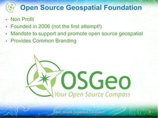
Open Source Geospatial
                       Foundation


                                    Jody Garnett


Open Source Geospatial Foundation                  1
Introductions


•   Australia                           •   GeoTools
•   Founded 1994                        •   GeoServer
•   Integration                         •   uDig
•   End to End                          •   OSGeo Charter Member
     – Solutions / Services                  – Incubation committee
     – Support


                      Open Source Geospatial Foundation               2
Did you Read the Title Page?
• Creative Commons License!
• This is worth getting excited about:


• Not just for books and presentations
• Governments around the world pushing to have public
  information available
   – 2008 Decree for Brazil
   – Chile is working on it
   – Australia is in process


                     Open Source Geospatial Foundation   3
Open Source GeoSpatial Foundation
• Open Source
   – DOD Memo
   – OSGeo Japan
• GeoSpatial
   – Standards
• Foundation
   – History and Organization


                    Open Source Geospatial Foundation   4
Open Source Geospatial Foundation
•   Non Profit
•   Founded in 2006 (not the first attempt!)
•   Mandate to support and promote open source geospatial
•   Provides Common Branding


                     Open Source Geospatial Foundation      5
OSGeo Organization

                        Board of
                        Directors


                                    Executive
             Officers
                                    Director


                         Local
Committees                                        Projects
                        Chapters


                        Members


              Open Source Geospatial Foundation              6
Volunteer Committees


 Incubation         Conference                     Funding


 Marketing        Public Geodata                   Education


System Admin          Website                       Journal


               Open Source Geospatial Foundation               7
Local Chapters
• Local (or Language) Promotion of OSGeo
   – Presence at Conferences and Workshops
   – Networking (ie beer)
• Seventeen official local chatpers
• Seven more in formation
   – Brazilian OSGeo Chapter
   – Aust-NZ Chapter

        OSGeo
      ? Brasil


                  Open Source Geospatial Foundation   8
Momentum
• steady stream of chatter on Internet Relay Chat #osgeo
• Annual “Free and Open Source Software for
  Geomatics”(FOSS4G) conference mark's year end
• Initial batch of projects allowed the foundation to cut its teeth
   – Open Source
   – Open Development
• Additional projects joining now
   – PostGIS is now accepted into incubation
   – GeoServer is now accepted into incubation


                      Open Source Geospatial Foundation          9
Department of Defence Memo
•   October 16 memo clarifying guidance regarding OSS
•   OSS meets the definition of “commercial computer software”
•   Market research for software should include OSS
•   Positive aspects of OSS
     – Continuous broad peer-review
     – Ability to modify software .. to respond more rapidly
     – Operated and maintained by multiple vendors
     – Mitigate risk of cost growth due to licensing
     – Sharing maintenance to reduce total cost


                      Open Source Geospatial Foundation     10
And a few Tricky bits
• Must ensure that the plan for software support is adequate
  (e.g., commercial or Government program office support)
• many open source licenses permit the user to modify OSS
  for internal use without being obligated to distribute source
  code to the public
• Release to the public when
   – It is in the Governments interest to do so
   – The government has the rights to do so
   – Release is not restricted by law


                     Open Source Geospatial Foundation        11
Geospatial and Standards
• Allow us to work together!
• We tend to follow OGC Standards
• OGC uses open source “Reference Implementations” and
  has a memorandum of understanding


       WMTS         Publication       Catalog           Database         GML
                                                                         KML
                                                                        GeoRSS


    Disk Array          Application Server                    Information

 DMZ             Enterprise Services

                    Open Source Geospatial Foundation                            12
Open Source Implementations
• Choosing is hard!
• And having a choice is great


     TileCache      GeoServer       GeoNetwork          PostGIS             Files


    Disk Array         Application Server                     Information

 DMZ             Enterprise Services


                    Open Source Geospatial Foundation                               13
Choice
                                                                          OSM
              OpenLayers      Map Bender                                                            gvSig Mobile


Browser                                                          Data Products             Mobile

                  Grass GIS          JUMP                           QuantumGIS            uDig         gvSig


Desktop


  TileCache            MapServer            GeoServer         deegree        GeoNetwork             PostGIS


Disk Array                                              Application Server                       Information

DMZ                Enterprise Services

                                    Open Source Geospatial Foundation                                          14
More
                                            MapGuide OS                        Mapserver


                                                   FDO

                          SAGA
WorldWind


                 GRASS                                          PROJ                                                MySQL


                 QGIS                                                                                               PostGIS
 ILWIS
                                                            GDAL/OGR                 GEOS
 OSSIM


            gvSigMobile
CatMDEdit                        gvSig                   ImageIO-EXT                  JTS
            SEXTANTE
                                                                                                        DeeGree
                                                                                             WKT4J
 Kosmo                    JUMP


OpenJump                                                                                               GeoServer     GeoNetwork
                                                                              GeoTools

deeJUMP                                                                                       Batik
                 Spatial Data Intergrator                uDig

GeoPISTA                                                                                     GeoAPI

                                         DIVAGIS         JGrass


                                                                   monoGIS   Geotools.Net              OpenLayers    Chameleon

                                                                                                                     MapBuilder
                          MapWindow
                                                                                                                       Ka-Map
                                                                                            SharpMap
                                                                                                                      CartoWeb
                                                                              NTS
                                                                                                                     MapBender


                                                           Friendly Survey - Tour                                       15
Open Source Take 2 FOSS4G Japan
        Video From OSGeo Japan


        Open Source Geospatial Foundation   16
Song 1 Ease of Use
FOSS4G is damn simple              • Seriously easy of use is key
                                   • We have about 10 minuets
FOSS4G,FOSS4G,FOSS4G,                of your time
it's easy                            (before you move on)
FOSS4G,FOSS4G, FOSS4G,             • time is spent on testing,
it's soooo easy!                     installers, user mailing lists


                 Open Source Geospatial Foundation              17
Song 2 Community Spirit
I can make                           • Fitness of purpose
your wish come true                  • There is no reason not to
with this software,                    have fun when you are
it will right now                      doing excellent work
if you do GIS thing,                 • Open source is a very
FOSS4G is the best choice              public process that really
                                       supports Quality


                   Open Source Geospatial Foundation                18
Song 3 Participation
you don't need no money               • It is true the software is free
you can do it as much as you            to download and try out
want                                  • We do recommend
'cause this is the fruit of             supporting your local
everyone's passion and effort           developers
so why don't you join us?


                    Open Source Geospatial Foundation               19
Song 4 Welcome to OSGeo
anyone can do it,                       • Welcome!
you can do it                           • Welcome to Geolivre
you use it, we share it                 • Welcome to OSGeo


                      Open Source Geospatial Foundation         20
Thank You
• Questions?
• See you in Barcelona


                   Open Source Geospatial Foundation   21

Uma introdução ao Open Geospatial Foundation

  • 1.
    Open Source Geospatial Foundation Jody Garnett Open Source Geospatial Foundation 1
  • 2.
    Introductions • Australia • GeoTools • Founded 1994 • GeoServer • Integration • uDig • End to End • OSGeo Charter Member – Solutions / Services – Incubation committee – Support Open Source Geospatial Foundation 2
  • 3.
    Did you Readthe Title Page? • Creative Commons License! • This is worth getting excited about: • Not just for books and presentations • Governments around the world pushing to have public information available – 2008 Decree for Brazil – Chile is working on it – Australia is in process Open Source Geospatial Foundation 3
  • 4.
    Open Source GeoSpatialFoundation • Open Source – DOD Memo – OSGeo Japan • GeoSpatial – Standards • Foundation – History and Organization Open Source Geospatial Foundation 4
  • 5.
    Open Source GeospatialFoundation • Non Profit • Founded in 2006 (not the first attempt!) • Mandate to support and promote open source geospatial • Provides Common Branding Open Source Geospatial Foundation 5
  • 6.
    OSGeo Organization Board of Directors Executive Officers Director Local Committees Projects Chapters Members Open Source Geospatial Foundation 6
  • 7.
    Volunteer Committees Incubation Conference Funding Marketing Public Geodata Education System Admin Website Journal Open Source Geospatial Foundation 7
  • 8.
    Local Chapters • Local(or Language) Promotion of OSGeo – Presence at Conferences and Workshops – Networking (ie beer) • Seventeen official local chatpers • Seven more in formation – Brazilian OSGeo Chapter – Aust-NZ Chapter OSGeo ? Brasil Open Source Geospatial Foundation 8
  • 9.
    Momentum • steady streamof chatter on Internet Relay Chat #osgeo • Annual “Free and Open Source Software for Geomatics”(FOSS4G) conference mark's year end • Initial batch of projects allowed the foundation to cut its teeth – Open Source – Open Development • Additional projects joining now – PostGIS is now accepted into incubation – GeoServer is now accepted into incubation Open Source Geospatial Foundation 9
  • 10.
    Department of DefenceMemo • October 16 memo clarifying guidance regarding OSS • OSS meets the definition of “commercial computer software” • Market research for software should include OSS • Positive aspects of OSS – Continuous broad peer-review – Ability to modify software .. to respond more rapidly – Operated and maintained by multiple vendors – Mitigate risk of cost growth due to licensing – Sharing maintenance to reduce total cost Open Source Geospatial Foundation 10
  • 11.
    And a fewTricky bits • Must ensure that the plan for software support is adequate (e.g., commercial or Government program office support) • many open source licenses permit the user to modify OSS for internal use without being obligated to distribute source code to the public • Release to the public when – It is in the Governments interest to do so – The government has the rights to do so – Release is not restricted by law Open Source Geospatial Foundation 11
  • 12.
    Geospatial and Standards •Allow us to work together! • We tend to follow OGC Standards • OGC uses open source “Reference Implementations” and has a memorandum of understanding WMTS Publication Catalog Database GML KML GeoRSS Disk Array Application Server Information DMZ Enterprise Services Open Source Geospatial Foundation 12
  • 13.
    Open Source Implementations •Choosing is hard! • And having a choice is great TileCache GeoServer GeoNetwork PostGIS Files Disk Array Application Server Information DMZ Enterprise Services Open Source Geospatial Foundation 13
  • 14.
    Choice OSM OpenLayers Map Bender gvSig Mobile Browser Data Products Mobile Grass GIS JUMP QuantumGIS uDig gvSig Desktop TileCache MapServer GeoServer deegree GeoNetwork PostGIS Disk Array Application Server Information DMZ Enterprise Services Open Source Geospatial Foundation 14
  • 15.
    More MapGuide OS Mapserver FDO SAGA WorldWind GRASS PROJ MySQL QGIS PostGIS ILWIS GDAL/OGR GEOS OSSIM gvSigMobile CatMDEdit gvSig ImageIO-EXT JTS SEXTANTE DeeGree WKT4J Kosmo JUMP OpenJump GeoServer GeoNetwork GeoTools deeJUMP Batik Spatial Data Intergrator uDig GeoPISTA GeoAPI DIVAGIS JGrass monoGIS Geotools.Net OpenLayers Chameleon MapBuilder MapWindow Ka-Map SharpMap CartoWeb NTS MapBender Friendly Survey - Tour 15
  • 16.
    Open Source Take2 FOSS4G Japan Video From OSGeo Japan Open Source Geospatial Foundation 16
  • 17.
    Song 1 Easeof Use FOSS4G is damn simple • Seriously easy of use is key • We have about 10 minuets FOSS4G,FOSS4G,FOSS4G, of your time it's easy (before you move on) FOSS4G,FOSS4G, FOSS4G, • time is spent on testing, it's soooo easy! installers, user mailing lists Open Source Geospatial Foundation 17
  • 18.
    Song 2 CommunitySpirit I can make • Fitness of purpose your wish come true • There is no reason not to with this software, have fun when you are it will right now doing excellent work if you do GIS thing, • Open source is a very FOSS4G is the best choice public process that really supports Quality Open Source Geospatial Foundation 18
  • 19.
    Song 3 Participation youdon't need no money • It is true the software is free you can do it as much as you to download and try out want • We do recommend 'cause this is the fruit of supporting your local everyone's passion and effort developers so why don't you join us? Open Source Geospatial Foundation 19
  • 20.
    Song 4 Welcometo OSGeo anyone can do it, • Welcome! you can do it • Welcome to Geolivre you use it, we share it • Welcome to OSGeo Open Source Geospatial Foundation 20
  • 21.
    Thank You • Questions? •See you in Barcelona Open Source Geospatial Foundation 21