Download as PDF, PPTX
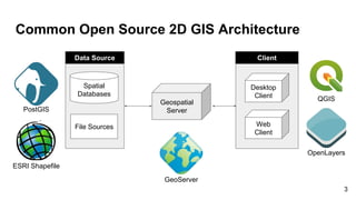
![New Open Source 3D GIS Stack
DBMS/File
GeoTools
GeoServer
Services/Applications
OS
Cesium/NASA World Wind/QGIS
Ubuntu/CentOS
Oracle/PostGIS
FeatureStore
(Well defined)
GML/ShapeFile...
I/O Plugins
[GeoJSON, ShapeFIle…]
DataStores
[JDBCDataStore/FileDataStore]
Query/Filter
(JTS Only)
WPS Process
(JTS Only)
SQLDialect
Data Management
[Vector, DB]
Services
[WFS, WCS, WPS, WMS]
Web Administration
UI
Oracle
PostGIS
SFCGAL Extension
New DataStores
(uses ISO Geometry)
New SQLDialect, I/O Plugin
(type mapping to ISO Geometry)
New FilterFactory,
(uses SFCGAL query evaluation)
WPS Process
(new proc using ISO geometry)
GeoServer 3D Extension
XML Binidng
(JTS Only)
XML Binding
(uses ISO geometry)
WFS 1.1 Service
(uses ISO geometry)
14](https://image.slidesharecdn.com/foss4g-2017-kansai-ryoo-kim-171023093829/85/Foss4-g-2017-kansai-ryoo-kim-14-320.jpg)

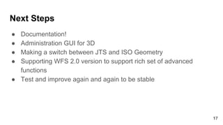


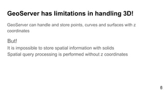
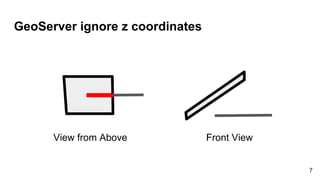
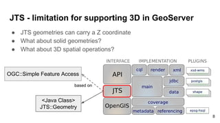
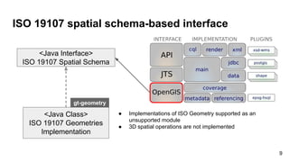
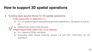
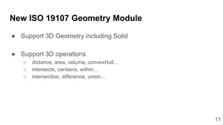
The document discusses the development of a GeoTools/GeoServer extension to handle three-dimensional geospatial data, addressing the current limitations of GeoServer that prevent effective storage and processing of 3D spatial information. It outlines proposed solutions, including the integration of an ISO 19107 geometry module, leveraging existing open-source libraries for 3D spatial operations, and strategies for implementation. Future steps include enhancing documentation, creating administration interfaces, and ensuring compatibility with advanced WFS versions.


![[FOSS4G 2017 Boston]Development of an extension of Geoserver for handling 3D ...](https://cdn.slidesharecdn.com/ss_thumbnails/v2oglr9ztj6rozsfllyr-signature-7a758961d3f50ce339111f96a982ffa97fdeafa443a72eaf3f00f44b1d62f961-poli-170822063420-thumbnail.jpg?width=640&height=640&fit=bounds)


