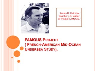
FAMOUS PROJECT
( FRENCH-AMERICAN MID-OCEAN
UNDERSEA STUDY).
James R. Heirtzler
was the U.S. leader
of Project FAMOUS.
 Classic survey of part of the Mid-Atlantic Ridge in 1970s.
 Provide understanding in pattern of volcanism, fissuring, rifting and
dykes injection that occur along ocean ridge axes.
 Start in 1971.
 As theory of sea floor spreading and plate tectonic being
accepted.
 Right time plate are generate ( oceanic ridge).
 Area of study:
 Small segment of Mid-Atlantic Ridge, southwest Azores.
 Boundary between African and American plate.
 Reason this area chosen:
 Aeromagnetic survey show clear central magnetic anomaly.
 Not far from port of Ponta Delgada .
 A series of bathymetric survey carried out to produce maps.
 On maps (Figure 4.5), transform fault can be seen.
 Figure 4.6Inner rift floor is 2.5km depth and contain small hills
such as Mount Venus and Mount Pluto.
TECHNIQUE.
 Almost every marine geological and geophysical
was used.
 Many technique not for marine studies and had to
be modified for FAMOUS project.
NAVIGATION SYSTEM.
 High precision required cause navigation problem
become acute.
 Solved by:
 By develop acoustic navigation system.
 Used acoustic transponder placed on sea floor and
linked to ship and submersible.
 Equipment proved adaptable.
 Can be used with other instrument packages that
towed near sea-floor.
SIDE-SCAN SONAR.
 GLORIA is a side-scan echo-sounding system contribute by
British.
 Gave image of sea-floor topography.
 The topography photo is built up by mosaic the records.
 For FAMOUS, side-scan sonar mosaic obtained by
combine overlapping sonographs.
 Useful for:
 Identify the major fault scarp.
 Determine the limit extent of fracture zone .
LIBEC
(LIGHT BEHIND CAMERA SYSTEM).
 Overcome field of view (FOV) and
underwater photo quality that cause by
limited light scattering.
 High intensity LIBEC towed above sea floor
and give large area photo.
 By taking many photo in rapid succession 
proved possible to build photomosaic of
sea-floor.
The LIBEC system shot 120-foot-
wide sections of the seafloor that
were pieced together. (Courtesy of
U.S. Naval Research Laboratory)
Project FAMOUS used the U.S.
Navy’s LIBEC camera system, which
suspended high-intensity electronic
flash lamps well above the ocean
bottom.
NARROW-BEAM ECHO –SOUNDER..
 Conventional echo-sounder beam width about 30º.
 Inadequate as the resolution more than 1km.
 Using US navy system (ALVIN) with beam width 2º.
 Much smaller object can be detect.
 Give submersible preparation guide.
 System have same FOV with submersible.
 Ease the manned submersible survey.
 Submersible designed with titanium hull for it work
under high pressure.
 Various sampling devices added:
 One arm manipulator pick specimen.
 Bag to collect loose sediment.
Alvin
French submersible Cyana
INTERPRETATION OF FAMOUS
DATA…
Assumption…
 The features on the topographic map is the result of
volcanism.
 Thus, each hill-like feature should have volcanic
vents at or near the top and flow direction radiating
from it.
EVOLUTION OF THE RIFT-VALLEY
FLOOR…
 Figure 4.15 and 4.16 shows the successive stages
in the formation of 2 – 3 km wide strips of new
oceanic crust either side of the Mid-Atlantic Ridge
during the last 200,000 years.
 The process are consistent with a (half) spreading
rate of 1 - 2cm per year.
EVOLUTION OF THE RIFT-VALLEY
FLOOR…
 The frequency of volcanic events varies
appreciably. By the time it was built up, each
volcano would be underlain by a swarm of dykes
emanating from the magma chamber beneath.
 Subsided and rifting process occurred. Rifts mostly
form beside either to the east or the west of each
volcano. Each new phase of volcano-building
develops about the latest rift. New volcanoes will
take up space so the older volcanoes are move
aside to accommodate them.
EVOLUTION OF THE RIFT-VALLEY
FLOOR…
 About 100,000 years old, the volcanic hills are
sufficiently far from the axis to be uplifted by faults
which mostly dip inwards from the walls.
 After 200,000 years, the volcanoes heave been
upfaulted completely out of the valley floor to the
tops of the walls.
PLAY
Thank you…

Famous project

  • 1.
    FAMOUS PROJECT ( FRENCH-AMERICANMID-OCEAN UNDERSEA STUDY). James R. Heirtzler was the U.S. leader of Project FAMOUS.
  • 2.
     Classic surveyof part of the Mid-Atlantic Ridge in 1970s.  Provide understanding in pattern of volcanism, fissuring, rifting and dykes injection that occur along ocean ridge axes.  Start in 1971.  As theory of sea floor spreading and plate tectonic being accepted.  Right time plate are generate ( oceanic ridge).  Area of study:  Small segment of Mid-Atlantic Ridge, southwest Azores.  Boundary between African and American plate.  Reason this area chosen:  Aeromagnetic survey show clear central magnetic anomaly.  Not far from port of Ponta Delgada .  A series of bathymetric survey carried out to produce maps.  On maps (Figure 4.5), transform fault can be seen.  Figure 4.6Inner rift floor is 2.5km depth and contain small hills such as Mount Venus and Mount Pluto.
  • 3.
    TECHNIQUE.  Almost everymarine geological and geophysical was used.  Many technique not for marine studies and had to be modified for FAMOUS project.
  • 4.
    NAVIGATION SYSTEM.  Highprecision required cause navigation problem become acute.  Solved by:  By develop acoustic navigation system.  Used acoustic transponder placed on sea floor and linked to ship and submersible.  Equipment proved adaptable.  Can be used with other instrument packages that towed near sea-floor.
  • 5.
    SIDE-SCAN SONAR.  GLORIAis a side-scan echo-sounding system contribute by British.  Gave image of sea-floor topography.  The topography photo is built up by mosaic the records.  For FAMOUS, side-scan sonar mosaic obtained by combine overlapping sonographs.  Useful for:  Identify the major fault scarp.  Determine the limit extent of fracture zone .
  • 6.
    LIBEC (LIGHT BEHIND CAMERASYSTEM).  Overcome field of view (FOV) and underwater photo quality that cause by limited light scattering.  High intensity LIBEC towed above sea floor and give large area photo.  By taking many photo in rapid succession  proved possible to build photomosaic of sea-floor.
  • 7.
    The LIBEC systemshot 120-foot- wide sections of the seafloor that were pieced together. (Courtesy of U.S. Naval Research Laboratory) Project FAMOUS used the U.S. Navy’s LIBEC camera system, which suspended high-intensity electronic flash lamps well above the ocean bottom.
  • 8.
    NARROW-BEAM ECHO –SOUNDER.. Conventional echo-sounder beam width about 30º.  Inadequate as the resolution more than 1km.  Using US navy system (ALVIN) with beam width 2º.  Much smaller object can be detect.  Give submersible preparation guide.  System have same FOV with submersible.  Ease the manned submersible survey.  Submersible designed with titanium hull for it work under high pressure.  Various sampling devices added:  One arm manipulator pick specimen.  Bag to collect loose sediment.
  • 9.
  • 10.
    INTERPRETATION OF FAMOUS DATA… Assumption… The features on the topographic map is the result of volcanism.  Thus, each hill-like feature should have volcanic vents at or near the top and flow direction radiating from it.
  • 11.
    EVOLUTION OF THERIFT-VALLEY FLOOR…  Figure 4.15 and 4.16 shows the successive stages in the formation of 2 – 3 km wide strips of new oceanic crust either side of the Mid-Atlantic Ridge during the last 200,000 years.  The process are consistent with a (half) spreading rate of 1 - 2cm per year.
  • 12.
    EVOLUTION OF THERIFT-VALLEY FLOOR…  The frequency of volcanic events varies appreciably. By the time it was built up, each volcano would be underlain by a swarm of dykes emanating from the magma chamber beneath.  Subsided and rifting process occurred. Rifts mostly form beside either to the east or the west of each volcano. Each new phase of volcano-building develops about the latest rift. New volcanoes will take up space so the older volcanoes are move aside to accommodate them.
  • 13.
    EVOLUTION OF THERIFT-VALLEY FLOOR…  About 100,000 years old, the volcanic hills are sufficiently far from the axis to be uplifted by faults which mostly dip inwards from the walls.  After 200,000 years, the volcanoes heave been upfaulted completely out of the valley floor to the tops of the walls.
  • 14.