Wind power impacts presentation by University of Rhode Island researchers Teresa Crean and Dr. Gopu Potty. For more information on the project, visit: http://seagrant.gso.uri.edu/resp/
The document summarizes a New York City case study that used LiDAR to create a high-accuracy 3D model of the city to analyze solar potential. Key points:
1) LiDAR was used to collect over 15 billion data points covering 362 square miles to create a detailed 3D model of NYC buildings and terrain.
2) The project partners were various NYC agencies and CUNY who collaborated to analyze solar potential and support the city's strategic energy plan.
3) The 3D model allowed for detailed analysis of solar radiation and shadows at specific locations to identify prime areas for solar installations.
This document summarizes a workshop on blending religious life and sustainable design. It discusses learning objectives around incorporating sustainability to reduce costs and environmental impact. It also covers defining strategies for making existing religious facilities more sustainable. The document provides information on sustainable approaches, technologies, and strategies to achieve goals like indoor air quality, energy efficiency, water conservation and cost savings.
The document summarizes a proposed redevelopment project in the Fountain District of Bellingham, Washington aimed at achieving LEED ND certification. It evaluates the site under the current conditions and with alternative redevelopment actions. Currently, the site scores well in Smart Location and Linkage but is lacking in other categories. With alternative actions like increasing density and including affordable housing, the redevelopment has the potential to achieve Gold certification and make the area more sustainable and livable.
This document discusses lessons learned from recent attempts at planning sustainable communities. It provides an overview of frameworks for understanding sustainability, including One Planet Living and LEED-ND. The primary challenges to achieving net-zero communities are also examined. Lastly, it emphasizes integrating sustainability into all aspects of the planning process from the beginning.
Exploring CEQA and the Air Quality Benefits of Good Land Usegbeltalliance
The document discusses the California Environmental Quality Act (CEQA) and how it relates to air quality benefits from good land use. It provides an overview of CEQA, the project review and timeline under CEQA, types of environmental impacts that are considered, ways of measuring impacts, mitigating significant impacts, and how to comment during public review. It also discusses the Bay Area Air Quality Management District's efforts to improve air quality through partnerships with local governments to support smart growth land use planning that reduces vehicle emissions.
Laurie Reilly - NY Community solar confluence presentationJoy Hughes
Laurie Reilly of sustainable CUNY presents on the New York City solar map. Presented at the Community Solar Confluence, April 23, 2012. Used by permission.
Leed 2009 for neighborhood development rating systemwhit1
This document provides an overview of the LEED 2009 for Neighborhood Development Rating System. It was created by the Congress for the New Urbanism, Natural Resources Defense Council, and the U.S. Green Building Council. The rating system aims to certify sustainable neighborhood design with points awarded in categories like Smart Location and Linkage, Neighborhood Pattern and Design, and Green Infrastructure and Buildings. Up to 110 total points are possible if bonus points are earned.
CA: Bay Friendly Landscaping Resource GuideSotirakou964
This document provides guidelines for environmentally friendly landscaping practices. It is organized around seven principles: 1) Landscape Locally, 2) Landscape for Less to the Landfill, 3) Nurture the Soil, 4) Conserve Water, 5) Conserve Energy, 6) Protect Water & Air Quality, and 7) Create & Protect Wildlife Habitat. For each principle, it lists specific practices and applications. The goal is for landscape professionals to consider these practices to design, construct, and maintain landscapes in a sustainable way that preserves natural resources and reduces waste.
This document provides an overview and summary of the Green Your Home workshop presented by Jonathan McGovern. The workshop covers motivations for greening your home, laying the groundwork by addressing common fears, the four steps to greening your home including prioritizing zones, and getting projects completed. Resources for rebates and incentives are also provided. Attendees are encouraged to read more on greening their home and create a prioritized project list.
Matthew Porrecca, Associate Principal, BNIM Architecture
Revitalizing Communities By Design
Regenerative design and development could be incredibly simple. It merely requires taking time in a place to uncover stories, discover patterns, find essence, and then add value in any way that improves the capacity of a place to be whole, vital and evolving. Together with our clients and collaborators, we are taking steps to maximize social health, invigorate a sustainable economy and restore natural systems. This workshop explores essential questions that hold the keys to a broad-based shift toward regenerative practice. We’ll share our observations, process, projects, and metrics while drawing participants into a rich dialog of discovery.
The document discusses how satellite imagery can support crisis response efforts by providing the right data at the right time to the right users. It outlines GeoEye's capabilities to collect and archive imagery that can then be easily accessed and shared through ArcGIS online mapping tools to support emergency planning, response, and recovery from natural disasters and other crises. Key requirements for imagery during crises are that it be fast, current, easy to access and share.
This document summarizes research from Nancy Clanton and Associates and the Virginia Tech Transportation Institute on the factors that influence visibility at night and people's perceptions of street lighting. The research involved temporary lighting installations in four cities - Anchorage, San Jose, Seattle, and San Diego - testing different lamp types and illumination levels. Participants provided subjective feedback by walking through the lit areas and rating their comfort and safety, and objective data was collected by having participants identify colored targets from a vehicle and measuring visibility distances. The research found that color, intensity and distribution of light, as well as pavement conditions, all impacted visibility. It observed differences between cities related to geography and psychology, and suggested lighting levels in Anchorage were higher than most cities
The document discusses how a design group redesigns, reinvents, and rethinks existing commercial properties through various tactics like cosmetic improvements, renovation, and expansion to breathe new life into underperforming spaces and meet changing market needs. They leverage architectural and graphic elements to create unique identities and improve visitor experiences. Before and after images show renovated and expanded shopping centers and town squares.
Greensburg | The Green Rebirth of a Kansas CommunityBNIM
The document summarizes BNIM's involvement in rebuilding the town of Greensburg, Kansas after it was nearly destroyed by an EF5 tornado in 2007. BNIM designed and built several high-performance green buildings in Greensburg, including City Hall and the Kiowa County Schools, both of which achieved substantial energy savings compared to conventional buildings. President Obama cited Greensburg as a model for how renewable energy can power an entire community and bring economic opportunities.
This document provides a summary of:
1) The Community Engagement and Stakeholder Management Plan for the construction and operation of the Murrumbidgee to Googong Water Transfer project outlines commitments to ongoing consultation with the community and stakeholders.
2) It details environmental commitments and conditions of approval from the project's Environmental Impact Statement and Development Approvals that must be addressed in the plan.
3) Key commitments include ongoing community consultation, addressing issues like noise management and traffic disruptions, and working with local groups on initiatives like revegetation along Burra Creek.
This document provides a preliminary draft summary of the Grandview Small Area Plan for Edina, Minnesota. It includes an introduction that reviews the small area planning process and establishes the purpose and guiding principles. It also outlines the project schedule, approach, and background analysis. Key points covered include a review of the planning process to date, the purpose to engage stakeholders in redevelopment planning, and the project timeline and public engagement strategy.
Interesting study "Smarter Neighborhoods, Smarter City" contains detailed recommendations on how to help America's largest urban area - the City of New York - plan for more sustainable growth.
The document discusses sustainability initiatives in Bridgeport, Connecticut. It focuses on (1) reducing pollution and toxicity to improve human and environmental health, (2) decreasing waste and increasing recycled content, and (3) lowering non-renewable energy consumption and depletion of natural resources. The city aims to lead by example in government and encourage similar actions in households and businesses.
The document discusses green building and LEED certification. It summarizes that the Pirates baseball team recycled over 262 tons of materials in 2010. It then discusses how green building impacts owners, designers, engineers, contractors, tenants, and occupants. The rest of the document provides an overview of the green building movement, benefits of green buildings like energy and water savings, and an introduction to LEED certification including the rating system, prerequisites and credits.
Tools for Assessing Economic Effects of Renewable Resource Projectsriseagrant
This document summarizes a presentation about tools for assessing the economic effects of renewable resource projects. It discusses how economics studies can provide information on the financial impacts of renewable energy investments for communities and the economic impacts in terms of jobs and wages. It outlines three principal tasks for economic analyses: examining financial costs and revenues, economic impacts, and compensation to host communities. The presentation illustrates existing spreadsheet tools like CREST and RETScreen that can evaluate project costs and revenues, and the JEDI model for assessing economic impacts in terms of jobs, wages, and other indicators.
Sustainable construction aims to meet present needs without compromising future generations' ability to meet their own needs. It requires balancing environmental, social, and economic factors. In the U.S., buildings account for around 40% of carbon emissions, driving efforts to adopt sustainable practices. Codes and standards like LEED and Passive House certification provide frameworks for lower-impact design and construction. Major builders are incorporating energy efficiency despite higher upfront costs, recognizing longer-term savings and market advantages of sustainability.
Presentation on "greening the gray" projects in Onondaga County, NY. Presented at the 2012 NYWEA Conference by Bob Kukenberger, Gray Infrastructure Program Manager, CDM Smith.
Ted Ko, Clean Coalition presentation at SF Bay Area Community Solar Confluenc...Rosana Francescato
The document discusses the Clean Coalition's mission to implement policies that transition the world to cost-effective clean energy now. It notes that Germany has deployed significantly more solar capacity than California in recent years despite California having a better solar resource. This is because Germany's solar capacity is primarily small distributed rooftop systems under 2 MW, while California relies more on large centralized projects. It then defines the key aspects of "CLEAN programs", which use standardized contracts to remove barriers to small renewable energy projects, driving private investment and local economic benefits. The document advocates for expanding California's CLEAN programs to unlock its solar potential as other areas have done through similar policies.
The document discusses the LEED-ND pilot rating system, which evaluates the sustainability of neighborhood developments. It combines principles of smart growth, new urbanism, and green building. The rating system has 4 categories and 106 total points. Projects can be certified, silver, gold, or platinum. While the system encourages compact, mixed-use projects near transit, some prerequisites like wetland conservation and minimum densities are challenging. The Village at Taylor Pond case study aims to achieve LEED-ND certification for its residential and retail development on a previously industrial site in Massachusetts.
The document discusses the Beacon Communities Program, which provided funding for 17 communities to build and strengthen their healthcare infrastructure and exchange of health information. It highlights the goals of the program to demonstrate better care through health information technology (HIT), support lasting learning networks, and provide best practices for other communities. An overview is provided of the stakeholders, HIE capabilities, and selected performance metrics of 9 Beacon communities.
Grid Alternatives Solar - EE in HOME WorkshopICF_HCD
GRID Alternatives is a non-profit organization that aims to empower low-income communities through renewable energy and energy efficiency services. It provides free solar installation through volunteer teams and trains homeowners. The presentation discusses GRID's programs, solar basics, the benefits of solar for low-income families, incentives available, and how cities and non-profits can work together to increase access to solar for those in need.
The document summarizes activities from the 2012 UEDA Summit including research on regional trade centers (RTCs) in Iowa. It describes characteristics of RTCs and analyzes economic sustainability indicators for three RTCs - Carroll, Ft. Madison/Keokuk, and Centerville. For each RTC, it outlines key findings, collaborations with other organizations, and impactful projects and events stemming from the regional assessments.
This document provides an overview of community wind project development. It discusses what community wind is and its benefits. The development process involves several phases: project planning, development and organization, construction, operations and maintenance, and decommissioning. Key steps in project planning include forming a team, conducting feasibility studies, and developing a project plan. Subsequent phases involve site selection, permitting, land acquisitions, turbine selection, power purchase agreements, financing, and construction. Community wind can provide local economic and social benefits through locally-owned renewable energy projects.
This document outlines the steps for developing a community wind project. It discusses forming a project team, conducting feasibility studies on wind resources and site selection, and developing a project plan. It also describes acquiring land through leases or easements, obtaining permits and approvals, financing the project, and constructing the wind farm. The goal is to develop a locally-owned, commercial-scale wind project that provides economic and social benefits to the local community.
The document discusses preserving South County's iconic agricultural landscapes from development pressures. It notes the importance of South County's agricultural heritage and discusses using tools like CEQA to address issues from a proposed development in the Southeast Quadrant of Morgan Hill, including farmland conversion, urban sprawl, greenhouse gas emissions, and traffic congestion. It provides an overview of CEQA and the EIR process, and how comments can advocate for addressing impacts to agriculture, transportation, air quality and other environmental factors.
This document outlines the agenda and goals of a stakeholder meeting for the Rhode Island Renewable Energy Siting Partnership (RESP). The meeting covered land-based wind, solar, and hydropower energy, as well as the outcomes of researching renewable energy resources and their impacts. Future stakeholder meetings and library lectures were announced to continue engaging the public on informed renewable energy siting decisions.
Navigant Ca Rps Infocast Webinar 3 Feb2011fredwellington
This document provides a summary of California's evolving renewable portfolio standard. It discusses the state's renewable energy supply and demand, factors influencing the price of renewable energy credits, and implications for renewable energy developers, investors, and utilities. The presentation was prepared by Navigant Consulting, an expert consulting firm in renewable energy technology and strategy, for Infocast on California's renewable portfolio standard trends and implications.
Navigant Consulting is a global consulting firm specialized in renewable energy technology and strategy. It has over 1,900 consultants across 40 offices in 4 countries. Its renewable energy practice has 50 consultants with over 25 years of experience, and provides services to financial investors, utilities, private corporations, and government agencies for solar and wind projects, including due diligence, corporate strategy, and policy support. Key risks for renewable energy projects in Ontario are low, though some technology and resource risks can be moderate. Project due diligence examines technical factors like permitting and interconnection plans, as well as financial factors like capital costs and tax considerations, to de-risk investments.
The document summarizes a project review of the Landsat Data Continuity Mission (LDCM) conducted by the Standing Review Board (SRB). It discusses perspectives from the SRB Chair, Project Manager, and Review Manager. They emphasize developing a partnership with open communication between the project and SRB. The SRB provided recommendations to help the project succeed within requirements and schedule constraints. Conducting thorough planning and documentation for project reviews was important for the SRB to assess progress and ensure the success of the LDCM.
The document summarizes a project review of the Landsat Data Continuity Mission (LDCM) conducted by the Standing Review Board (SRB). It discusses perspectives from the SRB Chair, Project Manager, and Review Manager. They emphasize developing a partnership with open communication between the project and SRB. The SRB provided recommendations to help the project succeed within requirements and schedule constraints. Conducting thorough planning and documentation for project reviews was important for the SRB to assess progress and ensure the mission's success.
Day1- session 2: RCREEE Planned Activities in Support of the Development and ...RCREEE
RCREEE has several planned activities in 2010 to support the development and implementation of the Arab EE Directive. These include workshops on topics like end use EE, an EE promotion program with work packages on policy development, technology promotion, and capacity building. The program will also involve projects on standards and labeling, mandatory audits, and a country support project to improve relations and identify priority areas. The overall goals are to enhance EE regulations and policies, build regional and national capacities, and support the evaluation and assessment of EE measures, sectors and technologies.
The document discusses the steps involved in assessing visual impact for planning projects using 3D visualizations. It outlines 7 steps: 1) identifying resources, 2) establishing regional visibility through viewshed maps and analysis, 3) documenting visibility through high resolution photos, 4) selecting representative views, 5) creating simulations of the proposed project, 6) rating and reporting the visual impacts, and 7) mitigating potential impacts. It also explores using these visualization technologies for other purposes beyond visual impact assessment, such as stormwater demonstration, architectural design, and watershed analysis.
Many large-scale energy customers, from local governments to corporations, have set ambitious clean energy goals. Utility investments in renewables in the overall generation mix are important to achieving them. But there can be a number of barriers to the inclusion of solar and other renewables in utility long-term planning, including cost and technology assumptions, modeling approaches and scenario development. Large-scale energy customers and utilities have an opportunity and are increasingly taking action to update practices and address these barriers.
This presentation highlights ways that solar energy is currently considered and can be improved in utility long-term planning, and how customers are engaging in these plans to advance their clean energy goals.
This document provides an overview of making communities ready for plug-in electric vehicles (PEVs). It discusses PEV readiness programs from the Department of Energy and California Energy Commission. It identifies five key actions for communities to become PEV ready: 1) update zoning and parking rules, 2) update building codes, 3) streamline permitting and inspection, 4) participate in training and education, and 5) conduct outreach. The document also discusses measuring success, resources for communities, and additional readiness actions.
The document discusses how businesses can prepare for and address the financial impacts of carbon pricing and regulatory policies related to sustainability. It provides questions businesses should consider around how carbon pricing may affect their costs, revenues, and risk profile. It then outlines three keys to running an eco-efficient business: focusing on people, systems, and the external environment. Specific strategies are described, including conducting energy audits, sustainable procurement practices, and using tools to measure and report on sustainability performance.
Solar Resource Assessment, Dealing with the uncertaintyCarlos Pinto
The document summarizes a presentation given by Celso Costa of MEGAJOULE at the Romanian Solar Summit in November 2012. The presentation addressed solar resource assessment and dealing with uncertainty. It discussed MEGAJOULE's expertise in renewable energy consulting, when and how to assess solar projects, sources of uncertainty, and provided guidelines for improving solar resource assessments to reduce project risks and uncertainty.
A presentation about comprehensive wastewater planning at the town level. Presented by Dr. Robert Duncanson, Chatham Health & Environment Director, during the Buzzards Bay Coalition's 2013 Decision Makers Workshop series. Learn more at www.savebuzzardsbay.org/DecisionMakers
This document outlines a proposed update to the Tehachapi General Plan. It discusses maintaining Tehachapi's character as a small mountain town while managing development interest and community concerns. The document evaluates different planning approaches and develops a vision of 6 planning areas to guide growth. It proposes applying this community-generated vision through a regulatory system including a physically-based general plan with 8 elements to clearly convey the vision and tailor development to Tehachapi.
On April 26, David Rouse and Rob Kerns of WRT and Shawn McLaughlin, Union County, PA Planning Director, presented "The Sustainable Comprehensive Plan" at the American Planning Association's National Conference in Minneapolis. WRT's planners are developing an overall approach and specific techniques designed to integrate sustainability into plans and implementing regulations at scales ranging from cities and regions to downtowns and neighborhoods. The Union County Comprehensive Plan, which was featured in the presentation, represents an application of WRT's sustainable planning and zoning initiative. It includes sustainability principles and keys as an organizing framework, supported by specific actions and indicators to measure progress in achieving sustainability targets.
Union County is a rural county in central Pennsylvania that is rich in agricultural, natural, historic, and small town resources. The comprehensive plan, which is expected to be adopted by the county commissioners this summer, was prepared with extensive public participation using the "values-driven" planning process pioneered by WRT. Through this process county residents expressed a strong interest in energy conservation and other sustainability issues.
"Union County is remarkable in that it is a small community with limited fiscal and staff resources that has made a commitment to sustainability in its draft comprehensive plan," said David Rouse, WRT's principal-in-charge of the project. "We expect major cities such as Seattle, Portland, and New York City to lead the way in addressing issues such as climate change and peak oil. However, we need many more places like Union County to take on this challenge if we are to find our way to a sustainable future."
Rob Barber, CEO of Environmental Data Resources, welcomed attendees to EDR's annual property due diligence summit. EDR's mission is to illuminate the relationship between people, properties, structures, and the environment by blending information, applications, analytics, events, and customer service. Barber outlined EDR's focus on sourcing and creating new data, adding value to existing data, and delivering data to customers through the front end strategy. Specific initiatives included acquiring high-resolution geo-referenced historic aerial photography, partnering to obtain over 2.4 billion city directory records from 1992-2012 covering the entire US, and continuing to build their collection of over 3,000 historical city directories produced nationally.
Similar to An overview of wind power effects on visual impacts, electromagnetic interference, shadow flicker, and property value impacts (20)
2015 International Spatial Planning Symposium: Sharing Practical Solutions riseagrant
The document summarizes findings from a review of marine spatial plans around the world. It finds that most plans are implemented at smaller spatial scales than entire ecosystems. It also finds that few institutional changes are made to governing bodies to implement coastal and marine spatial planning, relying instead on existing agencies. Additionally, it notes that while formal decision support tools are used, informal expert judgment also plays a role. The main messages are that there is no single approach for marine spatial planning and that the value is in the planning process of engaging stakeholders as much as the final plan.
Five regional planning bodies have been established across the United States to coordinate ocean planning: the Northeast, Mid-Atlantic, Pacific Islands, Caribbean, and West Coast. The Northeast and Mid-Atlantic regions have established charters and are drafting regional marine plans to be completed in 2016. The Pacific Islands has a charter and is beginning to draft a plan, while the Caribbean is still finalizing its charter and the West Coast is working on one.
This document assessed the impact of past ocean management plans in several countries and U.S. states. It found that the plans supported $4.1 billion in ocean economies by siting wind farms and retaining existing industries. The plans also generated hundreds of millions of dollars annually in economic gains for new industries like wind power and retained billions within existing industries like fishing and tourism. While fishermen lost some access, they were compensated. The plans encouraged collaboration among stakeholders and expanded environmental protections over 50% of the planned areas while managing industrial growth. Future research on newer plans is needed to fully understand the long-term economic, environmental and social impacts of comprehensive ocean management.
The Block Island Wind Farm project will consist of 5 turbines generating 30 MW of energy, enough for 17,000 homes. Construction is underway and commercial operations are scheduled for 2016. The project has completed permitting, engineering, and financing. It will create over 300 construction jobs and establish a new cable to the mainland, positioning the US for national leadership in offshore wind.
This document provides a tutorial for using STORMTOOLS, a web-based mapping tool for understanding coastal flood risk in Rhode Island. It outlines how to access and use the various features and layers in STORMTOOLS to determine flood depths and impacts under different hurricane and sea level rise scenarios. Key features include zooming and panning the map, adjusting layer transparency, toggling layers on and off, and clicking on locations to view flood depths and identify emergency services. The tutorial is created by a team from the University of Rhode Island and the Rhode Island Coastal Resources Management Council.
Shoreline Change Special Area Management Plan (Beach SAMP) Stakeholder Meeting. Held on July 14, 2015. The purpose of the meeting was to review progress to date on development of tools, and discuss the next phase of the Beach SAMP porject.
Legal and Policy Strategies for SLAMM in Rhode Islandriseagrant
This document discusses potential legal and policy strategies for addressing sea level rise and marsh migration in Rhode Island. It examines transferred development rights and rolling easements as adaptive tools, noting that the strategies were researched by Sea Grant Law Fellows to help inform the SLAMM and Beach SAMP teams. The Beach SAMP process will further explore using these strategies as well as property rights and liability issues related to climate change impacts.
This document summarizes coastal wetland adaptation strategies presented at two municipal workshops in October 2014. The strategies included upland actions like facilitating marsh migration and removing barriers, as well as in-marsh actions like drainage improvements, elevation enhancement, and erosion control. Specific project examples were provided from locations around Rhode Island where marsh migration was being facilitated or impeded, and adaptation techniques like creek excavation and land protection were undertaken. Partnerships between municipalities, land trusts, and state agencies were noted as important for implementing projects costing $5,000 to $15,000 each to adapt coastal marshes to sea level rise.
Sea Level Rise & the Conservation of Wetlands: Issues and Opportunities for C...riseagrant
1) The document discusses how municipalities in Rhode Island can incorporate projections of sea level rise and coastal flooding from the SLAMM (Sea Level Affecting Marshes Model) into their local comprehensive plans and policies.
2) It provides examples of how North Kingstown used SLAMM maps and data to update hazard mitigation and adaptation strategies in their comprehensive plan.
3) The document outlines challenges municipalities may face in planning for sea level rise and adapting infrastructure, and compares approaches some other states have taken through regulations and designated planning areas.
This document summarizes several local case studies on coastal communities in Rhode Island that are vulnerable to sea level rise. It describes modeling of 1 foot, 3 foot, and 5 foot sea level rise scenarios for the communities of Jamestown, Barrington/Warren, and Charlestown. For each community, the document identifies current land uses and infrastructure that are at risk of flooding and inundation. It also provides potential issues and opportunities to address the impacts of sea level rise through actions such as elevating roads, relocating facilities, protecting undeveloped lands, and coordinating land management between stakeholders.
Sea Level Affecting Marshes Model (SLAMM)riseagrant
The Sea Level Affecting Marshes Model (SLAMM) simulates wetland conversions during sea level rise. It has been applied and improved since 1985 and used worldwide. The document describes how SLAMM models elevation, vegetation zones, accretion rates, and other parameters to project wetland impacts from sea level rise under various scenarios. It also notes limitations such as uncertainty in sea level projections and complexity of ground conditions and coastal dynamics.
Sea Levels Affecting Marshes Model Using SLAMM to Conserve Rhode Island’s Coa...riseagrant
This document summarizes information presented at a workshop on using the Sea Level Affecting Marshes Model (SLAMM) to project impacts of sea level rise on coastal wetlands in Rhode Island. Key points include:
- Tidal marshes provide important ecosystem services like habitat, water filtration, and flood protection. Rhode Island has lost over 50% of its historic salt marshes.
- Sea levels are rising faster in Rhode Island due to climate change, increasing the risk of wetland loss and property damage from flooding. The SLAMM model projects significant wetland loss under scenarios of 1, 3, and 5 feet of sea level rise.
- The SLAMM projections will help identify vulnerable wetlands and
RI Shoreline Change Special Area Management Planriseagrant
This document discusses planning for sea level rise in Rhode Island. It provides past, present and projected future rates of sea level rise. It identifies potential impacts of sea level rise such as erosion, overwash, wetland loss, and infrastructure failure. Maps show examples of projected inundation in Newport Harbor from 5 feet of sea level rise. The document outlines studies and data being collected on erosion rates, sediment transport, inundation mapping, and economic impacts. It discusses developing policy recommendations, education materials, and adaptation guidelines for municipalities. Products under development include updated erosion maps, economic analyses, and identification of at-risk infrastructure. The goal is to provide cities and towns with tools and lessons from other areas to help plan for and
STORMTOOLS* -Simplified Flood Inundation Maps for RI with Sea Level Rise (SLR)riseagrant
Malcolm L. Spaulding1
Chris Damon2
1Professor Emeritus, Ocean Engineering
2Environmental Data Center
University of RI
December 9, 2014
*http://www.beachsamp.org/research/stormtools/
Narragansett, RI
Key Tools for Businesses
Overview of tools and resources that can help businesses address priority resilience issues. Fortified Commercial ™ – Chuck Miccolis, Insurance Institute for Business and Home Safety
Lessons from Sandy and Green Infrastructure Strategies riseagrant
Hoboken, New Jersey—Lessons from Sandy and Green Infrastructure Strategy. How to prepare for the next storm and be creative with flood control. Presented by Stephen Marks, City of Hoboken
Key Tools for Businesses: An overview of tools and resources that can help businesses address priority resilience issues. Resilience Green Infrastructure presented by James Houle, Stormwater Center, University of New Hampshire.
Gulf of Mexico Alliance Resilient Marina Checklistriseagrant
Key Tools for Businesses: An overview of tools and resources that can help businesses address priority resilience issues. Resilience Checklist presented by Lauren Land, Louisiana Sea Grant College Program
This document provides an overview of wound healing, its functions, stages, mechanisms, factors affecting it, and complications.
A wound is a break in the integrity of the skin or tissues, which may be associated with disruption of the structure and function.
Healing is the body’s response to injury in an attempt to restore normal structure and functions.
Healing can occur in two ways: Regeneration and Repair
There are 4 phases of wound healing: hemostasis, inflammation, proliferation, and remodeling. This document also describes the mechanism of wound healing. Factors that affect healing include infection, uncontrolled diabetes, poor nutrition, age, anemia, the presence of foreign bodies, etc.
Complications of wound healing like infection, hyperpigmentation of scar, contractures, and keloid formation.
Temple of Asclepius in Thrace. Excavation resultsKrassimira Luka
The temple and the sanctuary around were dedicated to Asklepios Zmidrenus. This name has been known since 1875 when an inscription dedicated to him was discovered in Rome. The inscription is dated in 227 AD and was left by soldiers originating from the city of Philippopolis (modern Plovdiv).
Andreas Schleicher presents PISA 2022 Volume III - Creative Thinking - 18 Jun...EduSkills OECD
Andreas Schleicher, Director of Education and Skills at the OECD presents at the launch of PISA 2022 Volume III - Creative Minds, Creative Schools on 18 June 2024.
A Visual Guide to 1 Samuel | A Tale of Two HeartsSteve Thomason
These slides walk through the story of 1 Samuel. Samuel is the last judge of Israel. The people reject God and want a king. Saul is anointed as the first king, but he is not a good king. David, the shepherd boy is anointed and Saul is envious of him. David shows honor while Saul continues to self destruct.
Gender and Mental Health - Counselling and Family Therapy Applications and In...PsychoTech Services
A proprietary approach developed by bringing together the best of learning theories from Psychology, design principles from the world of visualization, and pedagogical methods from over a decade of training experience, that enables you to: Learn better, faster!
Elevate Your Nonprofit's Online Presence_ A Guide to Effective SEO Strategies...TechSoup
Whether you're new to SEO or looking to refine your existing strategies, this webinar will provide you with actionable insights and practical tips to elevate your nonprofit's online presence.
How to Manage Reception Report in Odoo 17Celine George
A business may deal with both sales and purchases occasionally. They buy things from vendors and then sell them to their customers. Such dealings can be confusing at times. Because multiple clients may inquire about the same product at the same time, after purchasing those products, customers must be assigned to them. Odoo has a tool called Reception Report that can be used to complete this assignment. By enabling this, a reception report comes automatically after confirming a receipt, from which we can assign products to orders.
Level 3 NCEA - NZ: A Nation In the Making 1872 - 1900 SML.pptHenry Hollis
The History of NZ 1870-1900.
Making of a Nation.
From the NZ Wars to Liberals,
Richard Seddon, George Grey,
Social Laboratory, New Zealand,
Confiscations, Kotahitanga, Kingitanga, Parliament, Suffrage, Repudiation, Economic Change, Agriculture, Gold Mining, Timber, Flax, Sheep, Dairying,
This presentation was provided by Rebecca Benner, Ph.D., of the American Society of Anesthesiologists, for the second session of NISO's 2024 Training Series "DEIA in the Scholarly Landscape." Session Two: 'Expanding Pathways to Publishing Careers,' was held June 13, 2024.
Leveraging Generative AI to Drive Nonprofit InnovationTechSoup
In this webinar, participants learned how to utilize Generative AI to streamline operations and elevate member engagement. Amazon Web Service experts provided a customer specific use cases and dived into low/no-code tools that are quick and easy to deploy through Amazon Web Service (AWS.)
spot a liar (Haiqa 146).pptx Technical writhing and presentation skills
An overview of wind power effects on visual impacts, electromagnetic interference, shadow flicker, and property value impacts
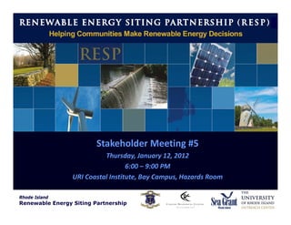
1. Rhode Island
Renewable Energy Siting Partnership
(RESP)
Stakeholder Meeting #5
Thursday, January 12, 2012
6:00 – 9:00 PM
URI Coastal Institute, Bay Campus, Hazards Room
Rhode Island
Renewable Energy Siting Partnership
2. Rhode Island
Renewable Energy Siting Partnership
(RESP)
Rhode Islanders will have access to relevant
information so they may make informed, fact‐
based decisions about renewable energy
Rhode Island
Renewable Energy Siting Partnership
5. RESP Outcomes
Research characterizing Rhode Island’s land‐based
renewable energy resources and evaluating its potential
effects on communities and the environment
Mapping products and siting decision support tools
A comprehensive online clearinghouse for Rhode Island
energy data and analytics
A public dialogue fostering and engaging a well‐informed &
well‐represented constituency
Rhode Island
Renewable Energy Siting Partnership
6. Project Phases
PHASE I: Issue Identification and Assessment (September – November 2011)
GOAL: Meet with stakeholders to identify issues of concern regarding the siting
and management of land‐based renewable energy. Identify existing research and
data. Understand past renewable energy efforts.
PHASE II: Information Synthesis and Communication (December 2011 – January 2012)
GOAL: Provide technical responses to the issues of concern identified by the
stakeholders during Phase I. Communicate to stakeholders the findings and
opportunities for continued engagement.
PHASE III: Develop Final Products (February – March 2012)
GOAL: Complete research products and develop specific siting and management
guidelines for land‐based renewable energy.
Rhode Island
Renewable Energy Siting Partnership
7. Visual Impacts
Subjective Issue
How do we quantify aesthetic/visual impacts and
establish evaluation criteria?
Rhode Island
Renewable Energy Siting Partnership
9. Visual Impacts
http://www.vermonterswithvision.org/sizecomparison.html
Rhode Island
Renewable Energy Siting Partnership
10. Clean Energy States Alliance, 2011
Rhode Island
Renewable Energy Siting Partnership
11. Visual Impacts
1. Size of turbine
2. Topography
3. Movement of the rotor/blades
4. Color of turbine components
5. Lighting
6. Signage
7. Weather conditions (cloudy vs. blue sky)
8. Seasons – trees with/without foliage
9. Proximity to valued cultural/historic
landscapes and scenic areas
Portsmouth High School, RI
Rhode Island
Renewable Energy Siting Partnership
14. Visual Impacts
Cultural, Historic, and Archaeological
Section 106 of National Historic Preservation Act
If project uses federal funds or requires federal
approval or permitting, SHPO must be consulted.
Define “APE” – Area of Potential Effect
Collect data on historical/culturally significant
properties within catchment area.
Rhode Island
Renewable Energy Siting Partnership
16. Visual Impacts
How can municipalities apply a
logical process to determining
the aesthetic/scenic/visual
impacts of wind power
projects?
• What are the responsibilities of the
developer?
• What are the responsibilities of the
City/Town?
• How should the public be engaged?
• What are the options to consider?
• Avoid
• Minimize
• Mitigate
Rhode Island
Renewable Energy Siting Partnership
17. Visual Impacts
“A Visual Impact Process for
Wind Energy Projects, 2011”
PROCESS:
Graphic Information:
• Project Map
• Viewshed Mapping
• Public Natural & Cultural Resources
• Viewpoints
• Document Character of Area
(photos)
• Photo Simulations of Project
Key Questions:
• What are project’s visual impacts?
• Will project have unreasonable or
undue visual impacts?
Rhode Island
Renewable Energy Siting Partnership
18. Visual Impacts
New York State Wind Energy Toolkit, 2009
QUESTIONS:
• To what extent is the turbine visible?
• When is the turbine visible (season, time of
day)?
• Who sees the turbine and under what
circumstances (season, light conditions, during
which activities)?
• To what extent does the visibility of the
project alter the character and quality of the
viewshed?
• What is the relationship of visual impacts to
the policies/values in the community?
Rhode Island
Renewable Energy Siting Partnership
19. Visual Impacts
New York State Wind Energy Toolkit, 2009
Visual Impact Analysis
Responsibilities of the Developer:
• Inventory scenic & aesthetic resources at state & local
level
• Prepare viewshed map
• Describe usage & aesthetic values within project area
• Reveal & characterize visual & aesthetic impacts of
project
• Employ mitigation strategies to minimize adverse
impacts
Responsibilities of the Town:
• Verify that project sponsor has inventoried significant
aesthetic resources, including from other jurisdictions
• Certify that impacts have been minimized
• Require project sponsors comply with mitigation
strategies
Rhode Island
Renewable Energy Siting Partnership
20. Visual Impacts
New York State Wind Energy Toolkit, 2009
Visual Impact Analysis (con’t)
Tools to describe and characterize visual
impacts:
• Viewshed map
• Visual simulations
• Line‐of‐sight profile
Mitigation Strategies:
• Downsizing
• Relocation
• Lighting
• Non‐specular materials
• Screening
• Camouflage
• Decommissioning
• Offsets
Rhode Island
Renewable Energy Siting Partnership
23. Visual Impacts
1. What is ‘visual impact’?
2. How are visual impacts assessed?
3. Responses to wind turbines in the
landscape?
4. What are concerns in RI related to
visual impact?
5. How have other states/countries
evaluated visual impacts of WTGs?
6. How can visual impacts be avoided
or mitigated?
7. Post installation, do impacts
change?
Rhode Island
Renewable Energy Siting Partnership
24. Visual Impacts
1. Attempt to quantify a
qualitative issue
2. Establish criteria for
assessment & accurately
predict impacts
3. Articulate clear expectations
& a process that the
developers, town officials,
and citizens can understand
Rhode Island
Renewable Energy Siting Partnership
25. Visual Impacts
Shadow Flicker
Rhode Island
Renewable Energy Siting Partnership
26. Discussion: Property Value Impacts
Process for evaluating impacts:
• Define the impact area
• Property sales data
• Statistical analysis to determine whether
wind project has influenced prices at which
properties have been sold
Rhode Island
Renewable Energy Siting Partnership
27. Discussion: Property Value Impacts
ISSUES:
• Property values fluctuate due to variety of factors, including local,
regional & national economic factors
• Can be considered subjective based on opinions of buyers and
sellers
• Consider potential tax revenue from wind energy projects to offset
local tax burdens, which may make a community more desirable.
• Research thus far has shown little measurable impact.
• Land transaction data – how many years of data is reasonable for
assessing impacts?
• What are realtors saying?
Rhode Island
Renewable Energy Siting Partnership
28. Property Value Impacts
“The Effect of Wind Development on
Local Property Values”, Renewable
Energy Policy Project, 2003
• 10 case studies, wind farms
>10MW,
• Property value data from
projects that came online
between 1998‐2001
• Conclusion: “…there is no
support for the claim that wind
development will harm property
values.”
Rhode Island
Renewable Energy Siting Partnership
29. Property Value Impacts
“The Impact of Wind Power Projects on
Residential Property Values in the United
States: A Multi‐Site Hedonic Analysis”, Hoen et
al, December 2009
• Reviewed available literature, 1996‐2009
• Concerns of possible impact of wind
projects on property values are reasonably
well established
• BUT, identified 7 shortcomings of existing
attempts to quantify impacts of wind
projects on residential property values
Rhode Island
Renewable Energy Siting Partnership
32. Property Value Impacts
“Wind Turbine Impact Study” Appraisal Group One, September 2009
• Study sponsor – Calumet County Citizens for Responsible Energy,
Wisconsin
• Literature study
• Realtor Opinion Survey
• Sales studies – compared vacant residential lot sales within the wind
turbine farm area to comparable sales located outside of the turbine
influence
“Field Guide to Wind Farms and their Effect on Property Values”, National
Association of Realtors, updated April 2011
• Summarizes current state of the wind industry
• Real estate‐related research and its critics
• Wind maps & regulations – where future projects are being considered
• Resources, both critical & supportive
Rhode Island
Renewable Energy Siting Partnership
33. Property Value Impacts
How should Rhode Island municipalities
assess property value impacts when
evaluating wind projects?
What mitigation measures would be
acceptable for projects where property
values are impacted?
Rhode Island
Renewable Energy Siting Partnership
35. RESP Online Resources
Interactive map viewer
Siting decision support tools
A comprehensive online clearinghouse for Rhode Island
energy data and analytics
Informational resources for citizens, businesses, decision‐
makers, communities, advocates…
Rhode Island
Renewable Energy Siting Partnership
36. RESP Online Resources
Interactive map viewer
Rhode Island
Renewable Energy Siting Partnership
38. RESP Online Resources
Interactive map viewer
Siting decision support tools
A comprehensive online clearinghouse for Rhode Island
energy data and analytics
Informational resources for citizens, businesses, decision‐
makers, communities, advocates…
Rhode Island
Renewable Energy Siting Partnership
39. RESP Online Resources
Siting decision support tools
• Resource availability
• Acoustics, shadow flicker, EMF
• Economics
Rhode Island
Renewable Energy Siting Partnership
40. RESP Online Resources
Interactive map viewer
Siting decision support tools
A comprehensive online clearinghouse for Rhode Island
energy data and analytics
Informational resources for citizens, businesses, decision‐
makers, communities, advocates…
Rhode Island
Renewable Energy Siting Partnership
41. RESP Online Resources
A comprehensive online clearinghouse for Rhode Island
energy data and analytics
Rhode Island
Renewable Energy Siting Partnership
42. RESP Online Resources
A comprehensive online clearinghouse for Rhode Island
energy data and analytics
Rhode Island
Renewable Energy Siting Partnership
43. RESP Online Resources
Interactive map viewer
Siting decision support tools
A comprehensive online clearinghouse for Rhode Island
energy data and analytics
Informational resources for citizens, businesses, decision‐
makers, communities, advocates…
Rhode Island
Renewable Energy Siting Partnership
44. RESP Online Resources
Informational resources for citizens, businesses, decision‐
makers, communities, advocates…
• Programs
• Policies
• Players
• Papers
Rhode Island
Renewable Energy Siting Partnership
45. Next Steps
• Stakeholder Meeting #6 – February 2, 2012
• Proposed Topics:
• Energy Data & Analytics
• Energy Data Visualization
• Online Resources
Rhode Island
Renewable Energy Siting Partnership
46. Next Steps
Library Lectures:
• Tuesday, January 24, 2012 What's in the Wind? Meteorological
Observations for Energy Siting
• Monday, February 6, 2012 Mapping Renewable Energy in Rhode
Island
• Wednesday, February 15, 2012 Science for Siting: Engineering for
Locating Wind Turbines
• Thursday, March 8, 2012 Wind Power and Wildlife: Assessing
Potential Impacts on Birds and Bats
Rhode Island
Renewable Energy Siting Partnership
47. Rhode Island
Renewable Energy Siting Partnership
(RESP)
Stakeholder Meeting #5
Thursday, January 12, 2012
6:00 – 9:00 PM
URI Coastal Institute, Bay Campus, Hazards Room
Rhode Island
Renewable Energy Siting Partnership