Visualizing history - A proposal for Augmentive Drones in Archaeology.
•Download as PPTX, PDF•
1 like•442 views

A report i'm working on for Archaeology sites, designed to incorporate drone technology and ubiquitous computing during the excavation process in Archaeology.
Report
Share
Report
Share

Recommended
ArchaeoSTOR Map: Publishing archaeological geodata on the web
http://dx.doi.org/10.1145/2345316.2345355
Modern field science, including archaeology, utilizes a mas- sive amount of digital data captured by state-of-the-art mea- surement instruments. Large archaeological data sets may include images, geospatial data, analytical data, and meta- data. Geospatial information plays a central role in the life cycle of those data; information is collected, organized, and published for analyses and visualization as final output us- ing geospatial data as an index. The web is an ideal place to publish scientific data and promote diverse collaboration, and thus we need a system to publish digital archaeologi- cal data efficiently so that it is also integrated in our data management workflow. In order to realize this goal, we designed and implemented a web-based application named ArcheoSTOR Map, which visualizes and publishes raw ar- chaeological data onto a map.
Lemmens kessler-agile-linked data v3-slideshare
Geo-Information Visualizations of Linked Data. Linked Data provides an ever-growing source of geographically referenced data for application development. In this paper, we analyse the workflow behind the development of such an application. Using two examples based on worldwide development aid and refugee data, we discuss the steps from locating data for use and data integration, up to the actual visualization in a web-based application. At each step, we discuss the skill set required for completion and point to potential challenges. This includes RDF, SPARQL, HTTP requests, HTML, and JavaScript. We conclude the paper by putting our case study in the context of GIScience curriculum development.
I ♥ Maps: Quantum GIS + Python
Quantum GIS (QGIS) is an open-source, highly customizable geospatial application that's great for data exploration, manipulation, and cartographic preparation -- in other words, it's software that allows you to make detailed, aesthetically-pleasing maps for free!
QGIS is also *extremely* script-able with Python, and integrates with a large number of database and analysis backends (GRASS, R, PostGIS, etc.). In this talk, Paige Bailey will be giving a short overview of QGIS; detailing a few mapping case studies; then showing how to leverage additional functionality by writing custom Python plugins.
The EnviroCar Platform: A Decentralized Approach to Monitoring Urban Traffic...
Presentation at Ground Transportation Technology Symposium: Big Data and Innovative Solutions for Safe,
Efficient and Sustainable Mobility. November 19, 2014 at
New York Institute of Technology (NYIT)
Bomb Sight presentation for Geomob London
Information about the Bomb Sight project (www.bombsight.org), mapping the World War 2 Blitz Bomb Census. Presented at Geomob London on 7th February 2013.
State briefing to asa april 2015
The document summarizes the state of the aerospace industry in Hawaii. It discusses Hawaii's assets like world-class astronomy facilities and sites for testing lunar and Mars analogues. It outlines several current and future aerospace projects and initiatives in Hawaii including hosting payloads for small satellite launches, supporting NASA missions, developing a commercial spaceport, and a student project to land an experiment on the Moon. The document positions Hawaii as an emerging leader in the aerospace industry and commercial space sector with opportunities for economic development and high-tech jobs.
Hawaii november conference outline
The document announces a conference from November 9-13, 2014 in Hawaii titled "The Next Giant Leap: Leveraging Lunar Resources for Sustainable Space Enterprise." The conference will discuss rationales for developing lunar resources, near-term development scenarios, and enabling mechanisms such as expanding space education and international partnerships. Conference deliverables will establish a vision and roadmap for leveraging lunar resources, prepare reports on next steps, and launch teams to coordinate long-term program development.
Geospatial trends
This document summarizes George Percivall's presentation on geospatial and geomatics trends at the 2013 TECTERRA Geomatics Showcase. Some of the key trends discussed include the power of location data and analytics, the rise of the Internet of Things and associated opportunities for geospatial processing and modeling, the mobile-first development landscape and standards like GeoPackage, opportunities in indoor mapping and modeling with IndoorGML, and advances in crowdsourced mapping, semantics, big data processing, and smart city applications. OGC standards play an important role in many of these emerging areas to support interoperability.
Where should-you-go
The document summarizes a project that develops a system to collect and analyze spatial-temporal data from web services in order to provide recommendations of places through geospatial analysis of real-time geostreams. It describes similar existing projects, challenges with resolving place equivalences across social networks, and lessons learned regarding hosting providers. The presentation concludes by discussing potential future work such as adding additional social networks, incorporating ratings into results, enabling place search and favorites without login, and developing a mobile application.
Get Big Geo Data
This document discusses developments in big geodata and its role in GIS. It encourages students to pay closer attention to data aspects of GIS and gain experience with large geodata sets. The presentation explains how data collection is changing from expert-driven and closed to crowd-sourced and open. Examples of big geodata sources include sensor data, social media, and the Internet of Things. Tips are provided for students to explore big geodata through MOOCs and recommended readings.
Establishment of Remote Sensing Data Centre in NAST
My presentation at the Faculty of Technology, Nepal Academy of Science and Technology during my tenure as a researcher. I discussed on how remote sensing is applicable in the context of Nepal and our vision of establishing a remote sensing data centre in NAST.
Crowd-Sourcing Approach of Building Ground Truth Database for Global Urban Ar...
This document proposes a crowd-sourcing approach to build a ground truth database for global urban area mapping. It describes existing ground truth data sources as being too scarce. It then outlines the design and implementation of a web-based crowd-sourcing system using free and open source software like MapServer, TinyOWS, and PostgreSQL to allow trained and untrained users to interpret satellite imagery and delineate urban boundaries from anywhere in the world. The system is intended to efficiently create a large ground truth dataset in a secure and organized manner.
[EN] Maps and Digital Tools For Activists [RO] Hărți și instrumente digitale ...
Hărți și instrumente digitale pentru activiști
Prezentare Fanfest 2015 @Caminul Cultural - Rosia Montana
Walking in the Cloud: A New Paradigm in Geospatial World
Cloud computing allows scalable and efficient use of computing resources in the internet cloud. The use of cloud computing is increasing across all the application domains, including in the field of GIS and remote sensing.
The advent of Google Earth Engine (GEE) in particular has brought about a revolutionary change in the way we use geospatial technology. The GEE is a cloud based geospatial platform that stores petabyte of satellite imagery and geospatial data and enables carrying out of complex image processing tasks and spatial analyses without the need of any GIS and remote sensing software.
Astute symposium 2013-10-10_mobile_emergencydispatching_bartadams
The document describes an emergency response demonstrator called Astute. It discusses how current emergency dispatching practices rely on centralized systems with overwhelming information, separate text/audio communication, and outdated paper documents. Astute aims to improve this with proactive decision support, integrated multi-modal communication, and an adaptive map-centric user interface. It provides benefits like proactivity, decision support, adaptive interfaces, and seamless connectivity. The document outlines user research conducted including field studies, prototyping, and usability testing with Belgian firefighters. Test results were positive but also identified some concerns. Technical challenges addressed in Astute include high performance visualization, reasoning on fast changing contexts, data preparation, and offline/online capabilities.
WV Geo Explorer Project (epan 2011)
The document summarizes the goals and components of the West Virginia GeoExplorer project. The project aims to digitize historic maps of West Virginia, create an online reference library and searchable database, and develop a website to host interactive map layers showing the evolution of historic resources over time. The website uses a content management system to allow collaboration on pages and GIS tools. It provides access to digitized maps, books, and photos in an online map gallery and database for researchers.
Spatial Computing and the Future of Utility GIS
This document discusses spatial computing and its potential applications for utility GIS. It begins by providing context on the evolution of spatial computing technologies like digital twins and sensor webs. It then discusses several emerging ideas for spatial computing in utilities, such as using digital twins to model urban energy systems, integrating predictive models across domains, and enabling geo-enabled edge computing. Finally, it considers the technology evolution required to realize these opportunities through standards, interoperability, and integrating emerging techniques like semantics and artificial intelligence.
Geographic Data and Leaflet.js
This document discusses geographic data and the Leaflet.js JavaScript library for interactive maps. It provides examples of open source web mapping projects and tools for crowdsourcing and displaying spatial data. Leaflet.js is highlighted for its ease of use, support for mobile, performance, open source nature, and active developer community. The document demonstrates adding Chicago building footprint data to an interactive map built with Leaflet.js.
Pm
This document proposes Pervasive Maps, an interface that allows users to create digital models of pervasive environments. It describes the Pervasive Maps architecture, which includes a host, client, and editor. The architecture allows users to model an environment by defining places, sights, and resources, and connecting those elements with additional information like photos and annotations. It then explores how users can navigate the modeled environment through application-based, resource-based, and augmented reality interfaces. An initial user study found the concept appreciated but identified room for improving the usability of the modeling tool.
Integrating Geospatial Data to your Applications
This document discusses integrating geospatial data into applications. It covers spatial data formats like raster, vector, and coordinate reference systems. It also discusses sources of free geospatial data and tools for working with spatial data like QGIS, GDAL, OGR and PostGIS. Finally, it discusses developing spatial web applications using frameworks like Leaflet, OpenLayers, GeoServer and GeoDjango along with processing and visualization libraries. A list of additional resources for geographic data, spatial databases, web mapping and spatial frameworks is also provided.
Introduction to Humanitarian OpenStreetMap Team
Introduction to Humanitarian OpenStreetMap TeamInternational Federation of Red Cross and Red Crescent Societies
This introduction was given at the International Humanitarian Technology Conference. http://ihtc.ieee.ca/ . This workshop session was run with Samuel Paul Alce and Pierre Beland of HOT OSM.
Summary: Since the Haiti earthquake in 2010, new partners support the UN Agencies and International organizations through the Web 2.0 or Collaborative Web. OpenStreetMap is one of these community of volunteers. It has shown on several occasions its ability to mobilize hundreds of contributors and support remotely, providing maps and services necessary for such actions. The Humanitarian OpenStreetMap Team (HOT) makes the bridge with the humanitarian organizations.
In this session, we will discuss open source methods for humanitarian technology. The workshop will include an overview of Humanitarian OpenStreetMap Team’s (HOT) activities, some of the tools and best practices. We will include stories of activations around the world from Indonesia to Haiti to Philippines and the DRC. Our session also includes hands on training from HOT community leaders. Join us and learn about new methods in digital and in-person responders using OpenStreetMap.
Hot.openstreetmap.org
Danish groundwater mapping – geological information building and disseminatio...
Danish groundwater mapping – geological information building and disseminatio...Geological Survey of Sweden
The document discusses I-GIS, a geoscience software company based in Denmark. It describes I-GIS's groundwater mapping work in Denmark, which involved a 15-year, $200 million campaign to map groundwater using tools like GeoScene3D. GeoScene3D is now used by the Danish government and private companies to build 3D geological models, share data, and conduct advanced groundwater analysis and modeling.Gis applications in civil engineering
This document discusses the use of Geographic Information Systems (GIS) in civil engineering applications. It provides examples of how several engineering consulting firms, including Stantec, Byers Engineering, and Rick Engineering utilize GIS technologies. It also briefly describes graduate degree programs in GIS at the University of Colorado Denver and what certification as a GIS Professional (GISP) involves.
GIS presentation
This document provides an overview of geographical information systems (GIS), including definitions of GIS, its basic principles and components, data types used in GIS (vector and raster), advantages and applications of GIS. Specifically, it defines GIS as a computer system for capturing, storing, analyzing and displaying spatially referenced data. It describes the key principles of data capture, management, analysis and visualization. It outlines the typical hardware, software and data components of a GIS, and differentiates between vector and raster data types. Finally, it discusses advantages like accurate representation and analysis, and applications across different domains.
Circular segundo y presentación
El documento es una carta de las maestras de inglés a las familias de los estudiantes. Informa que los estudiantes están aprendiendo sobre el sistema locomotor y los órganos de los sentidos en su libro de ciencias. Incluye una lista de vocabulario clave de la unidad y anima a las familias a ayudar a los estudiantes a aprender los contenidos usando los recursos del CD y repasando los órganos de los sentidos en diferentes situaciones.
Une nouvelle représentation du monde
Haiku Deck is a presentation platform that allows users to create Haiku-style slideshows. The document encourages the reader to get started creating their own Haiku Deck presentation on SlideShare by providing a link to do so. It aims to inspire the reader to try out Haiku Deck's unique presentation style.
Departamentos del peru
El departamento de La Libertad se encuentra en el noroeste de Perú, limitando con el océano Pacífico y los departamentos de Lambayeque, Cajamarca, San Martín, Ancash y Huánuco. Fue hogar de importantes culturas preincas como Moche y Chimú, y posteriormente fue anexado al Imperio incaico y a la corona española. El departamento de Arequipa se destaca por su geografía y ciudades históricas, así como por su cocina tradicional que incluye platos como el rocoto rell
More Related Content
What's hot
Where should-you-go
The document summarizes a project that develops a system to collect and analyze spatial-temporal data from web services in order to provide recommendations of places through geospatial analysis of real-time geostreams. It describes similar existing projects, challenges with resolving place equivalences across social networks, and lessons learned regarding hosting providers. The presentation concludes by discussing potential future work such as adding additional social networks, incorporating ratings into results, enabling place search and favorites without login, and developing a mobile application.
Get Big Geo Data
This document discusses developments in big geodata and its role in GIS. It encourages students to pay closer attention to data aspects of GIS and gain experience with large geodata sets. The presentation explains how data collection is changing from expert-driven and closed to crowd-sourced and open. Examples of big geodata sources include sensor data, social media, and the Internet of Things. Tips are provided for students to explore big geodata through MOOCs and recommended readings.
Establishment of Remote Sensing Data Centre in NAST
My presentation at the Faculty of Technology, Nepal Academy of Science and Technology during my tenure as a researcher. I discussed on how remote sensing is applicable in the context of Nepal and our vision of establishing a remote sensing data centre in NAST.
Crowd-Sourcing Approach of Building Ground Truth Database for Global Urban Ar...
This document proposes a crowd-sourcing approach to build a ground truth database for global urban area mapping. It describes existing ground truth data sources as being too scarce. It then outlines the design and implementation of a web-based crowd-sourcing system using free and open source software like MapServer, TinyOWS, and PostgreSQL to allow trained and untrained users to interpret satellite imagery and delineate urban boundaries from anywhere in the world. The system is intended to efficiently create a large ground truth dataset in a secure and organized manner.
[EN] Maps and Digital Tools For Activists [RO] Hărți și instrumente digitale ...
Hărți și instrumente digitale pentru activiști
Prezentare Fanfest 2015 @Caminul Cultural - Rosia Montana
Walking in the Cloud: A New Paradigm in Geospatial World
Cloud computing allows scalable and efficient use of computing resources in the internet cloud. The use of cloud computing is increasing across all the application domains, including in the field of GIS and remote sensing.
The advent of Google Earth Engine (GEE) in particular has brought about a revolutionary change in the way we use geospatial technology. The GEE is a cloud based geospatial platform that stores petabyte of satellite imagery and geospatial data and enables carrying out of complex image processing tasks and spatial analyses without the need of any GIS and remote sensing software.
Astute symposium 2013-10-10_mobile_emergencydispatching_bartadams
The document describes an emergency response demonstrator called Astute. It discusses how current emergency dispatching practices rely on centralized systems with overwhelming information, separate text/audio communication, and outdated paper documents. Astute aims to improve this with proactive decision support, integrated multi-modal communication, and an adaptive map-centric user interface. It provides benefits like proactivity, decision support, adaptive interfaces, and seamless connectivity. The document outlines user research conducted including field studies, prototyping, and usability testing with Belgian firefighters. Test results were positive but also identified some concerns. Technical challenges addressed in Astute include high performance visualization, reasoning on fast changing contexts, data preparation, and offline/online capabilities.
WV Geo Explorer Project (epan 2011)
The document summarizes the goals and components of the West Virginia GeoExplorer project. The project aims to digitize historic maps of West Virginia, create an online reference library and searchable database, and develop a website to host interactive map layers showing the evolution of historic resources over time. The website uses a content management system to allow collaboration on pages and GIS tools. It provides access to digitized maps, books, and photos in an online map gallery and database for researchers.
Spatial Computing and the Future of Utility GIS
This document discusses spatial computing and its potential applications for utility GIS. It begins by providing context on the evolution of spatial computing technologies like digital twins and sensor webs. It then discusses several emerging ideas for spatial computing in utilities, such as using digital twins to model urban energy systems, integrating predictive models across domains, and enabling geo-enabled edge computing. Finally, it considers the technology evolution required to realize these opportunities through standards, interoperability, and integrating emerging techniques like semantics and artificial intelligence.
Geographic Data and Leaflet.js
This document discusses geographic data and the Leaflet.js JavaScript library for interactive maps. It provides examples of open source web mapping projects and tools for crowdsourcing and displaying spatial data. Leaflet.js is highlighted for its ease of use, support for mobile, performance, open source nature, and active developer community. The document demonstrates adding Chicago building footprint data to an interactive map built with Leaflet.js.
Pm
This document proposes Pervasive Maps, an interface that allows users to create digital models of pervasive environments. It describes the Pervasive Maps architecture, which includes a host, client, and editor. The architecture allows users to model an environment by defining places, sights, and resources, and connecting those elements with additional information like photos and annotations. It then explores how users can navigate the modeled environment through application-based, resource-based, and augmented reality interfaces. An initial user study found the concept appreciated but identified room for improving the usability of the modeling tool.
Integrating Geospatial Data to your Applications
This document discusses integrating geospatial data into applications. It covers spatial data formats like raster, vector, and coordinate reference systems. It also discusses sources of free geospatial data and tools for working with spatial data like QGIS, GDAL, OGR and PostGIS. Finally, it discusses developing spatial web applications using frameworks like Leaflet, OpenLayers, GeoServer and GeoDjango along with processing and visualization libraries. A list of additional resources for geographic data, spatial databases, web mapping and spatial frameworks is also provided.
Introduction to Humanitarian OpenStreetMap Team
Introduction to Humanitarian OpenStreetMap TeamInternational Federation of Red Cross and Red Crescent Societies
This introduction was given at the International Humanitarian Technology Conference. http://ihtc.ieee.ca/ . This workshop session was run with Samuel Paul Alce and Pierre Beland of HOT OSM.
Summary: Since the Haiti earthquake in 2010, new partners support the UN Agencies and International organizations through the Web 2.0 or Collaborative Web. OpenStreetMap is one of these community of volunteers. It has shown on several occasions its ability to mobilize hundreds of contributors and support remotely, providing maps and services necessary for such actions. The Humanitarian OpenStreetMap Team (HOT) makes the bridge with the humanitarian organizations.
In this session, we will discuss open source methods for humanitarian technology. The workshop will include an overview of Humanitarian OpenStreetMap Team’s (HOT) activities, some of the tools and best practices. We will include stories of activations around the world from Indonesia to Haiti to Philippines and the DRC. Our session also includes hands on training from HOT community leaders. Join us and learn about new methods in digital and in-person responders using OpenStreetMap.
Hot.openstreetmap.org
Danish groundwater mapping – geological information building and disseminatio...
Danish groundwater mapping – geological information building and disseminatio...Geological Survey of Sweden
The document discusses I-GIS, a geoscience software company based in Denmark. It describes I-GIS's groundwater mapping work in Denmark, which involved a 15-year, $200 million campaign to map groundwater using tools like GeoScene3D. GeoScene3D is now used by the Danish government and private companies to build 3D geological models, share data, and conduct advanced groundwater analysis and modeling.Gis applications in civil engineering
This document discusses the use of Geographic Information Systems (GIS) in civil engineering applications. It provides examples of how several engineering consulting firms, including Stantec, Byers Engineering, and Rick Engineering utilize GIS technologies. It also briefly describes graduate degree programs in GIS at the University of Colorado Denver and what certification as a GIS Professional (GISP) involves.
GIS presentation
This document provides an overview of geographical information systems (GIS), including definitions of GIS, its basic principles and components, data types used in GIS (vector and raster), advantages and applications of GIS. Specifically, it defines GIS as a computer system for capturing, storing, analyzing and displaying spatially referenced data. It describes the key principles of data capture, management, analysis and visualization. It outlines the typical hardware, software and data components of a GIS, and differentiates between vector and raster data types. Finally, it discusses advantages like accurate representation and analysis, and applications across different domains.
What's hot (16)
Establishment of Remote Sensing Data Centre in NAST
Establishment of Remote Sensing Data Centre in NAST
Crowd-Sourcing Approach of Building Ground Truth Database for Global Urban Ar...
Crowd-Sourcing Approach of Building Ground Truth Database for Global Urban Ar...
[EN] Maps and Digital Tools For Activists [RO] Hărți și instrumente digitale ...
[EN] Maps and Digital Tools For Activists [RO] Hărți și instrumente digitale ...
Walking in the Cloud: A New Paradigm in Geospatial World
Walking in the Cloud: A New Paradigm in Geospatial World
Astute symposium 2013-10-10_mobile_emergencydispatching_bartadams
Astute symposium 2013-10-10_mobile_emergencydispatching_bartadams
Danish groundwater mapping – geological information building and disseminatio...
Danish groundwater mapping – geological information building and disseminatio...
Viewers also liked
Circular segundo y presentación
El documento es una carta de las maestras de inglés a las familias de los estudiantes. Informa que los estudiantes están aprendiendo sobre el sistema locomotor y los órganos de los sentidos en su libro de ciencias. Incluye una lista de vocabulario clave de la unidad y anima a las familias a ayudar a los estudiantes a aprender los contenidos usando los recursos del CD y repasando los órganos de los sentidos en diferentes situaciones.
Une nouvelle représentation du monde
Haiku Deck is a presentation platform that allows users to create Haiku-style slideshows. The document encourages the reader to get started creating their own Haiku Deck presentation on SlideShare by providing a link to do so. It aims to inspire the reader to try out Haiku Deck's unique presentation style.
Departamentos del peru
El departamento de La Libertad se encuentra en el noroeste de Perú, limitando con el océano Pacífico y los departamentos de Lambayeque, Cajamarca, San Martín, Ancash y Huánuco. Fue hogar de importantes culturas preincas como Moche y Chimú, y posteriormente fue anexado al Imperio incaico y a la corona española. El departamento de Arequipa se destaca por su geografía y ciudades históricas, así como por su cocina tradicional que incluye platos como el rocoto rell
Q6
We learned about several technologies through creating this title sequence project. We used the website "Art of the Title" to research title sequences from similar films and take notes. We wrote the script in CeltX, which allowed us to create an easy to read, professional-looking script more quickly than a word document. We filmed the sequence using a Panasonic HVC 550 camera on a tripod to keep shots steady. In post-production, we used Adobe Premiere Pro to edit the film, which allowed us to do so quickly and give it a polished look, then published the final product on Blogger.
Sil - LaDiferenciaQueHaceLaDifere
El documento discute las causas de la pobreza y la riqueza entre países. Señala que factores como la antigüedad, los recursos naturales e inteligencia de las personas no determinan si un país es rico o pobre. En cambio, argumenta que la actitud de las personas, como seguir reglas de ética, orden, responsabilidad y trabajo duro, es lo que diferencia a los países ricos de los pobres. Insta a los lectores a adoptar estas actitudes para mejorar el progreso y bienestar del país.
Blog tarea 2
Los documentos discuten el uso de neuroestimulación y vendajes funcionales en el tratamiento de esguinces leves a moderados de tobillo. El primero analiza la utilidad de la neuroestimulación en estos casos, mientras que el segundo explora la efectividad del vendaje funcional como principal tratamiento para esguinces del ligamento lateral externo del tobillo.
Meet Julia
The document provides details about a person living in Auckland, New Zealand. It mentions the beach near their house, their high school, family members including sister Anna and parents Barry and Felicity, their cats Max and Mia, and some typical New Zealand foods like pavlova, L&P drink, and pineapple lumps. It also briefly mentions the indigenous Maori people and rugby as the national sport.
Agosto 12 cts planificador del proyecto mis derechos humanos sexuales y repr...
El documento presenta un proyecto educativo sobre derechos humanos sexuales y reproductivos en una escuela de Cali, Colombia. El proyecto busca promover la valoración positiva de la sexualidad, la igualdad de género y la salud sexual en los estudiantes. Se desarrollará con estudiantes de grado sexto e incluirá actividades como la creación de videos, folletos y posters sobre estos temas. El objetivo principal es que los estudiantes contribuyan a que la escuela sea un espacio de reconocimiento y respeto por estos derechos
sistema de computo
El documento describe los componentes principales de un sistema de computo, incluyendo el hardware (partes físicas como la CPU, memoria y periféricos), software (programas que ejecutan tareas) y usuarios. Explica que estos componentes interactúan para lograr objetivos operando sobre la información de manera organizada.
The Rise of Rome
The document summarizes the rise and fall of the Roman Republic and the establishment of the Roman Empire. It traces Roman history from its founding myths to the establishment of the Republic and its struggles with the patrician and plebeian classes. It then discusses Rome's expansion through war with Carthage and conquest of the Mediterranean world. Internal problems and conflict between political factions led to the breakdown of the Republic and the rise of Julius Caesar as a dictator, followed by the establishment of the Roman Empire under Augustus Caesar. The Empire reached its height under the "Five Good Emperors" before various crises contributed to its eventual decline.
Viewers also liked (14)
Agosto 12 cts planificador del proyecto mis derechos humanos sexuales y repr...
Agosto 12 cts planificador del proyecto mis derechos humanos sexuales y repr...
Similar to Visualizing history - A proposal for Augmentive Drones in Archaeology.
USING E-INFRASTRUCTURES FOR BIODIVERSITY CONSERVATION - Module 2
An e-Infrastructure is a distributed network of service nodes, residing on multiple sites and managed by one or more organizations. e-Infrastructures allow scientists residing at distant places to collaborate. They offer a multiplicity of facilities as-a-service, supporting data sharing and usage at different levels of abstraction, e.g. data transfer, data harmonization, data processing workflows etc. e-Infrastructures are gaining an important place in the field of biodiversity conservation. Their computational capabilities help scientists to reuse models, obtain results in shorter time and share these results with other colleagues. They are also used to access several and heterogeneous biodiversity catalogues.
In this course, the D4Science e-Infrastructure will be used to conduct experiments in the field of biodiversity conservation. D4Science hosts models and contributions by several international organizations involved in the biodiversity conservation field. The course will give students an overview of the models, the practices and the methods that large international organizations like FAO and UNESCO apply by means of D4Science. At the same time, the course will introduce students to the basic concepts under e-Infrastructures, Virtual Research Environments, data sharing and experiments reproducibility.
Intro To Geospatial
The document introduces geospatial systems and data. It discusses how geospatial data relates to locations on Earth and can be structured as vector or raster maps. Geospatial systems allow for capture, storage, and analysis of spatial data. Examples of geospatial system applications include use by central government, local government, and utilities. Standards and privacy concerns are also addressed. The future of geospatial is discussed as increasingly incorporating open data, location-based services, social networking, and augmented reality applications on mobile devices.
2017 GIS in Education Track: Sharing Historical Maps and Atlases in Web Apps
This document discusses sharing historical maps and atlases through interactive web applications. It outlines a workflow for digitizing map collections that includes scanning maps, georeferencing them, creating mosaic datasets and image services, and developing a web app for users to view, compare and download maps. The goal is to provide rich online access to collections while archiving physical maps. Recommendations cover project planning, metadata, quality scanning, precise georeferencing, and sharing resources to enable others to digitize their own map archives.
Australian Ecosystems Science Cloud
TERN's Siddeswara Guru presents on the Australian Ecosystem Science Cloud, which will provide the ecosystem science community improved access to shared data, tools, platforms and computing resources.
Analysis Ready Data workshop - OGC presentation
The Open Geospatial Consortium (OGC) has activities relevant to the workshop scope of "the current state-of-the-art in satellite data interoperability”. This presentation will focus on two main topics with the option to discuss other relevant topics that the participants may wish to discuss, e.g., WFS3. The two focus areas of development: 1) Geospatial Datacubes and 2) Earth Observation Exploitation Platforms. 1) A Geospatial Datacube provides access to and analytics on analysis ready data (ARD) organized with coordinate axes of space and time with cells in the cube containing data of geospatial features, e.g., imagery. OGC members implementing geospatial datacubes are documenting common practices to spur development and leading to the possibility to federated geospatial datacubes. 2) OGC is forming a Earth Observation Exploitation Platform Domain Working Group with the goal of defining a standards-based framework for cloud-based access to and analysis of EO data. An ad-hoc meeting was held in March 2018 to scope the working group with the results issued in a request for comment: http://www.opengeospatial.org/pressroom/pressreleases/2792
CartoHeritage 2011: Georeferencer & MapRank Search
Presentation from the workshop: Digital Approaches in Cartographic Heritage 2011: 6th International Workshop, The Hague, 7-8 April 2011.
http://xeee.web.auth.gr/ICA-Heritage/Commission/6th_Workshop/TheHague/
Presentations:
P. Pridal, Georeferencer: Collaborative online georeferencing tool for scanned maps.
P. Pridal, MapRank Search: Intuitive geographical searching in map collections and metadata catalogs.
Geography of Digital Earth
Defining Digital Earth as a virtual representation of all digital information with a geospatial component, this geography attempts to delineate the scope and elements of Digital Earth. The framework for this geography is a set of layers applicable to describing an information system. From bottom to top the layers are physical, data, information, knowledge, decisions and actions. Conclusions of this geography are that some technologies are sufficient for a Digital Earth to come into existence, but some technologies, in particular in the upper layers, need to be developed. Three conclusions are listed in this abstract.
In the physical and data layers, the explosive growth of Internet provides access to much Digital Earth data. However, the bandwidth necessary for high-end Digital Earth clients will not be widely deployed for some time. In the near term it will be necessary to have Digital Earth access points in public places like museums where high bandwidth is available.
Digital Earth information volume is estimated by assuming a fraction of all digital information that has a geospatial component. Estimates place the total volume of recorded information at several thousand petabytes, i.e., several exabytes. It has been regularly postulated in the geographic community that half or more of all information has a geospatial component. Even though we will soon have the capacity to digitally record this volume of information, most of of it will never be looked at by a human. Tools are needed for auto-summarization, distilling the information into knowledge with lower volume and higher semantic content.
To allow decisions and actions based on the knowledge of Digital Earth requires analysis of the knowledge using tools particular to the geospatial domain. As Digital Earth will exist in a distributed service environment based on standards for interoperability, the standards must address the particulars of geospatial semantics. Syntax standards for transporting semantic information (e.g., XML) have been defined and extended with geospatial structures. Standards for achieving shared understandings ("domain semantics") are yet to be developed. Beyond domain semantics, the validity of chaining services on geospatial features ("process semantics") is less developed.
Crowd sourcing gis for global urban area mapping
1) Crowd-sourcing is proposed as a method to globally map urban areas by having an undefined large group of people interpret satellite imagery over the internet.
2) Developing such a system presents challenges including defining simple tasks, ensuring data quality, managing varied contributions, maintaining motivation, and providing reference information.
3) An experimental system was developed with web map and feature services to assign tiling tasks and collect ground information. Preliminary operation showed task completion times decreased with smaller tile sizes.
EarthCube Monthly Community Webinar- Nov. 22, 2013
This webinar features project overviews of all EarthCube Awards (Building Blocks, Research Coordination Networks, Conceptual Designs, and Test Governance), followed by a call for involvement, and a Q&A session.
Agenda:
EarthCube Awards – Project Overviews
1.. EarthCube Web Services (Building Block)
2. EC3: Earth-Centered Community for Cyberinfrastructure (RCN)
3. GeoSoft (Building Block)
4. Specifying and Implementing ODSIP (Building Block)
5. A Broker Framework for Next Generation Geoscience (BCube) (Building Block)
6. Integrating Discrete and Continuous Data (Building Block)
7. EAGER: Collaborative Research (Building Block)
8. A Cognitive Computer Infrastructure for Geoscience (Building Block)
9. Earth System Bridge (Building Block)
10. CINERGI – Community Inventory of EC Resources for Geoscience Interoperability (BB)
11. Building a Sediment Experimentalist Network (RCN)
12. C4P: Collaboration and Cyberinfrastructure for Paleogeosciences (RCN)
13. Developing a Data-Oriented Human-centric Enterprise for Architecture (CD)
14. Enterprise Architecture for Transformative Research and Collaboration (CD)
15. EC Test Enterprise Governance: An Agile Approach (Test Governance)
A Call for Involvement!
g-Social - Enhancing e-Science Tools with Social Networking Functionality
Presentation of "g-Social -
Enhancing e-Science Tools with Social Networking Functionality" given at the Workshop on Analyzing and Improving Collaborative eScience with Social Networks, Chicago October 8th, 2012. Co-located with IEEE eScience 2012.
Geohistory-Géohistoire Canada: Developing a partnership for historical GIS an...
NACIS 2016 Presentation
Byron Moldofsky, GIS and Cartography Office, Department of Geography and Planning, University of Toronto
Marcel Fortin, Map and Data Library, University of Toronto
The Canadian Historical Geographic Information Systems (HGIS) Partnership Development Project is a diverse group of geographers, historians, librarians, research NGOs, GIS companies, and members of the public. We are working to improve our collective ability to research historical subjects using GIS, and map them, primarily on the web. We are reaching out to the larger HGIS community to consolidate knowledge about what kinds of resources are currently available, and what will be needed in the future - not only to build historical GIS data and tools, but also to facilitate collaboration and data-sharing. In the first year of this two-year project we are laying the groundwork by reviewing current capabilities and needs, including doing a user needs survey for HGIS web-mapping. This presentation will present preliminary results from this study, and will discuss plans for pilot projects in the coming year.
Big data
Big data is a very important concept.In this slide you can find what is big data? where we can find it? how dose it work etc.I think it will very helpful for who is studying in Computer Science or Computer & Information technology related subjects.
Happy learning,
Bring Satellite and Drone Imagery into your Data Science Workflows
Overhead imagery from satellites and drones have entered the mainstream of how we explore, understand, and tell stories about our world.
Geo Analytics Canada Overview - May 2020
This document summarizes a new cloud-based platform for analyzing large satellite Earth observation (EO) data. Key points:
- Traditional desktop tools cannot handle the growing size of EO data, requiring a shift to cloud-native analytics using big data tools.
- The demonstrated platform brings algorithms to distributed data using open-source tools like Kubernetes, Docker, and Jupyter notebooks running on Google Cloud.
- It provides scalable infrastructure for processing and analyzing petabytes of EO data through pipelines, supports open data standards, and ensures data sovereignty with Canadian storage.
RemoteSensing_DeepLearning_v2.pptx
1) Deep learning is being applied to tasks in Earth observation like land cover mapping, vegetation biomass estimation, 3D building reconstruction, anomaly detection, and simulating remote sensing images.
2) There are unique challenges in applying deep learning to Earth observation data including the curved surface of the Earth, different acquisition geometries, sparse and heterogeneous data, and integrating multiple data sources and dimensions.
3) Examples of deep learning applications presented include using convolutional autoencoders to detect anomalies in remote sensing images, incorporating Lidar data to improve biomass estimation from SAR images, and using generative models to simulate SAR images from optical images.
Towards the Wikipedia of World Wide Sensors
Presentation given by Jie Liu, Principal Researcher, Microsoft Research at the 2011 Cybera Summit / Sensor Web Enablement Workshop.
Intro to qgis workshop
This document provides an introduction to GIS and QGIS. It discusses:
- Who the instructor is and their background in GIS.
- An overview of what GIS is, including its ability to store, manipulate and display geographic data, and how it can be used to analyze spatial relationships and patterns.
- A brief demonstration of QGIS and its capabilities. QGIS is an open source GIS software that can perform many of the same functions as ArcGIS desktop.
Shifting the Burden from the User to the Data Provider
As the volume and complexity of data from myriad Earth Observing platforms, both remote sensing and in-situ increases so does the demand for access to both data and information products from these data. The audience no longer is restricted to an investigator team with specialist science credentials. Non-specialist users from scientists from other disciplines, science-literate public, to teachers, to the general public and decision makers want access. What prevents them from this access to resources? It is the very complexity and specialist developed data formats, data set organizations and specialist terminology. What can be done in response? We must shift the burden from the user to the data provider. To achieve this our developed data infrastructures are likely to need greater degrees of internal code and data structure complexity to achieve (relatively) simpler end-user complexity. Evidence from numerous technical and consumer markets supports this scenario. We will cover the elements of modern data environments, what the new use cases are and how we can respond to them.
IEEE SIGHT Bombay section webinar talk on GIS & Remote Sensing-Introduction t...
My special talk on 'GIS & Remote Sensing-Introduction to the Primer’ is a part of the 'Learn from the Leaders- 2' webinar series organized by IEEE SIGHT, Bombay section on May 25th, 2021
Similar to Visualizing history - A proposal for Augmentive Drones in Archaeology. (20)
USING E-INFRASTRUCTURES FOR BIODIVERSITY CONSERVATION - Module 2
USING E-INFRASTRUCTURES FOR BIODIVERSITY CONSERVATION - Module 2
2017 GIS in Education Track: Sharing Historical Maps and Atlases in Web Apps
2017 GIS in Education Track: Sharing Historical Maps and Atlases in Web Apps
CartoHeritage 2011: Georeferencer & MapRank Search
CartoHeritage 2011: Georeferencer & MapRank Search
EarthCube Monthly Community Webinar- Nov. 22, 2013
EarthCube Monthly Community Webinar- Nov. 22, 2013
g-Social - Enhancing e-Science Tools with Social Networking Functionality
g-Social - Enhancing e-Science Tools with Social Networking Functionality
Geohistory-Géohistoire Canada: Developing a partnership for historical GIS an...
Geohistory-Géohistoire Canada: Developing a partnership for historical GIS an...
Bring Satellite and Drone Imagery into your Data Science Workflows
Bring Satellite and Drone Imagery into your Data Science Workflows
Shifting the Burden from the User to the Data Provider
Shifting the Burden from the User to the Data Provider
IEEE SIGHT Bombay section webinar talk on GIS & Remote Sensing-Introduction t...
IEEE SIGHT Bombay section webinar talk on GIS & Remote Sensing-Introduction t...
Recently uploaded
Fueling AI with Great Data with Airbyte Webinar
This talk will focus on how to collect data from a variety of sources, leveraging this data for RAG and other GenAI use cases, and finally charting your course to productionalization.
HCL Notes and Domino License Cost Reduction in the World of DLAU
Webinar Recording: https://www.panagenda.com/webinars/hcl-notes-and-domino-license-cost-reduction-in-the-world-of-dlau/
The introduction of DLAU and the CCB & CCX licensing model caused quite a stir in the HCL community. As a Notes and Domino customer, you may have faced challenges with unexpected user counts and license costs. You probably have questions on how this new licensing approach works and how to benefit from it. Most importantly, you likely have budget constraints and want to save money where possible. Don’t worry, we can help with all of this!
We’ll show you how to fix common misconfigurations that cause higher-than-expected user counts, and how to identify accounts which you can deactivate to save money. There are also frequent patterns that can cause unnecessary cost, like using a person document instead of a mail-in for shared mailboxes. We’ll provide examples and solutions for those as well. And naturally we’ll explain the new licensing model.
Join HCL Ambassador Marc Thomas in this webinar with a special guest appearance from Franz Walder. It will give you the tools and know-how to stay on top of what is going on with Domino licensing. You will be able lower your cost through an optimized configuration and keep it low going forward.
These topics will be covered
- Reducing license cost by finding and fixing misconfigurations and superfluous accounts
- How do CCB and CCX licenses really work?
- Understanding the DLAU tool and how to best utilize it
- Tips for common problem areas, like team mailboxes, functional/test users, etc
- Practical examples and best practices to implement right away
TrustArc Webinar - 2024 Global Privacy Survey
How does your privacy program stack up against your peers? What challenges are privacy teams tackling and prioritizing in 2024?
In the fifth annual Global Privacy Benchmarks Survey, we asked over 1,800 global privacy professionals and business executives to share their perspectives on the current state of privacy inside and outside of their organizations. This year’s report focused on emerging areas of importance for privacy and compliance professionals, including considerations and implications of Artificial Intelligence (AI) technologies, building brand trust, and different approaches for achieving higher privacy competence scores.
See how organizational priorities and strategic approaches to data security and privacy are evolving around the globe.
This webinar will review:
- The top 10 privacy insights from the fifth annual Global Privacy Benchmarks Survey
- The top challenges for privacy leaders, practitioners, and organizations in 2024
- Key themes to consider in developing and maintaining your privacy program
5th LF Energy Power Grid Model Meet-up Slides
5th Power Grid Model Meet-up
It is with great pleasure that we extend to you an invitation to the 5th Power Grid Model Meet-up, scheduled for 6th June 2024. This event will adopt a hybrid format, allowing participants to join us either through an online Mircosoft Teams session or in person at TU/e located at Den Dolech 2, Eindhoven, Netherlands. The meet-up will be hosted by Eindhoven University of Technology (TU/e), a research university specializing in engineering science & technology.
Power Grid Model
The global energy transition is placing new and unprecedented demands on Distribution System Operators (DSOs). Alongside upgrades to grid capacity, processes such as digitization, capacity optimization, and congestion management are becoming vital for delivering reliable services.
Power Grid Model is an open source project from Linux Foundation Energy and provides a calculation engine that is increasingly essential for DSOs. It offers a standards-based foundation enabling real-time power systems analysis, simulations of electrical power grids, and sophisticated what-if analysis. In addition, it enables in-depth studies and analysis of the electrical power grid’s behavior and performance. This comprehensive model incorporates essential factors such as power generation capacity, electrical losses, voltage levels, power flows, and system stability.
Power Grid Model is currently being applied in a wide variety of use cases, including grid planning, expansion, reliability, and congestion studies. It can also help in analyzing the impact of renewable energy integration, assessing the effects of disturbances or faults, and developing strategies for grid control and optimization.
What to expect
For the upcoming meetup we are organizing, we have an exciting lineup of activities planned:
-Insightful presentations covering two practical applications of the Power Grid Model.
-An update on the latest advancements in Power Grid -Model technology during the first and second quarters of 2024.
-An interactive brainstorming session to discuss and propose new feature requests.
-An opportunity to connect with fellow Power Grid Model enthusiasts and users.
Your One-Stop Shop for Python Success: Top 10 US Python Development Providers
Simplify your search for a reliable Python development partner! This list presents the top 10 trusted US providers offering comprehensive Python development services, ensuring your project's success from conception to completion.
Main news related to the CCS TSI 2023 (2023/1695)
An English 🇬🇧 translation of a presentation to the speech I gave about the main changes brought by CCS TSI 2023 at the biggest Czech conference on Communications and signalling systems on Railways, which was held in Clarion Hotel Olomouc from 7th to 9th November 2023 (konferenceszt.cz). Attended by around 500 participants and 200 on-line followers.
The original Czech 🇨🇿 version of the presentation can be found here: https://www.slideshare.net/slideshow/hlavni-novinky-souvisejici-s-ccs-tsi-2023-2023-1695/269688092 .
The videorecording (in Czech) from the presentation is available here: https://youtu.be/WzjJWm4IyPk?si=SImb06tuXGb30BEH .
Public CyberSecurity Awareness Presentation 2024.pptx
Cyber security awareness slides for a busisness by TreeTop Security
HCL Notes und Domino Lizenzkostenreduzierung in der Welt von DLAU
Webinar Recording: https://www.panagenda.com/webinars/hcl-notes-und-domino-lizenzkostenreduzierung-in-der-welt-von-dlau/
DLAU und die Lizenzen nach dem CCB- und CCX-Modell sind für viele in der HCL-Community seit letztem Jahr ein heißes Thema. Als Notes- oder Domino-Kunde haben Sie vielleicht mit unerwartet hohen Benutzerzahlen und Lizenzgebühren zu kämpfen. Sie fragen sich vielleicht, wie diese neue Art der Lizenzierung funktioniert und welchen Nutzen sie Ihnen bringt. Vor allem wollen Sie sicherlich Ihr Budget einhalten und Kosten sparen, wo immer möglich. Das verstehen wir und wir möchten Ihnen dabei helfen!
Wir erklären Ihnen, wie Sie häufige Konfigurationsprobleme lösen können, die dazu führen können, dass mehr Benutzer gezählt werden als nötig, und wie Sie überflüssige oder ungenutzte Konten identifizieren und entfernen können, um Geld zu sparen. Es gibt auch einige Ansätze, die zu unnötigen Ausgaben führen können, z. B. wenn ein Personendokument anstelle eines Mail-Ins für geteilte Mailboxen verwendet wird. Wir zeigen Ihnen solche Fälle und deren Lösungen. Und natürlich erklären wir Ihnen das neue Lizenzmodell.
Nehmen Sie an diesem Webinar teil, bei dem HCL-Ambassador Marc Thomas und Gastredner Franz Walder Ihnen diese neue Welt näherbringen. Es vermittelt Ihnen die Tools und das Know-how, um den Überblick zu bewahren. Sie werden in der Lage sein, Ihre Kosten durch eine optimierte Domino-Konfiguration zu reduzieren und auch in Zukunft gering zu halten.
Diese Themen werden behandelt
- Reduzierung der Lizenzkosten durch Auffinden und Beheben von Fehlkonfigurationen und überflüssigen Konten
- Wie funktionieren CCB- und CCX-Lizenzen wirklich?
- Verstehen des DLAU-Tools und wie man es am besten nutzt
- Tipps für häufige Problembereiche, wie z. B. Team-Postfächer, Funktions-/Testbenutzer usw.
- Praxisbeispiele und Best Practices zum sofortigen Umsetzen
Columbus Data & Analytics Wednesdays - June 2024
Columbus Data & Analytics Wednesdays, June 2024 with Maria Copot 20
JavaLand 2024: Application Development Green Masterplan
My presentation slides I used at JavaLand 2024
Skybuffer SAM4U tool for SAP license adoption
Manage and optimize your license adoption and consumption with SAM4U, an SAP free customer software asset management tool.
SAM4U, an SAP complimentary software asset management tool for customers, delivers a detailed and well-structured overview of license inventory and usage with a user-friendly interface. We offer a hosted, cost-effective, and performance-optimized SAM4U setup in the Skybuffer Cloud environment. You retain ownership of the system and data, while we manage the ABAP 7.58 infrastructure, ensuring fixed Total Cost of Ownership (TCO) and exceptional services through the SAP Fiori interface.
“Temporal Event Neural Networks: A More Efficient Alternative to the Transfor...
“Temporal Event Neural Networks: A More Efficient Alternative to the Transfor...Edge AI and Vision Alliance
For the full video of this presentation, please visit: https://www.edge-ai-vision.com/2024/06/temporal-event-neural-networks-a-more-efficient-alternative-to-the-transformer-a-presentation-from-brainchip/
Chris Jones, Director of Product Management at BrainChip , presents the “Temporal Event Neural Networks: A More Efficient Alternative to the Transformer” tutorial at the May 2024 Embedded Vision Summit.
The expansion of AI services necessitates enhanced computational capabilities on edge devices. Temporal Event Neural Networks (TENNs), developed by BrainChip, represent a novel and highly efficient state-space network. TENNs demonstrate exceptional proficiency in handling multi-dimensional streaming data, facilitating advancements in object detection, action recognition, speech enhancement and language model/sequence generation. Through the utilization of polynomial-based continuous convolutions, TENNs streamline models, expedite training processes and significantly diminish memory requirements, achieving notable reductions of up to 50x in parameters and 5,000x in energy consumption compared to prevailing methodologies like transformers.
Integration with BrainChip’s Akida neuromorphic hardware IP further enhances TENNs’ capabilities, enabling the realization of highly capable, portable and passively cooled edge devices. This presentation delves into the technical innovations underlying TENNs, presents real-world benchmarks, and elucidates how this cutting-edge approach is positioned to revolutionize edge AI across diverse applications.Connector Corner: Seamlessly power UiPath Apps, GenAI with prebuilt connectors
Join us to learn how UiPath Apps can directly and easily interact with prebuilt connectors via Integration Service--including Salesforce, ServiceNow, Open GenAI, and more.
The best part is you can achieve this without building a custom workflow! Say goodbye to the hassle of using separate automations to call APIs. By seamlessly integrating within App Studio, you can now easily streamline your workflow, while gaining direct access to our Connector Catalog of popular applications.
We’ll discuss and demo the benefits of UiPath Apps and connectors including:
Creating a compelling user experience for any software, without the limitations of APIs.
Accelerating the app creation process, saving time and effort
Enjoying high-performance CRUD (create, read, update, delete) operations, for
seamless data management.
Speakers:
Russell Alfeche, Technology Leader, RPA at qBotic and UiPath MVP
Charlie Greenberg, host
Choosing The Best AWS Service For Your Website + API.pptx
Have you ever been confused by the myriad of choices offered by AWS for hosting a website or an API?
Lambda, Elastic Beanstalk, Lightsail, Amplify, S3 (and more!) can each host websites + APIs. But which one should we choose?
Which one is cheapest? Which one is fastest? Which one will scale to meet our needs?
Join me in this session as we dive into each AWS hosting service to determine which one is best for your scenario and explain why!
zkStudyClub - LatticeFold: A Lattice-based Folding Scheme and its Application...
Folding is a recent technique for building efficient recursive SNARKs. Several elegant folding protocols have been proposed, such as Nova, Supernova, Hypernova, Protostar, and others. However, all of them rely on an additively homomorphic commitment scheme based on discrete log, and are therefore not post-quantum secure. In this work we present LatticeFold, the first lattice-based folding protocol based on the Module SIS problem. This folding protocol naturally leads to an efficient recursive lattice-based SNARK and an efficient PCD scheme. LatticeFold supports folding low-degree relations, such as R1CS, as well as high-degree relations, such as CCS. The key challenge is to construct a secure folding protocol that works with the Ajtai commitment scheme. The difficulty, is ensuring that extracted witnesses are low norm through many rounds of folding. We present a novel technique using the sumcheck protocol to ensure that extracted witnesses are always low norm no matter how many rounds of folding are used. Our evaluation of the final proof system suggests that it is as performant as Hypernova, while providing post-quantum security.
Paper Link: https://eprint.iacr.org/2024/257
“How Axelera AI Uses Digital Compute-in-memory to Deliver Fast and Energy-eff...
“How Axelera AI Uses Digital Compute-in-memory to Deliver Fast and Energy-eff...Edge AI and Vision Alliance
For the full video of this presentation, please visit: https://www.edge-ai-vision.com/2024/06/how-axelera-ai-uses-digital-compute-in-memory-to-deliver-fast-and-energy-efficient-computer-vision-a-presentation-from-axelera-ai/
Bram Verhoef, Head of Machine Learning at Axelera AI, presents the “How Axelera AI Uses Digital Compute-in-memory to Deliver Fast and Energy-efficient Computer Vision” tutorial at the May 2024 Embedded Vision Summit.
As artificial intelligence inference transitions from cloud environments to edge locations, computer vision applications achieve heightened responsiveness, reliability and privacy. This migration, however, introduces the challenge of operating within the stringent confines of resource constraints typical at the edge, including small form factors, low energy budgets and diminished memory and computational capacities. Axelera AI addresses these challenges through an innovative approach of performing digital computations within memory itself. This technique facilitates the realization of high-performance, energy-efficient and cost-effective computer vision capabilities at the thin and thick edge, extending the frontier of what is achievable with current technologies.
In this presentation, Verhoef unveils his company’s pioneering chip technology and demonstrates its capacity to deliver exceptional frames-per-second performance across a range of standard computer vision networks typical of applications in security, surveillance and the industrial sector. This shows that advanced computer vision can be accessible and efficient, even at the very edge of our technological ecosystem."Choosing proper type of scaling", Olena Syrota
Imagine an IoT processing system that is already quite mature and production-ready and for which client coverage is growing and scaling and performance aspects are life and death questions. The system has Redis, MongoDB, and stream processing based on ksqldb. In this talk, firstly, we will analyze scaling approaches and then select the proper ones for our system.
Best 20 SEO Techniques To Improve Website Visibility In SERP
Boost your website's visibility with proven SEO techniques! Our latest blog dives into essential strategies to enhance your online presence, increase traffic, and rank higher on search engines. From keyword optimization to quality content creation, learn how to make your site stand out in the crowded digital landscape. Discover actionable tips and expert insights to elevate your SEO game.
Introduction of Cybersecurity with OSS at Code Europe 2024
I develop the Ruby programming language, RubyGems, and Bundler, which are package managers for Ruby. Today, I will introduce how to enhance the security of your application using open-source software (OSS) examples from Ruby and RubyGems.
The first topic is CVE (Common Vulnerabilities and Exposures). I have published CVEs many times. But what exactly is a CVE? I'll provide a basic understanding of CVEs and explain how to detect and handle vulnerabilities in OSS.
Next, let's discuss package managers. Package managers play a critical role in the OSS ecosystem. I'll explain how to manage library dependencies in your application.
I'll share insights into how the Ruby and RubyGems core team works to keep our ecosystem safe. By the end of this talk, you'll have a better understanding of how to safeguard your code.
Biomedical Knowledge Graphs for Data Scientists and Bioinformaticians
Dmitrii Kamaev, PhD
Senior Product Owner - QIAGEN
Recently uploaded (20)
HCL Notes and Domino License Cost Reduction in the World of DLAU
HCL Notes and Domino License Cost Reduction in the World of DLAU
Your One-Stop Shop for Python Success: Top 10 US Python Development Providers
Your One-Stop Shop for Python Success: Top 10 US Python Development Providers
Public CyberSecurity Awareness Presentation 2024.pptx
Public CyberSecurity Awareness Presentation 2024.pptx
HCL Notes und Domino Lizenzkostenreduzierung in der Welt von DLAU
HCL Notes und Domino Lizenzkostenreduzierung in der Welt von DLAU
JavaLand 2024: Application Development Green Masterplan
JavaLand 2024: Application Development Green Masterplan
“Temporal Event Neural Networks: A More Efficient Alternative to the Transfor...
“Temporal Event Neural Networks: A More Efficient Alternative to the Transfor...
Connector Corner: Seamlessly power UiPath Apps, GenAI with prebuilt connectors
Connector Corner: Seamlessly power UiPath Apps, GenAI with prebuilt connectors
Choosing The Best AWS Service For Your Website + API.pptx
Choosing The Best AWS Service For Your Website + API.pptx
zkStudyClub - LatticeFold: A Lattice-based Folding Scheme and its Application...
zkStudyClub - LatticeFold: A Lattice-based Folding Scheme and its Application...
“How Axelera AI Uses Digital Compute-in-memory to Deliver Fast and Energy-eff...
“How Axelera AI Uses Digital Compute-in-memory to Deliver Fast and Energy-eff...
Best 20 SEO Techniques To Improve Website Visibility In SERP
Best 20 SEO Techniques To Improve Website Visibility In SERP
Introduction of Cybersecurity with OSS at Code Europe 2024
Introduction of Cybersecurity with OSS at Code Europe 2024
Biomedical Knowledge Graphs for Data Scientists and Bioinformaticians
Biomedical Knowledge Graphs for Data Scientists and Bioinformaticians
Visualizing history - A proposal for Augmentive Drones in Archaeology.
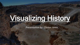
- 1. Visualizing History Presentation by: Clinton Jones
- 2. Problems in Archaeology • First surveyed in GIS (Geological information system) • When Archaeology sites are set up, they need to be painstakingly marked and recorded for scientific purposes • Information about site is recorded and organized; but not visually represented. An example of recording data points on map grid
- 3. Augmentive Proposal • Node based system which interacts with augmented interface -Nodes dug into ground • User visualizes data through GUI on a piece of hardware • Viewfinder being drone w/ camera system or handheld device (Ipad, tablet-like) -User sees real world site with visualized data Prototype nodes – detects grid area
- 4. GUI Interface • User navigates through interface which connects to relevant IOT data such as: • Heat map of previous finds • Geological overlays which integrates with G.I.S system, showing users topographical data • Provides additional visualization of area – possibly integrating models of real world objects (Pillars, Huts, historical objects) • Projects visualized grid onto area and records any areas in which artifacts are found Grid data sketch IOT’s prototype interface w/ heat map
- 5. Potential Pitfalls • Complex system interweaving outside data (GIS) and VR overlays • Would require a substantial amount of back end programming • User interface would need to be easy to use • User base would have a wide range of experience handling technology; UI would have to focus on simple design • Equipment would need to be durable; capable of withstanding a moderate amount of wear
- 6. Potential for Research • Project would allow advanced visualization of Archaeological data/GIS system • This would allow researchers to fully integrate data sets with another, allowing them to see in sites in vastly different perspectives • Would allow a greater range of mobility in dig sites • Reduces human error in recording artifact finds • Would impact education in society, allowing greater knowledge and retention of open source data within Anthropology
- 7. Summary • Archaeology digs need to integrate digital datasets to achieve greater results in the field • Augmented reality could potentially change the way Archaeologists preform digs and record results • My proposal would ease the burden on expeditions, and allow researchers to have a wide breadth of data to analyze during expeditions. • Questions?