
Recommended
Recommended
More Related Content
What's hot
What's hot (20)
Viewers also liked
Viewers also liked (20)
Similar to S2 GE Slides - Floods (Part 2)
Similar to S2 GE Slides - Floods (Part 2) (20)
More from LEEENNA
More from LEEENNA (20)
Recently uploaded
Recently uploaded (20)
S2 GE Slides - Floods (Part 2)
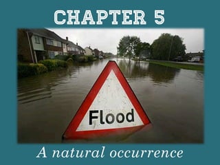
- 1. Chapter 5 A natural occurrence
- 2. 1) Types & Causes of floods: https://www.floodsmart.gov/floodsmart/pages/ flooding_flood_risks/flood_scenarios.jsp https://www.floodsmart.gov/floodsmart/pages/ flooding_flood_risks/levee_simulator.jsp 2) Factors that increase flood risks Recap:
- 3. 1. What are floods? What causes floods? 2. Which cities are prone to floods? Why are these cities more prone? 3. How do floods affect city dwellers? We want to learn about…
- 4. 3. How do floods affect city dwellers? Impacts of floods Social impacts (a) Economic impacts (B)
- 5. 3. How do floods affect city dwellers? Social impacts (a) 1. Injuries and loss of lives Fast-‐flowing flood waters cause buildings to collapse Sweep people & livestock away; causes injuries & deaths; Objects and debris are washed along by fast-‐moving water
- 6. 3. How do floods affect city dwellers? Social impacts (a) 2. Affects physical health People may get caught in the flood for too long Cause people to suffer from hypothermia (constant shivering, confusion, loss of coordina4on)
- 7. 3. How do floods affect city dwellers? Social impacts (a) 3. Affects emotional & mental health loss of homes or livestock loss of loved ones / family Cause mental stress Cause emo2onal distress
- 8. 3. How do floods affect city dwellers? Social impacts(a) 4. Spread of diseases During a flood, water supplies may be contaminated by chemical spills People may be exposed to contaminated drinking water Results in the spread of cholera and dysentery
- 9. More cases of malaria & dengue fever 3. How do floods affect city dwellers? Social impacts(a) 4. Spread of diseases Stagnant pools of floodwater encourage mosquitoes to breed
- 10. 3. How do floods affect city dwellers? Social impacts (a) 5. Homelessness Floodwaters can damage property & sweep houses away People lose a roof over their heads; People may have to evacuate to emergency shelters
- 11. 3. How do floods affect city dwellers? Social impacts (a) 6. Disruption to clean water supply Floodwaters can damage water pipes Cause disrupIon to water supply Water supply may also be contaminated due to burst sewage pipes
- 14. 3. How do floods affect city dwellers? Impacts of floods Social impacts (a) Economic impacts (B)
- 15. 3. How do floods affect city dwellers? Economic impacts (B) Machinery & equipment may be submerged or damaged by floodwaters Companies may lose profits & have to spend money to buy new equipment Factories unable to operate à suffer economic losses 1. Damage to machinery & equipment
- 16. Tourism declines 3. How do floods affect city dwellers? Economic impacts (B) Transport infrastructure submerged or damaged by floodwaters Overall reducIon in produc2vity, employment & profits People unable to travel to work 2. Damage to transport infrastructure
- 17. Loss of employment & income for individuals & companies Companies & factories are unable to operate 3. How do floods affect city dwellers? Economic impacts (B) During a flood, power lines may be damaged Causes power outages to occur, and leads to the lack of electricity 3. Disruption to energy supply
- 18. 1. What are floods? What causes floods? 2. Which cities are prone to floods? Why are these cities more prone? 3. How do floods affect city dwellers? 4. How should cities prepare for floods? We want to learn about…
- 19. 4. How should cities prepare for floods? (A) Regula2on (B) Investment in infrastructure (C) Disaster preparedness Zoning Levees and floodwalls ForecasIng and warning system Elevated properIes Channel improvement EvacuaIon drills Mitigation measures are implemented to: • reduce the impact of floods • help prevent floods from occurring
- 20. 4. How should cities prepare for floods? Regulation(a) (1) Zoning By using zoning laws: Specifies the areas where residential, industrial, commercial or recreational development may take place. Government plans the physical development of the land & its uses
- 21. 4. How should cities prepare for floods? Regulation(a) (1) Zoning • Flood-prone areas are often zoned as low-value developments (eg. parks & fields for recreational activities). • Low-value development usually does not cost much to develop à fewer economic losses during floods.
- 22. 4. How should cities prepare for floods? Regulation(a) (1) Zoning map Eg. Eagan City in Minnesota, USA
- 23. BENEFITS • Zoning creates spaces of green areas, such as parks and fields, which help to reduce the impact of flood damage. 4. How should cities prepare for floods? Regulation(a) (1) Zoning CHALLENGES • Zoning may limit the development of available land because only certain land uses are permiRed. • Zoning is difficult to carry out because of compe2ng land uses. People may also not abide by the recommended land use.
- 24. 4. How should cities prepare for floods? Regulation(a) (2) Elevated properties SG – Minimum platform level (MPL): • Minimum ground level for any development (eg. building) • Imposed on new & existing developments Properties are elevated or raised to a certain height.
- 25. 4. How should cities prepare for floods? Regulation(a) (2) Elevated properties Area with flood history and minimum platform level SG – Minimum platform level (MPL): Area with flood history and minimum platform level Areas with NO flood history MPL is 300mm above the adjacent road or ground level Areas with flood history MPL is 600mm above the highest recorded flood level
- 26. 4. How should cities prepare for floods? Regulation(a) (ii) Elevated properties A series of slopes or steps are built to meet the MPL requirements
- 27. BENEFITS • Development is protected against floods up to the height of the MPL. 4. How should cities prepare for floods? Regulation(a) (2) Elevated properties CHALLENGES • It is challenging to implement MPL because of the increased cost of development.
- 28. 4. How should cities prepare for floods? Investment in infrastructure(B) Barriers that are built higher than floodplains / rivers / canals (3) Levees & floodwalls
- 29. 4. How should cities prepare for floods? Investment in infrastructure(B) To keep out floodwater & protect developments from flooding Barriers that are built higher than floodplains / rivers / canals (3) Levees & floodwalls
- 31. 4. How should cities prepare for floods? Investment in infrastructure(B) (3) Levees & floodwalls Levees: raised banks Natural banks (made of mud) Man-made banks (made of concrete)
- 32. Levees: raised banks 4. How should cities prepare for floods? Investment in infrastructure(B) (3) Levees & floodwalls Bishan park, SG: man-made but natural looking
- 33. 4. How should cities prepare for floods? Investment in infrastructure(B) Floodwalls: Man-made structure (made of concrete) (3) Levees & floodwalls Austria’s flood walls: hRps:// www.youtube.com/watch?v=hzQyTOaBHzI
- 34. Investment in infrastructure (3) Levees & floodwalls BENEFITS • It is cheaper to build levees and floodwalls than to raise the height of the land surrounding the river. 4. How should cities prepare for floods? CHALLENGES • Regular maintenance is required to ensure that the levees and floodwalls are strong enough to hold back floodwater. • They are unable to prevent floods beyond a certain level. (B)
- 35. 4. How should cities prepare for floods? Investment in infrastructure(B) (4) Channel improvement To increase its capacity to hold water or to carry more storm water away. River channels and canals can be widened, deepened or straightened Prevents water in the river channels & canal from overflowing.
- 36. Investment in infrastructure (4) Channel improvement BENEFITS • Moderate-‐value & high-‐ value developments can now take place on the land next to river channels or canals. 4. How should cities prepare for floods? CHALLENGES • Is difficult to carry out if the land next to the river channels & canals is already used for other purposes. • May create problems for areas upstream or downstream of the improved area. (B)
- 37. 4. How should cities prepare for floods? Disaster preparedness(c) (5) Forecasting & warning system 2. The information collected is then analysed to make a flood forecast on the areas that are likely to be flooded 3. Flood warnings are issued to the public 1. Water levels in river channels and canals, tide levels in seas & surrounding weather conditions are monitored regularly.
- 38. (i) Manual monitoring systems (ii) Technology 4. How should cities prepare for floods? Disaster preparedness(c) (5) Forecasting & warning system using: 1. Water levels in river channels and canals, tide levels in seas & surrounding weather conditions are monitored regularly.
- 39. 4. How should cities prepare for floods? Disaster preparedness(c) (5) Forecasting & warning system Water level sensor used in SG Weather instruments used to collect information on weather conditions (i) Manual flood monitoring systems:
- 40. 4. How should cities prepare for floods? Disaster preparedness(c) (5) Forecasting & warning system (ii) Technology: Map out flood-prone areas make more accurate flood forecasts Remote sensing techniques + Geographical information systems (GIS)
- 41. (5) Forecasting & warning system Disaster preparedness BENEFITS • Provides useful informaIon so that there is 2me for people to take ac2on to minimise flood damage 4. How should cities prepare for floods? CHALLENGES • Some ci2es may not have the exper2se and technology to collect accurate data and make accurate flood forecasts. (C)
- 42. 4. How should cities prepare for floods? Disaster preparedness(c) A form of preparedness measure where people practise the steps to leave a place in a safe and orderly manner during an emergency. (6) Evacuation drills Involves: • People moving to safe locations by following instructions given by trained personnel. • Practising first aid
- 43. (6) Evacuation drills Disaster preparedness BENEFITS • People are educated on what to do when a flood warning is issued and this would thus reduce panic during a flood event. 4. How should cities prepare for floods? CHALLENGES • Limited par2cipa2on from the public will reduce the effec2veness of the city’s evacuaIon plan. (C)