Download to read offline


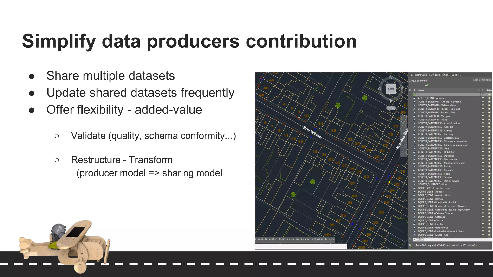
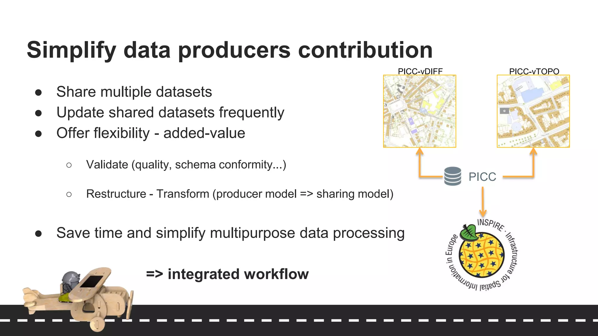
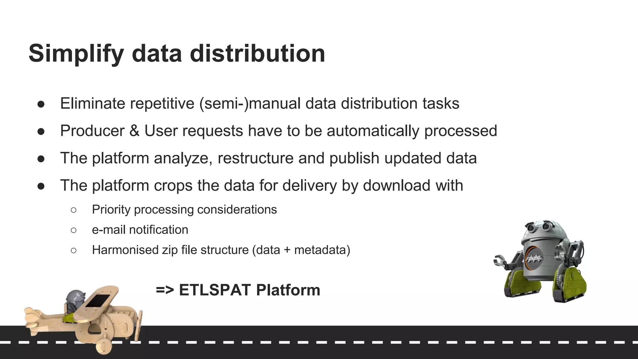

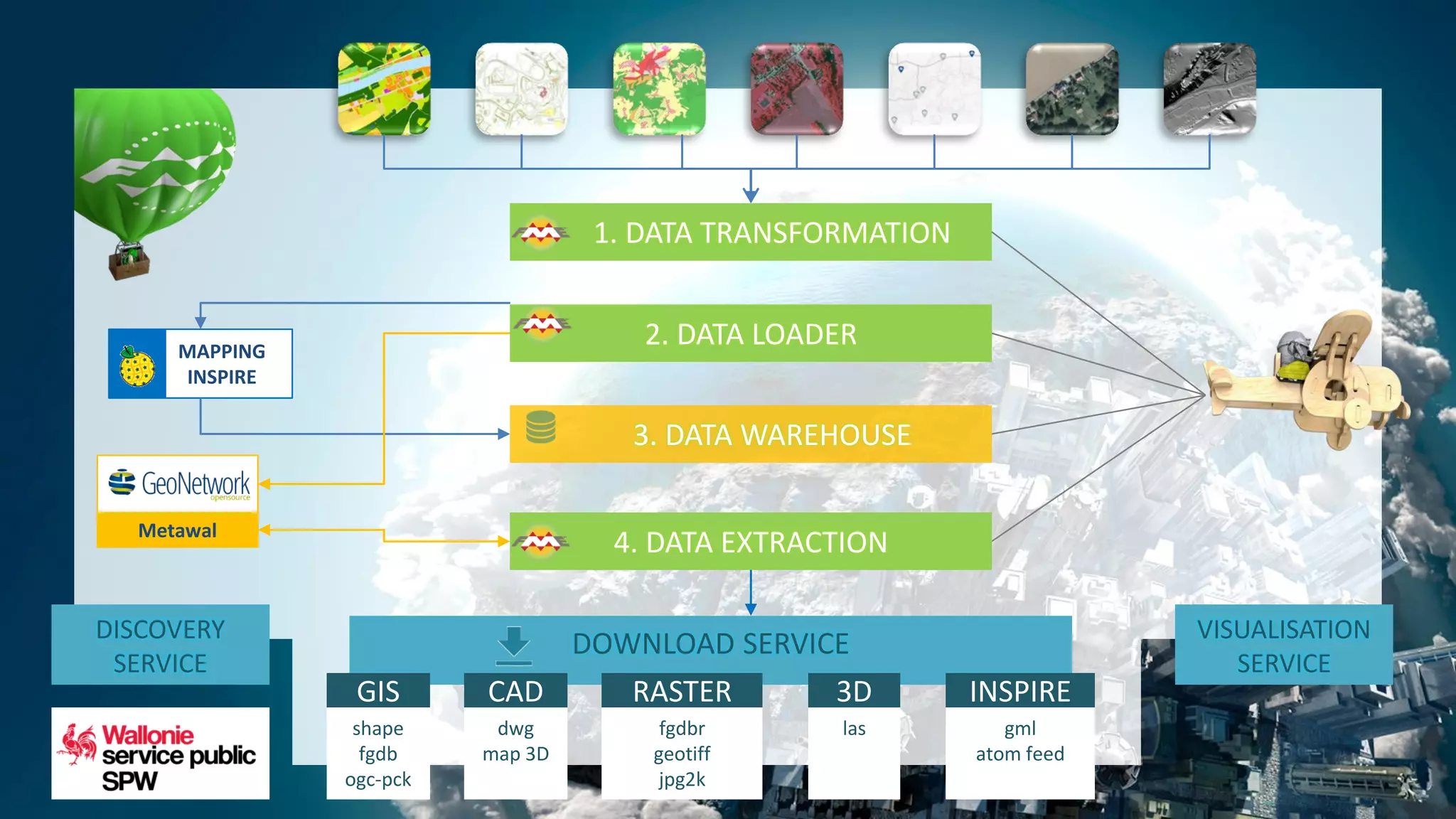


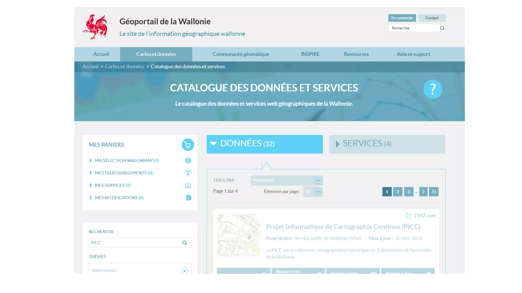
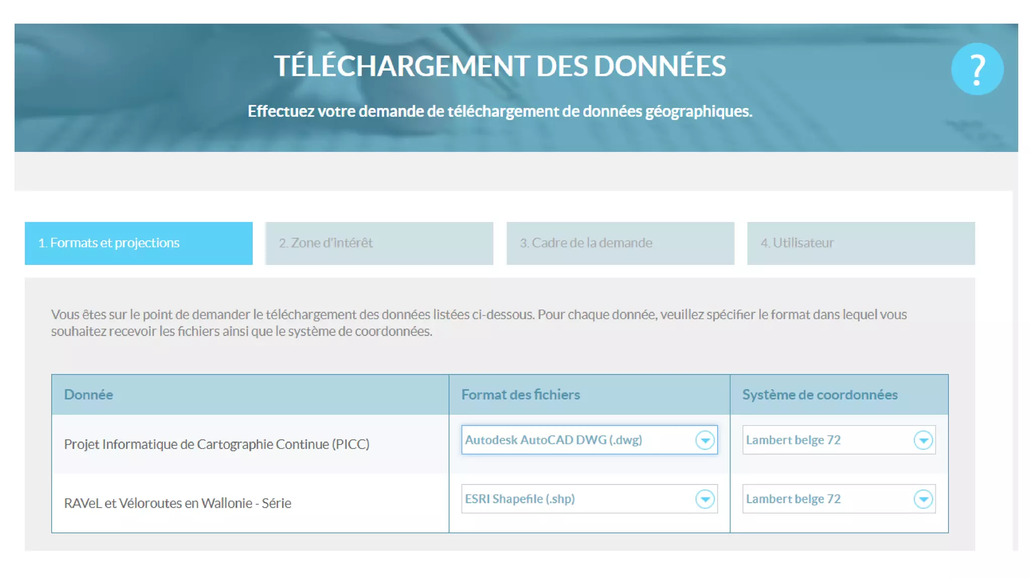

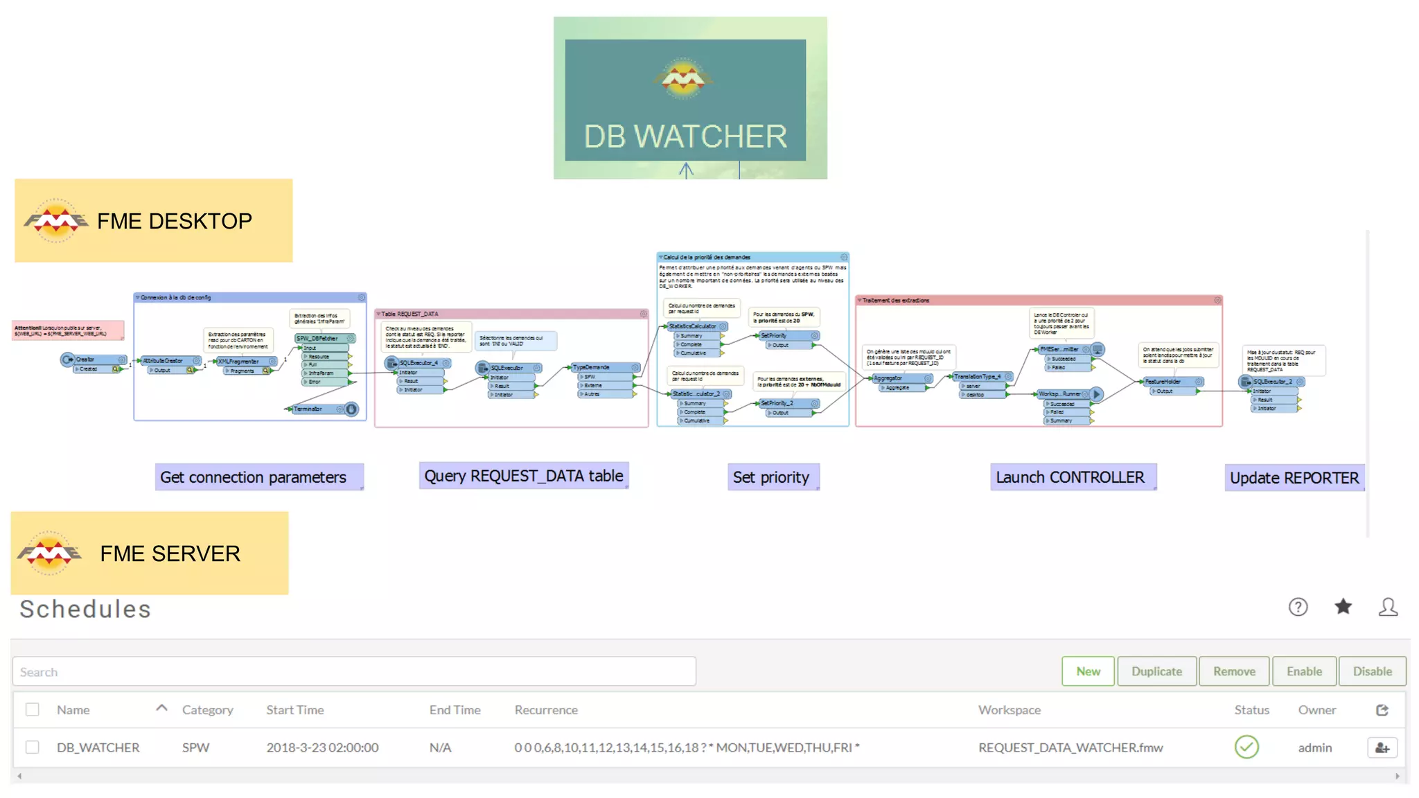

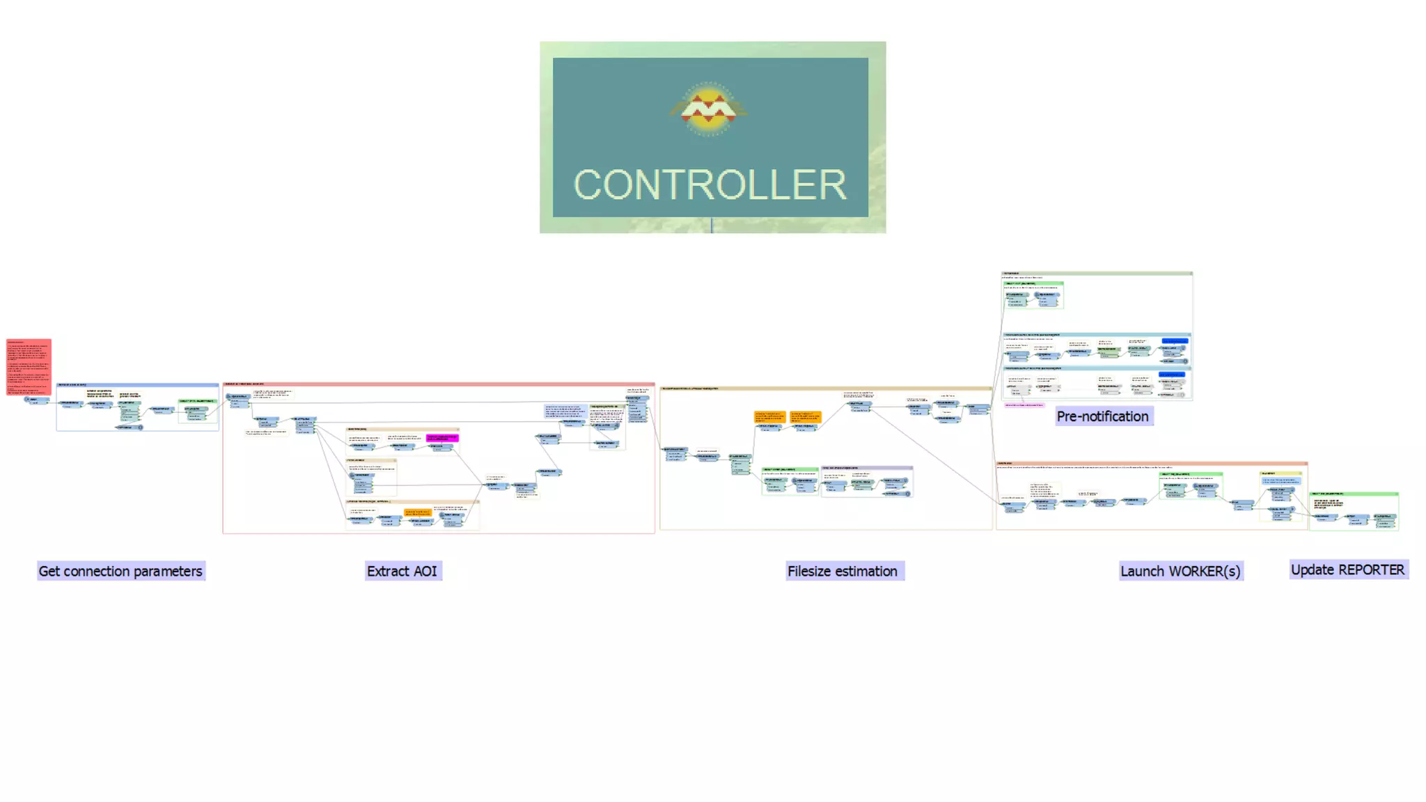

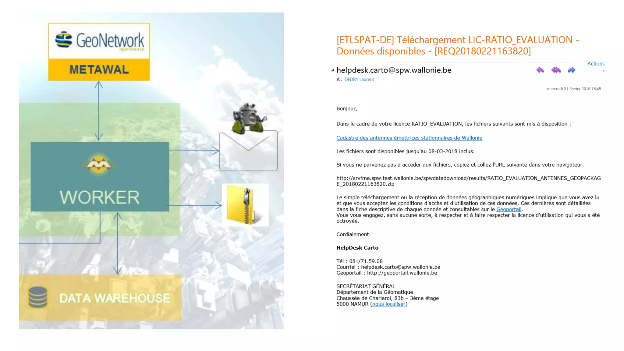
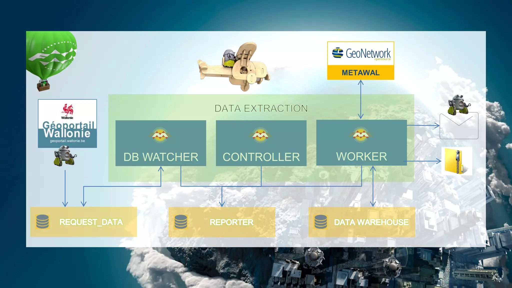


This document discusses automating spatial data sharing between data producers and end users in Wallonia, Belgium. It describes using FME to create an integrated workflow that simplifies data sharing. The workflow validates and transforms data from multiple producers into various formats, then distributes updated data on demand to end users based on their specifications. This automated process saves time by eliminating repetitive manual data distribution tasks.