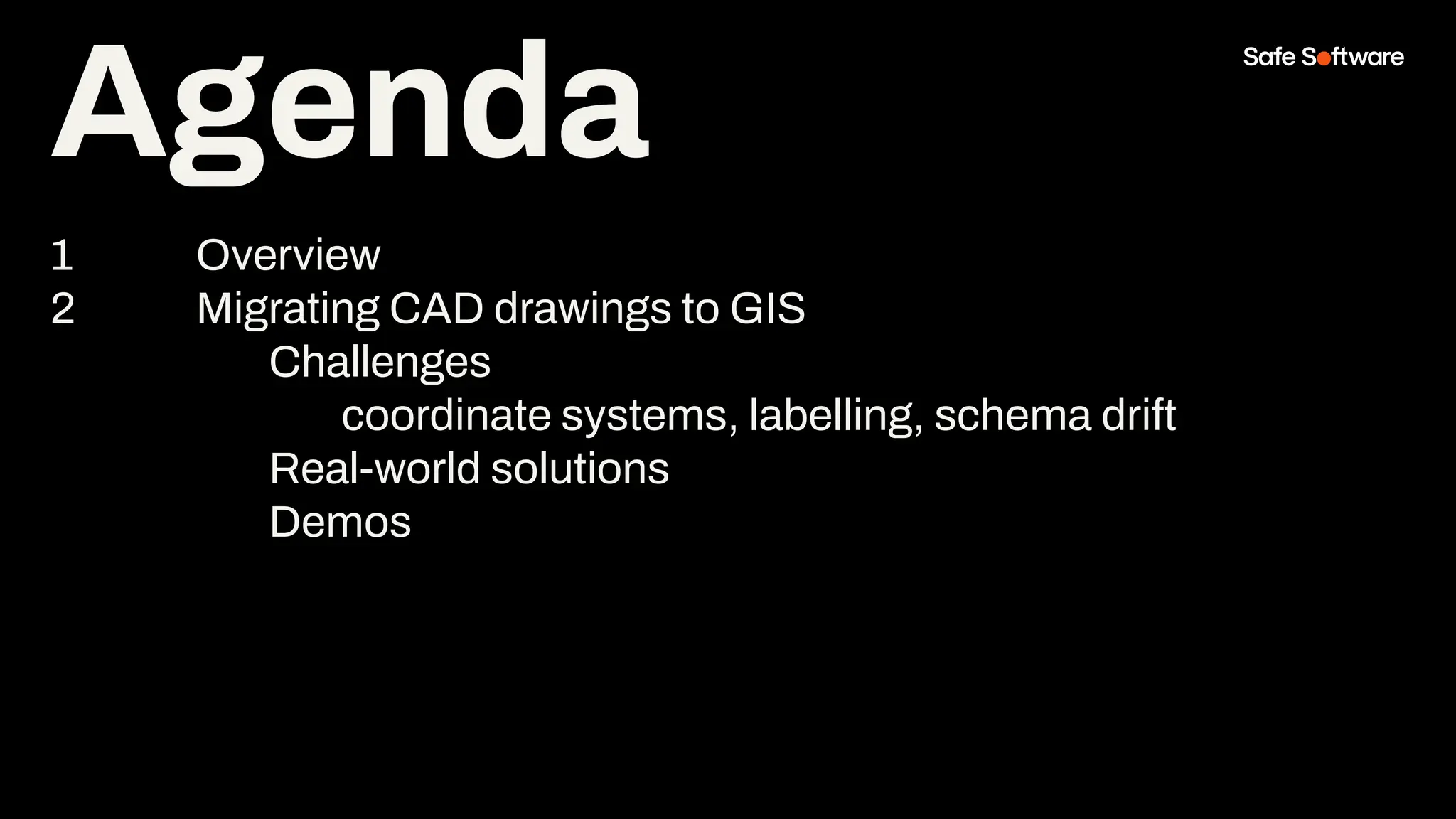
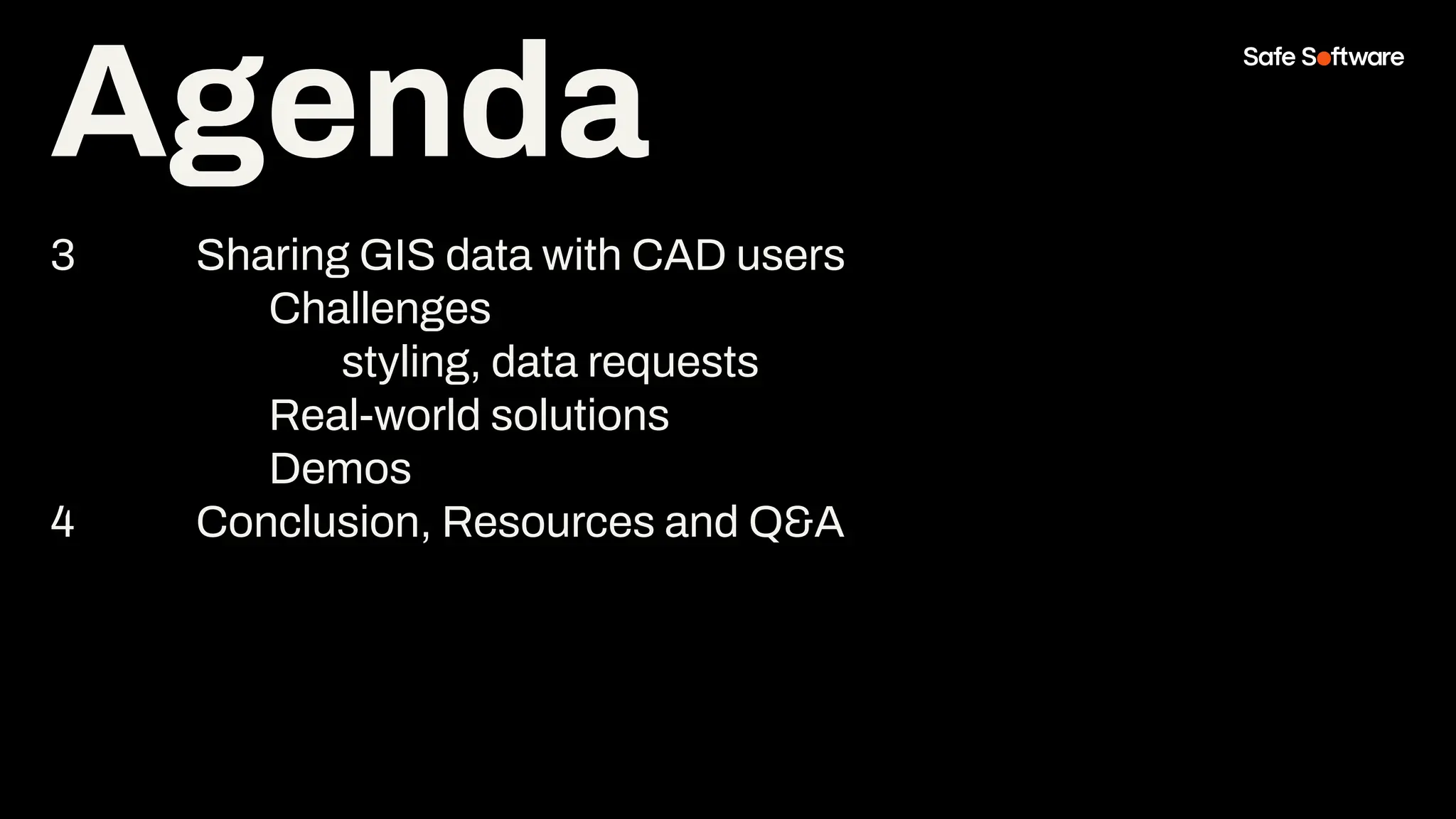
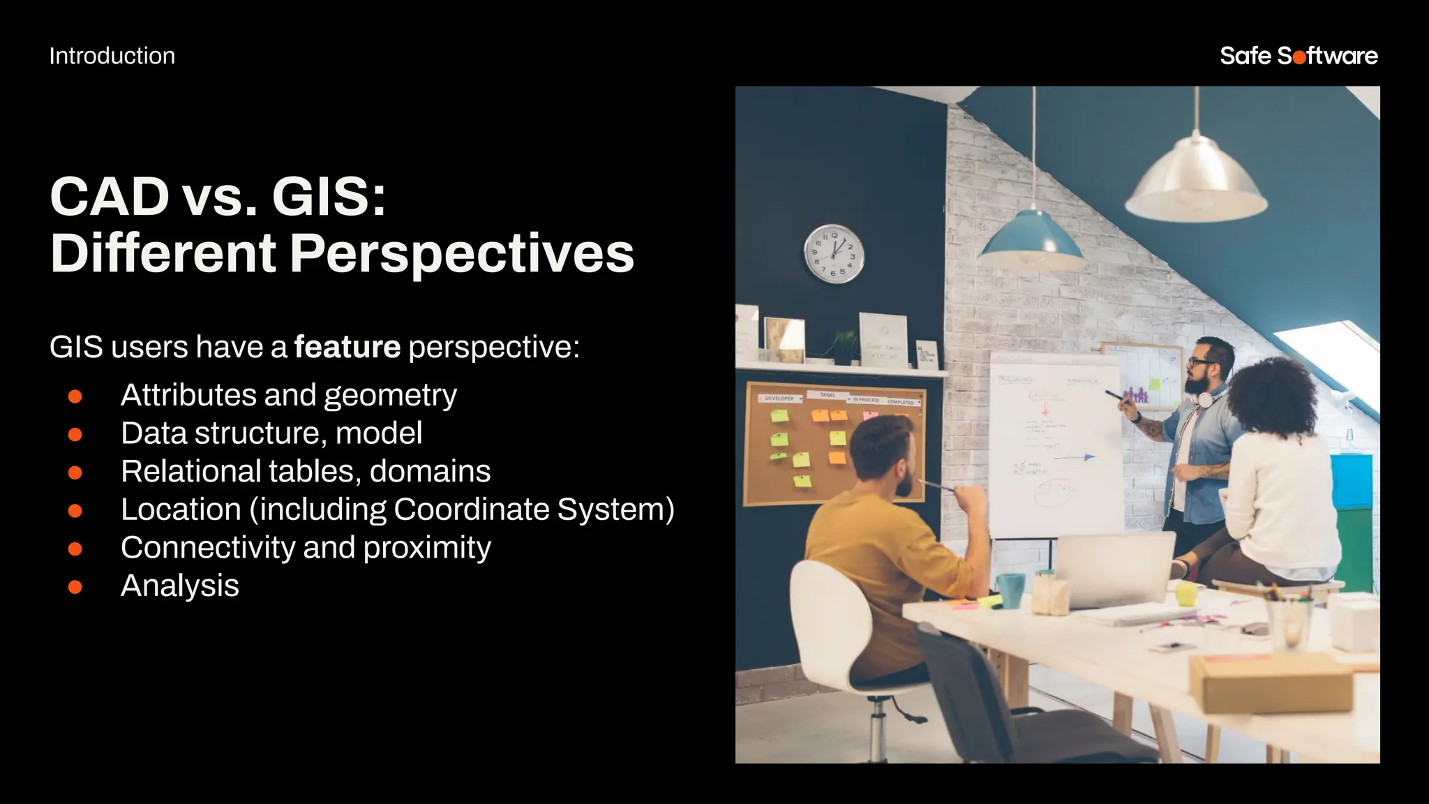
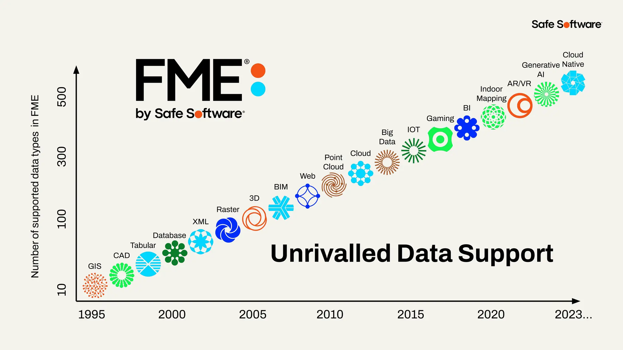
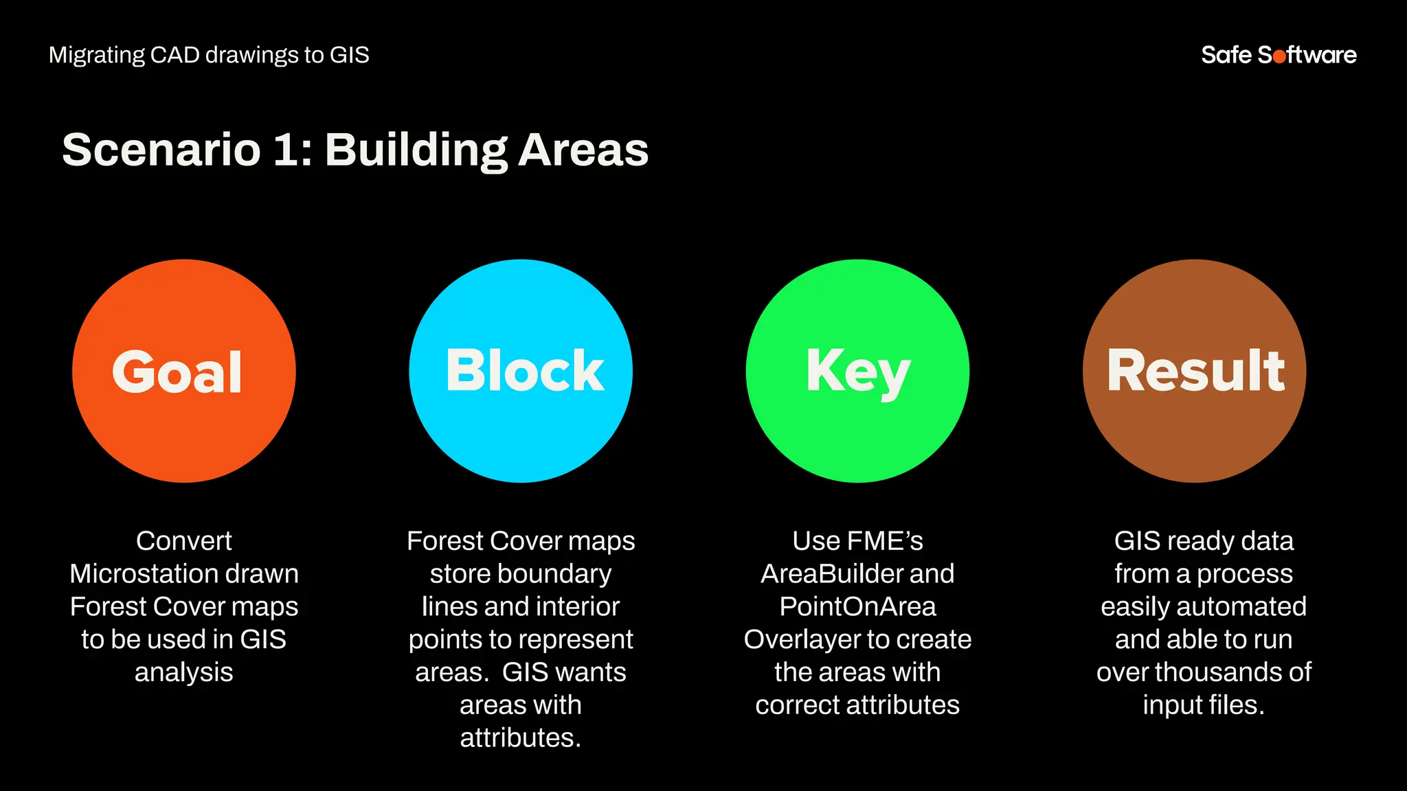
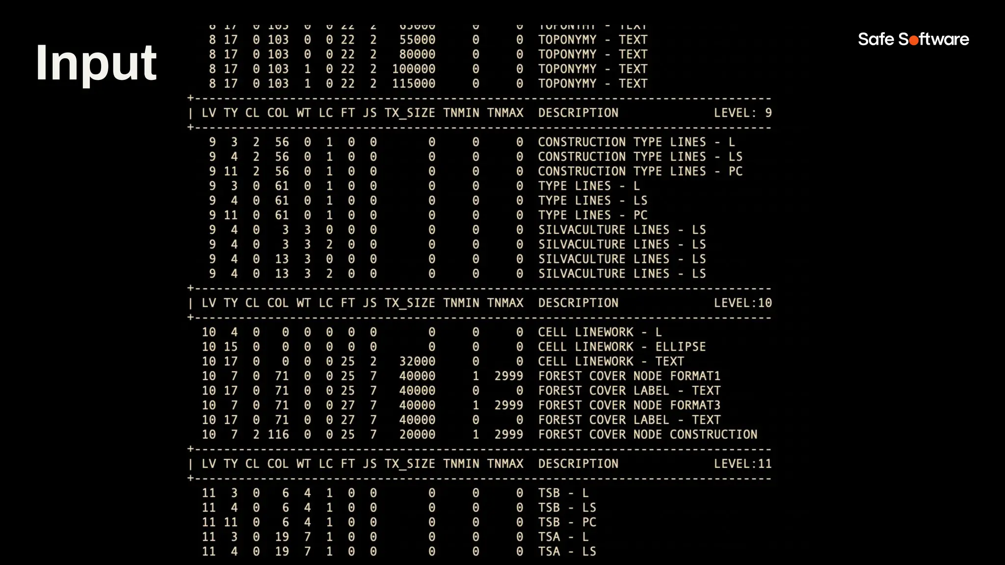
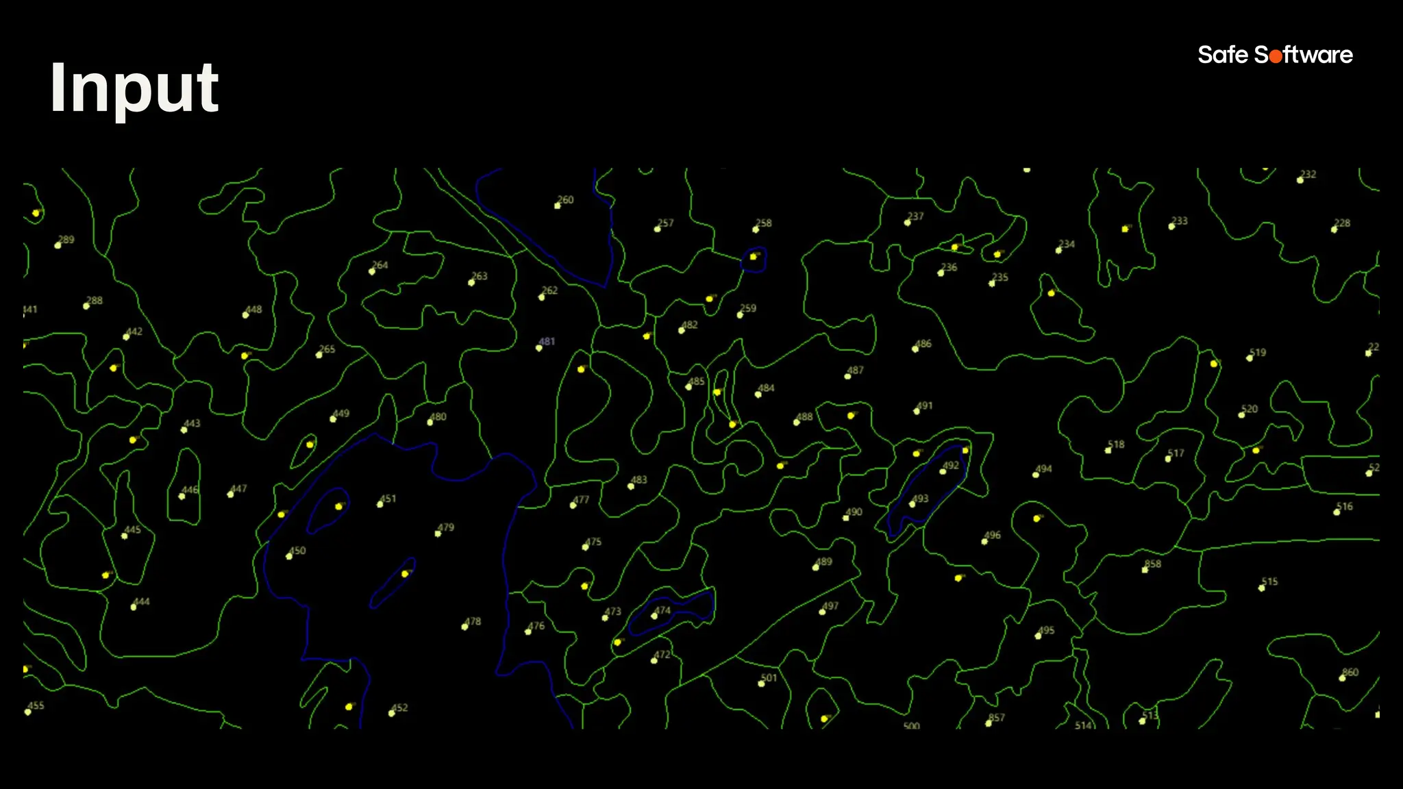
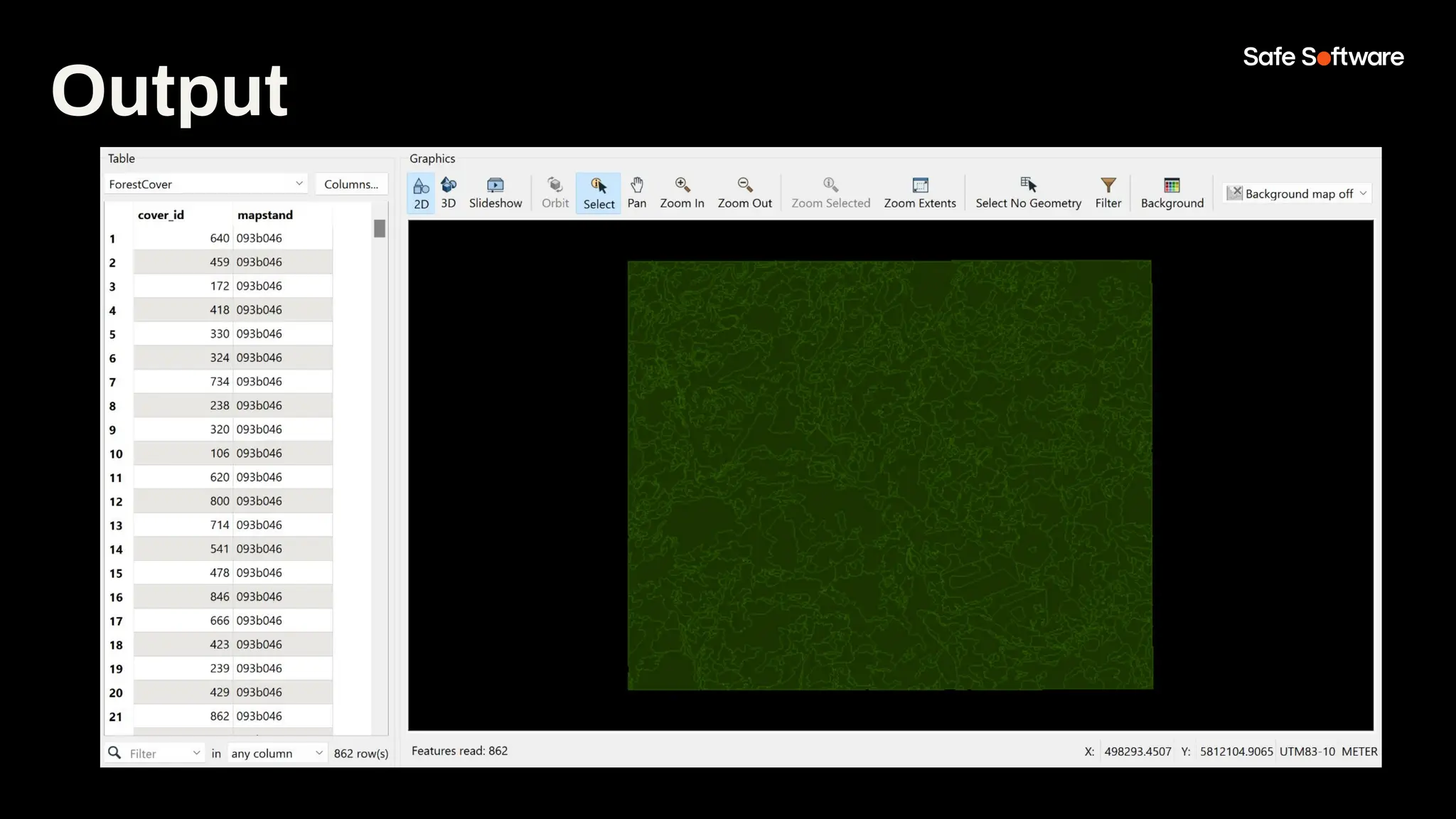
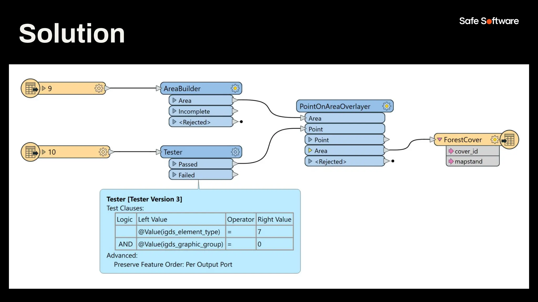
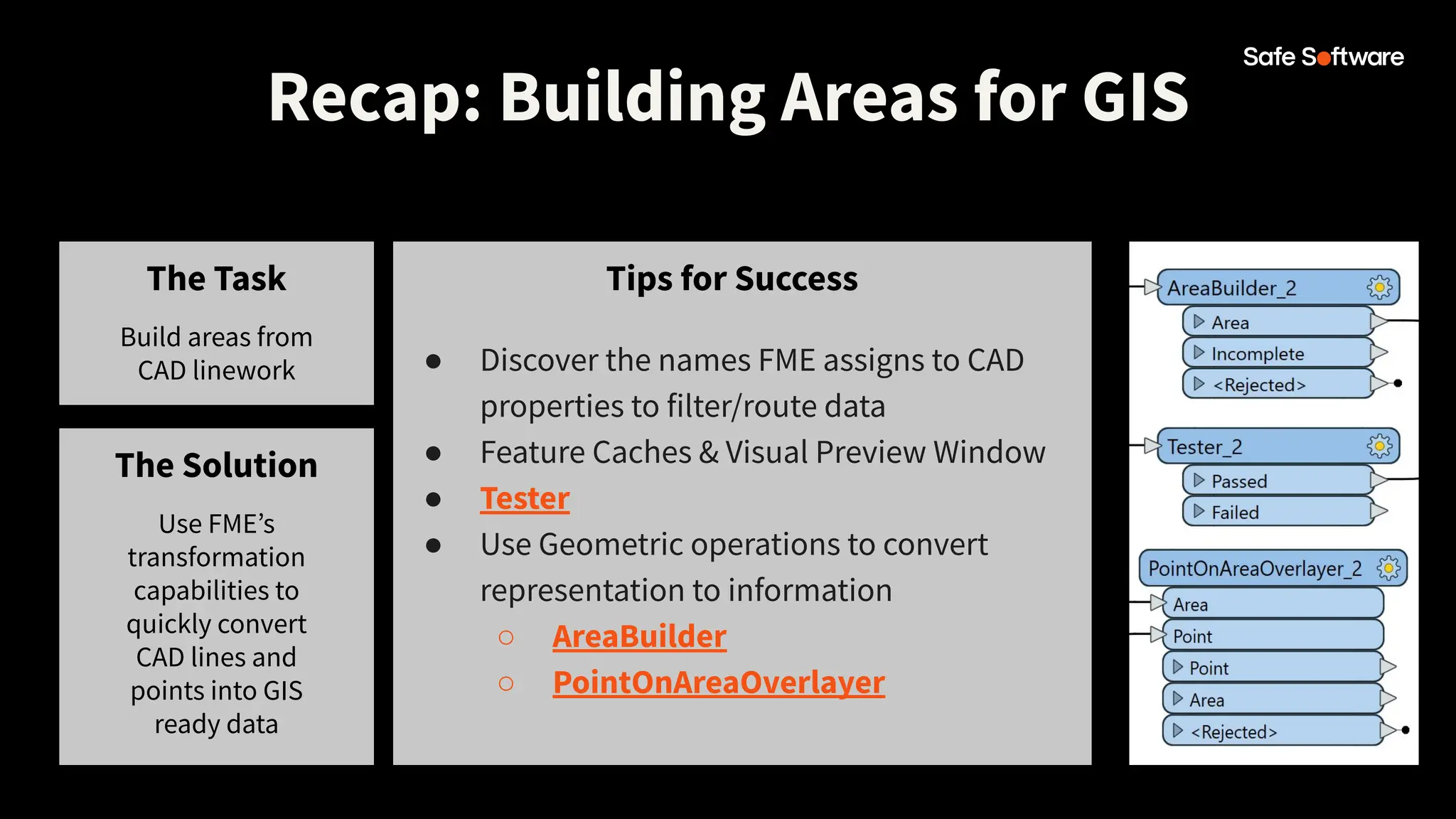
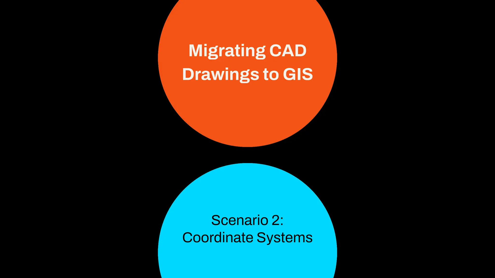
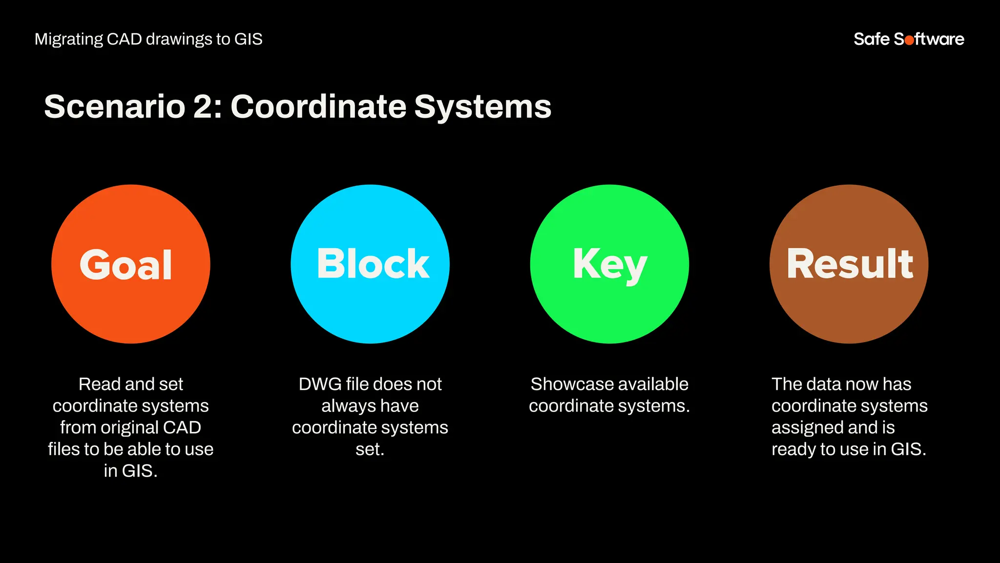
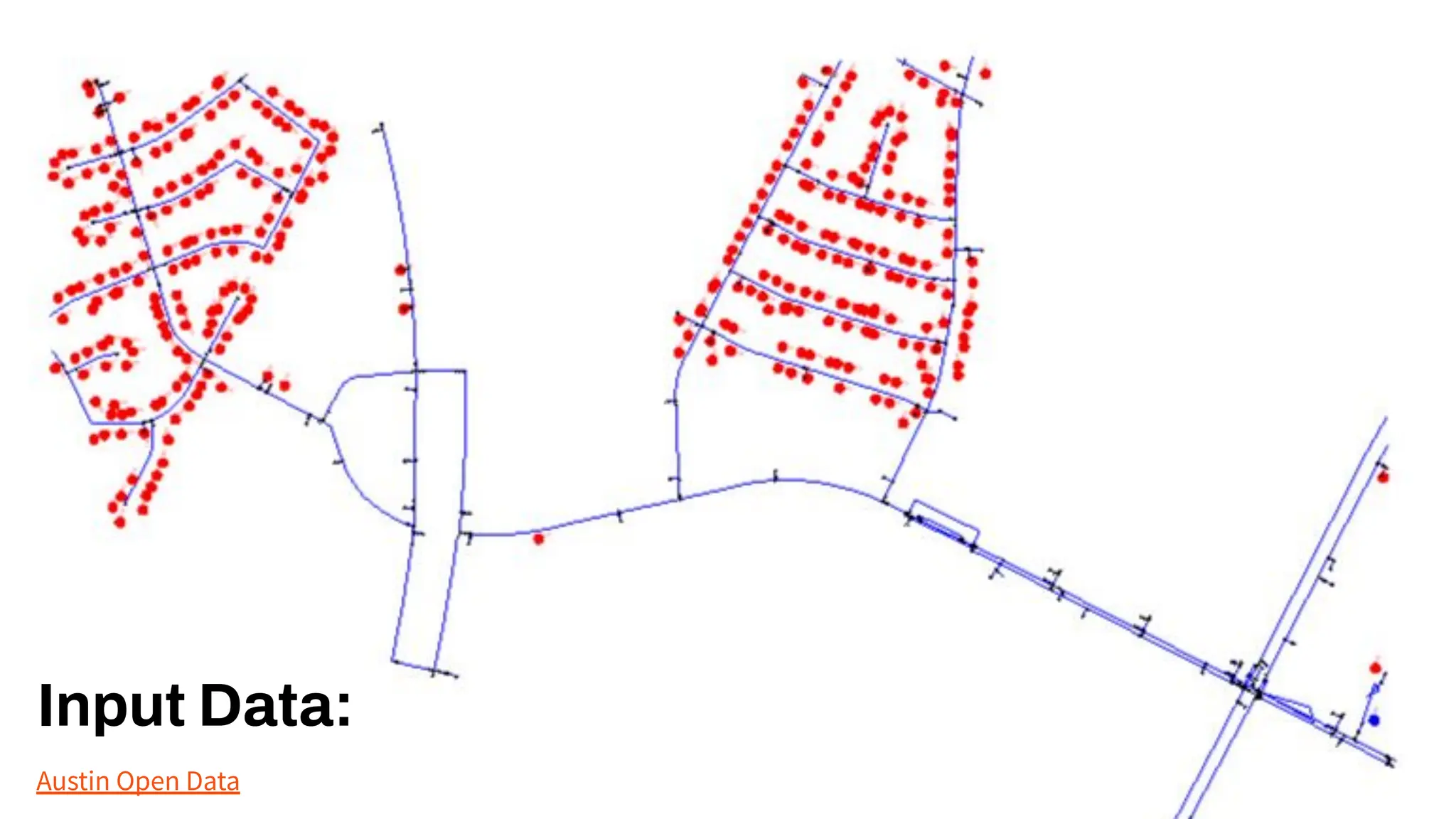
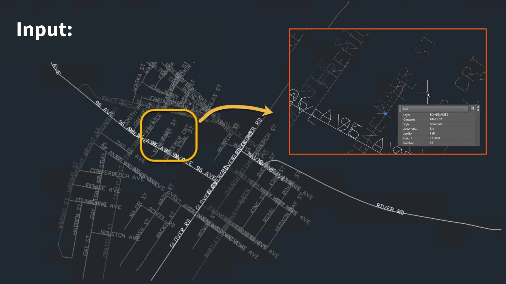
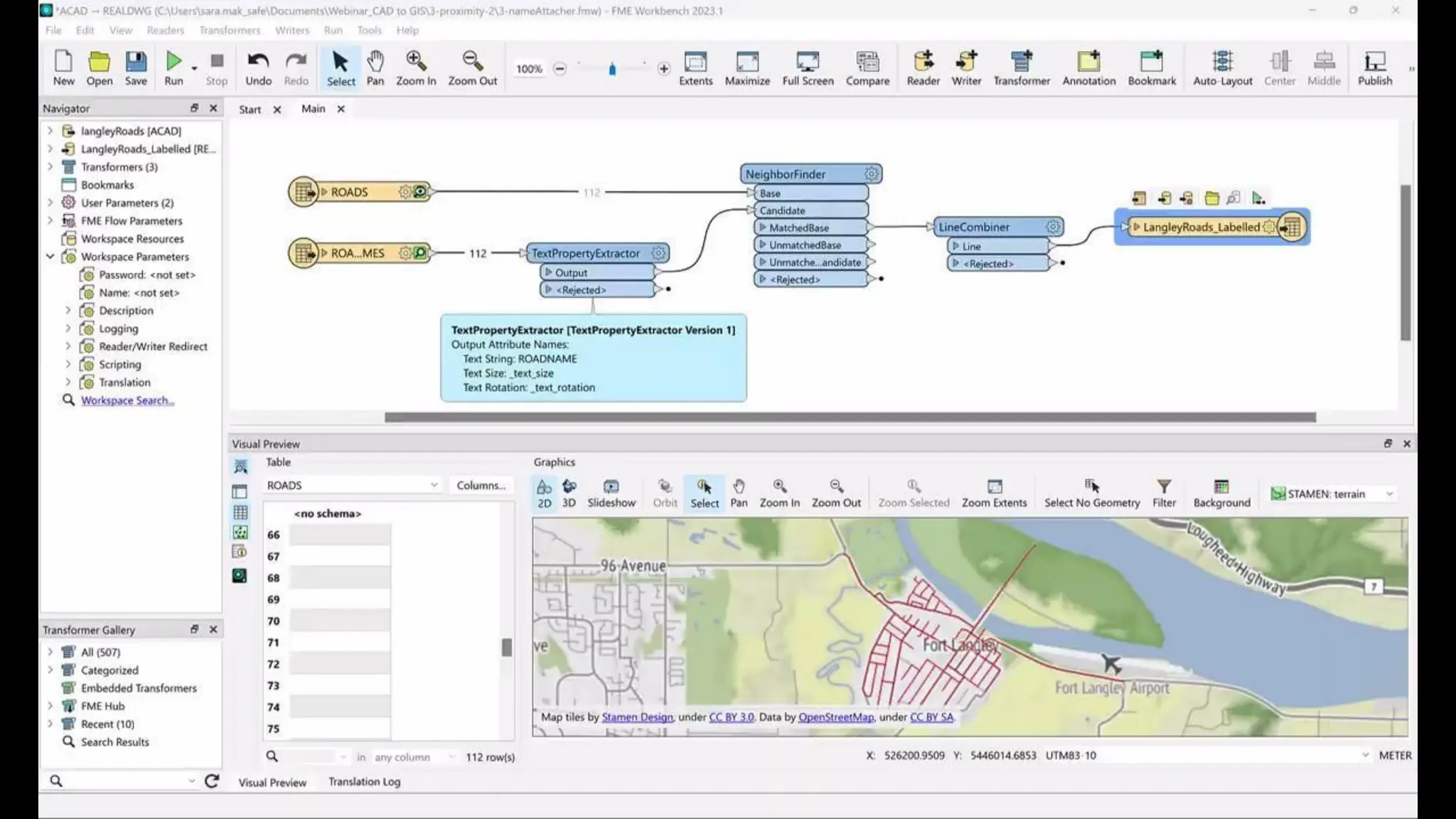
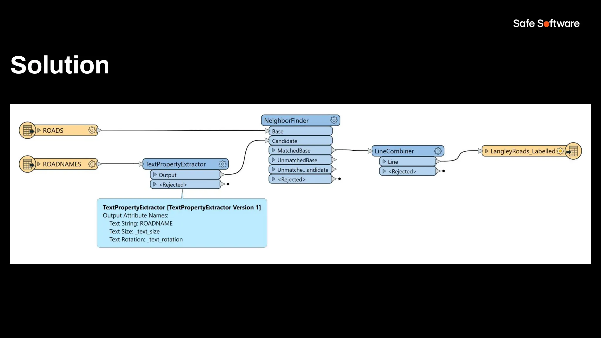
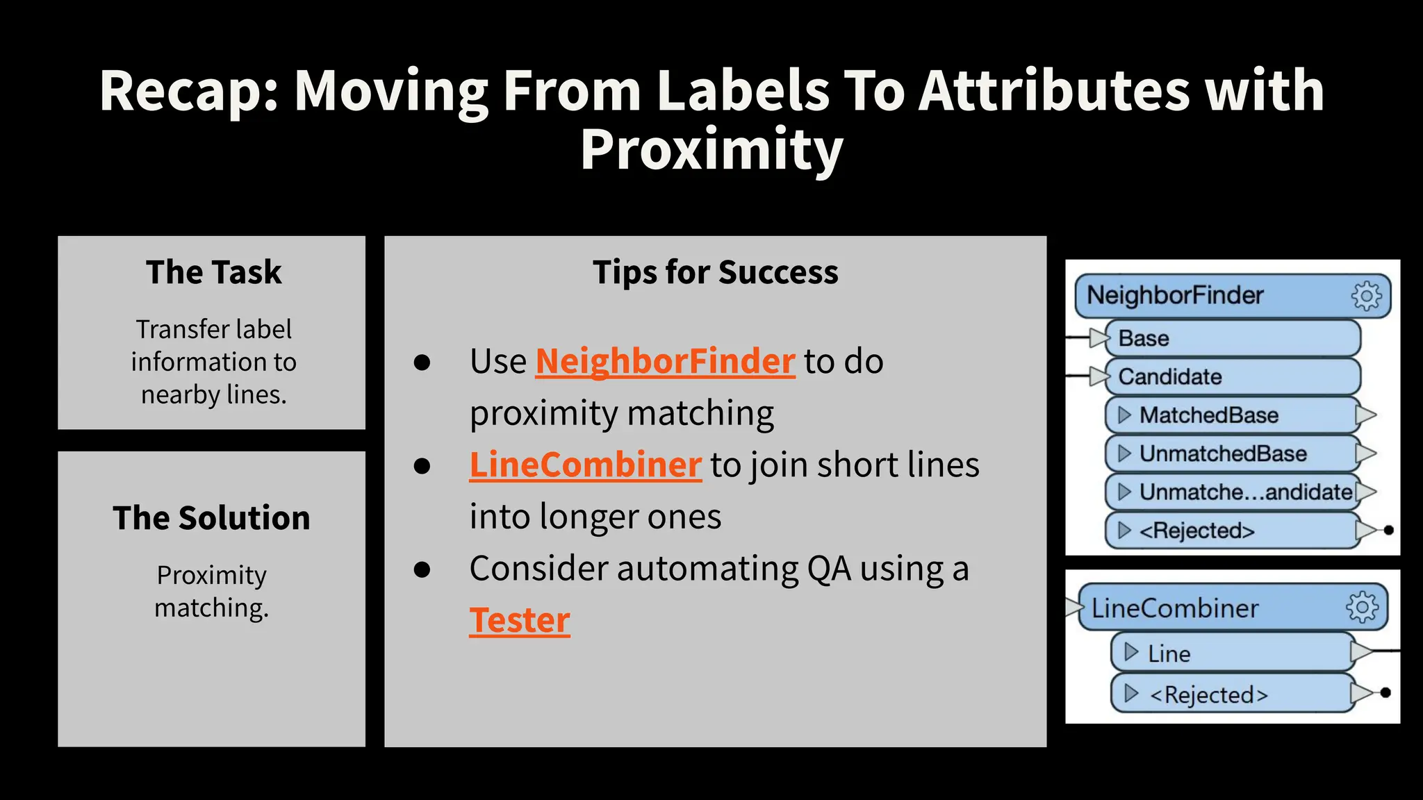
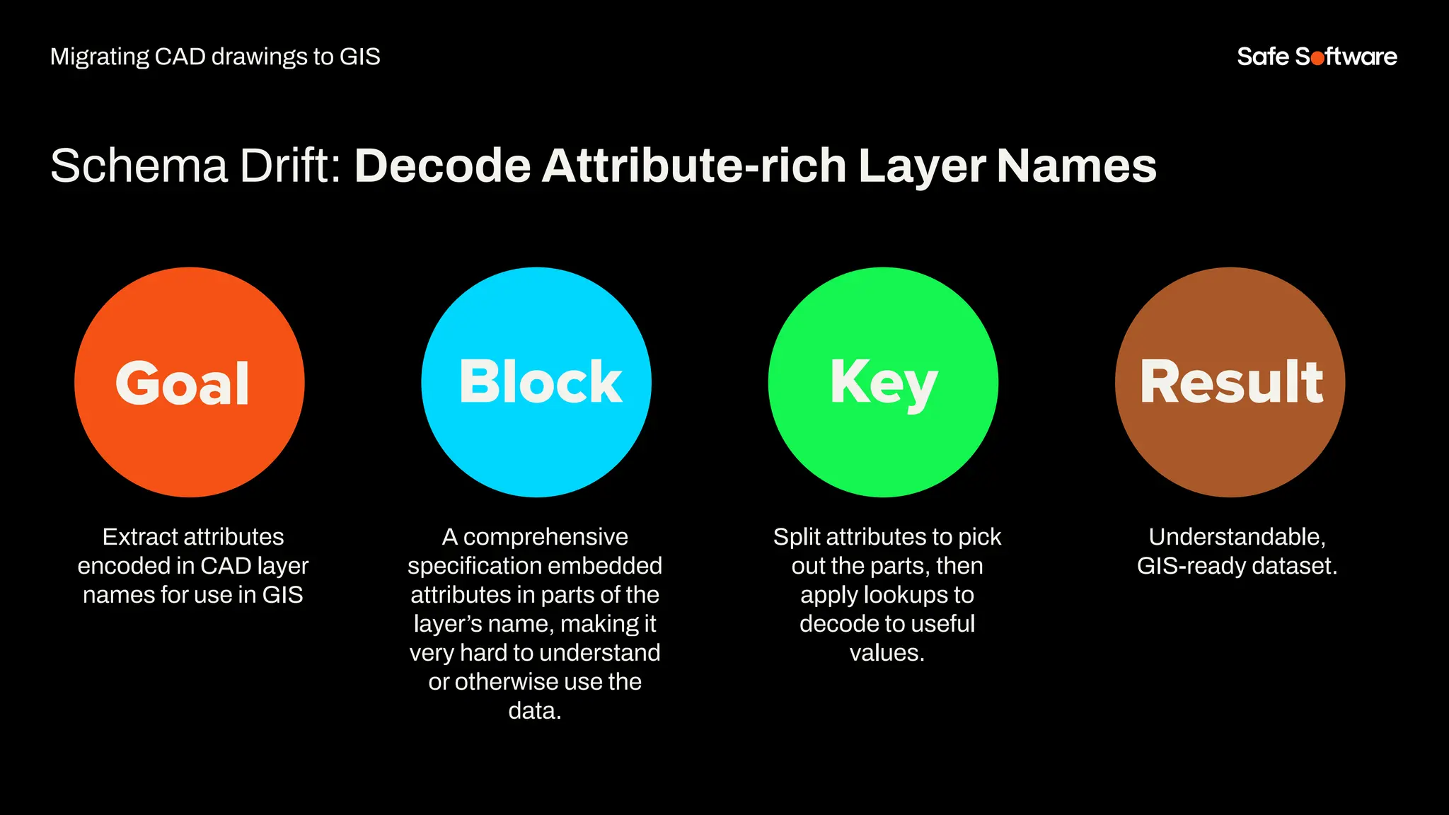
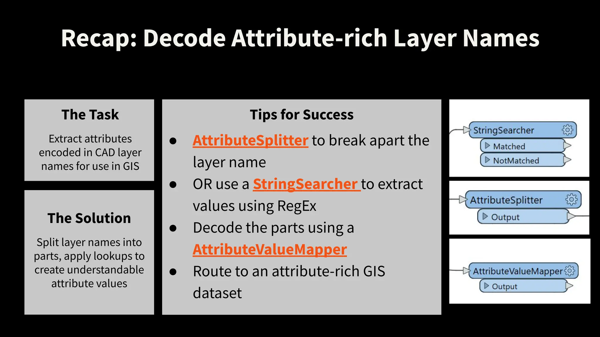
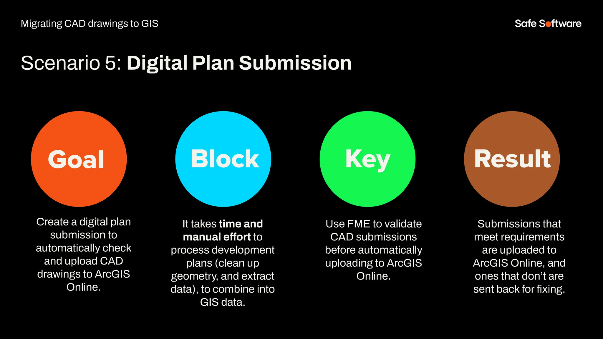
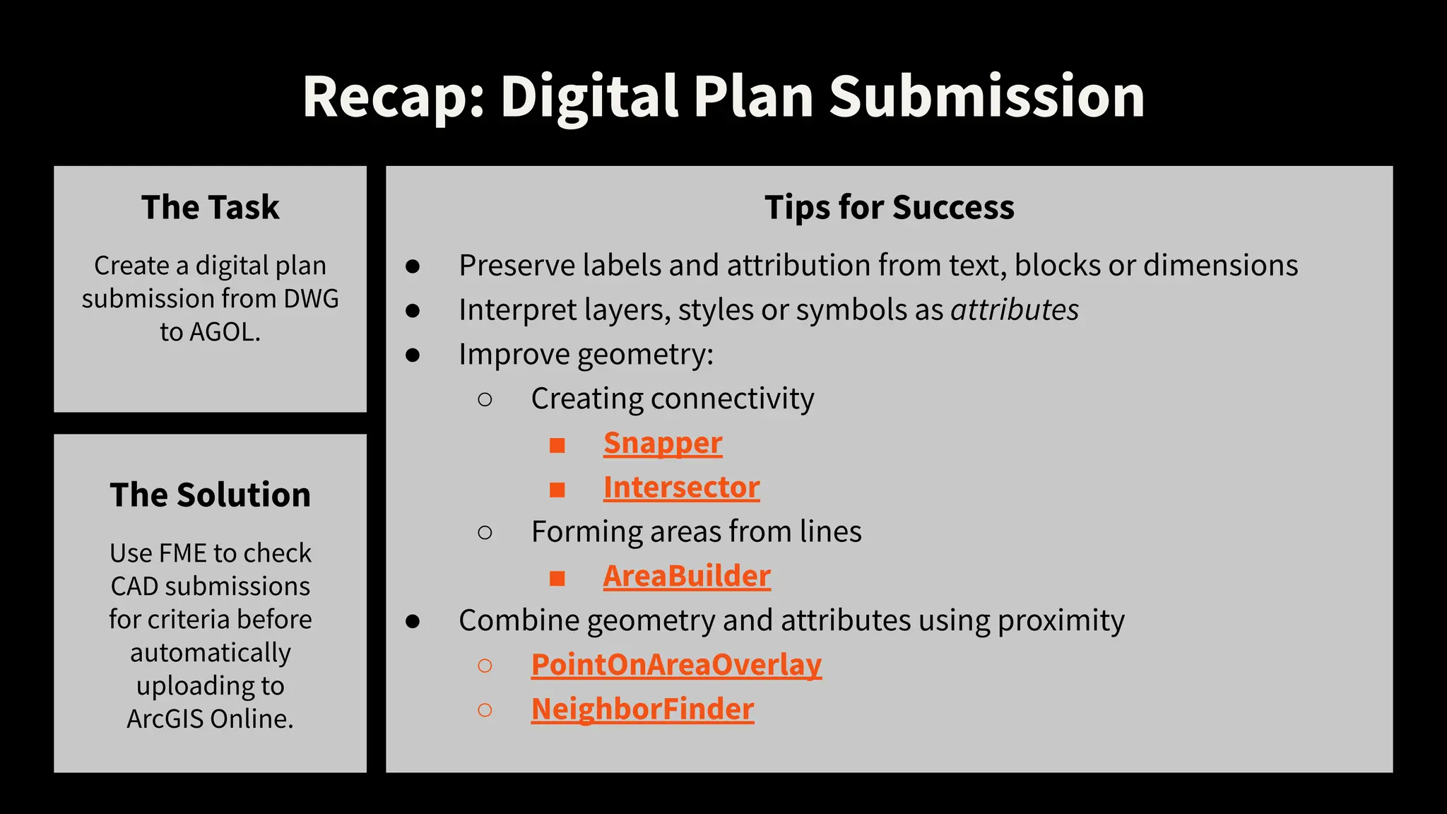
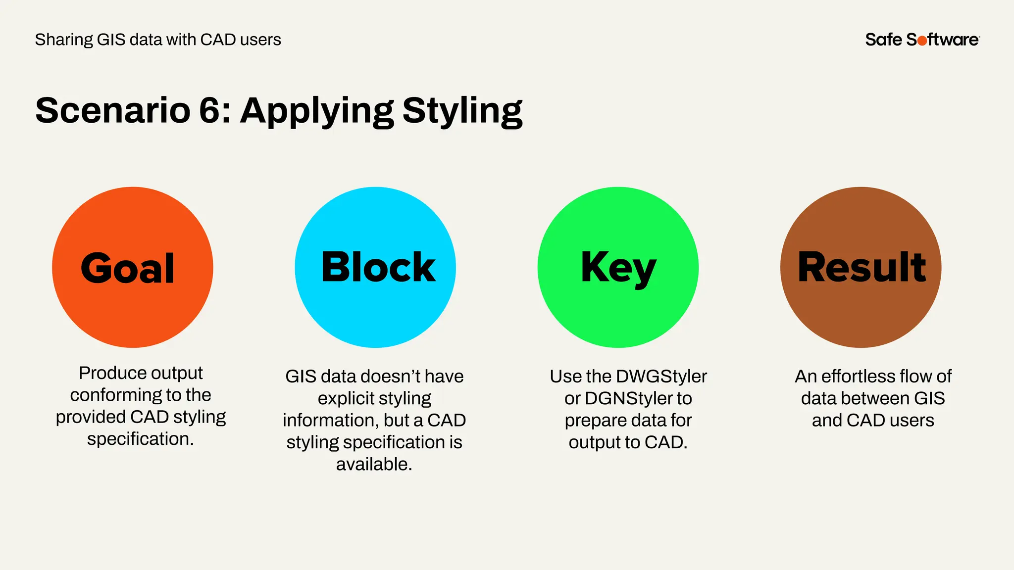
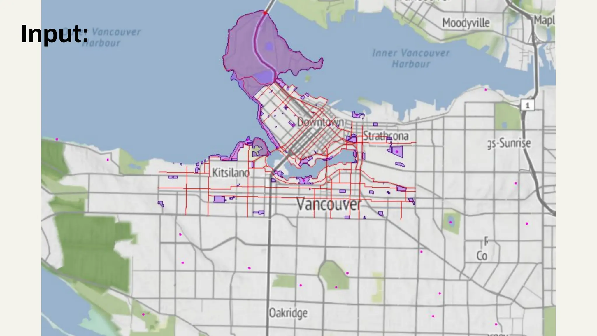
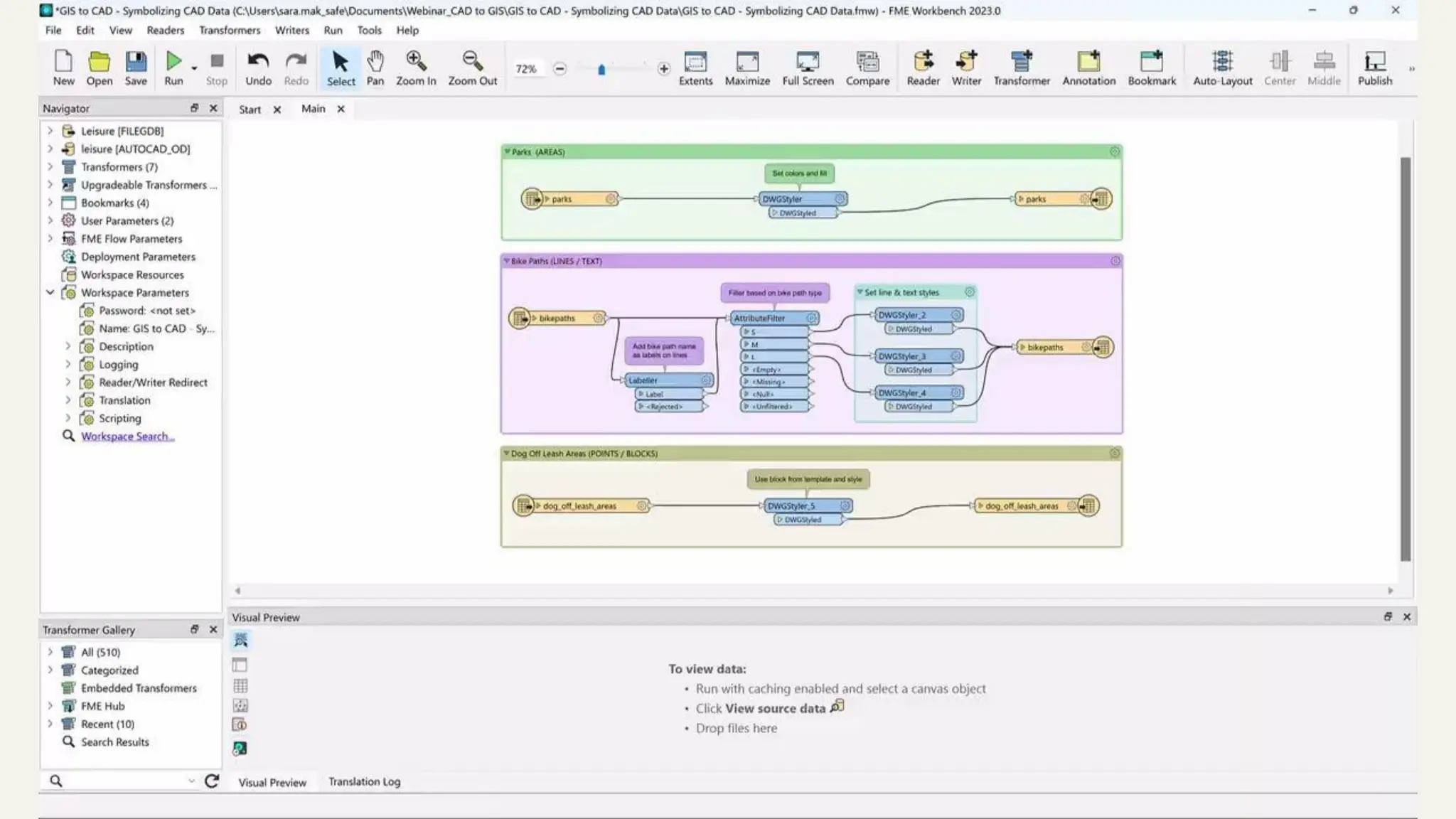
The document discusses strategies for automating data integration between CAD and GIS, highlighting common challenges and real-world applications. It covers various scenarios for migrating CAD data to GIS, including assigning coordinate systems and converting label information into attributes, as well as features for sharing GIS data with CAD users. The conclusion emphasizes the importance of automation for achieving seamless integration of CAD and GIS workflows.