Download as PDF, PPTX


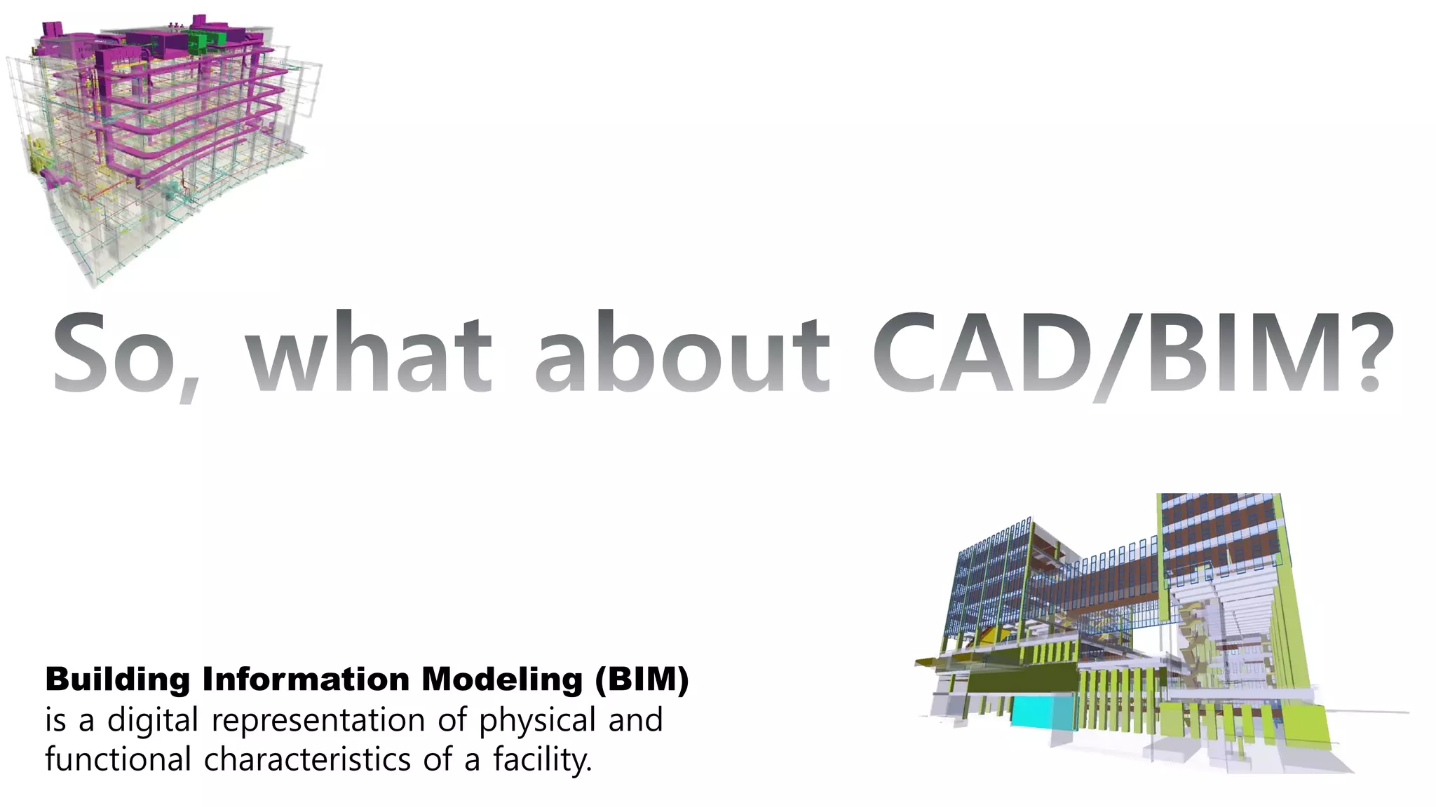
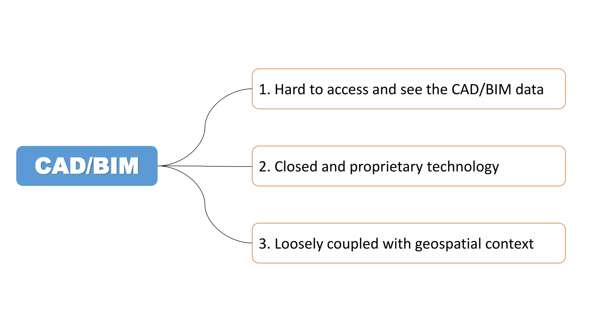
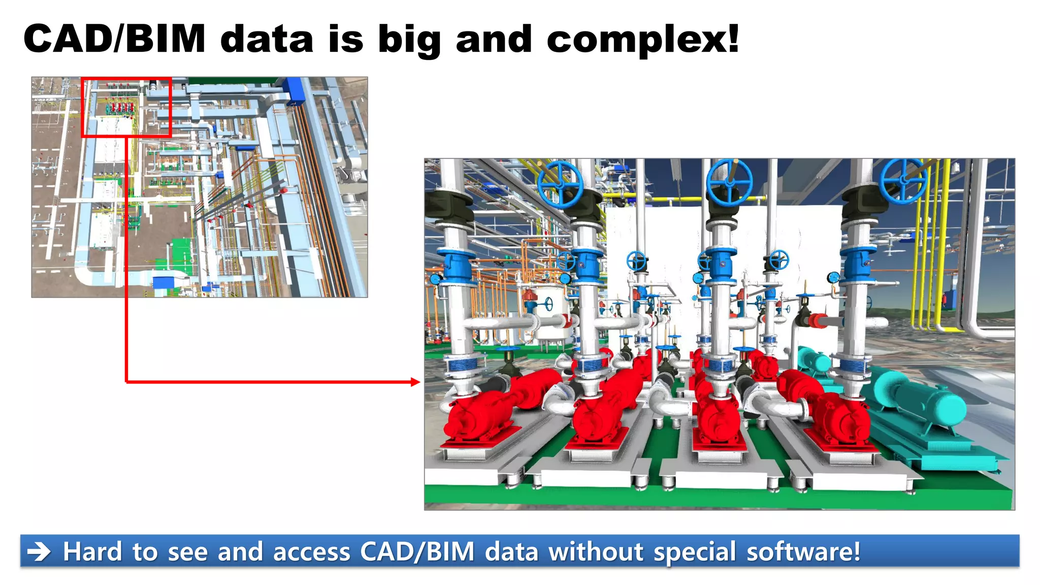
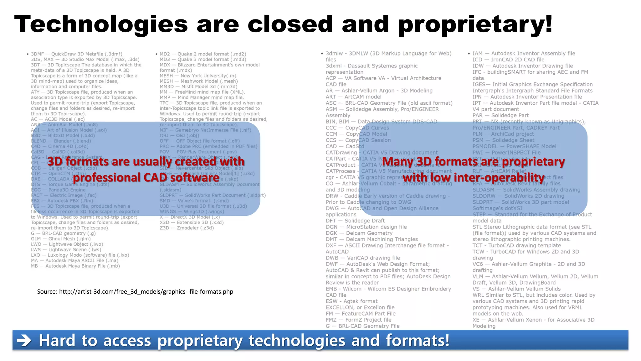
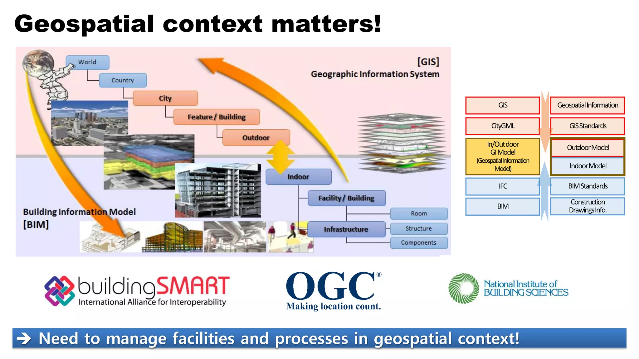

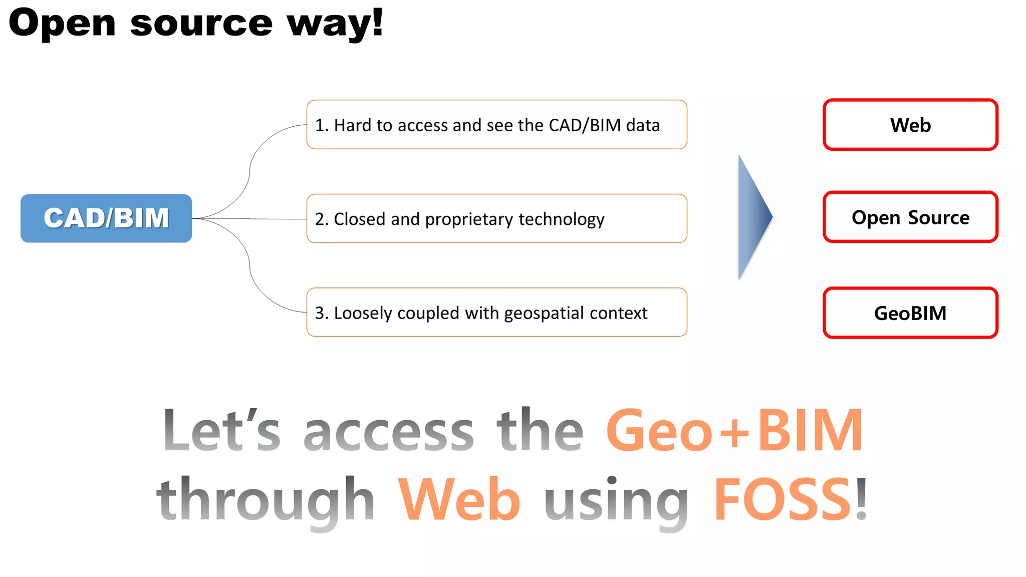
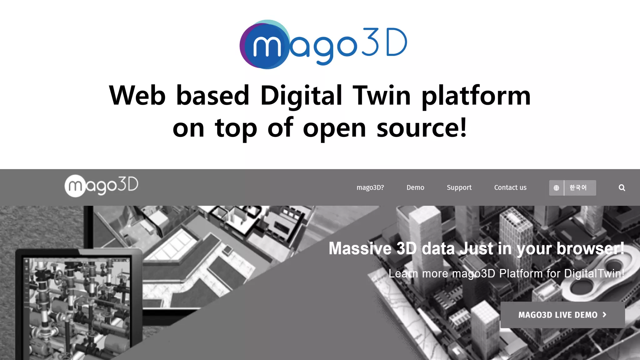

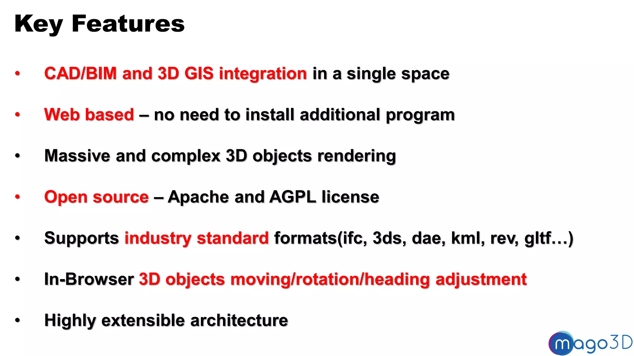
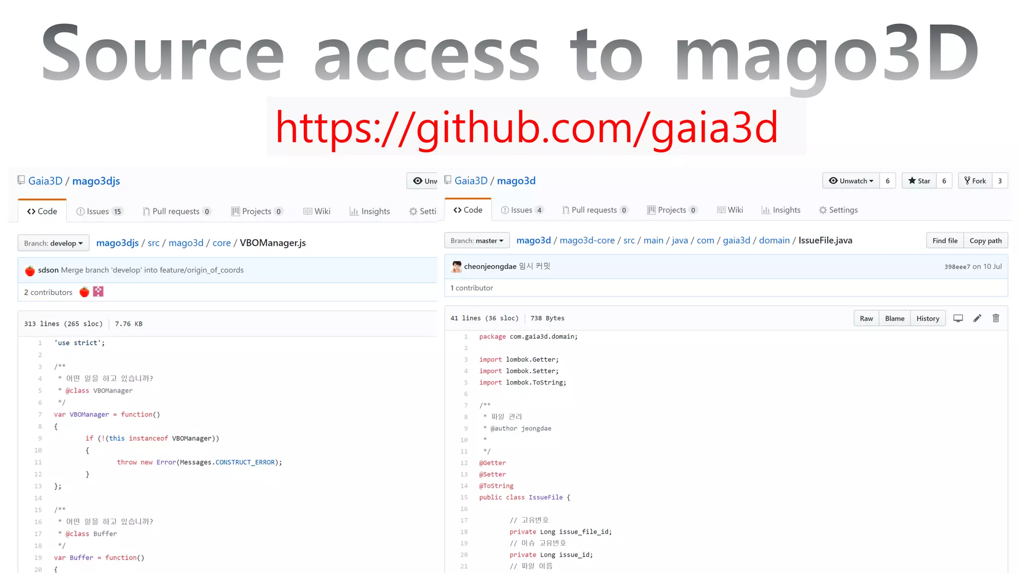
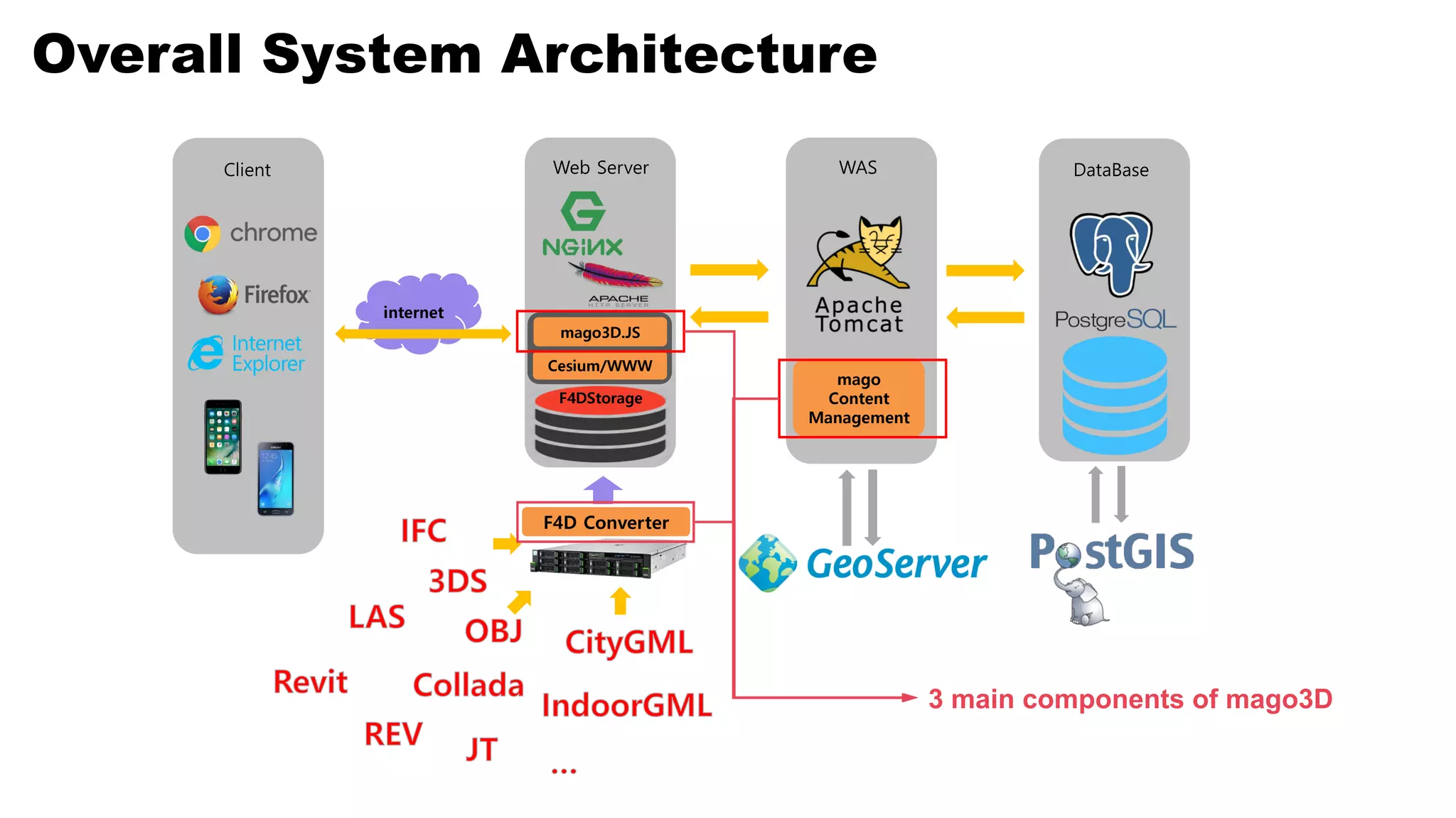


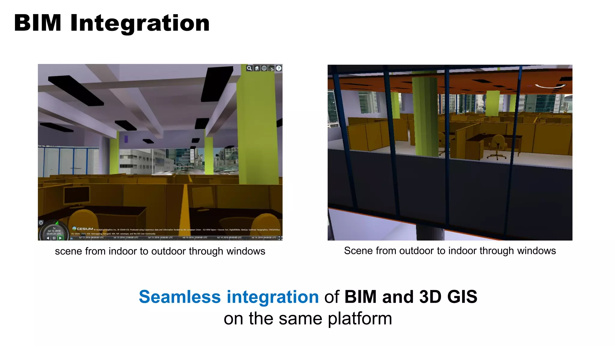
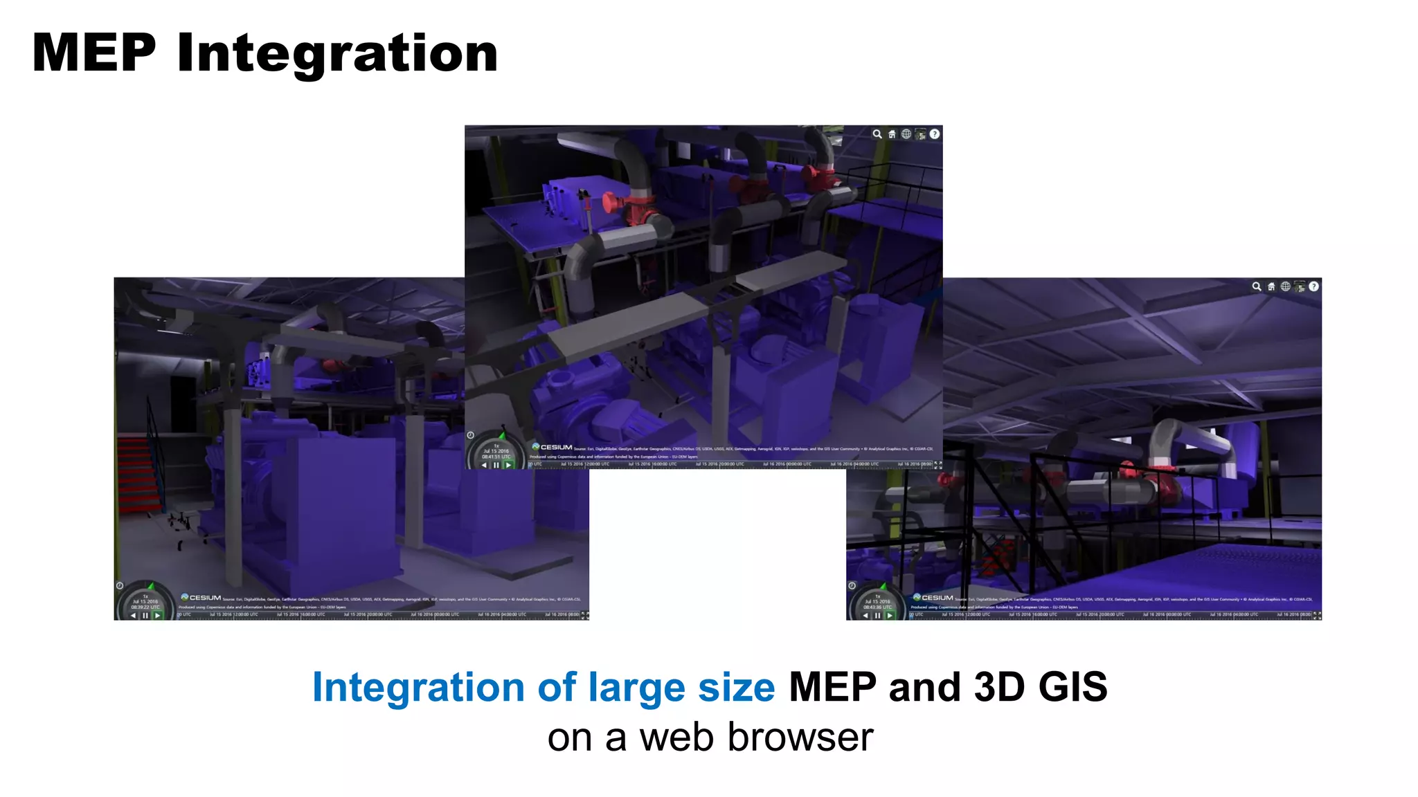
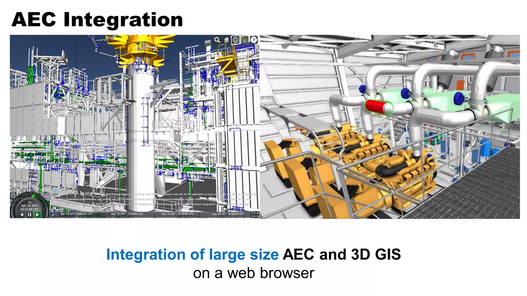
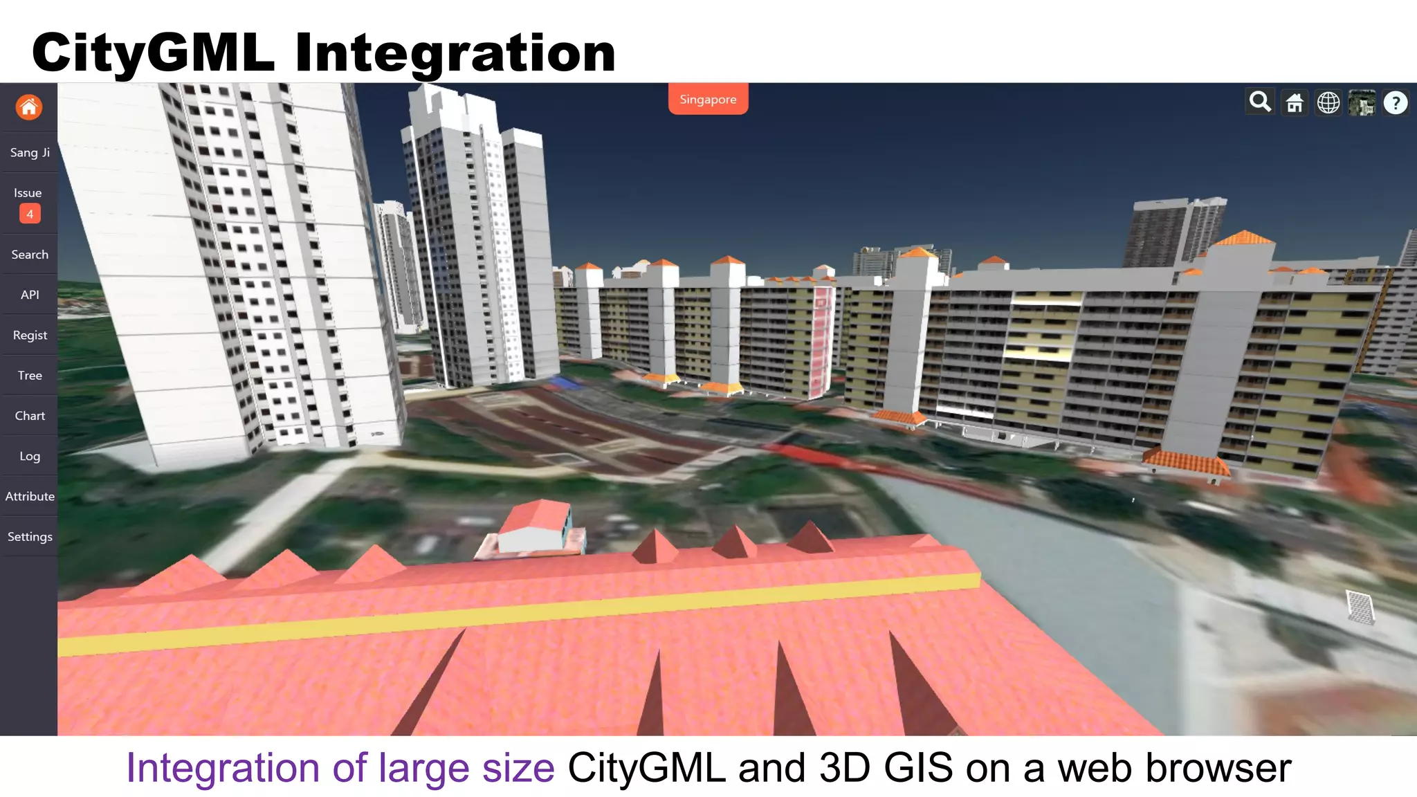
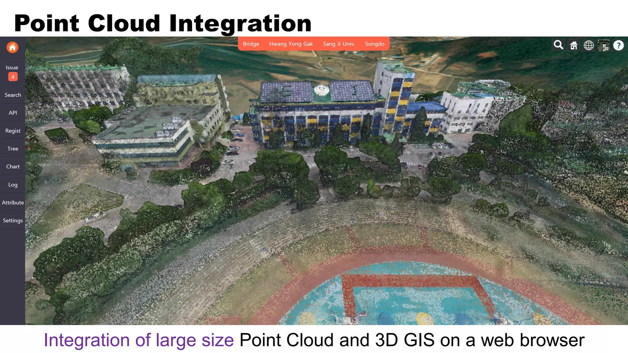
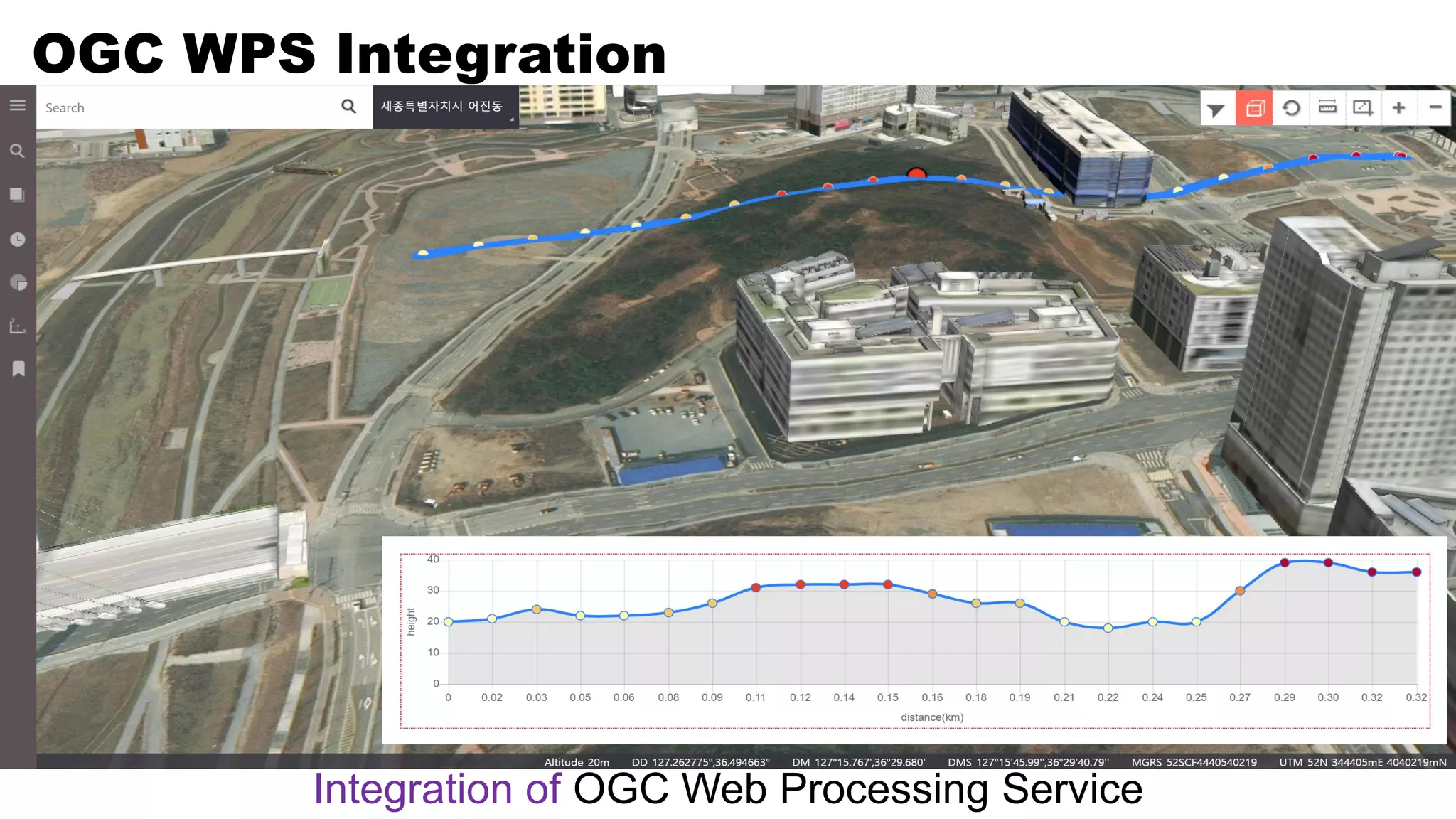
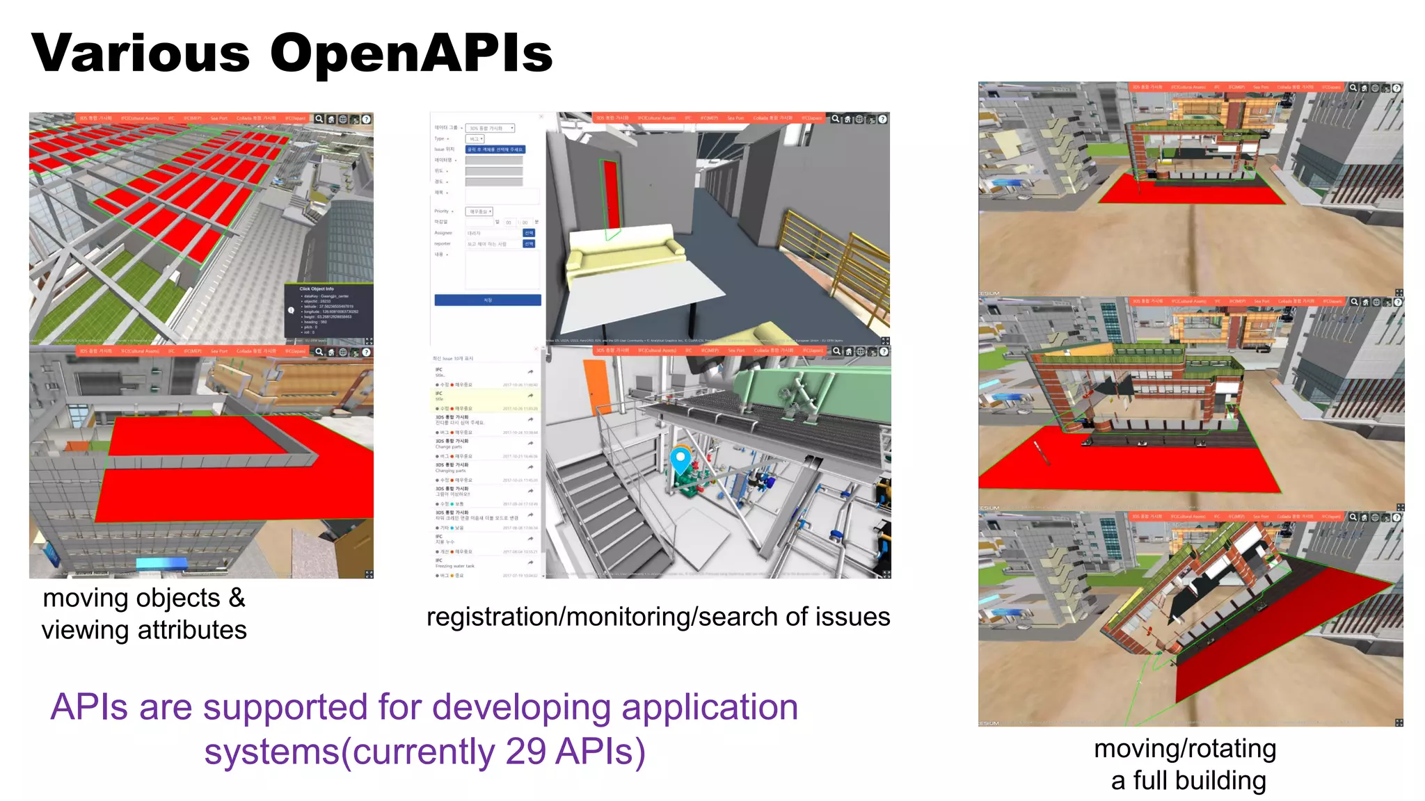

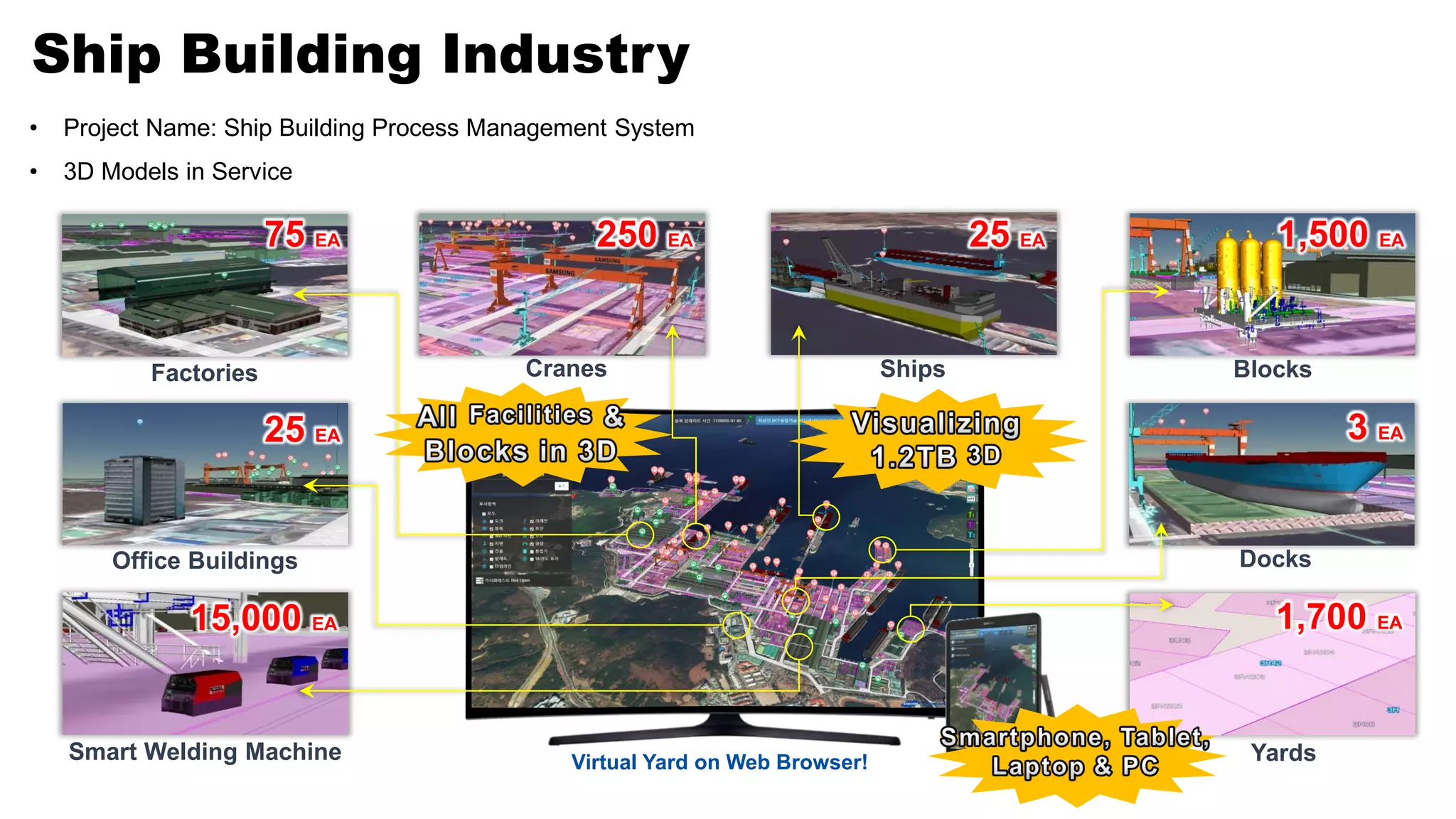
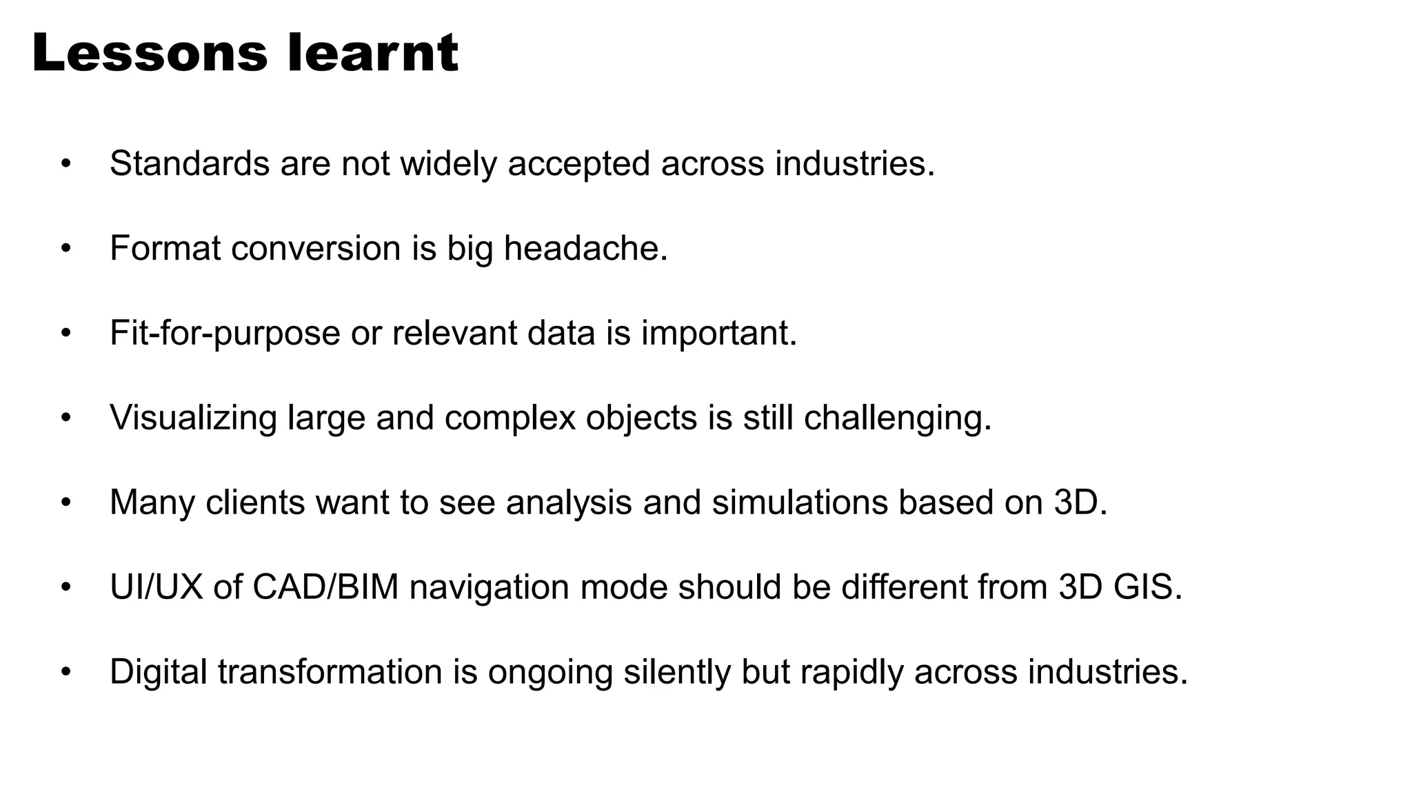

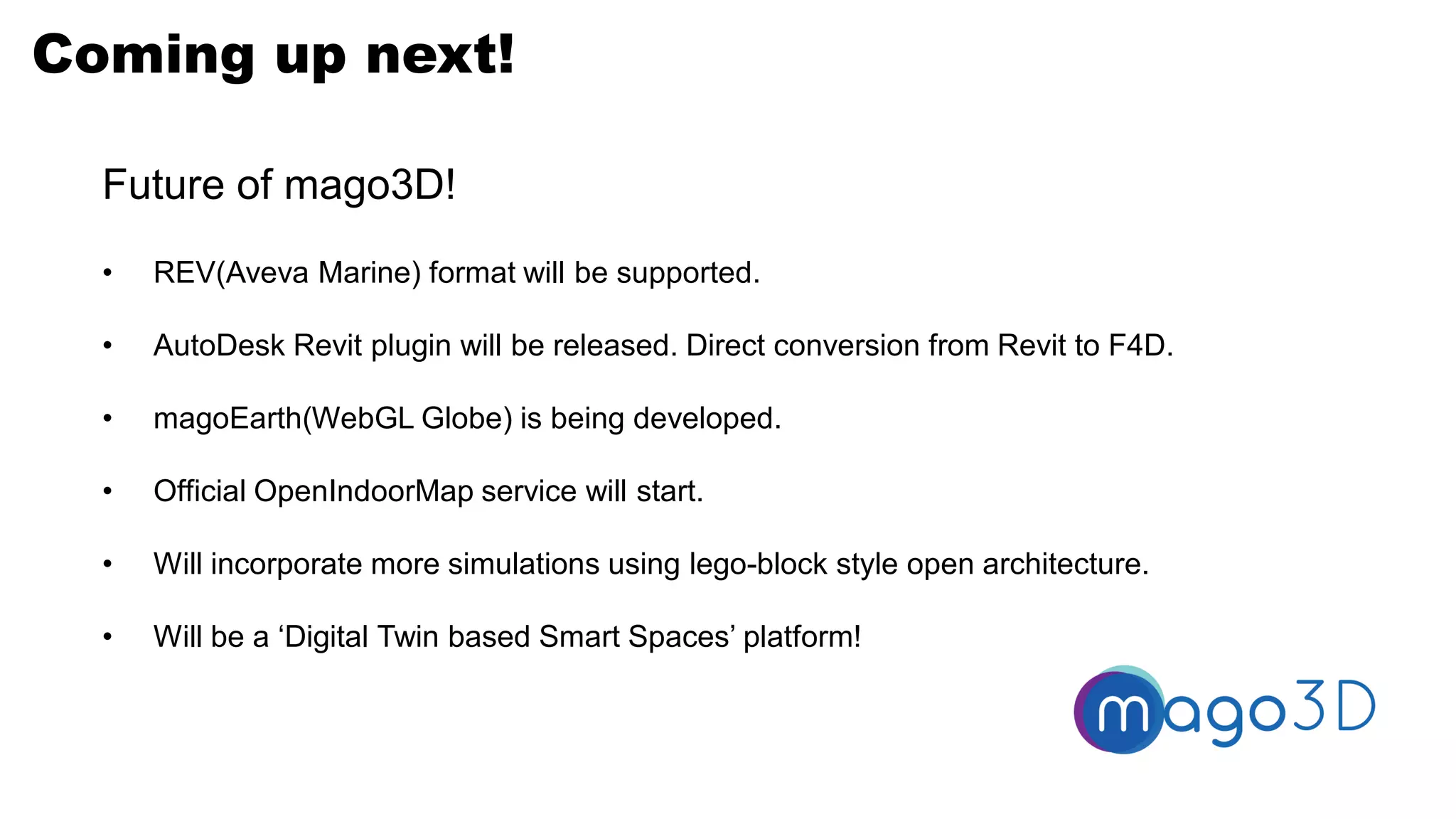
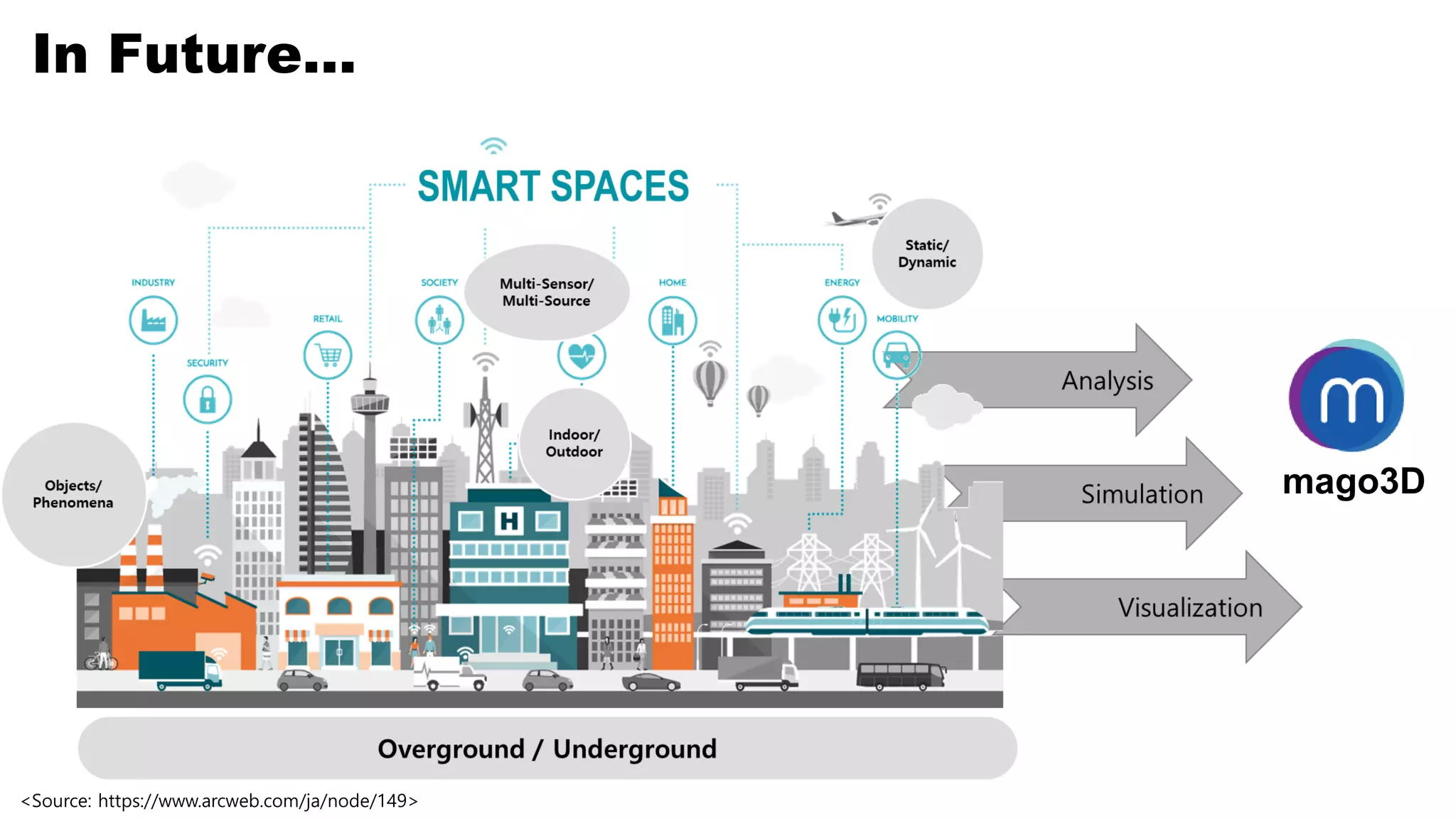


The document discusses the integration of CAD, BIM, and GIS on a web-based platform, emphasizing the challenges and solutions in handling complex 3D data. It outlines the development history and key features of the Mago3D system, including its open-source nature and the introduction of new formats for efficient data handling. Future enhancements and the importance of digital transformation across industries are also highlighted.


![[벤틀리시스템즈코리아 사용자세미나]세슘(Cesium) 제품과 디지털트윈 구현 사례](https://cdn.slidesharecdn.com/ss_thumbnails/gaia3dcesiumintroductionusecase1029-241104081234-24208b36-thumbnail.jpg?width=640&height=640&fit=bounds)


