This document discusses the development of unmanned vehicles for geo-environmental hazard assessment. Specifically, it details the development of a prototype unmanned ground vehicle called GeoBot and unmanned aerial vehicle called GeoCopter by undergraduate interns in 2014-2015. The goal was to create interchangeable sensor platforms that could be mounted on various unmanned vehicles to help evaluate geohazards. Case studies are provided on how GeoBot was used to investigate sinkholes and GeoCopter was used for photogrammetry and remote sensing to map landslides and rockfalls. The document advocates for unmanned vehicles as low-cost, high-resolution tools to access hazardous sites and collect temporal data for monitoring geohazards and failures.
We compared the accuracy of geospatial data derived from a RPAS and an RTK GPS
Aim: To understand the mapping applications RPAS can deployed for
Objective: By the end of this presentation the audience will be able to list the horizontal and vertical accuracies achieved by a RPAS
Check http://www.rpas.ie
Distribution of Oil spill off-shore Lebanon using Remote Sensing.
Oil and chemical spill in the marine environment have a widespread disaster. Real-time oil spill detection and monitoring using high special and spectral resolution severely remote sensing images to predict spill oil location. Build an oil spill distribution map by using GIS. Coastal states use both aerial and satellite remote sensing, this technique is also the dominant method of detection of oil slicks worldwide.
Application of Remote Sensing in Civil EngineeringIEI GSC
Presentation cum talk delivered by Dr Anjana Vyas, Dean CEPT University, Ahmedabad during 31st National Convention of Civil Engineering organized by The Institution of Engineers (India) Gujarat State Center, Ahmedabad
As in the modern days this Presentation covers the breif description about the introduction of Remote Sensing to the students of Civil Engineering with Basic concepts
Roles of gps in high rise buildings constructionKundan Sanap
What is GPS?
History of GPS
How does GPS work?
Application of GPS
GPS over Conventional method for deformation monitoring
Case study- Deformation Monitoring of High rise building using GPS
Long duration, lighter than air, stratospheric airships might offer a unique and compelling platform for a wide range of Earth science and astrophysics. There is also great commercial opportunity in stratospheric, stationary platforms that can remain aloft for months or even years at a time. A 2013 Keck Institute for Space Studies (KISS) series of workshops (http://kiss.caltech.edu/programs.html#airships) brought together a number of scientists and aerospace industry professionals to discuss this potential. The report from that study (http://kiss.caltech.edu/papers/airships/papers/airships.pdf) identified the need for a graduated approach to developing the necessary technology and recommended a funded challenge as one way to meet this need. The NASA Centennial Challenge office funded development of the Airships-20-20-20 Challenge, but NASA ultimately decided not to pursue the Challenge. I will describe the science enabled by airships and the proposed Challenge.
This environment GIS database is very accurate and complete. It was realized by compiling information and maps supplied by oil & gas companies at request of the government, by many departments of the government, by non-governmental organizations.
This database was completed by remote sensing analysis, satellite images digital mapping and field surveys. It is in compliance with the directives of IPIECA (International Petroleum Industry Environmental Conservation Association) and information is both in French and English.
The "PUN" Project (Gabon Urgency National Plan) includes a section about coastal sensitivity in case of oil pollution. The objective of this study was to establish an operational document to make decisions and act in case of accidental pollution, and to set the limits of the environmental and socio-economical coastal impact.
ESI classification (Environnemental sensitivity Index)
Remote sensing applications for seismic planningTTI Production
The cost effective satellite technics and image processing methodologies combined with expertise on surface conditions and geomorphology help reducing risks and provide good pre-analysis assessments for seismic planning and campaign.
Artificial intelligence (AI) is experiencing steadily growing interest over the recent years. For good reason, since these innovative algorithms and methods, such as machine learning and deep neural networks, in which knowledge is acquired and applied based on data, enable the automation of a wide range of processes and quickly deliver precise results. AI is also getting more and more popular in the space sector. The Institute of Space Technology & Space Applications (ISTA) at the Universität der Bundeswehr in Munich is conducting research around AI for space operations, science, and technology. An overview of activities and current developments towards fault management, autonomous collision avoidance, autonomous landing, as well as radio science at ISTA will be presented.
GPS and its use in vehicle movement study in Earthquake Disaster ManagementMayur Rahangdale
What is GPS?
GPS Segments
Pseudo – Random Numbers (PRN)
Coarse acquisition (C/A) code
P code (Precision or Protected code)
P code (Precision or Protected code)
GPS Trilateration
EARTHQUAKE DISASTER MANAGEMENT
Disaster Management Cycle
ADVANTAGE OF GPS IN DISASTER MANAGEMENT
GPS LIMITATION IN DISASTER MANAGEMENT
HOW DOES GPS PLAY A ROLE IN EARTHQUAKE RESCUE?
Case Study - Great East Japan Earthquake in Ishinomaki City, Japan -11 March 2011.
Pointed and well described all google algorithms including its effect on marketers and also picturized explanation which is well analysed by several renowned marketers.
As a 5linx Representative I have the pleasure of helping my family and friends, lower the cost for their products and services used every day!!! CABLE, INTERNET, HOME PHONE, HOME SECURITY SYSTEM & CELL PHONES plus more... Whether it's for your home or business, you can not only save money on products and services used every day, 5LINX offers a home based business opportunity with great tax advantages!!!
I hope you take the time to seriously consider saving money on services you use every day and/or sharing this and developing a growing RECESSION-PROOF business with residual income. By becoming your own BOSS and setting your own hours along with having a better quality of life!!!
I look forward to hearing from you soon.
Nick Reinsch
Text NPVR to 55255 to recieve my virtual business card.
www2.5LINX.net/L707250
5LINX Haiti Opportunity Presentation (Haitian Creole)Nick Reinsch
As a 5linx Representative I have the pleasure of helping my family and friends, lower the cost for their products and services used every day!!! CABLE, INTERNET, HOME PHONE, HOME SECURITY SYSTEM & CELL PHONES plus more... Whether it's for your home or business, you can not only save money on products and services used every day, 5LINX offers a home based business opportunity with great tax advantages!!!
I hope you take the time to seriously consider saving money on services you use every day and/or sharing this and developing a growing RECESSION-PROOF business with residual income. By becoming your own BOSS and setting your own hours along with having a better quality of life!!!
I look forward to hearing from you soon.
Nick Reinsch
Text NPVR to 55255 to recieve my virtual business card.
www2.5LINX.net/L707250
Now your employees have direct access to physicians 24/7/365 via email / phone / video for diagnosing and treating acute care illnesses. Americans are becoming price conscious purchasers of healthcare.
Employers who implement a Telemedicine program are able to lower healthcare costs, reduce medical absenteeism, increase employee productivity and overall plan satisfaction.
Use Telemedicine When You:
- Need basic medical care 24/7
- Don’t want to go to the emergency room or urgent care center
- Can't get timely appointment with your primary care physician
- Need Rx prescription/refills* for common conditions
- Can't afford the cost of office visit due to high deductible or no insurance coverage
- Can't afford to take off time from work
- Traveling and in need of medical care
Healthcare in the United States is in a transformational period
One of the central tenets of the ACA is to utilize technology to improve efficiencies within the healthcare system.
Telemedicine is a true Win-Win for employers and employees alike.
5LINX United States of America Opportunity PresentationNick Reinsch
As a 5linx Representative I have the pleasure of helping my family and friends, lower the cost for their products and services used every day!!! CABLE, INTERNET, HOME PHONE, HOME SECURITY SYSTEM & CELL PHONES plus more... Whether it's for your home or business, you can not only save money on products and services used every day, 5LINX offers a home based business opportunity with great tax advantages!!!
I hope you take the time to seriously consider saving money on services you use every day and/or sharing this and developing a growing RECESSION-PROOF business with residual income. By becoming your own BOSS and setting your own hours along with having a better quality of life!!!
I look forward to hearing from you soon.
Nick Reinsch
Text NPVR to 55255 to recieve my virtual business card.
www2.5LINX.net/L707250
SPARK 2016: Headline Testing May Be The Single Most Impactful Thing You Can DoTrackMaven
See Ory Rinat's presentation from Spark 2016, TrackMaven's annual digital marketing summit focused on the intersection of marketing art and science. Learn more at spark.trackmaven.com
Headlines have to live on their own – unlike in the print world where they were attached to your article and content. They travel across the web, asking readers for their click. Our research has shown that just changing a headline can swing engagement with a piece of content by 30%. So we test our headlines. A lot. Learn how we quickly and cheaply run A/B tests on our headlines, and see some of the key takeaways we apply as a result.
SPARK 2016: Inbound Marketing vs Account Based Marketing: A False Choice?TrackMaven
See Joe Chernov's presentation from Spark 2016, TrackMaven's annual digital marketing summit focused on the intersection of marketing art and science. Learn more at spark.trackmaven.com
We marketers are prone to FCS: False Choice Syndrome. Our programs are paid or organic, inbound or outbound, left brain or right brain. A similar zero sum situation has emerged over the past year: inbound / content marketing or account-based marketing. For most companies, absolutes are impediments to success. A blend of strategies is generally the best path. This example-rich session will explore the relationship between inbound marketing and content marketing and highlight ways to strike a balance.
UAVs are a disruptive technology bringing new geographic data and information to many application domains. UASs are similar to other geographic imagery systems so existing frameworks are applicable. But the diversity of UAVs as platforms along with the diversity of available sensors are presenting challenges in the processing and creation of geospatial products. Efficient processing and dissemination of the data is achieved using software and systems that implement open standards. The challenges identified point to the need for use of existing standards and extending standards. Results from the use of the OGC Sensor Web Enablement set of standards are presented. Next steps in the progress of UAVs and UASs may follow the path of open data, open source and open standards.
Aerial photogrammetry vs. terrestrial photogrammetryNI BT
The photogrammetry is broadly classified into two types as Aerial Photogrammetry and Terrestrial Photogrammetry. Aerial and Terrestrial photogrammetry are used for mapping and measurement related issues. Aerial is far range & terrestrial is close range photogrammetry
This presentation about photogrammetry survey, this presentation gives a complete detail of photogrammetry survey. Photogrammetry survey is a powerful technique used in various industries to obtain accurate measurements and three-dimensional (3D) data from photographs. It involves the process of extracting precise geometric information from images using specialized software, providing a cost-effective and efficient method for capturing and analysing spatial data.
Epitome Geotechnical is a Geo survey Mapping company in India. Our services are Drone Survey and Aerial Photography Survey Services in India.
visit: www.epitomegs.com
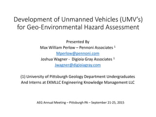
1. Development of Unmanned Vehicles (UMV’s)
for Geo-Environmental Hazard Assessment
Presented By
Max William Perlow – Pennoni Associates 1
Mperlow@pennoni.com
Joshua Wagner - Digioia Gray Associates 1
Jwagner@digioiagray.com
(1) University of Pittsburgh Geology Department Undergraduates
And Interns at EKMLLC Engineering Knowledge Management LLC
AEG Annual Meeting – Pittsburgh PA – September 21-25, 2015
2. GeoBot-GeoCopter Development
2014-2015 Intern Project
2014 Interns: Max Perlow & Joshua Wagner, Undergraduates in the Geology
Department, University of Pittsburgh
Objective: develop specifications for the next generation GeoBot UGV and
companion GeoCopter UAV
Application: Geohazard Hazard Assessment, Mitigation, Emergency
Response, and Failure Investigations.
The success of deploying low technology off-the-shelf
sensors with a radio controlled truck led to the following
undergraduate intern project to develop an interchangeable
suite of sensors that could be mounted on various unmanned
ground and aerial vehicle (UGV & UAV) platforms.
3. Geo-Environmental Hazard Assessment
Requirements
A. EVALUATION OF SITE HISTORY & PAST ACTIVITY
B. EVALUATION OF ACTIVE ON-GOING FAILURES
C. HAZARD ANALYSIS AND MITIGATION
D. EARLY WARNING MONITORING
E. EVALUATION OF MANS ACTIVITIES
F. IMPACT OF EXTREME WEATHER
4. GeoBot Prototype Development
A simple unmanned vehicle (UMV) prototype named GeoBot
was developed to aid the assessment and mitigation of
sinkhole collapse and subsidence failures in 2013- 2014.
5. Geo-Bot Next Generation
Interchangeable Sensor
Universal Mount System
Like the NASA Mars
Rovers that can be
Deployed on a variety of
Un-Manned Ground &
Sea Vehicles such as the
Clearpath Robotics RUV,
UGV’s and USV
http://www.clearpathrobotics.com/robots/
9. Evolution
• 1909
• Wilbur Wright
• und seine Flugmaschine First-
ever use of motion picture
aerial photography as filmed
from a heavier-than-air aircraft
12. Geo-Copter Prototype
• Developed Autumn 2014
• Low-cost, off the shelf, multi-sensor platform
capable UAV
• Intended uses
• Assessment of geologic hazards
• Monitoring of previous failures
• Emergency response assessment of ongoing
failures
• Near Surface Geophysical Surveys
• Geologic/Geomorphic mapping
• Photogrammetry
• Benefits over traditional methods
• High temporal and spatial resolution
• Low cost
• Access to hard to reach and/or hazardous areas
13. Geo-Copter Prototype; Photogrammetry
• Science of making measurements
from photographs
• Cost effective remote mean of
mapping
• Allows/provides access to sites
otherwise difficult to impossible
to investigate conventionally
• Digital Terrain Model generation
• Data used for geotechnical
stability and volumetric
analysis
• Reduction in time required
• Google Earth 3D http://www.ce.utexas.edu/prof/maidment/grad/tate/study/remote/TermProj.html
15. Geo-Copter Next Generation
Interchangeable Sensor Mount
System that can be Deployed from
Commercially Available UAV’s.
Use of Geo-Copters to Drop Off &
Retrieve Remote Sensor Packs
16. GeoBot Case Studies
Storm Line Sinkhole
Bethlehem, PA - 2013
• Sinkhole Cavity
Evaluation
• Storm Line Condition
• Monitoring Storm Line
during Low Mobility
Grouting - Grout
Migration into Pipe, Pipe
Invert Elevation and
Horizontal Alignment
Storm Arch Collapse
Fountain Hill PA - 2014
• Sinkhole Cavity
Evaluation
• Roof Drain Piping
Inspection
• Arch Condition and
Dimensions
• Monitoring of Flow Fill
Placement
21. Unmanned Aerial Systems Case Studies
UAV-based remote sensing of the
Super-Sauze landslide: Evaluation
and results
• Digital compact camera on mini quad-
rotor UAV
• Southern French Alps
• High-resolution ortho-mosaic of entire
landslide and DTMs of several regions
• Horizontal displacements of 7-55 m
between a high-res ortho-photo of May
2007 and a UAV-based ortho-mosaic of
October 2008
• Conclusions: “…radio controlled low-cost
UAVs can deliver high-resolution remote
sensing data on landslides”
Use of UAVs for photogrammetric
surveys in rockfall instability
studies
• UAV photogrammetry based on the use
of a drone helicopter
• Two rock slopes subject to frequent
rockfalls (Italy)
• Stereographic projections comparing data
from UAV-DTP and geological-engineering
surveys show good general
correspondence
• Conclusions: “Use of UAV is a good
terrestrial photogrammetric procedure to
reduce operating costs and speed up
acquisition phases…powerful tool for rock
slope stability analysis, discontinuity and
slope geometry…”
22. Unmanned Aerial Systems Case Studies
Application of Thermography to
Karst Hydrogeology and Natural
Gas Exploration and Development
• Use thermal imaging applied to
Oklahoma carbonate and shale outcrops
to detect heat signatures from karst
features and fractures
• Infrared thermograms of cavities and
fractures correlated with known features
on outcrop
• “This technique holds a promising
application for aerial detection of new
caves and fracture charazterization for
hydrocarbon exploration”
Aerial infrared thermography in the
surface waters contamination
monitoring
• Contamination monitoring by IR
thermography based on
• Rendering of the IR raw data that produce
images with a visible augmentation of
anomolies
• Illegal sanitary sewer and storm-drain
connections, illicit discharges and other
anomalies
• Plume of (contaminated) kiquid joining
and flowing…visible in thermal IR
spectrum due to difference in
temperatures of two liquids
• Aerial platform
• Multi-Spectral data?