SlideShare a Scribd company logo
1 of 20
Roles of GPS in High rise
buildings construction
• Name- Kundan Sahadev Sanap
• Roll No.- 202030016
• Subject- Integrated GIS & GPS In
Infrastructure
• Guide- Dr. S. Y. Mhaske
Veermata Jijabai Technological Institute,
Matunga
What is GPS?
• GPS is the shortened form of NAVSTAR GPS
• Its an abbreviated form of NAVigation Signal Time And Ranging Global
Positioning System.
• Space based satellite navigation system
• Provides location and time information
• In all weather, anywhere on or near the Earth.
What is GPS?
• GPS is a U.S.-owned utility that provides users with positioning, navigation, and
timing (PNT) services.
• This system consists of three segments:
• The space segment,
• The control segment, and
• The user segment.
• The U.S. Space Force develops, maintains, and operates the space and control
segments.
History of GPS
• The GPS project was developed in 1973 to overcome the limitations of previous
navigation systems.
• GPS was created and realized by the U.S. Department of Defense and was
originally run with 24 satellites.
• It became fully operational in 1995.
• “Bradford Parkinson”, “Roger L. Easton”, and “Ivan A. Getting” are credited with
inventing it.
How does GPS work?
• GPS network is depends on constellation of 24
satellites
• It is based on Trilateration Principle that is “You can
find one’s location if you know its distance from
other already-known locations”
• It requires distance from at least 3 satellites.
• It calculates the time taken to reach the wave at
desired point
Application of GPS
• Used to refer locations
• Environmental Monitoring
• Land seismic surveying
• Tracking the deployed equipment/ machines
• Calculate the 2D dimensions using either the data
collector software or any CAD program
• Monitoring the deformation of high rise buildings
GPS over Conventional method for deformation monitoring
• The advantages of GPS sensors compared to conventional deformation monitoring
sensors are:
• GPS requires no line-of-sight between the stations
• automated operation with high observation rate
• real-time data updates; and
• operates under all weather condition.
Case study- Deformation Monitoring of High rise building using GPS
• Introduction:
• Deformation refers to the changes a deformable body undergoes in its shapes,
dimension and position.
• Probable Reasons:
• changes in ground water level
• tectonic phenomena
• land movements or
• any other natural disasters.
• Deformation of large engineering structures are often measured in order to ensure
that these structures or features are exhibiting safe deformation behavior.
• GPS technique offers significant advantages over other measurement techniques. GPS
allows a high rate of measurement, over long distances between the control and
monitoring points and does not require line of sight to the control points.
Case study- Deformation Monitoring of High rise building using GPS
• Study Area:
• Republic Plaza is located in the Central
Business District (CBD) of Singapore
• Location: 1°17’00"N and 103° 51 '03"E.
• This building is 280 meters tall (66
storeys and 1 basement) and is one of the
tallest building in Singapore.
Case study- Deformation Monitoring of High rise building using GPS
• Monitoring Setup:
• The setup on Republic Plaza consisted of 3
high-precision RTK receivers; 2 Trimble R7
(R701 and R702) and 1 Trimble 5700
(5700).
• The locations of the receivers are shown in
Figure.
• The terminal servers and a router are
installed in a custom-made
weatherproof cabinet located on the
65th floor of the building.
Case study- Deformation Monitoring of High rise building using GPS
• Real time monitoring software:
• The Trimble Integrity Monitoring (TIM) is used for managing and monitoring of the
data sent back from the GPS receivers on top of Republic Plaza.
• The TIM monitoring system is a 24/7 continuously operating system which aids in the
monitoring and assessment of the structural health of a building.
• It has 4 main engines to monitor movement:
• RTK engine;
• Network Motion engine;
• Rapid Motion engine; and
• NMEA engine.
• The Rapid Motion engine in particular can monitor sudden big movement in a
network that is usually caused by an earthquake or other seismic activity
• The NMEA engine collect the NMEA output from receivers directly, synchronizes the
data and possibly applies a filter upon it.
Case study- Deformation Monitoring of High rise building using GPS
• Effects of Sumatran Earthquake As
Recorded By Monitoring System
• A 7.6-magnitude earthquake occurred
off the southern coast of Sumatra at
10:16:09 (UTC Time) on 30th
September 2009.
• The epicenter of the earthquake was
about 497km from Singapore.
• Tremors were felt by occupants of
high-rise buildings in Singapore and
Malaysia
Case study- Deformation Monitoring of High rise building using GPS
• Effects of seismic waves on point R701 by TIM NMEA engine
Fig. 12-minute displacement
plot for station R701 showing
high-frequency periodic
motion caused by
earthquake’s shockwave as
captured by the monitoring
system by TIM NMEA Engine
Case study- Deformation Monitoring of High rise building using GPS
• Effects of seismic waves on point R701 by TIM Rapid motion engine
Fig. 12-minute displacement
plot for station R701 showing
high-frequency periodic
motion caused by earthquake’s
shockwave by TIM Rapid
Motion Engine
Case study- Deformation Monitoring of High rise building using GPS
• Observation
• Both methods i.e. the TIM NMEA and the TIM Rapid Motion engines are
able to detect the shockwave motion of the building caused by the earthquake
on 30th September 2009.
• Although the peak-to-peak magnitude of the motion is small, its periodic
nature was captured by the monitoring system.
• The system can thus be used as a supplement to engineers in their building
assessment.
Case study- Deformation Monitoring of High rise building using GPS
• Conclusion:
• The results show that VRS-RTK technique provided by SiReNT and TIM
software is capable for real-time detection of tremors from distance
earthquake events.
• This technique can also be used to estimate displacement of a point and
detecting long-term deformation due to ground movements.
• The data obtain from the VRS-RTK (i.e. Virtual reference Station Real Time
Kinematic) technique need to be integrated into monitoring analysis
procedures and filtering techniques in providing a complete monitoring
solution.
Reference
• Wan Abdul Aziz Wan Mohd Akib, Shu Kian Kok, Zulkarnaini Mat Amin, High
Rise Building Deformation Monitoring With GPS, Department of Geomatic
Engineering.
• Victor H.S. KHOO, Yam Khoon TOR and Gerry ONG, Monitoring of High Rise
Building using Real-Time Differential GPS, Singapore.
Thank You..!!

More Related Content

What's hot

Gps introduction
Gps introductionGps introduction
Gps introductionShafiq Ridz
 
Project on GPS (Global Positioning System)
Project on GPS (Global Positioning System)Project on GPS (Global Positioning System)
Project on GPS (Global Positioning System)Jyotismat Raul
 
Global positioning system
Global positioning systemGlobal positioning system
Global positioning systemArjun Manjooran
 
Gps and remote sensing
Gps and remote sensingGps and remote sensing
Gps and remote sensingSanila Khalid
 
Global positioning system_Surveying, Civil Engineering
Global positioning system_Surveying, Civil EngineeringGlobal positioning system_Surveying, Civil Engineering
Global positioning system_Surveying, Civil EngineeringA Makwana
 
PERFORMANCE TESTING OF TRIMBLE GEOEXPLORER 3 GLOBAL POSITIONING SYSTEM RECEIVER
PERFORMANCE TESTING OF TRIMBLE GEOEXPLORER 3 GLOBAL POSITIONING SYSTEM RECEIVERPERFORMANCE TESTING OF TRIMBLE GEOEXPLORER 3 GLOBAL POSITIONING SYSTEM RECEIVER
PERFORMANCE TESTING OF TRIMBLE GEOEXPLORER 3 GLOBAL POSITIONING SYSTEM RECEIVERSahab Assas Ajaz
 
Global Positioning system GPS - Dr. S. Balamurugan
Global Positioning system GPS - Dr. S. BalamuruganGlobal Positioning system GPS - Dr. S. Balamurugan
Global Positioning system GPS - Dr. S. BalamuruganPrakash Kumar Sekar
 
ANALYSIS OF GPS ERRORS DURING DIFFERENT TIMES IN A DAY
ANALYSIS OF GPS ERRORS DURING DIFFERENT TIMES IN A DAY ANALYSIS OF GPS ERRORS DURING DIFFERENT TIMES IN A DAY
ANALYSIS OF GPS ERRORS DURING DIFFERENT TIMES IN A DAY IJORCS
 
GPS DOCUMENT
GPS DOCUMENTGPS DOCUMENT
GPS DOCUMENTTuhin_Das
 
Global positioning system(GPS)
Global positioning system(GPS)Global positioning system(GPS)
Global positioning system(GPS)Arghaya Goswami
 
Icl gnss helsinki-2014_lisi_v02
Icl gnss helsinki-2014_lisi_v02Icl gnss helsinki-2014_lisi_v02
Icl gnss helsinki-2014_lisi_v02Marco Lisi
 
GPS and its Application
GPS and its ApplicationGPS and its Application
GPS and its Application12208752
 
Practical Applications of GPS Technology
Practical Applications of GPS TechnologyPractical Applications of GPS Technology
Practical Applications of GPS Technologyshakezula
 
Remote sensing and gps
Remote sensing and gpsRemote sensing and gps
Remote sensing and gpsmsfbi1521
 

What's hot (20)

Gps introduction
Gps introductionGps introduction
Gps introduction
 
Project on GPS (Global Positioning System)
Project on GPS (Global Positioning System)Project on GPS (Global Positioning System)
Project on GPS (Global Positioning System)
 
GPS Application
GPS ApplicationGPS Application
GPS Application
 
Gps
GpsGps
Gps
 
Global positioning system
Global positioning systemGlobal positioning system
Global positioning system
 
Gps and remote sensing
Gps and remote sensingGps and remote sensing
Gps and remote sensing
 
Global positioning system_Surveying, Civil Engineering
Global positioning system_Surveying, Civil EngineeringGlobal positioning system_Surveying, Civil Engineering
Global positioning system_Surveying, Civil Engineering
 
PERFORMANCE TESTING OF TRIMBLE GEOEXPLORER 3 GLOBAL POSITIONING SYSTEM RECEIVER
PERFORMANCE TESTING OF TRIMBLE GEOEXPLORER 3 GLOBAL POSITIONING SYSTEM RECEIVERPERFORMANCE TESTING OF TRIMBLE GEOEXPLORER 3 GLOBAL POSITIONING SYSTEM RECEIVER
PERFORMANCE TESTING OF TRIMBLE GEOEXPLORER 3 GLOBAL POSITIONING SYSTEM RECEIVER
 
Global Positioning system GPS - Dr. S. Balamurugan
Global Positioning system GPS - Dr. S. BalamuruganGlobal Positioning system GPS - Dr. S. Balamurugan
Global Positioning system GPS - Dr. S. Balamurugan
 
GPS & GIS
GPS & GISGPS & GIS
GPS & GIS
 
ANALYSIS OF GPS ERRORS DURING DIFFERENT TIMES IN A DAY
ANALYSIS OF GPS ERRORS DURING DIFFERENT TIMES IN A DAY ANALYSIS OF GPS ERRORS DURING DIFFERENT TIMES IN A DAY
ANALYSIS OF GPS ERRORS DURING DIFFERENT TIMES IN A DAY
 
GPS DOCUMENT
GPS DOCUMENTGPS DOCUMENT
GPS DOCUMENT
 
Global positioning system(GPS)
Global positioning system(GPS)Global positioning system(GPS)
Global positioning system(GPS)
 
Introduction-of-GNSS-2
Introduction-of-GNSS-2Introduction-of-GNSS-2
Introduction-of-GNSS-2
 
Icl gnss helsinki-2014_lisi_v02
Icl gnss helsinki-2014_lisi_v02Icl gnss helsinki-2014_lisi_v02
Icl gnss helsinki-2014_lisi_v02
 
GPS and its Application
GPS and its ApplicationGPS and its Application
GPS and its Application
 
Practical Applications of GPS Technology
Practical Applications of GPS TechnologyPractical Applications of GPS Technology
Practical Applications of GPS Technology
 
Remote sensing and gps
Remote sensing and gpsRemote sensing and gps
Remote sensing and gps
 
Gps
GpsGps
Gps
 
8 17
8 178 17
8 17
 

Similar to Roles of gps in high rise buildings construction

Similar to Roles of gps in high rise buildings construction (20)

Application of GPS in mining
Application of GPS in miningApplication of GPS in mining
Application of GPS in mining
 
Global positioning system by abhiram
Global positioning system by abhiramGlobal positioning system by abhiram
Global positioning system by abhiram
 
gps system and application in mining
gps system and application in mininggps system and application in mining
gps system and application in mining
 
Global positioning system 1
Global positioning system  1Global positioning system  1
Global positioning system 1
 
Global positioning system 1
Global positioning system  1Global positioning system  1
Global positioning system 1
 
A seminar on GPS Technology
A seminar on GPS TechnologyA seminar on GPS Technology
A seminar on GPS Technology
 
Presentation on GPS by Harvendra Singh
Presentation on GPS by Harvendra SinghPresentation on GPS by Harvendra Singh
Presentation on GPS by Harvendra Singh
 
Control Surveying.ppt
Control Surveying.pptControl Surveying.ppt
Control Surveying.ppt
 
Remote Sensing ppt
Remote Sensing pptRemote Sensing ppt
Remote Sensing ppt
 
Global positioning system
Global positioning systemGlobal positioning system
Global positioning system
 
Global positioning system( copy1
Global positioning system(   copy1Global positioning system(   copy1
Global positioning system( copy1
 
GPS.pptx
GPS.pptxGPS.pptx
GPS.pptx
 
UNIT 6 introduction to gps
UNIT 6 introduction to gpsUNIT 6 introduction to gps
UNIT 6 introduction to gps
 
Gps surveying
Gps surveyingGps surveying
Gps surveying
 
Implementation of INS-GPS
Implementation of INS-GPSImplementation of INS-GPS
Implementation of INS-GPS
 
GPS technology s.pptx
GPS technology s.pptxGPS technology s.pptx
GPS technology s.pptx
 
GPS ERRORS
GPS ERRORS GPS ERRORS
GPS ERRORS
 
GLOBAL POSITIONING SYSTEM(GPS)
GLOBAL POSITIONING SYSTEM(GPS)GLOBAL POSITIONING SYSTEM(GPS)
GLOBAL POSITIONING SYSTEM(GPS)
 
GPS
GPS GPS
GPS
 
Paper presentation
Paper presentationPaper presentation
Paper presentation
 

More from Kundan Sanap

Cash flow report using ms project
Cash flow report  using ms projectCash flow report  using ms project
Cash flow report using ms projectKundan Sanap
 
Project monitoring activity
Project monitoring activityProject monitoring activity
Project monitoring activityKundan Sanap
 
Role of artificial intellligence in construction engg & management
Role of artificial intellligence in construction engg & managementRole of artificial intellligence in construction engg & management
Role of artificial intellligence in construction engg & managementKundan Sanap
 
Gantt chart of Minor bridge
Gantt chart of Minor bridge Gantt chart of Minor bridge
Gantt chart of Minor bridge Kundan Sanap
 
Report on Planning & scheduling of a Minor bridge
Report on Planning & scheduling of a Minor bridgeReport on Planning & scheduling of a Minor bridge
Report on Planning & scheduling of a Minor bridgeKundan Sanap
 
Organizational structure of SAIL
Organizational structure of SAILOrganizational structure of SAIL
Organizational structure of SAILKundan Sanap
 
Sampling of cement & its tests
Sampling of cement & its testsSampling of cement & its tests
Sampling of cement & its testsKundan Sanap
 
Forecasting method
Forecasting methodForecasting method
Forecasting methodKundan Sanap
 
Project management information system (PMIS)
Project management information system (PMIS)Project management information system (PMIS)
Project management information system (PMIS)Kundan Sanap
 
Environmental impact assessment case study
Environmental impact assessment case studyEnvironmental impact assessment case study
Environmental impact assessment case studyKundan Sanap
 
Case study on flexible pavement failures
Case study on flexible pavement failuresCase study on flexible pavement failures
Case study on flexible pavement failuresKundan Sanap
 
Cantilever bridge construction
Cantilever bridge constructionCantilever bridge construction
Cantilever bridge constructionKundan Sanap
 

More from Kundan Sanap (12)

Cash flow report using ms project
Cash flow report  using ms projectCash flow report  using ms project
Cash flow report using ms project
 
Project monitoring activity
Project monitoring activityProject monitoring activity
Project monitoring activity
 
Role of artificial intellligence in construction engg & management
Role of artificial intellligence in construction engg & managementRole of artificial intellligence in construction engg & management
Role of artificial intellligence in construction engg & management
 
Gantt chart of Minor bridge
Gantt chart of Minor bridge Gantt chart of Minor bridge
Gantt chart of Minor bridge
 
Report on Planning & scheduling of a Minor bridge
Report on Planning & scheduling of a Minor bridgeReport on Planning & scheduling of a Minor bridge
Report on Planning & scheduling of a Minor bridge
 
Organizational structure of SAIL
Organizational structure of SAILOrganizational structure of SAIL
Organizational structure of SAIL
 
Sampling of cement & its tests
Sampling of cement & its testsSampling of cement & its tests
Sampling of cement & its tests
 
Forecasting method
Forecasting methodForecasting method
Forecasting method
 
Project management information system (PMIS)
Project management information system (PMIS)Project management information system (PMIS)
Project management information system (PMIS)
 
Environmental impact assessment case study
Environmental impact assessment case studyEnvironmental impact assessment case study
Environmental impact assessment case study
 
Case study on flexible pavement failures
Case study on flexible pavement failuresCase study on flexible pavement failures
Case study on flexible pavement failures
 
Cantilever bridge construction
Cantilever bridge constructionCantilever bridge construction
Cantilever bridge construction
 

Recently uploaded

Architect Hassan Khalil Portfolio for 2024
Architect Hassan Khalil Portfolio for 2024Architect Hassan Khalil Portfolio for 2024
Architect Hassan Khalil Portfolio for 2024hassan khalil
 
(PRIYA) Rajgurunagar Call Girls Just Call 7001035870 [ Cash on Delivery ] Pun...
(PRIYA) Rajgurunagar Call Girls Just Call 7001035870 [ Cash on Delivery ] Pun...(PRIYA) Rajgurunagar Call Girls Just Call 7001035870 [ Cash on Delivery ] Pun...
(PRIYA) Rajgurunagar Call Girls Just Call 7001035870 [ Cash on Delivery ] Pun...ranjana rawat
 
Structural Analysis and Design of Foundations: A Comprehensive Handbook for S...
Structural Analysis and Design of Foundations: A Comprehensive Handbook for S...Structural Analysis and Design of Foundations: A Comprehensive Handbook for S...
Structural Analysis and Design of Foundations: A Comprehensive Handbook for S...Dr.Costas Sachpazis
 
chaitra-1.pptx fake news detection using machine learning
chaitra-1.pptx  fake news detection using machine learningchaitra-1.pptx  fake news detection using machine learning
chaitra-1.pptx fake news detection using machine learningmisbanausheenparvam
 
Call for Papers - African Journal of Biological Sciences, E-ISSN: 2663-2187, ...
Call for Papers - African Journal of Biological Sciences, E-ISSN: 2663-2187, ...Call for Papers - African Journal of Biological Sciences, E-ISSN: 2663-2187, ...
Call for Papers - African Journal of Biological Sciences, E-ISSN: 2663-2187, ...Christo Ananth
 
Decoding Kotlin - Your guide to solving the mysterious in Kotlin.pptx
Decoding Kotlin - Your guide to solving the mysterious in Kotlin.pptxDecoding Kotlin - Your guide to solving the mysterious in Kotlin.pptx
Decoding Kotlin - Your guide to solving the mysterious in Kotlin.pptxJoão Esperancinha
 
Coefficient of Thermal Expansion and their Importance.pptx
Coefficient of Thermal Expansion and their Importance.pptxCoefficient of Thermal Expansion and their Importance.pptx
Coefficient of Thermal Expansion and their Importance.pptxAsutosh Ranjan
 
Microscopic Analysis of Ceramic Materials.pptx
Microscopic Analysis of Ceramic Materials.pptxMicroscopic Analysis of Ceramic Materials.pptx
Microscopic Analysis of Ceramic Materials.pptxpurnimasatapathy1234
 
Gfe Mayur Vihar Call Girls Service WhatsApp -> 9999965857 Available 24x7 ^ De...
Gfe Mayur Vihar Call Girls Service WhatsApp -> 9999965857 Available 24x7 ^ De...Gfe Mayur Vihar Call Girls Service WhatsApp -> 9999965857 Available 24x7 ^ De...
Gfe Mayur Vihar Call Girls Service WhatsApp -> 9999965857 Available 24x7 ^ De...srsj9000
 
Introduction to Multiple Access Protocol.pptx
Introduction to Multiple Access Protocol.pptxIntroduction to Multiple Access Protocol.pptx
Introduction to Multiple Access Protocol.pptxupamatechverse
 
Processing & Properties of Floor and Wall Tiles.pptx
Processing & Properties of Floor and Wall Tiles.pptxProcessing & Properties of Floor and Wall Tiles.pptx
Processing & Properties of Floor and Wall Tiles.pptxpranjaldaimarysona
 
OSVC_Meta-Data based Simulation Automation to overcome Verification Challenge...
OSVC_Meta-Data based Simulation Automation to overcome Verification Challenge...OSVC_Meta-Data based Simulation Automation to overcome Verification Challenge...
OSVC_Meta-Data based Simulation Automation to overcome Verification Challenge...Soham Mondal
 
(ANVI) Koregaon Park Call Girls Just Call 7001035870 [ Cash on Delivery ] Pun...
(ANVI) Koregaon Park Call Girls Just Call 7001035870 [ Cash on Delivery ] Pun...(ANVI) Koregaon Park Call Girls Just Call 7001035870 [ Cash on Delivery ] Pun...
(ANVI) Koregaon Park Call Girls Just Call 7001035870 [ Cash on Delivery ] Pun...ranjana rawat
 
The Most Attractive Pune Call Girls Budhwar Peth 8250192130 Will You Miss Thi...
The Most Attractive Pune Call Girls Budhwar Peth 8250192130 Will You Miss Thi...The Most Attractive Pune Call Girls Budhwar Peth 8250192130 Will You Miss Thi...
The Most Attractive Pune Call Girls Budhwar Peth 8250192130 Will You Miss Thi...ranjana rawat
 
Analog to Digital and Digital to Analog Converter
Analog to Digital and Digital to Analog ConverterAnalog to Digital and Digital to Analog Converter
Analog to Digital and Digital to Analog ConverterAbhinavSharma374939
 
MANUFACTURING PROCESS-II UNIT-2 LATHE MACHINE
MANUFACTURING PROCESS-II UNIT-2 LATHE MACHINEMANUFACTURING PROCESS-II UNIT-2 LATHE MACHINE
MANUFACTURING PROCESS-II UNIT-2 LATHE MACHINESIVASHANKAR N
 
(ANJALI) Dange Chowk Call Girls Just Call 7001035870 [ Cash on Delivery ] Pun...
(ANJALI) Dange Chowk Call Girls Just Call 7001035870 [ Cash on Delivery ] Pun...(ANJALI) Dange Chowk Call Girls Just Call 7001035870 [ Cash on Delivery ] Pun...
(ANJALI) Dange Chowk Call Girls Just Call 7001035870 [ Cash on Delivery ] Pun...ranjana rawat
 
Call Girls in Nagpur Suman Call 7001035870 Meet With Nagpur Escorts
Call Girls in Nagpur Suman Call 7001035870 Meet With Nagpur EscortsCall Girls in Nagpur Suman Call 7001035870 Meet With Nagpur Escorts
Call Girls in Nagpur Suman Call 7001035870 Meet With Nagpur EscortsCall Girls in Nagpur High Profile
 

Recently uploaded (20)

Architect Hassan Khalil Portfolio for 2024
Architect Hassan Khalil Portfolio for 2024Architect Hassan Khalil Portfolio for 2024
Architect Hassan Khalil Portfolio for 2024
 
(PRIYA) Rajgurunagar Call Girls Just Call 7001035870 [ Cash on Delivery ] Pun...
(PRIYA) Rajgurunagar Call Girls Just Call 7001035870 [ Cash on Delivery ] Pun...(PRIYA) Rajgurunagar Call Girls Just Call 7001035870 [ Cash on Delivery ] Pun...
(PRIYA) Rajgurunagar Call Girls Just Call 7001035870 [ Cash on Delivery ] Pun...
 
Structural Analysis and Design of Foundations: A Comprehensive Handbook for S...
Structural Analysis and Design of Foundations: A Comprehensive Handbook for S...Structural Analysis and Design of Foundations: A Comprehensive Handbook for S...
Structural Analysis and Design of Foundations: A Comprehensive Handbook for S...
 
chaitra-1.pptx fake news detection using machine learning
chaitra-1.pptx  fake news detection using machine learningchaitra-1.pptx  fake news detection using machine learning
chaitra-1.pptx fake news detection using machine learning
 
Call for Papers - African Journal of Biological Sciences, E-ISSN: 2663-2187, ...
Call for Papers - African Journal of Biological Sciences, E-ISSN: 2663-2187, ...Call for Papers - African Journal of Biological Sciences, E-ISSN: 2663-2187, ...
Call for Papers - African Journal of Biological Sciences, E-ISSN: 2663-2187, ...
 
Decoding Kotlin - Your guide to solving the mysterious in Kotlin.pptx
Decoding Kotlin - Your guide to solving the mysterious in Kotlin.pptxDecoding Kotlin - Your guide to solving the mysterious in Kotlin.pptx
Decoding Kotlin - Your guide to solving the mysterious in Kotlin.pptx
 
Coefficient of Thermal Expansion and their Importance.pptx
Coefficient of Thermal Expansion and their Importance.pptxCoefficient of Thermal Expansion and their Importance.pptx
Coefficient of Thermal Expansion and their Importance.pptx
 
Microscopic Analysis of Ceramic Materials.pptx
Microscopic Analysis of Ceramic Materials.pptxMicroscopic Analysis of Ceramic Materials.pptx
Microscopic Analysis of Ceramic Materials.pptx
 
Gfe Mayur Vihar Call Girls Service WhatsApp -> 9999965857 Available 24x7 ^ De...
Gfe Mayur Vihar Call Girls Service WhatsApp -> 9999965857 Available 24x7 ^ De...Gfe Mayur Vihar Call Girls Service WhatsApp -> 9999965857 Available 24x7 ^ De...
Gfe Mayur Vihar Call Girls Service WhatsApp -> 9999965857 Available 24x7 ^ De...
 
Introduction to Multiple Access Protocol.pptx
Introduction to Multiple Access Protocol.pptxIntroduction to Multiple Access Protocol.pptx
Introduction to Multiple Access Protocol.pptx
 
Processing & Properties of Floor and Wall Tiles.pptx
Processing & Properties of Floor and Wall Tiles.pptxProcessing & Properties of Floor and Wall Tiles.pptx
Processing & Properties of Floor and Wall Tiles.pptx
 
OSVC_Meta-Data based Simulation Automation to overcome Verification Challenge...
OSVC_Meta-Data based Simulation Automation to overcome Verification Challenge...OSVC_Meta-Data based Simulation Automation to overcome Verification Challenge...
OSVC_Meta-Data based Simulation Automation to overcome Verification Challenge...
 
(ANVI) Koregaon Park Call Girls Just Call 7001035870 [ Cash on Delivery ] Pun...
(ANVI) Koregaon Park Call Girls Just Call 7001035870 [ Cash on Delivery ] Pun...(ANVI) Koregaon Park Call Girls Just Call 7001035870 [ Cash on Delivery ] Pun...
(ANVI) Koregaon Park Call Girls Just Call 7001035870 [ Cash on Delivery ] Pun...
 
DJARUM4D - SLOT GACOR ONLINE | SLOT DEMO ONLINE
DJARUM4D - SLOT GACOR ONLINE | SLOT DEMO ONLINEDJARUM4D - SLOT GACOR ONLINE | SLOT DEMO ONLINE
DJARUM4D - SLOT GACOR ONLINE | SLOT DEMO ONLINE
 
The Most Attractive Pune Call Girls Budhwar Peth 8250192130 Will You Miss Thi...
The Most Attractive Pune Call Girls Budhwar Peth 8250192130 Will You Miss Thi...The Most Attractive Pune Call Girls Budhwar Peth 8250192130 Will You Miss Thi...
The Most Attractive Pune Call Girls Budhwar Peth 8250192130 Will You Miss Thi...
 
Analog to Digital and Digital to Analog Converter
Analog to Digital and Digital to Analog ConverterAnalog to Digital and Digital to Analog Converter
Analog to Digital and Digital to Analog Converter
 
MANUFACTURING PROCESS-II UNIT-2 LATHE MACHINE
MANUFACTURING PROCESS-II UNIT-2 LATHE MACHINEMANUFACTURING PROCESS-II UNIT-2 LATHE MACHINE
MANUFACTURING PROCESS-II UNIT-2 LATHE MACHINE
 
(ANJALI) Dange Chowk Call Girls Just Call 7001035870 [ Cash on Delivery ] Pun...
(ANJALI) Dange Chowk Call Girls Just Call 7001035870 [ Cash on Delivery ] Pun...(ANJALI) Dange Chowk Call Girls Just Call 7001035870 [ Cash on Delivery ] Pun...
(ANJALI) Dange Chowk Call Girls Just Call 7001035870 [ Cash on Delivery ] Pun...
 
Call Girls in Nagpur Suman Call 7001035870 Meet With Nagpur Escorts
Call Girls in Nagpur Suman Call 7001035870 Meet With Nagpur EscortsCall Girls in Nagpur Suman Call 7001035870 Meet With Nagpur Escorts
Call Girls in Nagpur Suman Call 7001035870 Meet With Nagpur Escorts
 
★ CALL US 9953330565 ( HOT Young Call Girls In Badarpur delhi NCR
★ CALL US 9953330565 ( HOT Young Call Girls In Badarpur delhi NCR★ CALL US 9953330565 ( HOT Young Call Girls In Badarpur delhi NCR
★ CALL US 9953330565 ( HOT Young Call Girls In Badarpur delhi NCR
 

Roles of gps in high rise buildings construction

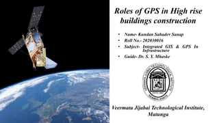
  • 1. Roles of GPS in High rise buildings construction • Name- Kundan Sahadev Sanap • Roll No.- 202030016 • Subject- Integrated GIS & GPS In Infrastructure • Guide- Dr. S. Y. Mhaske Veermata Jijabai Technological Institute, Matunga
  • 2. What is GPS? • GPS is the shortened form of NAVSTAR GPS • Its an abbreviated form of NAVigation Signal Time And Ranging Global Positioning System. • Space based satellite navigation system • Provides location and time information • In all weather, anywhere on or near the Earth.
  • 3. What is GPS? • GPS is a U.S.-owned utility that provides users with positioning, navigation, and timing (PNT) services. • This system consists of three segments: • The space segment, • The control segment, and • The user segment. • The U.S. Space Force develops, maintains, and operates the space and control segments.
  • 4. History of GPS • The GPS project was developed in 1973 to overcome the limitations of previous navigation systems. • GPS was created and realized by the U.S. Department of Defense and was originally run with 24 satellites. • It became fully operational in 1995. • “Bradford Parkinson”, “Roger L. Easton”, and “Ivan A. Getting” are credited with inventing it.
  • 5. How does GPS work? • GPS network is depends on constellation of 24 satellites • It is based on Trilateration Principle that is “You can find one’s location if you know its distance from other already-known locations” • It requires distance from at least 3 satellites. • It calculates the time taken to reach the wave at desired point
  • 6. Application of GPS • Used to refer locations • Environmental Monitoring • Land seismic surveying • Tracking the deployed equipment/ machines • Calculate the 2D dimensions using either the data collector software or any CAD program • Monitoring the deformation of high rise buildings
  • 7. GPS over Conventional method for deformation monitoring • The advantages of GPS sensors compared to conventional deformation monitoring sensors are: • GPS requires no line-of-sight between the stations • automated operation with high observation rate • real-time data updates; and • operates under all weather condition.
  • 8. Case study- Deformation Monitoring of High rise building using GPS • Introduction: • Deformation refers to the changes a deformable body undergoes in its shapes, dimension and position. • Probable Reasons: • changes in ground water level • tectonic phenomena • land movements or • any other natural disasters. • Deformation of large engineering structures are often measured in order to ensure that these structures or features are exhibiting safe deformation behavior. • GPS technique offers significant advantages over other measurement techniques. GPS allows a high rate of measurement, over long distances between the control and monitoring points and does not require line of sight to the control points.
  • 9. Case study- Deformation Monitoring of High rise building using GPS • Study Area: • Republic Plaza is located in the Central Business District (CBD) of Singapore • Location: 1°17’00"N and 103° 51 '03"E. • This building is 280 meters tall (66 storeys and 1 basement) and is one of the tallest building in Singapore.
  • 10. Case study- Deformation Monitoring of High rise building using GPS • Monitoring Setup: • The setup on Republic Plaza consisted of 3 high-precision RTK receivers; 2 Trimble R7 (R701 and R702) and 1 Trimble 5700 (5700). • The locations of the receivers are shown in Figure. • The terminal servers and a router are installed in a custom-made weatherproof cabinet located on the 65th floor of the building.
  • 11. Case study- Deformation Monitoring of High rise building using GPS
  • 12. Case study- Deformation Monitoring of High rise building using GPS • Real time monitoring software: • The Trimble Integrity Monitoring (TIM) is used for managing and monitoring of the data sent back from the GPS receivers on top of Republic Plaza. • The TIM monitoring system is a 24/7 continuously operating system which aids in the monitoring and assessment of the structural health of a building. • It has 4 main engines to monitor movement: • RTK engine; • Network Motion engine; • Rapid Motion engine; and • NMEA engine. • The Rapid Motion engine in particular can monitor sudden big movement in a network that is usually caused by an earthquake or other seismic activity • The NMEA engine collect the NMEA output from receivers directly, synchronizes the data and possibly applies a filter upon it.
  • 13. Case study- Deformation Monitoring of High rise building using GPS
  • 14. Case study- Deformation Monitoring of High rise building using GPS • Effects of Sumatran Earthquake As Recorded By Monitoring System • A 7.6-magnitude earthquake occurred off the southern coast of Sumatra at 10:16:09 (UTC Time) on 30th September 2009. • The epicenter of the earthquake was about 497km from Singapore. • Tremors were felt by occupants of high-rise buildings in Singapore and Malaysia
  • 15. Case study- Deformation Monitoring of High rise building using GPS • Effects of seismic waves on point R701 by TIM NMEA engine Fig. 12-minute displacement plot for station R701 showing high-frequency periodic motion caused by earthquake’s shockwave as captured by the monitoring system by TIM NMEA Engine
  • 16. Case study- Deformation Monitoring of High rise building using GPS • Effects of seismic waves on point R701 by TIM Rapid motion engine Fig. 12-minute displacement plot for station R701 showing high-frequency periodic motion caused by earthquake’s shockwave by TIM Rapid Motion Engine
  • 17. Case study- Deformation Monitoring of High rise building using GPS • Observation • Both methods i.e. the TIM NMEA and the TIM Rapid Motion engines are able to detect the shockwave motion of the building caused by the earthquake on 30th September 2009. • Although the peak-to-peak magnitude of the motion is small, its periodic nature was captured by the monitoring system. • The system can thus be used as a supplement to engineers in their building assessment.
  • 18. Case study- Deformation Monitoring of High rise building using GPS • Conclusion: • The results show that VRS-RTK technique provided by SiReNT and TIM software is capable for real-time detection of tremors from distance earthquake events. • This technique can also be used to estimate displacement of a point and detecting long-term deformation due to ground movements. • The data obtain from the VRS-RTK (i.e. Virtual reference Station Real Time Kinematic) technique need to be integrated into monitoring analysis procedures and filtering techniques in providing a complete monitoring solution.
  • 19. Reference • Wan Abdul Aziz Wan Mohd Akib, Shu Kian Kok, Zulkarnaini Mat Amin, High Rise Building Deformation Monitoring With GPS, Department of Geomatic Engineering. • Victor H.S. KHOO, Yam Khoon TOR and Gerry ONG, Monitoring of High Rise Building using Real-Time Differential GPS, Singapore.