Unmanned aerial vehicles (UAVs), or drones, have many applications in the mining industry that can improve safety, lower costs, and increase productivity and efficiency. Drones can be used to map deposit sites, monitor stockpiles and equipment, survey land, and inspect hazardous areas more safely and cheaply than traditional helicopters. Mining companies are increasingly using drones to generate high-resolution aerial imagery which provides data to assess the mine development, document changes, and calculate stockpile volumes. Drones allow monitoring of both aboveground and underground areas to improve underground worker safety.
Aerial surveying technology is utilized in a wide range of fields throughout the world. These range from the creation of maps, to terrain analysis and research (rivers, soil erosion, coasts, etc.), urban planning, road planning (roads, rails, etc.), and vegetation research (forests, agriculture, lakes and marshland, etc.).
Aerial surveying technology is utilized in a wide range of fields throughout the world. These range from the creation of maps, to terrain analysis and research (rivers, soil erosion, coasts, etc.), urban planning, road planning (roads, rails, etc.), and vegetation research (forests, agriculture, lakes and marshland, etc.).
Generation of high resolution DSM using UAV Images Nepal Flying Labs
A final year project by Geomatics Engineering Students at Kathmandu University,Dhulikhel,Kavre.
All the datasets required for this project have been downloaded from the popular Trimble Company.This project makes use of 27 high resolution (2.4 cm average spatial resolution) UAV-acquired images of a sand mine at Tielt-Winge, Belgium . These images have been acquired by a Sony Nex-5R digital camera mounted on a Trimble UX5 Imaging Rover, a fixed wing UAV. Three software: LPS, AgiSoft PhotoScan and PIX4D were used for image processing.
The team members:
1.Uttam Pudasaini : utmpudasaini@hotmail.com
2.Niroj Panta : sadrose777@gmail.com
3.Biplov Bhandari : bionicbiplov45@gmail.com
4.Upendra Oli : Upendraoli@gmail.com
The concept of total Horizontal and Vertical UncertaintyNzar Braim
My aim in this report is showing The Importance and significance the subject
of hydrographic which is important science in our life especially for some
countries that's covered with the water or let's say the large amount of water
so we knew that survey engineer deals with the coordinates measurement,
errors ,accuracies , other sectors so hydrographic surveyor should observing
carefully because it deals with the water as we know water let's say level of
the water is not suitable changes from place to another due to the gravity of
the Earth and all above mentioned it should be considered for the the
movement of the ships the other water vehicles in the water
Differential Global Positioning System (DGPS) is an enhancement to Global Positioning System that provides improved location accuracy, from the
15-meter nominal GPS accuracy to about 10 cm in case of the best implementations. Differential Global Positioning System (DGPS) is a method of providing differential corrections to a Global Positioning System (GPS) receiver in order to improve the accuracy of the navigation solution. DGPS corrections originate from a reference station at a known location. The receivers in these reference stations can estimate errors in the GPS because, unlike the general population of GPS receivers, they have an accurate knowledge of their position.
DGPS uses a network of fixed, ground-based reference stations to broadcast the difference between the positions indicated by the GPS (satellite) systems and the known fixed positions. These stations broadcast the difference between the measured satellite pseudoranges and actual (internally computed) pseudoranges, and receiver stations may correct their pseudoranges by the same amount. The digital correction signal is typically broadcast locally over ground-based transmitters of shorter range.
Modern oil and gas field management is increasingly reliant on detailed and precise 3D reservoir characterisation, and timely areal monitoring. Borehole seismic techniques bridge the gap between remote surface-seismic observations and downhole reservoir evaluation: Borehole seismic data provide intrinsically higher-resolution, higher-fidelity images than surface-seismic data in the vicinity of the wellbore, and unique access to properties of seismic wavefields to enhance surface-seismic imaging. With the advent of new, operationally-efficient very large wireline receiver arrays; fiber-optic recording using Distributed Acoustic Sensing (DAS); the crosswell seismic reflection technique, and advanced seismic imaging algorithms such as Reverse Time Migration, a new wave of borehole seismic technologies is revolutionizing 3D seismic reservoir characterization and on-demand reservoir surveillance. New borehole seismic technologies are providing deeper insights into static reservoir architecture and properties, and into dynamic reservoir performance for conventional water-flood production, EOR, and CO2 sequestration – in deepwater, unconventional, full-field, and low-footprint environments. This lecture will begin by illustrating the wide range of borehole seismic solutions for reservoir characterization and monitoring, using a diverse set of current- and recent case study examples – through which the audience will gain an understanding of the appropriate use of borehole seismic techniques for field development and management. The lecture will then focus on DAS, explaining how the technique works; its capability to deliver conventional borehole seismic solutions (with key advantages over geophones); then describing DAS’s dramatic impact on field monitoring applications and business-critical decisions. New and enhanced borehole seismic techniques – especially with DAS time-lapse monitoring – are ready to deliver critical reservoir management solutions for your fields.
Unmanned Aerial Systems for Precision MappingUAS Colorado
Presentation by Renee Walmsley, Remote Sensing Program Manager at Tetra Tech, for the August 16, 2017 Rocky Mountain UAS Professionals Meetup at the Esri Broomfield office.
A REVIEW OF THE VERSATILITY OF UAVS TECHNOLOGY APPLICATION IN THE SUPPORT OF ...EbeliaMandaMvula
Green and Automated mining involves the application of intelligent technologies that can greatly improve the quality of mining by enhancing high production, improved safety of operations, sustainable environmental management, and effective mine communication. The world is campaigning for sustainable utilization and exploitation of mineral resources by zero waste and zero mine accidents. Hence to realize this dream, the adoption of smart mining is becoming a priority. Automated mining entails that intelligent technologies are incorporated in the operations of the mines, these technologies include UAVs, robotics and artificial intelligence, Internet of Things (IoT) and different sensors. These technologies are at the helm of safer, faster and more effective collection of big data for better production planning, safety monitoring, transportation and fleet management, and real time monitoring of mining operations. The benefit of these technologies includes effective decision making and more efficient response to safety emergencies of the mine. This study highlights the different applications, advantages and challenges of UAVs and IoT in surface mine operations.
Epitome Geotechnical is a Geo survey Mapping company in India. Our services are Drone Survey and Aerial Photography Survey Services in India.
visit: www.epitomegs.com
In the vast realm of surveying techniques, Epitome provide drone aerial photography survey have emerged as a transformative technology, offering a unique perspective from the sky. This article delves into the evolution, applications, and future trends of drone aerial photography survey, unraveling the myriad advantages and challenges associated with this cutting-edge approach. Drone surveys have revolutionized the field of data collection, offering a nimble and efficient alternative to traditional survey methods. These unmanned aerial vehicles, equipped with advanced sensors and cameras, enable the rapid and cost-effective acquisition of high-resolution imagery and geospatial data.
Slope stability radar a need for open pit mines stabilityNIRAJ6665
Slope stability radar is a relatively new technology and is improving the way mines manage and minimize the risks associated with slope instability, enabling the appropriate precautionary measures to be taken. This technology meets the requirements that a monitoring system should have regarding precision, area coverage and failure mode detection. It is reliable in a variety of conditions, operates in a safe mode not requiring personnel to work on or near instability, and does not obstruct mining operations. The radar is equipped with a wireless link which transmits data in real time so engineers can make immediate decisions without having to be near a potentially unstable slope and the radar is trailer mounted for easy relocation. A variety of displays for data interpretation are available including deformation maps, digital photographs for reference and plots of deformation over time of specific points on the wall face. Alarm thresholds can be set, and are based upon total deformation and deformation of an area over a time frame.
Key words: Open Pit Mines Stability, Slope Stability Radar
Drone Mapping Services Revolutionizing the Future of Surveying and Mapping.pptxfalconsurveyme
Drone mapping services have transformed the landscape of surveying and mapping, offering unparalleled precision, efficiency, and cost-effectiveness. As these technologies continue to advance, we can expect even more accurate data collection, faster processing times, and expanded applications.
This paper will discuss three different aspects of surveying technology, namely the types of surveying technologies available for use in a quarry environment, the types of applications the surveying technologies are used for and comparative performance of different surveying technologies in measuring stockpile volumes.
Drones are increasingly asserting their significance in the realms of engineering and industry, marking a transformative shift in traditional practices. Technological breakthroughs have propelled drones to the forefront, with advancements in flying stability, extended battery life, augmented cargo capacity, and heightened data processing power. Their applications span diverse sectors, from infrastructure assessment to agriculture and disaster response.Industries, too, have embraced drones for various purposes. In agriculture, drones equipped with sensors monitor crop health, detect issues, and optimize irrigation. In mining operations, they map extraction areas, assess reserves, and enhance safety measures. Drones also play a pivotal role in disaster management, swiftly surveying affected areas, locating missing individuals, and supporting emergency response efforts.
10 Major Pros of Unmanned Aerial Vehicle(UAV) Drones.pptxFALCON 3D
Drones that master the art of data collection efficiently are now part of the current inspection standard. The use of unmanned aerial vehicles (UAVs) has prompted various businesses to adopt new methods.
Please Visit: https://www.falcon3dme.com/drone-inspection-services.html
In recent years, drones have become increasingly popular as a tool for land surveying. Drone survey in India has grown in popularity in recent years, thanks to the increasing availability of affordable drones, as well as the many benefits that drones offer over traditional land surveying methods.
Land surveying is a crucial aspect of the construction industry, providing essential information for engineers, architects, and contractors. The use of advanced technologies like Drone Survey in Raipur has revolutionized land surveying, making it more efficient and accurate than ever before.
DevOps and Testing slides at DASA ConnectKari Kakkonen
My and Rik Marselis slides at 30.5.2024 DASA Connect conference. We discuss about what is testing, then what is agile testing and finally what is Testing in DevOps. Finally we had lovely workshop with the participants trying to find out different ways to think about quality and testing in different parts of the DevOps infinity loop.
Encryption in Microsoft 365 - ExpertsLive Netherlands 2024Albert Hoitingh
In this session I delve into the encryption technology used in Microsoft 365 and Microsoft Purview. Including the concepts of Customer Key and Double Key Encryption.
Software Delivery At the Speed of AI: Inflectra Invests In AI-Powered QualityInflectra
In this insightful webinar, Inflectra explores how artificial intelligence (AI) is transforming software development and testing. Discover how AI-powered tools are revolutionizing every stage of the software development lifecycle (SDLC), from design and prototyping to testing, deployment, and monitoring.
Learn about:
• The Future of Testing: How AI is shifting testing towards verification, analysis, and higher-level skills, while reducing repetitive tasks.
• Test Automation: How AI-powered test case generation, optimization, and self-healing tests are making testing more efficient and effective.
• Visual Testing: Explore the emerging capabilities of AI in visual testing and how it's set to revolutionize UI verification.
• Inflectra's AI Solutions: See demonstrations of Inflectra's cutting-edge AI tools like the ChatGPT plugin and Azure Open AI platform, designed to streamline your testing process.
Whether you're a developer, tester, or QA professional, this webinar will give you valuable insights into how AI is shaping the future of software delivery.
Securing your Kubernetes cluster_ a step-by-step guide to success !KatiaHIMEUR1
Today, after several years of existence, an extremely active community and an ultra-dynamic ecosystem, Kubernetes has established itself as the de facto standard in container orchestration. Thanks to a wide range of managed services, it has never been so easy to set up a ready-to-use Kubernetes cluster.
However, this ease of use means that the subject of security in Kubernetes is often left for later, or even neglected. This exposes companies to significant risks.
In this talk, I'll show you step-by-step how to secure your Kubernetes cluster for greater peace of mind and reliability.
Essentials of Automations: Optimizing FME Workflows with ParametersSafe Software
Are you looking to streamline your workflows and boost your projects’ efficiency? Do you find yourself searching for ways to add flexibility and control over your FME workflows? If so, you’re in the right place.
Join us for an insightful dive into the world of FME parameters, a critical element in optimizing workflow efficiency. This webinar marks the beginning of our three-part “Essentials of Automation” series. This first webinar is designed to equip you with the knowledge and skills to utilize parameters effectively: enhancing the flexibility, maintainability, and user control of your FME projects.
Here’s what you’ll gain:
- Essentials of FME Parameters: Understand the pivotal role of parameters, including Reader/Writer, Transformer, User, and FME Flow categories. Discover how they are the key to unlocking automation and optimization within your workflows.
- Practical Applications in FME Form: Delve into key user parameter types including choice, connections, and file URLs. Allow users to control how a workflow runs, making your workflows more reusable. Learn to import values and deliver the best user experience for your workflows while enhancing accuracy.
- Optimization Strategies in FME Flow: Explore the creation and strategic deployment of parameters in FME Flow, including the use of deployment and geometry parameters, to maximize workflow efficiency.
- Pro Tips for Success: Gain insights on parameterizing connections and leveraging new features like Conditional Visibility for clarity and simplicity.
We’ll wrap up with a glimpse into future webinars, followed by a Q&A session to address your specific questions surrounding this topic.
Don’t miss this opportunity to elevate your FME expertise and drive your projects to new heights of efficiency.
LF Energy Webinar: Electrical Grid Modelling and Simulation Through PowSyBl -...DanBrown980551
Do you want to learn how to model and simulate an electrical network from scratch in under an hour?
Then welcome to this PowSyBl workshop, hosted by Rte, the French Transmission System Operator (TSO)!
During the webinar, you will discover the PowSyBl ecosystem as well as handle and study an electrical network through an interactive Python notebook.
PowSyBl is an open source project hosted by LF Energy, which offers a comprehensive set of features for electrical grid modelling and simulation. Among other advanced features, PowSyBl provides:
- A fully editable and extendable library for grid component modelling;
- Visualization tools to display your network;
- Grid simulation tools, such as power flows, security analyses (with or without remedial actions) and sensitivity analyses;
The framework is mostly written in Java, with a Python binding so that Python developers can access PowSyBl functionalities as well.
What you will learn during the webinar:
- For beginners: discover PowSyBl's functionalities through a quick general presentation and the notebook, without needing any expert coding skills;
- For advanced developers: master the skills to efficiently apply PowSyBl functionalities to your real-world scenarios.
UiPath Test Automation using UiPath Test Suite series, part 4DianaGray10
Welcome to UiPath Test Automation using UiPath Test Suite series part 4. In this session, we will cover Test Manager overview along with SAP heatmap.
The UiPath Test Manager overview with SAP heatmap webinar offers a concise yet comprehensive exploration of the role of a Test Manager within SAP environments, coupled with the utilization of heatmaps for effective testing strategies.
Participants will gain insights into the responsibilities, challenges, and best practices associated with test management in SAP projects. Additionally, the webinar delves into the significance of heatmaps as a visual aid for identifying testing priorities, areas of risk, and resource allocation within SAP landscapes. Through this session, attendees can expect to enhance their understanding of test management principles while learning practical approaches to optimize testing processes in SAP environments using heatmap visualization techniques
What will you get from this session?
1. Insights into SAP testing best practices
2. Heatmap utilization for testing
3. Optimization of testing processes
4. Demo
Topics covered:
Execution from the test manager
Orchestrator execution result
Defect reporting
SAP heatmap example with demo
Speaker:
Deepak Rai, Automation Practice Lead, Boundaryless Group and UiPath MVP
GraphRAG is All You need? LLM & Knowledge GraphGuy Korland
Guy Korland, CEO and Co-founder of FalkorDB, will review two articles on the integration of language models with knowledge graphs.
1. Unifying Large Language Models and Knowledge Graphs: A Roadmap.
https://arxiv.org/abs/2306.08302
2. Microsoft Research's GraphRAG paper and a review paper on various uses of knowledge graphs:
https://www.microsoft.com/en-us/research/blog/graphrag-unlocking-llm-discovery-on-narrative-private-data/
Dev Dives: Train smarter, not harder – active learning and UiPath LLMs for do...UiPathCommunity
💥 Speed, accuracy, and scaling – discover the superpowers of GenAI in action with UiPath Document Understanding and Communications Mining™:
See how to accelerate model training and optimize model performance with active learning
Learn about the latest enhancements to out-of-the-box document processing – with little to no training required
Get an exclusive demo of the new family of UiPath LLMs – GenAI models specialized for processing different types of documents and messages
This is a hands-on session specifically designed for automation developers and AI enthusiasts seeking to enhance their knowledge in leveraging the latest intelligent document processing capabilities offered by UiPath.
Speakers:
👨🏫 Andras Palfi, Senior Product Manager, UiPath
👩🏫 Lenka Dulovicova, Product Program Manager, UiPath
GDG Cloud Southlake #33: Boule & Rebala: Effective AppSec in SDLC using Deplo...James Anderson
Effective Application Security in Software Delivery lifecycle using Deployment Firewall and DBOM
The modern software delivery process (or the CI/CD process) includes many tools, distributed teams, open-source code, and cloud platforms. Constant focus on speed to release software to market, along with the traditional slow and manual security checks has caused gaps in continuous security as an important piece in the software supply chain. Today organizations feel more susceptible to external and internal cyber threats due to the vast attack surface in their applications supply chain and the lack of end-to-end governance and risk management.
The software team must secure its software delivery process to avoid vulnerability and security breaches. This needs to be achieved with existing tool chains and without extensive rework of the delivery processes. This talk will present strategies and techniques for providing visibility into the true risk of the existing vulnerabilities, preventing the introduction of security issues in the software, resolving vulnerabilities in production environments quickly, and capturing the deployment bill of materials (DBOM).
Speakers:
Bob Boule
Robert Boule is a technology enthusiast with PASSION for technology and making things work along with a knack for helping others understand how things work. He comes with around 20 years of solution engineering experience in application security, software continuous delivery, and SaaS platforms. He is known for his dynamic presentations in CI/CD and application security integrated in software delivery lifecycle.
Gopinath Rebala
Gopinath Rebala is the CTO of OpsMx, where he has overall responsibility for the machine learning and data processing architectures for Secure Software Delivery. Gopi also has a strong connection with our customers, leading design and architecture for strategic implementations. Gopi is a frequent speaker and well-known leader in continuous delivery and integrating security into software delivery.
GDG Cloud Southlake #33: Boule & Rebala: Effective AppSec in SDLC using Deplo...
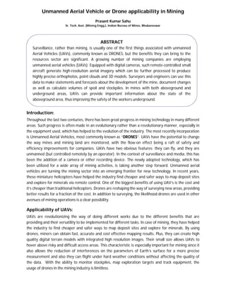
Unmanned aerial vehicle or drone applicability in mining
1. Unmanned Aerial Vehicle or Drone applicability in Mining
Prasant Kumar Sahu
Sr. Tech. Asst. (Mining Engg.), Indian Bureau of Mines, Bhubaneswar
Introduction:
Throughout the last two centuries, there has been great progress in mining technology in many different
areas. Such progress is often made in an evolutionary rather than a revolutionary manner, especially in
the equipment used, which has helped to the evolution of the industry. The most recently incorporation
is Unmanned Aerial Vehicles, most commonly known as “DRONES”. UAVs have the potential to change
the way mines and mining land are monitored, with the flow-on effect being a raft of safety and
efficiency improvements for companies. UAVs have two obvious features: they can fly, and they are
unmanned (but controlled remotely by an operator). In the context of surveillance and media, this has
been the addition of a camera or other recording device. The newly adopted technology, which has
been utilized for a wide array of mining activities, is taking another step forward. Unmanned aerial
vehicles are turning the mining sector into an emerging frontier for new technology. In recent years,
these miniature helicopters have helped the industry find cheaper and safer ways to map deposit sites
and explore for minerals via remote control. One of the biggest benefits of using UAV’s is the cost and
it’s cheaper than traditional helicopters. Drones are reshaping the way of surveying new areas, providing
better results for a fraction of the cost. In addition to surveying, the likelihood drones are used in other
avenues of mining operations is a clear possibility.
Applicability of UAVs:
UAVs are revolutionizing the way of doing different works due to the different benefits that are
providing and their versatility to be implemented for different tasks. In case of mining, they have helped
the industry to find cheaper and safer ways to map deposit sites and explore for minerals. By using
drones, miners can obtain fast, accurate and cost effective mapping results. Plus, they can create high
quality digital terrain models with integrated high resolution images. Their small size allows UAVs to
hover above risky and difficult access areas. This characteristic is especially important for mining since it
also allows the reduction of interferences on the parameters of Earth’s surface for a more precise
measurement and also they can flight under hard weather conditions without affecting the quality of
the data. With the ability to monitor stockpiles, map exploration targets and track equipment, the
usage of drones in the mining industry is limitless.
ABSTRACT
Surveillance, rather than mining, is usually one of the first things associated with unmanned
Aerial Vehicles (UAVs), commonly known as DRONES, but the benefits they can bring to the
resources sector are significant. A growing number of mining companies are employing
unmanned aerial vehicles (UAVs). Equipped with digital cameras, such remote-controlled small
aircraft generate high-resolution aerial imagery which can be further processed to produce
highly precise orthophotos, point clouds and 3D models. Surveyors and engineers can use this
data to make statements and forecasts about the development of the mine, document changes
as well as calculate volumes of spoil and stockpiles. In mines with both aboveground and
underground areas, UAVs can provide important information about the state of the
aboveground area, thus improving the safety of the workers underground.
2. Some of their applications in Mining:
Geological reconnaissance
Iteration mapping and target generation
Mine Planning
Mine measurement/survey/dispute resolution
Mine development reports
Structural and terrain analysis
Hyper spectral analysis
Mine dump and tailings analysis
To survey or monitor exploration land
To monitor mining lease perimeters and the condition of related infrastructure such as haul roads
To assist in the condition monitoring of the mine itself, including to identify potential subsidence
or deterioration of benches
To monitor the deployment of equipment and personnel
Safety and Security (search & rescue, monitoring / providing information from dangerous and
difficult locations)
Exploration and Development (such as aerial photography and remote sensing)
Productivity (stockpile mapping, mine mapping & reconciliation and time lapse photography)
List of wide ranging applicability
Sl. No. Role /Purpose of Use Sl. No. Role /Purpose of Use
1
Geology:
• Stock pile management
• Grade control & exploration planning
7
Managing Waste Dumps:
• Dumping of waste from extraction
needs to be monitored whether the
waste is being put in the right site as per
the regulations or norms are being
violated.
2
Hydrology:
• Drainage and water management
• Watershed, drainage basin & water
flow mapping
• Thermal detection of ground water
inflows
• Tailings dam management
8
Heritage & Environmental Management:
• Reporting
• Erosion detection
• Vegetation change tracking
• Inundation tracking
• Slurry pipeline stability & leakage
detection
• Game counting
• Surrounding community mapping
3
Mineral Exploration:
• Resource calculation
• Geophysical & watershed/catchment
area modelling
• Supporting photography (land usage,
SEIA etc.)
9
Regulation and Operation of Mines:
• In case of regulations and operations,
the activities are volume of extraction
which has been reported by the mining
agency, whether the volume has been
reported correctly or not. It is generally a
time taking process.
Drone or UAV
3. 4
Short-Term Planning:
• Pit & dump management
• Communication of daily/weekly
mining plans
• Haul route surface optimization
• Storm damage assessment & control
10
Post Mining Reclamation:
• For Reclamation activities, mining
agency needs to reclaim the land after the
mine has been closed. IBM has to monitor
whether the reclamation has been done
as committed by the agency. Count the
number of trees that has been planted or
calculate the total green cover area that
has been developed as part of
reclamation drive.
5
Long-Term Planning:
• Haul road, dump and pit design
• Geotechnical
• Surface stability monitoring
• Joint mapping
• Control for mining in void areas
• Mapping of steep inaccessible
inclines
11
Surveillance or Monitoring:
• Surveillance or monitoring of any illegal
mining activities being performed in any
area.
6
Drill & Blast:
• Up-to-date surfaces for optimized
blast designs
• Pre- & post-blast data
• Identification of misfires & wall
damage
12
Community:
• Community relations/marketing
• Impact reporting
• Oblique imagery
Conclusion:-
Furthermore, there are current changing trends in mining technology show a huge rise in automation
which directly impacts on the operational cost as well safety incidents. Currently UAVs can be viable for
mining industries which could cater for specialist jobs in their relevant field. With changes to the
feasibility as costs decrease and quality of the systems increase UAVs will become more prevalent in
mining industries in the upcoming future.
Reference:
1. The Ministry of Mines, Government of India. Website: - www.mines.nic.in.
2.www.dronedeploy.com,www.alphaunmannedsystems.com,www.lexology.com,www.miningglobal.co
m, www.sensefly.com, www.gim-international.com
Benefits of adopting UAVs in Mining
Improved Safety Cost-effectiveness More Reliability Boosting ProductivityHigher Mobility