Download to read offline
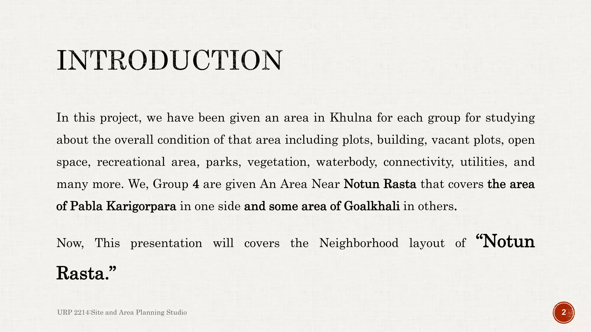
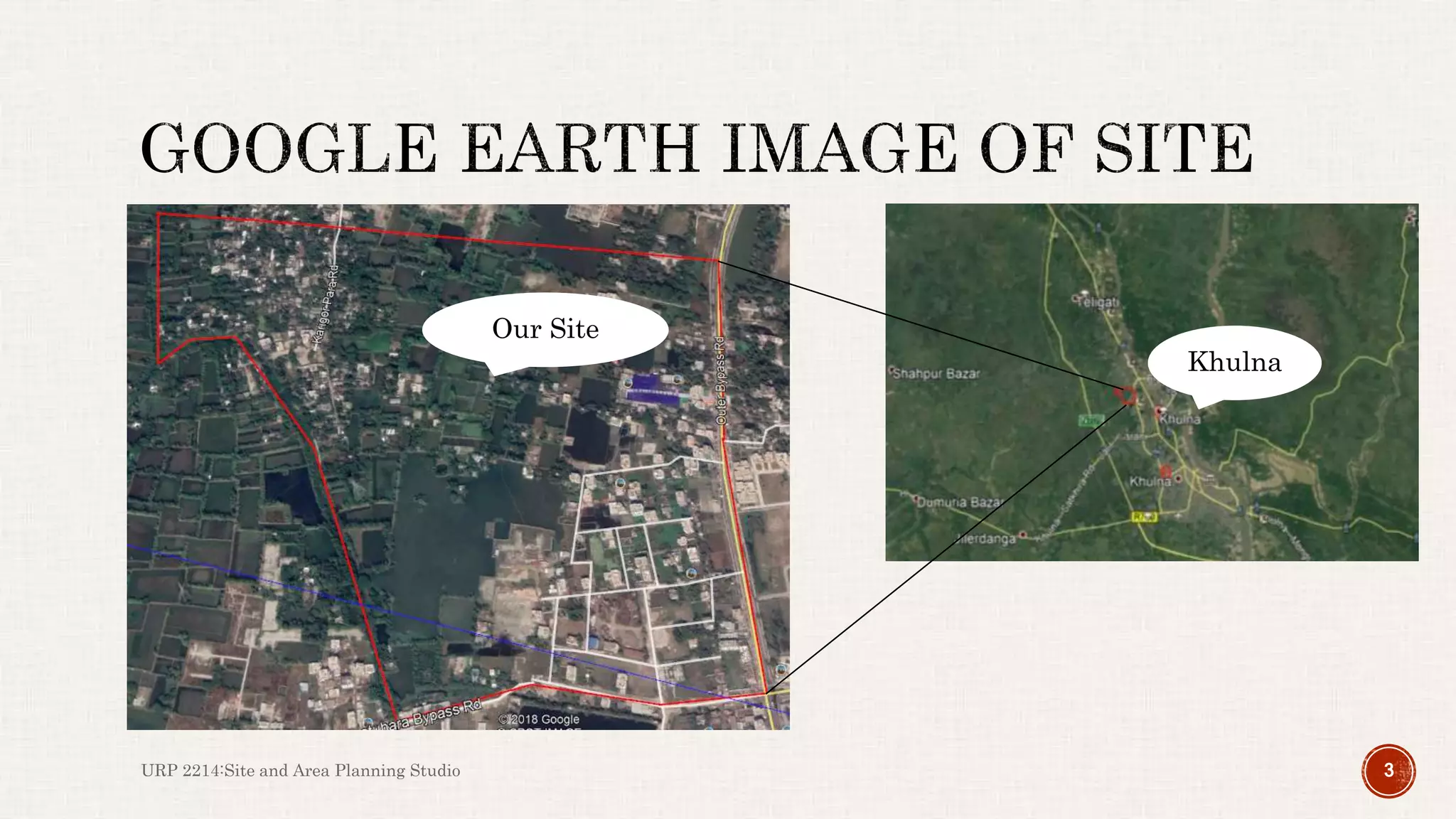
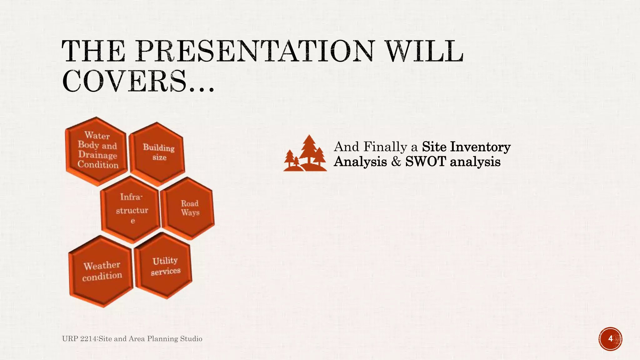
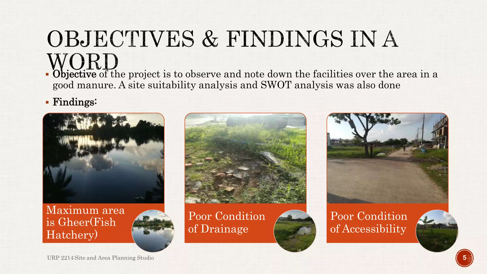

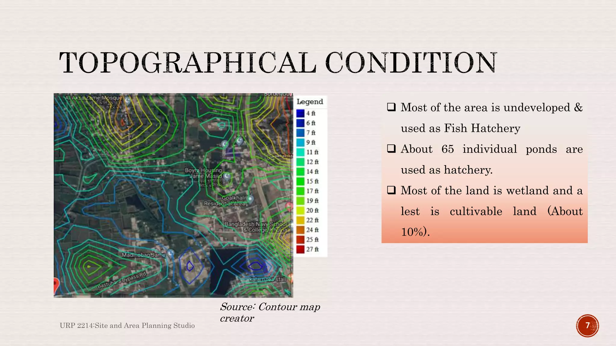

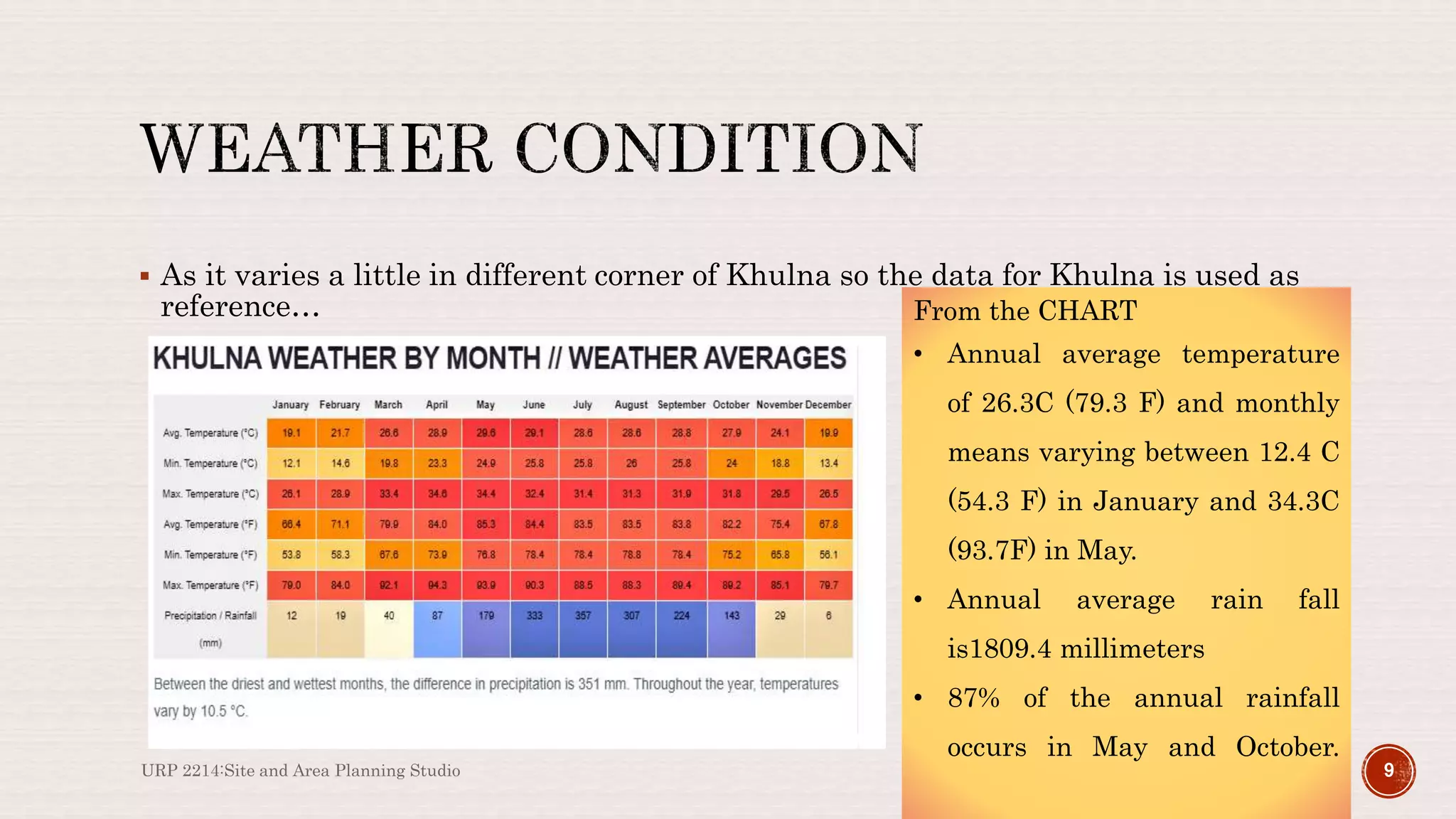
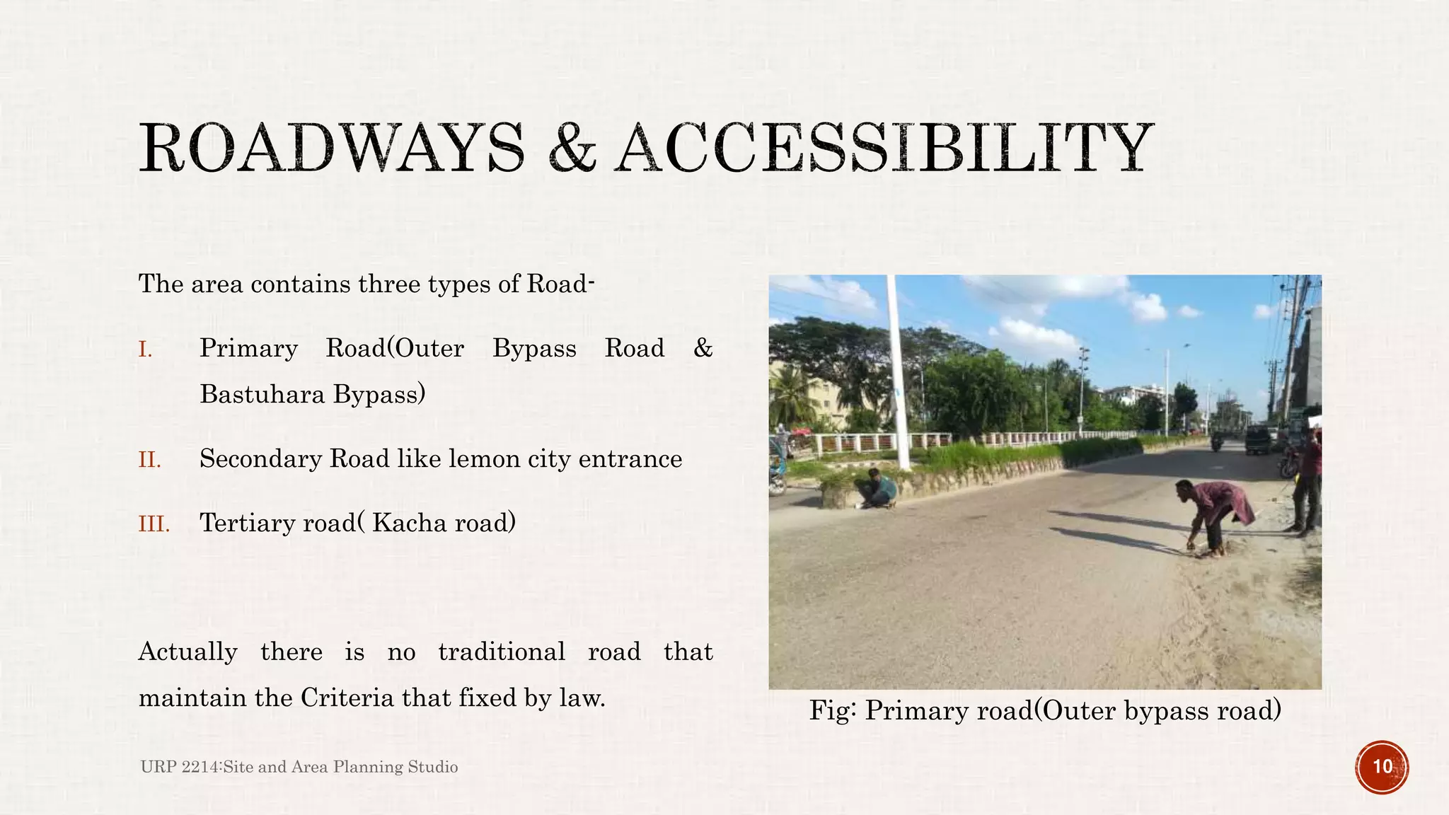
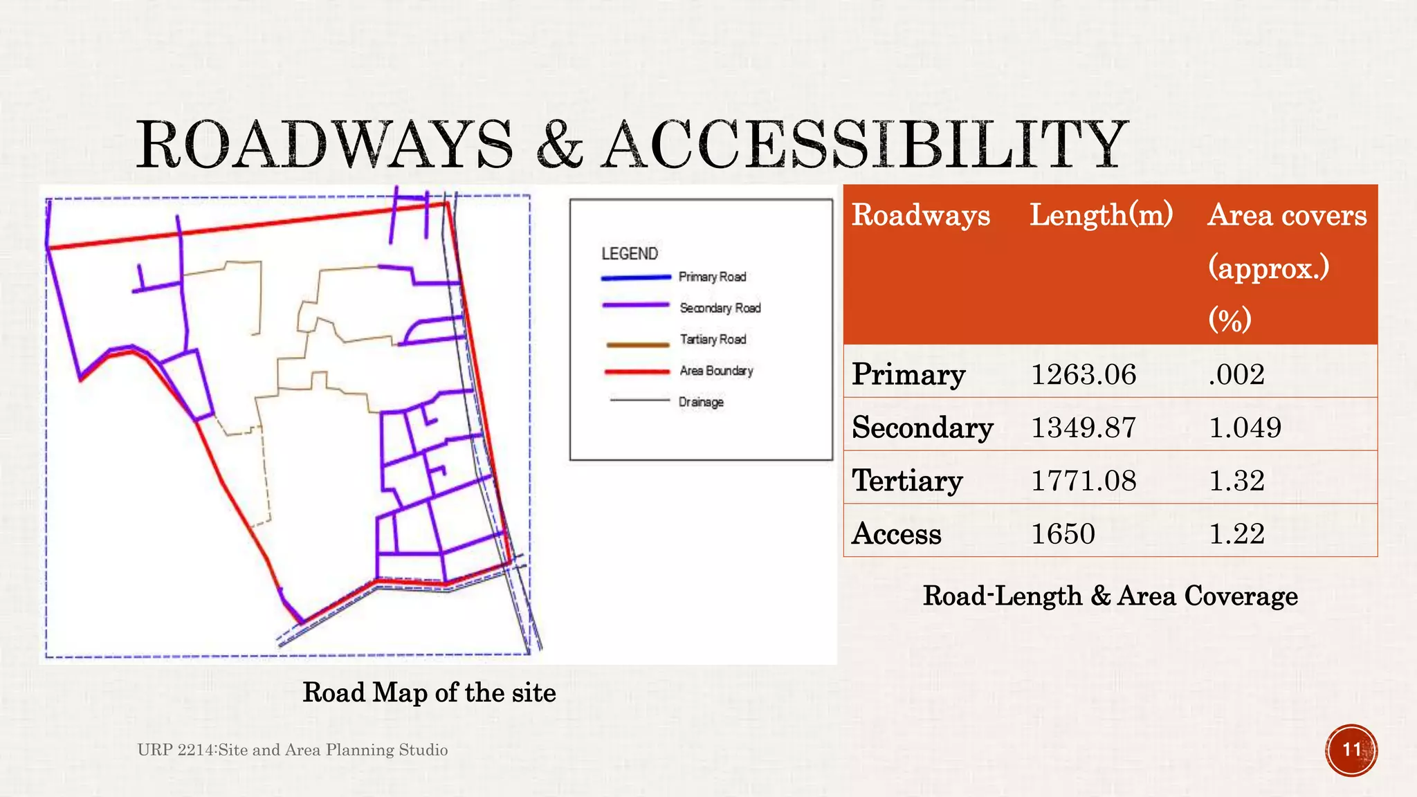
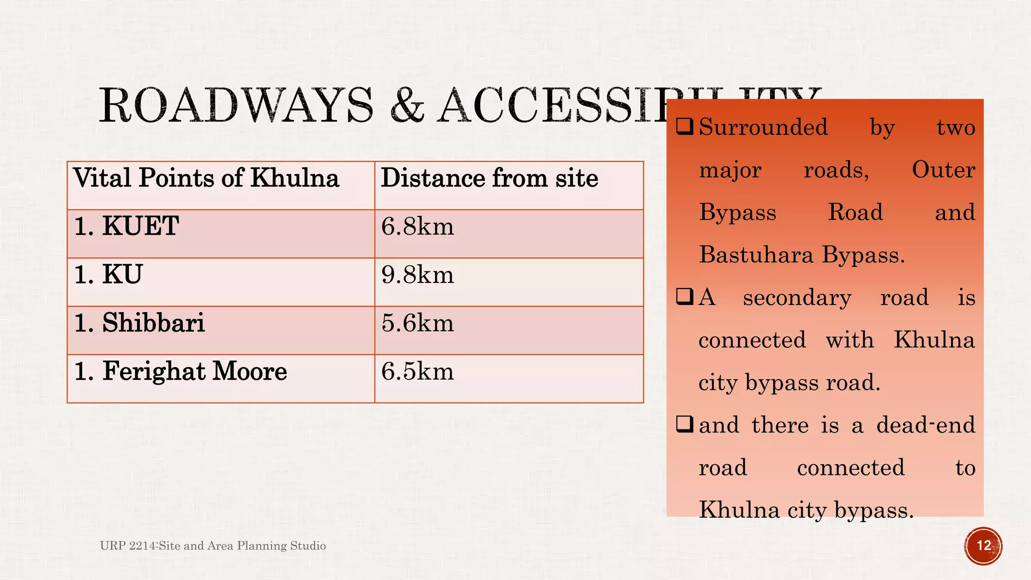
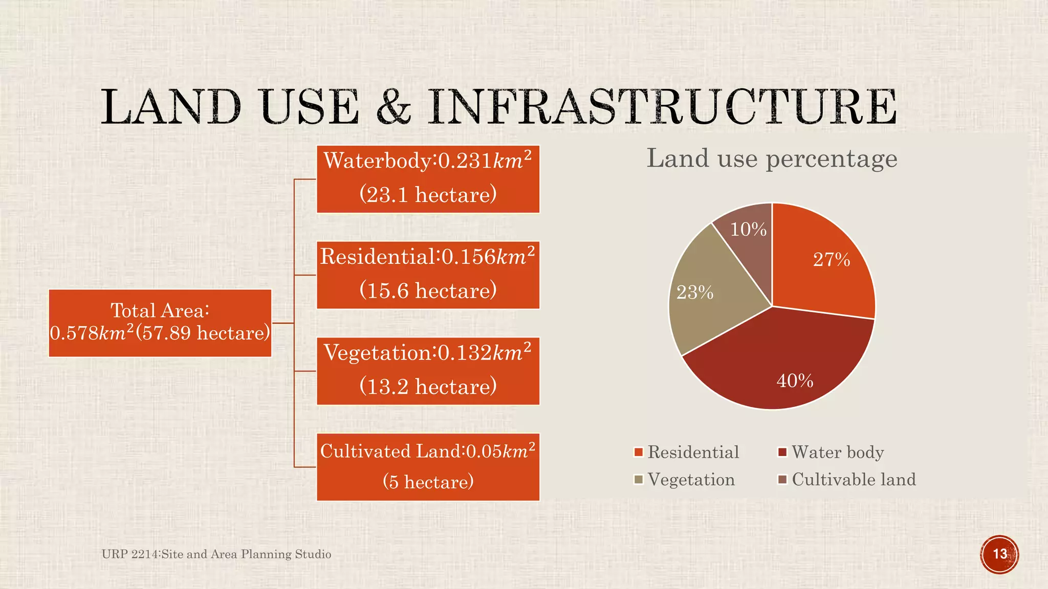
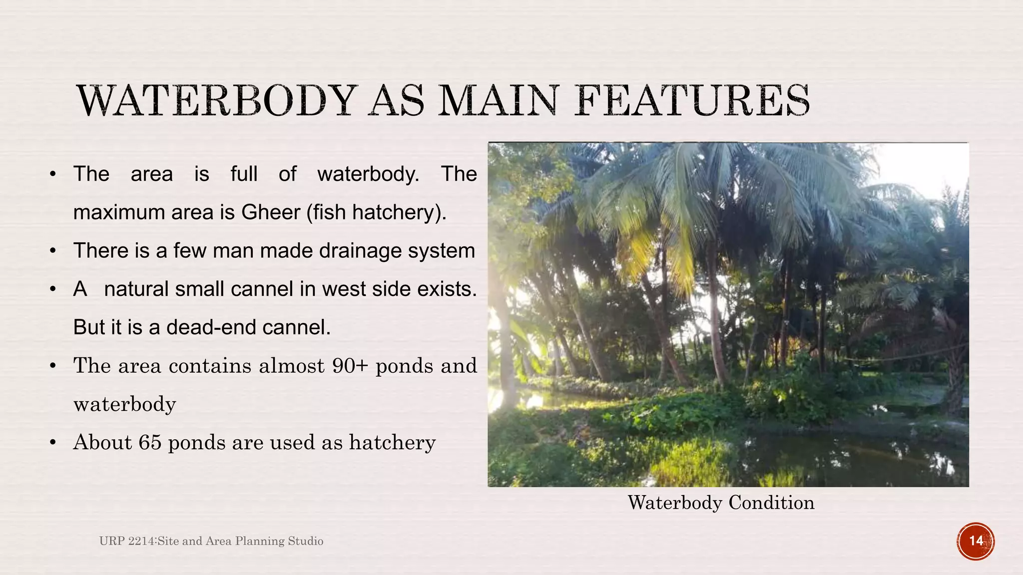
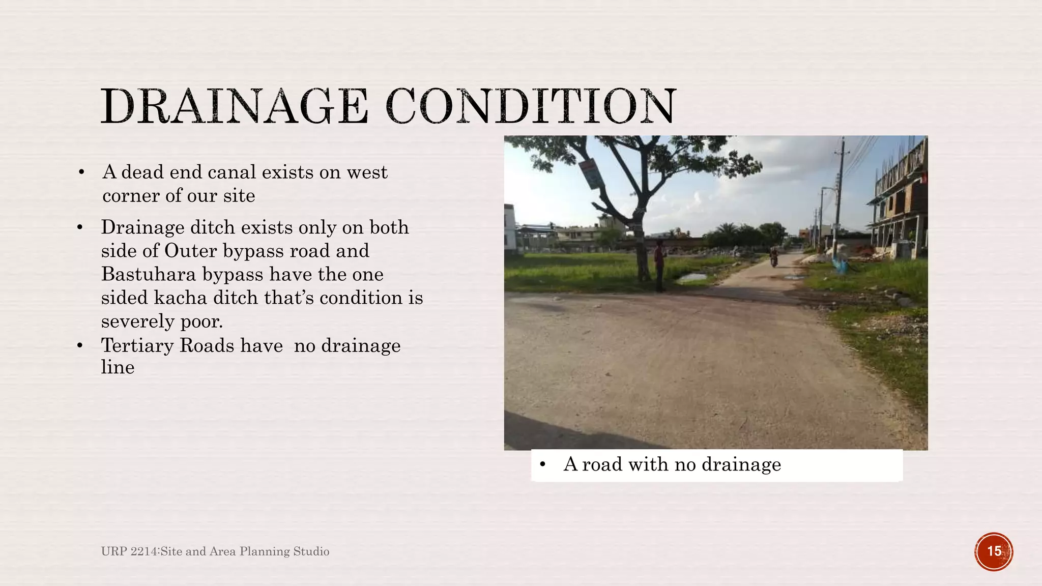
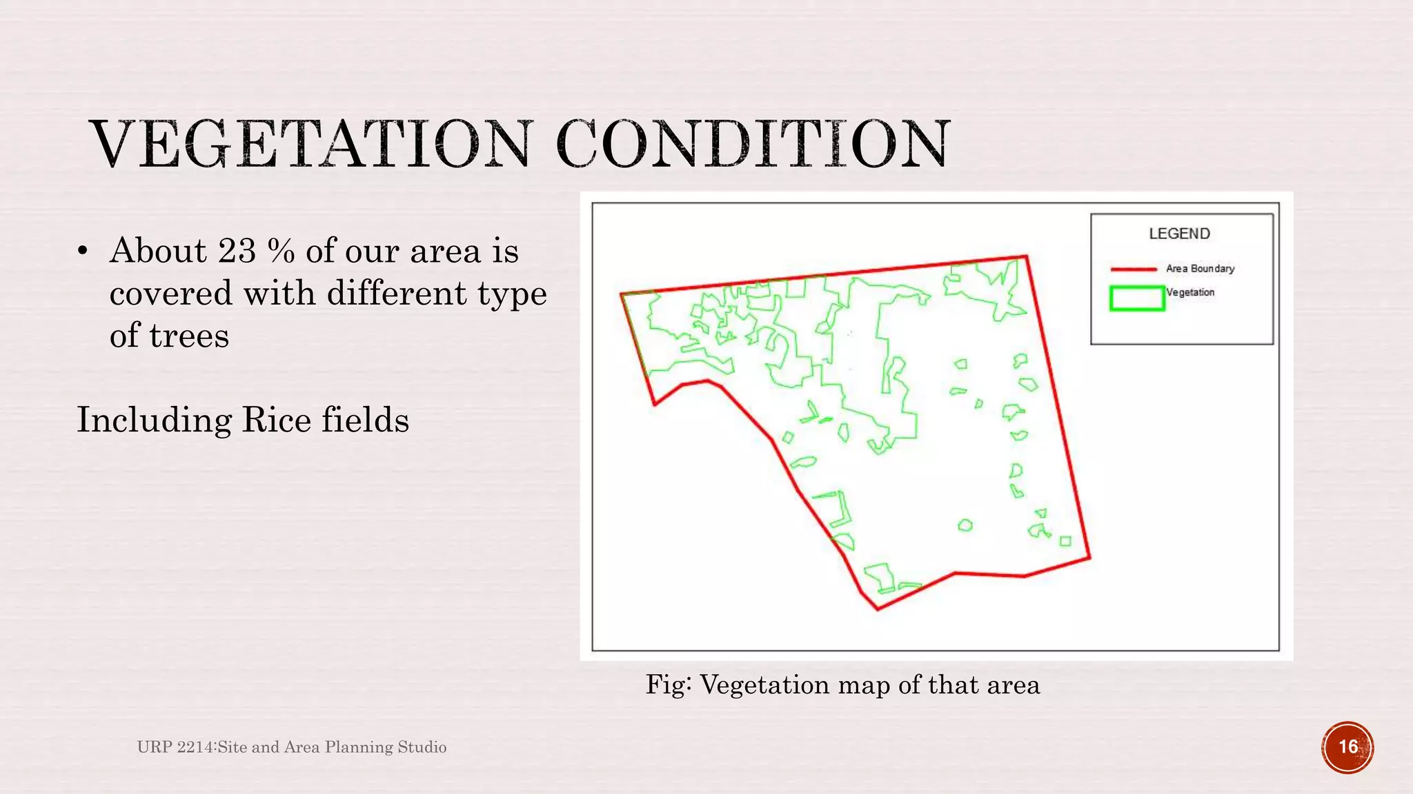
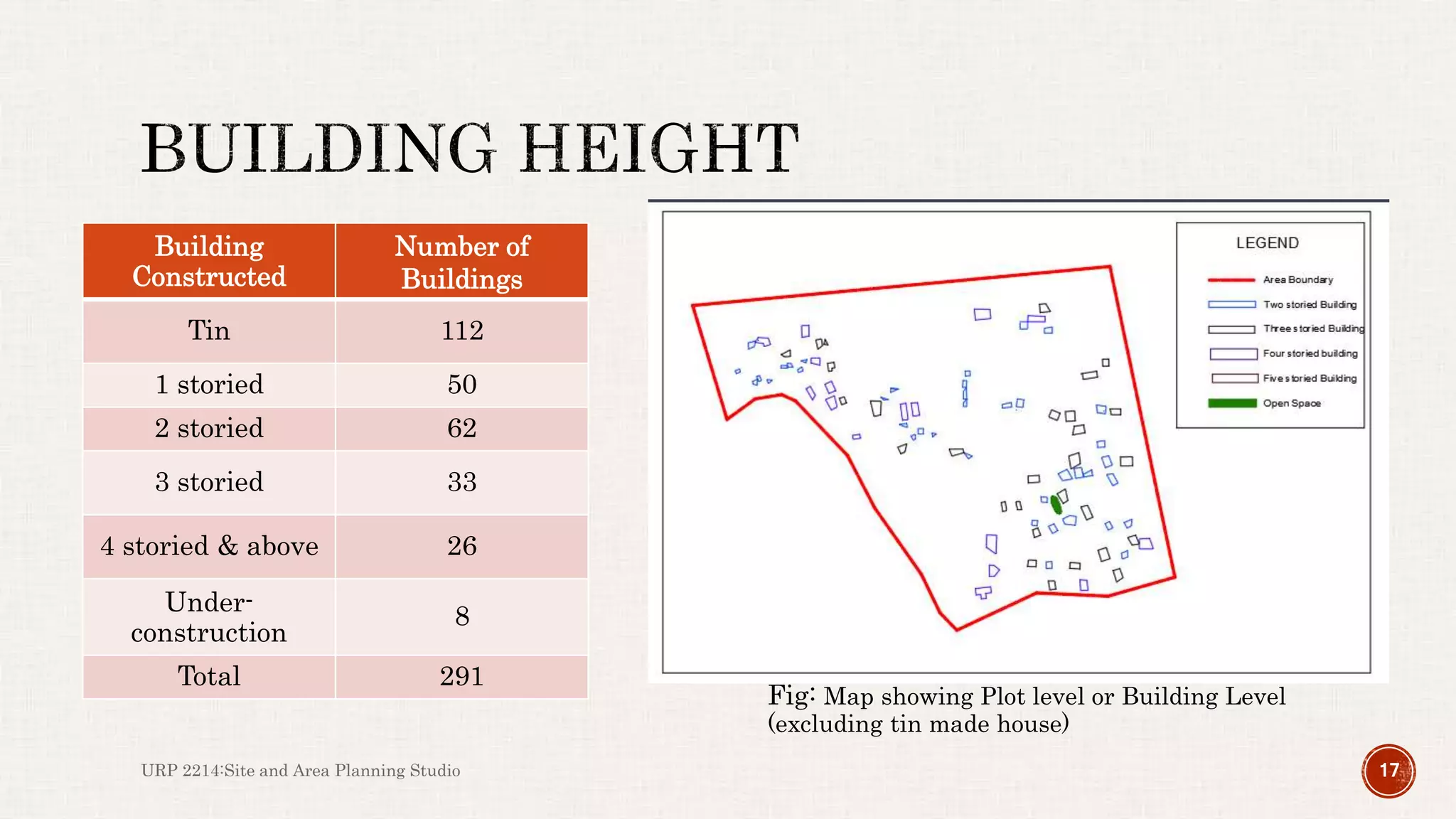
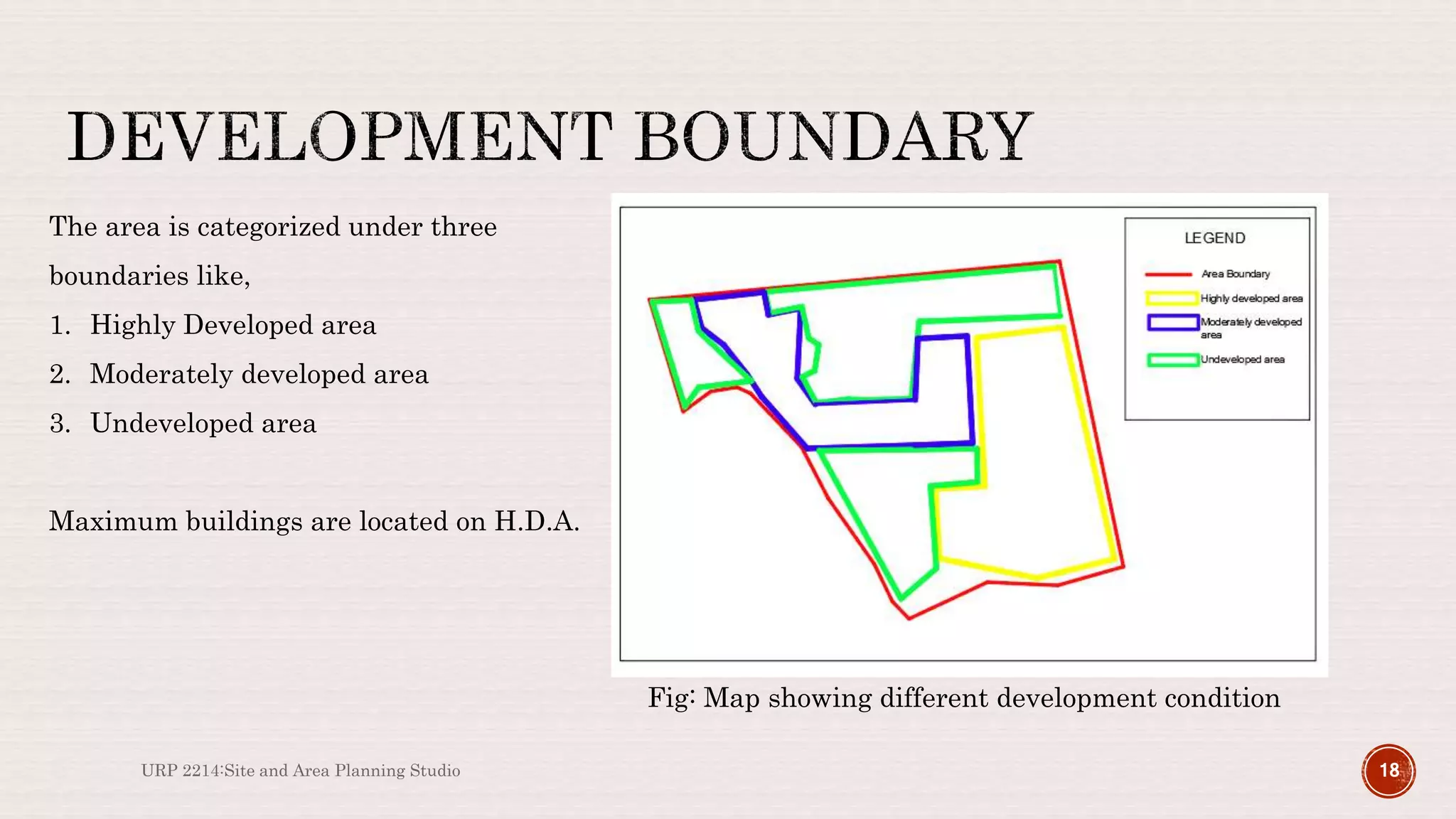

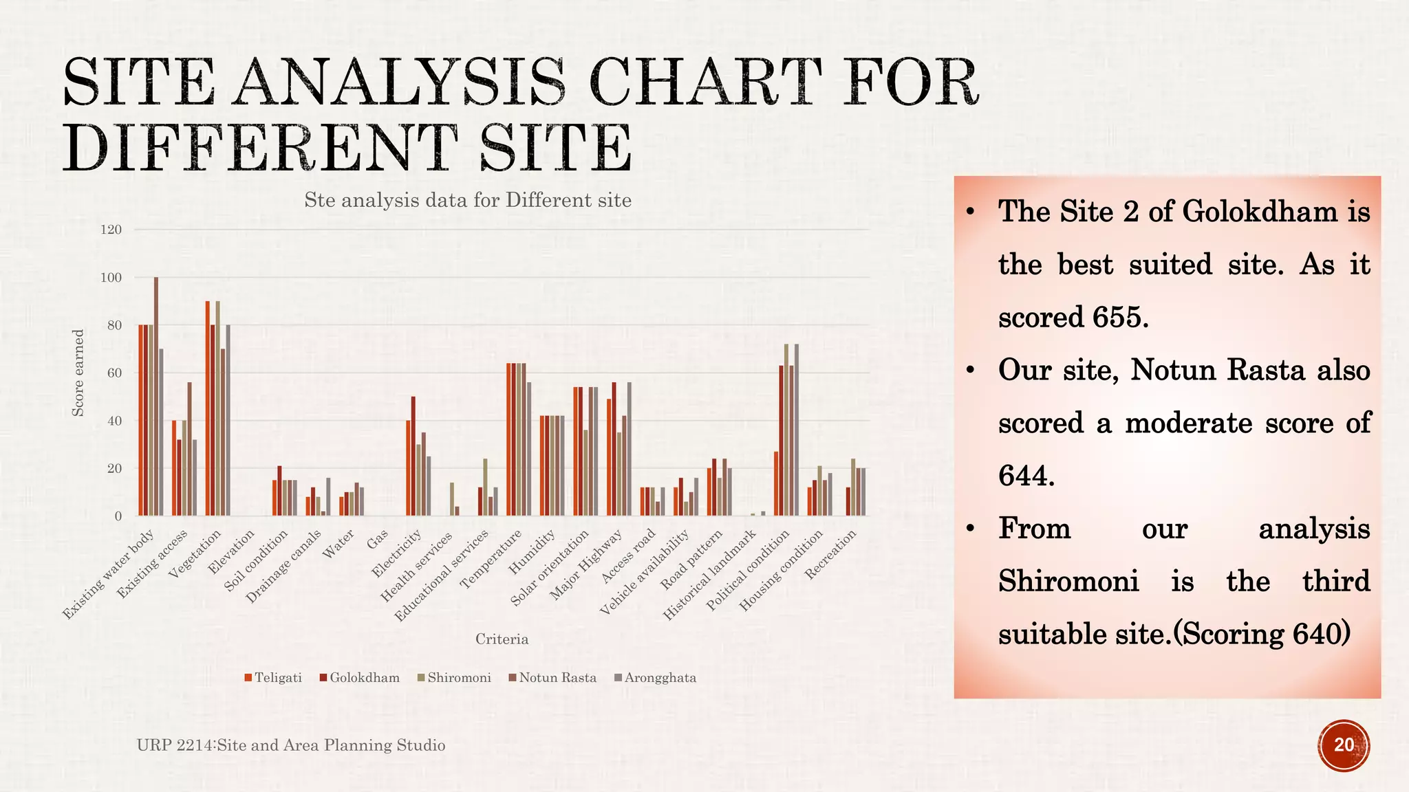
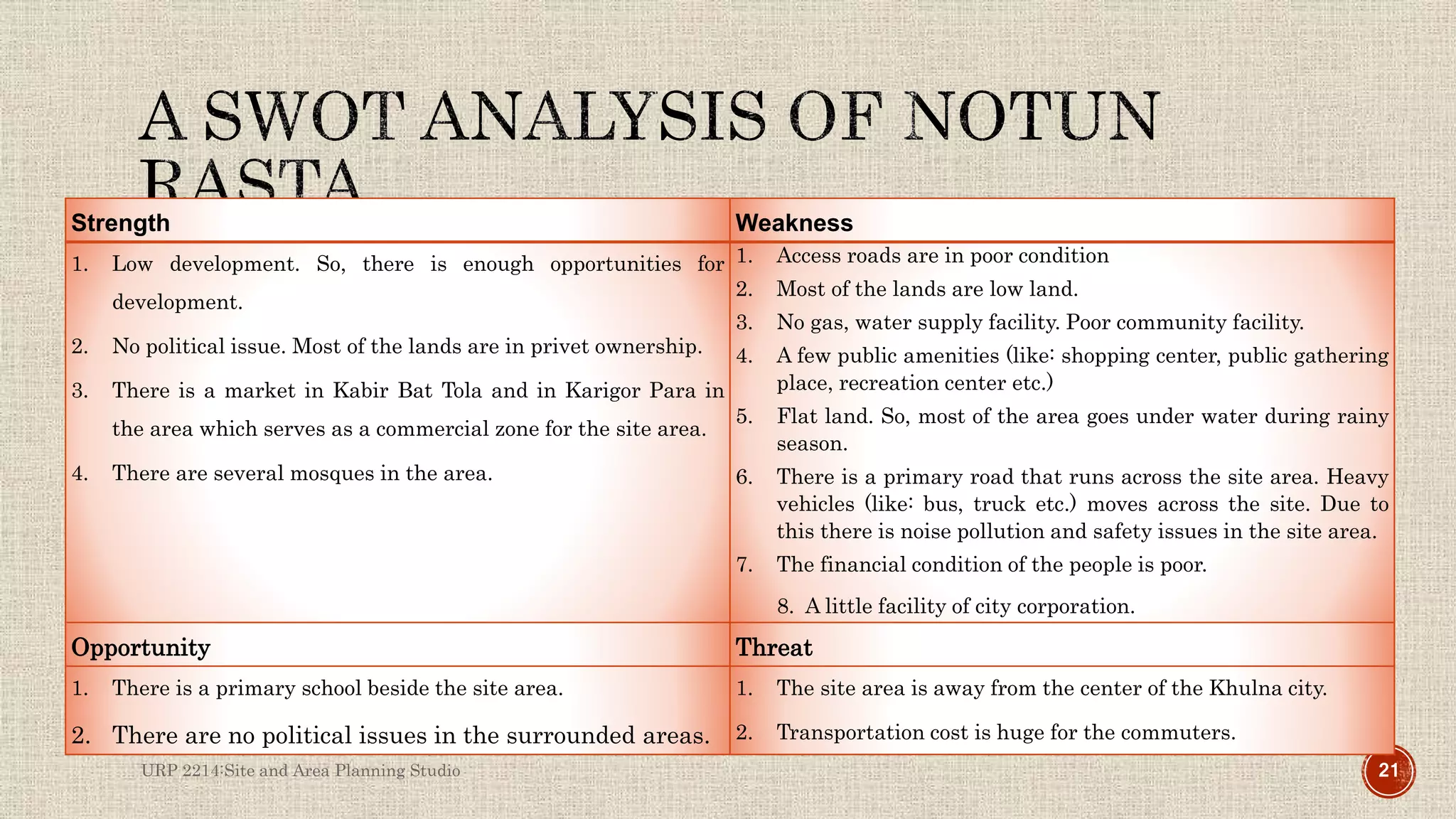


The document outlines a project conducted by Group 4, focused on the area of Notun Rasta in Khulna, analyzing various aspects such as land use, drainage conditions, and accessibility. Key findings highlight significant undeveloped land mainly used for fish hatcheries, poor drainage facilities, and the area's overall potential for development. The project concludes with recommendations for infrastructural improvements to enhance the site's suitability for residential and commercial purposes.


