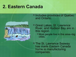
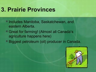
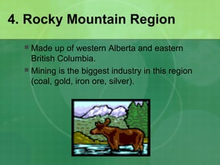
Canada’s Six Geographic
Regions
Unit 5 Notes
Physical Characteristics
 Stretches from Atlantic to Pacific and
bordered to the north by Arctic Ocean
and to the south by the United States.
 Most of the 30 million people live in:
Toronto, Ontario; Montreal, Quebec;
Vancouver, British Columbia; and
Ottawa, Ontario.
 Most of the population lives within 200
miles of the US/Canada border because
of the warmer climate
 Physical Features: mountains, prairies,
islands, tundra, lakes, and rivers.
Ottawa, Ontario
Natural Resources
 Minerals: Large exporter of
minerals.
 Forests: Makes up 1/3 of Canada.
Provides lumber, pulp, and paper.
 Fish: Fisheries in Atlantic and
Pacific.
 Lakes and Rivers: Produce
hydroelectric power.
 Soil: Canada has excellent
farmland.
1. Atlantic Canada
 Made up of Newfoundland, Nova
Scotia, New Brunswick, and Price
Edward Island.
 Also called Maritime Provinces.
 Fishing is important here, but
overfishing has caused problems.
 Overfishing occurs when too many
fish are caught that there are not
enough to breed more.
2. Eastern Canada
 Includes provinces of Quebec
and Ontario.
 Great Lakes, St. Lawrence
River, and Hudson Bay are in
this region.
 Most people live in this area--big
cities.
 The St. Lawrence Seaway
has made Eastern Canada
home to manufacturing
companies.
3. Prairie Provinces
 Includes Manitoba, Saskatchewan, and
eastern Alberta.
 Great for farming! (Almost all Canada’s
agriculture happens here)
 Biggest petroleum (oil) producer in Canada.
4. Rocky Mountain Region
 Made up of western Alberta and eastern
British Columbia.
 Mining is the biggest industry in this region
(coal, gold, iron ore, silver).
5. Pacific Coast
 Located between the Rocky Mountains and Gulf
of Alaska in British Columbia.
 The nice weather brings people to Vancouver,
Canada’s third largest city.
 Timber (logging), fishing, and mining are
important industries.
 Overfishing has caused the fish population to decline.
6. Arctic Region
 Includes Canada’s three territories: Yukon,
the Northwest Territories, and Nunavut.
 Most of Canada’s Inuit (indigenous people)
live in this region.
 Tundra – land stays frozen all year.
 Covered by the Canadian Shield, which
makes mining a HUGE industry (coal, gold,
silver, iron ore).

6 geographic regions

  • 1.
  • 2.
    Physical Characteristics  Stretchesfrom Atlantic to Pacific and bordered to the north by Arctic Ocean and to the south by the United States.  Most of the 30 million people live in: Toronto, Ontario; Montreal, Quebec; Vancouver, British Columbia; and Ottawa, Ontario.  Most of the population lives within 200 miles of the US/Canada border because of the warmer climate  Physical Features: mountains, prairies, islands, tundra, lakes, and rivers. Ottawa, Ontario
  • 3.
    Natural Resources  Minerals:Large exporter of minerals.  Forests: Makes up 1/3 of Canada. Provides lumber, pulp, and paper.  Fish: Fisheries in Atlantic and Pacific.  Lakes and Rivers: Produce hydroelectric power.  Soil: Canada has excellent farmland.
  • 4.
    1. Atlantic Canada Made up of Newfoundland, Nova Scotia, New Brunswick, and Price Edward Island.  Also called Maritime Provinces.  Fishing is important here, but overfishing has caused problems.  Overfishing occurs when too many fish are caught that there are not enough to breed more.
  • 5.
    2. Eastern Canada Includes provinces of Quebec and Ontario.  Great Lakes, St. Lawrence River, and Hudson Bay are in this region.  Most people live in this area--big cities.  The St. Lawrence Seaway has made Eastern Canada home to manufacturing companies.
  • 6.
    3. Prairie Provinces Includes Manitoba, Saskatchewan, and eastern Alberta.  Great for farming! (Almost all Canada’s agriculture happens here)  Biggest petroleum (oil) producer in Canada.
  • 7.
    4. Rocky MountainRegion  Made up of western Alberta and eastern British Columbia.  Mining is the biggest industry in this region (coal, gold, iron ore, silver).
  • 8.
    5. Pacific Coast Located between the Rocky Mountains and Gulf of Alaska in British Columbia.  The nice weather brings people to Vancouver, Canada’s third largest city.  Timber (logging), fishing, and mining are important industries.  Overfishing has caused the fish population to decline.
  • 9.
    6. Arctic Region Includes Canada’s three territories: Yukon, the Northwest Territories, and Nunavut.  Most of Canada’s Inuit (indigenous people) live in this region.  Tundra – land stays frozen all year.  Covered by the Canadian Shield, which makes mining a HUGE industry (coal, gold, silver, iron ore).
  • 10.
    6. Arctic Region Includes Canada’s three territories: Yukon, the Northwest Territories, and Nunavut.  Most of Canada’s Inuit (indigenous people) live in this region.  Tundra – land stays frozen all year.  Covered by the Canadian Shield, which makes mining a HUGE industry (coal, gold, silver, iron ore).