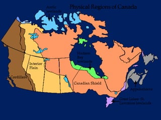
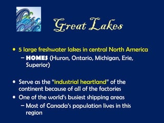
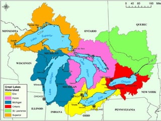
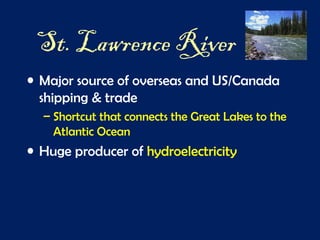
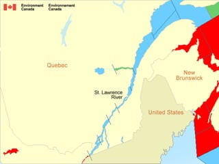
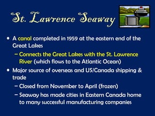
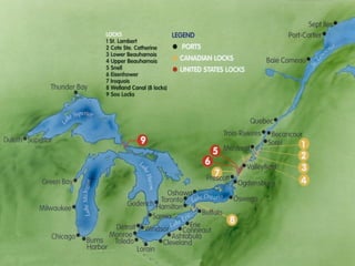
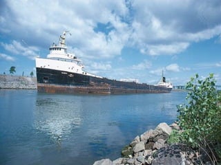
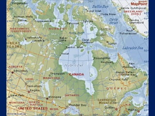
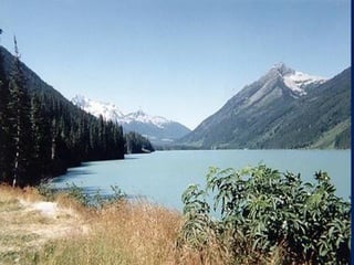
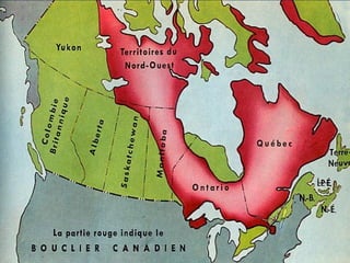
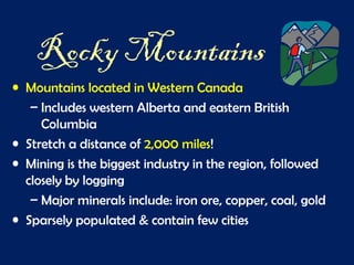
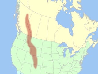
Physical Features of
Canada
Great Lakes
• 5 large freshwater lakes in central North America
– HOMES (Huron, Ontario, Michigan, Erie,
Superior)
• Serve as the “industrial heartland” of the
continent because of all of the factories
• One of the world’s busiest shipping areas
– Most of Canada’s population lives in this
region
They freeze!
Click the link for the video!
http://www.youtube.com/watch?v=tAGffb9wWOQ
St. Lawrence River
• Major source of overseas and US/Canada
shipping & trade
– Shortcut that connects the Great Lakes to the
Atlantic Ocean
• Huge producer of hydroelectricity
St. Lawrence Seaway
• A canal completed in 1959 at the eastern end of the
Great Lakes
– Connects the Great Lakes with the St. Lawrence
River (which flows to the Atlantic Ocean)
• Major source of overseas and US/Canada shipping &
trade
– Closed from November to April (frozen)
– Seaway has made cities in Eastern Canada home
to many successful manufacturing companies
Click the link for the video!
See how the St. Lawrence Seaway works:
http://www.youtube.com/watch?v=Xic6smTfc0I
Why is it important?
http://www.youtube.com/watch?v=fbE2-TzWdzY
Hudson Bay
• HUGE inland sea in east central Canada
• “an arm” of the Atlantic Ocean
–Grain from Alberta & Saskatchewan is
shipped from Hudson Bay out to the
Atlantic and on to other countries
–Only navigable from July to October
Atlantic Ocean
• 2nd
largest of the earth’s 5 oceans
• Most heavily traveled ocean
• Forms the eastern border of Canada
– Major shipping route to Europe & Africa
Pacific Ocean
• Largest & deepest of the world’s 5 oceans
• Covers 1/3 of the earth’s surface!
• Western border of Canada
– Major shipping route to Asia
Canadian Shield
• Stretches from Great Lakes to Arctic Ocean; covers
half of Canada!
– Horseshoe region around Hudson Bay
• Region of mostly thin soil lying on top of rock, with
many bare outcrops of rock & thousands of lakes
• Major source of natural resources: timber, minerals,
& water
Click the link for the video!
http://youtu.be/Ys_ODZBcXqE
Helpful Overview of Canada-
http://youtu.be/TftLaHb1FvA
Rocky Mountains
• Mountains located in Western Canada
– Includes western Alberta and eastern British
Columbia
• Stretch a distance of 2,000 miles!
• Mining is the biggest industry in the region, followed
closely by logging
– Major minerals include: iron ore, copper, coal, gold
• Sparsely populated & contain few cities
Click the link for the video!
A walking tour-
http://www.youtube.com/watch?v=6bY1EpDaJ0c
Bird Eye View-
http://www.youtube.com/watch?v=aZ2pREbOyzo
Canadian Rockies-

Canada physical features with video links

  • 1.
  • 3.
    Great Lakes • 5large freshwater lakes in central North America – HOMES (Huron, Ontario, Michigan, Erie, Superior) • Serve as the “industrial heartland” of the continent because of all of the factories • One of the world’s busiest shipping areas – Most of Canada’s population lives in this region
  • 7.
  • 9.
    Click the linkfor the video! http://www.youtube.com/watch?v=tAGffb9wWOQ
  • 10.
    St. Lawrence River •Major source of overseas and US/Canada shipping & trade – Shortcut that connects the Great Lakes to the Atlantic Ocean • Huge producer of hydroelectricity
  • 13.
    St. Lawrence Seaway •A canal completed in 1959 at the eastern end of the Great Lakes – Connects the Great Lakes with the St. Lawrence River (which flows to the Atlantic Ocean) • Major source of overseas and US/Canada shipping & trade – Closed from November to April (frozen) – Seaway has made cities in Eastern Canada home to many successful manufacturing companies
  • 16.
    Click the linkfor the video! See how the St. Lawrence Seaway works: http://www.youtube.com/watch?v=Xic6smTfc0I Why is it important? http://www.youtube.com/watch?v=fbE2-TzWdzY
  • 17.
    Hudson Bay • HUGEinland sea in east central Canada • “an arm” of the Atlantic Ocean –Grain from Alberta & Saskatchewan is shipped from Hudson Bay out to the Atlantic and on to other countries –Only navigable from July to October
  • 21.
    Atlantic Ocean • 2nd largestof the earth’s 5 oceans • Most heavily traveled ocean • Forms the eastern border of Canada – Major shipping route to Europe & Africa
  • 23.
    Pacific Ocean • Largest& deepest of the world’s 5 oceans • Covers 1/3 of the earth’s surface! • Western border of Canada – Major shipping route to Asia
  • 25.
    Canadian Shield • Stretchesfrom Great Lakes to Arctic Ocean; covers half of Canada! – Horseshoe region around Hudson Bay • Region of mostly thin soil lying on top of rock, with many bare outcrops of rock & thousands of lakes • Major source of natural resources: timber, minerals, & water
  • 30.
    Click the linkfor the video! http://youtu.be/Ys_ODZBcXqE Helpful Overview of Canada- http://youtu.be/TftLaHb1FvA
  • 31.
    Rocky Mountains • Mountainslocated in Western Canada – Includes western Alberta and eastern British Columbia • Stretch a distance of 2,000 miles! • Mining is the biggest industry in the region, followed closely by logging – Major minerals include: iron ore, copper, coal, gold • Sparsely populated & contain few cities
  • 37.
    Click the linkfor the video! A walking tour- http://www.youtube.com/watch?v=6bY1EpDaJ0c Bird Eye View- http://www.youtube.com/watch?v=aZ2pREbOyzo Canadian Rockies-