SlideShare a Scribd company logo
(National Workshop on Challenges In Irrigation Management
For Food Security, Roorkee, 26 Nov 2016)
D.S. Bundela*, D.K. Sharma, J. Triantafilis, Bhaskar Narjary and Aslam Pathan
ICAR-Central Soil Salinity Research Institute, Karnaly
& UNSW, Sydney, Australia
E-mail: ds.bundela@icar.gov.in
Background
• Canal irrigation development paradigm resulted in several-
folds increase in crop productivity during green revolutionfolds increase in crop productivity during green revolution
• It was forgotten that mega quantities of water also
introduce mega quantities of salts into an irrigated areaintroduce mega quantities of salts into an irrigated area
and change its hydrology and salt balance
• Consequently, irrigated lands has started losing yield gain
and over a period of time, these lands develop into twin
problems- soil salinity & waterlogging.
• Soil salinity and sodicity are widespread in irrigated areas
under arid & semi-arid regions of India as well in the World.
• In India, irrigation water mobilizes salts and aggravates the
secondary salinization problem in ~20% of irrigated areas
Background…
• Remote sensing provides spatial distribution of soil surface
salinity that too moderate and severe classes but not slightsalinity that too moderate and severe classes, but not slight
class of surface salinity and NOT at all sub surface salinity
P i l i b d h i l th d id• Proximal sensing based geophysical methods provide
spatial & vertical distribution of salts in soil profiles/regolith
f• Therefore, there is need to apply multiple coil DUALEM
technology in salinity research to collect EM data quickly for
3D salinity assessment and mappingy pp g
• Expansion of secondary salinization in canal commands
• 50,000 ha under waterlogged saline soils in Haryana
• 2.95 m ha saline soils in the country
Huge Potential: Proximal sensing for rapid assessment of soil salinity
Single coil (EM38)  multiple coils (DUALEM)
Objectives
• To assess and map soil salinity at two Indian sites to
generate reliable 2D /3D EM conductivity/ soil salinity
images for salinity managementimages for salinity management
• To monitor the efficacy and impact of salinity
management strategies implemented by re measuringmanagement strategies implemented by re-measuring
and remapping salinity
Study Area: Western Yamuna CanalStudy Area: Western Yamuna Canal CommandCommand
WYC
GCA:  13,543 sq km
CCA 10 840 kCCA:  10,840 sq km 
7 Water Circles
Districts:     5 Full
7 Part
Tehsils: 14 Full    
22 Part 
Nain Field
Mokha Kheri
Villages:    2206
Mokha Kheri
Technology shift from EM38 to DUALEM System
Conventional: Geonics EM-38
DUALEM‐21, 421 and 642  can investigate 
vertical salt distribution and soil/ water salinityvertical salt distribution and soil/ water salinity 
up to 3, 6 and 10 m depth 
Modern EM tool: DUALEM-21
DUALEM 21DUALEM‐21
Theoretical depth of ECa measurement
S.
N
EM
S t
Depth
l d( )
Variety of DUALEM Systems
No System resolved(m)
1. DUALEM-2 3 (1)
2. DUALEM-21 3 (4)
3. DUALEM-421 6 (6)
Geonics EM38 0 0 5 m
( )
4. DUALEM-642 10 (6)
Operating
Frequency: 9.0 kHz
Geonics EM38 0‐0.5 m
0‐1.5 m
0‐1.0 m
0 3 0 m0‐3.0 m
DUALEM‐21
DUALEM-21 http://www.dualem.com/
Survey Transect & Soil samples at Nain Farm
Data point:3349Data point:3349
Soil sampled points: 32
Site  Salinity  Assessment
Nain Field
Survey Transects
32 Sample Locations at Nain Farm32 Sample Locations at Nain Farm
4 depth soil samples
(0-15 15-45 45-75 &
Total soil samples collected: 128 (32x4) (8-9 Jan 2016)
(0 15, 15 45, 45 75 &
75-105 cm)
(10 11 Jan 2016)
Mokhra Kheri Field
Total soil samples
collected: 96 (24x4)
(10-11 Jan 2016)
55.5
60
0‐15 cm 15‐45 cm 45‐75 cm 75‐105 cm
Soil salinity sample and depth wise at Nain Farm
50
ECe
12 soil samples (37.5%) Ece < 4.0
20 samples (62.5%) with ECe range 4.12 to 55.5
32.8 32.1
33.2
30
40
14.62
16.54
12.51
19.55 19.8
20
10.311.07
4.76
3.153.652.88
1.6
3.02
4.343.563.232.65
6.06
5
8.96
2.22
4.984.123.94 3.8
1.82
5.74
3.98
8.17
0
10
0
1 2 3 4 5 6 7 8 9 10 11 12 13 14 15 16 17 18 19 20 21 22 23 24 25 26 27 28 29 30 31 32
Sampling point ID
St ti ti f EC f 32 l t N i F )Statistics of ECe of 32 samples at Nain Farm)
Depth (cm) n Min Mean Median SD Max Skewness
0-15 32 1.60 10.8 4.87 12.2 55.5 2.2
15-45 32 0.81 7.6 5.29 6.8 30.8 1.7
45-75 32 0.93 9.9 7.36 8.6 38.0 1.4
75-105 32 1.00 10.1 6.79 8.3 28.0 0.7
EM Data of Nain Site
2D EM Conductivity Images of Four Receivers
1m Hcon
(0-1.5m)
2m Hcon
(0-3 m)
1m Pcon 2m Pcon
(0-0.5m) (0-1.0m)
Quasi-2d and 3d inversion modellingQuas d a d 3d e s o ode g
WE CAN use a
single frequency and 
multiple array technology
Inversion modelling parameters
Forward modelling: CF or FS (Maxwell) multiple array technology
DUALEM
g ( )
Inversion algorithm:
Occam’s regularization with  S1 or S2
( )
+
2D/3D  inversion software 
DUALEM‐21Dampness factor (λ): 0.07-3.0
Best Inversion Results: 
EM4Soil
/3Best Inversion Results: 
Cumulative function(CF) forward 
modeling, 
l h d d
EM4Soil
Quasi‐2D/3D Module 
S2 inversion algorithm, and damping 
factor λ (0.07)
To generate 3D salinity Images
Salinity inversion modelling results (32 sets)Salinity inversion modelling results (32 sets)
Q3D Results
Coefficient of determination (R2) between soil ECe andCoefficient of determination (R ) between soil ECe and
apparent electrical conductivity (ECa) at Nain Farm
and between True ECe and ECe
Depth (cm) 1mPcon 1mHcon 2mPcon 2mHcon
0-15 0.90 0.82 0.85 0.69
15-45 0.78 0.79 0.81 0.76
45-75 0.70 0.75 0.77 0.83
75-105 0.60 0.64 0.67 0. 73
Best Parameters Regression model between True ECe and ECe
0 07 S2 CF R2 0 780.07, S2, CF R2=0.78
Inverted ECe Images (Nain Field)
(0-0 2m) (0 2 0 5m)(0-0.2m) (0.2-0.5m)
(0.5-0.8m) (0.5-1.1m)
Seven depths, Z= 0-0.2, 0.2-0.5, 0.5-0.8, 0.8-1.1, 1.1-1.5, 1.5-2.3 and 2.3-3.3 m
3D Conductivity Images (Nain Field)
Layer 1: < 0.2 m
Layer 2: 0.2-0.5 m
Layer 3: 0.5-0.8 my
Layer 4: 0.8-1.1m
Layer 5: 1.1-1.5 m
Layer 6:1.5- 2.3 m
Layer 7:2 3 3 3 mLayer 7:2.3- 3.3 m
3D Conductivity Images (X‐Cut)
3D Conductivity Images (Y‐Cut)
Mapping salinity in 3D Mokhra Kheri sitepp g y
Salinity Management Strategies
• Pre-reclamation management components
• Reclamation components
P l i• Post-reclamation management components
Salinity Management Strategies
Group/sub‐group Technology/StrategiesGroup/sub group Technology/Strategies
Reclamation  Surface & Subsurface drainage
 On‐farm land development including surface drainage
 Leaching Leaching
Management
Crop management
 Selection of crops and cropping sequences
 Exploitation of varietal differencesCrop management  Exploitation of varietal differences
 Improved agronomic practices
Soil management  Land forming/seeding
 Application of additional nutrients
Irrigation water management Shallow depth‐high frequency irrigation
Pre/post‐sowing irrigationPre/post sowing irrigation
Switchover to improved irrigation techniques
Leaching for salt balance
Chemical management  A li ti   f  h i l  d t  ( )Chemical management  Application of chemical amendments (gypsum)
Rainwater management In‐situ rainwater conservation,  Rainwater harvesting 
and reuse, Fallowing
Conclusions •Conclusions
• Dual geometry multiple coil EM methodology tested has
shown its potential for rapid salinity assessment across
• .
shown its potential for rapid salinity assessment across
affected field and with depths.
• Salinity inversion (EM4Soil) software inverts ECa data with
best inversion parameters to generate 2D/3D salinity mapsbest inversion parameters to generate 2D/3D- salinity maps
of sites using 2D/ 3D quasi-inversion modeling.
• The modelled ECe values showed the close match with the
b d EC l f N i Fi ld (R2 0 78)observed ECe values for Nain Field (R2 = 0.78).
• DUALEM technology makes salinity mapping both spatially
and vertically a single step process and thereby a efficienty g p p y
way of generating 2D/3D digital soil salinity maps for
effective salinity management
/kU;okn/kU;~okn
Email: 
ds.bundela@icar.gov.inThis is not the end…but the beginning!

More Related Content

What's hot

What's hot (20)

26 nov16 issues_and_challenges_in_water_productivity_for_sustainable_agricult...
26 nov16 issues_and_challenges_in_water_productivity_for_sustainable_agricult...26 nov16 issues_and_challenges_in_water_productivity_for_sustainable_agricult...
26 nov16 issues_and_challenges_in_water_productivity_for_sustainable_agricult...
 
26 nov16 farmer’s_survey_in_ganga_river_basin
26 nov16 farmer’s_survey_in_ganga_river_basin26 nov16 farmer’s_survey_in_ganga_river_basin
26 nov16 farmer’s_survey_in_ganga_river_basin
 
River Basin Planning of Baitarani Sub-Basin
River Basin Planning of Baitarani Sub-BasinRiver Basin Planning of Baitarani Sub-Basin
River Basin Planning of Baitarani Sub-Basin
 
26 nov16 irrigation_water_use_efficiency
26 nov16 irrigation_water_use_efficiency26 nov16 irrigation_water_use_efficiency
26 nov16 irrigation_water_use_efficiency
 
26 nov16 canal_automation
26 nov16 canal_automation26 nov16 canal_automation
26 nov16 canal_automation
 
27 nov16 conjunctive_use_planning_in_a_canal_command_for_food_security
27 nov16 conjunctive_use_planning_in_a_canal_command_for_food_security27 nov16 conjunctive_use_planning_in_a_canal_command_for_food_security
27 nov16 conjunctive_use_planning_in_a_canal_command_for_food_security
 
Decentralized surface water irrigation as a pathway for sustainable intensifi...
Decentralized surface water irrigation as a pathway for sustainable intensifi...Decentralized surface water irrigation as a pathway for sustainable intensifi...
Decentralized surface water irrigation as a pathway for sustainable intensifi...
 
27 nov16 solar_energy_in_irrigation
27 nov16 solar_energy_in_irrigation27 nov16 solar_energy_in_irrigation
27 nov16 solar_energy_in_irrigation
 
27 nov16 water_and_fertilizer_management_using_micro_irrigation
27 nov16 water_and_fertilizer_management_using_micro_irrigation27 nov16 water_and_fertilizer_management_using_micro_irrigation
27 nov16 water_and_fertilizer_management_using_micro_irrigation
 
Groundwater in Urban India : An Overview
Groundwater in Urban India : An OverviewGroundwater in Urban India : An Overview
Groundwater in Urban India : An Overview
 
Conjunctive Use of Poor Quality Groundwater
Conjunctive Use of Poor Quality Groundwater Conjunctive Use of Poor Quality Groundwater
Conjunctive Use of Poor Quality Groundwater
 
Improved On-farm Irrigation Management for Olive Growing
Improved On-farm Irrigation Management for Olive GrowingImproved On-farm Irrigation Management for Olive Growing
Improved On-farm Irrigation Management for Olive Growing
 
Promoting conjunctive use of surface and groundwater: A case study from a maj...
Promoting conjunctive use of surface and groundwater: A case study from a maj...Promoting conjunctive use of surface and groundwater: A case study from a maj...
Promoting conjunctive use of surface and groundwater: A case study from a maj...
 
Groundwater status in india review
Groundwater status in india reviewGroundwater status in india review
Groundwater status in india review
 
CLIMWAT and CROPWAT Model
CLIMWAT and CROPWAT ModelCLIMWAT and CROPWAT Model
CLIMWAT and CROPWAT Model
 
Groundwater crisis in india
Groundwater crisis in indiaGroundwater crisis in india
Groundwater crisis in india
 
Boosting Crop Intensification in southern Bangladesh: how surface water irrig...
Boosting Crop Intensification in southern Bangladesh: how surface water irrig...Boosting Crop Intensification in southern Bangladesh: how surface water irrig...
Boosting Crop Intensification in southern Bangladesh: how surface water irrig...
 
Bio-drainage trenches for management of water log soil for enhancing farm pro...
Bio-drainage trenches for management of water log soil for enhancing farm pro...Bio-drainage trenches for management of water log soil for enhancing farm pro...
Bio-drainage trenches for management of water log soil for enhancing farm pro...
 
Innovative Approaches for Irrigation in India
Innovative Approaches for Irrigation in IndiaInnovative Approaches for Irrigation in India
Innovative Approaches for Irrigation in India
 
Asia Regional Program Planning Meeting- Water scarcity and low water use effi...
Asia Regional Program Planning Meeting- Water scarcity and low water use effi...Asia Regional Program Planning Meeting- Water scarcity and low water use effi...
Asia Regional Program Planning Meeting- Water scarcity and low water use effi...
 

Viewers also liked

ROLE OF WRD&M IN BHARAT NIRMAN DURING WRD 2007
ROLE OF WRD&M IN BHARAT NIRMAN DURING WRD 2007ROLE OF WRD&M IN BHARAT NIRMAN DURING WRD 2007
ROLE OF WRD&M IN BHARAT NIRMAN DURING WRD 2007
IWRS Society
 
EFFICIENCY OF WATER RESOURCES SYSTEM WRD - 2004
EFFICIENCY OF WATER RESOURCES SYSTEM WRD - 2004EFFICIENCY OF WATER RESOURCES SYSTEM WRD - 2004
EFFICIENCY OF WATER RESOURCES SYSTEM WRD - 2004
IWRS Society
 
HUMAN ISSUES INVOLVED IN WATER RESOURCES DEVELOPMENT - 2000
HUMAN ISSUES INVOLVED IN WATER RESOURCES DEVELOPMENT - 2000HUMAN ISSUES INVOLVED IN WATER RESOURCES DEVELOPMENT - 2000
HUMAN ISSUES INVOLVED IN WATER RESOURCES DEVELOPMENT - 2000
IWRS Society
 

Viewers also liked (11)

Constitutional and Legal Issues
Constitutional and Legal IssuesConstitutional and Legal Issues
Constitutional and Legal Issues
 
ROLE OF WRD&M IN BHARAT NIRMAN DURING WRD 2007
ROLE OF WRD&M IN BHARAT NIRMAN DURING WRD 2007ROLE OF WRD&M IN BHARAT NIRMAN DURING WRD 2007
ROLE OF WRD&M IN BHARAT NIRMAN DURING WRD 2007
 
26 nov16 development_of_irrigation_laws_and_policy_in_india
26 nov16 development_of_irrigation_laws_and_policy_in_india26 nov16 development_of_irrigation_laws_and_policy_in_india
26 nov16 development_of_irrigation_laws_and_policy_in_india
 
27 nov16 role_of_tehri_dam_in_increasing_food_production_in_the_command_area...
27 nov16  role_of_tehri_dam_in_increasing_food_production_in_the_command_area...27 nov16  role_of_tehri_dam_in_increasing_food_production_in_the_command_area...
27 nov16 role_of_tehri_dam_in_increasing_food_production_in_the_command_area...
 
India's Water Policy and Strategy for Implementation
India's Water Policy and Strategy for ImplementationIndia's Water Policy and Strategy for Implementation
India's Water Policy and Strategy for Implementation
 
INTEGRATED WRD &M - 2002
INTEGRATED WRD &M - 2002INTEGRATED WRD &M - 2002
INTEGRATED WRD &M - 2002
 
EFFICIENCY OF WATER RESOURCES SYSTEM WRD - 2004
EFFICIENCY OF WATER RESOURCES SYSTEM WRD - 2004EFFICIENCY OF WATER RESOURCES SYSTEM WRD - 2004
EFFICIENCY OF WATER RESOURCES SYSTEM WRD - 2004
 
Tugas tutorial 2
Tugas tutorial 2Tugas tutorial 2
Tugas tutorial 2
 
HUMAN ISSUES INVOLVED IN WATER RESOURCES DEVELOPMENT - 2000
HUMAN ISSUES INVOLVED IN WATER RESOURCES DEVELOPMENT - 2000HUMAN ISSUES INVOLVED IN WATER RESOURCES DEVELOPMENT - 2000
HUMAN ISSUES INVOLVED IN WATER RESOURCES DEVELOPMENT - 2000
 
MANAGEMENT OF FOODS AND DROUGHTS - 2001
MANAGEMENT OF FOODS AND DROUGHTS - 2001MANAGEMENT OF FOODS AND DROUGHTS - 2001
MANAGEMENT OF FOODS AND DROUGHTS - 2001
 
Use of IoT in increasing opeartional efficiency in manufacturing plants- a ca...
Use of IoT in increasing opeartional efficiency in manufacturing plants- a ca...Use of IoT in increasing opeartional efficiency in manufacturing plants- a ca...
Use of IoT in increasing opeartional efficiency in manufacturing plants- a ca...
 

Similar to 26 nov16 3d_salinity_mapping

OPTIMUM WATER TABLE DEPTH FOR ACRA-Part 5 (2)
OPTIMUM WATER TABLE DEPTH FOR ACRA-Part 5 (2)OPTIMUM WATER TABLE DEPTH FOR ACRA-Part 5 (2)
OPTIMUM WATER TABLE DEPTH FOR ACRA-Part 5 (2)
Dedi Kusnadi Kalsim
 

Similar to 26 nov16 3d_salinity_mapping (20)

Fertigation for coffee through irrigation in Highland region
Fertigation for coffee through irrigation in Highland regionFertigation for coffee through irrigation in Highland region
Fertigation for coffee through irrigation in Highland region
 
Development of Techniques in Improving Irrigation Water Quality Parameters an...
Development of Techniques in Improving Irrigation Water Quality Parameters an...Development of Techniques in Improving Irrigation Water Quality Parameters an...
Development of Techniques in Improving Irrigation Water Quality Parameters an...
 
Measuring Success of Targeted BMP Implementation, and Getting Smarter about E...
Measuring Success of Targeted BMP Implementation, and Getting Smarter about E...Measuring Success of Targeted BMP Implementation, and Getting Smarter about E...
Measuring Success of Targeted BMP Implementation, and Getting Smarter about E...
 
Ijetcas14 589
Ijetcas14 589Ijetcas14 589
Ijetcas14 589
 
Borehole Magnetic Resonance for Aquifer Characterization - Jordan Furnans
Borehole Magnetic Resonance for Aquifer Characterization - Jordan FurnansBorehole Magnetic Resonance for Aquifer Characterization - Jordan Furnans
Borehole Magnetic Resonance for Aquifer Characterization - Jordan Furnans
 
Prasad H - UEI Day 1 - Kochi Jan18
Prasad H - UEI Day 1 - Kochi Jan18Prasad H - UEI Day 1 - Kochi Jan18
Prasad H - UEI Day 1 - Kochi Jan18
 
16 Aug-2013 - Ary van der Lely - A stratigraphic model of the MIA
16 Aug-2013 - Ary van der Lely - A stratigraphic model of the MIA16 Aug-2013 - Ary van der Lely - A stratigraphic model of the MIA
16 Aug-2013 - Ary van der Lely - A stratigraphic model of the MIA
 
LARGE SCALE INSTALLATION OF SUBSURFACE DRAINAGE SYSTEM
LARGE SCALE INSTALLATION OF SUBSURFACE DRAINAGE SYSTEM LARGE SCALE INSTALLATION OF SUBSURFACE DRAINAGE SYSTEM
LARGE SCALE INSTALLATION OF SUBSURFACE DRAINAGE SYSTEM
 
Significance of Soil Survey and Land Use Planning for Sustainable Agriculture...
Significance of Soil Survey and Land Use Planning for Sustainable Agriculture...Significance of Soil Survey and Land Use Planning for Sustainable Agriculture...
Significance of Soil Survey and Land Use Planning for Sustainable Agriculture...
 
Quality status of groundwater around industrial area for irrigation
Quality status of groundwater around industrial area for irrigationQuality status of groundwater around industrial area for irrigation
Quality status of groundwater around industrial area for irrigation
 
Spectral data fusion for quantitative assessment of soils from Brazil, Dr. Fa...
Spectral data fusion for quantitative assessment of soils from Brazil, Dr. Fa...Spectral data fusion for quantitative assessment of soils from Brazil, Dr. Fa...
Spectral data fusion for quantitative assessment of soils from Brazil, Dr. Fa...
 
3.11 IUKWC Workshop Freshwater EO - Arindam Chowdhury - Jun17
3.11 IUKWC Workshop Freshwater EO - Arindam Chowdhury - Jun173.11 IUKWC Workshop Freshwater EO - Arindam Chowdhury - Jun17
3.11 IUKWC Workshop Freshwater EO - Arindam Chowdhury - Jun17
 
6 akmal karimov - uzbekistan
6 akmal karimov - uzbekistan6 akmal karimov - uzbekistan
6 akmal karimov - uzbekistan
 
Sediment Assessment of UJJANI Reservoir in Maharashtra by using Remote Sensin...
Sediment Assessment of UJJANI Reservoir in Maharashtra by using Remote Sensin...Sediment Assessment of UJJANI Reservoir in Maharashtra by using Remote Sensin...
Sediment Assessment of UJJANI Reservoir in Maharashtra by using Remote Sensin...
 
IUKWC Workshop Nov16: Developing Hydro-climatic Services for Water Security –...
IUKWC Workshop Nov16: Developing Hydro-climatic Services for Water Security –...IUKWC Workshop Nov16: Developing Hydro-climatic Services for Water Security –...
IUKWC Workshop Nov16: Developing Hydro-climatic Services for Water Security –...
 
saline water management
 saline water management saline water management
saline water management
 
GROUNDWATER FLOW SIMULATION IN GUIMARAS ISLAND, PHILIPPINE
GROUNDWATER FLOW SIMULATION IN GUIMARAS ISLAND, PHILIPPINEGROUNDWATER FLOW SIMULATION IN GUIMARAS ISLAND, PHILIPPINE
GROUNDWATER FLOW SIMULATION IN GUIMARAS ISLAND, PHILIPPINE
 
OPTIMUM WATER TABLE DEPTH FOR ACRA-Part 5 (2)
OPTIMUM WATER TABLE DEPTH FOR ACRA-Part 5 (2)OPTIMUM WATER TABLE DEPTH FOR ACRA-Part 5 (2)
OPTIMUM WATER TABLE DEPTH FOR ACRA-Part 5 (2)
 
The status of soil resources, needs and priorities towards sustainable soil m...
The status of soil resources, needs and priorities towards sustainable soil m...The status of soil resources, needs and priorities towards sustainable soil m...
The status of soil resources, needs and priorities towards sustainable soil m...
 
July 30-210-Mubarak Abdalla
July 30-210-Mubarak AbdallaJuly 30-210-Mubarak Abdalla
July 30-210-Mubarak Abdalla
 

More from IWRS Society

More from IWRS Society (6)

Hydropower Development and Management Thinking Ahead - 22-March 2017
Hydropower Development and Management Thinking Ahead - 22-March 2017Hydropower Development and Management Thinking Ahead - 22-March 2017
Hydropower Development and Management Thinking Ahead - 22-March 2017
 
26 nov16 reservoir_command_area_management
26 nov16 reservoir_command_area_management26 nov16 reservoir_command_area_management
26 nov16 reservoir_command_area_management
 
26 nov16 proposed_academic_curriculum_for_bachelor_of_technology_in_water_res...
26 nov16 proposed_academic_curriculum_for_bachelor_of_technology_in_water_res...26 nov16 proposed_academic_curriculum_for_bachelor_of_technology_in_water_res...
26 nov16 proposed_academic_curriculum_for_bachelor_of_technology_in_water_res...
 
27 nov16 wu_as_need_for_institutional_strengthening
27 nov16 wu_as_need_for_institutional_strengthening27 nov16 wu_as_need_for_institutional_strengthening
27 nov16 wu_as_need_for_institutional_strengthening
 
Adaptation to Climate Change in Agriculture: Review of Food Security- Water- ...
Adaptation to Climate Change in Agriculture: Review of Food Security- Water- ...Adaptation to Climate Change in Agriculture: Review of Food Security- Water- ...
Adaptation to Climate Change in Agriculture: Review of Food Security- Water- ...
 
CONSERVATION OF WATER IN AGRICULTURE AND INDUSTRIAL SECTORS - 2003
CONSERVATION OF WATER IN AGRICULTURE AND INDUSTRIAL SECTORS - 2003CONSERVATION OF WATER IN AGRICULTURE AND INDUSTRIAL SECTORS - 2003
CONSERVATION OF WATER IN AGRICULTURE AND INDUSTRIAL SECTORS - 2003
 

Recently uploaded

一比一原版(Adelaide毕业证)阿德莱德大学毕业证成绩单
一比一原版(Adelaide毕业证)阿德莱德大学毕业证成绩单一比一原版(Adelaide毕业证)阿德莱德大学毕业证成绩单
一比一原版(Adelaide毕业证)阿德莱德大学毕业证成绩单
ehbuaw
 
一比一原版(Adelaide毕业证)阿德莱德大学毕业证成绩单
一比一原版(Adelaide毕业证)阿德莱德大学毕业证成绩单一比一原版(Adelaide毕业证)阿德莱德大学毕业证成绩单
一比一原版(Adelaide毕业证)阿德莱德大学毕业证成绩单
enbam
 
一比一原版(IC毕业证)帝国理工大学毕业证成绩单
一比一原版(IC毕业证)帝国理工大学毕业证成绩单一比一原版(IC毕业证)帝国理工大学毕业证成绩单
一比一原版(IC毕业证)帝国理工大学毕业证成绩单
exuyk
 

Recently uploaded (20)

What is the point of small housing associations.pptx
What is the point of small housing associations.pptxWhat is the point of small housing associations.pptx
What is the point of small housing associations.pptx
 
Item # 4 -- 525 Argo Avenue ARB Case 926F
Item # 4 -- 525 Argo Avenue ARB Case 926FItem # 4 -- 525 Argo Avenue ARB Case 926F
Item # 4 -- 525 Argo Avenue ARB Case 926F
 
07/03/2024 Publiekdomeindag - namiddag
07/03/2024 Publiekdomeindag - namiddag07/03/2024 Publiekdomeindag - namiddag
07/03/2024 Publiekdomeindag - namiddag
 
Counting Class for Micro Observers 2024.pptx
Counting Class for Micro Observers 2024.pptxCounting Class for Micro Observers 2024.pptx
Counting Class for Micro Observers 2024.pptx
 
“Be part of the Plan” International Day For Biological Diversity 2024.
“Be part of the Plan” International Day For Biological Diversity 2024.“Be part of the Plan” International Day For Biological Diversity 2024.
“Be part of the Plan” International Day For Biological Diversity 2024.
 
PPT Item # 8 - Tuxedo Columbine 3way Stop
PPT Item # 8 - Tuxedo Columbine 3way StopPPT Item # 8 - Tuxedo Columbine 3way Stop
PPT Item # 8 - Tuxedo Columbine 3way Stop
 
Inflation scarring: How has the cost-of-living crisis changed Britain?
Inflation scarring: How has the cost-of-living crisis changed Britain?Inflation scarring: How has the cost-of-living crisis changed Britain?
Inflation scarring: How has the cost-of-living crisis changed Britain?
 
Elderly Persons Midday Meal Program kurnool
Elderly Persons Midday Meal Program kurnoolElderly Persons Midday Meal Program kurnool
Elderly Persons Midday Meal Program kurnool
 
“Educate an African fit for the 21st Century: Building resilient education sy...
“Educate an African fit for the 21st Century: Building resilient education sy...“Educate an African fit for the 21st Century: Building resilient education sy...
“Educate an African fit for the 21st Century: Building resilient education sy...
 
一比一原版(Adelaide毕业证)阿德莱德大学毕业证成绩单
一比一原版(Adelaide毕业证)阿德莱德大学毕业证成绩单一比一原版(Adelaide毕业证)阿德莱德大学毕业证成绩单
一比一原版(Adelaide毕业证)阿德莱德大学毕业证成绩单
 
一比一原版(Adelaide毕业证)阿德莱德大学毕业证成绩单
一比一原版(Adelaide毕业证)阿德莱德大学毕业证成绩单一比一原版(Adelaide毕业证)阿德莱德大学毕业证成绩单
一比一原版(Adelaide毕业证)阿德莱德大学毕业证成绩单
 
2024: The FAR - Federal Acquisition Regulations, Part 35
2024: The FAR - Federal Acquisition Regulations, Part 352024: The FAR - Federal Acquisition Regulations, Part 35
2024: The FAR - Federal Acquisition Regulations, Part 35
 
PPT Item # 4 - 525 Argo Avenue ARB Case # 926F
PPT Item # 4 - 525 Argo Avenue ARB Case # 926FPPT Item # 4 - 525 Argo Avenue ARB Case # 926F
PPT Item # 4 - 525 Argo Avenue ARB Case # 926F
 
How to Save a Place: How to Fund Your Preservation Project
How to Save a Place: How to Fund Your Preservation ProjectHow to Save a Place: How to Fund Your Preservation Project
How to Save a Place: How to Fund Your Preservation Project
 
PPT Item # 9 - 2024 Street Maintenance Program(SMP) Amendment
PPT Item # 9 - 2024 Street Maintenance Program(SMP) AmendmentPPT Item # 9 - 2024 Street Maintenance Program(SMP) Amendment
PPT Item # 9 - 2024 Street Maintenance Program(SMP) Amendment
 
Item # 7 - BB Inspection Services Agreement
Item # 7 - BB Inspection Services AgreementItem # 7 - BB Inspection Services Agreement
Item # 7 - BB Inspection Services Agreement
 
一比一原版(IC毕业证)帝国理工大学毕业证成绩单
一比一原版(IC毕业证)帝国理工大学毕业证成绩单一比一原版(IC毕业证)帝国理工大学毕业证成绩单
一比一原版(IC毕业证)帝国理工大学毕业证成绩单
 
Writing Sample-Title: Pioneering Urban Transformation: The Collective Power o...
Writing Sample-Title: Pioneering Urban Transformation: The Collective Power o...Writing Sample-Title: Pioneering Urban Transformation: The Collective Power o...
Writing Sample-Title: Pioneering Urban Transformation: The Collective Power o...
 
Item # 6 - 7001 Broadway Significance Review
Item # 6 - 7001 Broadway Significance ReviewItem # 6 - 7001 Broadway Significance Review
Item # 6 - 7001 Broadway Significance Review
 
Proposed Facility Types: Chesapeake Trails and Connectivity Plan
Proposed Facility Types: Chesapeake Trails and Connectivity PlanProposed Facility Types: Chesapeake Trails and Connectivity Plan
Proposed Facility Types: Chesapeake Trails and Connectivity Plan
 

26 nov16 3d_salinity_mapping

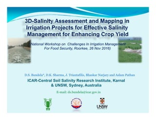
  • 1. (National Workshop on Challenges In Irrigation Management For Food Security, Roorkee, 26 Nov 2016) D.S. Bundela*, D.K. Sharma, J. Triantafilis, Bhaskar Narjary and Aslam Pathan ICAR-Central Soil Salinity Research Institute, Karnaly & UNSW, Sydney, Australia E-mail: ds.bundela@icar.gov.in
  • 2. Background • Canal irrigation development paradigm resulted in several- folds increase in crop productivity during green revolutionfolds increase in crop productivity during green revolution • It was forgotten that mega quantities of water also introduce mega quantities of salts into an irrigated areaintroduce mega quantities of salts into an irrigated area and change its hydrology and salt balance • Consequently, irrigated lands has started losing yield gain and over a period of time, these lands develop into twin problems- soil salinity & waterlogging. • Soil salinity and sodicity are widespread in irrigated areas under arid & semi-arid regions of India as well in the World. • In India, irrigation water mobilizes salts and aggravates the secondary salinization problem in ~20% of irrigated areas
  • 3. Background… • Remote sensing provides spatial distribution of soil surface salinity that too moderate and severe classes but not slightsalinity that too moderate and severe classes, but not slight class of surface salinity and NOT at all sub surface salinity P i l i b d h i l th d id• Proximal sensing based geophysical methods provide spatial & vertical distribution of salts in soil profiles/regolith f• Therefore, there is need to apply multiple coil DUALEM technology in salinity research to collect EM data quickly for 3D salinity assessment and mappingy pp g
  • 4. • Expansion of secondary salinization in canal commands • 50,000 ha under waterlogged saline soils in Haryana • 2.95 m ha saline soils in the country Huge Potential: Proximal sensing for rapid assessment of soil salinity Single coil (EM38)  multiple coils (DUALEM)
  • 5. Objectives • To assess and map soil salinity at two Indian sites to generate reliable 2D /3D EM conductivity/ soil salinity images for salinity managementimages for salinity management • To monitor the efficacy and impact of salinity management strategies implemented by re measuringmanagement strategies implemented by re-measuring and remapping salinity
  • 6. Study Area: Western Yamuna CanalStudy Area: Western Yamuna Canal CommandCommand WYC GCA:  13,543 sq km CCA 10 840 kCCA:  10,840 sq km  7 Water Circles Districts:     5 Full 7 Part Tehsils: 14 Full     22 Part  Nain Field Mokha Kheri Villages:    2206 Mokha Kheri
  • 7. Technology shift from EM38 to DUALEM System Conventional: Geonics EM-38 DUALEM‐21, 421 and 642  can investigate  vertical salt distribution and soil/ water salinityvertical salt distribution and soil/ water salinity  up to 3, 6 and 10 m depth  Modern EM tool: DUALEM-21
  • 8. DUALEM 21DUALEM‐21 Theoretical depth of ECa measurement S. N EM S t Depth l d( ) Variety of DUALEM Systems No System resolved(m) 1. DUALEM-2 3 (1) 2. DUALEM-21 3 (4) 3. DUALEM-421 6 (6) Geonics EM38 0 0 5 m ( ) 4. DUALEM-642 10 (6) Operating Frequency: 9.0 kHz Geonics EM38 0‐0.5 m 0‐1.5 m 0‐1.0 m 0 3 0 m0‐3.0 m DUALEM‐21 DUALEM-21 http://www.dualem.com/
  • 9. Survey Transect & Soil samples at Nain Farm Data point:3349Data point:3349 Soil sampled points: 32
  • 11. Survey Transects 32 Sample Locations at Nain Farm32 Sample Locations at Nain Farm 4 depth soil samples (0-15 15-45 45-75 & Total soil samples collected: 128 (32x4) (8-9 Jan 2016) (0 15, 15 45, 45 75 & 75-105 cm) (10 11 Jan 2016) Mokhra Kheri Field Total soil samples collected: 96 (24x4) (10-11 Jan 2016)
  • 12. 55.5 60 0‐15 cm 15‐45 cm 45‐75 cm 75‐105 cm Soil salinity sample and depth wise at Nain Farm 50 ECe 12 soil samples (37.5%) Ece < 4.0 20 samples (62.5%) with ECe range 4.12 to 55.5 32.8 32.1 33.2 30 40 14.62 16.54 12.51 19.55 19.8 20 10.311.07 4.76 3.153.652.88 1.6 3.02 4.343.563.232.65 6.06 5 8.96 2.22 4.984.123.94 3.8 1.82 5.74 3.98 8.17 0 10 0 1 2 3 4 5 6 7 8 9 10 11 12 13 14 15 16 17 18 19 20 21 22 23 24 25 26 27 28 29 30 31 32 Sampling point ID
  • 13. St ti ti f EC f 32 l t N i F )Statistics of ECe of 32 samples at Nain Farm) Depth (cm) n Min Mean Median SD Max Skewness 0-15 32 1.60 10.8 4.87 12.2 55.5 2.2 15-45 32 0.81 7.6 5.29 6.8 30.8 1.7 45-75 32 0.93 9.9 7.36 8.6 38.0 1.4 75-105 32 1.00 10.1 6.79 8.3 28.0 0.7
  • 15. 2D EM Conductivity Images of Four Receivers 1m Hcon (0-1.5m) 2m Hcon (0-3 m) 1m Pcon 2m Pcon (0-0.5m) (0-1.0m)
  • 16. Quasi-2d and 3d inversion modellingQuas d a d 3d e s o ode g WE CAN use a single frequency and  multiple array technology Inversion modelling parameters Forward modelling: CF or FS (Maxwell) multiple array technology DUALEM g ( ) Inversion algorithm: Occam’s regularization with  S1 or S2 ( ) + 2D/3D  inversion software  DUALEM‐21Dampness factor (λ): 0.07-3.0 Best Inversion Results:  EM4Soil /3Best Inversion Results:  Cumulative function(CF) forward  modeling,  l h d d EM4Soil Quasi‐2D/3D Module  S2 inversion algorithm, and damping  factor λ (0.07) To generate 3D salinity Images
  • 17. Salinity inversion modelling results (32 sets)Salinity inversion modelling results (32 sets)
  • 19. Coefficient of determination (R2) between soil ECe andCoefficient of determination (R ) between soil ECe and apparent electrical conductivity (ECa) at Nain Farm and between True ECe and ECe Depth (cm) 1mPcon 1mHcon 2mPcon 2mHcon 0-15 0.90 0.82 0.85 0.69 15-45 0.78 0.79 0.81 0.76 45-75 0.70 0.75 0.77 0.83 75-105 0.60 0.64 0.67 0. 73 Best Parameters Regression model between True ECe and ECe 0 07 S2 CF R2 0 780.07, S2, CF R2=0.78
  • 20. Inverted ECe Images (Nain Field) (0-0 2m) (0 2 0 5m)(0-0.2m) (0.2-0.5m) (0.5-0.8m) (0.5-1.1m) Seven depths, Z= 0-0.2, 0.2-0.5, 0.5-0.8, 0.8-1.1, 1.1-1.5, 1.5-2.3 and 2.3-3.3 m
  • 21. 3D Conductivity Images (Nain Field) Layer 1: < 0.2 m Layer 2: 0.2-0.5 m Layer 3: 0.5-0.8 my Layer 4: 0.8-1.1m Layer 5: 1.1-1.5 m Layer 6:1.5- 2.3 m Layer 7:2 3 3 3 mLayer 7:2.3- 3.3 m
  • 25. Salinity Management Strategies • Pre-reclamation management components • Reclamation components P l i• Post-reclamation management components
  • 26. Salinity Management Strategies Group/sub‐group Technology/StrategiesGroup/sub group Technology/Strategies Reclamation  Surface & Subsurface drainage  On‐farm land development including surface drainage  Leaching Leaching Management Crop management  Selection of crops and cropping sequences  Exploitation of varietal differencesCrop management  Exploitation of varietal differences  Improved agronomic practices Soil management  Land forming/seeding  Application of additional nutrients Irrigation water management Shallow depth‐high frequency irrigation Pre/post‐sowing irrigationPre/post sowing irrigation Switchover to improved irrigation techniques Leaching for salt balance Chemical management  A li ti   f  h i l  d t  ( )Chemical management  Application of chemical amendments (gypsum) Rainwater management In‐situ rainwater conservation,  Rainwater harvesting  and reuse, Fallowing
  • 27. Conclusions •Conclusions • Dual geometry multiple coil EM methodology tested has shown its potential for rapid salinity assessment across • . shown its potential for rapid salinity assessment across affected field and with depths. • Salinity inversion (EM4Soil) software inverts ECa data with best inversion parameters to generate 2D/3D salinity mapsbest inversion parameters to generate 2D/3D- salinity maps of sites using 2D/ 3D quasi-inversion modeling. • The modelled ECe values showed the close match with the b d EC l f N i Fi ld (R2 0 78)observed ECe values for Nain Field (R2 = 0.78). • DUALEM technology makes salinity mapping both spatially and vertically a single step process and thereby a efficienty g p p y way of generating 2D/3D digital soil salinity maps for effective salinity management