Downloaded 118 times


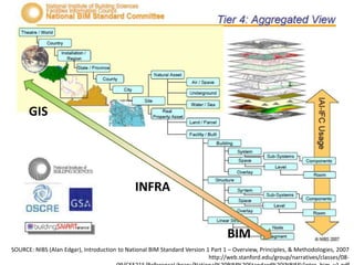

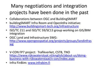


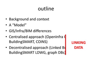

The document discusses the integration of Building Information Modeling (BIM) with Geographic Information Systems (GIS) and infrastructure by highlighting key collaborations and projects in the field. It presents both centralized and decentralized approaches to data interoperability, showing the involvement of organizations like buildingSMART and OGC in these initiatives. The emphasis is on the development of linked data applications and standards that will enhance data integration throughout the building lifecycle.


![[Cib]achieving interoperability between bim and gis final](https://cdn.slidesharecdn.com/ss_thumbnails/cibachievinginteroperabilitybetweenbimandgisfinal-190919140136-thumbnail.jpg?width=640&height=640&fit=bounds)


