150 Branches of Earth Sciences
•
3 likes•1,467 views

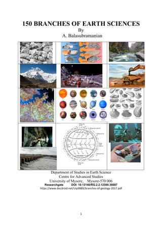
Earth Science is a major Subject of life. Earth Science encompasses hundreds of branches. Geology is the scientific study of the all constituents of planets, their internal and external forms and processes. More precisely, it is the study of nature, structure and history of the planet. Earth is the home to all life, well known to the humankind. Geology, itself, is a major part of The Earth and atmospheric sciences, which were born as twins . The subject of geology encompasses all aspects including the composition, structure, physical properties, and history of a planets'( like Earth's) inter-related components and the processes that are shaping the features on the surface.

Recommended
More Related Content
What's hot
What's hot (20)
Similar to 150 Branches of Earth Sciences
Similar to 150 Branches of Earth Sciences (20)
More from Prof. A.Balasubramanian
More from Prof. A.Balasubramanian (20)
Recently uploaded
Recently uploaded (20)
150 Branches of Earth Sciences
- 1. 1 150 BRANCHES OF EARTH SCIENCES By A. Balasubramanian Department of Studies in Earth Science Centre for Advanced Studies University of Mysore, Mysore-570 006 Researchgate DOI: 10.13140/RG.2.2.12500.30087 https://www.docdroid.net/Uip9B8X/branches-of-geology-2017.pdf
- 2. 2 150 BRANCHES OF EARTH SCIENCES by Prof A. Balasubramanian Centre for Advanced Studies in Earth Science University of Mysore Mysore-6 Introduction: Earth Science is a major Subject of life. Earth Science encompasses hundreds of branches. Geology is the scientific study of the all constituents of planets, their internal and external forms and processes. More precisely, it is the study of nature, structure and history of the planet. Earth is the home to all life, well known to the humankind. Geology, itself, is a major part of The Earth and atmospheric sciences, which were born as twins . The subject of geology encompasses all aspects including the composition, structure, physical properties, and history of a planets'( like Earth's) inter-related components and the processes that are shaping the features on the surface. Geologists are the scientists who study the origin, occurrence, distribution and utilities of all materials(metallic, non- metallic, inorganic, etc), minerals, rocks, sediments, soils, water, oil and all other inorganic natural resources. It is a very vast subject covering a wide spectrum of scientific principles and holding hundred and fifty plus scientific branches. This report enumerates and highlights most of them, in a nutshell, for all those who intends to know for planning their career path. Some more branches could be added as and when needed. The Subject of Geology: The word "Geology" is derived from the Greek word "geo" means globe and "logos" means logical discourse. Hence, geology is defined as the logical study of all of the globe. Today, geology does not restrict its domain to the study of the planet earth alone. It also includes the study of the other planets and moons of the entire solar system. Geology is a very vast subject. It has several branches. In the olden days, people divided it into two broad areas, as physical geology and historical geology. The subject of Physical geology deals with the study of Earth's materials, such as minerals and rocks, as well as the processes that are operating on and within the Earth and on its surface. The subject of Historical geology focuses on the origin and evolution of life on the Earth, its continents, oceans, atmosphere, and the life of all ecosystems. Historical geology is more than just concentrating on the past events in geological history. It is the study of the sequential changes that have happened and evolved continuously during the past 4.6 billion years on the planet. Geology is a grand parent subject comprising four levels of grand children branches. Some of the notable ones are only discussed in this report. 1. Physical Geology: Physical geology is the fundamental study of the earth's lithospheric components like rocks, minerals, and soils and how they got originated over a period of time. Many geological processes are active on the surface of the earth. They are called as exogenous processes. The highly complex internal processes such as plate tectonics and mountain‐building have also formed the crustal rocks and brought them to the earth's surface. These are called as endogenous processes. All these processes are capable of creating both constructional and destructional landforms. The agents that are responsible for these actions are called as geological agents. The notable surface geological processes are weathering, mass-wasting, erosion, transportation and deposition. The subject , physical geology, deals with the Solar system, the Earth's origin, age and internal constitution, weathering and mass-wasting, geological work of river, lake, glacier, wind, sea and groundwater. It also deals with the Volcanoes - their types & distribution, geological effects and products; earthquakes -its distribution, causes and effects. Physical Geology also projects the elementary ideas about the origin of geo synclines, concept of isostasy and mountain building(Orogeny), continental drift, seafloor spreading and plate tectonics. This subject gives the
- 3. 3 foundation for all other earth science branches. 2. Historical geology : The planet earth has undergone several changes during each geologic period. Great mountain ranges have been folded up in one period and eroded away in the following one. Many of them have been uplifted more than once. Some of them often got washed off into the adjacent depressed zones like basins and seas. Historical geology is the discipline that uses the principles and techniques of geology to reconstruct and understand the past geological history of Earth. It is a major branch which deals with the records of events of earth history and with the historical sequence and evolution of plants and animals of past ages. Its object is to arrange the events of earth history in the regular chronological order of their occurrence and to interpret their significance. Fortunately, the historical records are preserved in the layered rocks of the crust. Historical Geology is , sometimes , called as Stratigraphical Geology. It brings together all collated details of other Branches of Geology like Paleontology, petrology and structural geology, pertaining to age-wise correlated beds. 3. Geomorphology : Geomorphology is the scientific study of the origin and evolution of landforms and landscapes created by physical, chemical or biological processes operating at or near the Earth's surface. It is concerned with the internal geologic processes of the earth's crust, such as tectonic activity and volcanism that constructs new landforms, as well as externally driven forces of wind, water, waves, and glacial ice that modify such landforms. It is closely related to soil science, hydrology, geology and environmental science. This has the potential for applications in environmental / development planning, transport, human settlements, mining and hydrological sectors, hospitality and tourism. Geomorphology also focuses on the investigation of surface processes and the way these processes create small-scale landforms. Geomorphology was first used as a term to describe the morphology of the Earth’s surface in the 1870s and 1880s. Geomorphologists work within certain disciplines such as physical geography, geology, geodesy, engineering geology, archaeology and geotechnical engineering. This broad base of interest contributes to many research areas and interests within the field of terrain evaluation, remote sensing, defence operations, transport systems, and all urban development . Geomorphology is further divided into various branches. To mention a few, are: a) Evolutionary Geomorphology - which deals with the Davisian Erosion Cycles / peneplain (Footprints of Darwinian Evolution) b) Process Geomorphology - Process geomorphology is the study of the processes responsible for landform development. c) Quantitative Dynamic Geomorphology - Drainage basin morphology (stream order, density etc.) Newtonian mechanistic approach (stream power, fluvial erosion, diffusion/transport laws , Dynamic equilibrium approach d) Thermodynamic Geomorphology - Entropy concept e) Predictive Geomorphology - Earthcast ( extreme events – flood, landslide) - Mathematical morphology (Fractal, Spatio-temporal Geoscience Information System analysis) - Deterministic & Numerical models - Artificial Neuron Network (ANN). The other branches include the following: a) Planetary geomorphology b) Mega-geomorphology c) Tectonic geomorphology d) Volcanic geomorphology e) Fluvial geomorphology and river management f) Coastal geomorphology g) Submarine geomorphology h) Aeolian systems and arid geomorphology
- 4. 4 i) Tropical geomorphology j) Cold region geomorphology. Geomorphology is fully concerned with landforms and their origin and evolution. This subject has been studied, initially , using qualitative approaches, with the description of landforms, by describing the forces acting on Earth’s surface to produce landforms and landform change. Later, more quantitative approaches came in, which were largely based on the work of Horton, Strahler, and Leopold in the 1940’s and 50’s. These scientists advocated for a physically-based assessment of landforms. There are many sub disciplines in geomorphology including tectonic, fluvial, storm, aeolian, floodplain, glacial, groundwater, climate, tsunami, and many others. These sub disciplines are mainly driven by distinctions in the mechanics and dynamics that are involved in the processes. 4. Fluvial Geomorphology: The term 'Fluvial' refers to the processes associated with running waters, 'geo' refers to earth and 'morphology' refers to channel shape. Fluvial geomorphology is the scientific study of the forms and functions of streams and the interaction between streams and the landscapes that evolve around them. Fluvial geomorphology is an applied science. It is mainly devoted to understand the development of rivers, both in their natural setting as well as on how they respond to the anthropogenic changes imposed within a watershed. One of the objectives , is to predict what changes will occur to a stream channel, in response to alterations in watershed conditions; and, in turn, how these changes will affect /help human infrastructure and aquatic habitat. The geomorphology, hydrology, and ecology of river systems interact through complex processes occurring across a range of spatial and temporal scales. A river's adjustment to watershed perturbations may take thousands of years. Modifications in a stream channel may take place in less than a decade. Understanding of how these modifications, operating at different time scales, alter the width, depth, and cross-section of a channel, is critical for identifying potential problem areas, in any river system. A geomorphological approach to river management will certainly help to reduce the flood damages and improve the aquatic habitat along river courses. River Ecology is a branch which orients its approach towards the subject of fluvial geomorphology with biological inputs. 5. Coastal Geomorphology: Coastal geomorphology, by definition, is the scientific study of the morphological development and evolution of the coasts. Coastal landforms are developed under the influence of winds, waves, currents, and sea-level changes. This branch focuses on the physical processes and their responses in the coastal zone. It is also an applied science. Sustainable management of coastal resources requires a detailed knowledge on coastal zones. Coastal zone development and management requires a thorough study of coastal geomorphology. This subject also takes the involvement of basics principles of hydrodynamics of oceanic waters. The effect of sea-level rise on coastal geomorphology is yet another area of study, in addition to global climate changes and their effects. It is a fact that rising sea- levels, result in the spatial shift of coastal geomorphology, by redistributing the coastal landforms comprising sub-tidal bed-forms, intertidal flats, salt-marshes, shingle banks, spits and bars, sand dunes, cliffs and coastal lowland. Coastal landforms act to attenuate wave and tidal energy and respond to the time-variant changes in energy conditions with reference to space and time. 6. Climatic Geomorphology: Climatic geomorphology is the study of the role of climate in shaping landforms and the earth-surface processes. An approach used in climatic geomorphology is to study relict landforms to infer about the ancient climates. It is mainly concerned about the past climates. Climatic geomorphology identifies climatic factors such as the intensity, frequency and duration of precipitation, frost intensity, direction and power of wind, and it explains the development of landscapes under different climatic conditions. Since landscape features in one region might have evolved under certain specific climate, different from that of today, studying climatologically distinct regions of the past might help
- 5. 5 to understand the present-day landscapes. This subject helps to decipher the role of various climatic elements in shaping landforms and the earth-surface processes. The prime approach used in climatic geomorphology is to study the relict landforms to infer their ancient climates. Being often concerned about past climates, climatic geomorphology is considered to be a part of historical geology. Climatic geomorphology highlights the influence of climatic factors and explains the development of landscapes formed under different climatic conditions. The core factor is that each climate type produces its own characteristics assemblages of landforms and classifies the geomorphic processes which produces them. 7. Tropical geomorphology: The tropics are a typical climatic region. They are characterized by particular climates, that may be dry or humid. The tropics can be divided into two primary units based on annual rainfall, the humid tropics and the arid topics. These are the belts of low latitudes and high temperature. Like climate, landforms and operating geomorphic processes are not the same across the tropics. The tropics are an assemblage of active tectonic belts, ancient cratons, alluvial valleys and subsiding deltas. Geomorphology in the tropics provides twin opportunities to discover new facts and to apply such information to manage the environment for a sustainable future. Tropical geomorphology has a tendency to look forward rather than look back exclusively at past landforms. Relative to temperate zones, the tropics contain areas of high temperatures, high rainfall intensities and high evapotranspiration, all of which are climatic features relevant for surface processes. Tropical zones include a great variety of landforms and ecosystems. These areas are not only containing important natural resources but also face numerous natural hazards. Humid tropical areas contain numerous mineral, hydrocarbon, forest, and agricultural resources. These belts are located on tectonically active zones and hence they are often affected by earthquakes and tsunamis. Volcanic hazards are also very severe, especially the explosive ones, with the bursting of fire clouds, ash falls, and lahars. in addition to these, the highest occurrence of other hazards associated with tropical areas include tropical cyclones strong destructive winds, floods, and slides related to the cyclonic rains, as well as onshore storm surges caused by wind and atmospheric pressure changes. The analyses of tropical geomorphology are useful for planning , alleviation of environmental degradation and avoiding of natural hazards. 8. Glacial geomorphology: Glacial geomorphology is concerned principally with the role of glacial ice in landform and landscape evolution. It is the scientific study of the processes, landscapes, and landforms produced by ice sheets, valley glaciers, and other ice masses on the surface of the Earth. These processes include understanding how ice masses move, and how glacial ice erodes, transports, and deposits sediment. This subject is much useful to the planetary geologists who are interested in understanding the evolution and history of the surface of nearby planets in our solar system. It has been reported that the planet Mars is covered with permafrost, where the soil temperatures are permanently below the freezing point of water. Bitter cold temperatures dominate the Martian equatorial regions, with an annual-mean temperature of the soil colder than -50 deg C, and colder still at middle and high latitudes. Therefore, any water present in the Martian soil must be in the form of ice. Glacial deposits form characteristic flow features that indicate thick piles of water ice in a slow viscous motion. 9. Periglacial Geomorphology: Glacial and periglacial geomorphology are those branches of geomorphology concerned with the evolution of landscapes in high latitudes and altitudes. Periglacial geomorphology must also be viewed as one of the group of sciences that concern the cryosphere. Periglacial geomorphology has a special interest in the thawing and freezing of ground. The core of periglacial geomorphology is concerned with the study of freezing processes, associated with ground ice, and their
- 6. 6 related landforms. Such an approach places permafrost in a central position, within periglacial geomorphology. This subject primarily focuses on the geomorphological processes and landforms associated with glaciers, permafrost, periglacial and slope environments. Periglacial environments are characterised by frost action and the recurrent presence of a snow cover. The salient components of modern periglacial geomorphology include the study of i) the nature of permafrost-related processes, ground ice, and associated landforms; ii) the azonal processes that operate in cold non- glacial environments; iii) the ice-marginal (proglacial) environment and associated paraglacial transitions; iv) the alpine (montane) environment; v) Pleistocene cold-climate paleo-environmental reconstructions; vi) environmental and geotechnical studies associated with frozen ground, ground freezing and global climate change. 10. Geocryology: Geocryology is the study of frozen rock, soils, and ground. It deals with the origin, historical development, and conditions of existence of frozen strata in the earth’s crust. It helps to study the processes and phenomena that occur in freezing, frozen, and thawing rock, soils, and ground, as well as their structure, composition, and properties. The subject also deals with the geophysical, physico- geological, geomorphological, and hydrogeological phenomena that are related to the processes of the freezing, thawing, and diagenesis of frozen strata. In addition to developing the theory of such processes, geocryology also deals with the development of methods of influencing processes of freezing in the interests of construction, transportation, agriculture, and other activities. There are two main branches , as —general geocryology and engineering geocryology. The second one has much more practical significances. The early development of geocryology occurred in Russia as early as 1924. The first edition of a standard text which came from the Soviet Union, Obshcheye Merzlotovedeniya (General Permafrostology) , was published in the year 1940. By comparison, North American geocryology is of relatively recent origin. Geocryology got emerged initially from geophysics. Today, geocryology uses various methods of investigation—as a complex of field (expeditionary) and laboratory methods of the geological, geographic, and geophysical sciences and the physical and physicochemical laboratory methods. Geocryology combines the experimental research with theoretical basis and makes extensive use of numerical approaches. 11. Tectonic geomorphology: Tectonic geomorphology is the study of the interplay between tectonic and geomorphic processes in regions where the Earth’s crust actively deforms. Tectonic geomorphology is the study of the interplay between tectonic and surface processes that shape the landscape in regions of active deformation. Recent advances in the quantification of rates and physical basis of tectonic and surface processes have rejuvenated the field of tectonic geomorphology. Modern tectonic geomorphology is an exciting and highly integrative field which utilizes techniques and data derived from studies of geomorphology, seismology, geochronology, structure, geodesy, and Quaternary climate change. While emphasizing new insights from the last decade of research, Tectonic Geomorphology reviews the fundamentals of the subject which include the nature of faulting and folding, the creation and use of geomorphic markers for tracing deformation, chronological techniques which date deformation, geodetic techniques for defining recent deformation, and paleo-seismologic approaches to calibrate past deformation. Tectonic geomorphology is an integrated subject that presents stimulating challenges to anyone trying to extract information from deforming landscapes. 12. Submarine geomorphology: Submarine geomorphology deals with the form, origin, and development of features of the oceanic bottoms . In shallow marine environments, the landforms include ripples, dunes, sand waves, sand ridges, shorelines, and subsurface channels. In the continental slope transition zone the features studied are submarine canyons and gullies, inter-canyon areas, intra-slope basins, and slump and slide
- 7. 7 scars. The deep ocean basins contain varied landforms like trenches , trench fans, sediment wedges, abyssal plains and distributary channels. 13. Planetary geomorphology: Planetary geomorphology is yet another branch of geomorphology. It involves the study of landforms on planets and their satellites. It is a modern branch. Most of the surface processes on other planets and their satellites depend on various factors like mean distance from the Sun, annual receipt of solar energy, rotational period, and on the nature of the planetary atmospheric conditions. Observed geomorphic processes include weathering, wind activity, fluvial activity, glacial activity, and mass wasting. 14. Geomorphometry: Geomorphometry is yet another branch of geomorphology. It is also called as landform morphometry. It helps to study quantitatively the geometric forms of the land surfaces. The concepts of geomorphometry dates back to the work of both Alexander von Humboldt and Carl Ritter, who postulated these ideas in the early and mid-nineteenth century. Morphometric analysis, quantitative description and analysis of landforms are the primary focus in this subject. Morphometry is an essential means in geomorphic analysis of an area. Morphometry is defined as the measurement and mathematical analysis of the configuration of the earth’s surface and of the shape and dimension of its landforms. It is done mainly to understand the structure, processes and evolution of landscape. Analysis of the flow pattern in the basin helps to relate the runoff characteristics to the morphometric parameters. The quantitative analysis of drainage basins is an important aspect of characterization of its sub-basins and watersheds. Such characterization of watersheds plays an important role in forecasting the hydrological behavior within the system and thereby it helps planning for hydrologic designs. 15. Human geomorphology: The subject of anthropogenic geomorphology is the description of the wide and ever-widening range of surface landforms, extremely diverse in origin and in purpose, created by the operation of human society. In a broader sense, artificially created landforms have manifold influences on the environment and modify the natural processes. Human geomorphology studies the impacts humans have on the globe, on reshaping the landforms. Thus, it is difficult to imagine a location or circumstance that has not been impacted by geomorphic processes, by the existence of human beings. The subject of anthropogenic geomorphology is broadened by the fact that the artificially created landforms have manifold influences on the environment (e.g. alterations in meso- and microclimate, biota, etc.). In addition, they may also modify natural processes. Human geomorphic action may induce cascading environmental changes, whose study obviously lies within the scope of anthropogenic geomorphology. The major fields of anthropogenic geomorphology are: Mining and processes involved and the resulting landforms, industrialization and its impact reflected in industrogenic landforms, settlement (urban) expansion exerting a major influence on the landscape over ever increasing areas, advanced farming which heavily relying on rivers, water management (river channelization, drainage). All these occupies a special position in anthropogenic geomorphology. Agriculture is a major social activity causing changes on the surface. Agrogenic impacts also include transformation due to forestry. Although warfare is not a productive activity it has long-established surface impacts. In contrast, the impacts of tourism and sports activities are rather new fields of study in anthropogenic geomorphology.
- 8. 8 16. Applied geomorphology: Applied geomorphology is the study of interactions of humans with landscapes and landforms. The interaction between geomorphology and public policies, with contributions on rural land-use and soil erosion, urban land-use, slope management, river management, coastal management, and policy formulation are discussed in this subject. Landslides , debris flows and soil erosion may become more severe in some places. The sediment load of some rivers may increase, some beaches and cliffs may erode faster, some of the coastal lowlands may become submerged, and frozen ground in the tundra environments may thawing processes. Applied geomorphologists are concerned with all these potentially damaging changes, their causative factors and to provide solutions to solve them also. 17. Biogeomorphology and Ecogeomorphology: Biogeomorphology and ecogeomorphology are the study of interactions between organisms and the development of landforms. Organisms affect geomorphic processes in a variety of ways. For example, trees can reduce landslide potential where their roots penetrate to underlying rock, plants and their litter inhibit soil erosion. The biochemicals produced by plants accelerate the chemical weathering of bedrock and regolith. Similarly, the marine animals cause the bioerosion of coral. The study of the interactions between marine biota and coastal landform processes is called coastal biogeomorphology. Biogeomorphology has two-way interaction between geomorphology and ecology. Ecogeomorphology is synonymous with biogeomorphology. There are some key applications of biogeomorphological research. The roles of organisms in environmental reconstruction, trace fossil analysis, extraterrestrial geomorphology, environmental engineering and the built environment are the major aspects. 18. Phytogeomorphology: The subject phyto-geomorphology can be defined as the study of relationships between the earth's relief features and the distribution of plant species. The subject mainly emphasizes on the importance of combining plants and landforms in studies related to the land surface of the earth and in recognition of their interdependence. It forms a powerful tool for the survey, management and planning of our environment. In addition, there are more specific discipline-oriented studies that can benefit directly or indirectly from a phyto-geomorphic approach. It is a fact that the balance between landforms and vegetation varies greatly. This subject is a part of biogeomorphology. It deals with the narrower subject of how terrain affects plant growth. It focuses on how terrain attributes affect crop growth and yield in a farm field. Precision agriculture models where crop variability is at least partially defined by terrain attributes can be considered as phytogeomorphological precision agriculture. Phytogeomorphology is an interdisciplinary subject including the concepts of plant ecology, geography and geology. Due to this, the study of phyto-geomorphology has attracted geographers, plant ecologists and also geologists each with diverse objectives. 19 Hydrogeomorphology : The term of hydrogeomorphology was first used by Scheidegger in 1973. Hydrogeomorphology is defined as “an interdisciplinary science that focuses on the interaction and linkage of hydrologic processes with landforms or earth materials and the interaction of geomorphic processes with surface and subsurface water in temporal and spatial dimensions". Hydrogeomorphology is considered as the basic study of landforms caused by the action of water. This branch describes and evaluates the geomorphic environment, in which water occurs and circulates. Hydrogeomorphology of a drainage basin is a function of rainfall kinematics, surface topography, drainage basin morphology and runoff. Geological conditions may also control and influence the effect of most of these factors. The role of these factors are reflected as drainages which in-turn provide the information to understand the situation and to make the proper decisions on water resources management. It is majoritively a
- 9. 9 quantitative study , of areal, linear and relief morphometric aspects of a drainage basin, provides the theoretical base for all the hydrogeomorphic approaches. 20. Engineering geomorphology: Engineering geomorphology is concerned with the evaluation of landform changes, especially the effects of construction on the environment, notably on the operation of surface processes and the risks from surface processes, whether current processes or the legacies of past processes. Engineering geomorphology provides practical support for engineering decision-making (project planning, investigation, design and construction) and engineering geomorphologists form an integrate part of the engineering or environmental team. Engineering geomorphology has developed in the last few decades to support a number of distinct areas of engineering, including river engineering, coastal engineering, and geotechnical engineering, where engineering geomorphology has complemented engineering geology and has proven to be valuable, especially for rapid site reconnaissance and slope stability studies. Engineering geomorphology can also be applied to agricultural engineering, primarily in the investigation and management of soil erosion problems. 21. Paleontology or Palaeontology: Paleontology (US spelling) or palaeontology (UK spelling) is the scientific study of the developing history of life on earth. It is the study of ancient plants and animals based on their fossil record. It is a fact that the evidence of existence of all life on earth, since the origin, are mostly preserved in rocks. This includes the study of body fossils, tracks, burrows, cast off parts, fossilized faeces ("coprolites"), and chemical residues. Body fossils and trace fossils are the principal types of evidences that help to know about the ancient life. In addition, the geochemical evidences also help to decipher the evolution of primitive life existed before. The subject of Paleontology helps to determine the organisms' evolution and interactions with each other and their environments (their paleoecology). It also heavily relies on the two subjects such as biology and geology. It differs from archaeology in that it excludes the study of anatomically modern humans. It uses techniques drawn from a wide range of allied sciences like biochemistry, mathematics, and engineering. Use of all techniques from other sciences, has enabled paleontologists to discover much of the evolutionary history of life, almost all the way back to the origin of Earth. As the knowledge level has increased, paleontology became a specialised subject with more and more sub-divisions. Some of which focus on different types of fossil organisms , while the other branched out and orients towards the ecology and environmental history of ancient climates. On several fronts, paleontology overlaps with geology (the study of rocks and rock formations) as well as with botany, biology, zoology and ecology. Today, paleontology has become a very big subject with its own branches. These branches are unique in their applications. The major subdivisions of paleontology include paleozoology (animals), paleobotany (plants) and micropaleontology (microfossils) and palynology. Paleozoologists may specialise in invertebrate paleontology, which deals with animals without backbones or in vertebrate paleontology, dealing with fossils of animals with backbones, including fossil hominids (paleoanthropology). Micropaleontologists study microscopic fossils, including organic-walled microfossils whose study is called palynology. There are many developing specialties such as paleobiology, paleoecology, ichnology (the study of tracks and burrows) and taphonomy (the study of what happens to organisms after they expire). Major areas of study include the correlation of rock strata with their geologic ages and the study of evolution of life forms. 22. Invertebrate Paleontology: Invertebrate paleontology (it is also spelled as Invertebrate palaeontology) is considered to be a subfield of paleontology, paleozoology, or paleobiology. It is the scientific study of prehistoric invertebrates by analyzing invertebrate fossils in the geologic record. The invertebrates include the
- 10. 10 non-vertebrate creatures of the kingdom Animalia (or Metazoa) in the biotic domain of Eukaryota. By phyletic definition, these are many-celled, sub-vertebrate animals. They lack a vertebral column, spinal column, vertebrae, backbone, or long, full-length notochord -- in contrast, of course, to the vertebrates , in the one phylum of Chordata. The invertebrates have never had a cartilaginous or boney internal skeleton. It has gill slits, ribs and jaws. Throughout the geologic time, invertebrates have remained non-craniate creatures. 23. Vertebrate Paleontology: Vertebrates are all the animals with backbones, the fishes, amphibians, reptiles, birds, and mammals. These animals have attracted a great deal of study. Vertebrate paleontology is a subfield of paleontology. The study seeks to discover, the features of fossilized remains, the behavior, reproduction and appearance of extinct animals with vertebrae or a notochord. Vertebrate paleontology covers everything from the tiny, fish-like creatures that first evolved backbones, to the salamander-like ancestors of all land vertebrates including dinosaurs, mammals, flying and swimming reptiles, mastodons, marsupials. Vertebrate paleontology embraces far beyond the study of large, legendary creatures. Smaller animals, like our ancestors, the early mammals, are equally important. Small animals tend to be more common in the fossil record and better preserved. Hence, they reveal enormous amounts of information on the ecosystems and climates of Earth’s distant past. The fields of paleobiology, paleoecology, biomechanics, anatomy, paleoclimatology, evolutionary biology and many others are represented in vertebrate paleontology research. 24. Micropaleontology: Micropaleontology (also spelled as micropalaeontology) is a modern branch of palaeontology. It deals with the study of microfossils, or fossils that require the use of a microscope to see the organism, its morphology and its characteristics. Since the size of the microfossils are generally ranging between 0.001mm and 1 mm, their study requires the use of light or electron microscopes. Fossils which can be studied with the naked eye or low-powered magnification, such as a hand lens, are referred to as macrofossils. the microfossils are the remains of unicellular, multicellular micro- organisms and the dissociated elements and skeletal fragments of macro-organisms. The types of families of microfossils studied and analysed are Foraminifera, Ostracods, Coccolithophora, Diatoms, Radiolaria and Dinoflagellates. Micropaleontology is also one of the largest branches of paleontology. The microfossils are by far the most abundant of all fossils present on the earth's stratigraphic beds. The practical value of marine microfossils in various fields of historical geology is enhanced by their minute size, abundant occurrence, and wide geographic distribution in sediments of all ages and in almost all the marine environments. Due to their small sizes and large numerical abundance, relatively small sediment samples can usually yield enough data for the application of more rigorous quantitative methods of analysis. Marine microfossils occur in sediments of Precambrian to Recent ages, and in every part of the stratigraphic column, one or more groups can always be found more useful for biostratigraphic and paleoecologic correlations. Microfossils remain an indispensable part of any sedimentary basin study, providing the biostratigraphical and palaeoecological framework and, increasingly, a measure of maturity of hydrocarbonprone rocks. Microfossils are vital indicators for oil exploration. The condition of the fossils indicates whether the petroleum source rocks have been buried and heated sufficiently to generate oil from trapped organic matter. Micropalaeontology brings three unique perspectives to the study of evolution: the dimension of time, abundance of specimens (allowing statistical analysis of trends) and long complete fossil records, particularly in marine groups.
- 11. 11 25. Palynology: The term palynology was introduced by Hyde and Williams in 1944. Palynology is the scientific study of contemporary and fossil palynomorphs, including pollen, spores, orbicules, dinocysts, acritarchs, chitinozoans and scolecodonts, together with particulate organic matter (POM) and kerogen found in sedimentary rocks and sediments. The particles of a size between five and 500 micrometres, found in rock deposits, and composed of organic material are analysed in this subject. A classic palynologist analyses the particulate samples collected from the air, from water, or from deposits including sediments of any age. The condition and identification of those particles, organic and inorganic, give the palynologist clues to the life, environment, and energetic conditions that produced them. ( Palynology does not include diatoms, foraminifera or other organisms which have siliceous or calcareous exoskeletons). Today, palynology has become an interdisciplinary branch of earth science and biological science, particularly plant science. Actuopalynology is the study of extant palynomorphs which are either living, still retain their cell contents, or whose cell contents have been removed by maceration. Paleopalynology is the study of fossil palynomorphs, where "fossil" is defined as "any indication of past life" including the term "sub-fossil." The study of chitinozoans (animal remains), fungal spores, dinoflagellates, acritarchs and other organisms (except diatoms) is also included in palaeopalynology. Copropalynology (Greek ‘kopros’ means dung) is the study of palynomorphs present in coprolite (= fossilized excrement) of animals. Human coprolite is preserved in dry caves. Pollen and spore analyses of human coprolite provide information about the diet of prehistoric humans. Pollen analysis of herbivore coprolite provides data to reconstruct the composition of pastures of that time. This study also includes the pollen analysis of recent excreta. Forensic palynologists determine the last diet of a murdered person by pollen analyses of stomach, gut and feces. Entomopalynology is the study of pollen grains that are associated with insects. This study mainly encompasses melissopalynology, research on honeybees, foraging distances of insects and pollination biology, etc. The basic purpose of studying this subject is to find the relation of pollinators and crop yield. It is observed that in apples, melons and almonds etc. the yield increases with the increase of pollinators. Some pollinators are pests on some crops. By studying the pollinators and pests, efficient management practices can be developed to increase the crop yield. Latropalynology is the ‘study of spores and pollen as applied to human health problems’—Traverse. It is known that pollen and spore have medicinal properties. As for example Arabian physicians use Lycopodium spores— commercially called ‘vegetable sulphur’ for the treatment of stomach disorders. The spores of Adiantum phillippinense are used to cure coughs. Forensic Palynology is the study of palynomorphs that are used as evidence in criminal cases and resolve other legal problems. Forensic palynology also includes identifying and linking the suspect to the scene of the crime. 26. Stratigraphical palynology: Stratigraphical palynology is a branch of micropalaeontology and paleobotany, which studies fossil palynomorphs from the Precambrian to the Holocene. The subject relies on the use of palynomorphs, their identification, distribution, and abundance to correlate among sedimentary sequences of any age, or to provide chronological control for these sedimentary sequences.
- 12. 12 27. Quaternary Palynology: Quaternary Palynology deals with the quantitative analysis of pollen, spores and related microfossils in sediments of Quaternary age (the last 2.5 million years). Quaternary Palynology relies heavily on the precise dating for correlation among stratigraphic sequences, and for reconstructing rates of environmental change. For the late-Quaternary (the last 50,000 years), time control is based primarily based on radiocarbon dating. The Quaternary spans much of the time on the development of humans. Particularly during the late Quaternary, the influence of environmental change on humans, and the influence of humans on the environment are important aspects covered under Quaternary Palynology. 28. Archaeological Palynology: Archaeological Palynology is another branch using palynology as an archaeological tool. It is also a branch of Archaeobotany - applying botanical and paleo-botanical techniques to archaeological investigations. 29. Environmental Palynology: Environmental Palynology focuses on the use of palynomorphs, their identification, distribution, and abundance in order to determine the past changes in the biota, climate, or surficial geology of an area. 30. Paleobotany: Paleobotany, is the study of ancient plants, which are existing in fossilized forms. It is one of the branches of paleontology or paleobiology. It deals with the recovery and identification of plant remains from the geological formations, and their use for the biological reconstruction of past environments (paleogeography), and both the evolutionary history of plants, with a bearing upon the evolution of life. Paleobotany includes the study of terrestrial plant fossils, as well as the study of prehistoric marine photoautotrophs, such as photosynthetic algae, seaweeds or kelp. A closely related field to this is palynology. Paleobotany is important in the reconstruction of ancient ecological systems and climate, which is known as paleoecology and paleoclimatology respectively. Paleobotany has become important to the field of archaeology, primarily for the use of phytoliths in relative dating. 31. Paleoecology: Paleoecology (also spelled palaeoecology) is the study of interactions between organisms and/or interactions between organisms and their environments, across geologic timescales. As a discipline, paleoecology interacts with, depends on and informs a variety of fields including paleontology, ecology, climatology and biology. Paleoecology got emerged out of the field of paleontology in the 1950’s, though paleontologists have conducted paleoecological studies since the creation of paleontology in the 1700s and 1800s. Combining the investigative approach of searching for fossils with the theoretical approach of Charles Darwin and Alexander von Humboldt, paleoecology began as paleontologists began examining both the ancient organisms they discovered and their environments. Visual depictions of past marine and terrestrial communities has been considered an early form of paleoecology. 32. Palaeogeography: Palaeogeography (or paleogeography) is the scientific study of historical geography, generally within the physical landscapes. Palaeogeography includes the study of human or cultural environments. Paleogeography yields information that is crucial to the scientific understanding in a variety of contexts. Paleogeographers also study the sedimentary environment associated with fossils for clues to the evolutionary development of extinct species. Paleogeographic evidences have contributed to
- 13. 13 the development of continental drift theory including plate tectonic theories, shape and latitudinal location of supercontinents such as Pangaea and ancient oceans such as Panthalassa. It helps to enable the reconstruction of prehistoric continents and oceans. 33. Crystallography: The first historical references to the use of crystals come from the Ancient Sumerians (4th millennium BC). The Ancient Greeks identified quartz with the word "crystal". The study of crystals became a separate subject called as Crystallography. Crystallography is the experimental science of determining the arrangement of atoms in the crystalline solids. Today we know that crystals are made of matter, atoms, molecules and/or ions that fit together in repeating patterns, called unit cells, which like bricks stacked in three dimensions form the crystals. Inside the unit cells atoms are also repeated by symmetry operations. These patterns cause the crystals to show many sorts of unique shapes. Crystallographers use the properties and inner structures of crystals to determine the arrangement of atoms and generate knowledge that is used by chemists, physicists, biologists, and others. Crystallographers have been associated with the geosciences, metallurgy, and ceramics engineering. The pharmaceutical and biochemical fields rely extensively on the crystallographic studies. 34. X-ray Crystallography The subject of X-ray Crystallography is a modern development in the field of crystallography. Since the 1920s, X-ray diffraction has been the principal method for determining the arrangement of atoms in minerals and metals. The application of X-ray crystallography to mineralogy began with the structure of garnet, which was determined in 1924 by Menzer. A systematic X-ray crystallographic study of the silicates was undertaken in the 1920s. The oldest and most precise method of X- ray crystallography is single-crystal X-ray diffraction, in which a beam of X-rays strikes a single crystal, producing scattered beams. Crystallographic methods now depend on analysis of the diffraction patterns of a sample targeted by a beam of some type. X-rays are most commonly used; other beams used include electrons or neutrons. This is facilitated by the wave properties of the particles. Crystallographers use X-ray, neutron, and electron diffraction techniques to identify and characterize solid materials. Since many materials can form crystals—such as salts, metals, minerals, semiconductors, as well as various inorganic, organic, and biological molecules—X-ray crystallography has been fundamental in the development of many scientific fields. X-ray crystallography is still the chief method for characterizing the atomic structure of new materials and in discerning materials that appear similar by other experiments. X-ray crystallography is related to several other methods for determining atomic structures. X-ray diffraction has a wide and various applications on the chemical, biochemical, physical, material and mineralogical sciences. Laue`s said that 'has extended the power of on serving minute structure ten thousand times beyond that of the optical microscope. 35. Mineralogy : The history of mineralogy is as old as humankind. Minerals have been an important part of our society since the time of prehistoric man. Mineralogy is the branch of geology concerned with the study of minerals. The early writings on mineralogy were devoted to gemstones, mostly seen in the records of ancient Babylonia, the ancient Greco-Roman world, ancient and medieval China, and Sanskrit texts from ancient India and the ancient Islamic World. The modern study of mineralogy was founded on the principles of crystallography. It is the scientific study of chemistry, crystal structure, and physical (including optical) properties of minerals. Specific studies within mineralogy include the processes of mineral origin and formation, classification of minerals, their geographical distribution, as well as their utilization. There are several different branches to mineralogy.
- 14. 14 Physical mineralogy: Physical mineralogy is concerned with the physical properties and descriptions of minerals. Minerals can be described using several physical attributes, including hardness, specific gravity, luster, color, streak, and cleavage. Chemical Mineralogy The chemical mineralogy deals with the investigation of the chemical composition of minerals and its variation, the processes of mineral formation, and the changes minerals undergo when acted upon chemically. 36. Descriptive mineralogy Descriptive mineralogists use the properties discussed in physical mineralogy to name and classify the new minerals. Determinative mineralogy is the branch of mineralogy that deals with identifying unknown minerals, also using the physical properties of minerals. Other branches of mineralogy include chemical mineralogy (identifying minerals to determine the chemical composition of the earth's crust), optical mineralogy (using light to determine the crystal structure of minerals). 37. Optical Mineralogy: Optical mineralogy is the study of minerals and rocks by measuring their optical properties. Most commonly, rock and mineral samples are prepared as thin sections or grain mounts for study in the laboratory with a petrographic microscope. Optical mineralogy is used to identify the mineralogical composition of geological materials in order to help reveal their origin and evolution. It deals with the principles of optics, behaviour of light through isotropic and anisotropic substances, petrological microscope, construction and working of nicol prism, birefringence, pleochrosim , extinction, physical, chemical and optical properties of more common rock forming minerals. The subject deals with the optical properties of crystalline matter and to the polarizing microscope for optical mineral identification. Thin section and polished section studies provide important information on the crystallographic properties and the chemical composition of the common rock-forming minerals. Optical mineralogy analyses the interaction of light with minerals, most commonly limited to visible light and usually further limited to the non-opaque minerals. Opaque minerals are more commonly studied in reflected light and that study is generally called ore microscopy - alluding to the fact many opaque minerals are also ore minerals. Optical mineralogy is the study of minerals and rocks by measuring their optical properties. Most commonly, rock and mineral samples are prepared as thin sections or grain mounts for study in the laboratory with a petrographic microscope. Optical mineralogy is the study of minerals and rocks by measuring their optical properties. Most commonly, rock and mineral samples are prepared as thin sections or grain mounts for study in the laboratory with a petrographic microscope. Optical mineralogy is used to identify the mineralogical composition of geological materials in order to help reveal their origin and evolution. Optical mineralogy deals with the study of the interaction of light with minerals, most commonly limited to visible light and usually further limited to the non-opaque minerals. Opaque minerals are more commonly studied in reflected light and that study is generally called ore microscopy - alluding to the fact many opaque minerals are also ore minerals. The most general application of optical mineralogy is to aid in the identification of minerals, either in rock thin sections or individual mineral grains. Another application occurs because the optical properties of minerals are related to the crystal chemistry of the mineral -- for example, the mineral's chemical composition, crystal structure, order/disorder. Thus, relationships exist, and correlations are possible between them and some optical property. This often allows a simple optical measurement with the petrographic microscope (a polarizing microscope) that may yield important information about some crystal chemical aspect of the mineral under study.
- 15. 15 38. Petrology Petrology is the scientific study of rocks, their composition, texture, and structure, their occurrence, distribution and origin in relation to physicochemical conditions and geologic processes of formation. It is concerned with all three major types of rocks—igneous, metamorphic, and sedimentary. Petrography is a branch of petrology that focuses on detailed descriptions of rocks. Someone who studies petrography is called a petrographer. The mineral content and the textural relationships within the rock are described in detail. Petrologic, petrographic, and petrogenetic studies can be applied to igneous, metamorphic or sedimentary rocks. The classification of rocks is based on the information acquired during the petrographic analysis. Petrographic descriptions start with the field notes at the outcrop and include all macroscopic description of hand specimens. The most important tool for a petrographer is the petrographic microscope. The detailed analysis of minerals by optical mineralogy in thin section and the micro- texture and structure are critical to understanding the origin of the rock. EPMA- Electron microprobe analysis of individual grains as well as the whole rock chemical analysis by atomic absorption, X-ray fluorescence, and laser-induced breakdown spectroscopy, are used for understanding the genesis and distribution. Analysis of microscopic fluid inclusions, within the mineral grains, with a heating stage on a petrographic microscope, provides clues to the temperature and pressure conditions existent during the mineral formation. 39. Petrogenesis : Petrogenesis refers to the origin of a rock or mineral deposit. It is an exclusive sub-branch of petrology. It is studied under specialization of various rock systems. Petrogenetic significances are very much essential for geomodelling , geodynamics and in geotctonics. 40. Petrography Petrography is a branch of petrology that focuses on detailed descriptions of rocks. Someone who studies petrography is called a petrographer. The mineral content and the textural relationships within the rock are described in detail. The classification of rocks is based on the information acquired during the petrographic analysis. Petrographic descriptions start with the field notes at the outcrop and include macroscopic description of hand specimens. However, the most important tool for the petrographer is the petrographic microscope. The detailed analysis of minerals by optical mineralogy in thin section and the micro-texture and structure are critical to understanding the origin of the rock. Electron microprobe analysis of individual grains as well as whole rock chemical analysis by atomic absorption, X-ray fluorescence, and laser-induced breakdown spectroscopy are used in a modern petrographic lab. Individual mineral grains from a rock sample may also be analyzed by X-ray diffraction when optical means are insufficient. Analysis of microscopic fluid inclusions within mineral grains with a heating stage on a petrographic microscope provides clues to the temperature and pressure conditions existent during the mineral formation. 41. Igneous Petrology: Igneous petrology is the scientific study of igneous rocks, that are formed from magma. As a branch of geology, igneous petrology is closely related to volcanology, tectonophysics, and petrology in general. The study of igneous rocks utilizes a number of techniques, some of them developed in the fields of chemistry, physics, or other earth sciences. Petrography, crystallography, and isotopic studies are common methods used in igneous petrology. The major aspects studied are magma - its composition and nature, crystallization of magma, Differentiation and assimilation, Bowen's reaction principle, Texture and structure of igneous rocks, mode of occurrence and mineralogy of igneous rocks, in addition to the classification and varieties of igneous rocks. Petrologic, petrographic, and petrogenetic studies are applied to all kinds of igneous rocks.
- 16. 16 42. Sedimentary Petrology: Sedimentary petrology is one of the branches of petrology. It focuses on the origin, occurrence, distribution, composition and texture of sedimentary rocks such as sandstone, shale, or limestone. These rocks consist of pieces or particles derived from other rocks or biological or chemical deposits. These masses are usually bound together in a matrix of finer material. The major aspects studied are sedimentary process and products, classification of sedimentary rocks and primary sedimentary structures like bedding, cross bedding, graded bedding, ripple marks, sole structures, parting lineation. It also includes the study of residual deposits , their mode of formation, characteristics and important types. Sedimentary petrologists work to re-establish the ancient depositional environment. Sedimentary petrology also help to study the rocks under deep burial, which may be in elevated temperature and pressure conditions. That leads to the study on the transitional area between sedimentary rock and metamorphic rock. 43. Metamorphic Petrology: The metamorphic petrology a branch of petrology. It is concerned with decoding the mineralogical and microstructural record of burial/heating and exhumation/cooling imprinted on pre-existing sedimentary, igneous and metamorphic rocks by processes such as subduction, accretion, trench advance or retreat, collisional orogenesis and orogenic collapse. Metamorphic petrology covers the chemical and physical work done in natural systems in response to changing physical conditions. Petrogenetic processes such as recrystallization, continuous and discontinuous reactions, mixed volatile reactions and deformation are studied in detail. The principles of metamorphic petrology are then applied to a number of orogenic events through geologic time, and modern advances in research in metamorphic petrology are explored. the basic concepts include simple recrystallization; metamorphic reactions in a closed system; isograds, metamorphic facies; continuous reactions; mixed volatile reactions; metamorphism and melting; and metamoprphic tectonites and deformation. 44. Structural Geology : Structural geology is the scientific study of the three-dimensional distribution of rock units with respect to their deformational genesis and histories. The primary goal of structural geology is to use measurements of present-day rock geometries to uncover the information about their origin and history of deformation (strain) in the rocks. It helps to understand the stress field that resulted in the observed features of strain and geometries. This understanding can also be linked to important events in the geologic past. These can also help to find out the date of events. Once the nature of these rocks are determined, petroleum geologists can discover if petroleum, natural gas, or other natural resources that are trapped within the rocks. Deposits of gold, silver, copper, lead, zinc, and other metals, are commonly located in structurally complex areas. Structural Geology aims to characterise deformation structures (geometry), to characterize flow paths followed by particles during deformation (kinematics), and to infer the direction and magnitude of the forces involved in driving deformation (dynamics). This subject is a field-based discipline. Field Geology is a branch which requires the knowledge of Geomorphology, Petrology, Sedimentology and Stratigraphy, Structural Geology and GIS. Structural geology is an essential part of engineering geology, which is concerned with the physical and mechanical properties of natural rocks. 45. Economic Geology: Economic Geology is the scientific study of the Earth’s sources of mineral raw materials and the practical application of the acquired knowledge. Economic geology is primarily concerned with the earth's materials that are used for economic and/or industrial purposes. These materials include precious stones and base metals, nonmetallic minerals, construction-grade stones, petroleum minerals, coal, and water. These materials include precious and base metals, nonmetallic minerals, construction- grade stone, petroleum minerals, coal, and water. Economic geology is a subdiscipline of the
- 17. 17 geosciences. It is “the application of geology”. It might also called as the scientific study of the Earth’s sources of mineral raw materials and the practical application of the acquired knowledge The term commonly refers to metallic mineral deposits and all other mineral resources. The techniques employed by other branches of earth sciences (such as geochemistry, mineralogy, geophysics, petrology and structural geology) are used to understand, describe, and exploit an ore deposit. Economic geology may be of interest to other professions such as engineers, environmental scientists, and conservationists because of the far-reaching impact that extractive industries have on society, the economy, and the environment. Economic geology focuses on the properties and characteristics of ores, ore minerals and gangue minerals, gives an outline of the processes of formation and classification of ore deposits, the mode of occurrence, origin, distribution (in India) and economic uses of gold, ores of iron, manganese, chromium, copper, aluminium, lead and zinc; mica, gypsum, magnesite and kyanite; diamond; coal and petroleum. 46. Ore Geology: Geologists are involved in the study of ore deposits, which includes the study of ore genesis and the processes within the Earth's crust that form and concentrate mainly on ore minerals into economically viable quantities. The study of metallic ore deposits involves the use of structural geology, geochemistry, the study of metamorphism and its processes, as well as understanding metasomatism and other processes related to ore genesis. In general, ore deposits are delineated by mineral exploration methods, which uses geochemical prospecting, drilling and resource estimation via geostatistics to quantify economic ore bodies. The ultimate aim of this process is mining. 47. Petroleum geology: Petroleum geology is the study of origin, occurrence, movement, accumulation, and exploration of hydrocarbon fuels. It refers to the specific set of geological disciplines that are applied to the search for hydrocarbons (oil exploration). Petroleum geology is principally concerned with the evaluation of several key elements in sedimentary basins, like, source, reservoir, seal, trap, timing, maturation, and migration. In general, all these elements must be assessed from exploration wells. Recently, the availability of inexpensive, high quality 3D seismic data (from reflection seismology) and data from various electromagnetic geophysical techniques (such as Magnetotellurics) has greatly aided the accuracy of such interpretation in oil exploration. 48. Coal geology: Coal Geology is a modern branch of geology. It deals with all aspects of coal and the role of geology in coal industry. It deals not only with the formation, distribution, composition and character of the coals, but also with the exploration, extraction, and utilization of coal resources. The subject focuses on the origin of coal together with the physical and chemical properties of coal and coal petrology , in addition to all areas of coal exploration, production and use. Coal geology is an important field of earth science today. The evolution of coal formation was affected by paleobotanical, paleogeographic, and paleotectonic factors. Therefore, coals occurring in different basins have different characteristics that are closely related to the different coal-forming periods of geologic history. 49. Stratigraphy : Stratigraphy is defined as "the science of rock strata." It is "the study of rock successions and the correlation of geological events and processes in time and space". Stratigraphy is a branch of geology concerned with the study of rock layers (strata) and layering (stratification). It is primarily used in the study of sedimentary and layered volcanic rocks. Stratigraphy has two related subfields. They are lithologic stratigraphy or lithostratigraphy, and biologic stratigraphy or biostratigraphy. The fundamental laws of stratigraphy, classification of the stratified rocks into groups, systems and series and classification of geologic time into eras, periods and epochs are studied in this subject.
- 18. 18 50. Biostratigraphy: Biostratigraphy is the branch of stratigraphy which focuses on correlating and assigning relative ages of rock strata by using the fossil assemblages contained within them. Usually the aim is correlation, demonstrating that a particular horizon in one geological section represents the same period of time as another horizon at some other section. The fossils are useful because sediments of the same age can look completely different because of local variations in the sedimentary environment. For example, one section might have been made up of clays and marls while another has more chalky limestones, but if the fossil species recorded are similar, the two sediments are likely to have been laid down at the same time. Biostratigraphy originated in the early 19th century, where geologists recognised that the correlation of fossil assemblages between rocks of similar type but different age decreased as the difference in age increased. The method was well-established before Charles Darwin explained the mechanism behind it - evolution In paleontology, biochronology is the correlation in time of biological events using fossils. In its strict sense, it refers to the use of assemblages of fossils that are not tied to stratigraphic sections (in contrast to biostratigraphy, where they are). Collections of land mammal ages have been defined for every continent except Antarctica, and most are correlated with each other indirectly through known evolutionary lineages. A combination of argon–argon dating and magnetic stratigraphy allows a direct temporal comparison of terrestrial events with climate change and mass extinctions. 51. Lithostratigraphy: Lithostratigraphy is a sub-discipline of stratigraphy, the geological science associated with the study of strata or rock layers. Major focuses include geochronology, comparative geology, and petrology. In general a stratum will be primarily igneous or sedimentary relating to how the rock was formed. Sedimentary layers are laid down by deposition of sediment associated with weathering processes, decaying organic matters (biogenic) or through chemical precipitation. These layers are distinguishable as having many fossils and are important for the study of biostratigraphy. Igneous layers are either plutonic or volcanic in character depending upon the cooling rate of the rock. These layers are generally devoid of fossils and represent intrusions and volcanic activity that occurred over the geologic history of the area. There are a number of principles that are used to explain the appearance of stratum. When an igneous rock cuts across a formation of sedimentary rock, then we can say that the igneous intrusion is younger than the sedimentary rock. The principle of superposition states that a sedimentary rock layer in a tectonically undisturbed stratum is younger than the one beneath and older than the one above it. The principle of original horizontality states that the deposition of sediments occurs as essentially horizontal beds. 52. Chronostratigraphy: Chronostratigraphy is the element of stratigraphy that deals with the relative time relations and ages of rock bodies.Chronostratigraphy is the branch of stratigraphy that studies the age of rock strata in relation to time. The ultimate aim of chronostratigraphy is to arrange the sequence of deposition and the time of deposition of all rocks within a geological region, and eventually, the entire geologic record of the Earth. The standard stratigraphic nomenclature is a chronostratigraphic system based on palaeontological intervals of time defined by recognised fossil assemblages (biostratigraphy). The aim of chronostratigraphy is to give a meaningful age date to these fossil assemblage intervals and interface. Chronostratigraphical divisions are ‘time/rock’ units, i.e. they refer to the sequence of rocks deposited during a particular interval of time. Chronostratigraphy is the application of disciplines such as biostratigraphy, magnetostratigraphy, chemostratigraphy, cyclostratigraphy, sequence stratigraphy, and numerical dating to stratigraphic successions in order to interpret temporal correlations.
- 19. 19 53. Magnetostratigraphy: Magnetostratigraphy is a geophysical correlation technique used to date sedimentary and volcanic sequences. The method works by collecting oriented samples at measured intervals throughout the section. The samples are analyzed to determine their characteristic remanent magnetization (ChRM), that is, the polarity of Earth's magnetic field at the time a stratum was deposited. This is possible because volcanic flows acquire a thermoremanent magnetization and sediments acquire a depositional remanent magnetization, both of which reflect the direction of the Earth's field at the time of formation. This technique is typically used to date sequences that generally lack fossils or interbedded igneous rock. 54. Tectonostratigraphy : In geology, tectonostratigraphy is stratigraphy that refers either to rock sequences in which large-scale layering is caused by the stacking of thrust sheets, or nappes, in areas of thrust tectonics or to the effects of tectonics on lithostratigraphy. It deals with the stratigraphy of large-scale strata caused by tectonic activity. The large-scale layering is caused by the stacking of thrust sheets, or nappes. 55. Chemostratigraphy: Chemostratigraphy is the study of the chemical variations within sedimentary sequences to determine stratigraphic relationships. It uses chemical fingerprints stored in sediments and sedimentary rocks for stratigraphic correlation. Stable isotope signatures fixed in sedimentary inorganic and organic matter are among the most powerful proxies used in chemostratigraphy. This subject come into common usage in the early 1980s, but the basic idea of chemostratigraphy is nearly as old as stratigraphy itself. The distinct chemical signatures of sediments can be as useful as distinct fossil assemblages or distinct lithographies in establishing stratigraphic relationships between different rock layers. Chemostratigraphy generally provides two useful types of information to the larger geological community. First, chemostratigraphy can be used to investigate environmental change on the local, regional, and global levels by relating variations in rock chemistry to changes in the environment in which the sediment was deposited. Second, regionally or globally correlatable chemostratigraphic signals can be found in rocks whose formation time is well-constrained by radionuclide dating of the strata themselves or by strata easily correlated with them, such as a volcanic suite that interrupts nearby strata. Chemostratigraphy can be applied to sediments of any age, of any lithology and from any depositional environment. More importantly, however, it can be applied to any sample, with the majority of our work being done on cuttings samples. As such, it is probably the most versatile stratigraphic tool available to the industry at this moment. 56. Sequence Stratigraphy: Sequence Stratigraphy is a branch of geology that attempts to subdivide and link sedimentary deposits into unconformity bound units on a variety of scales and explain these stratigraphic units in terms of variations in sediment supply and variations in the rate of change in accommodation space (often associated with changes in relative sea level). The essence of the method is mapping of strata based on identification of surfaces which are assumed to represent time lines (e.g. subaerial unconformities, maximum flooding surfaces), and therefore placing stratigraphy in chronostratigraphic framework. Sequence stratigraphy is a useful alternative to a lithostratigraphic approach, which emphasizes similarity of the lithology of rock units rather than time significance. Sequence stratigraphy deals with genetically related sedimentary strata bounded by unconformities. The 'sequence' part of the name refers to cyclic sedimentary deposits.
- 20. 20 57. Cyclostratigraphy: Cyclostratigraphy is the study of astronomically forced climate cycles within recorded within the sedimentary successions. Astronomical cycles are variations of the Earth's orbit around the sun due to the gravitational interaction with other masses within the solar system. Due to this cyclicity solar irradiation differs through time on different hemispheres and seasonality is affected. These insolation variations have influence on Earth's climate and so on the deposition of sedimentary rocks. Cyclostratigraphic studies of rock records can lead to accurate dating of events in the geological past, to increase understanding of cause and consequences of Earth's (climate) history, and to more control on depositional mechanisms of sediments and the acting of sedimentary systems. 58. Geochemistry: Geochemistry is a branch that uses the tools and principles of chemistry to explain the mechanisms behind major geological systems such as the Earth's crust and its oceans. The realm of geochemistry extends beyond the Earth, encompassing the entire Solar System . This subject has made important contributions to the understanding of a number of processes including mantle convection, the formation of planets and the origins of all kinds of rocks, minerals, mineral fuels, soils and valuables. The mobility of all elements on in and out of a planet are fully studied under geochemistry. Today. geochemistry is a major branch of Earth Science that applies varieties of chemical principles to deepen the understanding of the planets. Geochemists consider the globe composed of discrete spheres — rocks, fluids, gases and biology — that exchange matter and energy over a range of time scales. An appreciation for rates of reactions and the range of physical conditions responsible for the chemical expressions of each sphere provides the significant framework to study the co-evolution of the solid Earth, its oceans, atmosphere, biosphere, and climate. Sub-disciplines of geochemistry include biogeochemistry, organic geochemistry, trace and elemental geochemistry, and metamorphic and igneous-rock geochemistry. The wings of geochemistry are, Organic Geochemistry, Inorganic Geochemistry, Stable Isotope Geochemistry, Light Stable Isotope Geochem, Metallic Element Stable Isotope Geochem, Actinide/Radionuclide Geochemistry, Petroleum Geochemistry, Aqueous Geochemistry, Environmental Geochemistry, Biogeochemistry, and Planetary Geochemistry. It involves thermodynamics, and analytical chemistry as major tools and techniques. The analytical instruments and their use are also a part of it. The instruments include inductively-coupled plasma and stable-isotope mass spectrometers, a chromFTIR lab, fully automated electron microprobe, X-ray diffractometer, laser Raman, SEM, and several other equipment facilities. 59. Isotope geochemistry: Isotope geochemistry is yet another important branch of geology. It is based upon the study of natural variations in the relative abundances of isotopes of various elements. Variations in isotopic abundance are measured by isotope ratio mass spectrometry. This study can reveal much information about the ages and origins of rock, air or water bodies, or processes of mixing between them. Stable isotope geochemistry is largely concerned with isotopic variations arising from mass-dependent isotope fractionation, whereas radiogenic isotope geochemistry is concerned with the products of natural radioactivity. The origins of stable isotope geochemistry are closely tied to the development of modern physics in the first half of the 20th century. The discovery of the neutron in 1932 by H. Urey and the demonstration of variable isotopic compositions of light elements by A. Nier in the 1930’s and 1940’s were the precursors to this development. 60. Isotope Geology: Rocks and minerals contain natural radioactive elements which decay at specific constant rates. Consequently, the composition of the material changes within time. The science of geochronology depends on such mechanisms. Isotope geochemistry and geochronological investigations on rocks and minerals provide geoscientists with answers to questions on various petrogenetic, mineral deposit and
- 21. 21 paleoclimatic issues. Radiogenic and stable isotopes are used widely in the Earth sciences to determine the ages of rocks, meteorites, and archeological objects, and as tracers to understand geological and environmental processes. Isotope methods determine the age of the Earth, help reconstruct the climate of the past, and explain the formation of the chemical elements in the Universe. This textbook provides a comprehensive introduction to both radiogenic and stable isotope techniques. Isotope geology is the off spring of geology on one hand and of the concepts and methods of nuclear physics on the other side. It was initially known as‘‘nuclear geology’’. Variations in these isotope compositions yield useful information for the geological sciences (in the broad sense). The first breakthrough in isotope geology was the age determination of rocks and minerals, which at a stroke transformed geology into a much advanced quantitative science. Next came the measurement of past temperatures and the birth of paleoclimatology. Then the horizons of earth science got broadened with the emergence of the concept of isotopic tracers to encompass not only questions of the Earth’s structures and internal dynamics, of erosion, and of the transport of material, but also problems of cosmochemistry, including those relating to the origins of the chemical elements. And so isotope geology has not only extended across the entire domain of the earth sciences but has also expanded the domain, opening up many new areas, from astrophysics to environmental studies. 61. Geochronology: Geochronology is the science of determining the age of rocks, fossils, and sediments using signatures inherent in the rocks themselves. Absolute geochronology can be accomplished through radioactive isotopes, whereas relative geochronology is provided by tools such as palaeomagnetism and stable isotope ratios. By combining multiple geochronological (and biostratigraphic) indicators the precision of the recovered age can be improved. Geochronology is different in application from biostratigraphy, which is the science of assigning sedimentary rocks to a known geological period via describing, cataloguing and comparing fossil floral and faunal assemblages. Biostratigraphy does not directly provide an absolute age determination of a rock, but merely places it within an interval of time at which that fossil assemblage is known to have coexisted. Both disciplines work together hand in hand however, to the point where they share the same system of naming rock layers and the time spans utilized to classify layers within a stratum. The science of geochronology is the prime tool used in the discipline of chronostratigraphy, which attempts to derive absolute age dates for all fossil assemblages and determine the geologic history of the Earth and extraterrestrial bodies. Geochronology means dating of geological events. Although this expression was first used for geological time estimates, based on sedimentation rates, this term is now commonly applied to geological dating, based on radioactive decay and spontaneous fission. 62. Thorium Geology: Thorium is a naturally occurring radioactive element which is found in the Earth mainly in oxides, silicates, carbonates and phosphates. Thorium exists almost entirely as 232Th which has a half-life of 14 050 million years. From its natural state, 232Th decays through a number of stages to eventually form 208Pb, which is stable.The main difference is that thorium is far less mobile than uranium in oxidising surface conditions (Mernagh and Miezitis, 2008). Most thorium resources are found in heavy mineral sands such as those in the Murray Basin, which are derived from the erosion of older rocks, where thorium is contained primarily in monazite grains. Thorium is also concentrated in igneous processes. Carbonatites, such as the Mount Weld carbonatite in Western Australia are known to have anomalously high thorium contents. Alkaline igneous complexes also contain enrichments in thorium relative to average igneous rocks. Other granitic bodies and pegmatites may also have high thorium. Another important category is thorium-bearing veins and lodes. Concentrations of thorium may also be found in iron oxide Cu-Au, skarn and phosphate deposits, and in coal and peat accumulations. Thorium geology is a modern branch.
- 22. 22 63. Dendrochronology: It is the science that uses tree rings dated to their exact year of formation to analyze temporal and spatial patterns of processes in the physical and cultural sciences. A tree's growth rate changes in a predictable pattern throughout the year in response to seasonal climate changes, resulting in visible growth rings. Each ring marks a complete cycle of seasons, or one year, in the tree's life. Dendrochronology (or tree-ring dating) is the scientific method of dating tree rings (also called growth rings) to the exact year they were formed in order to analyze atmospheric conditions during different periods in history. Dendrochronology is useful for determining the timing of events and rates of change in the environment (most prominently climate) and also in works of art and architecture, such as old panel paintings on wood, buildings, etc. It is also used in radiocarbon dating to calibrate radiocarbon ages. New growth in trees occurs in a layer of cells near the bark. As per one record of the year 2013, it has been noted that the oldest tree-ring measurements in the Northern Hemisphere extend back to 13,900 years. It has several wings. Dendroarchaeology is the science that uses tree rings to date when timber was felled, transported, processed, or used for construction or wooden artifacts. Example: dating the tree rings of a beam from a ruin in the American Southwest to determine when it was built. Dendroclimatology is the science that uses tree rings to study present climate and reconstruct past climate. Example: analyzing ring widths of trees to determine how much rainfall fell per year long before weather records were kept. Dendroecology is another wing which uses tree rings to study factors that affect the earth's ecosystems. Example: analyzing the effects of air pollution on tree growth by studying changes in ring widths over time. Dendrogeomorphology is the science that uses tree rings to date earth surface processes that created, altered, or shaped the landscape. Example: analyzing changes in tree growth patterns via tree rings to date a series of landslide events. Dendroglaciology is anotherw wing which uses tree rings to date and study past and present changes in glaciers. Example: dating the inside rings of trees on moraines to establish the approximate date of a glacial advance. Dendrohydrology is the science that uses tree rings to study changes in river flow, surface runoff, and lake levels. Example: dating when trees were inundated to determine the sequence of lake level changes over time. Dendropyrochronology is a modern outlook which uses tree rings to date and study past and present changes in wildfires. Example: dating the fire scars left in tree rings to determine how often fires occurred in the past. Dendroentomology is a branch that uses tree rings to date and study the past dynamics of insect populations. Because of that precision, dendrochronology is used to calibrate radiocarbon dating, by giving science a measure of the atmospheric conditions which are known to cause radiocarbon dates to vary. Radiocarbon dates which have been corrected--or rather, calibrated--by comparison to dendrochronological records are designated by abbreviations such as cal BP, or calibrated years before the present.
- 23. 23 64. Thermochronology: Thermochronology is the study of dating the cooling of rocks through exhumation. In its simplest form, thermochronology can be considered to date the moment when a mineral passes through a specific closure temperature (Tc). Minerals have different closure temperatures and so by using a suite of thermochronometers on a single sample, its cooling path through the crust can be reconstructed. Thermochronology is the study of the thermal evolution of a region of a planet. Thermochronologists use radiometric dating along with the closure temperatures that represent the temperature of the mineral being studied at the time given by the date recorded, to understand the thermal history of a specific rock, mineral, or geologic unit. It is a subfield within geology, and is closely associated with geochronology. A typical thermochronological study will involve the dates of a number of rock samples from different areas in a region, often from a vertical transect along a steep canyon, cliff face, or slope. These samples are then dated. With some knowledge of the subsurface thermal structure, these dates are translated into depths and times at which that particular sample was at the mineral's closure temperature. If the rock is today at the surface, this process gives the exhumation rate of the rock. Common isotopic systems used for thermochronology include fission track dating in zircon and apatite, potassium-argon and argon-argon dating in apatite, uranium-thorium-helium dating in zircon and apatite, and 4He/3He dating. (U-Th)/He thermochronology is based upon the accumulation of 4He in rocks and minerals over geologic time due to the radioactive decay of U, Th, and/or Sm. Although 4He is constantly being produced by decay, when the rocks are at hot He will not be retained in the crystals, and will instead diffuse out of the system (and into the atmosphere, where it makes up about 1 ppm, or 0.0001%, of what we breathe). However, once a mineral is sufficiently cool, the He will be retained. Therefore, when it is possible to calculate the (U-Th)/He age of a rock or mineral, you are in effect calculating the time that has elapsed since the system switched from open (hot) to closed (cool) behavior. The transitional temperature is called the closure temperature, and is different depending on what mineral people are interested to study in. Fission-track thermochronology/-chronometry is based on the analysis of radiation damage trails (‘fission tracks’) in uranium-bearing, non-conductive minerals and glasses. It is routinely applied on the minerals apatite, zircon and titanite. 65. Tephrochronology: Tephrochronology is an emerging subject of earth science. It involves the use of a geochronological technique that uses discrete layers of tephra—volcanic ash from a single eruption—to create a chronological framework in which paleoenvironmental or archaeological records can be placed. Such an established event provides a "tephra horizon". The premise of the technique is that each volcanic event produces ash with a unique chemical "fingerprint" that allows the deposit to be identified across the area affected by fallout. Thus, once the volcanic event has been independently dated, the tephra horizon will act as time marker. The main advantages of the technique are that the volcanic ash layers can be relatively easily identified in many sediments and that the tephra layers are deposited relatively instantaneously over a wide spatial area. This means they provide accurate temporal marker layers which can be used to verify or corroborate other dating techniques, linking sequences widely separated by location into a unified chronology that correlates climatic sequences and events. Tephrochronology requires accurate geochemical fingerprinting (usually via an electron microprobe). An important recent advance is the use of LA-ICP-MS (i.e. laser ablation ICP-MS) to measure trace- element abundances in individual tephra shards. One problem in tephrochronology is that tephra chemistry can become altered over time, at least for basaltic tephras.
- 24. 24 66. Volcanology: Volcanology (also spelled vulcanology) is the study of volcanoes, lava, magma, and related geological, geophysical and geochemical phenomena. The term volcanology is derived from the Latin word vulcan. Vulcan was the ancient Roman god of fire. Volcanologist examining tephra horizons in south-central Iceland. In 1841, the first volcanological observatory, the Vesuvius Observatory, was founded in the Kingdom of the Two Sicilies. Seismic observations are made using seismographs deployed near volcanic areas, watching out for increased seismicity during volcanic events, in particular looking for long period harmonic tremors, which signal magma movement through volcanic conduits. Surface deformation monitoring includes the use of geodetic techniques such as leveling, tilt, strain, angle and distance measurements through tiltmeters, total stations and EDMs. This also includes GNSS observations and InSAR. Surface deformation may also indicate magma upwelling: increased magma supply produces bulges in the volcanic center's surface. Gas emissions are also monitored with equipment including portable ultra-violet spectrometers, which analyzes the presence of volcanic gases such as sulfur dioxide; or by infra-red spectroscopy (FTIR). Increased gas emissions, and more particularly changes in gas compositions, may signal an impending volcanic eruption. Temperature changes are monitored using thermometers and observing changes in thermal properties of volcanic lakes and vents, which may indicate upcoming activity. Satellites are widely used to monitor volcanoes, as they allow a large area to be monitored easily. They can measure the spread of an ash plume, as well as SO2 emissions. Other geophysical techniques (electrical, gravity and magnetic observations) include monitoring fluctuations and sudden change in resistivity, gravity anomalies or magnetic anomaly patterns that may indicate volcano-induced faulting and magma upwelling. Stratigraphic analyses includes analyzing tephra and lava deposits and dating these to give volcano eruption patterns, with estimated cycles of intense activity and size of eruptions. It is a very unique subject of its own. 67. Geophysics: Geophysics is a major subject of natural science. It is a core branch of geology. It is concerned with the physical processes and physical properties of the Earth and its surrounding space environment, and the use of quantitative methods for their analysis. The term geophysics sometimes refers only to the geological applications: Earth's shape; its gravitational and magnetic fields; its internal structure and composition; its dynamics and their surface expression in plate tectonics, the generation of magmas, volcanism and rock formation. The study includes the water cycle including snow and ice; fluid dynamics of the oceans and the atmosphere; electricity and magnetism in the ionosphere and magnetosphere and solar-terrestrial relations; and analogous problems associated with the Moon and other planets. Although geophysics was only recognized as a separate discipline in the 19th century, its origins date back to ancient times. The first magnetic compasses were made from lodestones, while more modern magnetic compasses played an important role in the history of navigation. The first seismic instrument was built in 132 BC. Isaac Newton applied his theory of mechanics to the tides and the precession of the equinox; and instruments were developed to measure the Earth's shape, density and gravity field, as well as the components of the water cycle. In the 20th century, geophysical methods were developed for remote exploration of the solid Earth and the ocean, and geophysics played an essential role in the development of the theory of plate tectonics. Today, Geophysics is applied to societal needs, such as mineral resources, mitigation of natural hazards and environmental protection. Geophysical survey data are used to analyze potential petroleum reservoirs and mineral deposits, locate groundwater, find archaeological relics, determine the thickness of glaciers and soils, and assess sites for environmental remediation. While there are many divisions of geophysics such as oceanography, atmospheric physics, climatology, and planetary geophysics, this brochure describes
- 25. 25 three of the most popular branches of geophysics: Petroleum Geophysics and Environmental Geophysics. The major branches of geophysics are: 1. Biogeophysics – study of how plants, microbial activity and other organisms alter geologic materials and affect geophysical signatures. 2. Exploration geophysics – the use of surface methods to detect concentrations of ore minerals and hydrocarbons. 3. Geophysical fluid dynamics – study of naturally occurring, large-scale flows on Earth and other planets. 4. Geodesy – measurement and representation of the Earth, including its gravitational field. 5. Geodynamics – study of modes of transport deformation within the Earth: rock deformation, mantle convection, heat flow, and lithosphere dynamics. 6. Geomagnetism – study of the Earth's magnetic field, including its origin, telluric currents driven by the magnetic field, the Van Allen belts, and the interaction between the magnetosphere and the solar wind. 7. Mathematical geophysics – development and applications of mathematical methods and techniques for the solution of geophysical problems. 8. Mineral physics – science of materials that compose the interior of planets, particularly the Earth. 9. Near-surface geophysics – the use of geophysical methods to investigate small-scale features in the shallow (tens of meters) subsurface. 10. Paleomagnetism – measurement of the orientation of the Earth's magnetic field over the geologic past. 11. Seismology – study of the structure and composition of the Earth through seismic waves, and of surface deformations during earthquakes and seismic hazards. 12. Tectonophysics – study of the physical processes that cause and result from plate tectonics. 68. Exploration Geophysics: Exploration geophysics is an applied branch of geophysics, which uses physical methods, such as seismic, gravitational, magnetic, electrical and electromagnetic at the surface of the Earth to measure the physical properties of the subsurface, along with the anomalies in those properties. It is most often used to detect or infer the presence and position of economically useful geological deposits, such as ore minerals; fossil fuels and other hydrocarbons; geothermal reservoirs; and groundwater reservoirs. Exploration geophysics can be used to directly detect the target style of mineralization, via measuring its physical properties directly. For example, one may measure the density contrasts between the dense iron ore and the lighter silicate host rock, or one may measure the electrical conductivity contrast between conductive sulfide minerals and the resistive silicate host rock. In archaeology, geophysical survey is ground-based physical sensing techniques used for archaeological imaging or mapping. Remote sensing and marine surveys are also used in archaeology, but are generally considered separate disciplines. Other terms, such as "geophysical prospection" and "archaeological geophysics" are generally synonymous. 69. Seismology: Seismology is the scientific study of earthquakes and the propagation of elastic waves through the Earth or through other planet-like bodies. The field also includes studies of earthquake environmental effects such as tsunamis as well as diverse seismic sources such as volcanic, tectonic, oceanic, atmospheric, and artificial processes such as explosions. A related field that uses geology to infer information regarding past earthquakes is paleoseismology. A recording of earth motion as a function of time is called a seismogram. A seismologist is a scientist who does research in seismology.
- 26. 26 70. Paleoseismology: Paleoseismology is the study of ancient rocks and sediments for evidence of seismic events, such as earthquakes and tsunamis, from times before records were kept. The basic assumption that paleoseismologists use is that what happened in the past will most likely happen again in the future. Therefore, the more information that can be gathered about the past, the better idea we’ll have about what is likely to happen in the future. Paleoseismology looks at geologic sediments and rocks, for signs of ancient earthquakes. It is used to supplement seismic monitoring, for the calculation of seismic hazard. Paleoseismology is usually restricted to geologic regimes that have undergone continuous sediment creation for the last few thousand years, such as swamps, lakes, river beds and shorelines. Many notable discoveries have been made using the techniques of paleoseismology. It is now known (using paleoseismology) that nearly all the movement of the fault takes place with extremely large earthquakes. All of these seismic events (with a moment magnitude of over 8), leave some sort of trace in the sedimentation record. Paleoseismology has become an important component of seismic risk analysis, which is mandated for nuclear power plants, dams, waste repositories, and other critical structures. 71. Reflection seismology: Seismology is the study of acoustic waves in the earth. Reflection seismology is a subset of controlled source seismology. It is the primary method the oil industry uses to find mineral resources. Processing reflection seismic data is highly computer intensive. Reflection seismology uses man- made sources to create sound waves. The size of sources can range from sledge hammers striking metal plates to large, several thousand pound chemical explosions. Sources in the water are typically airguns , large, metal canisters which fill up with compressed air that is suddenly released like the popping of a balloon. Environmentally sensitive Vibrator trucks can shake the ground very powerfully to produce sound waves. The sound waves travel through the earth and reflect off boundaries between rock layers having different acoustic properties. The reflections are digitally recorded by a nominally linear array of small instruments called geophones. The data is processed to account for loss of signal with increasing distance, noise, geometrical factors, and other things. The final product is a seismic cross section. This one shows some folds lying under horizontal rock layers. Reflection seismology (or seismic reflection) is used as a method of exploration geophysics that uses the principles of seismology to estimate the properties of the Earth's subsurface from reflected seismic waves. Reflection seismology is similar to sonar and echolocation. 72. Refraction Seismology: Refraction Seismology is the science of studying the earth's subsurface zones using artificial sources of forces sent as wave forms of energy. One can study subsurface velocity and layer interface structure by analyzing the first arrival times of P-waves (longitudinal or compressional waves) at the surface of the earth. This technique is termed seismic refraction. Applications of subsurface imaging include locating buried archeological sites, assessing subsurface geological hazards, defining aquifer geometry, and exploring for fossil fuel and other natural resources. Seismic refraction is a geophysical principle governed by Snell's Law. Used in the fields of engineering geology, geotechnical engineering and exploration geophysics, seismic refraction traverses (seismic lines) are performed using a seismograph(s) and/or geophone(s), in an array and an energy source. Seismic refraction data led A. Mohorovicvic in 1909 to one of the most important discoveries about earth structure. Seismic refraction surveying has largely contributed to the understanding of the architecture and composition of the earth’s crust and uppermost mantle. Crustal thicknesses of the ocean and continental lithosphere have been determined largely due to the frequently encountered strong impedance contrasts at the crust–mantle boundary.