Downloaded 15 times

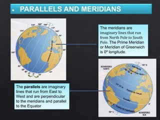


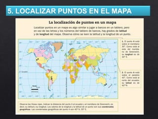


The document discusses key concepts in geography including: 1. Parallels and meridians - imaginary lines that circle the globe and are used to measure latitude and longitude. 2. Latitude and longitude - systems used to identify locations on Earth by their angular coordinates. 3. Map projections - methods of representing the 3D Earth on a 2D surface like a map, including cylindrical, conic, and azimuthal projections. 4. Cardinal directions, compass roses, and geographic coordinates - tools used to orient locations on maps.


