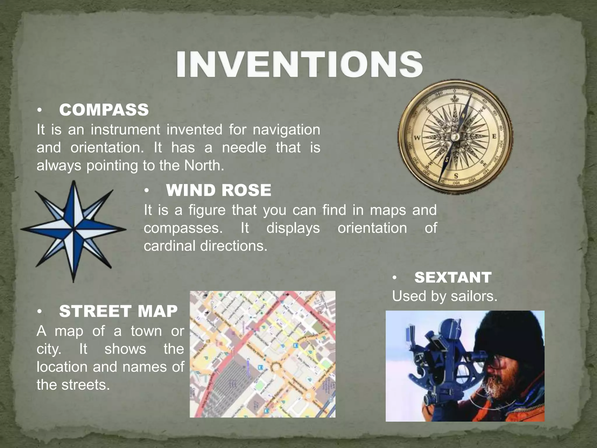
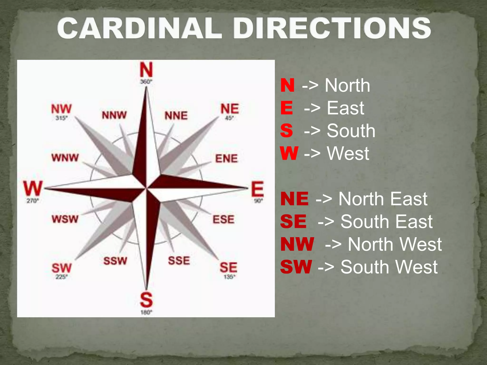
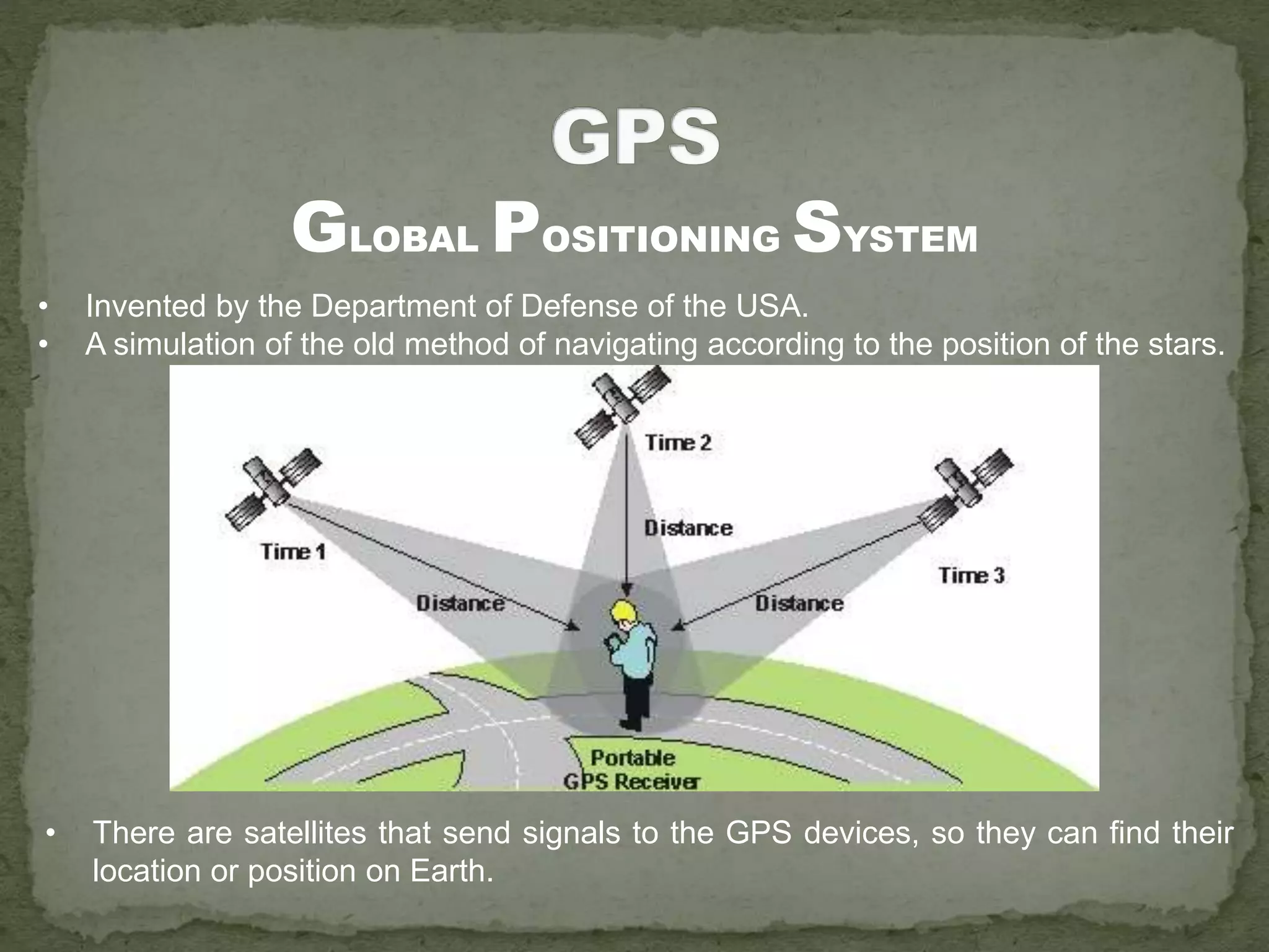
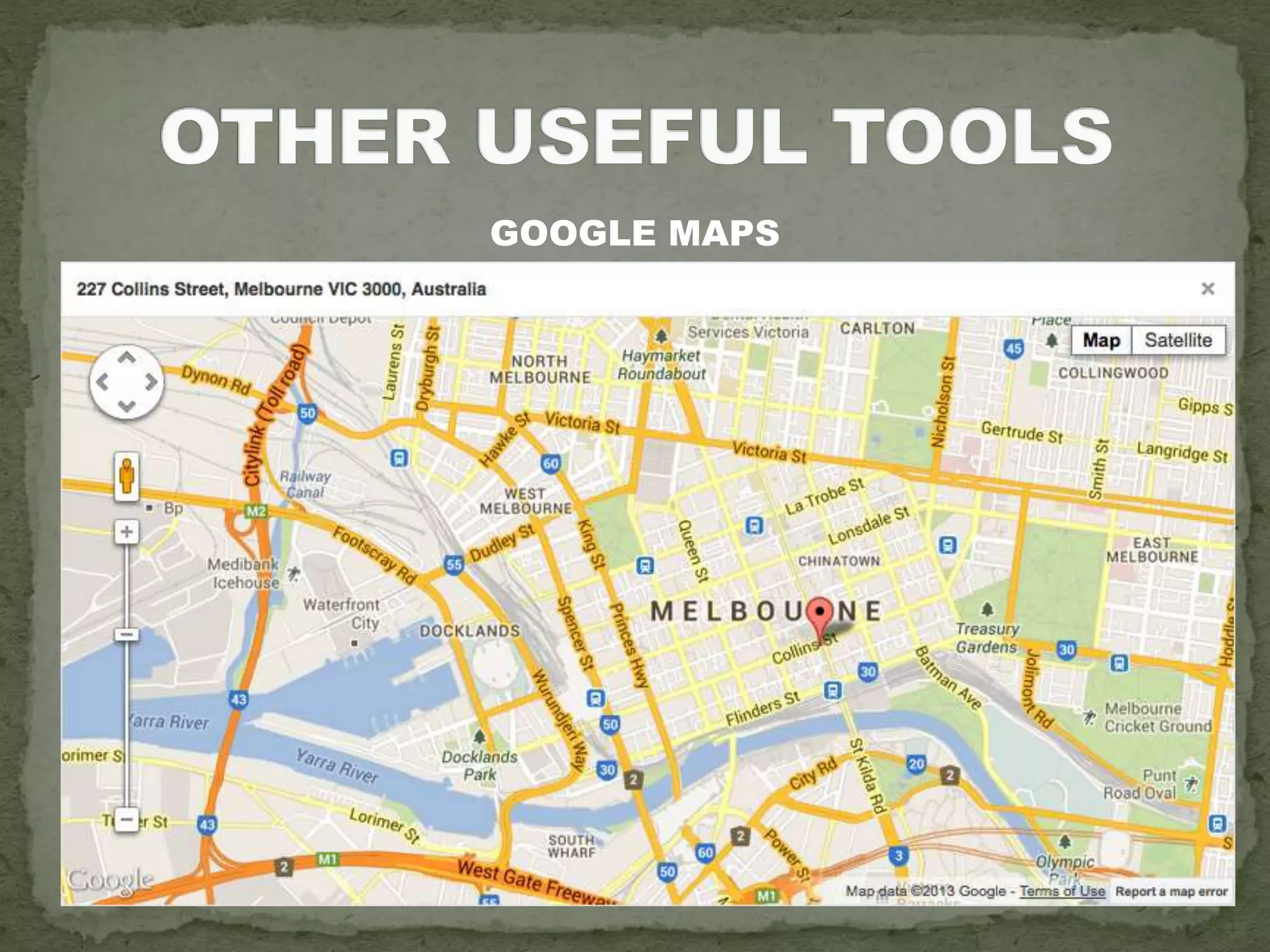
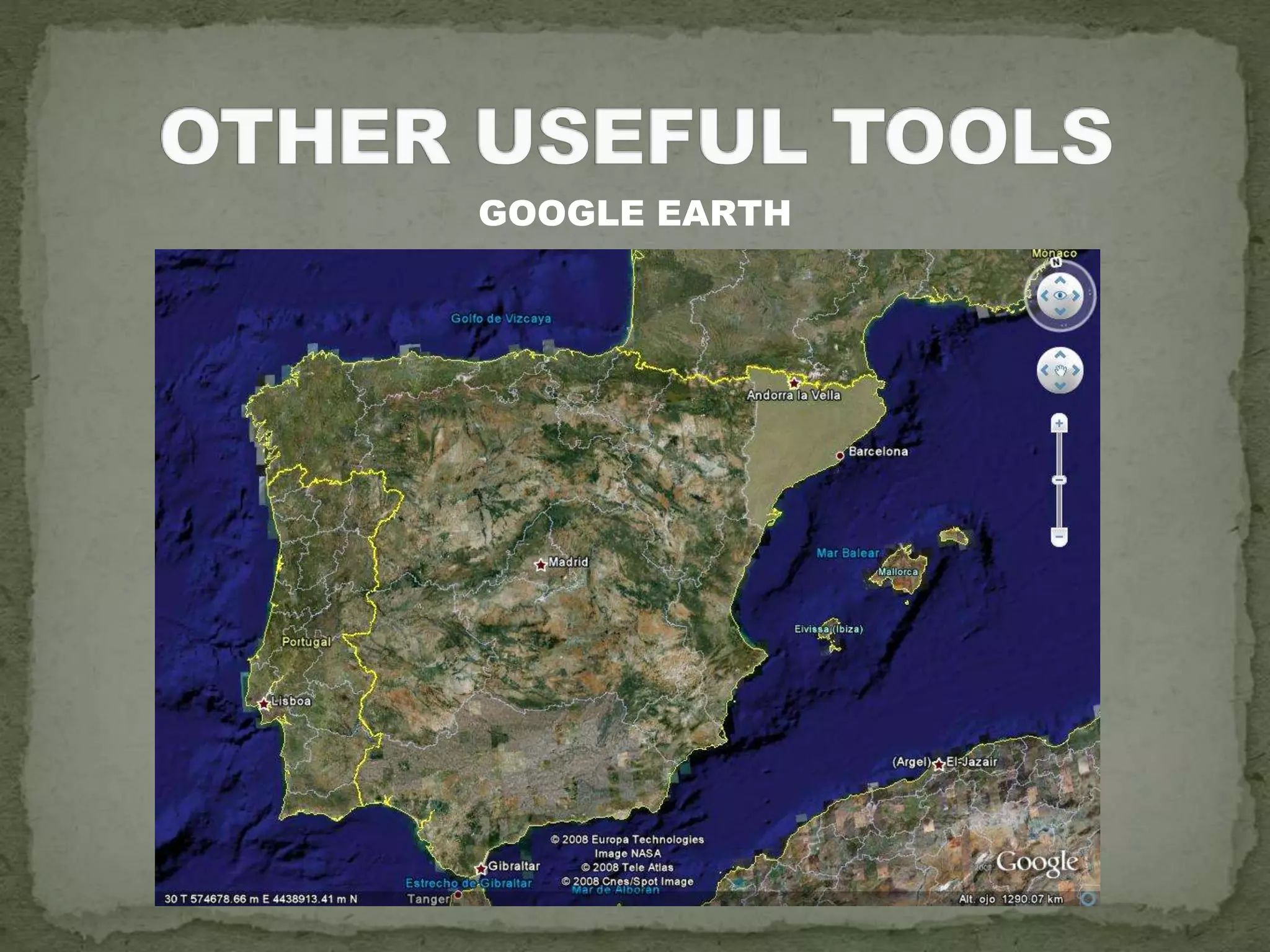
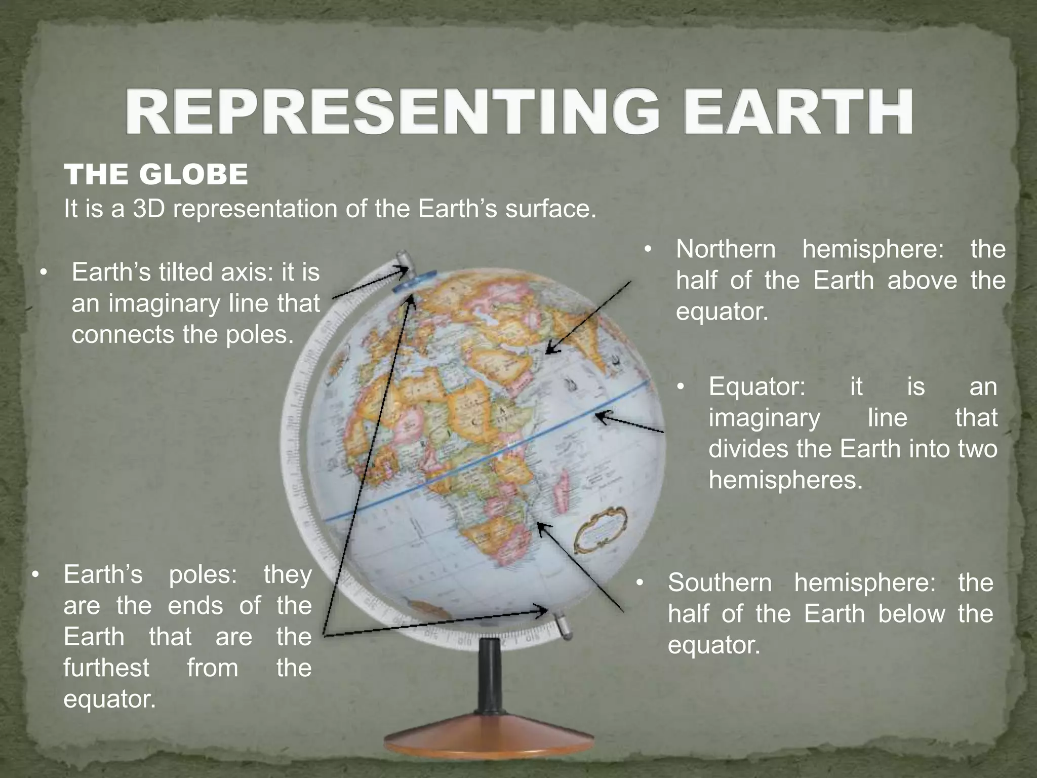
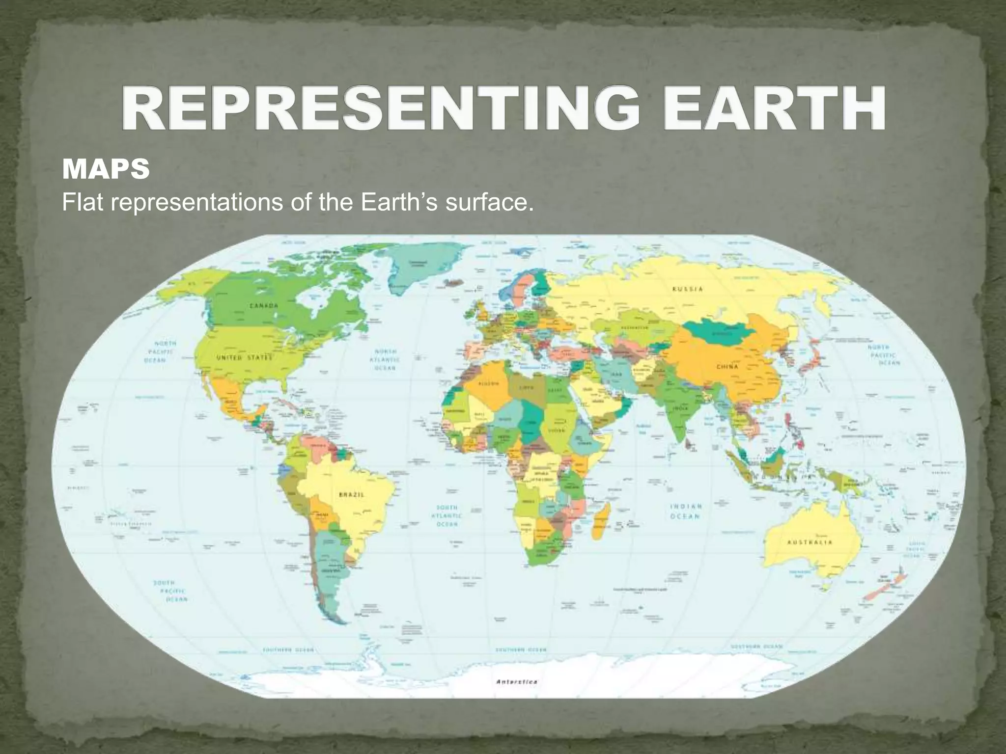
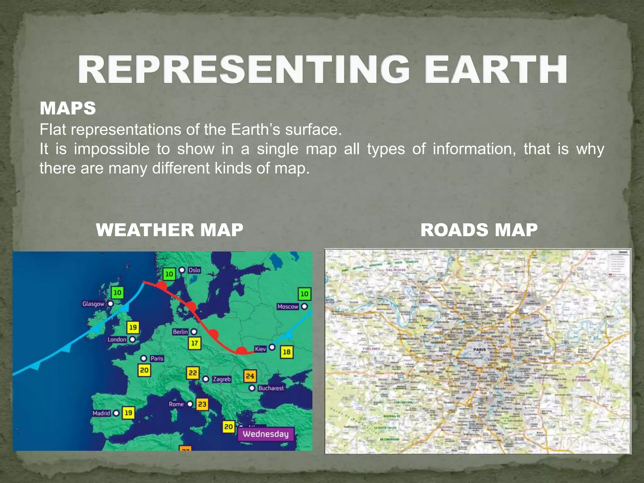
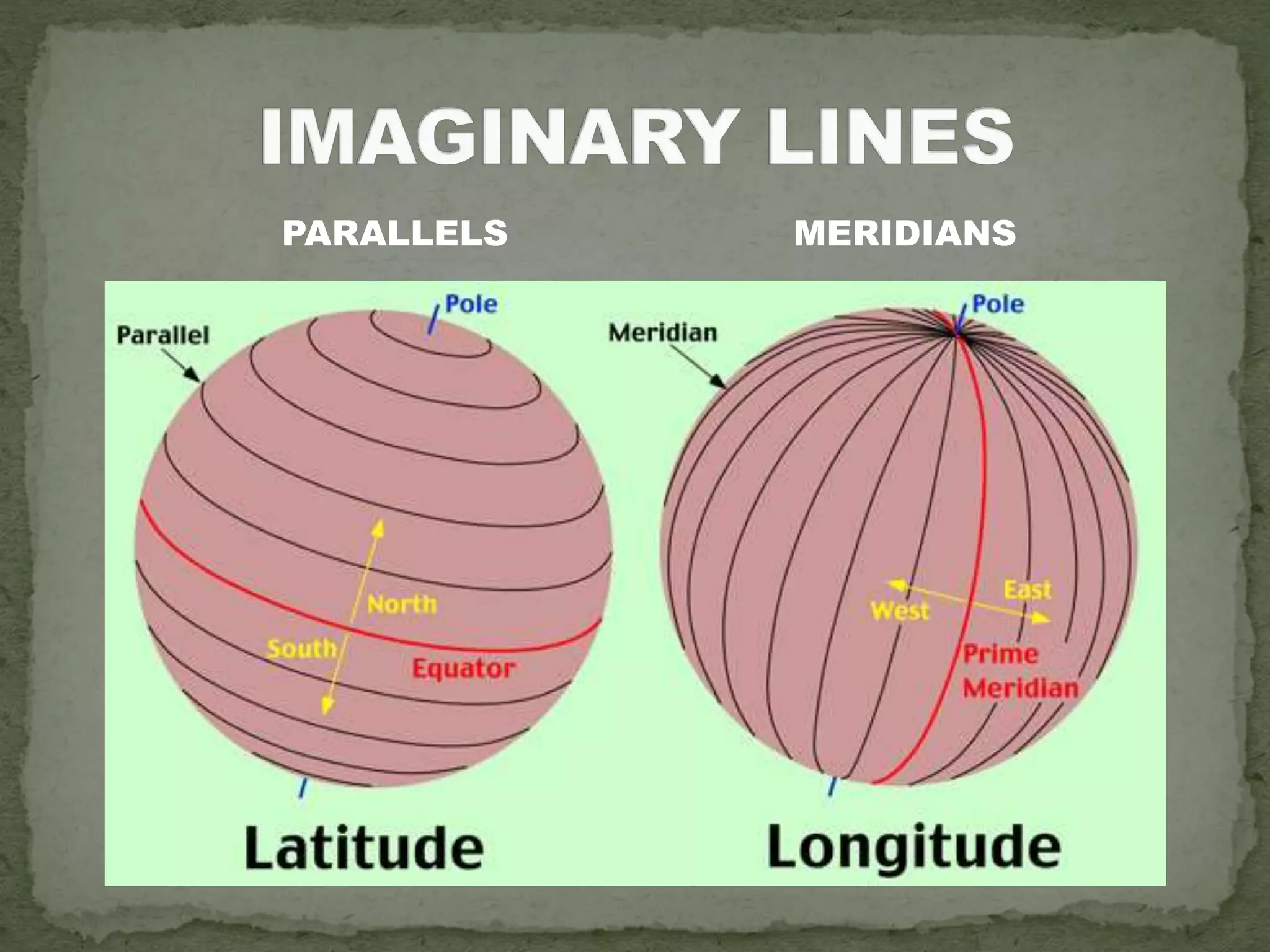
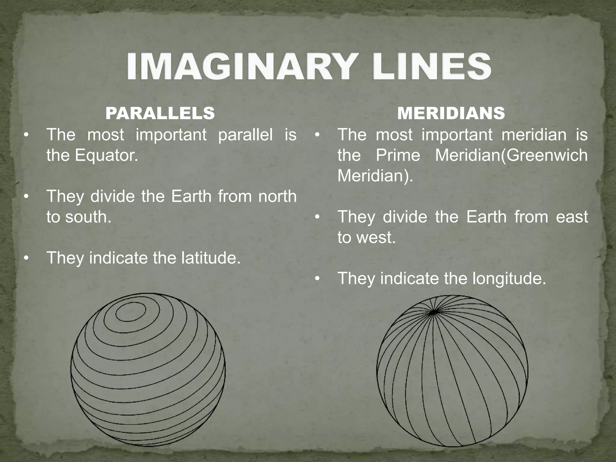
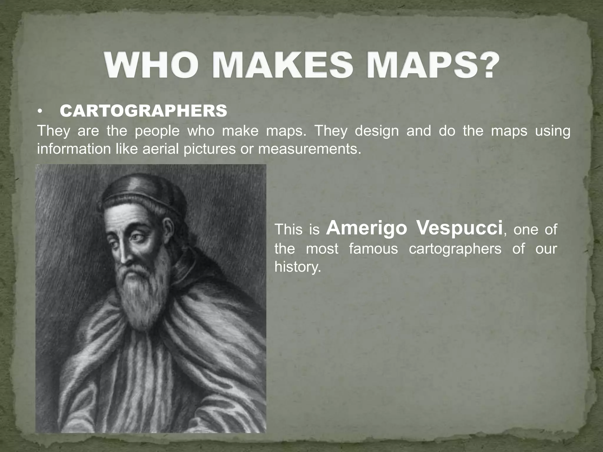
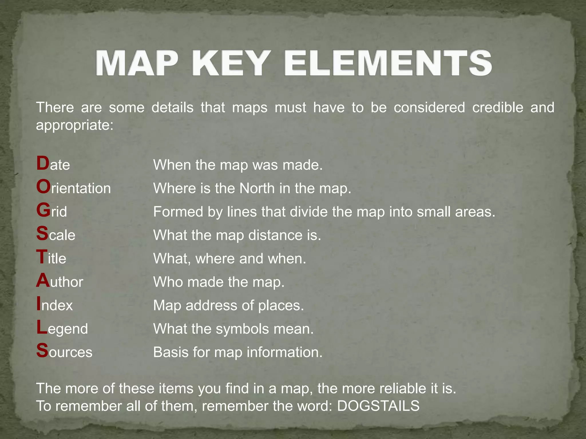
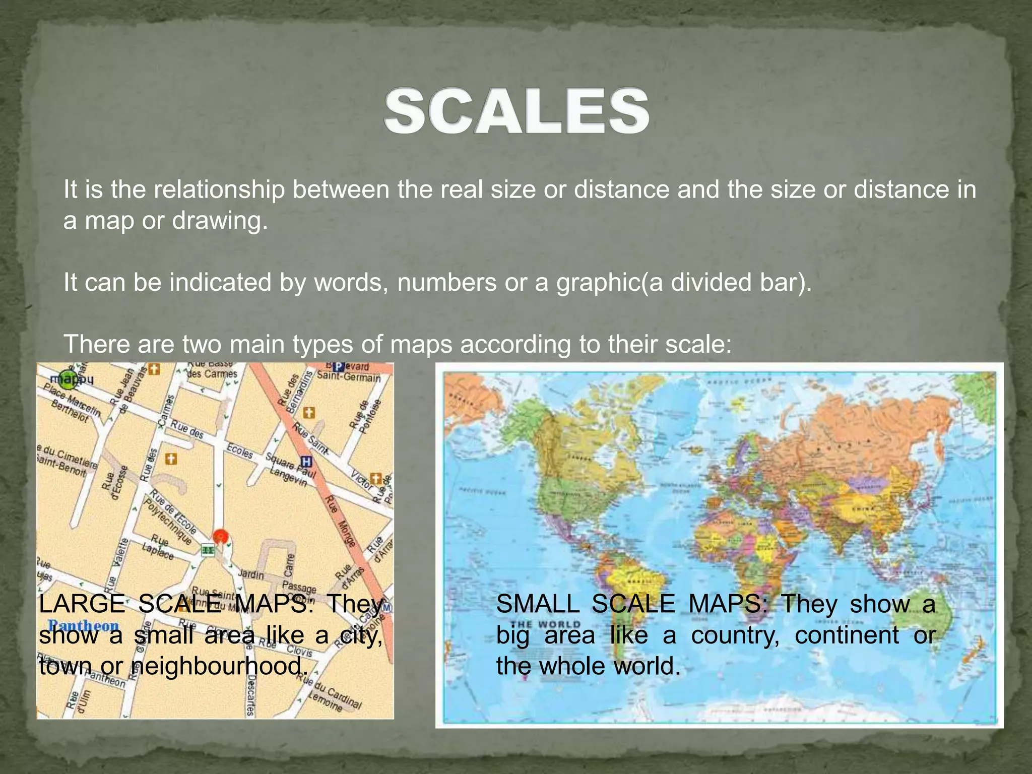
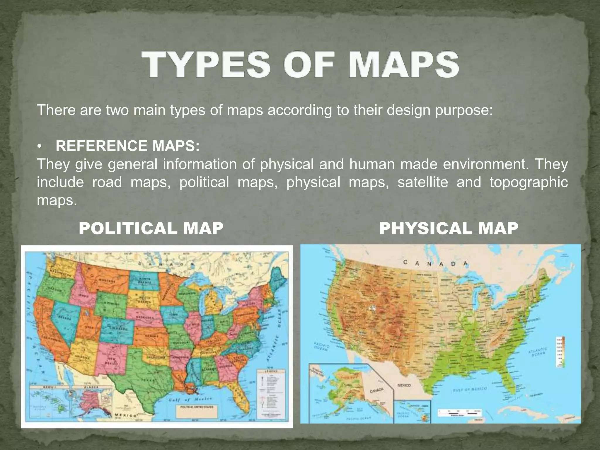
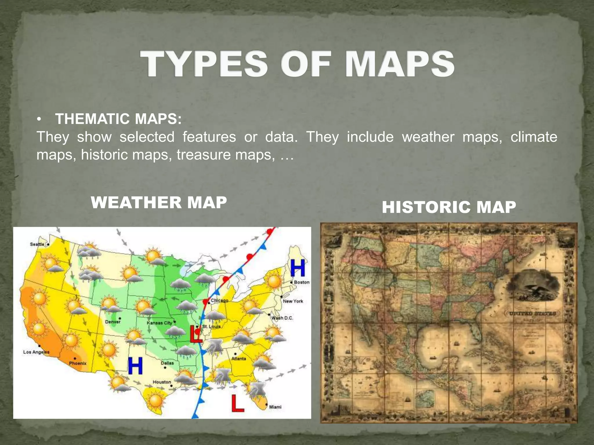
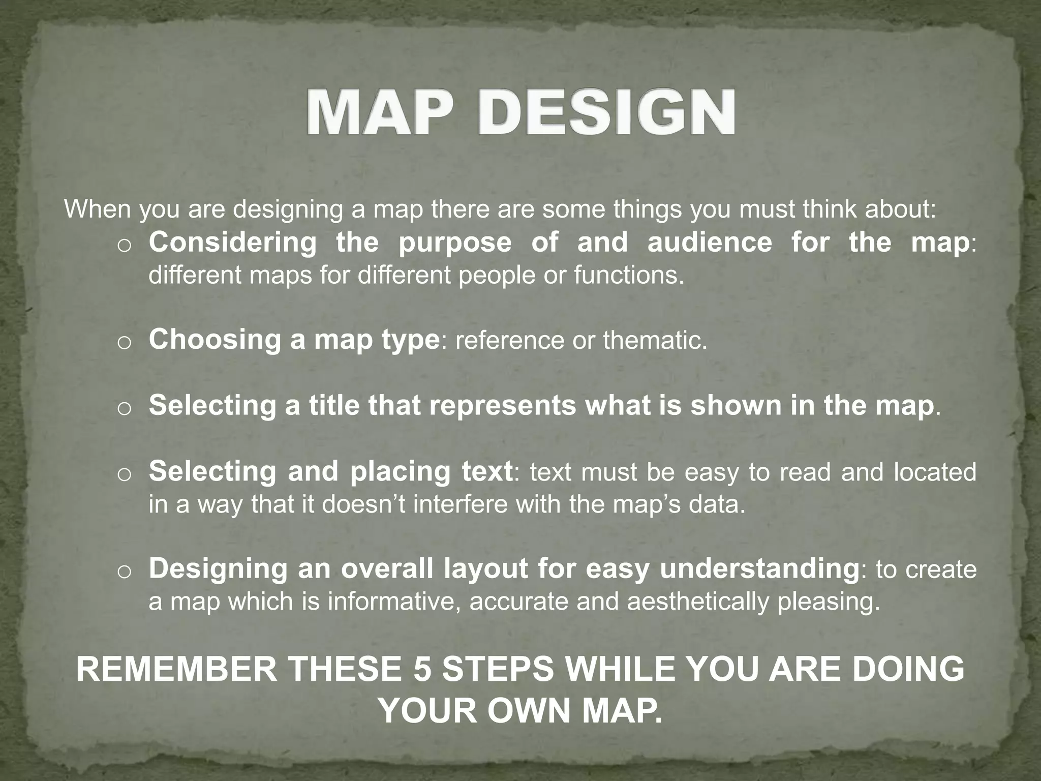
ORIENTATION
AND
MAPS
1. HOW MUCH WE HAVE CHANGED!
 INVENTIONS
 THE GPS
 OTHER USEFUL TOOLS
2. REPRESENTING EARTH
 GLOBES
 MAPS:
• WHAT IS A MAP?
• WHO MAKES MAPS?
• MAP KEY ELEMENTS
• SCALES
• TYPES OF MAP
• MAP DESIGN
• COMPASS
It is an instrument invented for navigation
and orientation. It has a needle that is
always pointing to the North.
• WIND ROSE
It is a figure that you can find in maps and
compasses. It displays orientation of
cardinal directions.
• SEXTANT
Used by sailors.
• STREET MAP
A map of a town or
city. It shows the
location and names of
the streets.
N -> North
E -> East
S -> South
W -> West
NE -> North East
SE -> South East
NW -> North West
SW -> South West
• Invented by the Department of Defense of the USA.
• A simulation of the old method of navigating according to the position of the stars.
GLOBAL POSITIONING SYSTEM
• There are satellites that send signals to the GPS devices, so they can find their
location or position on Earth.
GOOGLE MAPS
GOOGLE EARTH
THE GLOBE
It is a 3D representation of the Earth’s surface.
• Northern hemisphere: the
half of the Earth above the
equator.
• Southern hemisphere: the
half of the Earth below the
equator.
• Equator: it is an
imaginary line that
divides the Earth into two
hemispheres.
• Earth’s tilted axis: it is
an imaginary line that
connects the poles.
• Earth’s poles: they
are the ends of the
Earth that are the
furthest from the
equator.
MAPS
Flat representations of the Earth’s surface.
MAPS
Flat representations of the Earth’s surface.
It is impossible to show in a single map all types of information, that is why
there are many different kinds of map.
WEATHER MAP ROADS MAP
PARALLELS MERIDIANS
PARALLELS
• The most important parallel is
the Equator.
• They divide the Earth from north
to south.
• They indicate the latitude.
MERIDIANS
• The most important meridian is
the Prime Meridian(Greenwich
Meridian).
• They divide the Earth from east
to west.
• They indicate the longitude.
• CARTOGRAPHERS
They are the people who make maps. They design and do the maps using
information like aerial pictures or measurements.
This is Amerigo Vespucci, one of
the most famous cartographers of our
history.
There are some details that maps must have to be considered credible and
appropriate:
Date When the map was made.
Orientation Where is the North in the map.
Grid Formed by lines that divide the map into small areas.
Scale What the map distance is.
Title What, where and when.
Author Who made the map.
Index Map address of places.
Legend What the symbols mean.
Sources Basis for map information.
The more of these items you find in a map, the more reliable it is.
To remember all of them, remember the word: DOGSTAILS
It is the relationship between the real size or distance and the size or distance in
a map or drawing.
It can be indicated by words, numbers or a graphic(a divided bar).
There are two main types of maps according to their scale:
LARGE SCALE MAPS: They
show a small area like a city,
town or neighbourhood.
SMALL SCALE MAPS: They show a
big area like a country, continent or
the whole world.
There are two main types of maps according to their design purpose:
• REFERENCE MAPS:
They give general information of physical and human made environment. They
include road maps, political maps, physical maps, satellite and topographic
maps.
POLITICAL MAP PHYSICAL MAP
• THEMATIC MAPS:
They show selected features or data. They include weather maps, climate
maps, historic maps, treasure maps, …
WEATHER MAP HISTORIC MAP
When you are designing a map there are some things you must think about:
o Considering the purpose of and audience for the map:
different maps for different people or functions.
o Choosing a map type: reference or thematic.
o Selecting a title that represents what is shown in the map.
o Selecting and placing text: text must be easy to read and located
in a way that it doesn’t interfere with the map’s data.
o Designing an overall layout for easy understanding: to create
a map which is informative, accurate and aesthetically pleasing.
REMEMBER THESE 5 STEPS WHILE YOU ARE DOING
YOUR OWN MAP.

Unit 5 Orientation and Maps

  • 1.
  • 2.
    1. HOW MUCHWE HAVE CHANGED!  INVENTIONS  THE GPS  OTHER USEFUL TOOLS 2. REPRESENTING EARTH  GLOBES  MAPS: • WHAT IS A MAP? • WHO MAKES MAPS? • MAP KEY ELEMENTS • SCALES • TYPES OF MAP • MAP DESIGN
  • 3.
    • COMPASS It isan instrument invented for navigation and orientation. It has a needle that is always pointing to the North. • WIND ROSE It is a figure that you can find in maps and compasses. It displays orientation of cardinal directions. • SEXTANT Used by sailors. • STREET MAP A map of a town or city. It shows the location and names of the streets.
  • 4.
    N -> North E-> East S -> South W -> West NE -> North East SE -> South East NW -> North West SW -> South West
  • 5.
    • Invented bythe Department of Defense of the USA. • A simulation of the old method of navigating according to the position of the stars. GLOBAL POSITIONING SYSTEM • There are satellites that send signals to the GPS devices, so they can find their location or position on Earth.
  • 6.
  • 7.
  • 8.
    THE GLOBE It isa 3D representation of the Earth’s surface. • Northern hemisphere: the half of the Earth above the equator. • Southern hemisphere: the half of the Earth below the equator. • Equator: it is an imaginary line that divides the Earth into two hemispheres. • Earth’s tilted axis: it is an imaginary line that connects the poles. • Earth’s poles: they are the ends of the Earth that are the furthest from the equator.
  • 9.
    MAPS Flat representations ofthe Earth’s surface.
  • 10.
    MAPS Flat representations ofthe Earth’s surface. It is impossible to show in a single map all types of information, that is why there are many different kinds of map. WEATHER MAP ROADS MAP
  • 11.
  • 12.
    PARALLELS • The mostimportant parallel is the Equator. • They divide the Earth from north to south. • They indicate the latitude. MERIDIANS • The most important meridian is the Prime Meridian(Greenwich Meridian). • They divide the Earth from east to west. • They indicate the longitude.
  • 13.
    • CARTOGRAPHERS They arethe people who make maps. They design and do the maps using information like aerial pictures or measurements. This is Amerigo Vespucci, one of the most famous cartographers of our history.
  • 14.
    There are somedetails that maps must have to be considered credible and appropriate: Date When the map was made. Orientation Where is the North in the map. Grid Formed by lines that divide the map into small areas. Scale What the map distance is. Title What, where and when. Author Who made the map. Index Map address of places. Legend What the symbols mean. Sources Basis for map information. The more of these items you find in a map, the more reliable it is. To remember all of them, remember the word: DOGSTAILS
  • 15.
    It is therelationship between the real size or distance and the size or distance in a map or drawing. It can be indicated by words, numbers or a graphic(a divided bar). There are two main types of maps according to their scale: LARGE SCALE MAPS: They show a small area like a city, town or neighbourhood. SMALL SCALE MAPS: They show a big area like a country, continent or the whole world.
  • 16.
    There are twomain types of maps according to their design purpose: • REFERENCE MAPS: They give general information of physical and human made environment. They include road maps, political maps, physical maps, satellite and topographic maps. POLITICAL MAP PHYSICAL MAP
  • 17.
    • THEMATIC MAPS: Theyshow selected features or data. They include weather maps, climate maps, historic maps, treasure maps, … WEATHER MAP HISTORIC MAP
  • 18.
    When you aredesigning a map there are some things you must think about: o Considering the purpose of and audience for the map: different maps for different people or functions. o Choosing a map type: reference or thematic. o Selecting a title that represents what is shown in the map. o Selecting and placing text: text must be easy to read and located in a way that it doesn’t interfere with the map’s data. o Designing an overall layout for easy understanding: to create a map which is informative, accurate and aesthetically pleasing. REMEMBER THESE 5 STEPS WHILE YOU ARE DOING YOUR OWN MAP.